Trip to Kithira - September 2011
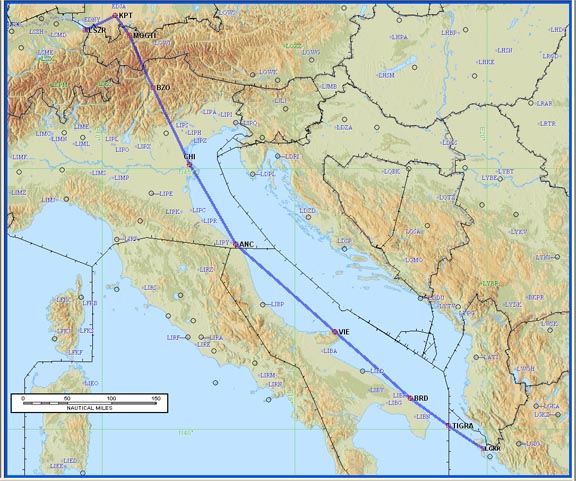
This article describes an IFR (airways) trip from Shoreham (EGKA) to Kithira (LGKC) in Greece, via Portoroz (LJPZ) in Slovenia, Kerkira (LGKR) in Greece, and back via Kerkira (LGKR) and St Gallen (LSZR) in Switzerland. St Gallen is also known as Altenrhein.
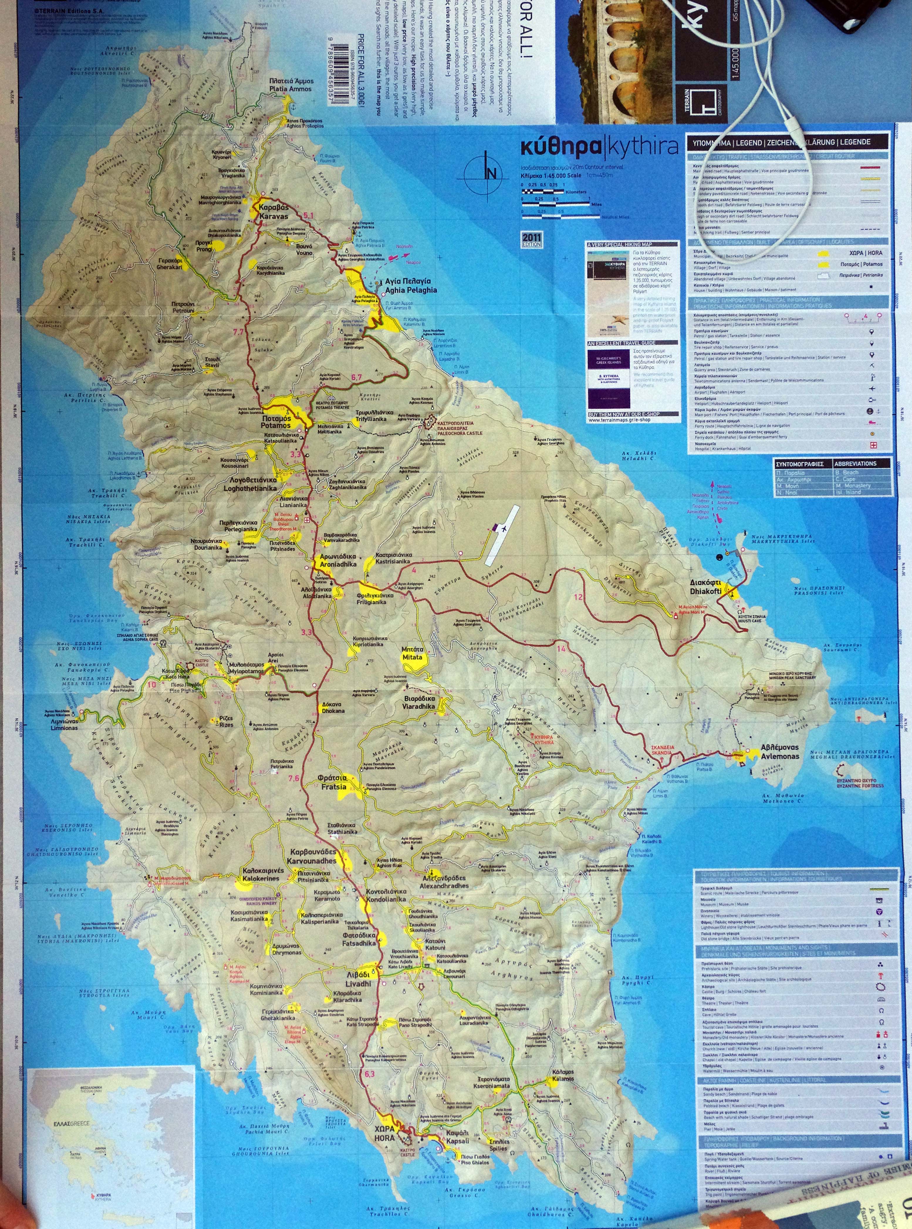
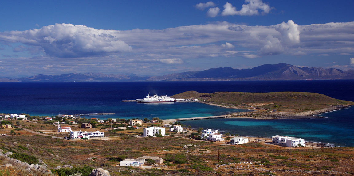
Kithira was recommended as a very picturesque and laid-back island. It certainly lives up to its reputation, and we think it is one of the most lovely islands we have been to in Greece. Click on the map below to see the full size roadmap
To a pilot, Kithira is a bit of a planning challenge because the airport has very limited opening hours and does not have any fuel (avgas or avtur). It also does not have Customs although we discovered that it is possible to fly between it and other Schengen airports; this is a new one for Greece which signed Schengen but disregards it for anyone using a "vehicle".
However, the Schengen option is of less value than might appear: while a TB20 can fly there easily enough from many places in Europe, one may not have enough left in the tanks to return to somewhere useful. Italy is the only nearby Schengen country but the nearby parts of it do not have any airports which can be relied on to have avgas which they will sell to foreigners (short of a backhander to an aeroclub member).
Update 5/2012: Italy, in a desperate but clumsy attempt to curb tax evasion,
has imposed massive taxes on private aircraft and boats. The aircraft tax starts
at around €3000 after 45 days' stay on Italian soil. There are no exemptions
for aircraft grounded due to weather or e.g. pilot licensing/medical issues,
but there is an exemption for aircraft undergoing "maintenance" (which
is not defined but presumably means booked in with an Italian maintenance company
![]() ). Italy is therefore
now off-limits to all private aviation except those who feel pretty confident
they are not going to get AOG'd. Only a fool would fly there now, or even enter
its airspace, in case of an emergency diversion.
). Italy is therefore
now off-limits to all private aviation except those who feel pretty confident
they are not going to get AOG'd. Only a fool would fly there now, or even enter
its airspace, in case of an emergency diversion.
Update 12/2013: the Italian tax timeframe appears to have been increased to
6 months, which is acceptable - so long as you do not suffer a major mechanical
problem. However I am unable to find a reference to this change.
Most pilots will therefore route via Kerkira (Corfu) LGKR or Sitia LGST for
both avgas and Customs clearance. Kerkira is an H24 airport but suffers from
a pointless but strictly enforced 48hr PPR requirement which must be obtained
in writing. Sitia is a wonderfully laid back and welcoming airport but like
Kithira has very limited opening hours. For Greece, the only reliable guide
to airport opening hours are the airport Notams or a written confirmation direct
from the airport (there is no online AIP) and the notams
show that e.g. a flight from Kithira to Sitia is impossible in anything below
an F16 due to the small opening hours overlap. Flying Sitia to Kithira is however
OK. Hania (LGSA) which is just a short hop across the water from Kithira, has
Customs and avgas but requires between 5 days' and 20 days' PPR
for foreigners ![]() (the
actual figure varies according to who you ask).
(the
actual figure varies according to who you ask).
If, when wishing to depart from Kithira, one encountered problems getting the PPR from Kerkira, or one needed to depart Kithira with less than 48hrs' notice, the only same-day option out of Greece where avgas is available would be via Athens LGAV (3hrs' PPR via handling agent, and €150-200). If a 1-day delay was acceptable, one could fly out to various places, stay 1 night, and then fly to e.g. Sitia LGST, refuel, and depart out of Greece. These are the only strictly legal options as far as Greek Customs go.
A flight out of Kithira, without a refuel, to a non-Schengen country i.e. a Customs stop only has several options: LGKF (24hrs PPR), LGZA (12hrs PPR), and others.
With an avtur-fuelled aircraft e.g. a TBM850, one would have better options because there are quite a few airports in Greece which have Customs (basically, all those which accept scheduled and charter flights from abroad), avtur, but no avgas. A TBM also has a better range than a TB20. Unfortunately, avtur options in piston aircraft are poor, with no reliable and long-term-proven engine technology currently available, and one does want something very reliable for trips like this.
All stops on this trip were chosen to be in places which we wanted to visit anyway i.e. no stops purely for fuel. Being able to do that is one of the luxuries of the TB20, with its ~1300nm range.
Procedurally, the flight was very similar to other airways flights I have done. Other VFR and IFR trip reports can be found here. Kithira is very close to Crete to which we have been before in 2004, 2007 and 2010.
Here is a glossary for non-aviation readers.
Pilot
FAA CPL/IR
JAA PPL/IR
1500hrs (approx).
Aircraft
The aircraft is a 2002 Socata TB20GT which has a zero-fuel "book" range of approximately 1100nm and an economical cruise speed of 155kt TAS at 10,000ft. Extra economical cruise power settings can extend the zero-fuel range to 1300nm which, according to FAA rules, translates to approximately 1100nm with IFR reserves. It has a ceiling of about 20,000ft and is equipped with oxygen. It is not certified for flight into icing conditions but has a TKS de-iced propeller. This is the actual aircraft
 :
:
Navigation equipment includes a KLN94 IFR/BRNAV GPS and a KMD550 MFD and these are used for primary navigation. IFR flight in Europe at any meaningfully high altitude requires BRNAV certification which in the GA context is met only with a BRNAV approved IFR GPS installation. The most common means of BRNAV compliance is one of the Garmin 430/530 products but many other panel mounted GPSs have been approved. BRNAV can also be met with the old KNS80 (with an antenna filter to meet FM Immunity regs) but this product will not alone function in today's "everything is RNAV" environment where one is routinely sent to a VOR which is a great distance away.
The aircraft has a KFC225 autopilot which can track VOR/GPS/LOC/ILS and fly a preset altitude or a preset VS. There is an additional battery powered Garmin 496 GPS which also provides an audio terrain warning (TAWS) function with a European terrain and obstacle database. The TAWS function projects the current trajectory for 2 minutes and if there is a terrain conflict, one gets a "pull up" type audio warning whose tone gradually becomes more urgent. A WX500 stormscope is also installed. One of the radios has 8.33kHz channel spacing to legalise flight at 20,000ft although I have never been assigned such a frequency
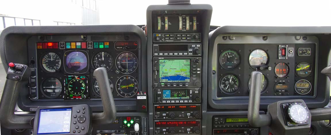
A Sandel SN3500 EHSI was recently installed which provides automatic waypoint sequencing to the autopilot so a whole route can be flown without HSI course pointer adjustment.
Flight Planning
The routes (which included various options) were planned using Flight Plan Pro (FPP) which was used to generate a Eurocontrol-accepted airways route which was then pasted into Jeppesen FliteStar from which I printed out enroute chart sections, plogs, etc. The workflow I use is illustrated in this article. The flight plans were filed using EuroFPL.
However, there are numerous other ways one can do this job, and there is enough capability in FPP alone, or EuroFPL alone, to generate adequate data to do an IFR flight with. Taking the simplest case, one can fly IFR in Europe's enroute airspace system with just a list of waypoints like this which EuroFPL emails you some hours before the flight planned EOBT. If you pick up this email on a phone, you can enter it into the IFR GPS and just fly it. Electronic or printed enroute (airway) charts are very unlikely to be required. However, my view is that this is somewhat risky, and I have been asked to fly named airways on a few occassions.
There is also RocketRoute (which runs FPP code) and, being a straight website, is the only current facility for generating optimised airway routings for pilots with non-Windows / OSX platforms (Iphone, Ipad, Android phones, etc). EuroFPL offers the Eurocontrol "route suggest" feature which is continually improving but is still less optimised than FPP's routes, not least because the entire Eurocontrol-suggested route is prepared for a single flight level.
With European IFR flight itself being a wholly point to point RNAV DCT-button-pushing exercise, a flight done fully under IFR needs a lot less traditional flight planning than under VFR which requires current VFR charts. However, IFR flights which involve VFR sections, and this includes Z and Y flight plans, do require VFR charts, awareness of controlled airspace, etc.
It always pays to do as much as possible back home, before departure, where internet is free, printing is cheap and quick, and one would not depart in any case if the weather is not suitable. For this trip, all routes were preplanned and the ones actually intended to be flown, and all main and alternate approach plates, were printed on a colour laser printer. The pile of paper was about 20mm thick.
Some pilots have gone "paperless" in the cockpit and use e.g. an Ipad as the display device for both enroute charts and approach plates. I have worked in electronics and IT for many years and I know that this is going to bite you one day - unless you have backups and then you end up with yet more gear, with the associated chargers, etc.
Weather Planning
I try to use "technical" methods to make the go/no-go decision as objective as possible. In the context of flying a non-deiced aircraft (I have propeller-only TKS de-ice, which really does work very well but is no good for spending hours in icing conditions) this means establishing whether the enroute section of the flight can be done substantially in VMC, which given the subzero temperatures at typical European airway levels most of the year means VMC on top if there is any cloud about.
One therefore needs to establish where the cloud tops are likely to be. Cloud tops are almost impossible to forecast with any useful accuracy, but things have improved in recent years with satellite IR images which show actual cloud top temperatures and thus altitudes. Some notes are here and here.
Since about 2009 I have been heavily relying on satellite IR images to get
a "cloud tops METAR" just before a flight and this simple technique
has been completely successful on every flight where I have used it. No flight
I have done has been what some pilots call "eventful", and I have
never had to turn back. The cost of this strategy, with the TB20, and with long
legs of e.g. 700nm+, is that the despatch rate on a particular day is only about
80%. But this is a whole lot better than it would be under VFR... especially
legal VFR ![]()
Equipment
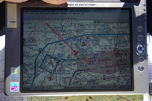
On any significant trip I carry a lightweight laptop (an old 12" Thinkpad X60S-1704 with a 4 hour battery) which does everything needed for VFR and IFR route planning, weather, notams, flight plans, and communication via fax and email. Not having this capability makes long trips by light aircraft far too much hassle. The laptop has several different ways to get internet access; in descending order of preference: normal WIFI, a WIFI connection to an E585 GPRS/3G-WIFI modem, a bluetooth connection to my Nokia E51 GPRS/3G phone, a USB cable connection to the same phone, a built-in GPRS/3G radio (with a UK T-Mobile SIM), and a USB cable connection to a Thuraya 7100 satellite phone. Fax (which remains essential for airport communications, where a phone call is difficult due to language issues, and published email addresses often don't work) is done via email2fax and fax2email accounts; these are not free but are very cheap. I used to use Winfax for sending faxes directly out of the laptop but thankfully have not used it for a couple of years; it was never reliable with GSM modems and, like everything which Symantec have ever touched, worked only on Mondays... On long trips I also carry a Canon IP90 A4 printer
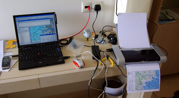
The printer can be battery powered but the battery pack makes it heavy, and
the mains power unit has to be carried anyway in case the battery goes flat.
The printer may seem "excessive" but is brilliant for printing out
enroute charts and approach plates when one has to substantially replan something.
The alternative is to print to a PDF, copy it to a USB stick, and look for an
internet cafe / printing bureau / hotel reception which can print off the PDF
.... hopefully in colour. Nobody makes a compact lightweight A5 printer. There
are some A6 "photo" printers but that is too small to read, for most
people over 45 ![]()
A loss or failure of the laptop would be extremely inconvenient, so on long trips I carry a spare laptop which has almost the same software configuration as the main laptop. This backup laptop stays in the back of the aircraft for the duration of the entire trip.
I always fly with a liferaft, an emergency bag containing a 406MHz
EPIRB, a handheld radio and a lot of other stuff, a second 406MHz+GPS EPIRB,
and together with the large 48 cu. ft. carbon/kevlar oxygen cylinder these take
up the RH back seat. I carry a spare oxygen cylinder of the same size (and a
spare 1st stage regulator) in case the main cylinder leaked out through a faulty
valve, or because I forgot to shut off the gas after landing. There is also
a large toolbox with enough tools to do the 50-hr service plus potential emergency
jobs like changing the vacuum pump. On longer trips such as this one I also
carry a complete set of spare servos for the notoriously
unreliable KFC225 autopilot, 1 refill for the 2-litre TKS propeller de-ice system,
and several 1-litre bottles of isopropyl alcohol (IPA) for use as fuel anti-icing
additive (there is no known case of a TB20 suffering fuel icing but this is
a very cheap precaution, although on this trip the temperatures were so high
- lowest seen was -6C at FL170 - that I did not use any IPA). Plus four 1qt
bottles of engine oil. Plus a lightweight reflective aircraft cover (from Bruce's
Custom Covers) which keeps the cockpit cool when parked in hot climates and
is a huge help in keeping the interior in good condition. It is difficult to
imagine doing such a trip in one of the many 2-seater "homebuilt/sports"
types (although many people have done exactly that... travelling with a toothbrush
![]() ). This leaves the
LH back seat free and Justine sometimes likes to sit there; that seat is a lot
thicker and softer than the front ones. In that case I run down the LH fuel
tank substantially, to keep the aircraft balanced.
). This leaves the
LH back seat free and Justine sometimes likes to sit there; that seat is a lot
thicker and softer than the front ones. In that case I run down the LH fuel
tank substantially, to keep the aircraft balanced.
The route illustrations in this article are screenshots from Jeppesen FliteStar IFR. The terrain profiles shown at the bottom are not usable for safety altitude planning; in fact the Jeppesen data contains systematic errors. The vertical profile of an IFR flight is at a minimum level which is decided by what is acceptable to the Eurocontrol computer. The minimum levels which can be filed tend to be around FL070 but acceptable routings usually need higher levels. Sensible routings start to appear around FL100 and the best ones (below FL200) are obtained at FL140-FL160. Oxygen is therefore highly desirable for European IFR.
In some airspaces, one can file IFR below FL070 without the Eurocontrol computer chucking it out, but that is another story... the result is likely to be a route which lies below controlled airspace and the enroute IFR ATC system is likely to wash its hands of your flight. Some notes are here.
On all long flights I run the European VFR charts as a GPS moving map under Oziexplorer, mainly for emergency use but also for identifying interesting objects on the ground
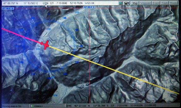
For crossing mountains above a solid cloud layer, there are better topographic maps for emergency use e.g. this synthetic one derived from the Space Shuttle (SRTM) radar imagery
Unfortunately, the terrain database used in the above example is not obtainable
in a straightforward manner. It was generated from Google Terrain using Mobile
Atlas Creator (MOBAC). This is an open source map tile download program which
can retrieve mapdata from a variety of online sources, and generate GPS databases
which can be used in a wide variety of GPSs. One of the supported output formats
is Oziexplorer (PNG+MAP files). Unfortunately MOBAC's developers got sued (and
otherwise threatened) by the owners of most of the databases who did not want
their data to be retrieved in an "automated" manner, despite the data
being publicly accessible. The map business is full of this nonsense, especially
in Europe. The developers caved in and simply removed support for most of the
databases. All the Google sources are now lost, for example. However, at time
of writing (10/2011) a specific old version of the program (v1.8) still works
![]() I have generated map
coverage for the Alps, and most of Europe east and south of there, all the way
down to Crete. The data does not show airports but they can be overlaid within
Oziexplorer using a separate process.
I have generated map
coverage for the Alps, and most of Europe east and south of there, all the way
down to Crete. The data does not show airports but they can be overlaid within
Oziexplorer using a separate process.
The Alps offer suprisingly favourable engine failure options if one is flying say 8000ft+ above the terrain. I would say that 90% of the time there is an easy, flat, and obvious landing site within glide range. The Pyrenees are a very different story, however...
Oziexplorer was originally developed for offroad driving in the Australian outback but it is really just a GPS moving map application which can run almost any graphical image (that can be georeferenced) as a GPS moving map. The LS800 tablet computer used here is an outdated product but remains one of the few tablets which is truly sunlight readable. It has been modified with a solid state hard drive; the original one used to crash around FL130. It is also used to display weather data using an internet connection with a satellite phone
although on this flight I didn't bother because the weather was so obviously very good. As it runs WinXP, one can do more or less anything with it.
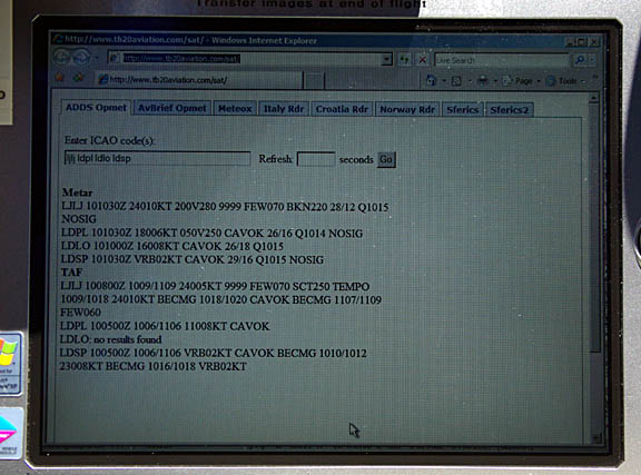
Each weather check like the one above costs about $1, using a Thuraya 7100 PAYG phone, connecting on a 1722 dial-up call at 9600 baud. The system is a long way from being 100% reliable (I don't think Thuraya care much for the reliability of their data service) but usually works fine in the context of a flight lasting several hours. One can supposedly get destination weather from ATC but many ATCOs are too busy, many in southern Europe cannot speak English well, and some evidently don't like doing it anyway. It also appears unprofessional when the vast majority of the players in the IFR airspace (airlines) can get weather via their own comms systems (ACARS). I did some tests on using satelline phones for aviation weather - here.
The Ipad
In 2011, no flying article would be complete without the latest pilot fashion
statement: the Ipad ![]()
It would indeed be desirable to replace the old LS800 with an Ipad which is lighter and has a much better battery life. An Ipad, with a good quality matt antireflective filter stuck on it, makes a good display device for PDF documents. Both the built-in PDF reader and the more feature-packed (but not wholly bug-free) Goodreader program are fine for displaying externally supplied PDFs.
If you have a friend who has access to Jeppview and who can get you selected Jepp plates in PDF form, that is far more economical than the Jepp subscription product for the Ipad which like every Jeppview-based product (PC, MFD, or Ipad) is eye wateringly priced at somewhere over €2000 for Europe. It is also currently extremely buggy and virtually useless. However, the Ipad can also display the free AIP PDF plates which despite being mostly drafted for A4 are perfectly readable on an Ipad.
However, my Ipad2/3G falls short of replacing the LS800: it cannot run any GPS moving map application for which I can get the maps I want (Oziexplorer/IOS is claimed to be in development); the sunlight readability is barely adequate even with an antireflective filter; its internal GPS has proved to be exceptionally unreliable during flight (possibly due to lack of a GSM signal to help it, because it is excellent on the ground); it does not work with my bluetooth GPS which runs from a dedicated rooftop antenna (Apple have stupidly made these products incompatible with every standard NMEA GPS on the market, and there is no Ipad-compatible bluetooth GPS which has an external antenna socket); it cannot interface to any satellite phone.
The screen filter I have used is this one (local copy) which is not cheap but is very good.
An Ipad would also wholly replace the printer mentioned above, which is a big plus. One would print to a PDF and somehow transfer that to the Ipad. The operative term is "somehow". The Apple Politburo has determined that no USB (controller) or SD interfaces will be provided, so the only methods are email via WIFI or GPRS/3G, or via a USB cable using an Itunes sync from a windows or Apple laptop. There are alternatives to Itunes (example) especially if the Ipad is jailbroken. There is no way to transfer data using a flash memory device. Email is unlikely to be preferred if you are on a roaming connection.
However, the biggest issue is that of a backup for any electronic device. I would not rely on an Ipad as my only display device for flight-critical data. Paper needs no backup.
An interesting alternative to the Ipad is the Samsung Galaxy 10" tablet, which has comparable hardware specs, and runs Android so is a lot less functionally restricted. Oziexplorer for Android is available now.
Flight Shoreham-Portoroz
For most of this trip, Shoreham to Kithira and most of the way back, the weather
was excellent. We were partly lucky of course but the timing was picked for
"maximum passenger comfort" ![]() Normally, on longer trips like this one, we would set aside 2-3 days for the
departure, and if it looked impossible all the way through we would get an airline
flight (and probably go somewhere else). Once one is well away from the UK weather
system, e.g. south of the Alps, things tend to be a lot easier.
Normally, on longer trips like this one, we would set aside 2-3 days for the
departure, and if it looked impossible all the way through we would get an airline
flight (and probably go somewhere else). Once one is well away from the UK weather
system, e.g. south of the Alps, things tend to be a lot easier.
The 0600 and 1200 MSLPs were clean, as were the satellite IR, radar, sferics and TAFs/METARs. For good measure, the 0600 and 1200 SigWx were also clean. The following day's weather was also good but one should always pick the first technically flyable opportunity.
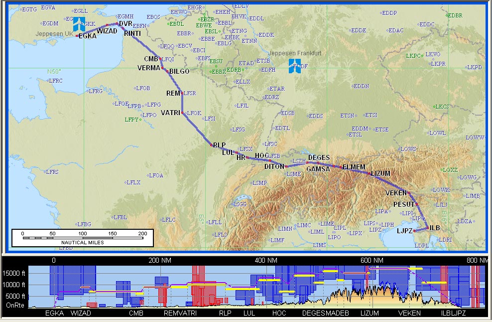
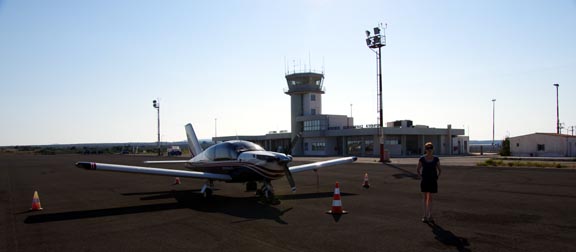
EGKA
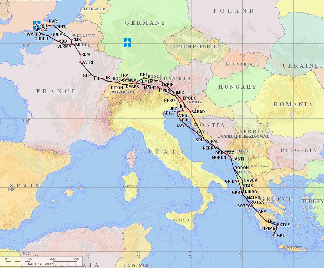
WIZAD M140 DVR/N0150F110 L10 RINTI B3 RLP G4 HR/N0150F120 G4 HOC L613 DITON/N0150F140
N871 DEGES/N0150F170 N871 MADEB N606 ELMEM L607 ILB
LJPZ FL140 Alternates: LJLJ, LDPL
Distance 641nm (GC) 761nm (airways)
The flight plan was filed the evening before, using EuroFPL. With IFR flights - particularly ones to the east - there is a risk of a departure slot being issued by Eurocontrol. For GA flights in the FL100-190 band, these slots are apparently meaningless artefacts of their software and in any case the resulting delay tends to shrink near the time due to the slot time being modified, so one must still be ready for a departure at the originally filed time (EOBT). The paid EuroFPL subscription delivers slot notifications etc by email and SMS, which is handy especially when departing from an unmanned airfield which Shoreham is between 8am and 9am (this facility needs an annual permission, plus a previous day's PPR).
If doing this type of "unmanned airfield" departure, one normally contacts London Information on 124.60 when airborne but on this occassion there was someone in the tower and they phoned up London Control in the usual way for the provisional IFR clearance. The phone number for London Control is not published, which is a pity because London Information can take up to 30 minutes to get the provisional clearance and one can be out of UK airspace by then, especially if departing to the south, which at worst could force a turn-back if the lack of a climb clearance into CAS makes it impossible to avoid hazardous weather down the route. One trick to play in such a situation is to climb to FL054 or FL074 (just below the base of CAS to the south of Shoreham) in a suitable "hole" in the weather, before calling up anybody, but this altitude may not be sufficient.
The provisional clearance from Shoreham Tower was "remain OCAS, squawk 0515, contact London Control on 133.175".
There was a bank of fog in the vicinity of the airport
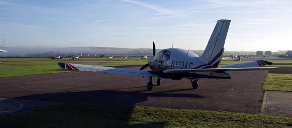
but otherwise the conditions were clear
London Control gave us a DCT to TRACA FL070 and that was it - straight into CAS (Class A). Later, Lille issued a squawk change to 5624, which is not uncommon even though most Eurocontrol IFR flights are done wholly on a single squawk. Due to the clear weather and to conserve oxygen, I asked for a stop climb at FL100. At this level, the oxygen usage is so low that the gauge on the 48 cu. ft. cylinder barely moves over a 5hr flight with 2 people, but it keeps one wide awake.
As all flights on this trip being well within the aircraft range, there was no need to fly particularly slowly for the very best range. The whole trip was flown at 2400RPM, full throttle of course, and leaned for peak EGT. At FL100, this yields 20" MP, 10.4USG/hr, and about 150kt TAS at 0C. This is an endurance of over 8hrs and a range of about 1200nm to zero fuel.
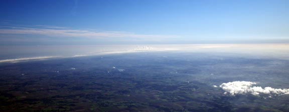
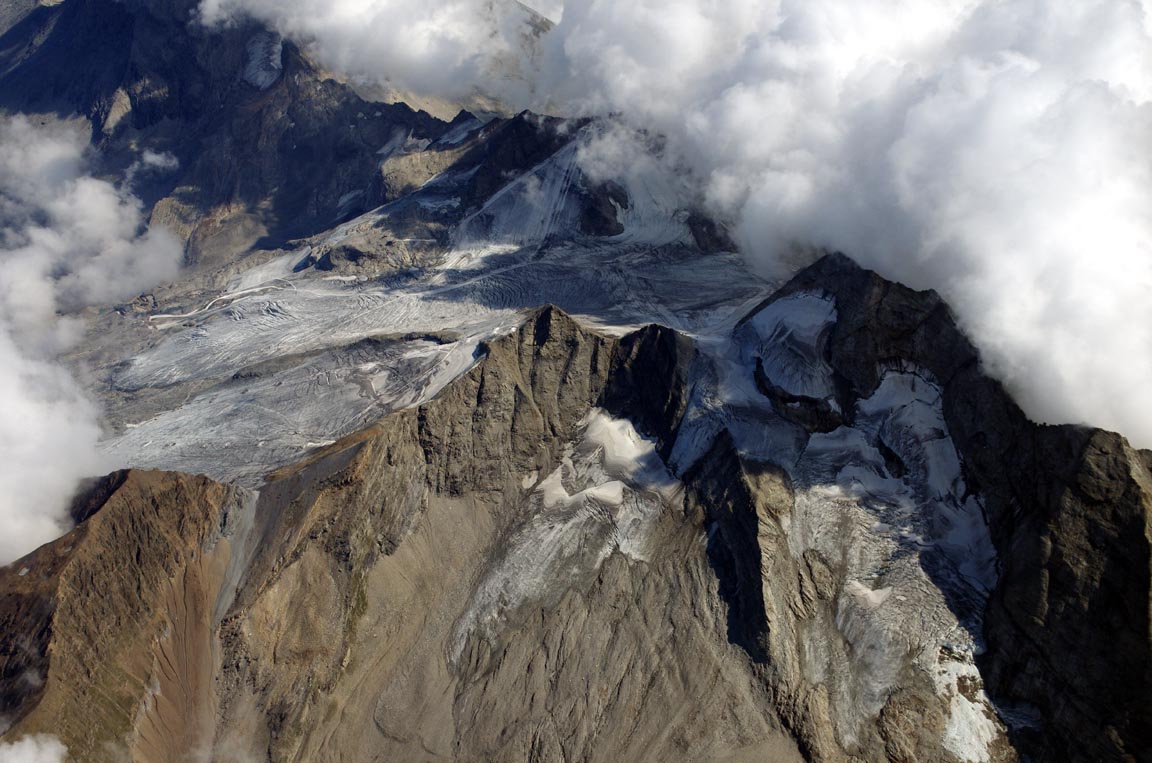
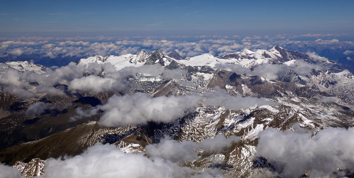
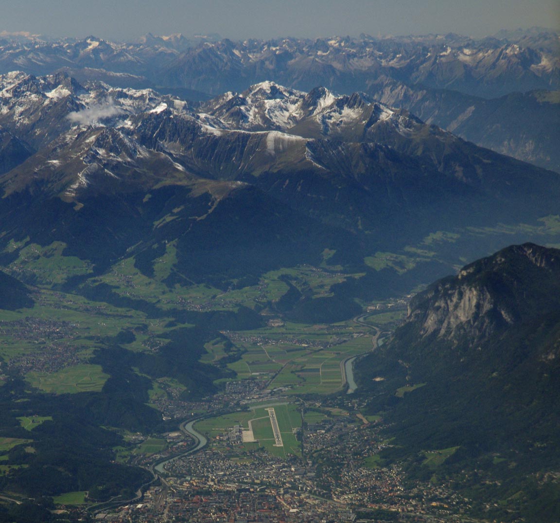
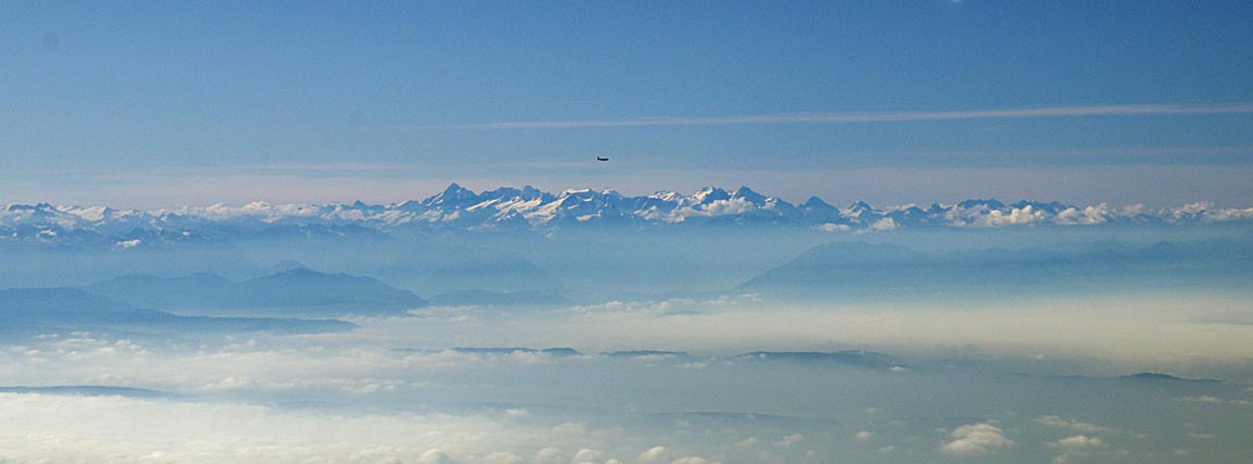
As the Alps appeared in the distance
we climbed to FL170. The MEA on the route was FL150 but FL170 offers better options for an engine failure, as well as more protection from turbulence caused by airflow over the mountains. The climb was not particularly quick, due to the temperature being well above ISA, at -6C. The TAS was 140kt, with GS reaching 165kt due to tailwind.
The wind on the flight varied from 25kt tailwind to 10kt headwind. Early on in the flight, the computed landing fuel on board (LFOB) figure stabilised around 32USG and stayed that way till the destination, within a gallon or two.
Over the Alps, the wind was generally under 10kt. A very rough rule is that for every 10kt of wind flowing across mountain ridges, one should be at least 1000ft above the terrain in order to limit the up/downdraughts to 500fpm. In this case, we were about 8000ft above most of the terrain, and there was no turbulence.
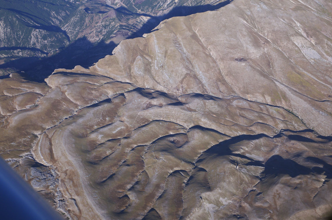
On clear days, the terrain is always spectacular
and this is not even near the "real" Alps which are a lot further to the west. I have done a number of crossings of the Alps above a solid overcast and while I do not mind because I have the risk covered, it is not ideal. At FL170, the terrain is mostly 8,000ft below... it appears much closer!
Immediately after the Alps comes Slovenia, and here is Portoroz
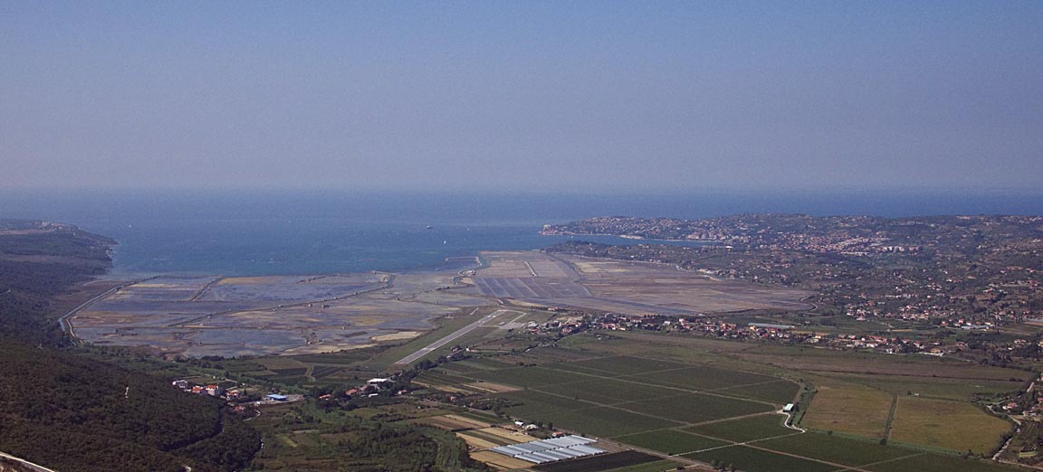
and here we are on final, having flown the VOR 15 approach procedure with a circle to land to 33 with a RH downwind leg. Presumably they don't go for the much more common right break to circle to land because it would take one into Croatian airspace. Relations between the two countries appear to be OK if somewhat "cool". The following approach looks steep, partly because I flew a tight right-base approach and partly because one has to clear a hill just before the runway
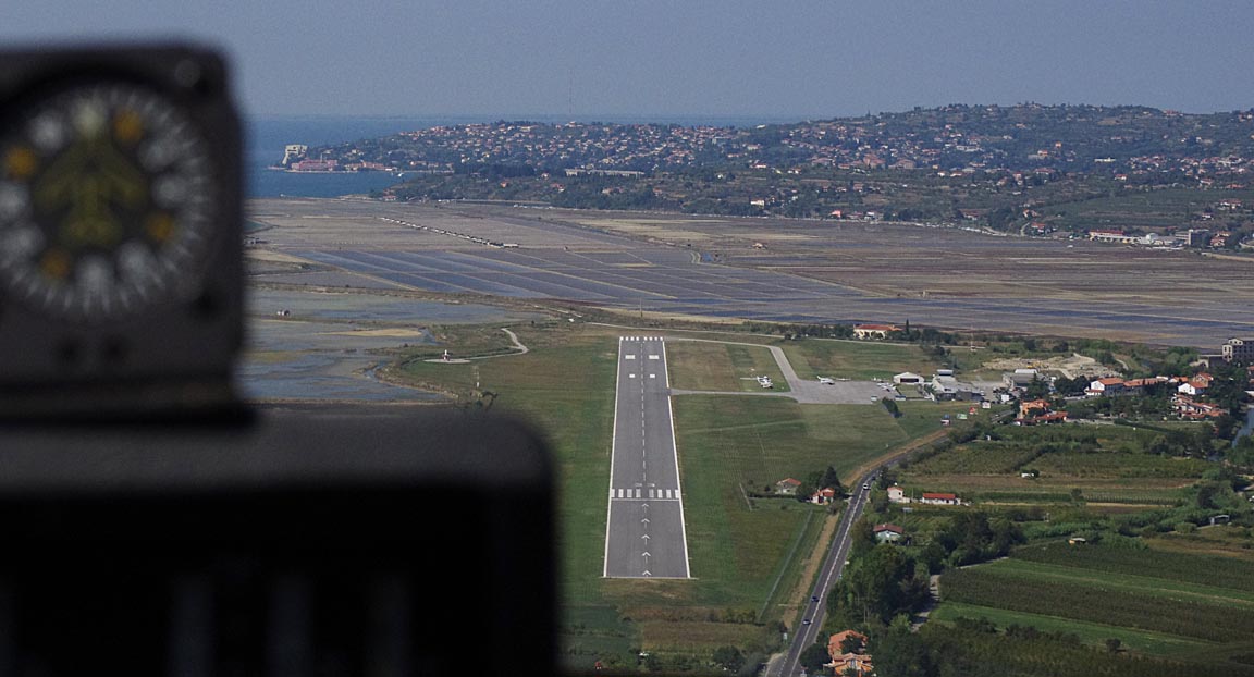
The hard parking is reserved for large aircraft only (jets etc) and locally based piston aircraft, so we pushed the aircraft back on grass which was in excellent condition
The route actually flown, from the Eurocontrol tracking facility accessible via EuroFPL, is here
I could not find any way to zoom it to see the track properly.
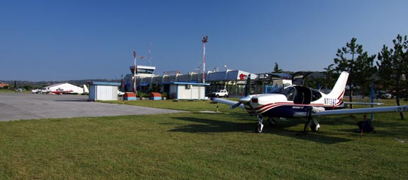
In line with all our previous experiences in Slovenia and Croatia, Portoroz Airport is a model of efficiency, with friendly and helpful staff and no hassle. A single policeman makes it an "international airport" with a Customs presence. The opening hours are reasonable, too: 0630-1800 UTC at time of writing. There is no sign of the UK yellow jacket brigade. [price info]
In line with the standard practice of always refilling immediately after arrival (to avoid departure delays) we refuelled right away. In a warm place, this has the drawback that one is likely to lose anything up to a gallon of fuel (approx 1% of the fuel tank content) to evaporation and fuel loss through the expansion vents as the tanks warm up, but is still worth doing.
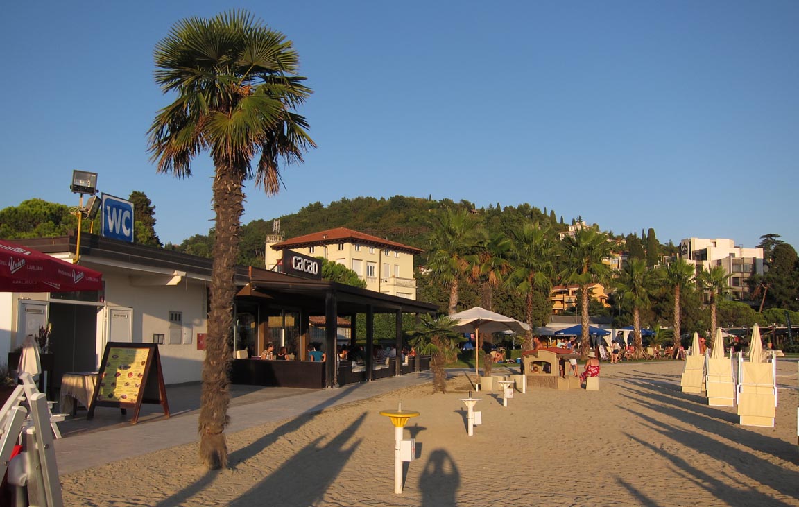
Portoroz
Portoroz is a very attractive town, with a mixture of Italy, Switzerland, and Yugoslavia
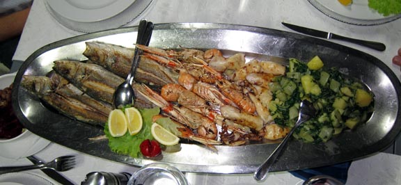
We met up with two other pilot friends, had an excellent dinner
and spent the night at the Tomi Hotel, and departed the following morning for Kerkira (Corfu).
Flight Portoroz-Kerkira
The weather was good. The 0600 and 1200 MSLPs, the satellite IR, the 0600 SigWx, and the TAFs/METARs were all clear.
LJPZ
ABLAT/N0150F130 P28 PUL/N0150F140 N606 ZDA L607 DBK R45 RODON N732 PITAS
LGKR FL140 Alternates: LGIO, LDDU
448nm (GC), 471nm (airways)
Kerkira LGKR has a 48hr PPR requirement which must be obtained in writing from the Hellenic CAA (HCAA) office at the airport. Every Greek airport which has an ICAO code is required have an HCAA office on site. On past visits, there were various hassles e.g. it took multiple faxes to get a response, or the local CAA (HCAA) staff claimed the PPR was actually 5 days. However, on this trip I concurrently contacted both the HCAA office (email kakkkt (at) hcaa.gr), and Olympic Handling (email cfu.staco (at) olympic-handling.aero) which is one of the mandatory handling agents. SwissAir reportedly offers a discount to holders of any AOPA card, but while I am a member of AOPA USA I did not have a card with me. Also, Olympic Handling are always the first out when one lands, leaving one with no opportunity to use other agents. You are able to refuse their service, and they probably should not turn up to meet you if you have booked in with a different handler, but I can't see why one would worry about it because we have found them excellent. Due to the need for weather related flexibility I had earlier (when still back home) asked for a PPR for any of several consecutive days. We got a rapid reply from Olympic, with the permission, and for the series of dates. Some days later the HCAA office also replied but refused to do more than one date (but they did say that an email the day before would do i.e. not the full 48hrs). Obviously it would be a bad idea to look a gift horse in the mouth and query the Olympic version against the HCAA version, so we ran with the former, but I had a printout of the permission email on my clipboard so I could read off the names on the bottom if ATC queried anything during the approach. The ability to get the PPR from Olympic Handling rather than the HCAA office is a big advantage but should not have been a suprise because that is how airports everywhere work - the handling agent lubricates things, in return for his fee, and often the handling agent is the only office at the whole airport where anybody actually works.
On IFR flights I normally fly the full arrival/departure/approach routes for practice; procedural or radar vectored. Portoroz is non-radar and is thus procedural. The departure from Portoroz was on the ABLAT 1S SID and I got an initial climb to 6000ft, followed by a handover to Pula Radar and a climb to FL130.
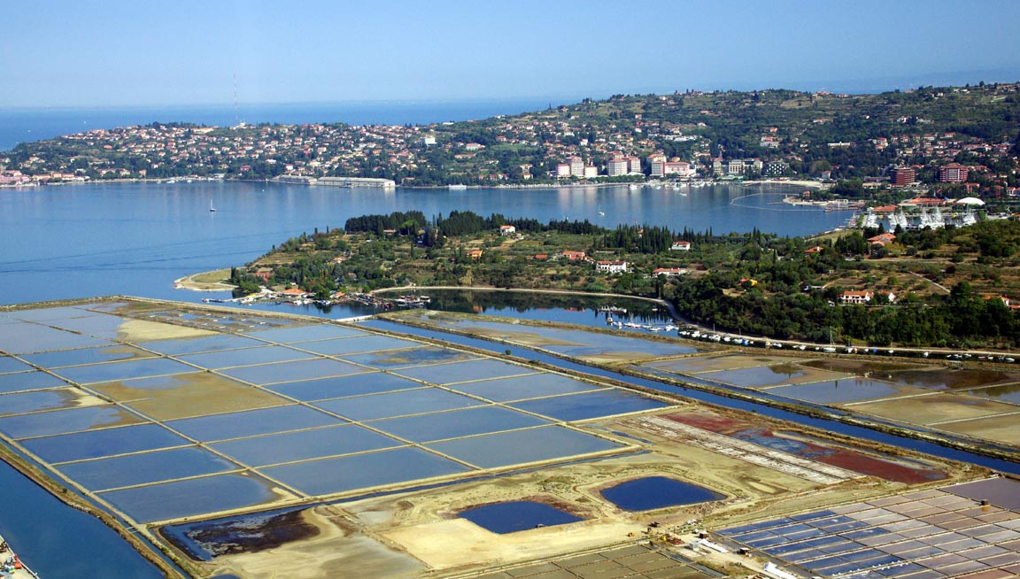
These are salt pans, viewed shortly after departure from Portoroz. Judging from the lorry-sized piles of salt and the price of sea salt in the shops, this is a lucrative business
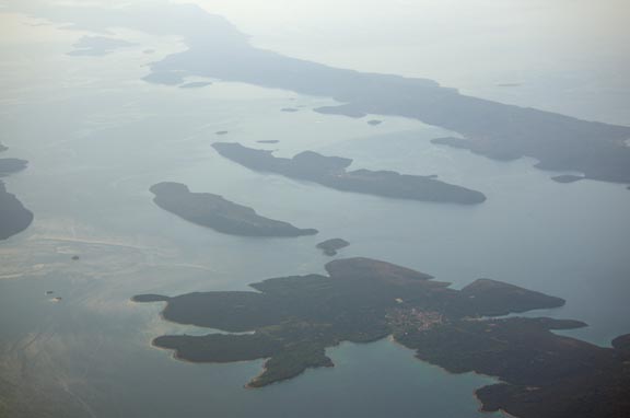
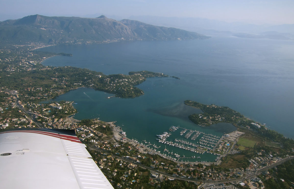
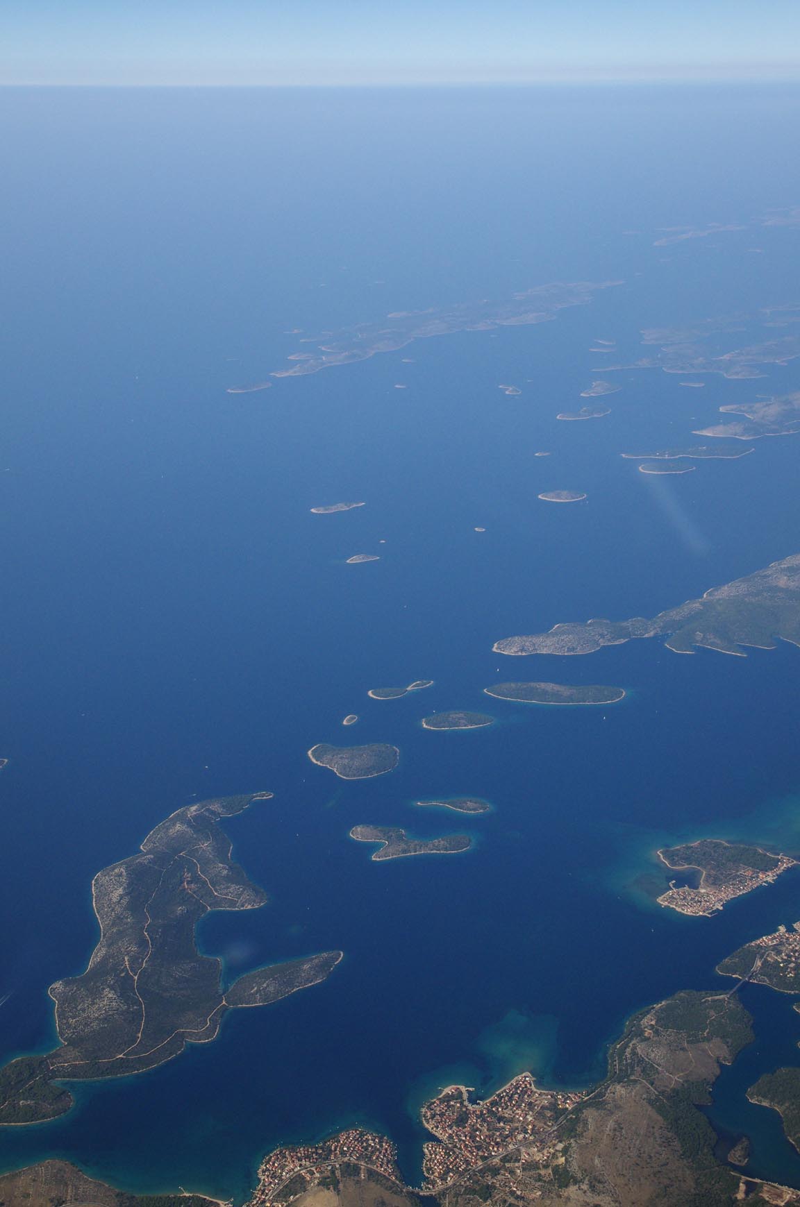
By now we are very familiar with the Croatian coastline and its hundreds of lovely islands; in this case poorly visible due to haze
On this trip I used a circular polarising filter on the Pentax K5 camera, and when appropriately rotated this improves the haze. It also produces a dramatically dark blue sky which is particularly evident when on the ground. The downside is that a polarising filter loses a lot of light but modern DSLRs like the K5 have a much more sensitive sensor so one can get reasonable images down to ISO 3000 or even higher; especially for website use.
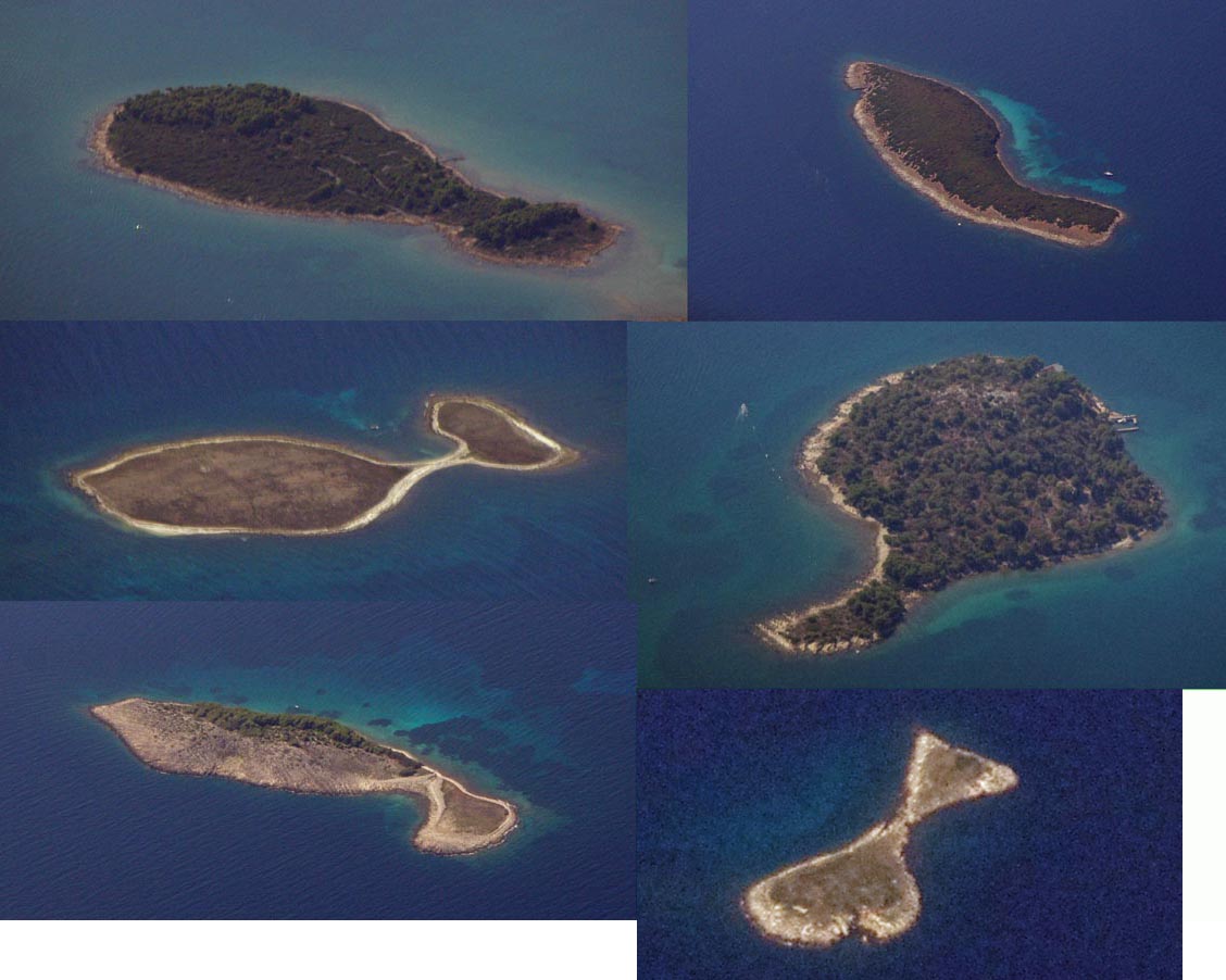
As on previous trips, we photographed every fish-shaped island encountered; here are some new ones
Some of our previous highly recommended Croatian airports were passed; the following pics were enhanced in Photoshop due to the haze below us at FL130:
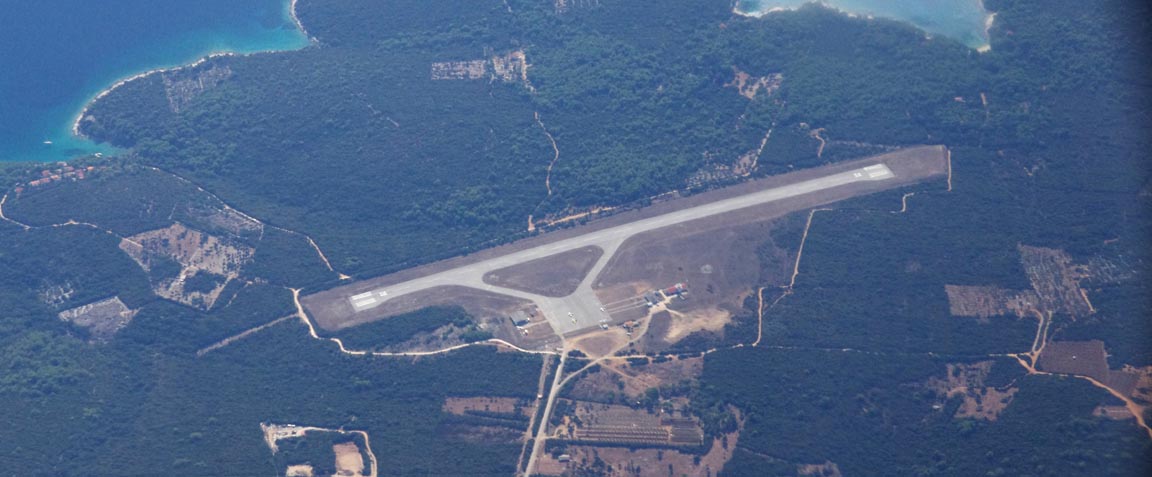
Losinj LDLO
Split LDSP
Brac LDSB
Brac and Losinj are particular favourites, for both the friendly airports (with Customs and avgas) and the islands themselves.
Not much was seen of Albania due to the haze. We did speak to Tirana Radar,
who were very clear as always. I cannot understand why so many ATC units, including
many in the UK, have crappy equipment (possibly just a crappy microphone) while
others are very clear. Radio was invented... when? Must have been a while ago
because the Titanic had it ![]() Generally, ATC in northern Europe is better than in the south, but the controllers
in Slovenia, Croatia, Montenegro and Albania are very good. Greece then goes
downhill...
Generally, ATC in northern Europe is better than in the south, but the controllers
in Slovenia, Croatia, Montenegro and Albania are very good. Greece then goes
downhill...
On arrival at Kerkira (the island is variously called Corfu or Kerkira, but the airport is called Kerkira) we were cleared to the VOR W 35 approach which initially goes to the KRK VOR, once around the hold (if approaching from the north) and then back to intercept the GAR VOR inbound
Olympic Handling were very efficient, very friendly, and we were refuelled and sorted within 15 minutes - a dramatic improvement from our previous visits to Corfu. Apparently Olympic have recently been privatised, and it really shows. However, you do need to do flight plan filing via the internet (who doesn't in 2011?) otherwise you still have to do the old Kerkira business of taking the stairs or the lift to the tower and presenting the written flight plan in person, with escorts there and back because it is all airside.
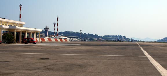
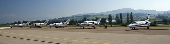
There were rather more aircraft parked there than we had seen previously
but their GA apron (in front of the disused and crumbling old terminal building) has a huge capacity which shows up the 48hr PPR as a pure job creation scheme
As always in flying, we filled up immediately after landing. Kerkira was the only airport I've been to in 2011 where I was able to use my AIR BP fuel card, which seems to be increasingly irrelevant in Europe where practically every airport accepts Visa. I gather some non-international French airfields require the TOTAL fuel card which needs a French bank account, but one cannot fly to those airfields direct from the UK anyway, and many are French speaking only..
We stayed 1 night at the Arcadion Hotel which was well located in the town centre (above MacDonalds) and was fine. Every hotel and rental apartment we have seen in Greece has exceptionally hard beds and this takes a lot of getting used to. Unless really tired, I find myself waking up every hour or two.
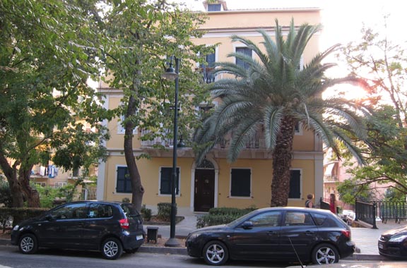
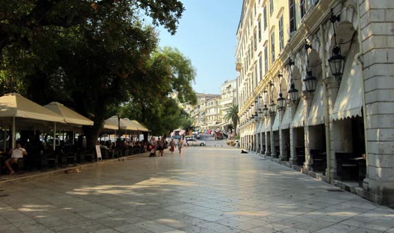
Corfu town is a mixture of upmarket areas
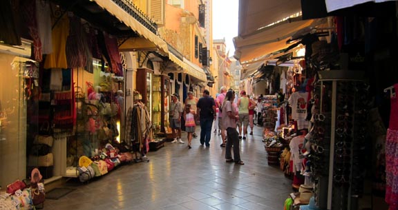
and endless amounts of tourist shops selling every imaginable type of Chinese made junk
Interestingly, there are many shops openly selling fake designer-name watches (D&G, IWC, etc) which go around €20-100. They are usually only partly functional, with the small dials etc just printed on.
A lot of the grand buildings are crumbling on the outside, but that seems to be common across Greece. My guess is that - unlike in the UK - they don't have a "management company" or similar arrangement which forces every tenant to pay €X/year towards exterior maintenance, and no other agreement can be reached...
Corfu is well worth a visit. It has a strong European flavour; distinct from the rest of Greece. It has a lot of "class" and does not suffer much from the British "fish and chips" cheap tourism which has ruined so many places. If you can, hire a car and have a drive around the island.
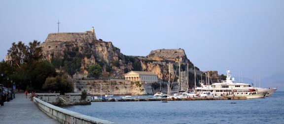
Above the town is the castle which is worth a visit even though there is not a lot to see inside
We have been to Corfu a number of times because it has Customs and avgas and presents the obvious (sometimes the only practical) entry point for most Greek islands. Out of the UK, in any reasonably long range aircraft, the best first destination is Croatia and from Croatia the main options in Greece are Corfu LGKR, Sitia (Crete) LGST, or the main Athens airport LGAV (about 2x more expensive than LGKR but not outrageous). I have other Corfu trip reports e.g. here.
The TB20 could make Shoreham-Corfu in a single flight. The Eurocontrol route is about 1150nm which leaves about 200nm to play with, which is OK as a legal IFR reserve but none of the reachable alternates have avgas, so the flight could be a recipe for getting into a right mess. It would of course be better to pick a day with a massive tailwind, which should not be too hard... The only way I would ever consider doing a flight like that would be to use the accurate fuel flow totaliser to take a view of the reserve after ANC and if it is below the limit, throw in the towel and divert to one of the Croatian airports. Dubrovnik would be the last chance...
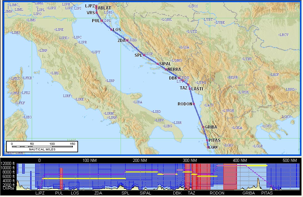
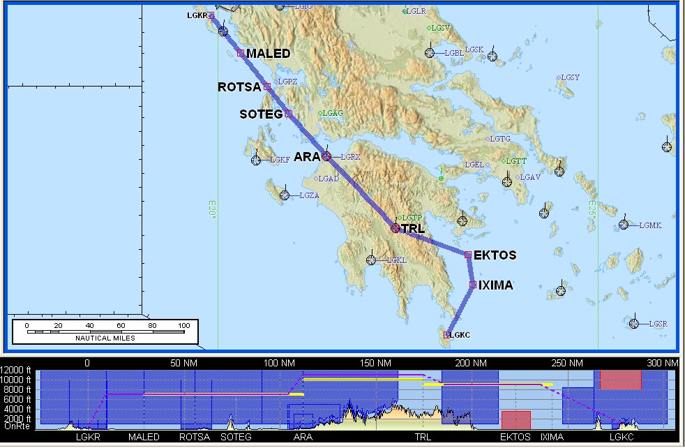
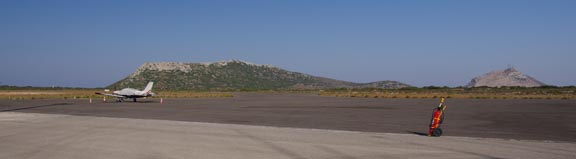
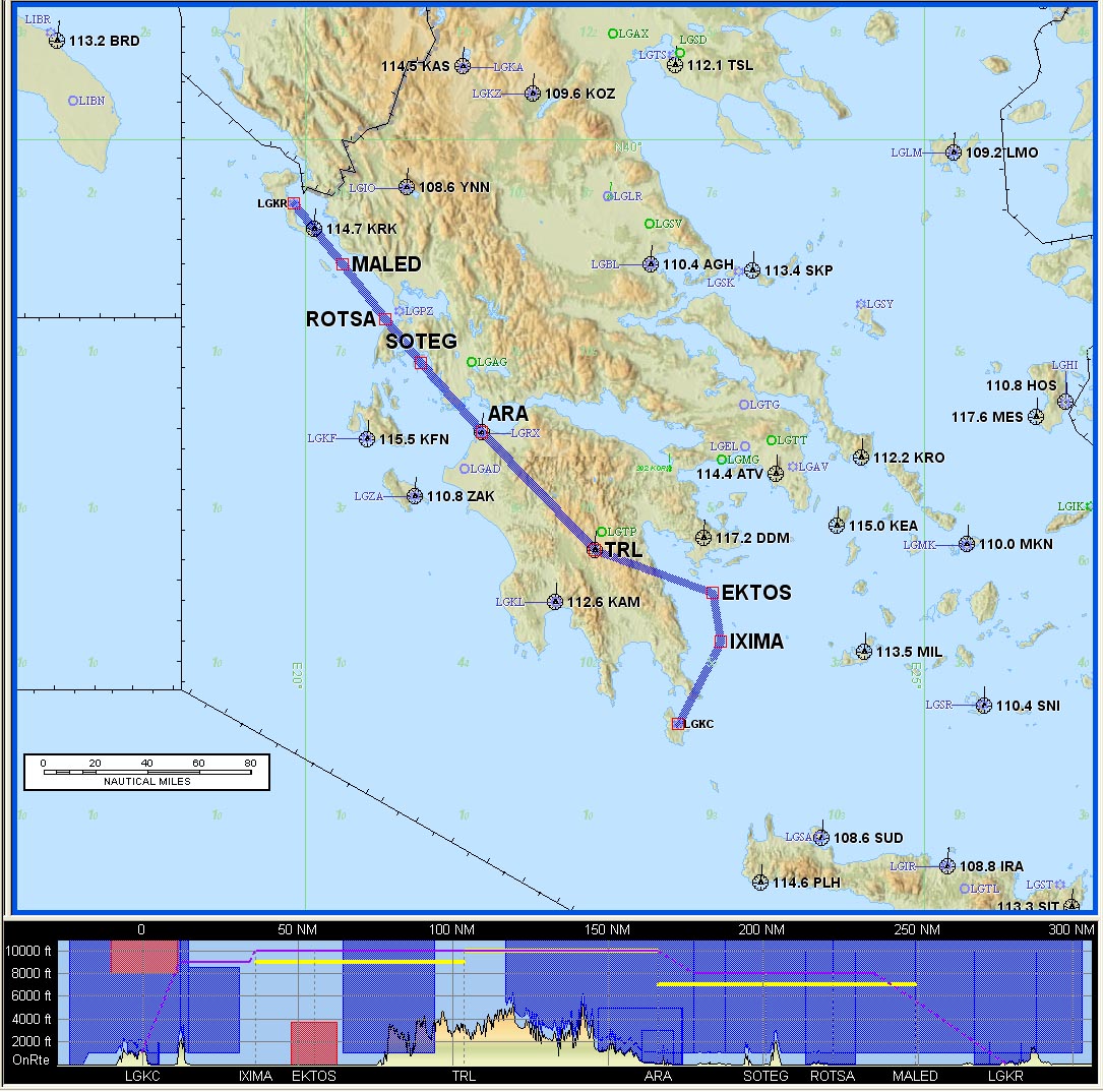
Flight Kerkira-Kithira
The weather was again very good. The 0600 and 1200 MSLPs, the satellite IR, the 0600 and 1200 SigWx, and the TAFs/METARs were all clear.
LGKR
DCT MALED A14 EKTOS B1 IXIMA DCT
LGKC FL140 Alternates: LGKR, LGSA
248nm (GC), 278nm (airways)
I filed Hania LGSA as the 2nd alternate even though it is 5-20 days' PPR. It has both Customs and avgas. Either alternate would be a Mayday situation because both are PPR...
Olympic Handling staff were again very efficient, getting us quickly through security, and the journey to the aircraft was under 30 minutes - again a big improvement on previous occassions.
Unfortunately, I made a couple of mistakes. The first was that my watch was on UTC+2 (from Slovenia) whereas Greece is on UTC+3 in the summer. While this did not affect the planned timing because it was all done in UTC, it resulted in us having apparently too much time at the airport, and together with having to aim to land within the 3-hour opening time of Kithira Airport, I decided to move the flight plan an hour earlier. This cannot be done as such (only delaying a FP is directly supported in the "system") so one has to cancel the FP and file a new one. That was the second mistake; a late FP filing is more likely to trigger a Eurocontrol slot. I thought this would be safe because Greek airspace is so self evidently devoid of traffic, and we checked the arrivals and departures board to make sure there was nothing happening at the airport.
As luck would have it, we got a time slot with a 2hr delay, which made reaching Kithira unlikely. I asked ATC, on the radio, if they can do anything, but they just said I could try cancelling and re-filing the original (later) FP, adding that only the handling agent could do anything with a FP. It was indeed suprising that ATC are unable to even delay a FP. I said the destination airport will close before I get there; they appeared helpless but came back a bit later with the closing time for Kithira which showed it would be OK but in fact that time was incorrect... maybe they got it from the ancient Greek AIP book which nobody uses. I also enquired about a VFR departure, which (after a while) ATC said would be OK, but by then I decided not to try that because we could get shafted by not being allowed to climb above weather, etc. In the sweltering heat I tried re-doing the FP
and managed to cancel the existing one, but when I tried filing the new one, the EuroFPL website threw up an error condition, complaining about invalid data in one of the FP fields. I went through each field in turn and found an invalid character after the aircraft tail number (no idea how it got there; perhaps a slip on the keyboard) but there was another one elsewhere which I never found. So I used my backup FP filing method: AFPEx. That worked fine, but somehow the slot remained, so given the +35C heat I asked ATC to call up Olympic Handling and collect us and take us inside the airport building where we could wait for the 2 hours. Olympic kindly let us sit in their airside office, which avoided another round of passport checks, etc. And, as usual, the Eurocontrol slot shrank somewhat, so we departed about 1hr late.
There is nothing new to learn here, except to not try to be too clever! And always have two ways of doing everything! The EuroFPL issue was never resolved. I rather like AFPEx for its simplicity (some notes on online flight plan filing are here) but it has two major drawbacks: there is an effectively randomly timed ~ 3MB update of the massive Java application (which could be an issue if you are on a roaming data connection, or on any slow data connection e.g. GPRS), and it doesn't support notification of incoming AFTN events (e.g. slots) via SMS or email. The last one means that the first you will hear of a slot is when you try to depart and ATC tells you that you can't go.
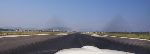
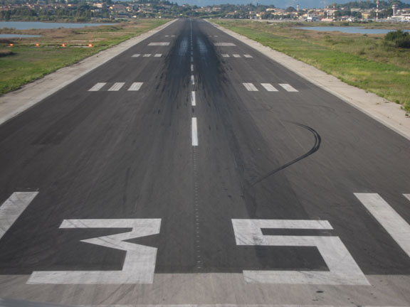
We departed on the MALED1F SID in ISA+20 conditions but the runway is plenty big enough
The route (above) has an obvious kink after TRL which I was hoping to straighten out once enroute. Fuel economy was important because Kithira has no fuel (of any kind) and I wanted to have as much in the tanks as possible after landing there, for the best departure options.
Another reason for landing with maximum fuel was that this trip was made during the severe Greek debt crisis and it could not be ruled out that there might be a financial system collapse resulting in an inability to purchase fuel, in which case an "escape" flight completely out of Greece would be the only way.
The flight was straightforward, with very little visibility due to the haze whose top was found at FL130. We got the shortcut after TRL, on the condition that we remain at/above FL110 until 20D after TRL, but only after Athens Control transferred us to the Kalamata airbase for the final part of the flight (after TRL). We lost radio comms with Kalamata shortly afterwards (a well known problem in the area, due to terrain) but another aircraft relayed a message that we should change to Kithira AFIS for further instructions.
This is the Sparti "airbase" which appears very quiet
In fact it is sporadically used by the Hellenic Air Force (HAF) during the summer as a base for their crop spraying aircraft; a service by the state to the farmers. For unknown reasons it is not accessible to GA, which is a great pity since the historic town of Sparta is nearby.
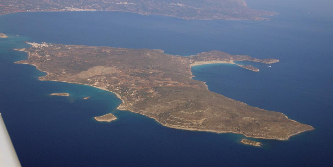
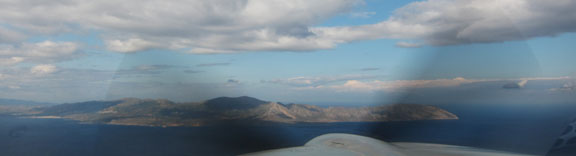
This is Elafonisos; a small island before Kithira to which one can get a boat trip from Kithira
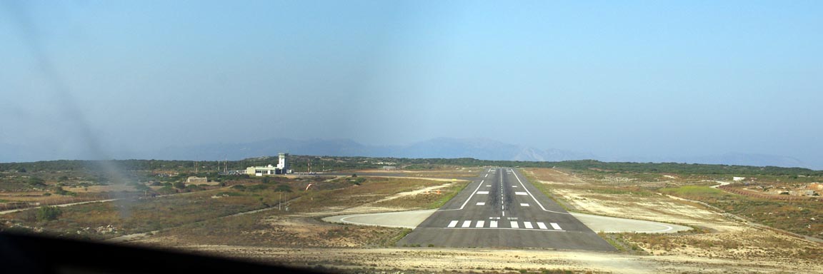
To save fuel I did not ask for the instrument approach and flew a visual approach to runway 02. Here is the downwind leg, on which we descended from about FL100 to 3000ft
with a further descent onto final
Only about one other aircraft - a scheduled flight from Athens - was due to
land that day, so what looked like the entire airport staff turned up to greet
us, with a pair of 747-sized chocks ![]() We were processed very quickly
We were processed very quickly
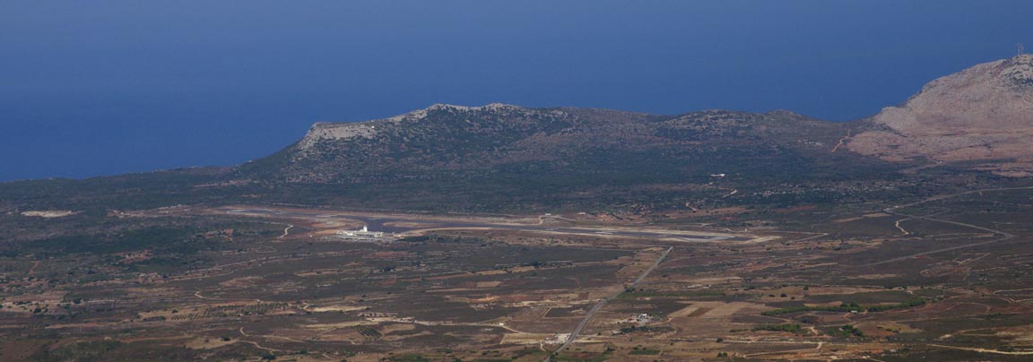
For true aviation connoisseurs, this is the airport VOR, which was notamed INOP but actually was working, though the DME wasn't
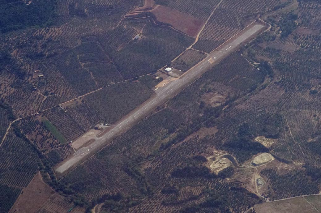
Kithira Airport appears to be of new construction. It is another undiscovered Greek gem like Sitia in Crete, and is is a unique case in Greece in that despite not being a Port of Entry, it is OK for a flight to/from Schengen countries. There is a shop, a cafe, and a car hire outfit (Panayotis) which was remarkably cheap at €35/day for a little car.
Like Sitia LGST, Kithira does not have ATC. It is "Information" i.e. AFIS.
If Kithira had avgas, it would be wonderful. They could do what Sitia does: keep it in drums. They would get a lot of business.
The airport certainly has plenty of room
One of the many great things about Greece is that large parts of it have not yet been affected by the strictly policed northern European way of life. If you fly to Kithira - or perhaps most of the Greek islands - say once a month, you can keep an old car parked at or near the airport. When you next visit, it will still be there. Little things like that are real luxuries. If you tried this where we live, the car would be towed away, or stolen, or vandalised, within days.
We spent 5 days at the village of Kapsali in the south of the island, in the Kapsali Sun apartments, where we got a huge double apartment (big enough for 6 people) for €60/day, and rented a car to drive around the island.
The island was mostly deserted, with hardly any road traffic. This was a real eye-opener and was possibly partly due to it being off-season (17th September onwards) but also it is hard to reach since almost the only flights are from Athens, and while Greece has boats going everywhere, they are very slow due to the distances.
Kithira is really beautiful, with lots of postcard photo opportunities:
Diakofti:
Suprisingly, the above pic has not been photoshopped. I merely used a circularly polarised filter on the camera.
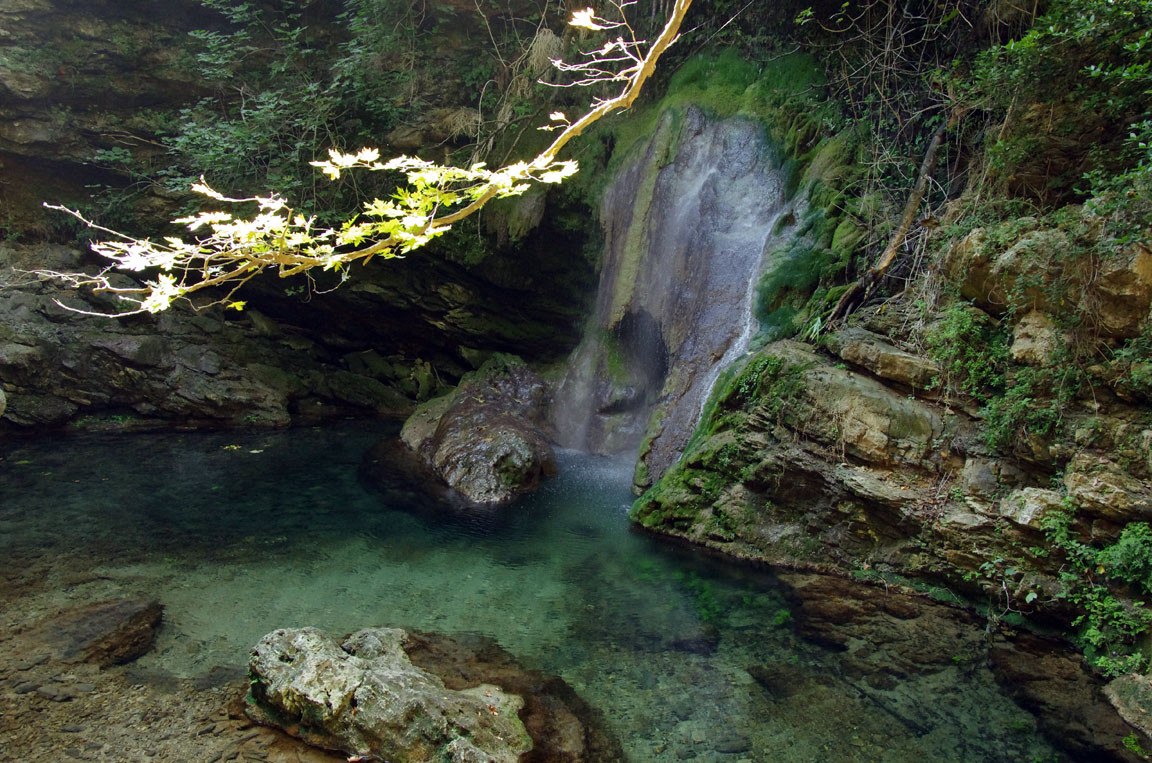
Mylopotamos waterfall:
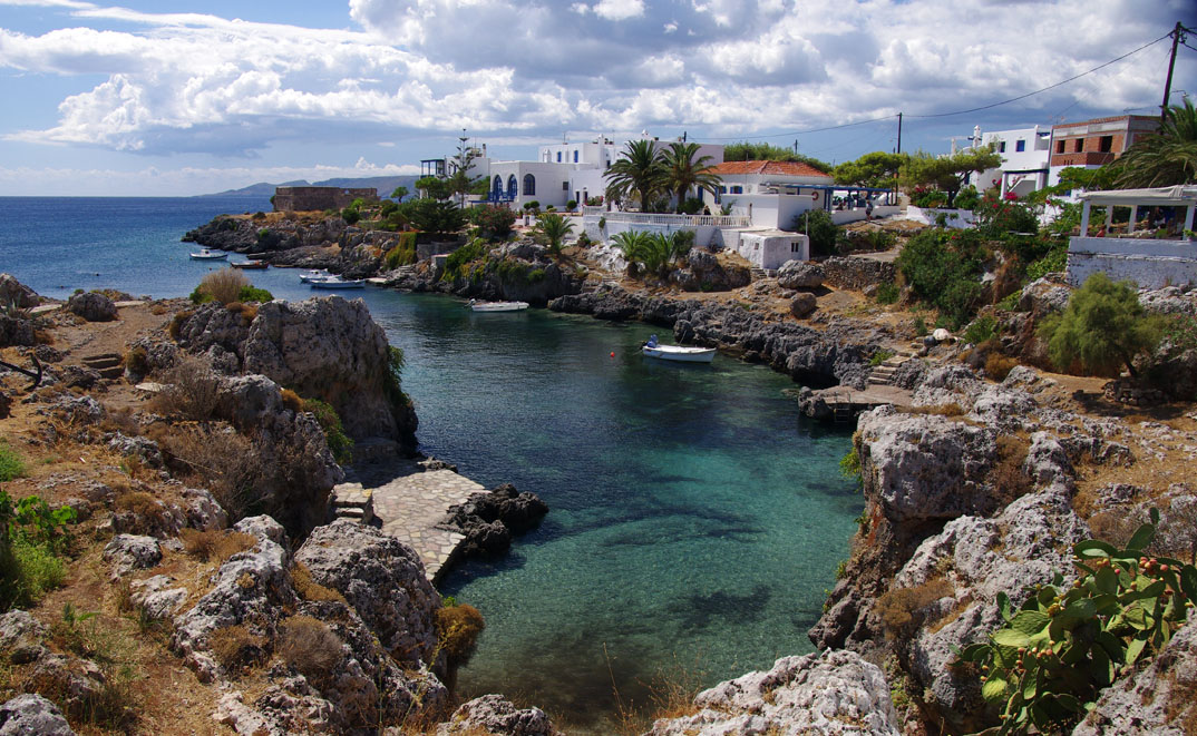
Avlemonas:
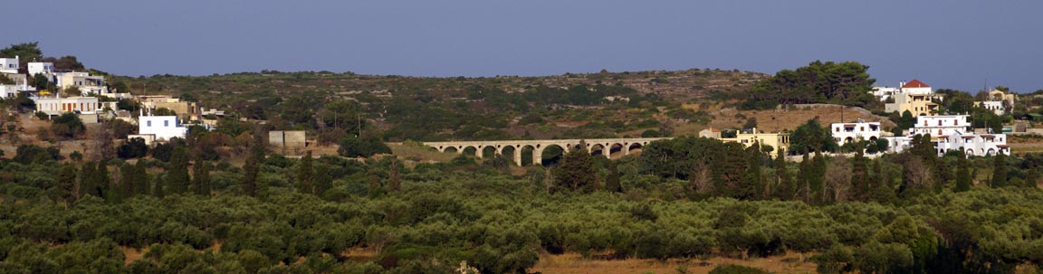
Curiously, this bridge was built by the British
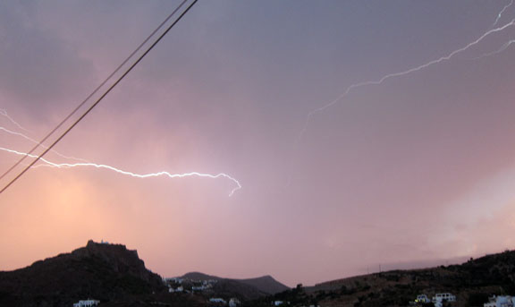
Nearly all long trips like this one are worked around the weather patterns, so some flexibility on flight dates is necessary. While we were at Kithira, there was a lot of very bad weather passing to the north, and getting back to the UK would have often been hazardous to say the least due to the usual weather patterns up there.
The 5 nights in Kithira worked out just right because it is not a huge island and there were also a couple of days there when flying anywhere would have been "character forming" to say the least
JUSTINE'S TOP SPOTS IN KITHIRA
Potamos: For a different kind of shopping experience from your usual Tesco run try the Sunday morning market in Potamos. Here you can buy vegetables, fruit, honey, cheese, flowers and every type of local produce, or just kill time having coffee. When you're all shopped out and in need of a memorable feed try the wild mountain goat in oregano sauce at the restaurant in the town square.
Chora: Essential visiting for fantastic views and traditional houses with woodwork painted in ice cream colours. Even the car park has a fabulous outlook down to the sea. Stavros on the way into town sells local goodies and some dusty but interesting books. A decent supermarket in the middle of town, a travel agent and not one but two (!) working ATMs make this a functional stop as well.
Kapsali: A good place to stay if you want to be right on the beach, with enough tavernas to keep you going for a week even late in the season, and a small supermarket for self-caterers.
Diakofti: The presence of two wrecked boats doesn't seem to stop people coming here for the ferry but apart from this the place is truly the back of beyond. If you really want to escape from it all come here for crystal clear water and deserted beaches. The view from the road winding down the hillside is amazing - on a clear day you'll see all the way to the mainland mountains.
Avlemonas: I fell in love with this paradisally gorgeous fishing village. Give yourself a real treat and try to spend a night or two here; you may never go home again. The colours are out of this world, as is the almond cake at the café on the way into town. The man in the minimarket sells olive oil from his own trees, and you can buy local sea salt.
Flight Kithira-Kerkira
With 62 USG in the tanks, flying back via Kerkira LGKR was the only real option. I filed Dubrovnik as the alternate. Fortunately, obtaining the PPR for Kerkira from the Olympic Handling agent seems to be a very smooth process now, and I did not bother contacting the LGKR HCAA office at all.
The weather was again good. The 0600 and 1200 MSLPs, the satellite IR, the 1200 SigWx, and the TAFs/METARs were all clear - except for a PROB30 TEMPO 2203/2212 5000 RA SCT012 BKN030 at Kithira, but when we got there, none of that was actually present.
The route was an exact reverse of the outbound route, which is unusual in Europe
LGKC
DCT IXIMA B1 EKTOS A14 MALED DCT
LGKR FL140 Alternate: LDDU
248nm (GC), 278nm (airways)
Upon our arrival at the airport, we hit another big problem: a strike of Greek air traffic controllers, connected with the Greek debt crisis:
A1659/11 - DUE TO INDUSTRIAL ACTION OF AIR TRAFFIC CONTROL
PERSONNEL SERVING
AT ATHINAI/MACEDONIA ACC, ATHINAI/TMA, ATHINAI/ELEFTHERIOS
VENIZELOS ATZ/TWR, PARTICIPATING IN GENERAL WORK SUSPENSION OF THE
CONFEDERATION OF UNIONS SYNDICATES OF GREEK CIVIL SERVANTS
(ADEDY), FLIGHTS WILL BE AFFECTED.
THE FOLLOWING FLIGHTS WILL BE SERVED:
1.TRAFFIC DEPARTING/ARRIVING TO LGTS VIA LWSS/FIR, LBSR/FIR.
2.TRAFFIC DEPARTING/ARRIVING TO LGKR BIA LIBB/FIR, LAAA/FIR.
3.TRAFFIC DEPARTING/ARRIVING TO LGRP VIA LTBB/FIR.
4.ALL ACFT OVERFLYING ATHINAI FIR/HELLAS UIR.
5.VIP FLIGHTS (HEADS OF STATES-PRIME MINISTERS)
6.ALL STATE OPERATIONAL ACFT PARTICIPATING IN SCHEDULED EXERCISES.
7.FLIGHTS IN UNUSUAL OR EMERGENCY SITUATIONS.
8.HOSPITAL FLIGHTS.
9.HUMANITARIAN FLIGHTS
10.SEARCH AND RESCUE FLIGHTS. SEP 22 0930-1230, 22 SEP 09:30 2011 UNTIL 22
SEP 12:30 2011. CREATED: 21 SEP 10:20 2011
I had actually not seen the above notam because when flying IFR I don't get enroute notams; they have little value for enroute IFR where one is flying under ATC control, in an RNAV environment where INOP navaids are irrelevant. I get just airport notams... What I got was a Eurocontrol slot with a 2 hour delay. This threatened to delay the flight almost to the point where Kithira airport would be closed before we got away. However, in common with most Eurocontrol slots, this slot shrank 3 times, eventually resulting in a delay of just 10 minutes. Apparently, the ATCOs went back to work shortly before my 1230 UTC filed EOBT.
Getting out through Kithira airport was very quick, with the Olympic Handling staff escorting us out, via the HCAA office where someone signed off the GENDEC form already prepared by Olympic (not sure why Greek airports need this but it does certify that the passengers do not have tuberculosis), and out on the apron. The charges were very reasonable - around €40 for landing and 5 nights' parking. They appeared to not charge for handling as we did not have any.
The departure clearance did not mention any SID; it was just "cleared to destination, FL120, squawk 7036" so I simply departed DCT IXIMA, etc. There is a bit of "terrain" there
though nothing like what one has at Corfu...
We departed Kithira with 62USG. Once stabilised enroute, the LFOB (landing fuel on board) figure for Kerkira LGKR was 39USG. I loaded Dubrovnik LDDU (the filed alternate) as the destination and got 20USG, which is a reasonable figure.
2hrs later, here we go again; another landing at LGKR. I have no idea how Justine managed to get this photo...
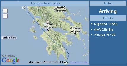
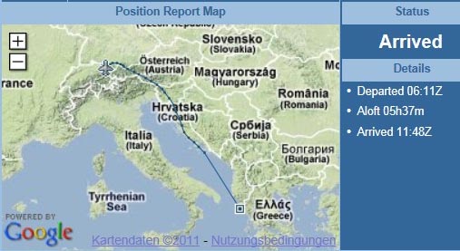
The route actually flown is this; essentially identical to the filed route
As we were going to depart early the next morning, we paid all dues after landing, together with the avgas. This saves a lot of time later, and is another improvement at Kerkira where this was not possible in the past. It was interesting to discover that Olympic Handling treat a visit under 24hrs as a "technical stop" and charge €43 instead of the standard €80 which is the starting cost of longer visits.
I found that the avgas bowser at LGKR under-delivered by about 3%, which is a little naughty. I always fill right up so it doesn't affect safety.
Another reasonably healthy evening out... It can be difficult to find reasonable food on holidays, but Greece makes it a lot easier than northern Europe
Corfu is a nice place for an overnight stop. Even late in the tourist season, almost everything is still open.
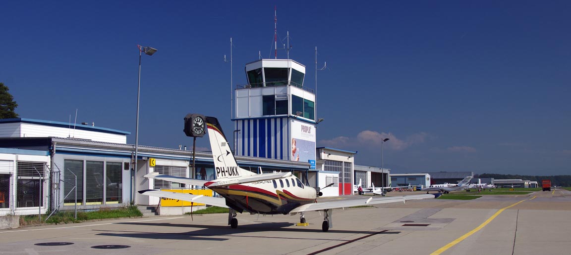
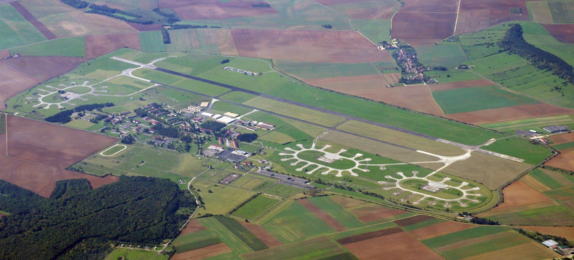
On the morning of departure, there was some interesting hardware
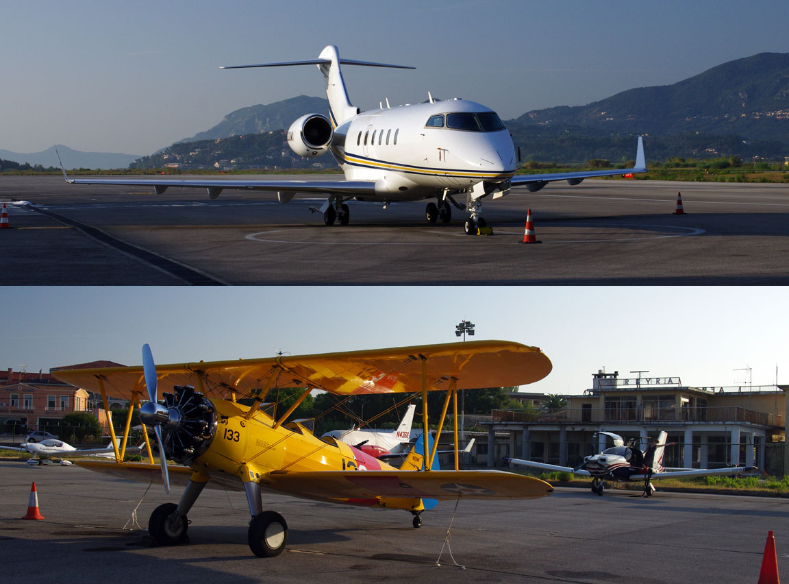
The jet seems to be a common fixture there but the Stearman was unusual.
We had to depart at a specific time because St Gallen closes for lunch, which is really stupid for an airport that serves a lot of business jets. If you aim to arrive shortly before lunch, all you need is a Eurocontrol slot and you are stuffed, so the only "safe" option is to aim to arrive either well before lunch (which in our case would have meant a very early departure from Kerkira) or just after lunch. We went for the latter, which meant an 0600 UTC departure. Another thing to check (with Olympic) was whether there would be a lot of traffic at Kerkira around that time (ATC there tend to put light GA on an indefinite wait until all the jets are out of the way) but 0600 UTC was clear.
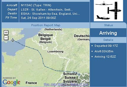
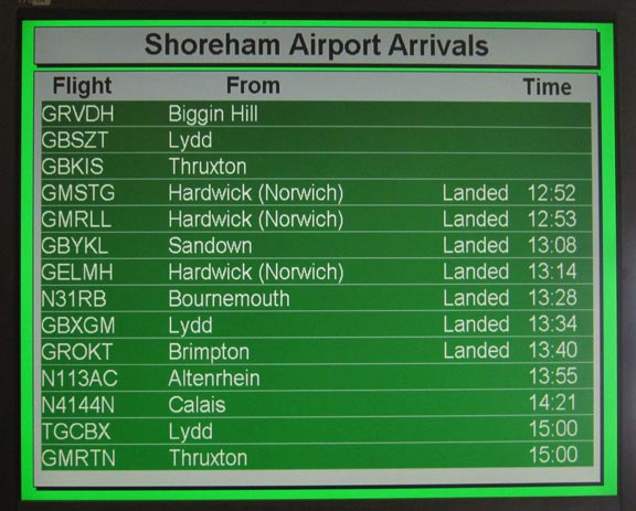
Flight Kerkira-St Gallen
The weather was again very good. The 0600 and 1200 MSLPs, the satellite IR, the 0600 and 1200 SigWx, the sferics, and the TAFs/METARs were all clear.
LGKR
NIKRO M127 OVVER L611 RODON R45 DBK L607 SPL L862 EPODO/N0150F150 L862 GIMIX
L608 KPT
LSZR FL140 Alternates: LSZH, EDNY
651 nm (GC), 724nm (airways)
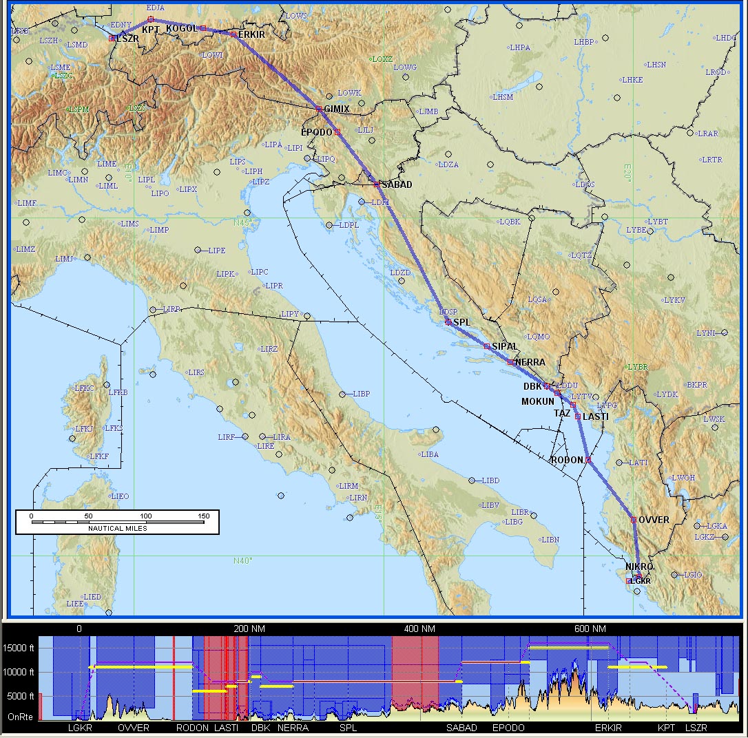
An alternative route was prepared which is slightly shorter and passes nearer the higher and more scenic parts of the Alps
but it was not flown because the east coast of Italy is far less scenic than the coast of Croatia, and most of the flight would be over water and out of glide range.
The first waypoint on the filed route was NIKRO and we got the NIKRO 2F SID. This has an elaborate track to reach 10000ft by NIKRO, which we almost reached. For some reason, ATC asked for FL110 by NIKRO. The TB20 can climb fast enough but in VMC conditions and particularly in the hot weather I put more effort into engine management and keeping the hottest cylinder (#3) below 400F, which involves climbing at 120kt+ instead of the 95kt Vy. Anyway, the long-winded SID provides ample opportunities for sightseeing
We did wonder, upon leaving Greece, what it will be like next time we fly there. It was in a severe financial crisis whose resolution will involve huge upheavals.
The barren hills of Albania appear very soon
Further up, in Croatia, the route passes near the big but little used Zadar (LDZD) airport, seen here in thick haze
We visited Zadar last year. The city is lovely and well worth a visit.
The Croatian islands are always a great sight
Due to the possibility of fog over a large area north of the Alps, I used the Thuraya 7100 satellite phone, connected to the LS800 tablet computer via a USB-RS232 connection, to get weather for various destinations
The EGKK data above was not applicable to this leg, obviously, but it was worth looking at for the following day's long TAF.
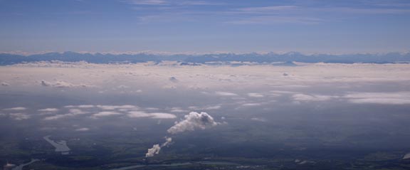
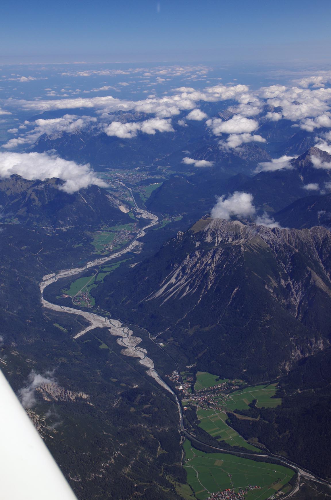
We got some long DCT shortcuts, including a 160nm one to KPT. The Alps had only a very slight amount of cloud
This is Innsbruck from about FL140
Here is a
video (50MB MP4) of a small piece of that flight. I won't get any awards
for it ![]() but it is interesting
to note what video quality can be achieved using the MP4 format. The Canon Legria
G10 original (1920x1080x50i) was edited using Sony Vegas and then compressed
with Handbrake using the "Iphone 4" HD preset at about 2500kbits/sec.
It should play fine with VLC
Media player, or Apple Quicktime player, etc. and plays fine on an Ipad. Here
is a Vimeo version
of the video, which plays fine on most devices including an Ipad. Unfortunately
neither of these videos will play well on an older computer, or over a slow
wifi connection.
but it is interesting
to note what video quality can be achieved using the MP4 format. The Canon Legria
G10 original (1920x1080x50i) was edited using Sony Vegas and then compressed
with Handbrake using the "Iphone 4" HD preset at about 2500kbits/sec.
It should play fine with VLC
Media player, or Apple Quicktime player, etc. and plays fine on an Ipad. Here
is a Vimeo version
of the video, which plays fine on most devices including an Ipad. Unfortunately
neither of these videos will play well on an older computer, or over a slow
wifi connection.
I normally print out all approach plates required for a trip, before leaving home. For some reason I could not find the St Gallen ones, but had them on the Ipad.
Radar vectors onto the ILS 10 approach are provided by Zurich. I had asked earlier if they would be procedural or vectored, because the STAR(s) need to be studied in the former case. There was a circling approach to runway 28 which has a left break because the plate says circling is "not authorised south of the airport". Actually there is loads of room to the south, but presumably not for a large aircraft and according to the approach design criteria. This is ILS 10, taken before breaking off to circle, in heavy haze and enhanced as far as it could be
At this point we got a spurious but increasingly urgent GPWS warning from the Garmin 496, which evidently has some defective data in its terrain database. There are indeed mountains in that direction but they are much further away than the 2 minutes' extrapolation of the current track which is what the 496 is supposed to be doing.
This is a pic from right base to runway 28
and final
With reassuringly expensive hardware around
including this TBM with an "interesting" tail number ![]()
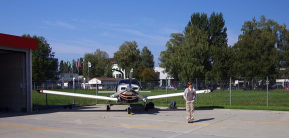
and it being Switzerland, the airport is unsuprisingly efficient and everything happens instantly and with a smile. Well, except the crazy lunch break which drops a spanner into flight planning... I asked for hard parking; it sounded like this may have been an issue but we got it for the 1 night. Justine was very happy to stretch her legs after the long flight from Corfu
The actual track flown, from the Eurocontrol tracking facility accessible via EuroFPL, is here
There is an obvious problem with the first part of it, where Eurocontrol did not pick it up until around Dubrovnik, so it just shows a straight line.
We stayed with a very kind pilot friend at Lichtenstein (40 mins' drive away) in an amazing house an an amazing location on the side of a mountain. He flies a TB20 too, which is virtually identical to mine and one of the last few built, from another airfield (with a 490m runway) which has no Customs but with Switzerland being Schengen this is not a huge problem for pilots based there and flying mostly in central Europe.
Flight St Gallen-Shoreham
The weather was again good, with a high pressure still holding over much of Europe and keeping some frontal weather away from the south east of the UK. The 0600 1200 1800 MSLPs, the satellite IR, the 0600 1200 1800 SigWx, the sferics, and the TAFs/METARs were all clear except for the 5000 BR BKN008 at St Gallen which is perfectly fine IFR flying weather. The few lightning strikes seen at the UK end in the sferics data are not alone significant; one can get isolated strikes like that almost anywhere and they tend to be caused by little lumps of cumulus at high altitudes; not an issue as there was the option of an early descent in UK airspace (near DVR) followed by a low level flight under any weather which might be hazardous at high altitudes. The winds for 0600 and 1200 looked fine too, though this is obvious from the MSLP charts anyway, and with the flight being under 40% of the aircraft range, we had loads of spare fuel.
LSZR
DCT TRA L856 HOC G4 RLP B3 BILGO H20 XORBI H40 ABB T27 GURLU Y8 WAFFU DCT
EGKA FL140 Alternates: EGHH, EGMD, EGMC
435 nm (GC), 485nm (airways)
The flight plan was filed, via EuroFPL as usual, the previous evening. The departure time of 0900 UTC was chosen to be 1hr before the airport closes for lunch, which should take care of any Eurocontrol slot. Interestingly, the ACK message arrived by email (and was visible on the EuroFPL website, post-filing) but not by SMS, which suggests that the network which my phone was roaming on at the time (from memory, Orange Switzerland) does not have an agreement with the network into which EuroFPL are injecting their SMS messages. This issue is rare in terrestrial GSM (it is very common with satellite phones whose SMS interoperability with terrestrial networks is poor). It didn't matter, but would have prevented using SMS to delay the flight plan...
We paid for the landing, parking and fuel on the morning of departure. The landing and parking came to about €85, and Avgas was €2.34/litre.
The first waypoint on the filed route was TRA and we got the TRA2V SID. The KLN94 GPS does not have RNAV SIDs/STARs stored whole (how Honeywell managed to get away with that on an "IFR" GPS...) but it does have the individual waypoints for these RNAV procedures in its database i.e. SITOR, ZR500, ZR501, ENIBI, TINOX, TRA and with the Sandel EHSI driving the autopilot, the entire departure can be flown automatically.
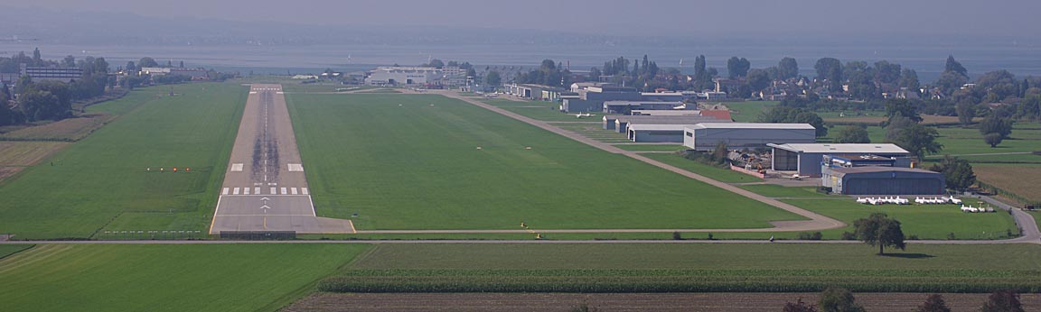
St Gallen was overcast at 700ft with a 5000m visibility
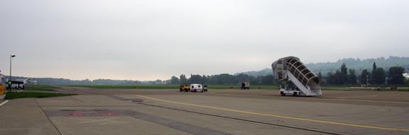
Here is a fine demonstration of how accurate a "cheap" handheld GPS can be in altitude, especially when receiving EGNOS
The actual error is several feet because the GPS is yoke mounted...
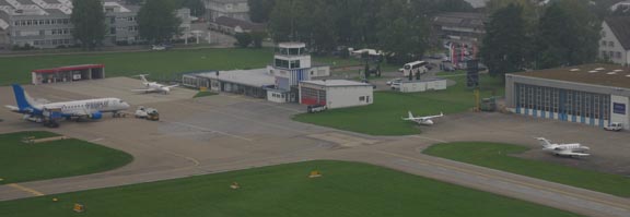
One can see there is not a huge amount of GA parking especially when something bigger turns up
The departure (initial clearance 5000ft) took us into cloud very quickly but we were on top very soon

As usual, most of the SID was skipped because we were handed over to Zurich immediately after departure and they cleared us SITOR TINOX, with a climb to FL120 where we stayed; I asked for a stop climb there, instead of the filed FL140.
This pic shows the only other aircraft which we saw on this entire trip
The "crowded European skies" is a myth perpetuated by loads of job-creation axe grinders... The reality is that, in the FL100-FL190 airspace used by most light GA, there is almost nothing there, and the Eurocontrol routings keep GA traffic away from the busy terminal areas (see the long detour around Paris on the LSZR-EGKA flight, VATRI-XORBI, for example, which applies to all traffic below FL200).
Due to the lack of weather, we descended from FL120 to FL100 in France. Justine is not so keen to have the cannula stuck up her nose the whole time...
Flight over northern France offers little scenery
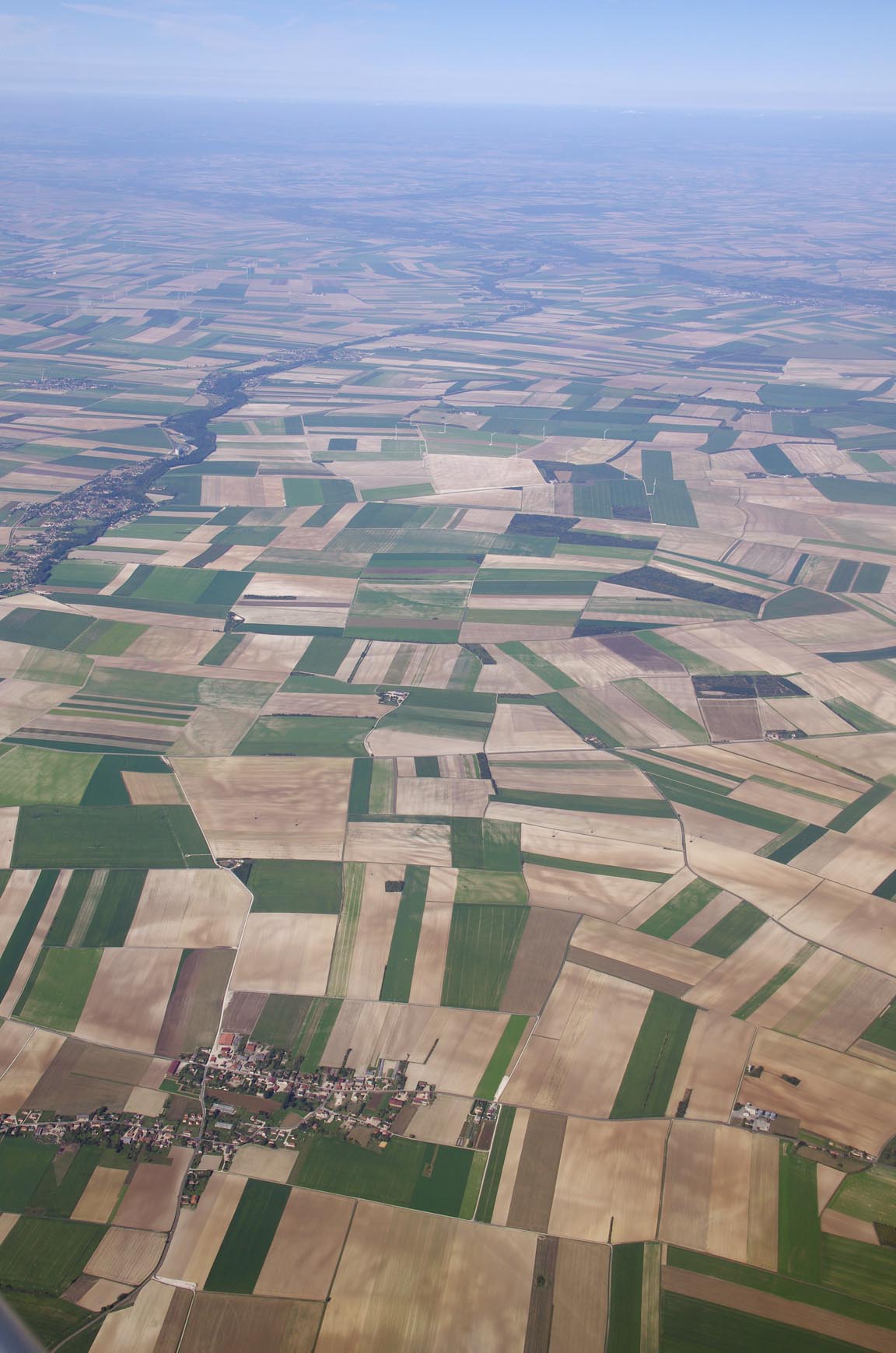
but one sees an occassional interesting airport; this one is presumably military; possibly disused, somewhere in the area of RLP
Due to the proximity of the front near the SE UK, weather was obtained over the satellite phone 1hr before arrival, and was fine
The alternates have poor utility for Shoreham. Bournemouth and Southend are 2 trains away and Lydd is a £200 taxi.
As usual, we got handed over from Paris Control to London Control around GUBAR. Interestingly, London Control asked us to route "WAFFU Y8" (i.e. WAFFU CAMRA GWC) which was a rare instance of ATC asking for a route by airway name. Some pilots apparently fly with just a waypoint list, and one of these - example - is emailed by EuroFPL shortly before EOBT, and this will do 99% of the time, but airway charts are clearly needed on occassions. I rarely fly with the off the shelf printed ones; I print enroute chart sections from FliteStar IFR Europe - example - and these I fly with in A4 printed form, double-sided to save paper.
There was a good layer of cloud to descend through over the Channel

but the destination was clear. It was hellishly busy in the circuit though...
The route actually flown is here
Spot the odd one out...
Consistently, on any GA airfield movement data, the US registered aircraft are flying the longest routes. I don't suppose anybody in EASA gives a damn, however, with these corrupt dishonest job-creating gravy train riding axe grinders in the expenses-fuelled "European Union" having just shafted most of the European population of IFR capable private pilots, by passing a purely politically motivated decree requiring them to obtain European duplicates of their ICAO compliant licenses and ratings, by 2014. I am now (9/2011) part way through doing the completely pointless European IR, on top of my American CPL/IR. I have always had a UK PPL and medical.
General Notes, and Lessons Learnt
GA Access to Greece: Greece remains a relatively predictable destination for GA, helped by airport personnel being friendly and communicating well in English. Olympic Handling have had a complete re-vamp and are now very efficient. If an airport tells you they have avgas, they have it and you can buy it. On the minus side: no new avgas facilities have appeared, and airport opening hours can be restrictive to the point where the ability to visit some places is seriously affected. Kithira in particular would really benefit from avgas because two "tech stops" at Kerkira are probably going to set you back several hundred €... and they could easily do what Sitia does i.e. one man and some drums.
Fly later in the year: Looking back on previous trips to Greece, it appears clear that going in September is much better than in June, because there is much less convective (stormy) weather. Of our long trips, this one was unusual in that the whole trip was flown as planned, with some date flexibility but with no changes to the routes or the airports visited. Also, all of the pre-planned Eurocontrol routes worked fine on the day, which is also somewhat unusual. As a result, the portable Canon printer (mentioned earlier in this article) remained in the back of the aircraft throughout, which was a relief because it is a bit of a hassle.
Cloud Tops: this trip has again proven the use of IR satellite imagery
as a preflight go/no-go decider. One could achieve safe IFR flight using this
data, with TAFs and METARs for the terminal areas to check against approach
minima in the usual way. MSLP charts still play a part in more general forward
planning because they can be obtained 5 days ahead and show obvious suspect
weather. SigWx charts have recently been dumbed-down by ICAO and no longer show
fronts, or any weather in areas where CBs are forecast, and are now almost useless
for this kind of non-deiced non-radar-equipped flying. I still look at SigWx
charts but rarely see anything on them which is not obvious from the MSLP charts.
Normally I use this
UKMO site for cloud tops, and it is updated every hour, but recently I have
come across this
Turkish site (thanks Kyp!) which delivers a temperature-calibrated cloud
tops image, but is updated every 3 hours. I have asked the UKMO if they could
provide their image with a temperature scale, which they obviously can, but
they responded with a useless reply along the lines of how would it be funded.
There is every indication that the EUMETSAT organisation tries to keep a lid
on the dissemination of this "top secret" data ![]()
Mobile Internet: It has become apparent over our two trips to Greece in 2011 (May and September) that WIFI has practically disappeared there as a free resource. Many cafes still have it, and most hotels have it, but often the password doesn't work or the signal is too weak. Instead, commercial WIFI access points are common, but usually charge ripoff prices. It is also obvious that these WIFI companies have done a "sweep" of the neighbourhood and have done what must have been a huge amount of door knocking to shut down unsecured WIFI access points in homes and businesses. So, GPRS/3G is now the most practical way to get internet access. 3G is a lot more prevalent than in the UK where most of the countryside is slow-GPRS-only. However, if you want to use your UK phone, or use your phone as a modem for a laptop, the continuing issue is roaming data costs. For EU destinations, most UK networks sell "EU data bundles" which can be very good value but the bundle size allows only light usage e.g. T-Mobile's 50MB/30-day deal for £10. For heavier usage, e.g. for running Google Maps on some mobile device while driving around some Greek island, you need a lot more than 50MB and then a locally purchased data SIM card is the way. Nowadays almost every European country offers such cheap local (non roaming) data deals. There are several of these in Greece; I bought a Cosmote "Internet On The Go Me Karta" which for €15 gives you 2GB over 7 days and this totally solves any connectivity issues. Short of big movie downloads, you will never get through 2GB during a holiday. The Cosmote connection was not wholly reliable (it seemed to disconnect every few minutes, possibly to frustrate certain types of heavy usage) but it worked well enough, and the rest of the time I used the 50MB/£10 T-Mobile EU data bundle on my phone, to check emails, get TAFs/METARs, etc. Obviously this Greek SIM is no good in your main phone because the phone number changes so you can no longer be contacted on it (and it may not even support voice calls) so I put the Greek SIM into an E585 which provides a private WIFI access point, which is directly usable by multiple mobile devices with WIFI. Purchasing the Cosmote SIM involves a visit to a phone shop with a passport and an hour's messing about (a recent measure in Greece, perhaps intended to keep a lid on businesses operating totally below the tax radar) where you purchase the SIM and purchase a top-up scratch card, and then visiting a Cosmote website (which is accessible only from a device using that SIM) where the SIM is activated and the scratch card code is entered, but once this is done the SIM should "remain alive" for 12 months (the data bundle itself may be good for only 10 days) with topups purchased as required during each visit to Greece. They don't make it easy...
PPR: This remains a persistent issue on trips around Europe, and is not improving. "PPR/PNR for Customs" is more common still. A local-language speaker can bluff his way into most places, but a foreigner may be denied a landing clearance by some idiot jobsworth, perhaps especially if flying a US registered aircraft. The result is that you need to contact the airport before you fly there even if the airport Notams are clean. In an urgent situation telephoning the airport is the only way and while this is fine in N Europe and some other places, I know of cases (Greece) where a telephoned permission turned out to be worthless and the aircraft was forced to turn back. A reasonably good source of airport emails and fax numbers is this airport directory, another one is ACUKWIK, another one is the Navbox flight planning program. One would expect the AFPEx tool (available only to pilots with a UK address) to work well, using its AFTN free text message function, but I have found that most messages do not elicit a reply. Olympic Handling contact details are here.
IFR route development: FlightPlanPro worked out every route on this trip, though the current version does occasionally crash. It is great to report that for the past 2 years I have been able to file and fly IFR without all the Eurocontrol routing garbage which we had to deal with. However, it is apparent that two route development methods are required, just in case, and for me these are 1) FPP and 2) EuroFPL's Route Suggest feature.
Airport Costs: None of the airports visited were outrageously pricey, along the lines of the £500 charged at the likes of Gatwick, Luton, Frankfurt, Munich, etc. All were easily affordable in the context of a long trip, on which the fuel and hotel costs dominate. However, all of them were too expensive to operate as a base for healthy light GA activity; if the landing fee is say €50, a flying school/club cannot operate there unless the airport gives it a big discount.
One-night stops: We did a few of these, and they result in a tiring trip. 2-night stops (or longer) are much better. Last year's trip to Sitia was far less tiring on the way down there, though the return route was complicated by a stop to meet up with some other pilots.
Photos: The pictures in this writeup were taken with a Pentax K5 and a Canon S90/S95. The images within the text were cropped and adjusted in Photoshop to remove, as far as possible, the blue haze which features in most high altitude photos, but the images in the galleries are mostly original due to the amount of time it takes to do the Photoshop stuff. The polarising filter helped a lot. To get acceptable pictures from an aircraft, the windows need to be clean and scratch-free and care needs to be taken to minimise reflections from bright objects inside the cockpit; these may need to be temporarily moved or re-orientated. For example I usually have to turn my kneeboard upside down. I have some photo tips here.
Why fly IFR, and so high, when the weather is good?
A number of people ask this question. Why not fly VFR?
IFR is safe because keeps all the options open. Under IFR, if you need a climb (due to terrain-induced turbulence or to stay above cloud buildups), ATC grants usually this immediately, especially if you ask for it "to avoid" i.e. in the obvious context of avoiding hazardous weather. Normally one would ask for a left/right turn "to avoid" but this is not always going to do the job of avoiding prolonged flight in IMC and potential icing conditions. I rarely do flight in IMC when IFR/enroute because, at typical Eurocontrol levels, the temperature is usually below 0C. It is one thing to climb or descend through IMC (subject to various limits, especially if climbing through it) but if one is going to sit in it for hours, at say -5C, airframe icing is almost inevitable. Under IFR, ATC works for you / with you because you already have a clearance to be there, and it is generally easy to play the long game of flying VMC on top.
If you are flying VFR, usually (due to airspace management policies) you are flying at a low level; typically in the 1000ft-10000ft range. Then, if you need to climb to penetrate weather and to hopefully remain above it, you will find ourself having to climb into controlled airspace (if you are not in it already) and have to ask for an "IFR clearance". The time it takes to get this varies hugely. It can be "instant" if flying from the UK to say Le Touquet, and you find the weather is such that the ILS is required, and Lille Radar deal with it right away, in a typically French-ATC pragmatic and easy going manner. However, I know a pilot who killed himself and his family in France, near Lyon, while waiting for an IFR clearance. To be fair he left it far too late and made plenty of mistakes anyway, but it proves you can't always get it when you really need it. Picking up an IFR clearance can also be dodgy if departing from VFR-only airfields as illustrated by the Messalonghi-Corfu debacle on this trip where it apparently never happened before I landed at Corfu, and there is no alternative in that case (unless it can be done over the telephone before departure) but this sort of thing can be very dangerous. At the far end, you have the southern UK where an IFR clearance is almost impossible to get, due to most controlled airspace being Class A and the watertight separation between the "IFR enroute" controllers (e.g. London Control) and the ad hoc ATC provisions below them (e.g. London Info, Farnborough Radar, etc). Having spoken to some ATCOs (non-UK ones; this subject appears to be a sore point in the UK) the reason why getting an IFR clearance can be difficult appears to be due to the fact that ATC cannot just simply have traffic popping in and out of their airspace; they have to create a flight plan for it, which is passed to subsequent units. It doesn't have to be a complete end-to-end flight plan, but it needs to be a reasonable fragment of one. And while most of this stuff is nowadays electronic, not every country has bought the extra software needed to do it efficiently, so they just refuse entry. And light GA does not pay route charges... Filing and flying IFR the whole way avoids this hassle because the IFR clearance is a done deal.
Another reason for IFR is that some countries insist on specific VFR routes in their airspace. In northern Europe, the USA, and a few other places one can fly around freely if remaining outside controlled airspace, but this is not the case in most of the world. On this VFR trip I had a VFR flight plan cancelled by Montenegro, because they did not like the route. This can catch you by suprise; a UK pilot simply does not expect to have a flight plan chucked out. IFR avoids all this hassle. Also, various countries, Greece included, require VFR flight to be done on published airway routes, so the flexibility of VFR is lost anyway.
End-to-end IFR also avoids the need to carry VFR charts. This was particularly relevant on this trip, because no VFR charts exist south of Croatia. All one has are the Jeppesen low level airway charts, which do contain controlled airspace information, but as per the paragraph above this is not necessarily sufficient for filing a valid VFR flight plan. There are now some VFR charts for Greece, compiled by helicopter pilots as an informal project.
Flight Times (airborne):
EGKA-LJPZ 5:00
LJPZ-LGKR 3:30
LGKR-LGKC 2:00
LGKC-LGKR 2:15
LGKR-LSZR 5:35
LSZR-EGKA 4:35
On all long trips I have the LS800 tablet computer running a VFR or other topographical chart under Oziexplorer. The GPS track from this gets logged. Here is the track actually flown on the entire trip. The text version of the track is here. Due to a bug in the old SIRF-2 bluetooth GPS used to drive the LS800, the altitude has a constant ~ 150ft positive bias i.e. to get the correct altitude you have to subtract 150ft.
The altitude plot of the entire trip is here. You can see two things there: a slight upward slope means you are flying (at a constant altimeter setting and indication) towards a higher pressure, and the fact that the highest level flown was FL170 shows how a temperature above ISA causes the aircraft to fly at a higher real altitude. On occassions, I saw a GPS altitude 700ft above the indicated altitude even though the QNH was set correctly from a ground station. The atmosphere expands according to the variation in the absolute temperature (in degrees K) so e.g. ISA+29 would represent a 10% expansion - assuming of course that the temperature delta was maintained all the way up from the surface.
The aircraft performed perfectly. Some notes on Socata TB20 ownership and operation are here. As on every IFR flight I have done, the late-1990s avionics were 100% capable of everything required. It would be such a shame to have to rip them out to comply with PRNAV which is another European jobsworth boat which left the harbour about 15 years ago... I also do not want a "glass cockpit" because if something goes wrong in e.g. Greece, one would be stuffed. As I write this, a colleague is installing his 3rd Aspen EFD-1000 replacement in about 2 years...
This is the stuff which we carried in the back of the aircraft on this holiday
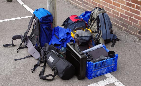
and that is additional to stuff which lives in the aircraft permanently: a life raft, life jackets, an emergency bag with an ELT and a handheld radio and GPS, a toolbox sufficient to do a 50hr service, etc.
Total oil used was about 3 litres. Total fuel burnt... don't ask ![]() but the general fuel flow rate was slightly under 10 USG/hr. Avgas prices in
southern Europe are now universally high and mostly a lot higher than in the
UK.
but the general fuel flow rate was slightly under 10 USG/hr. Avgas prices in
southern Europe are now universally high and mostly a lot higher than in the
UK.
All flights on this trip but the last could have been done under VFR on the day, albeit with a possibility of the usual airspace access issues which would mean the routes and altitudes would have been very different. Had VFR flights been attempted at the levels we flew at, they might have been forced down (by ATC) into lower levels at which there was cloud; this is the standard problem with VFR in Europe, where many ATC units run their own private policies which are in breach of ICAO airspace classification (VFR should be permitted in all airspace except Class A, though an ATC clearance is required in Classes B through D). The last flight was definitely IFR-only, due to the conditions at St Gallen.
I would like to give my thanks to Kyprianos Biris for his original suggestion to visit Kithira.
Pilot: FAA CPL/IR, approx 1400 hours at the time.
This page last edited 20th December 2013
Any feedback, reports of dead links, corrections or suggestions much appreciated:
