
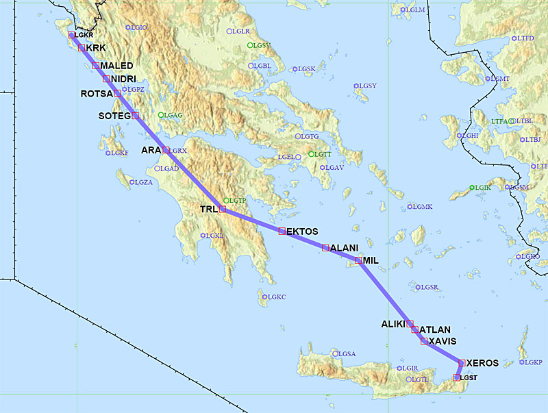
Trip from Shoreham to Corsica and Greece, September 2014
This article describes a relatively complicated trip from Shoreham EGKA, UK, with the following stops
(1) Albenga LIMG in Italy (refuel only)
(2) Calvi LFKC in Corsica, France - the EuroGA
fly-in
(3) Corfu LGKR in Greece (refuel)
(4) Sitia LGST in Crete, Greece (refuel)
(5) Samos LGSM in Greece (refuel)
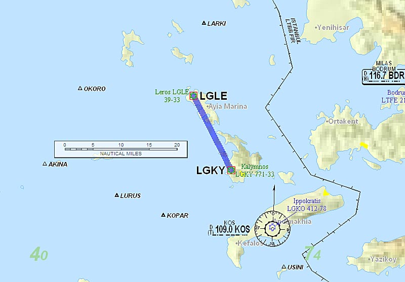
(6) Kalymnos LGKY in Greece.
(7) Leros LGLE in Greece.
(8) Ikaria LGIK in Greece.
(9) Samos LGSM in Greece (refuel only)
(10) Lesbos LGMT in Greece
(11) Zagreb LDZA in Croatia (refuel)
and back to (12) Shoreham EGKA.
I flew out with two passengers, left one (Jenny) in Corsica, left the other (Colm) in Samos, picked up my girlfriend Justine in Samos, did the small Greek islands with her, and dropped her off at Lesbos.
Astonishingly, the whole trip went to plan, with not a single flight delayed. This was due to good weather. The last two legs suffered strong headwinds - up to 45kt and way above forecasts - and could not have been done safely without an accurate fuel metering system linked to the GPS.
Other trip writeups are here
For non-aviation readers, here is a glossary
Pilot
FAA CPL/IR, JAA/EASA PPL/IR, ~1800hrs.
Aircraft
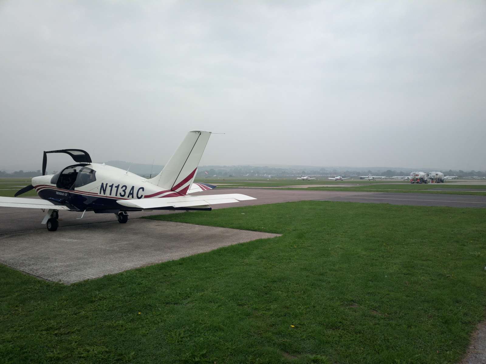
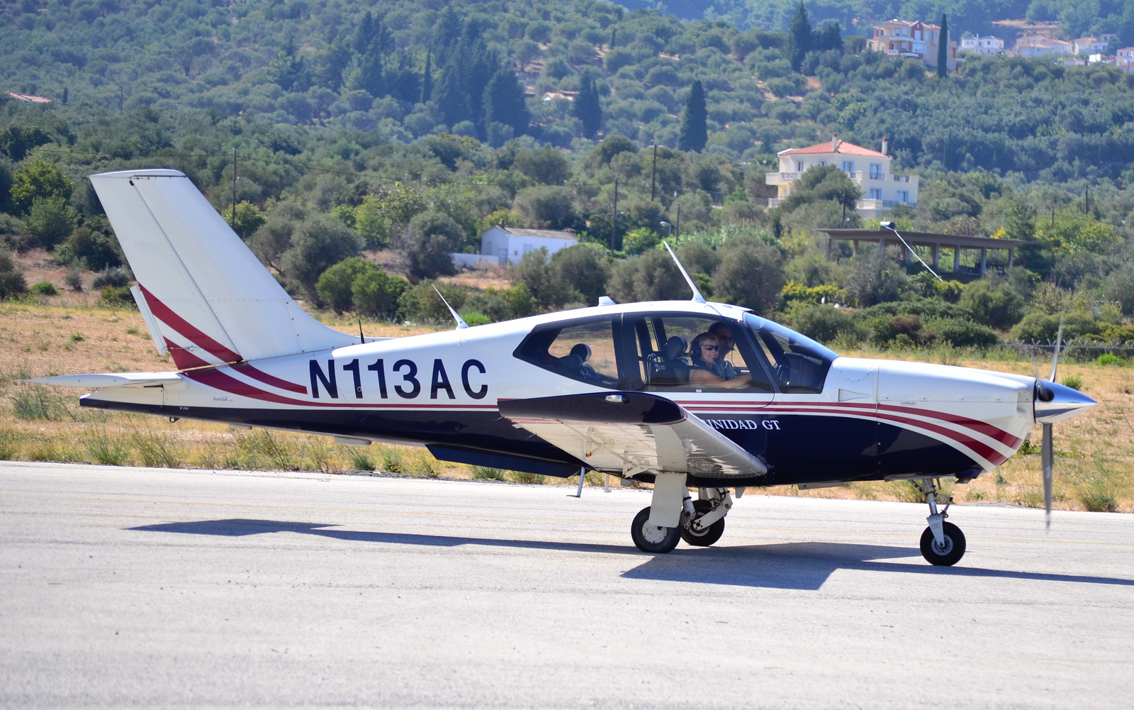
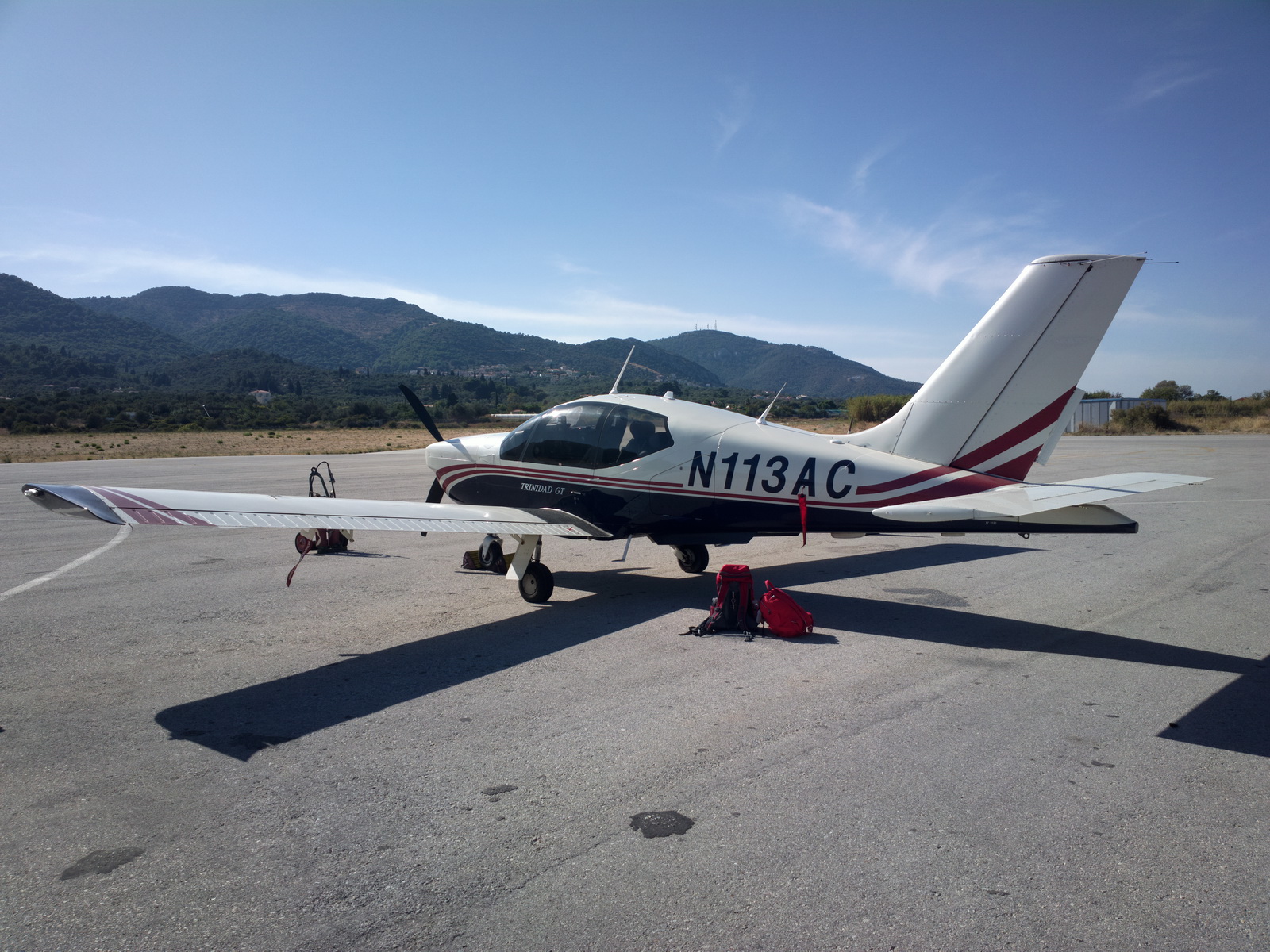
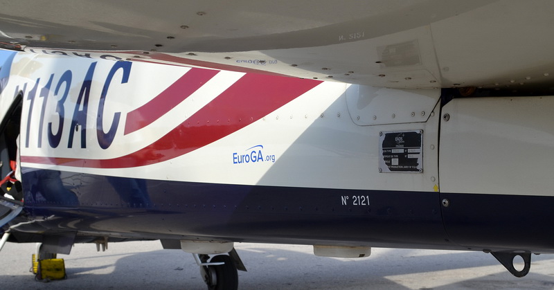
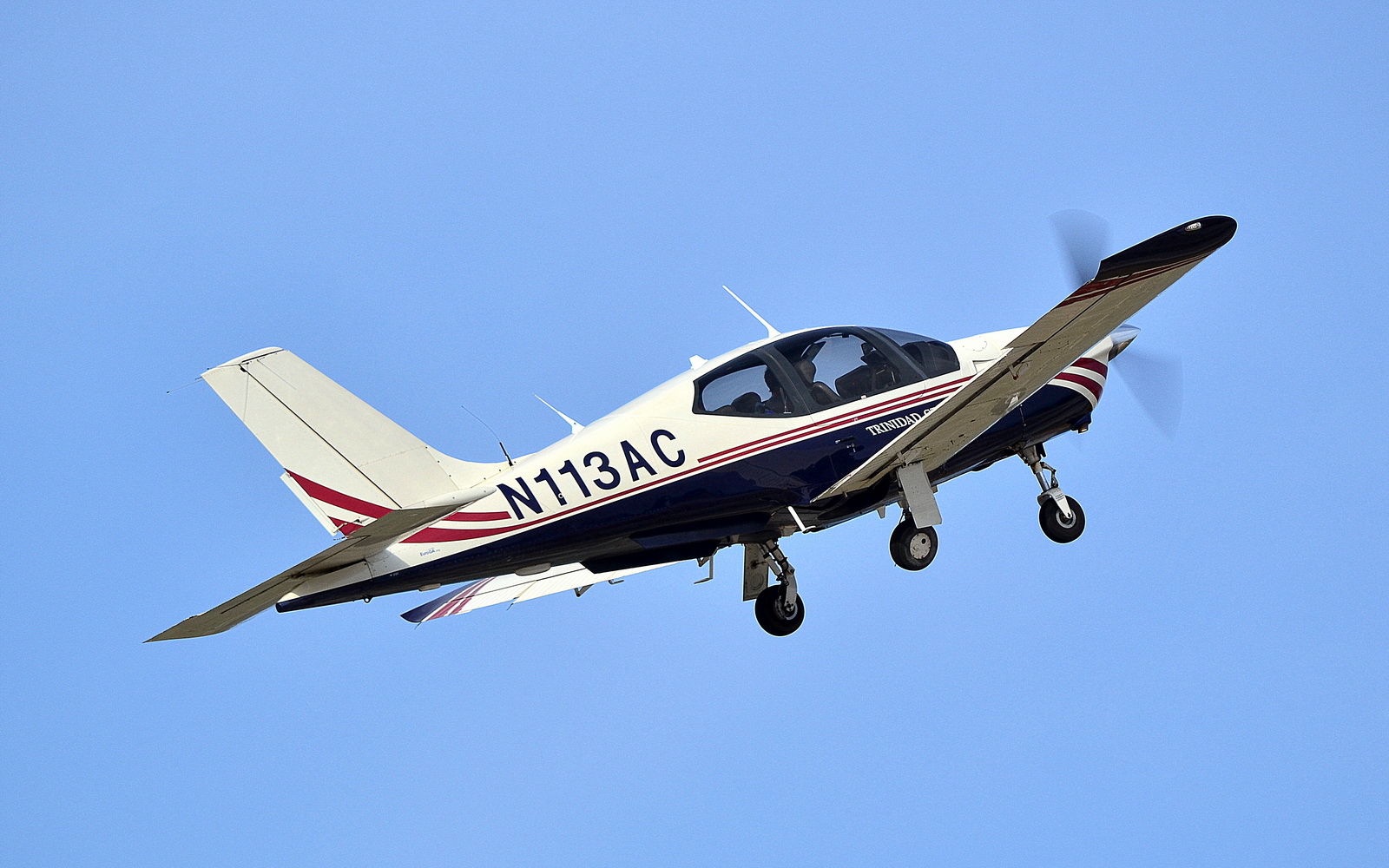
The aircraft is a 2002 TB20GT
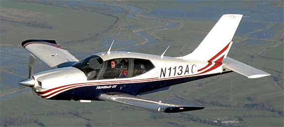
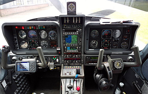
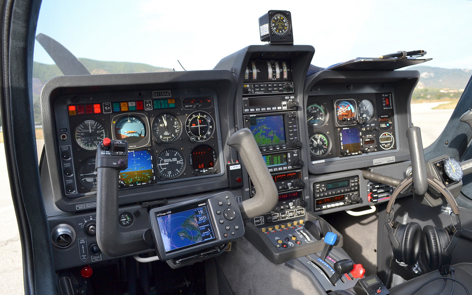
The aircraft has an economy cruise speed of 140-150kt TAS depending on altitude and a 20000ft ceiling. It has an autopilot which will fly GPS/LNAV approaches (laterally only) or ILS approaches (laterally and vertically). It does not have LPV capability; fortunately LPV is not yet operationally relevant in Europe. An article on the TB20GT aircraft is here
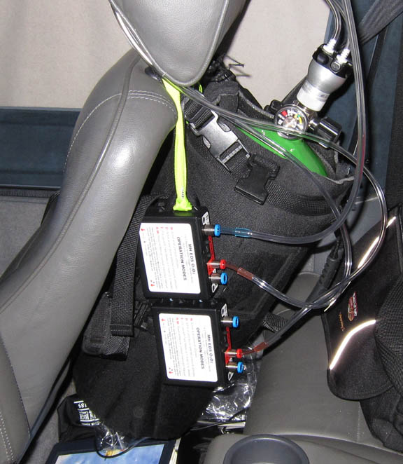
Oxygen is used on all IFR flights, with the Mountain High O2D2 electronic regulators and cannulas. The performance of this system (comparison) is way above anything else on the market, with flight at 20000ft being perfectly possible with cannulas. I carry masks in case somebody has a blocked nose, but they have almost never been used.
European IFR flight is only marginally feasible without oxygen, due to the minimum practical Eurocontrol routings, and on some routes due to the terrain. This trip was filed mostly at FL100-FL110 as the initial level, which is OK for legal non-oxygen flight (although after a few hours most people will be very tired), but we had to climb up to FL190 to stay above weather. In short, oxygen gives you lots more options, but you still need an aircraft with the climb performance.
Route Planning
With the exception of the short flights of under an hour (Albenga to Calvi, and between the Greek islands) the whole trip was flown under IFR. I have had the IR since 2006 and use it whenever possible, because IFR facilitates much easier flight planning, and much easier flying because controlled airspace becomes almost irrelevant.
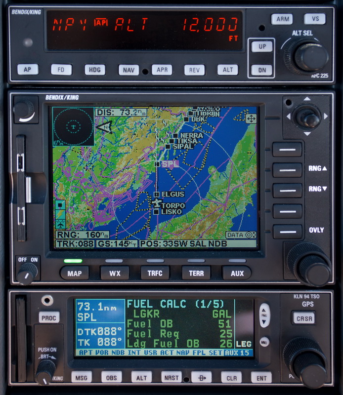
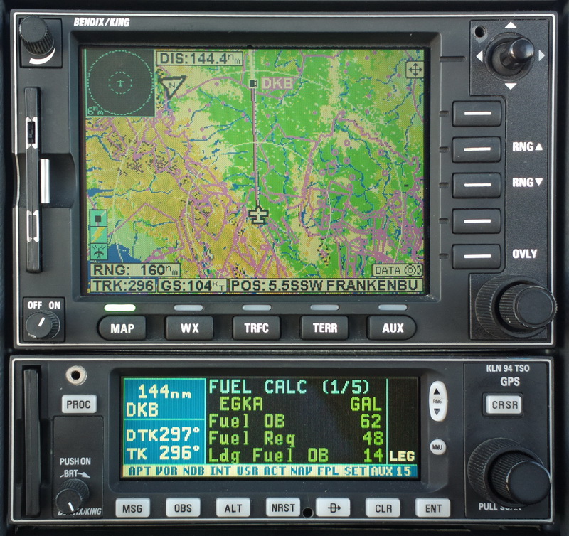
The IFR routes were developed using the EuroGA autorouter. As far as possible, all were preplanned back home, before departure, and printed off to produce a "routepack" for each leg, comprising of a whole-route picture (example) and a plog (example).
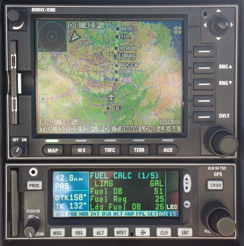
The plog contains the waypoints that are loaded into the GPS, though in practice there are usually too many for my GPS (KLN94, max 20 waypoints per flight plan) so one loads the first 15 or so, and the destination, and loads the rest as the flight progresses.
The VFR routes were trivial and mostly flown as a single DCT.
The EuroGA autorouter now supports flight plan filing and this was used for the IFR flight plans. It does not currently support the filing of purely-VFR ("V") flight plans. The VFR flight plans were filed using EuroFPL.
Due to these software tools, the whole "IFR in Europe" process is much simpler than it was some years ago. Today, route planning is normally very quick. What takes time is all the peripheral stuff like checking out airport opening hours...
Airport PNR/PPR & other issues
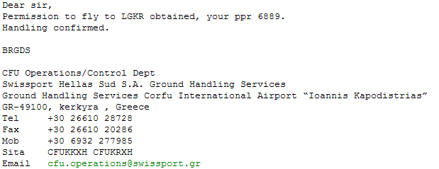
The only airport on this trip which is absolutely PPR was Corfu LKGR. This is notamed during the summer season
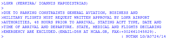
You must get the reply in writing, because Corfu has a proven history of refusing a landing clearance if they think they didn't issue the permission. They will do this even if the apron is empty or nearly empty (which 99% of the time it is). In the past this was all done by fax which is a hassle for most pilots (I use an email2fax and fax2email facility which is cheap and effective, with incoming faxes delivered to me by email as PDFs) but nowadays you apply to the handling agent (rather than the airport itself) which is Swissport or Skyserv (formerly Olympic Handling) and they deal with it efficiently by email - example:
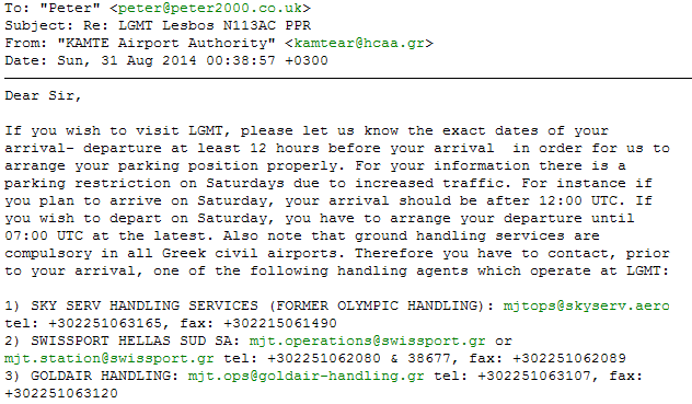
Some other airports are PPR also, in a more ambiguous manner. This is from Lesbos LGMT which also has a vast amount of segregated GA parking, whose capacity is wasted by somebody having painted a tiny number of parking positions with enough spacing for 747s...
Ultimately, for southern Europe, it pays to simply shoot off emails and faxes to every airport on a trip, some days ahead, and see what comes back. This is a quick and easy process. Usually, they don't respond, but sometimes the response is hugely valuable if e.g. it tells you that the notamed opening hours are wrong! Some notes are here.
On the whole, this issue is much easier than it was a decade ago and, in Greece, almost anything of relevance is notamed. Greek airport personnel speaks good English and that transforms the whole experience compared to e.g. Spain, Italy or even France where you can find yourself at a relatively sizeable airport where not a single person speaks a single word of English.
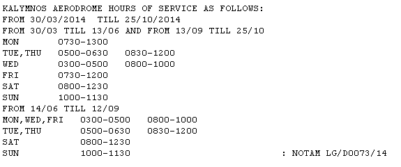
Greek airports publish their opening times by notam only. Normally this is a very reliable system - actual example. On this trip, there were several airports with very narrow opening times (LGST, LGKY, LGLE, LGIK) and consequently that part of the trip had to be done in a specific sequence. It was OK because in those cases we did two nights per destination but it means that many Greek islands (basically all the ones without all-day scheduled holiday flights from N Europe) cannot be visited by air as a day trip. You have to stay overnight.
Weather - General Notes
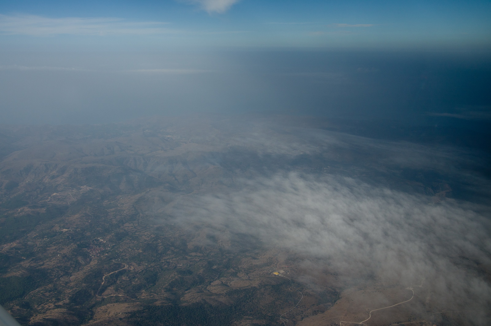
The weather on the whole trip was good but with a lot of haze, lots of buildups (CU and TCU and general convective IMC to say FL150) and isolated serious activity (CB). To remain VMC, we had to climb to high altitudes: up to FL190 on the first leg, over the Alps. The TB20 will do FL200 but in typical summer temperatures (ISA+10 to ISA+15) and maximum weight it struggles to reach FL190.
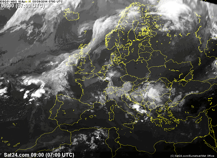
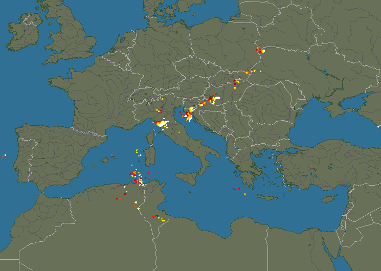
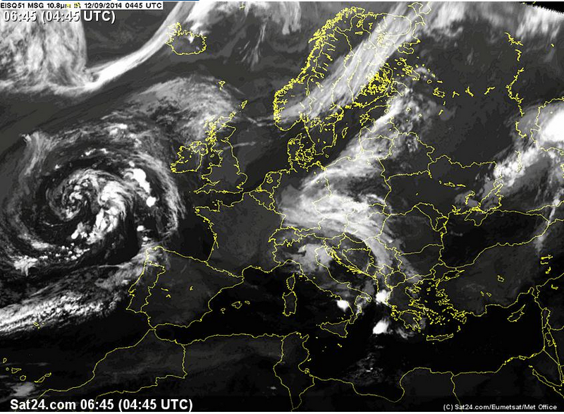
Over the years I have worked through various ways of looking at the weather. Unfortunately most of the methods - usually involving 3D cross-sections generated from the US GFS weather model - are not reliable enough. Nowadays I use the IR image shortly before a flight, sometimes supplemented by radar and sferics (lightning) and these have proved to be a very reliable indicator of whether the flight is feasible VMC on top in the TB20. Some info on cloud tops is here and here. I almost never cancel a flight on the basis of forecasts only, because such cancellations turn out to be mostly unwarranted.
The biggest issue on this trip was the headwind on the two return flights: LGMT-LDZA and LDZA-EGKA. This was around 40-50kt and those two flights could have never been done without an accurate GPS-linked fuel totaliser.
The entire trip (12 flights) went completely to plan, without anything being delayed. That is very rare for any significant trip using light GA!
On this trip, most of the filed alternates were not practical and would have caused big hassles. That is common in GA... Even back home, if I cannot get into Shoreham and have to divert to Biggin Hill, it costs hundreds of £ in taxis or other transport, airport costs, etc.
Shoreham to Calvi, Corsica
Due to a lack of fuel on Corsica (strike action by the French) there was very little avgas there and it was rationed to virtually useless amounts per aircraft. Since the next leg was to be a direct flight to Corfu, Greece, the simplest solution was a fuel stop on the way to Corsica, and I chose Albenga, Italy. Of course there were many other permutations but a fuel stop requires a descent and a climb which exposes the flight to possible bad weather at lower levels, so a fuel stop is best done when the weather is verifiably good. And if one is going to an airport which doesn't have instrument approaches (not an issue on this trip before Greece) it better to use a coastal airport because one can do a descent safely over the sea.
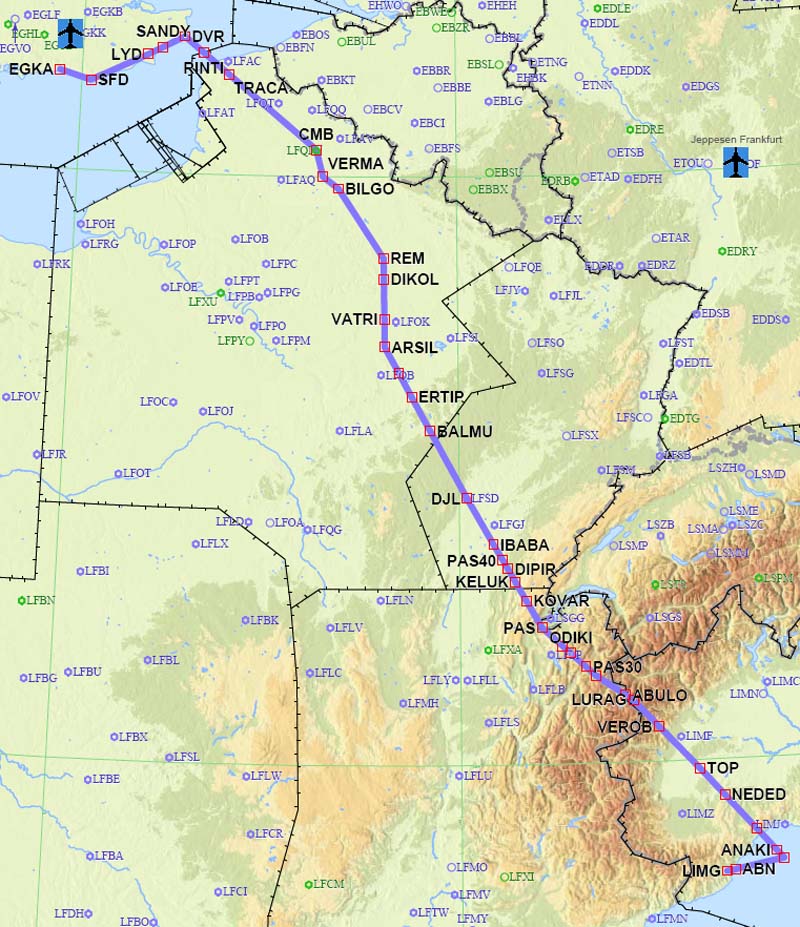
This was the filed route EGKA-LIMG. It is a "typical modern" Eurocontrol route, filed for a silly FL060 and then full of meaningless level changes:
EGKA N0147F060 SFD/N0151F090 Y803 LYD/N0152F100 Y803 DVR L10 RINTI B3 VATRI G40 ARSIL B13 SOMDA A6 DJL B37 IBABA/N0148F130 B37 DIPIR/N0147F140 B37 KELUK/N0146F150 B37 KOVAR/N0145F160 B37 PAS/N0144F170 G32 ODIKI/N0142F180 G32 ROCCA M135 LURAG/N0146F150 M135 TOP/N0152F110 L50 NEDED/N0152F100 L50 IXITO LIMG
Alternates: Genoa LIMJ, Bastia LFKB
634.4 NM (direct: 532.0 NM, overhead: 19%)
The short flight LIMG-LFKC was flown as a DCT, under VFR, at about 6000ft. Here is the IFR version:
96nm GC, 126nm IFR
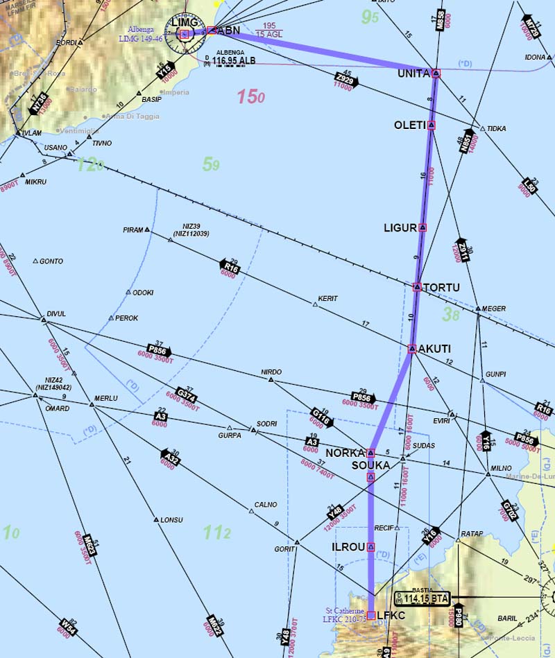
The direct route EGKA-LFKC would have been this.
Alternates: Bastia LFKB, Genoa LIMJ (avgas in Genoa, not in Bastia)
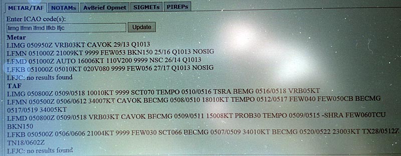
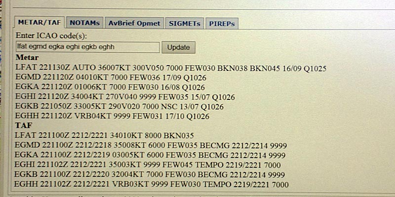
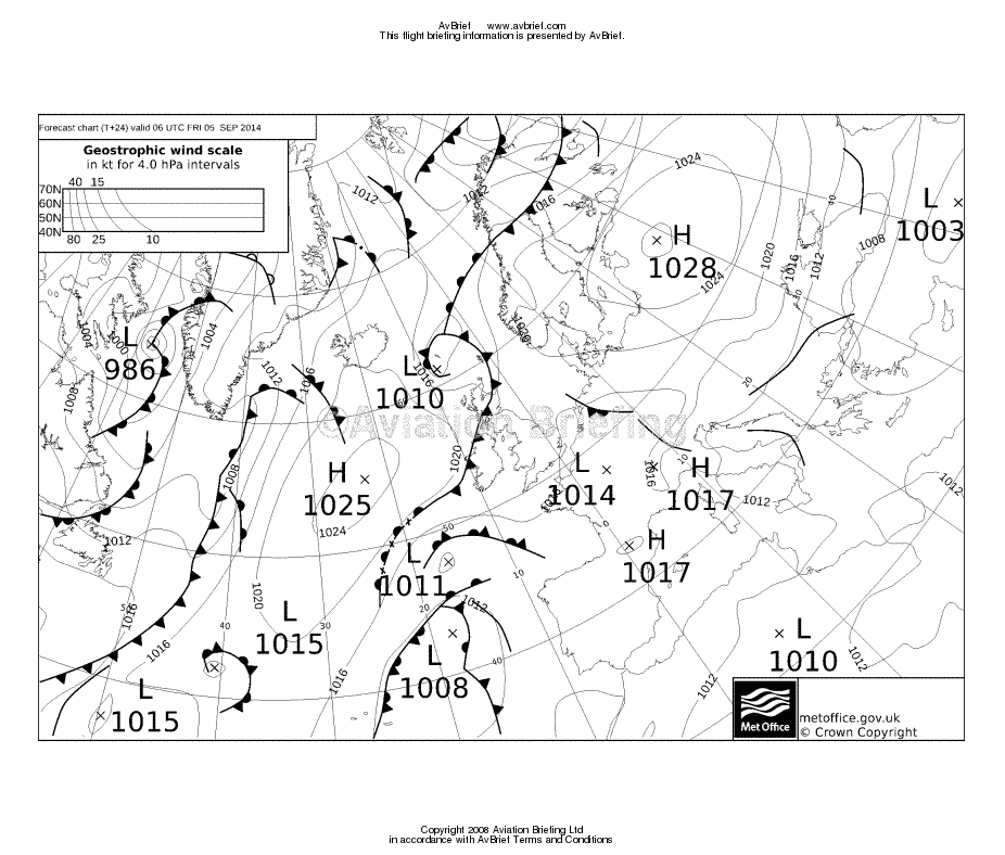
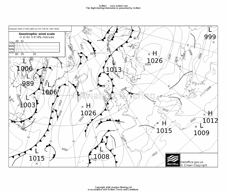
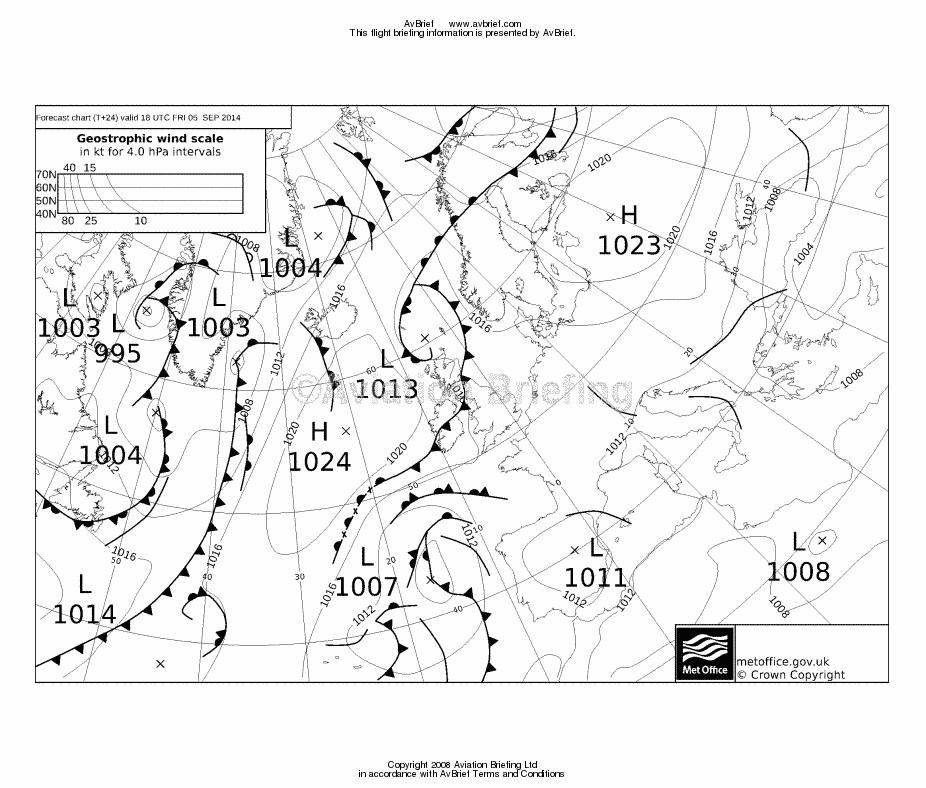
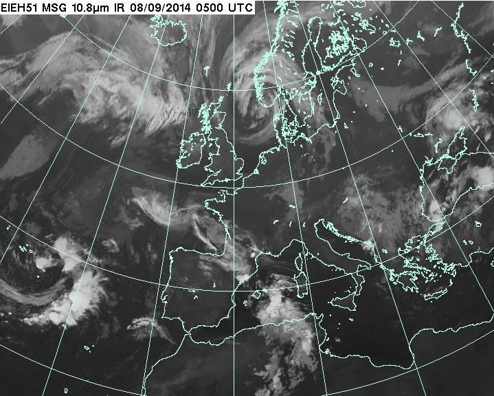
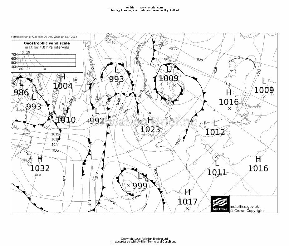
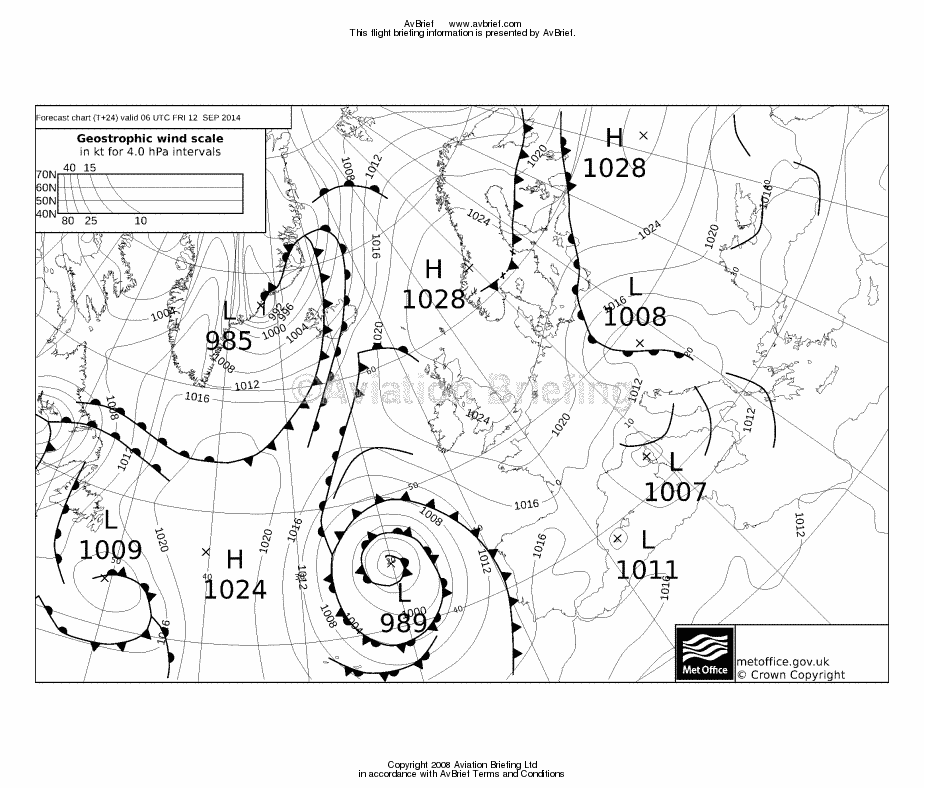
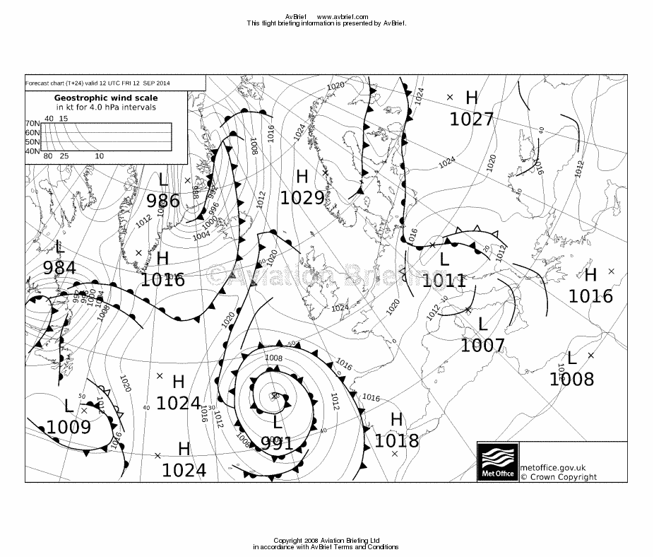
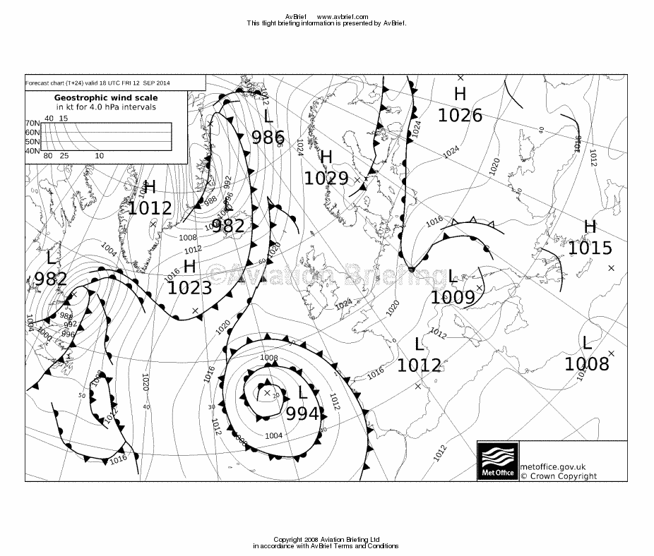
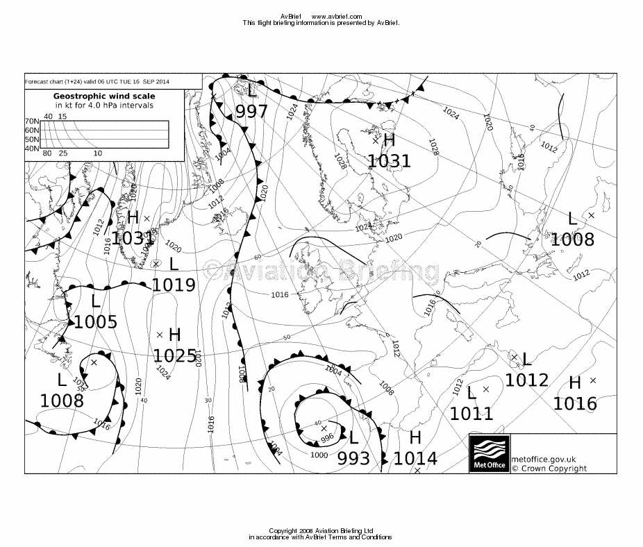
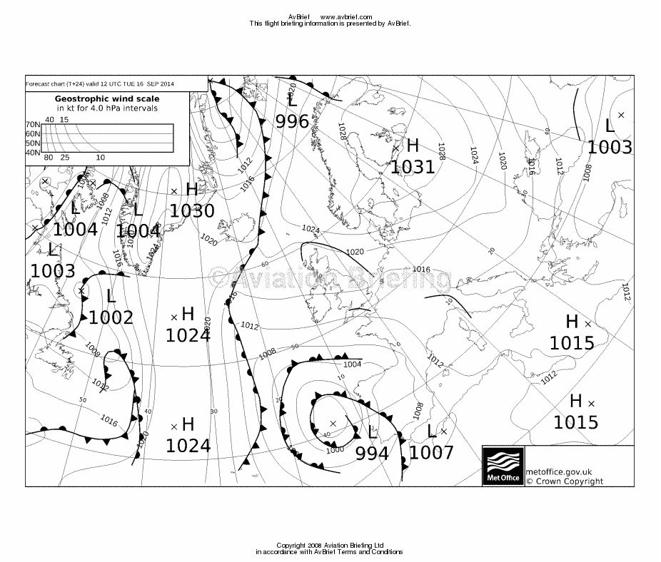
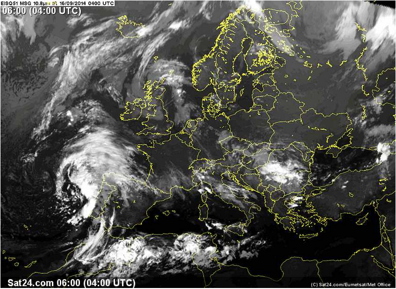
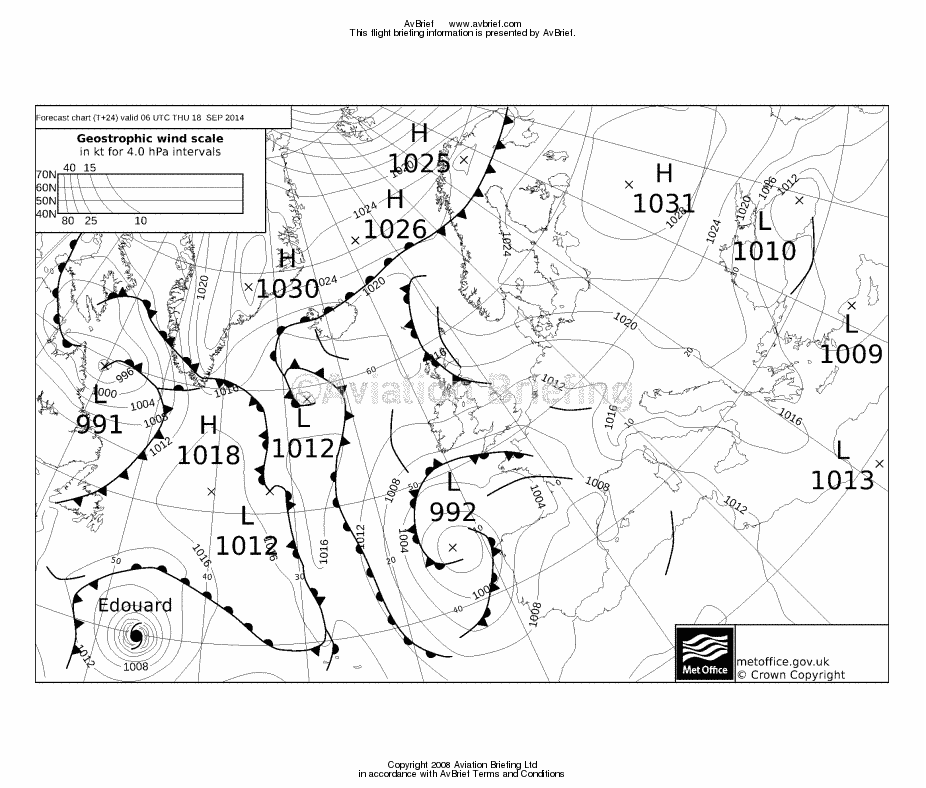
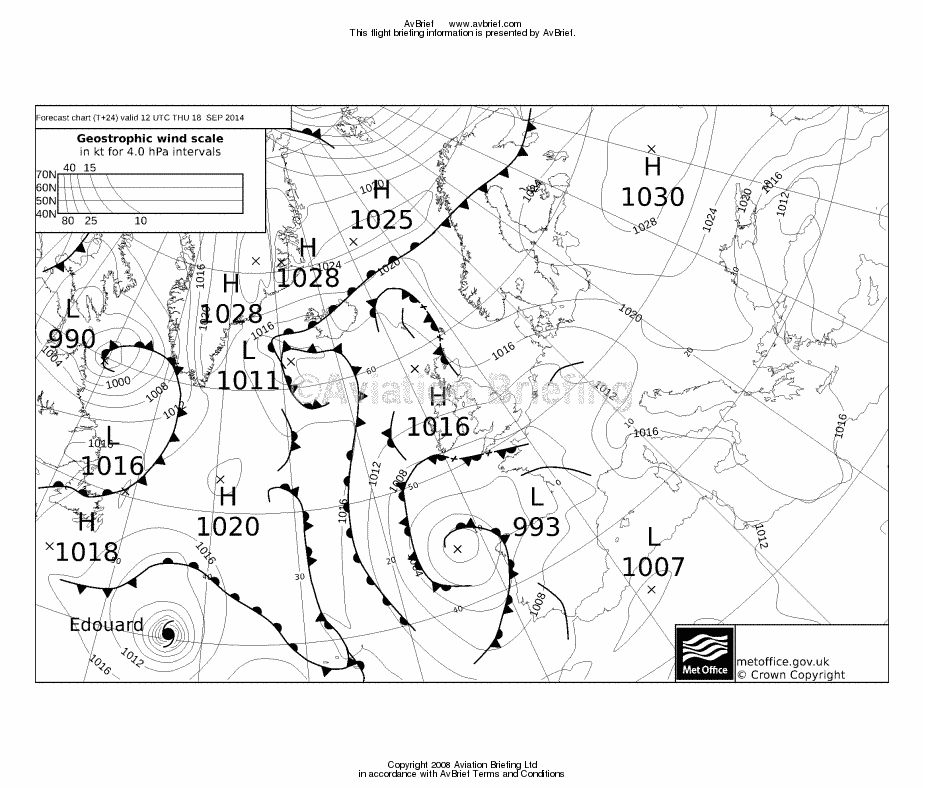
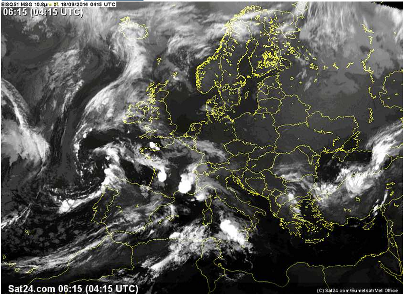
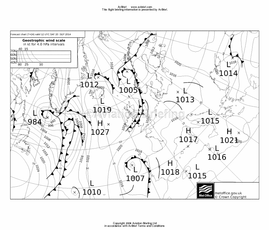
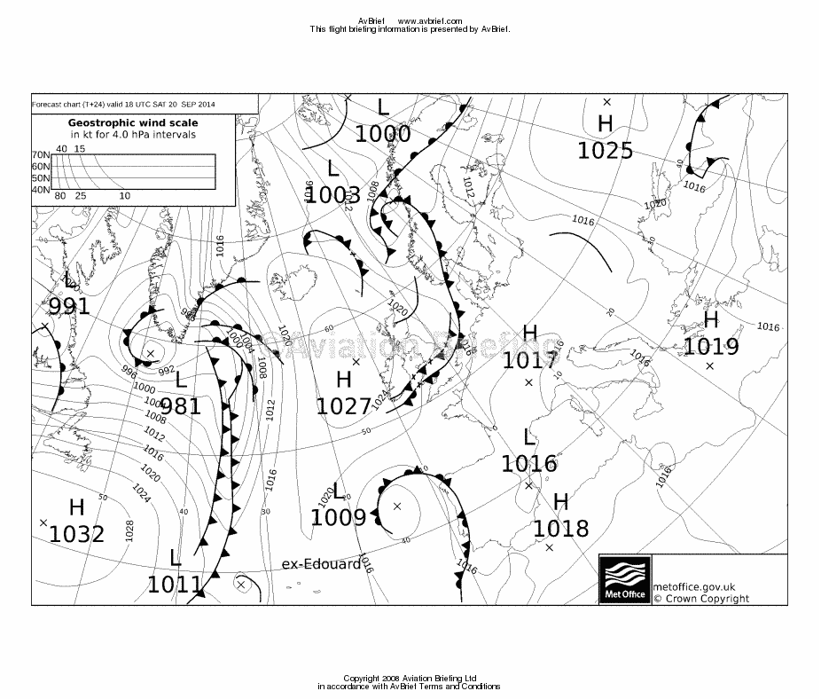
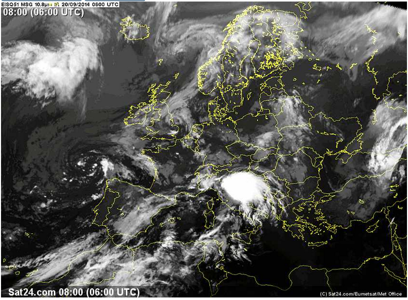
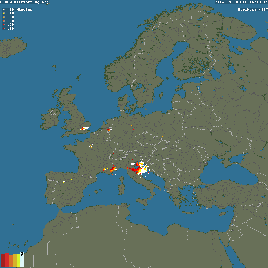
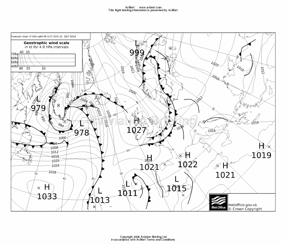
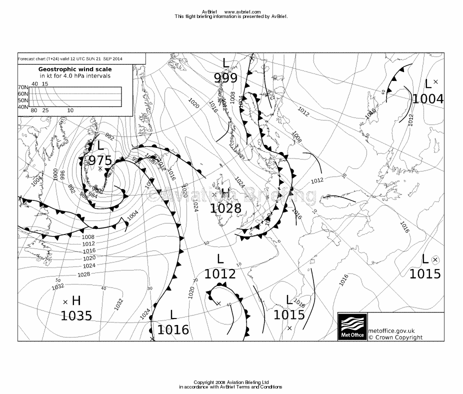
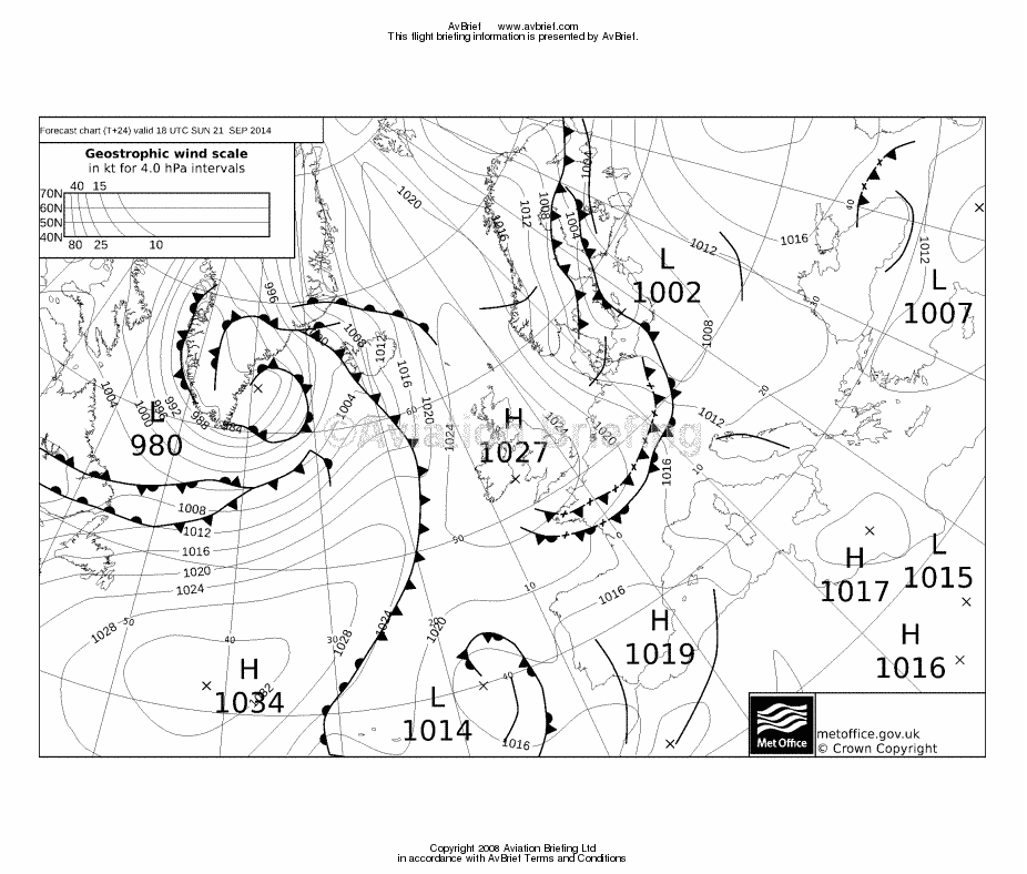
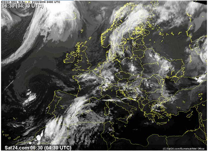
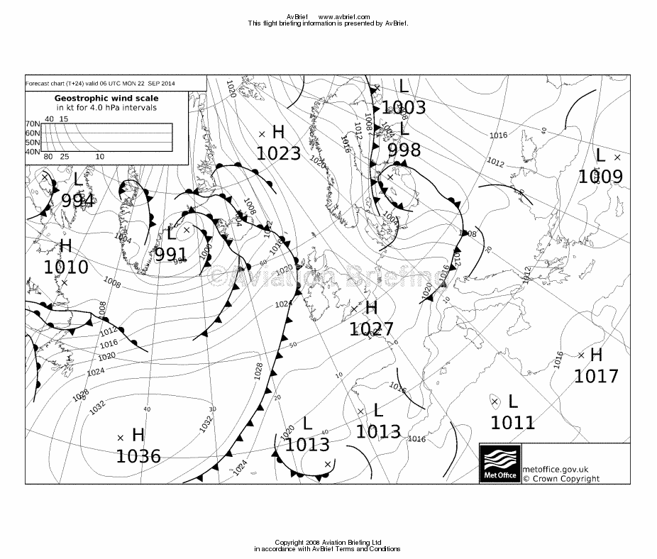
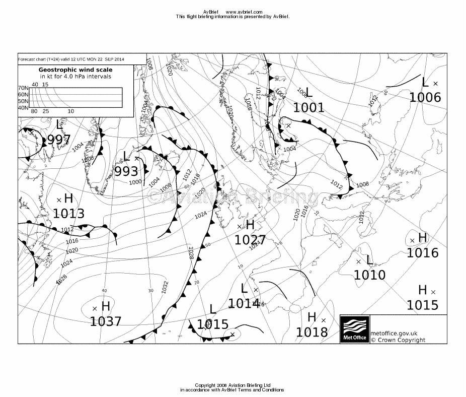
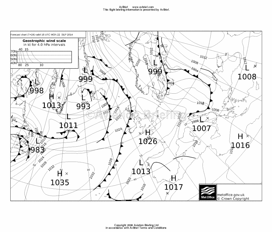
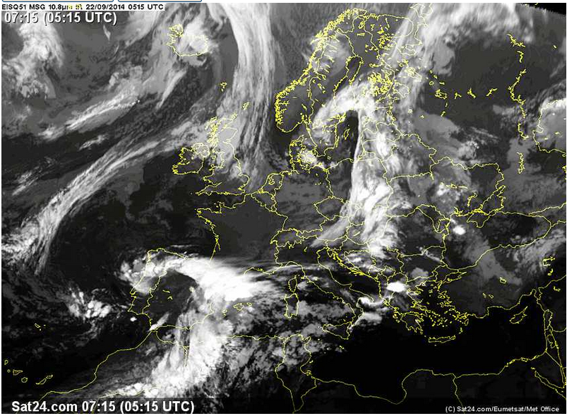
The weather data looked OK: MSLP 0600 1200 1800 SigWx 0600 1200 1800. The IR image indicated cloud tops estimated around FL100-150 which the TB20 can easily outclimb. The TAFs and METARs did not show anything problematic and importantly did show good VFR conditions for LIMG and for the subsequent flight to LFKC.
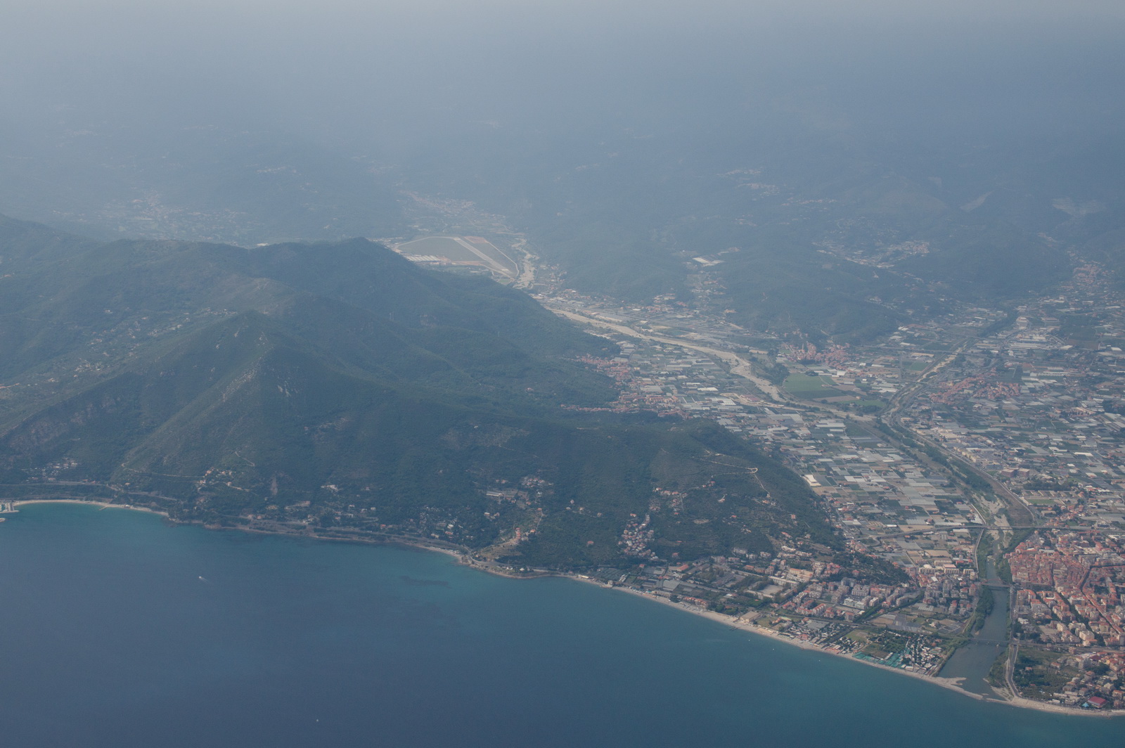
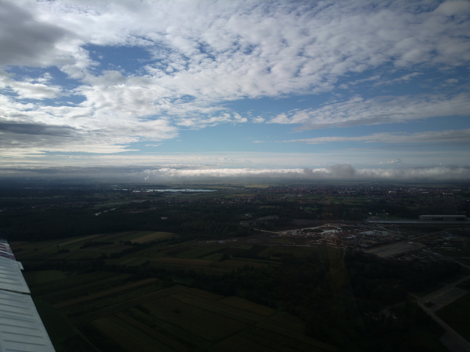
The departure weather was fine, though a bit hazy and with a low cloudbase
Climbing up to the top is always a great feeling
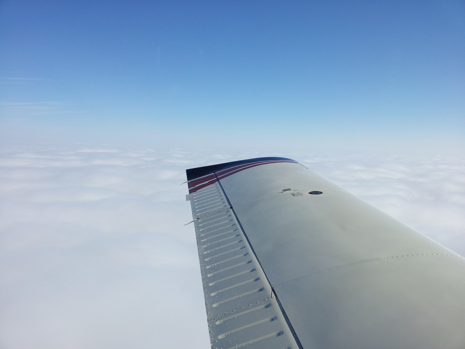
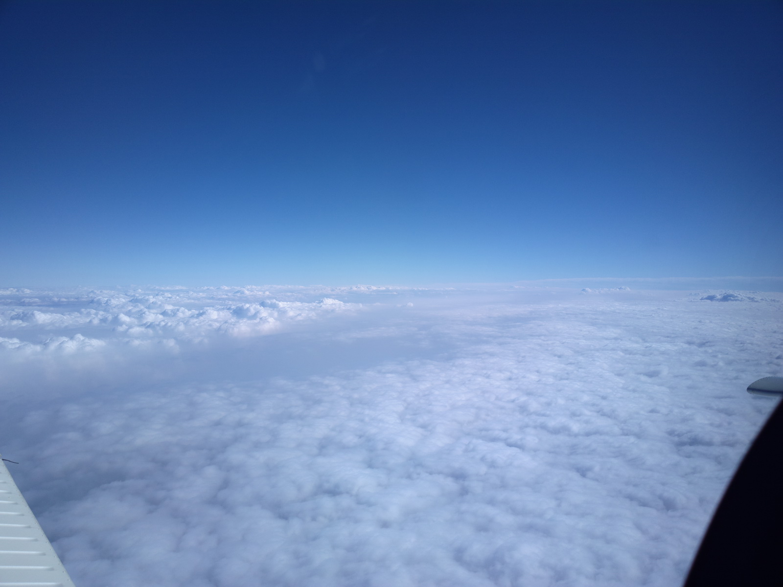
and we settled at FL100 for the cruise. The enroute weather was initially very good, with cloud tops around FL080 all the way to the Alps
Typical performance was 143kt TAS at 10.3 USG/hr, +8C, 2400rpm.
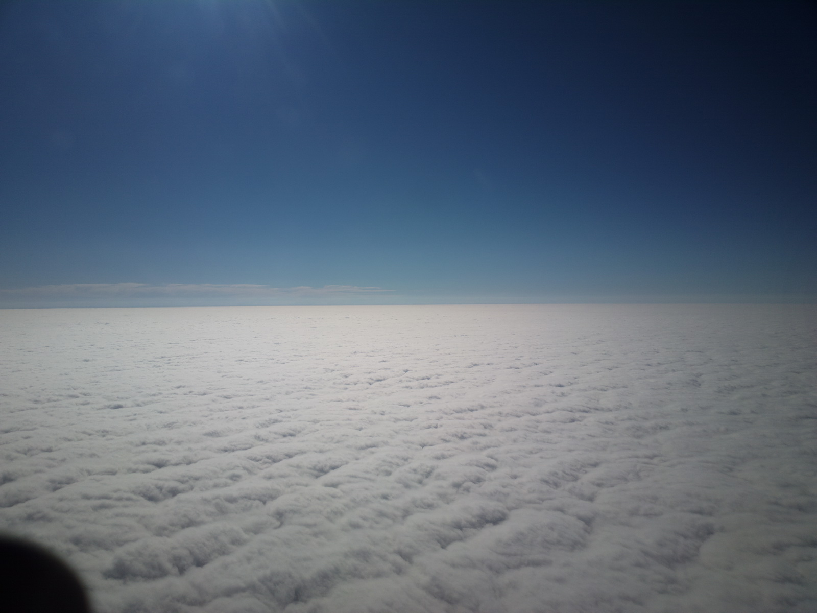
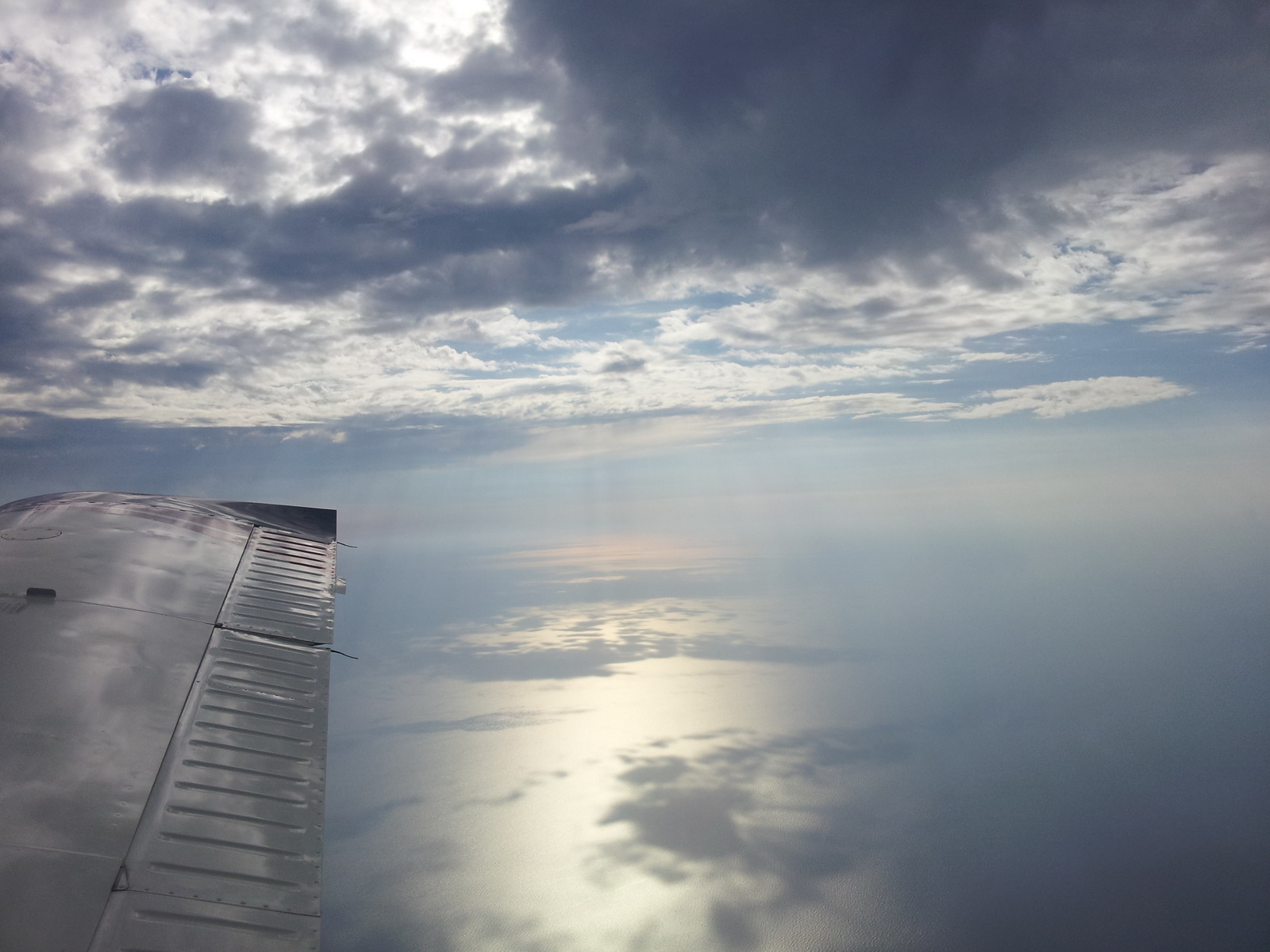
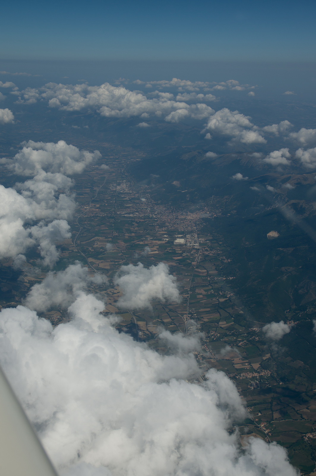
Soon we were between layers but there was no point in climbing higher because there was nothing significant above
Then it got a bit more convective
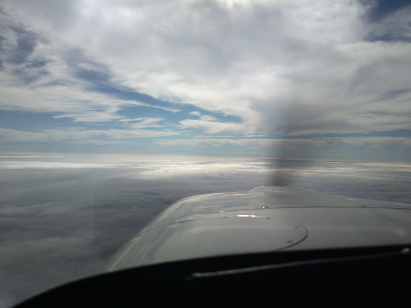
Not much was seen of France
I picked up the weather for the destination area, over the Thuraya 7100 satellite phone connected to the Lenovo T2 tablet
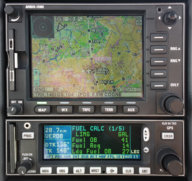
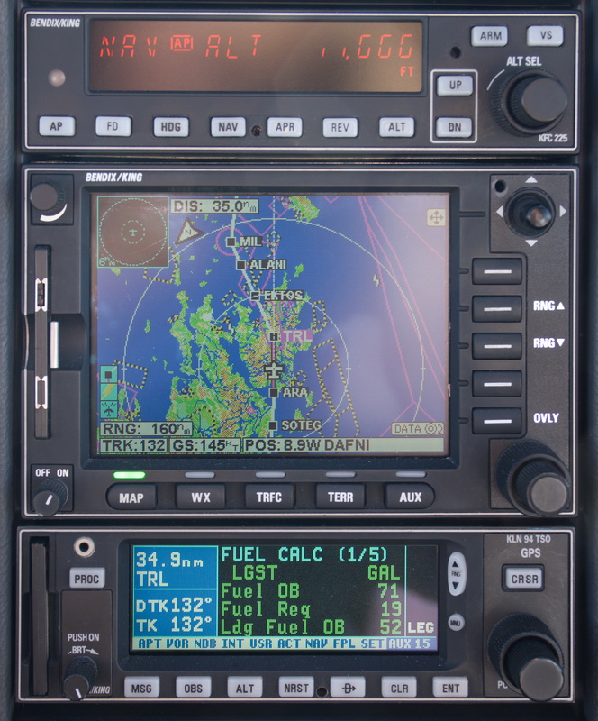
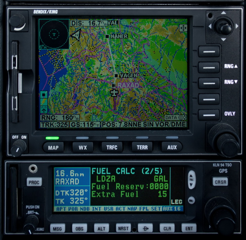
We are now approaching the Alps and starting to climb, initially FL120. The GPS-linked fuel totaliser is showing 26 USG on landing, which is fine
Then the layer thinned out but also got more convective content
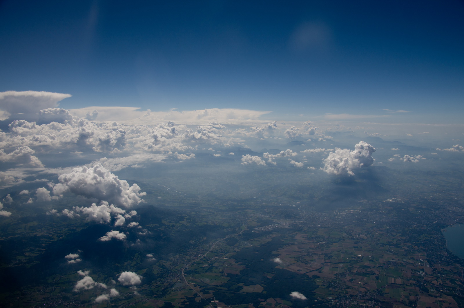
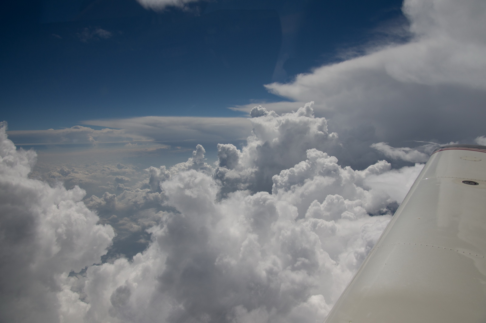
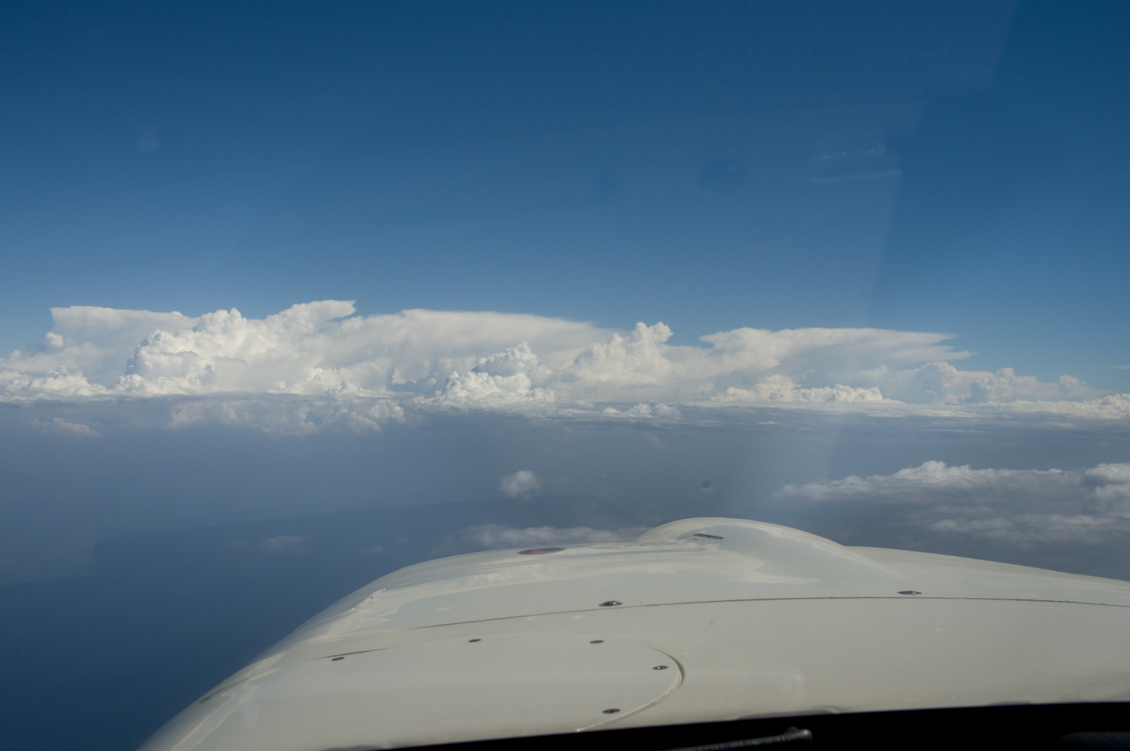
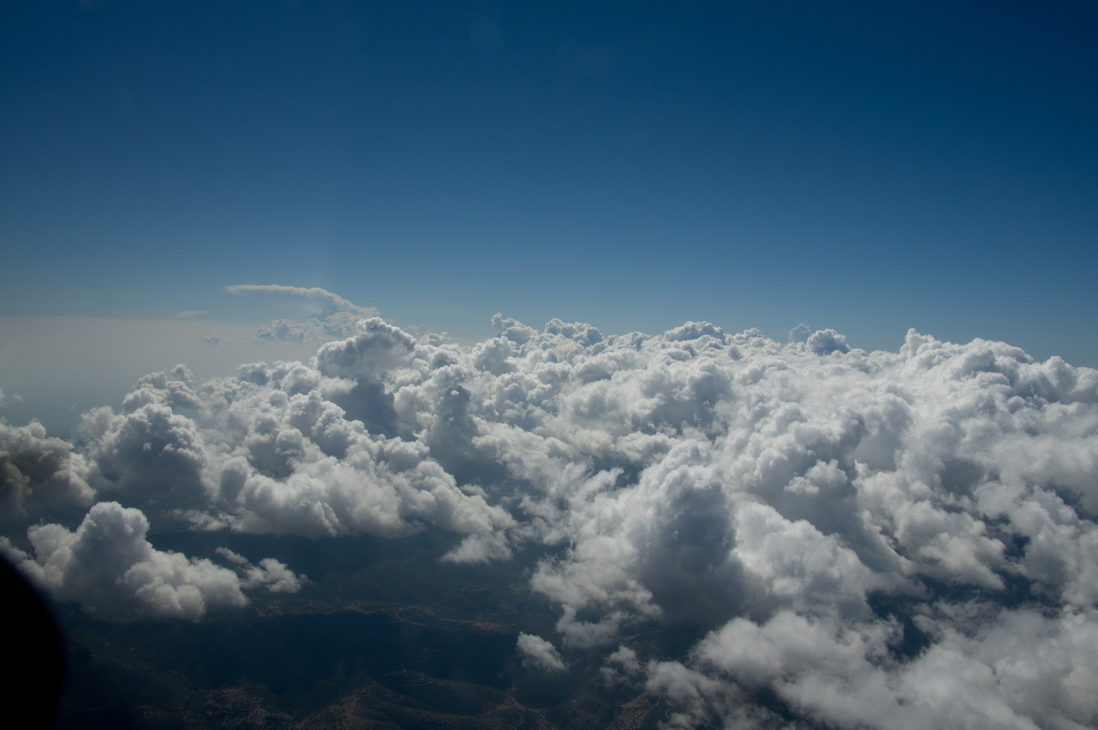
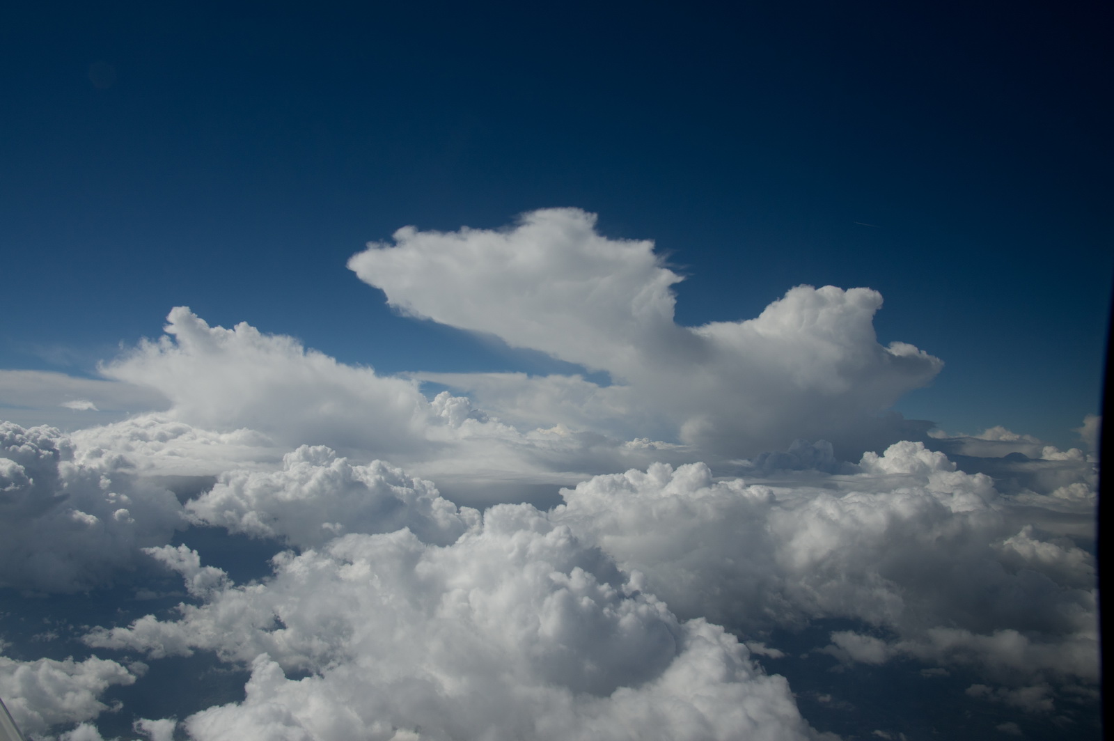
with some impressive buildups
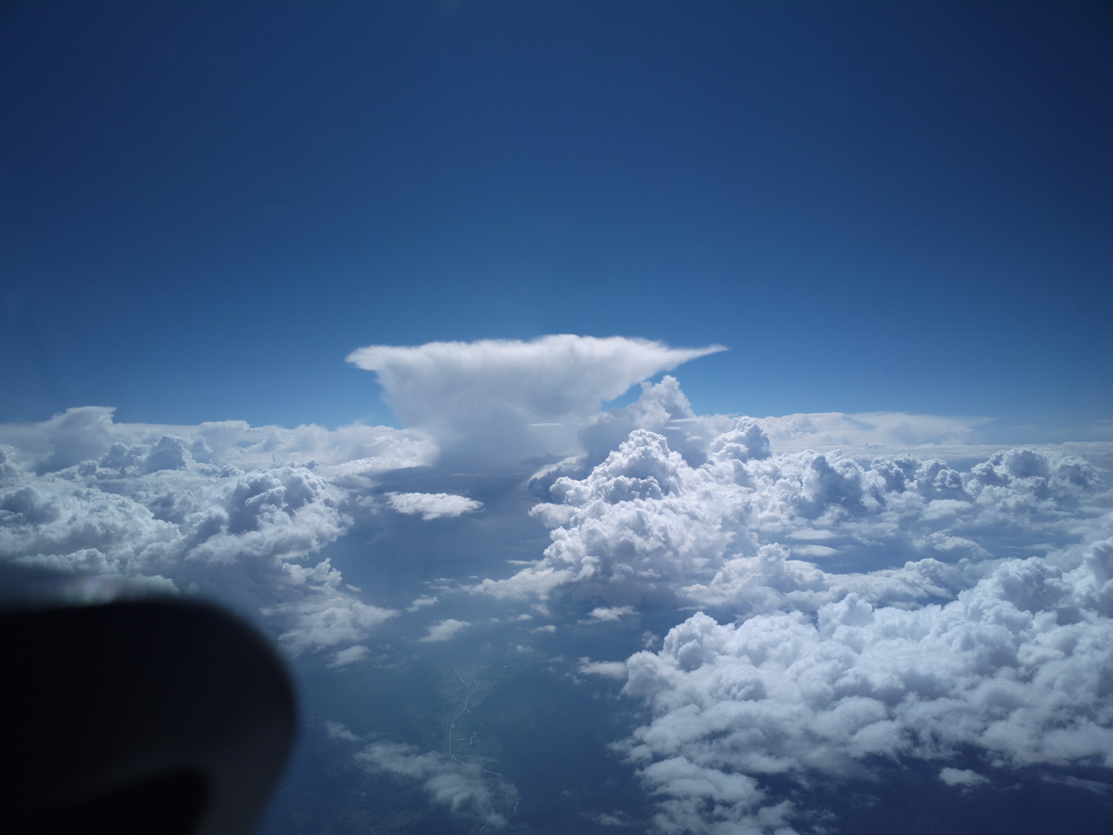
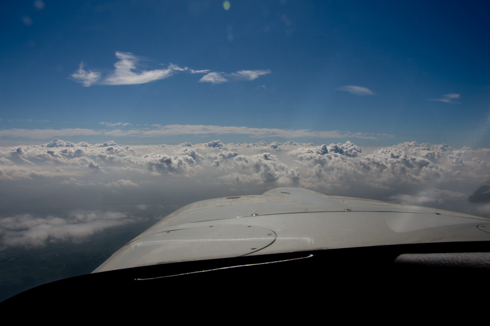
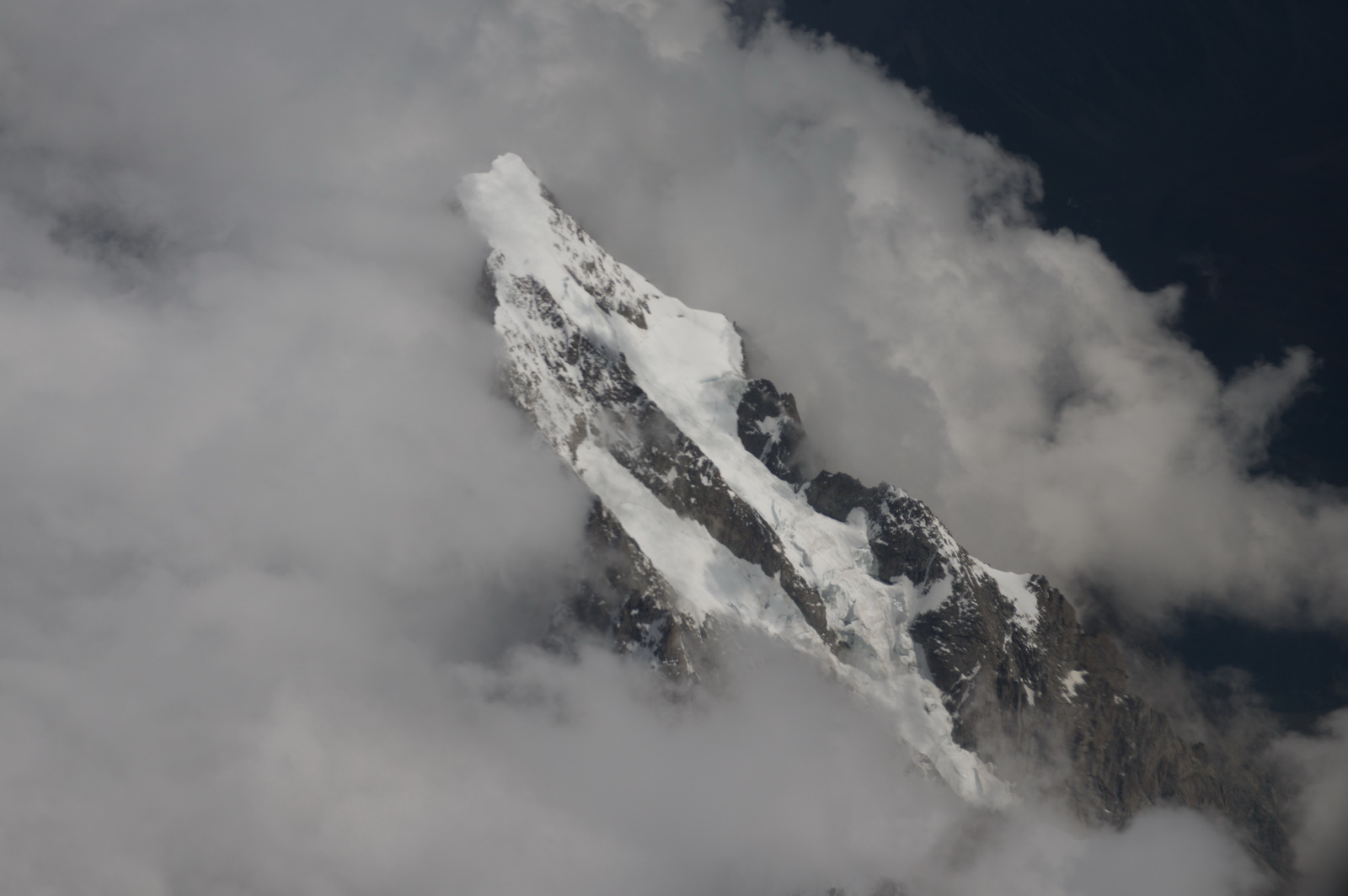
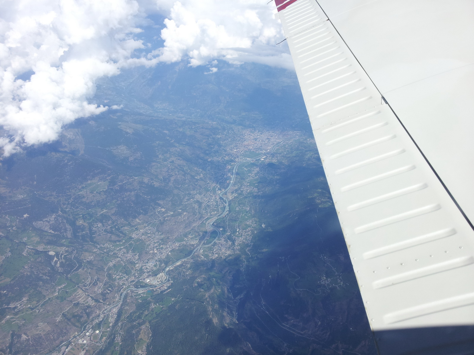
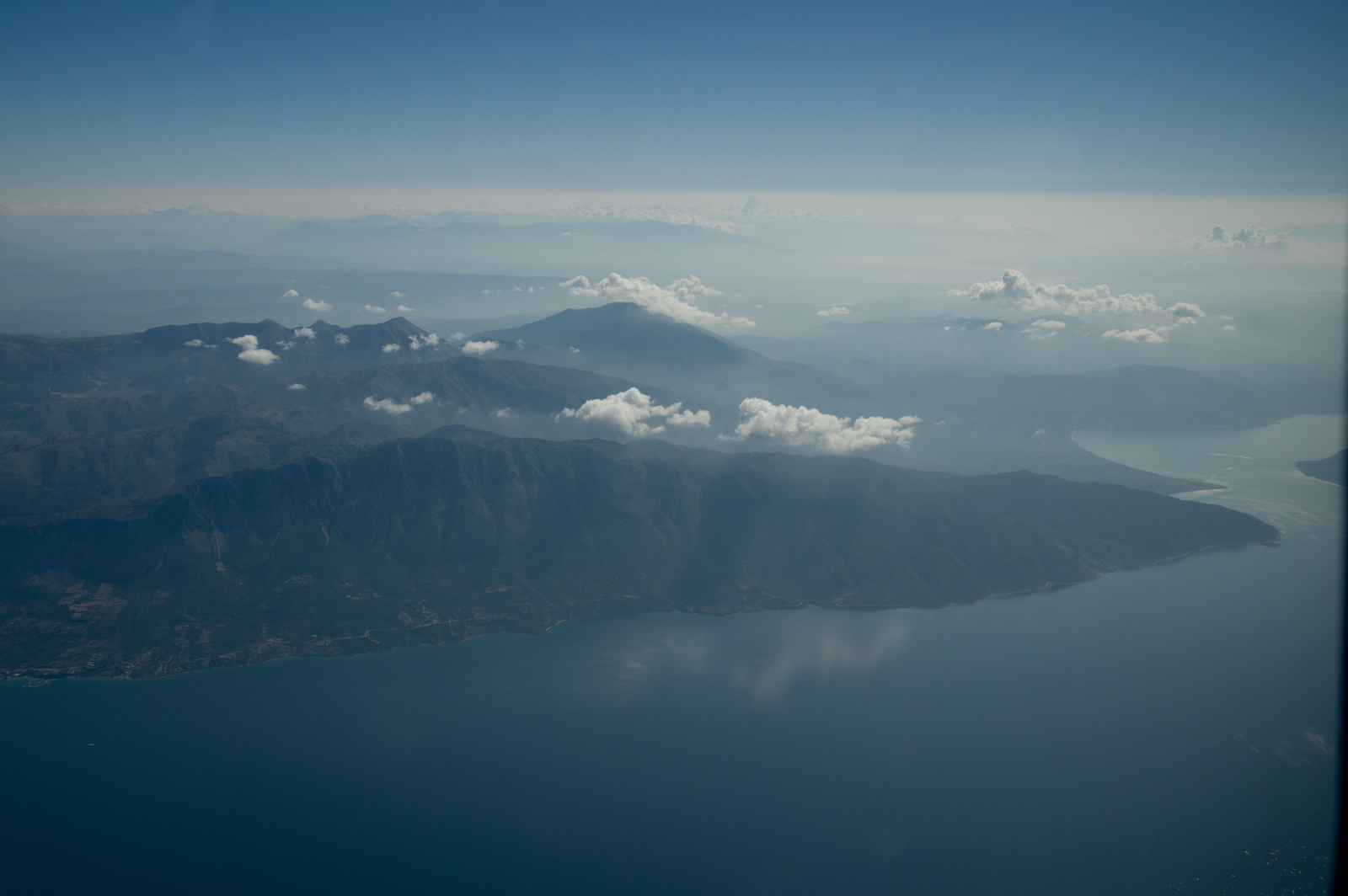
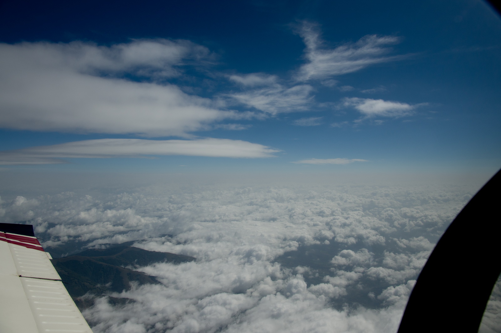
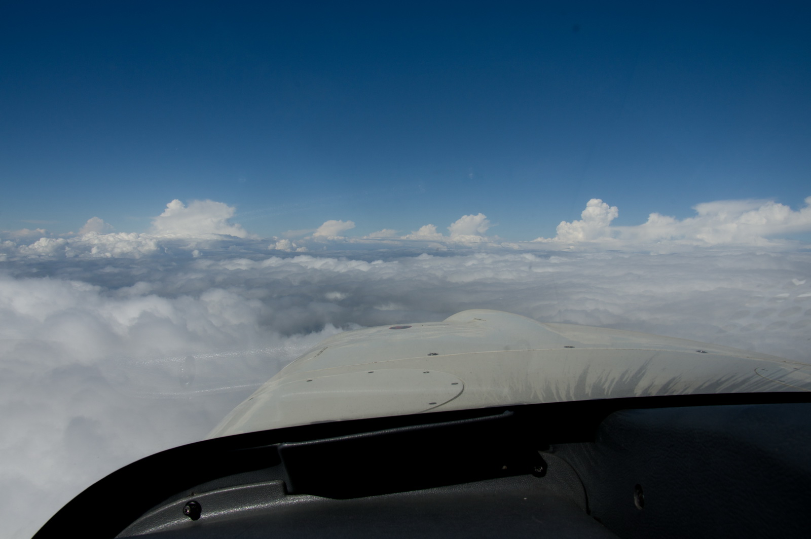
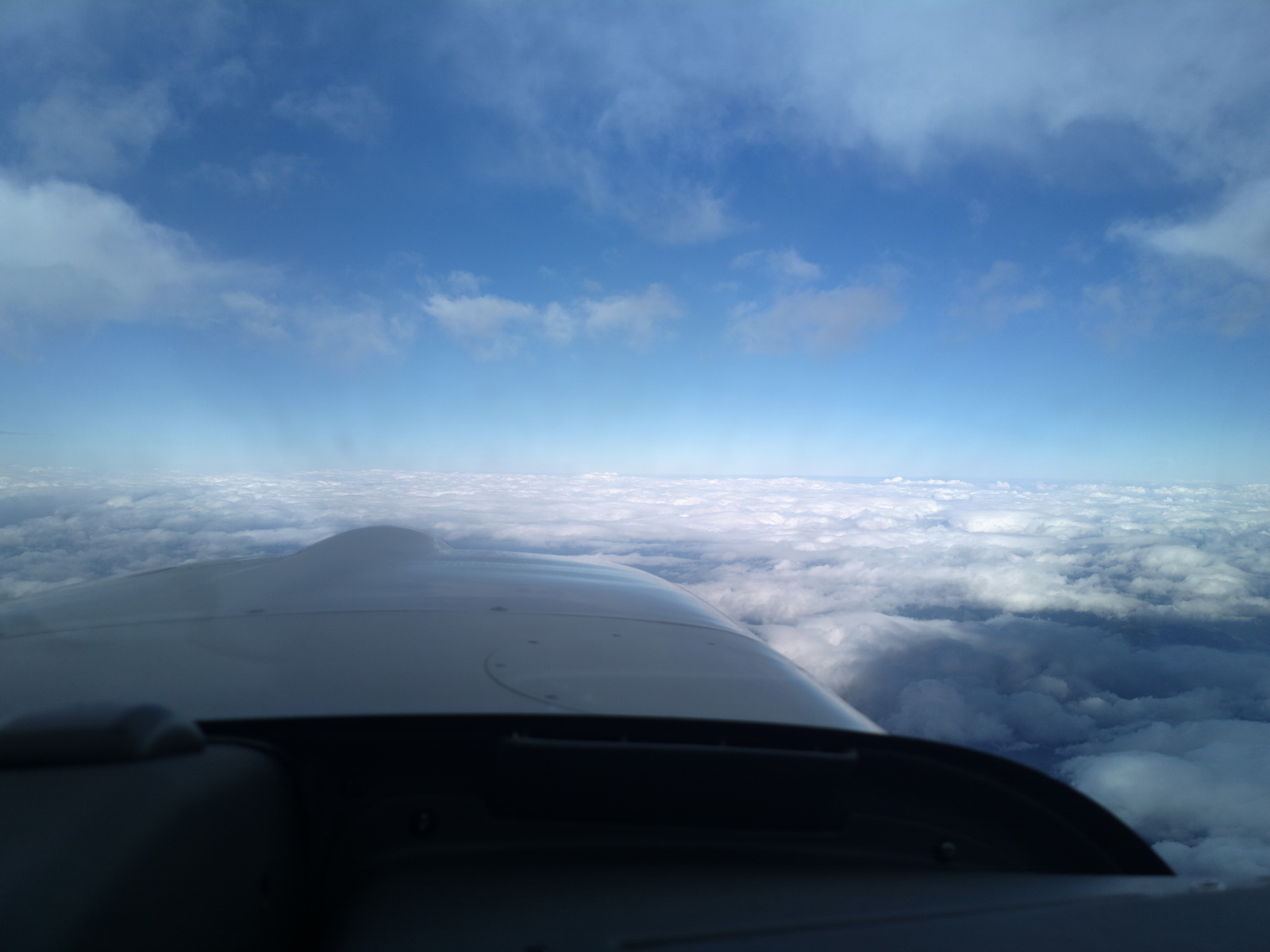
Soon we climbed to FL180 but unfortunately little was seen of the Alps which in that area (near Mt Blanc) should have been very scenic
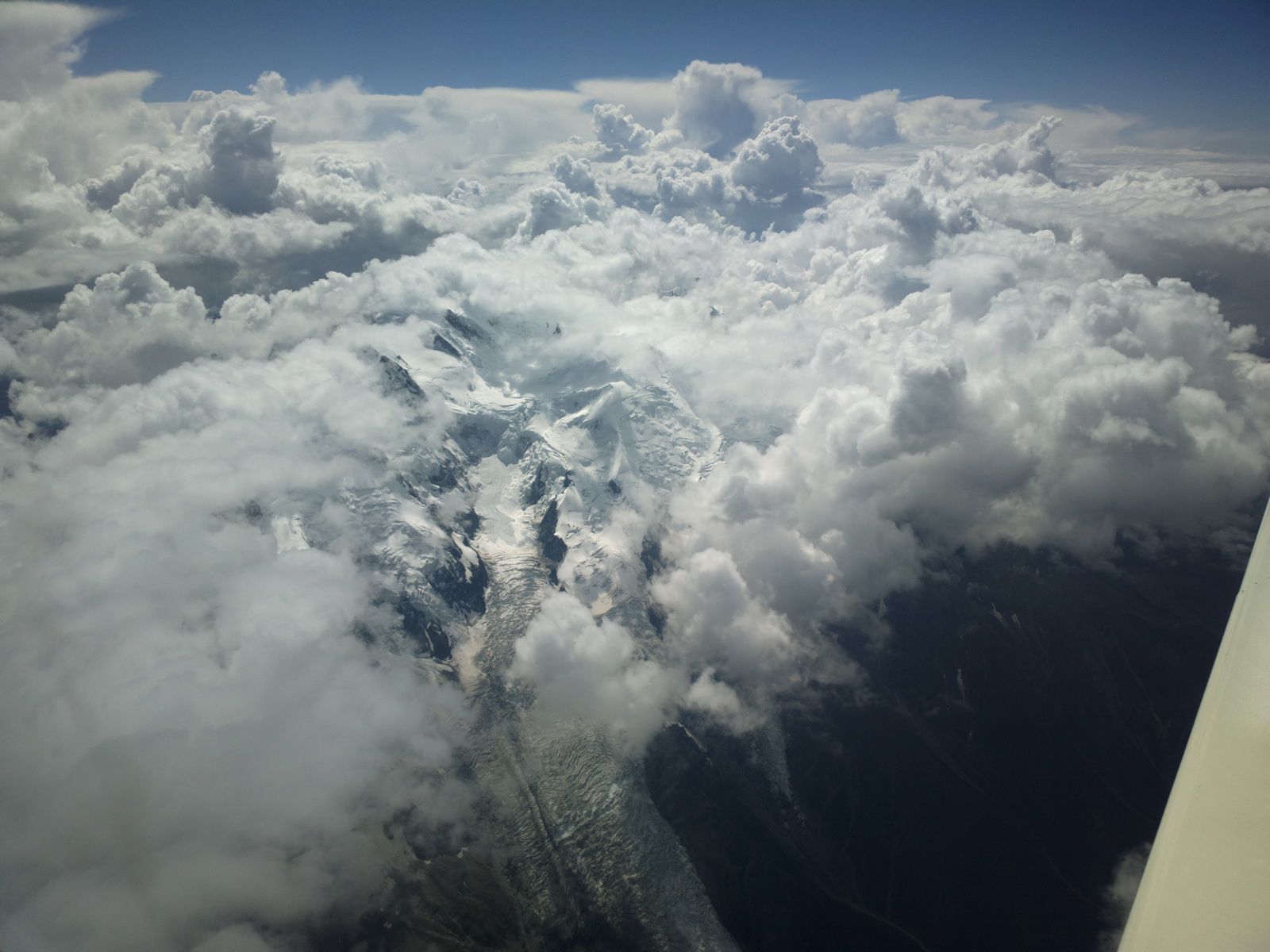
The Alps generally have plenty of landing opportunities in case of an engine failure providing one is running a moving map GPS with proper topographic data which depicts the terrain clearly
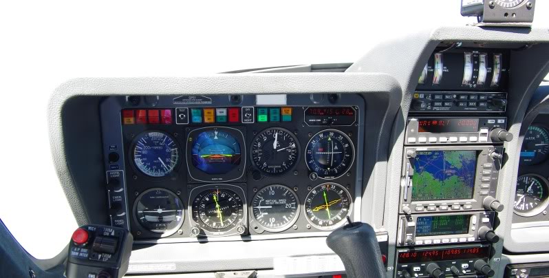
To stay above the buildups we had to climb to FL190 and that was about the limit in the conditions (-13C at FL190 i.e. ISA+10) as can be seen in the pitch (on the Sandel SN3500 EHSI, switched into the reversionary horizon mode) approaching 10 degrees
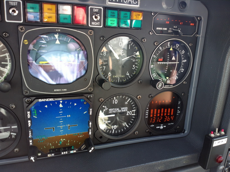
The "1312" on the EGT is the "best power" mixture setting which is around 130F ROP, which is necessary to get to FL190. In fact we only reached FL189, at which point the stall warner came on. It does come on about 10kt above Vs so this sounds much more alarming than it is, but at that point one needs to keep a very careful eye on things, and preferably fly by hand. The aircraft will make FL200 but not in ISA+10.
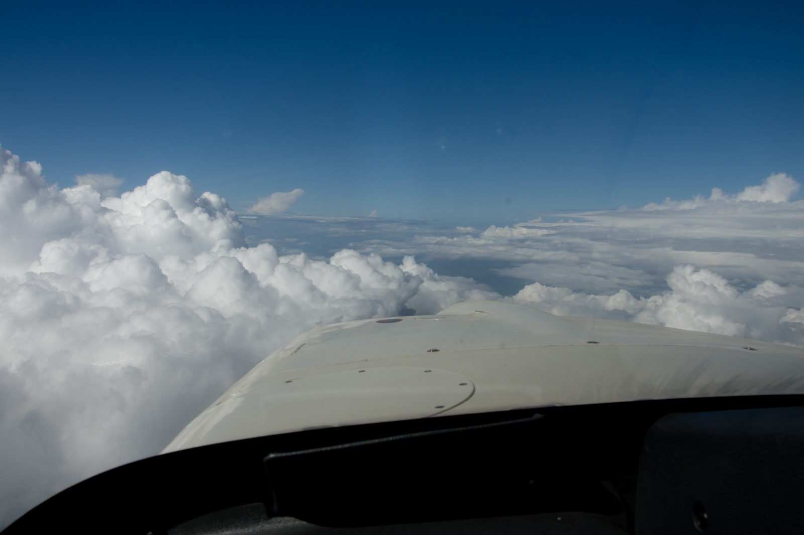
One last gap to squeeze through at FL189 before commencing descent over the sea to Albenga
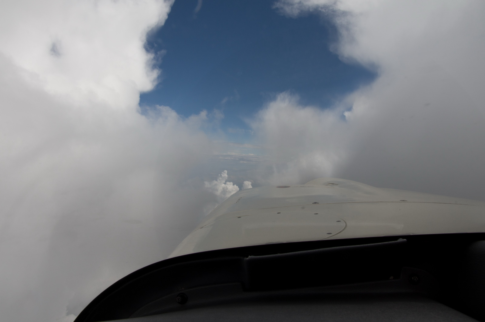
and then it opened up
I little bit of ice was picked up in the descent through some IMC but it didn't matter because we were going down anyway and soon it would be very warm
and here we are below the muck

To make life simpler, we cancelled IFR at this point (at 5000ft) because the cloudbase would make the approach easy and give us a big shortcut
You can see a lightning strike in the above pic, to the right of the track. There were some buildups over the mountains and one needs only one of them to produce one strike. This is very common.
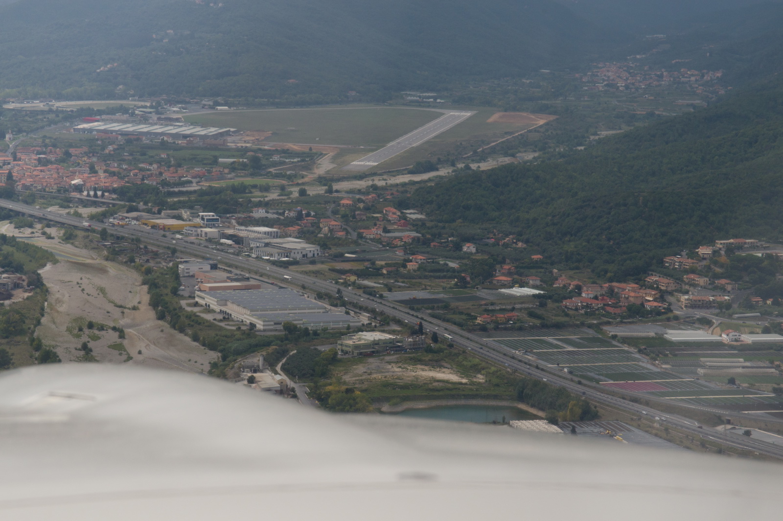
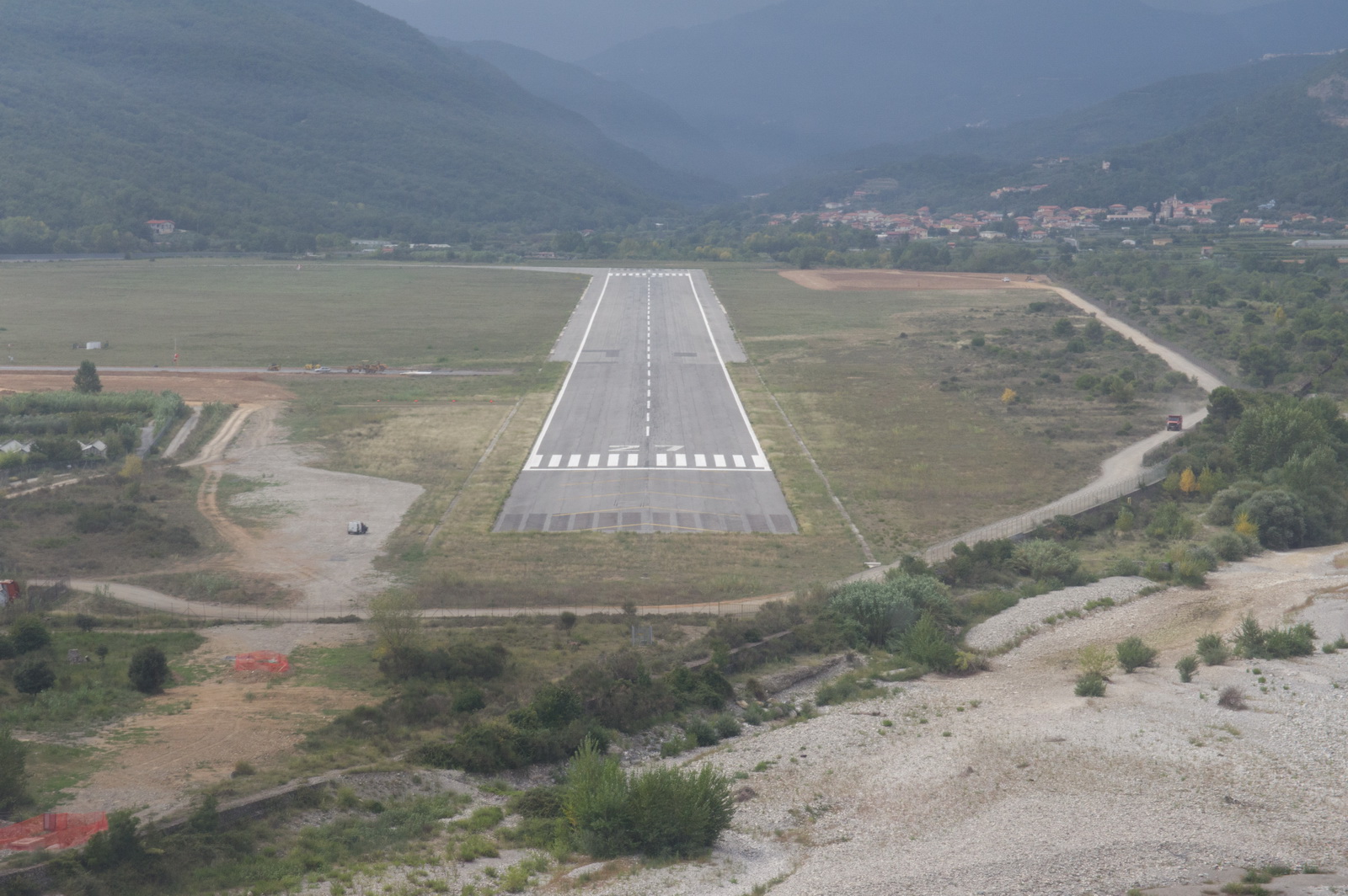
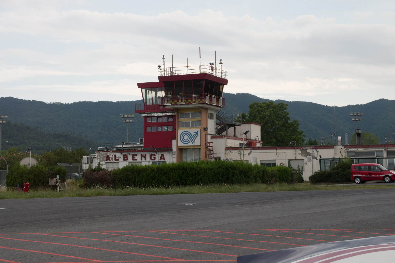
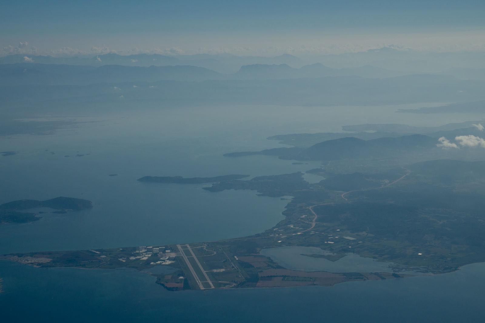
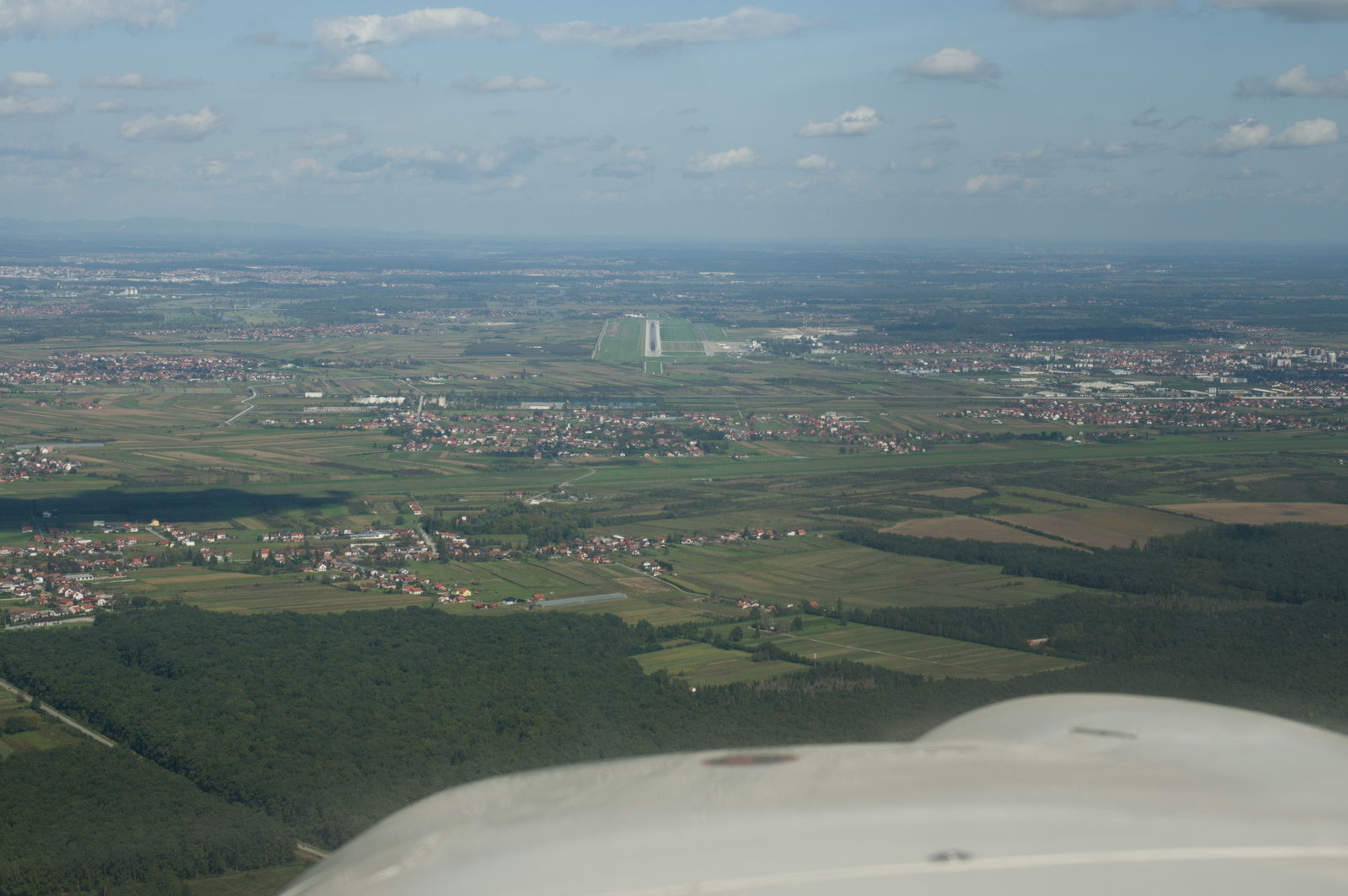
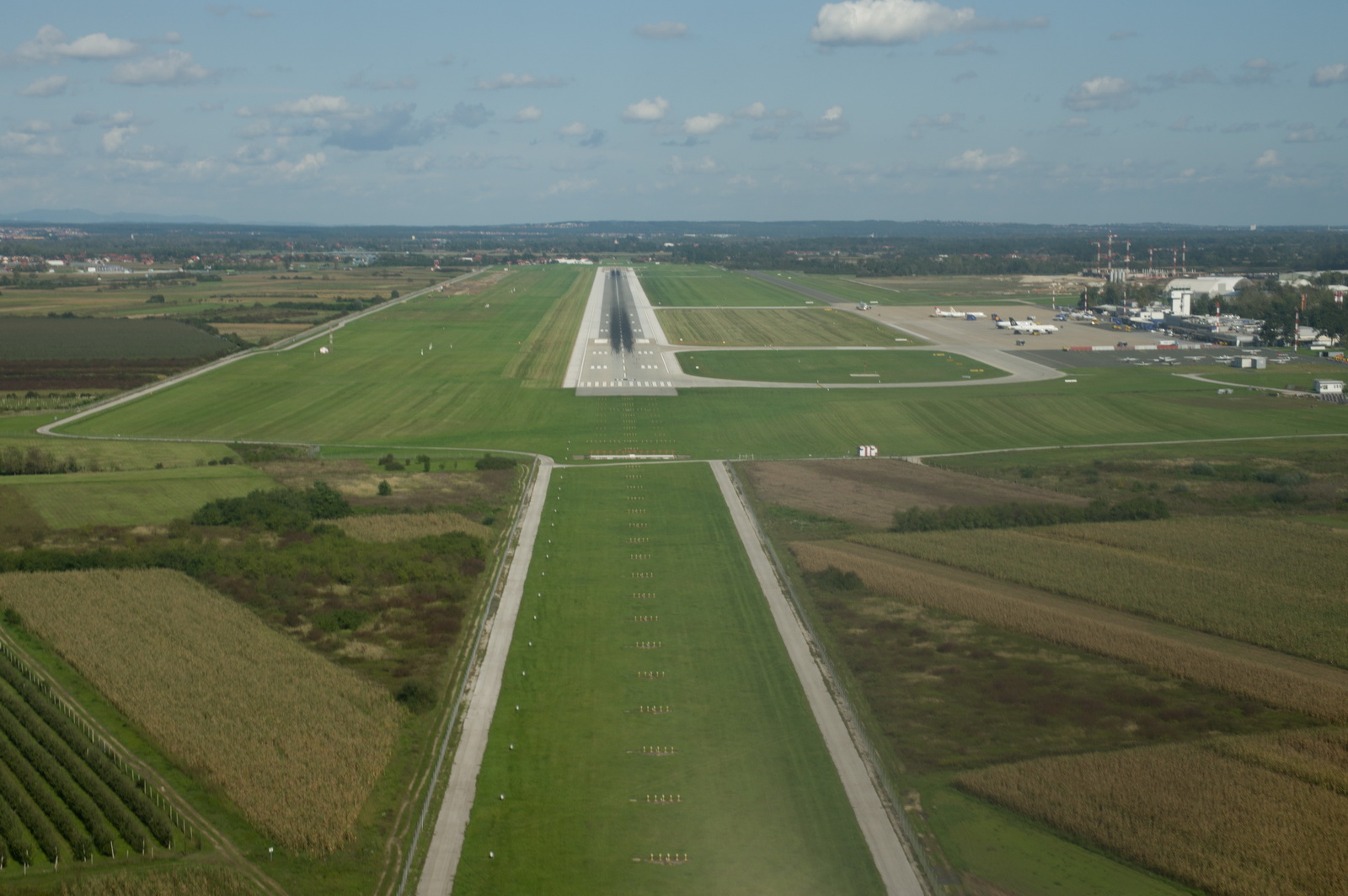
Here is the Albenga runway just becoming visible
Right base for runway 27
One just has to get the right pictures ![]() Shooting through the propeller, the shutter speed needs to be 1/125 or slower
to avoid the horrible prop blade effects...
Shooting through the propeller, the shutter speed needs to be 1/125 or slower
to avoid the horrible prop blade effects...
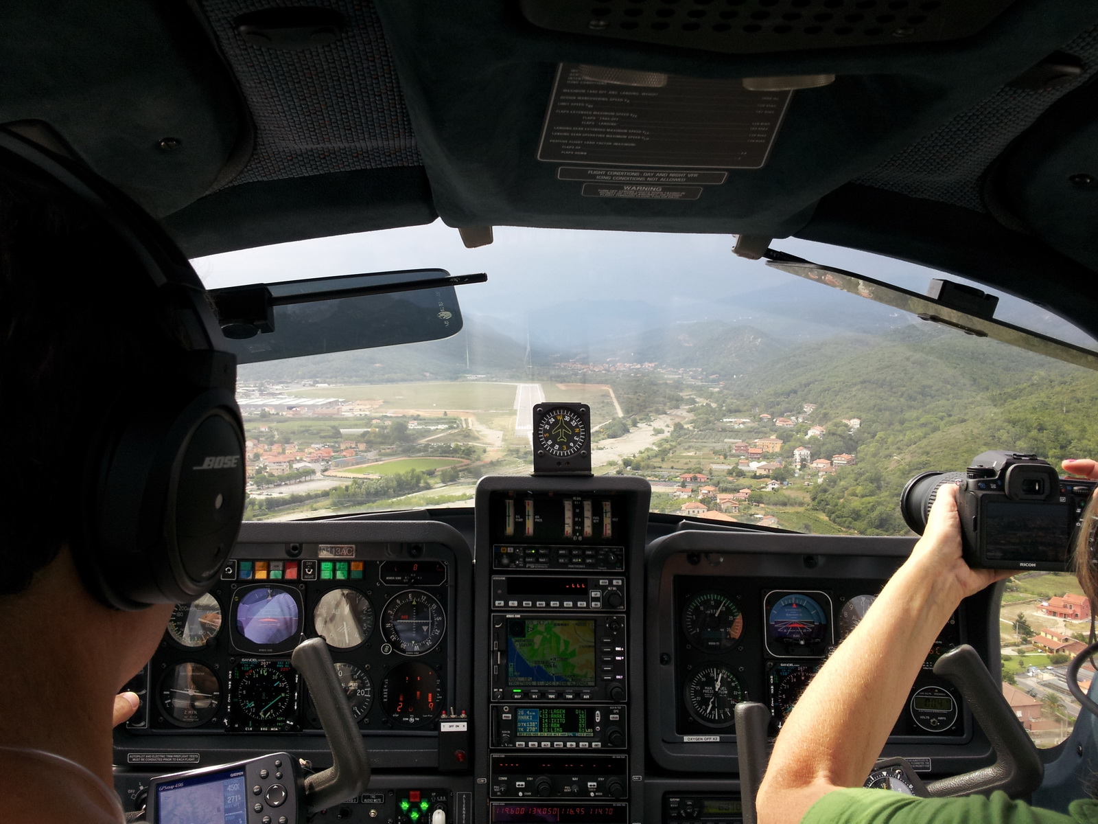
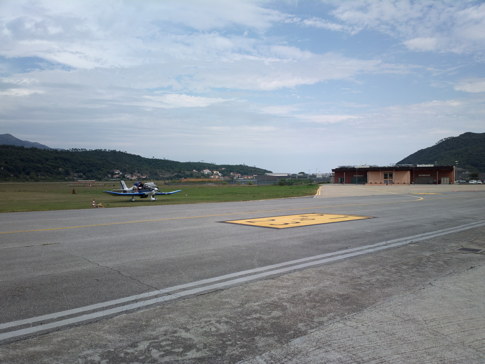
Final approach into Albenga LIMG
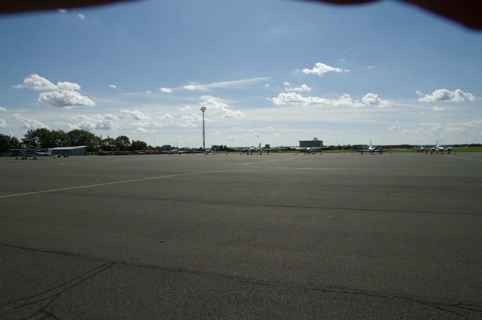
There was a small amount of GA activity there. We got fuel within an hour or so. The whole process takes a while because one has to queue up while various bits of paper are processed, etc
Departure was straight out over the sea
We flew all the way just below the cloudbase, at varying levels around 5000-6000ft, with nobody in ATC being the least bit interested
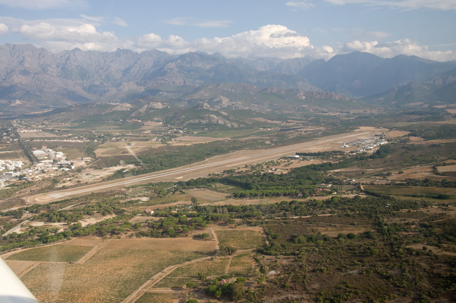
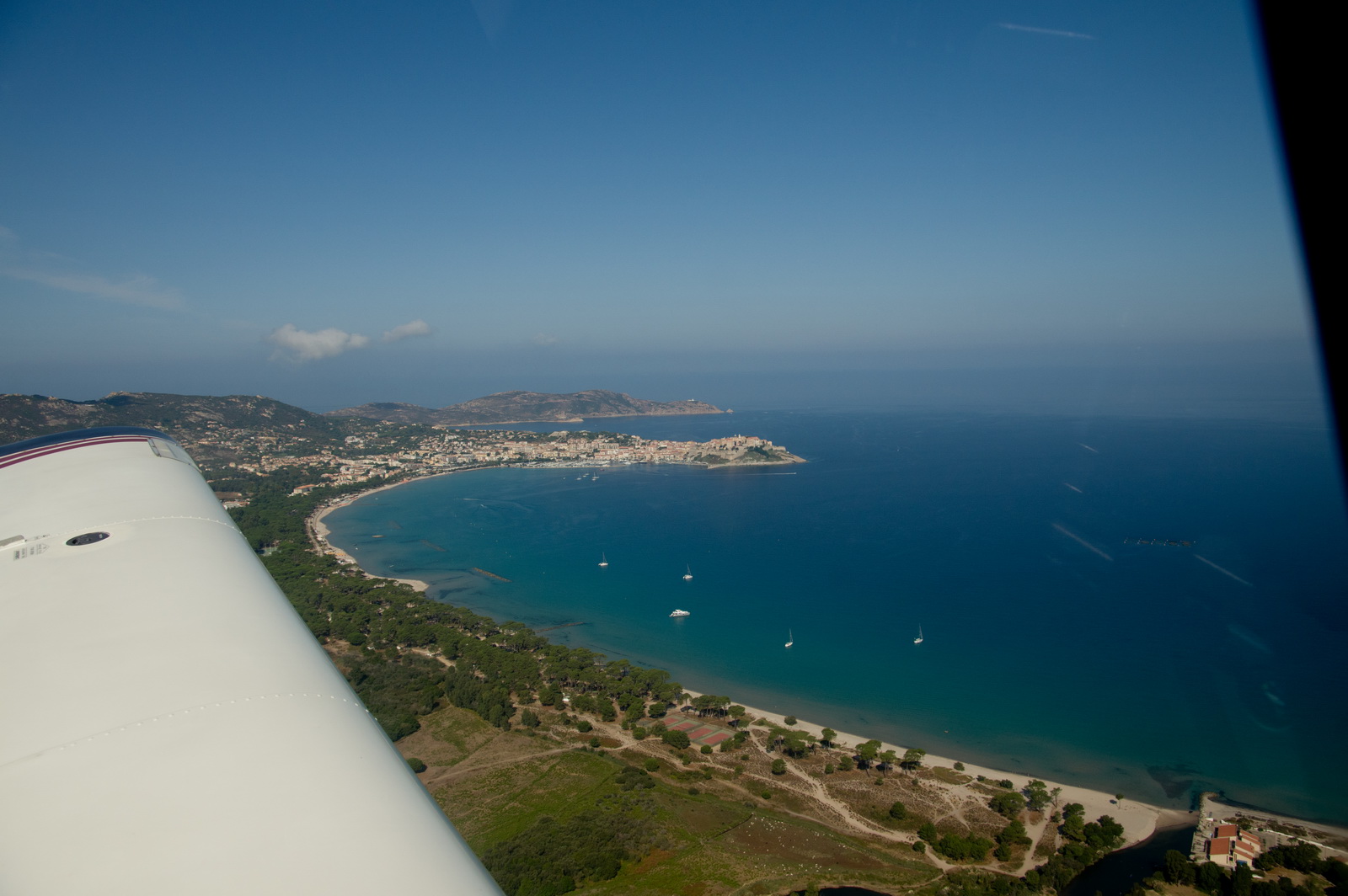
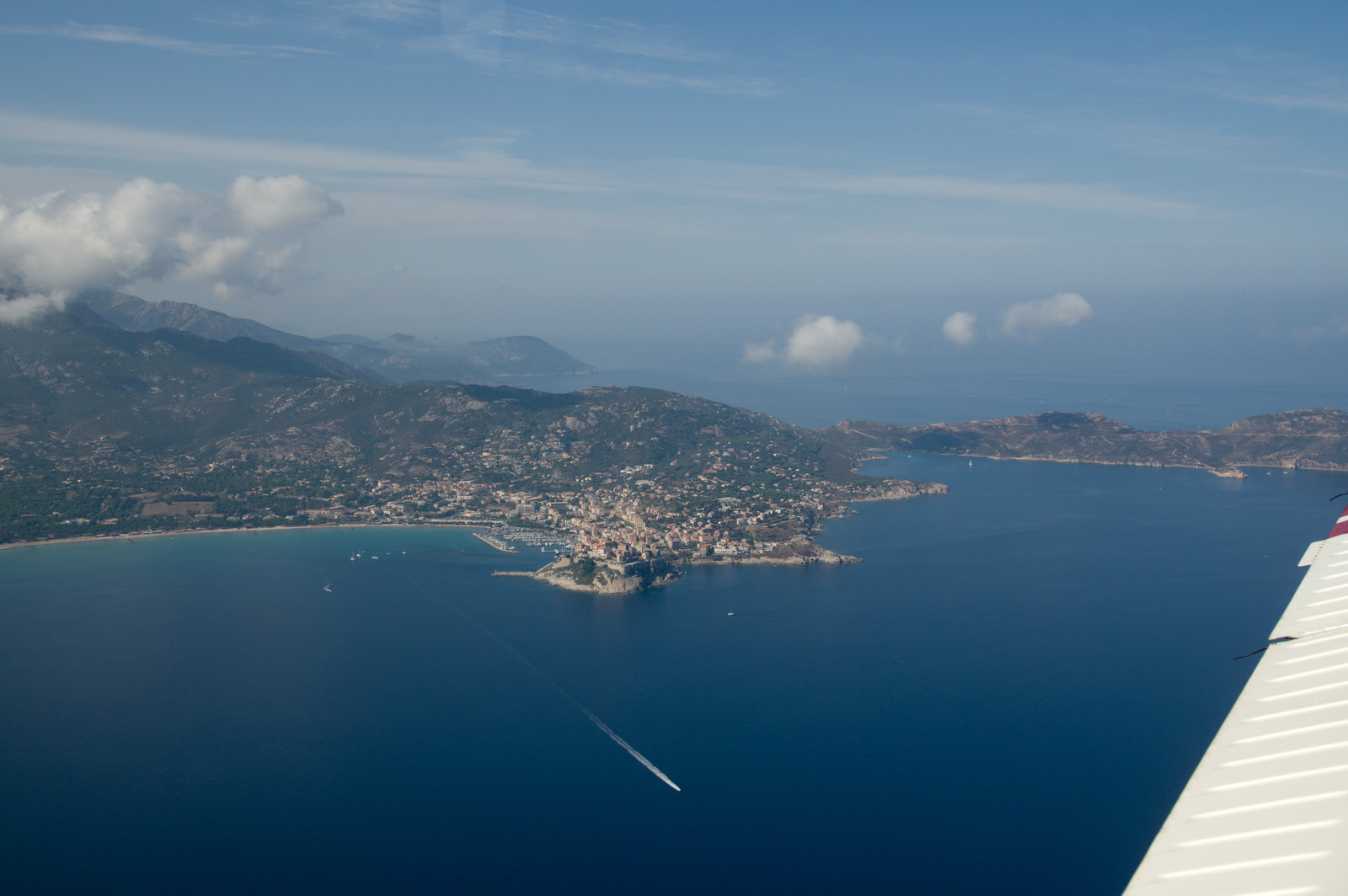
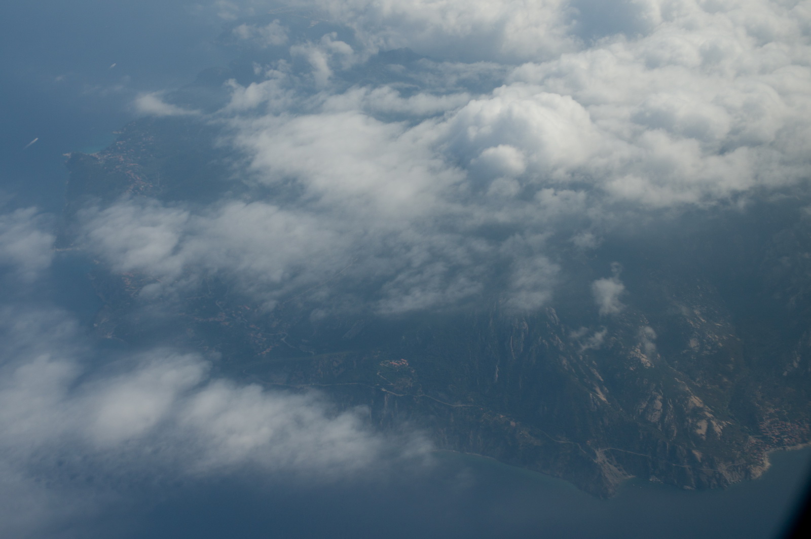
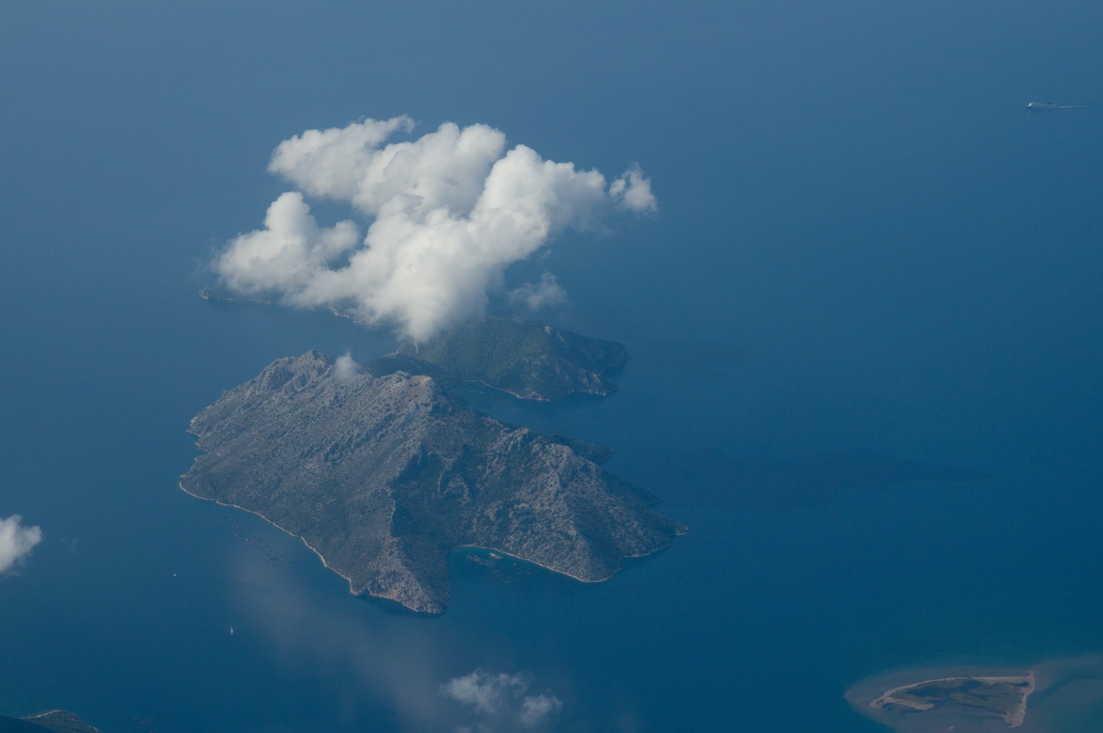
Less than hour later, Corsica appeared out of the haze
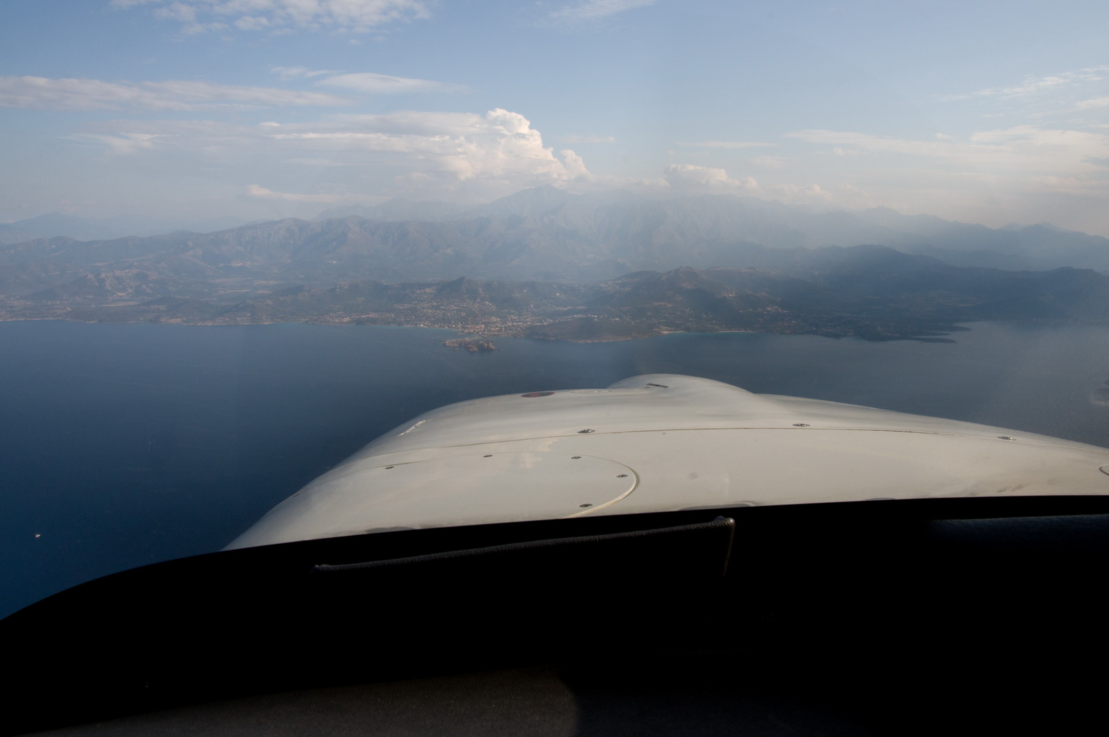
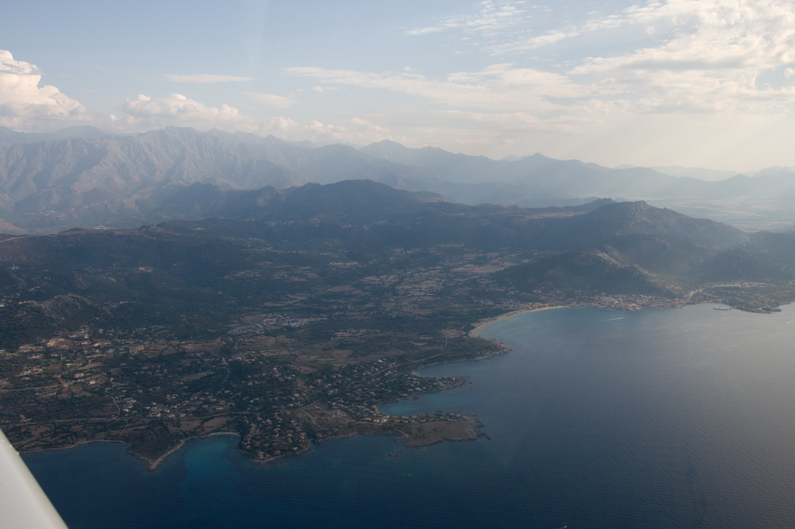
and here is Calvi. We joined downwind, LH circuit, to land in the opposite direction to the picture below
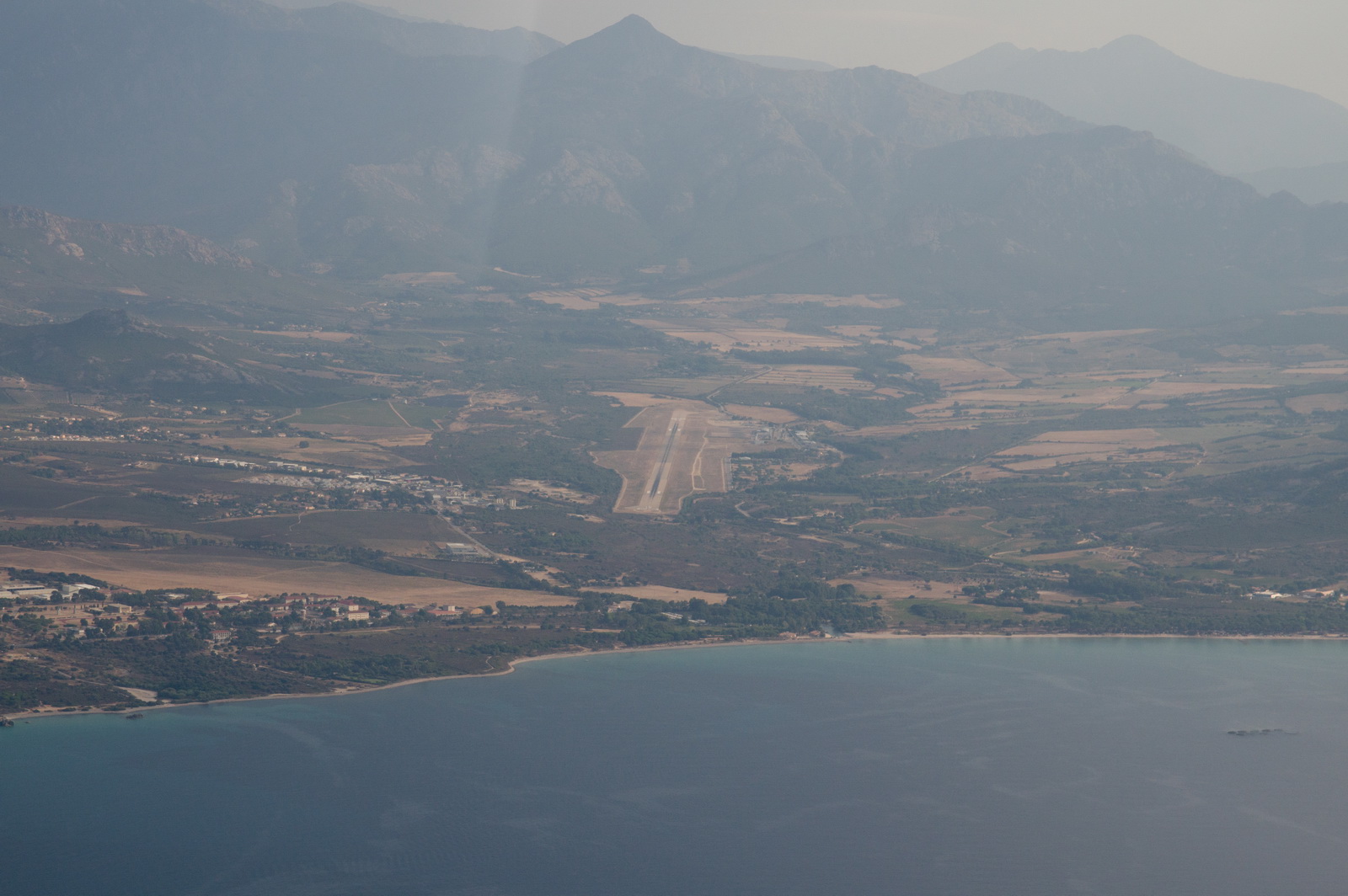
Calvi does have instrument approaches (LOC and RNAV) but we arrived VFR and the conditions were fine.
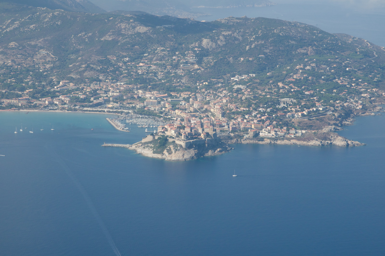
A nice view of the airport from downwind
Left base
Final approach into Calvi LFKC
The EuroGA fly-in was very successful and a good selection of aircraft turned up - as well as a number of others
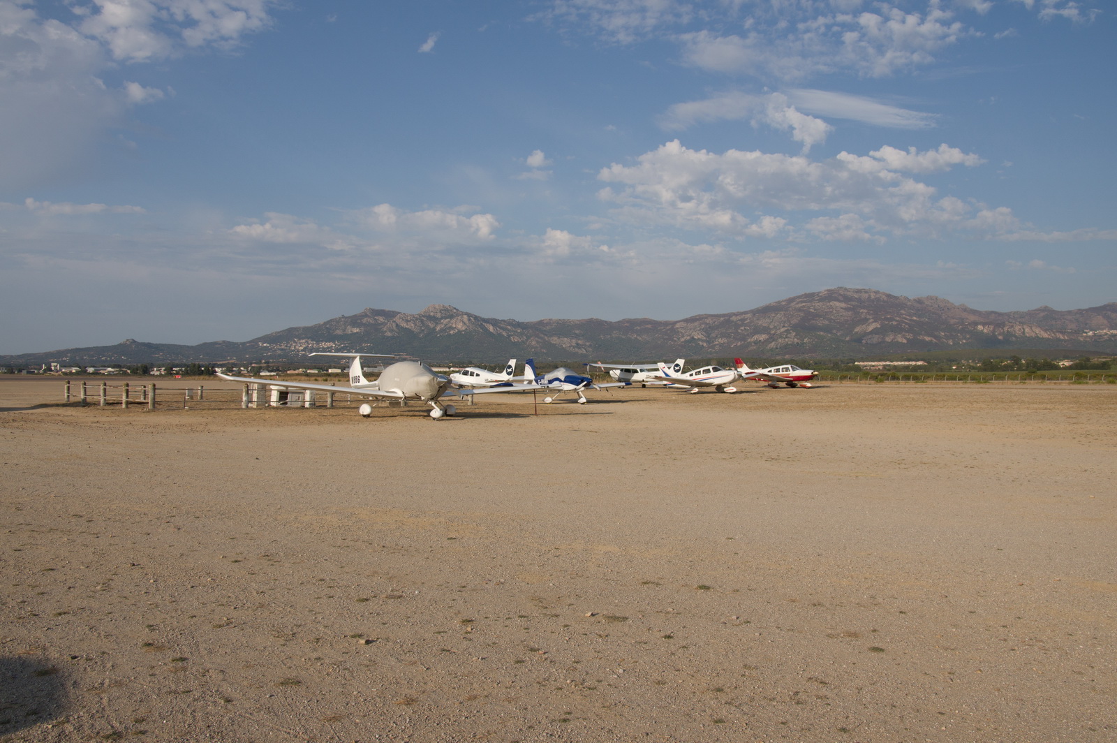
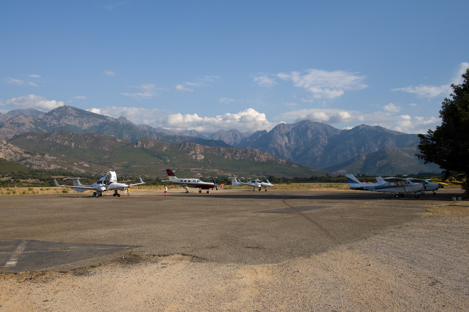
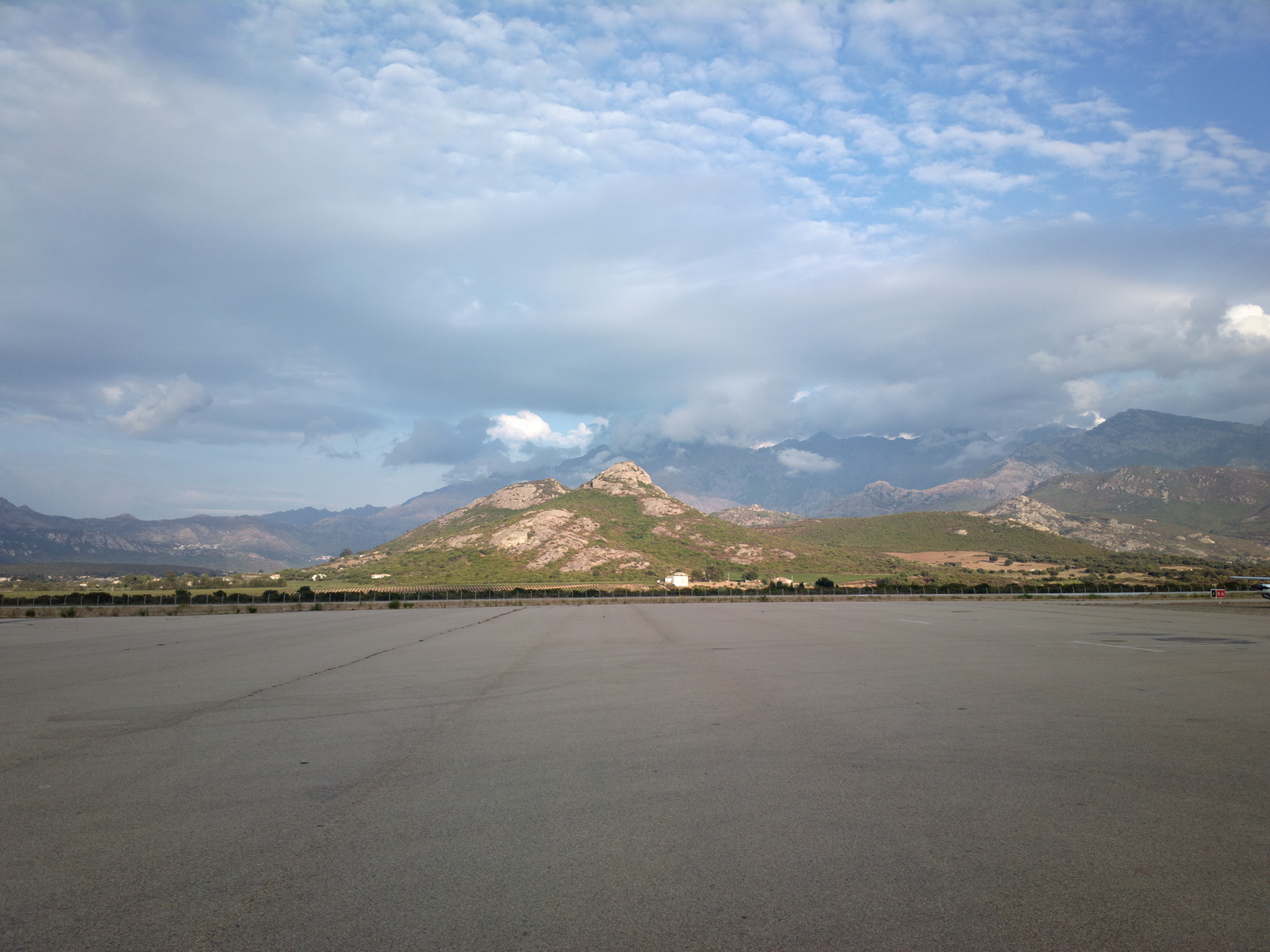
A disappointing feature of Calvi airport was the surface on which most light aircraft were required to park (visible above) which was of appallingly bad quality. It was hard-packed but with a surface layer of fine and extremely abrasive sand, which got blown all over the place like a sandstorm whenever any aircraft engine was running. After we parked up
we could not put the aircraft cover on because doing so would scratch the windows. Even very gently wiping the crap off with a rag produced thousands of tiny scratches on the windows, so one of my passengers very kindly ran over to the GA terminal many times, refilling bottles of water which we used to wash off the crap from the areas which the cover would touch (mostly the roof and the windows). That did the job but the rest of the aircraft remained covered in the crap until a couple of weeks later when a huge overnight downpour in Zagreb washed most of it off. I also forgot to close all three doors as somebody taxied past so a lot of the grit ended up inside the backpacks and clothing... It is astonishingly arrogant of the airport management to allow this sort of thing, but it was evident that most other pilots were not bothered and were happy to taxi around, covering everybody else with huge clouds of the stuff. Here is a video of a Cirrus who departed after we offered to help him pull his aircraft off the surface
This is the fancy new "GA terminal" which appeared to not go anywhere useful so we went elsewhere to pay and get off the airport
Update 3/2018: one pilot has reported that hard surface parking was available at no extra cost. So I would suggest simply refusing to park on this stuff if told to do so.
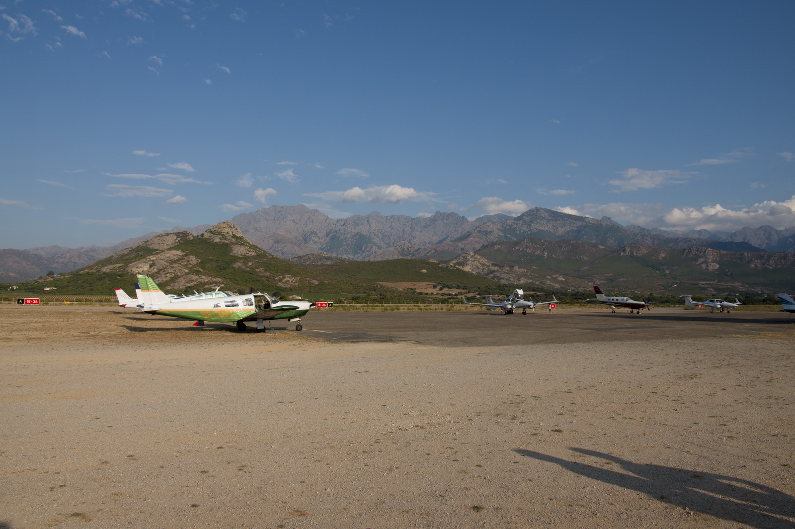
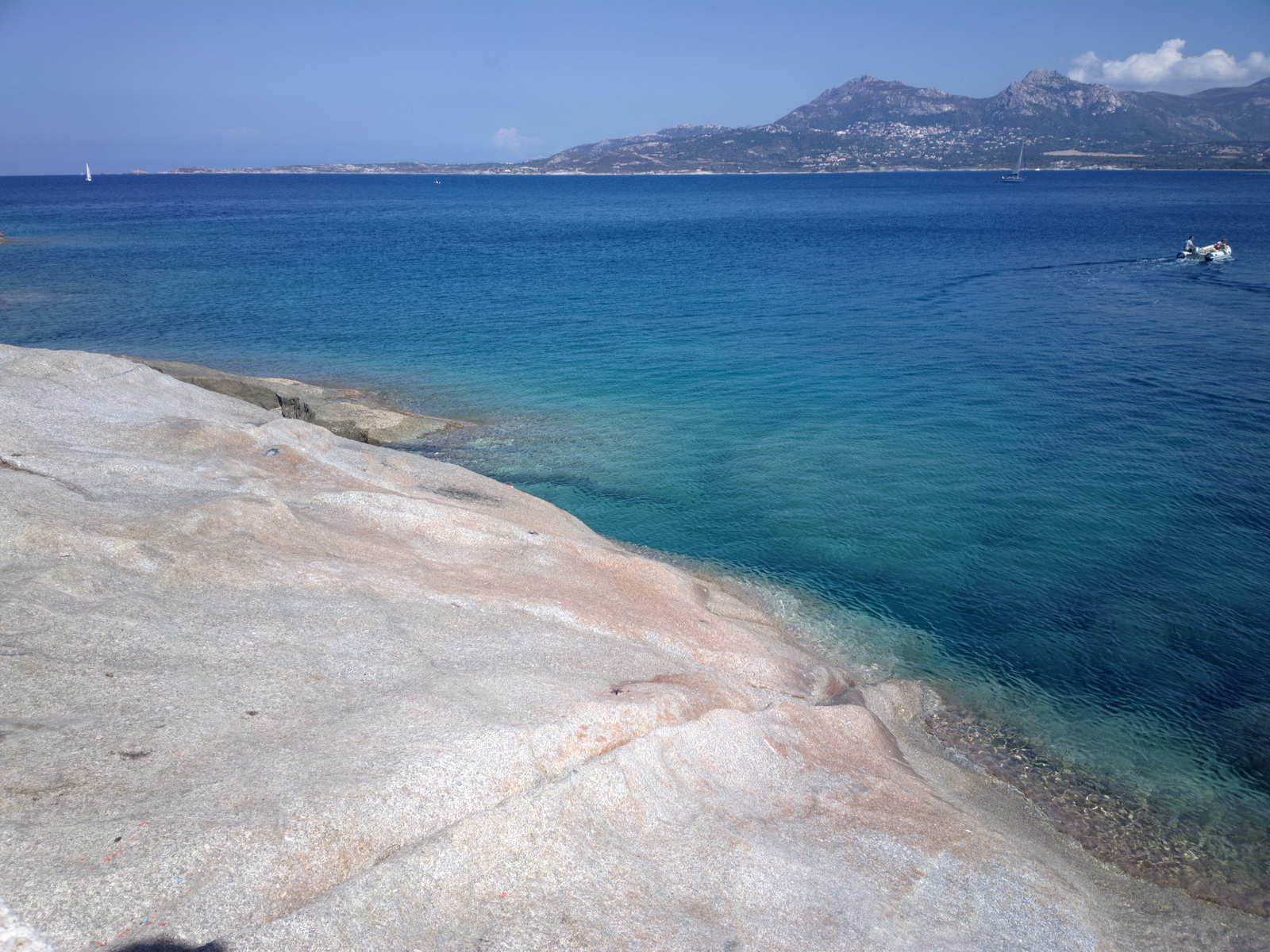
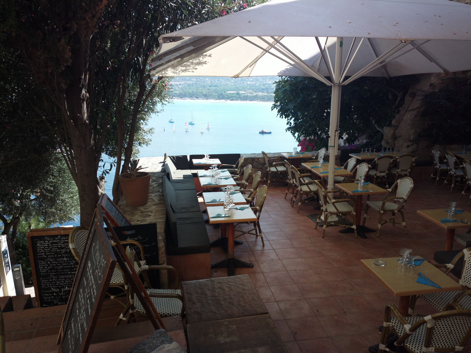
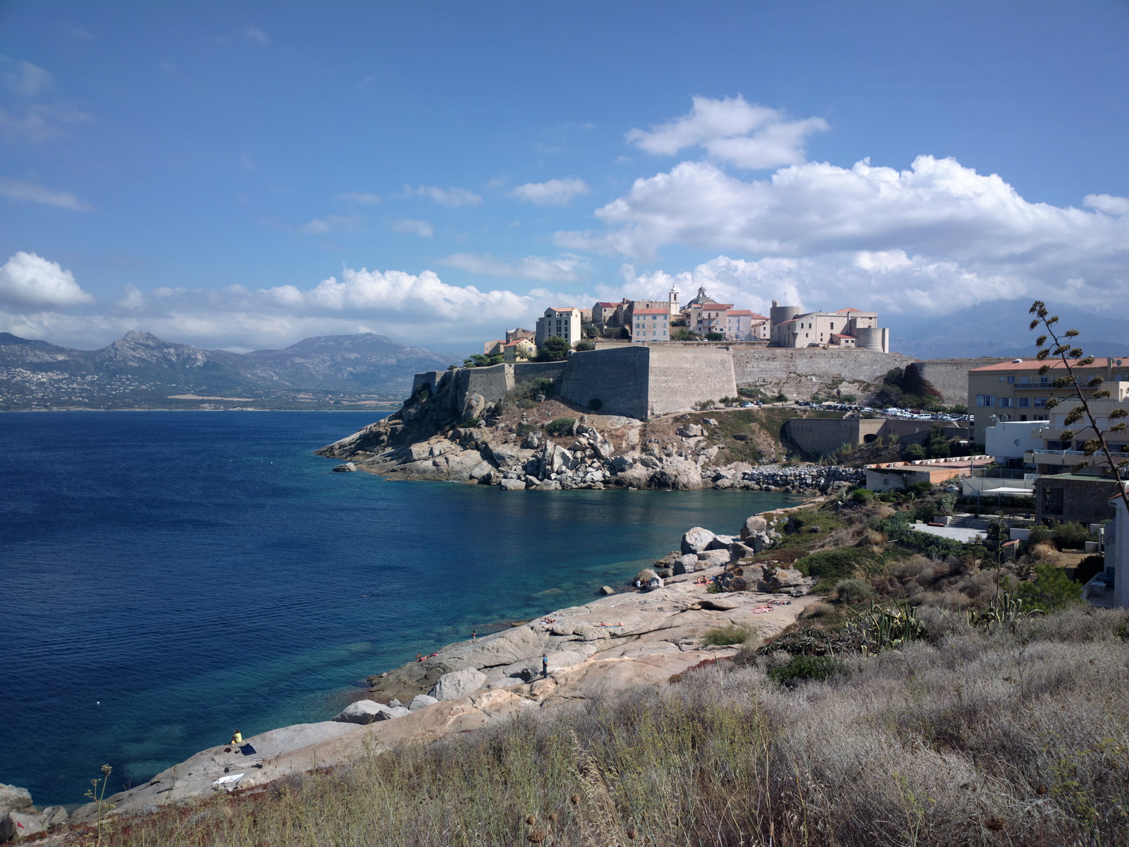
The scenery around the airport and everywhere else in Corsica is simply awesome
The sea was warm enough to swim in, which is always a nice surprise in Europe
![]() There were some sea
urchins but it was easy enough to avoid them
There were some sea
urchins but it was easy enough to avoid them
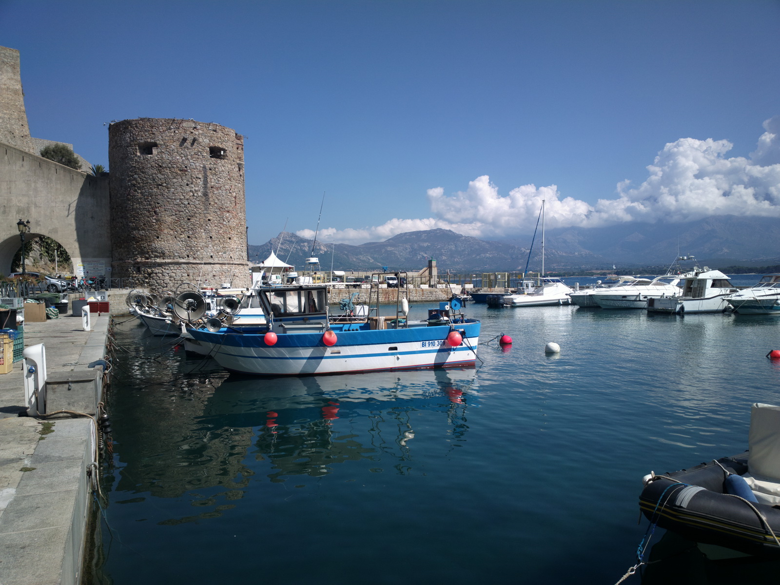
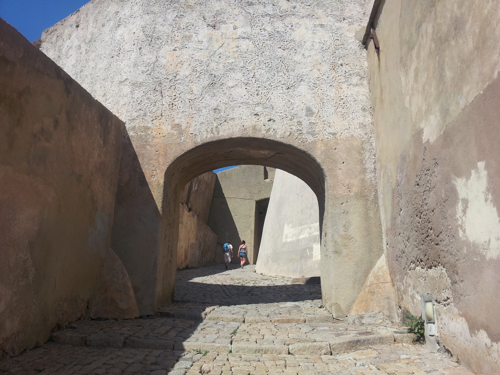
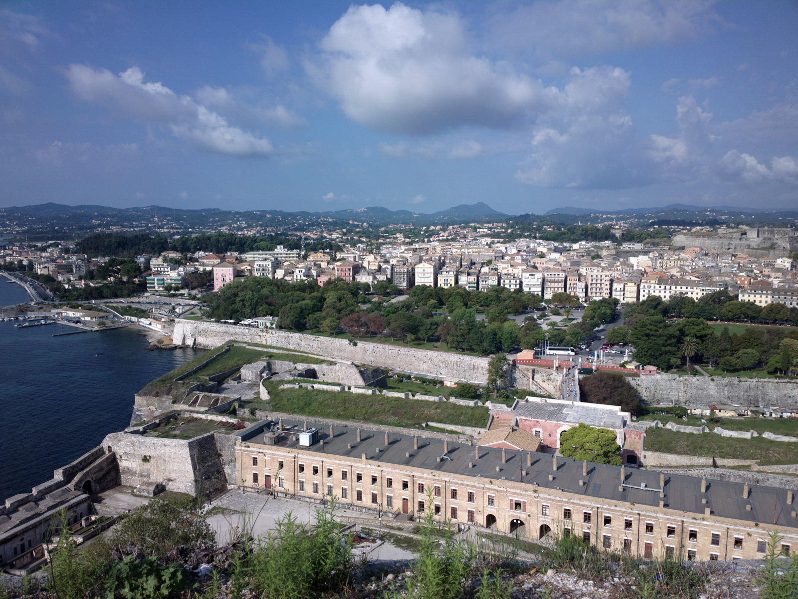
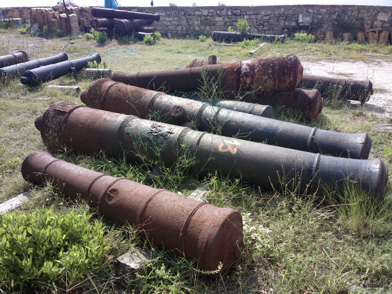
The Citadel. There is little to see inside...
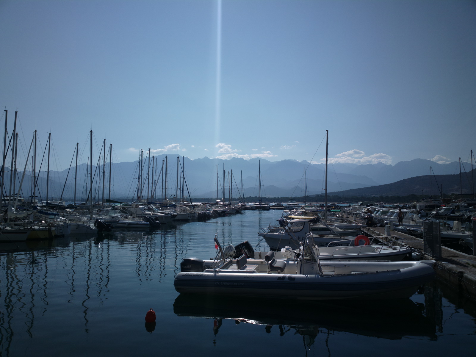
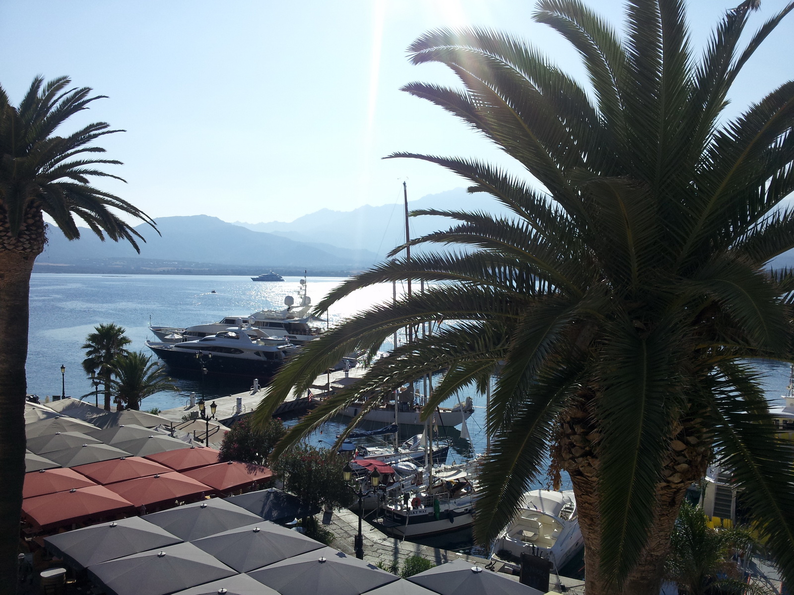
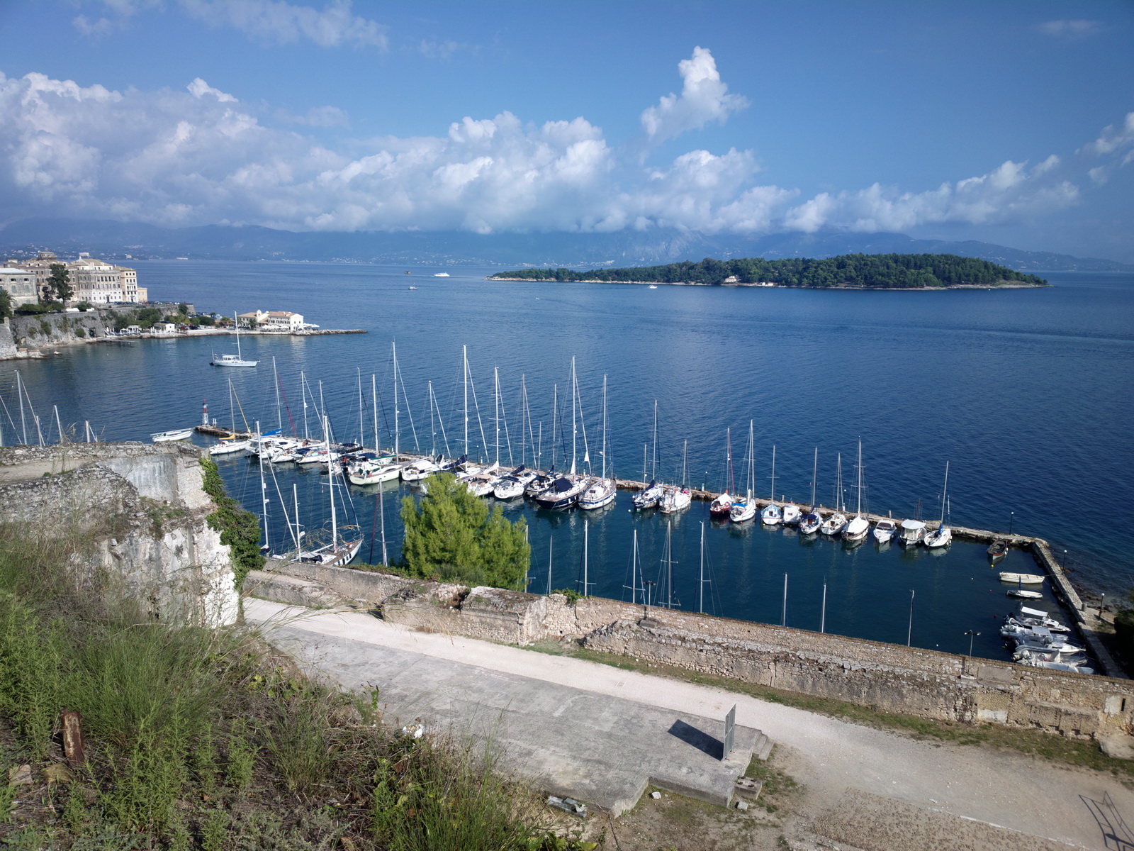
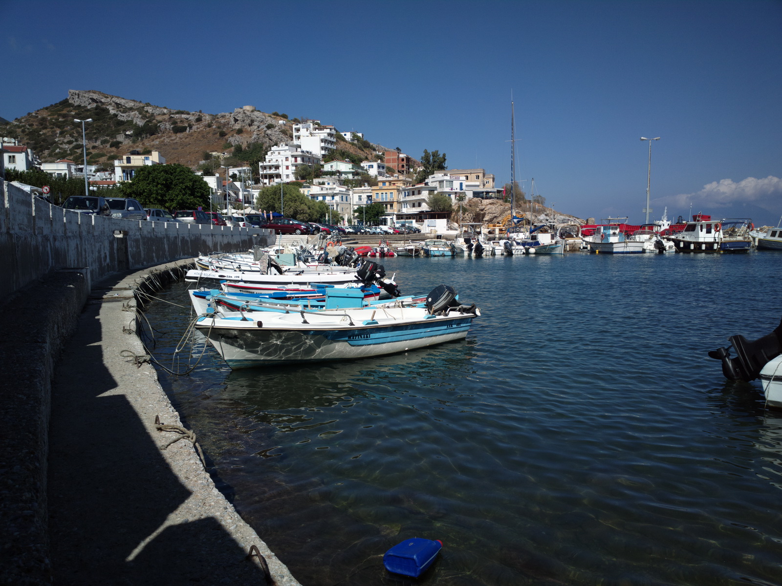
Some nice boats...
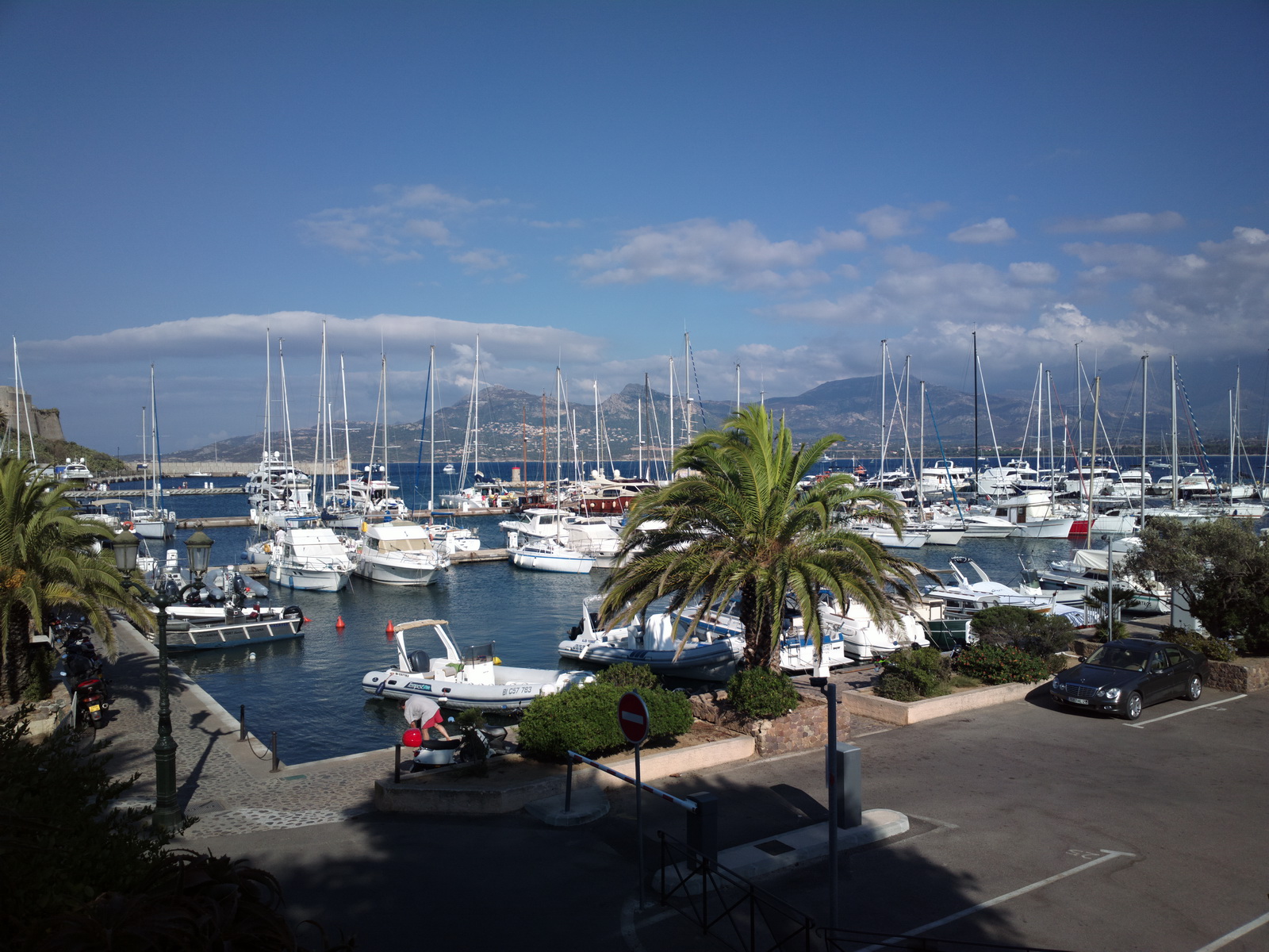
This is the Citadel
It was brilliant to see old friends, meet new ones, and everybody enjoyed themselves.
It was a great destination for a fly-in which had something for everyone - unlike
the more traditional "airport fly-in" which needs a bus to ferry the
"non-aviation" people into town to do shopping ![]()
However, I am not going to park on that "GA parking area" ever again... I don't know the process for avoiding it but it probably involves either having a twin engined aircraft, or paying a handling fee.
Calvi to Corfu
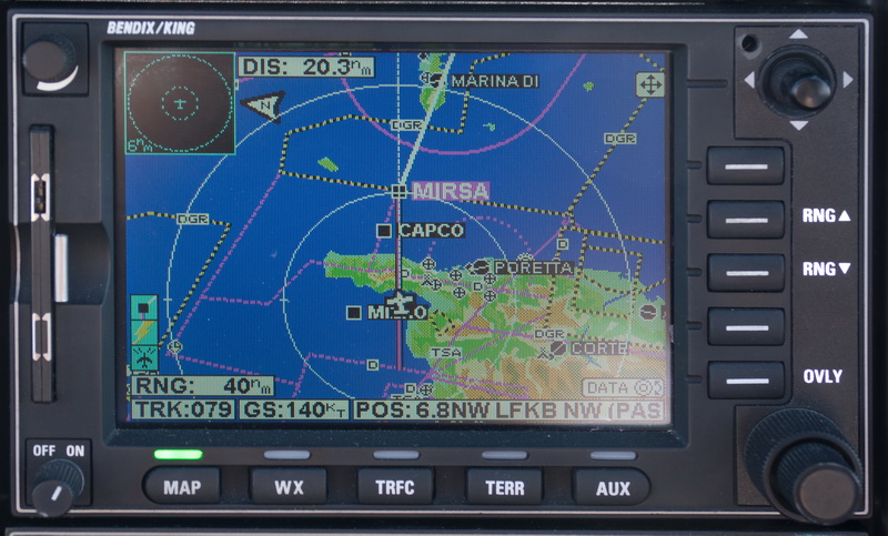
The shortest Eurocontrol IFR route passes down the west coast of Italy. A rather more scenic route was filed
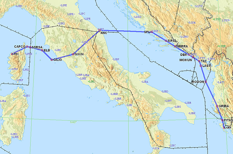
LFKC DCT CAPCO A3 MIRSA L127 ELB M729 GILIO Q195 GIKIN L865 ANC M730 SPL L607
DBK R45 RODON N732 PITAS LGKR
FL120
Alternates: Dubrovnik LDDU
523nm GC, 611nm as filed IFR
Weather data: MSLP 0600 1200 1800. The IR image indicated clear weather except in the Dubrovnik area, and this was confirmed by radar and sferics. The TAFs and METARs confirmed this further. The TS was not a problem because it was over the mountains and one could have avoided it by going further out over the sea.
Departure from Calvi was straight out over the sea
and later passing over Elba
of which very little was seen due to cloud cover
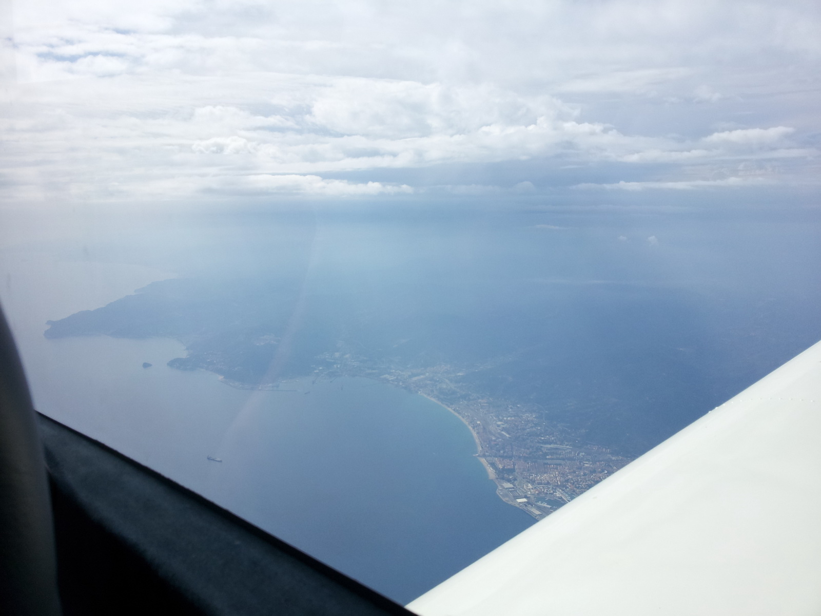
The flight over the piece of Italy was at FL120 and little of note was seen
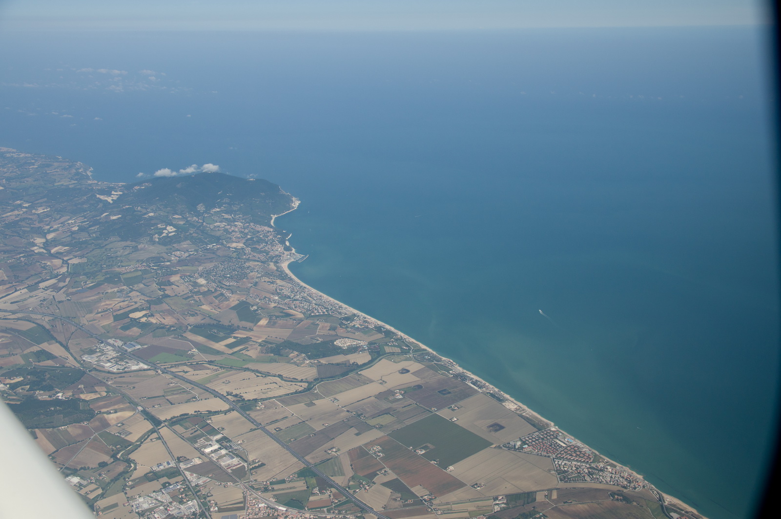
Here is the east coast of Italy
The LFOB for Corfu showed 26 USG which was fine, and sufficient for a return to Dubrovnik all the way back from Corfu. In reality, had this reduced significantly enroute, we would have landed at any of the Croatian airports: Split, Brac, Dubrovnik...
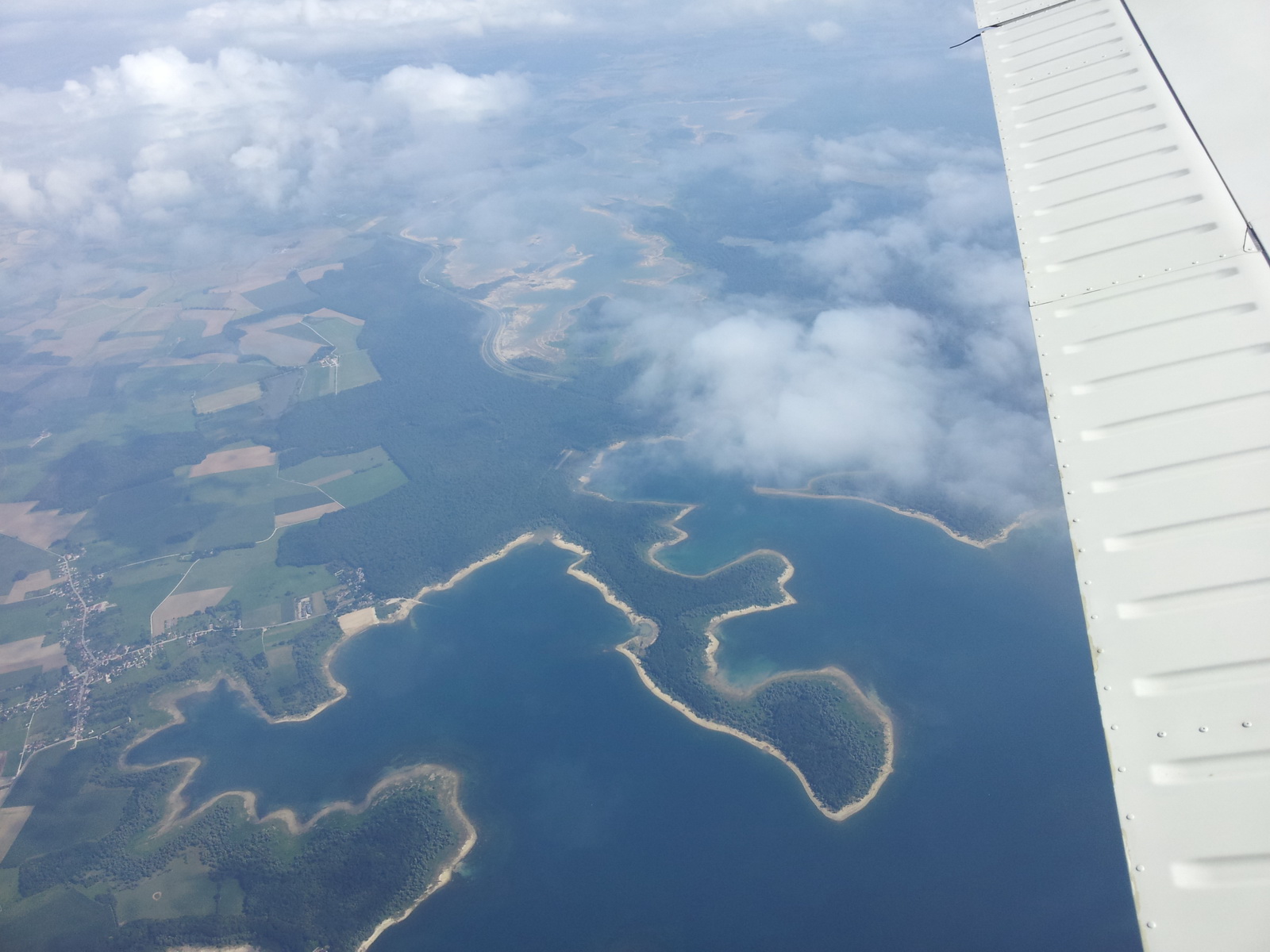
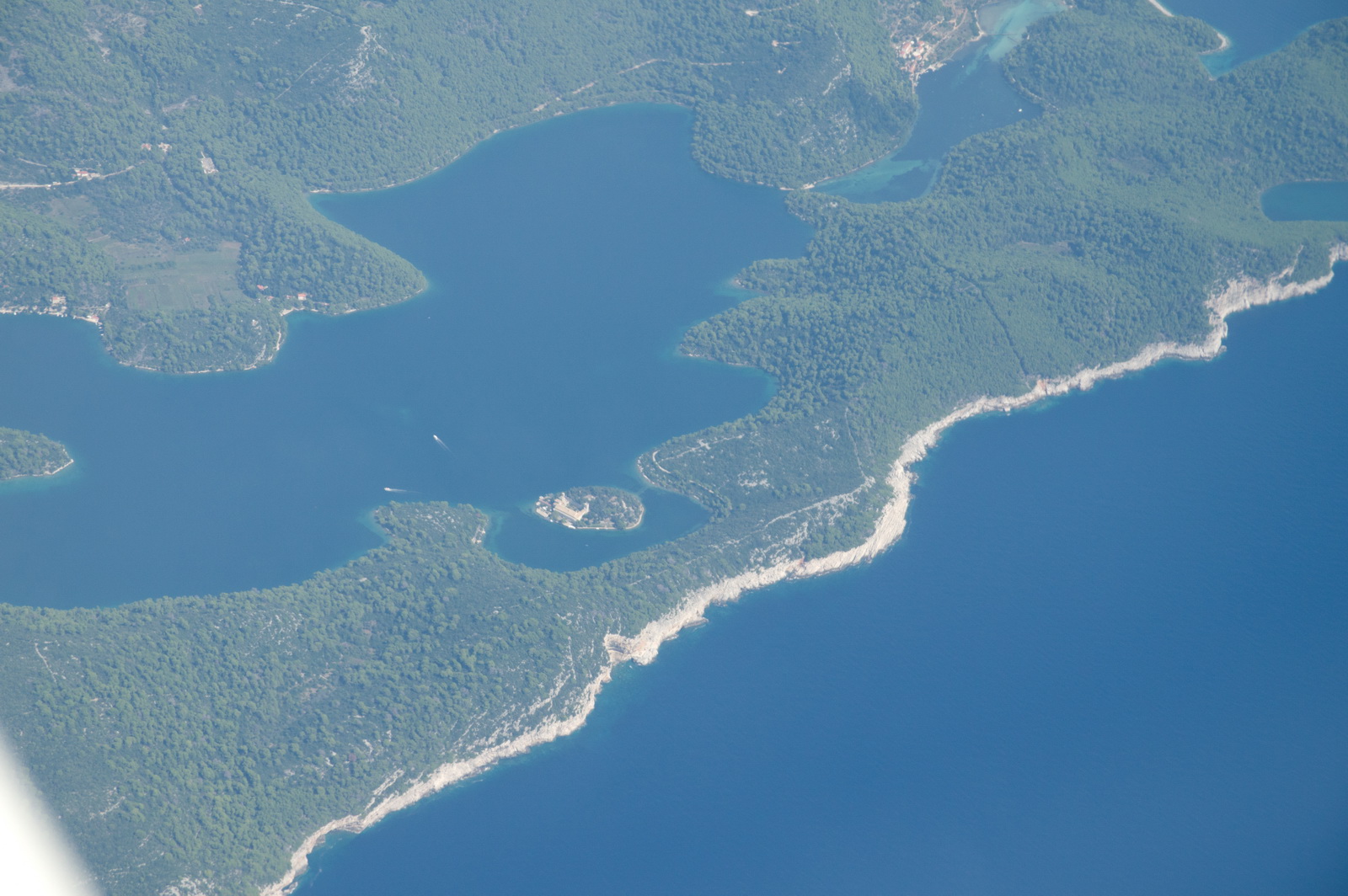
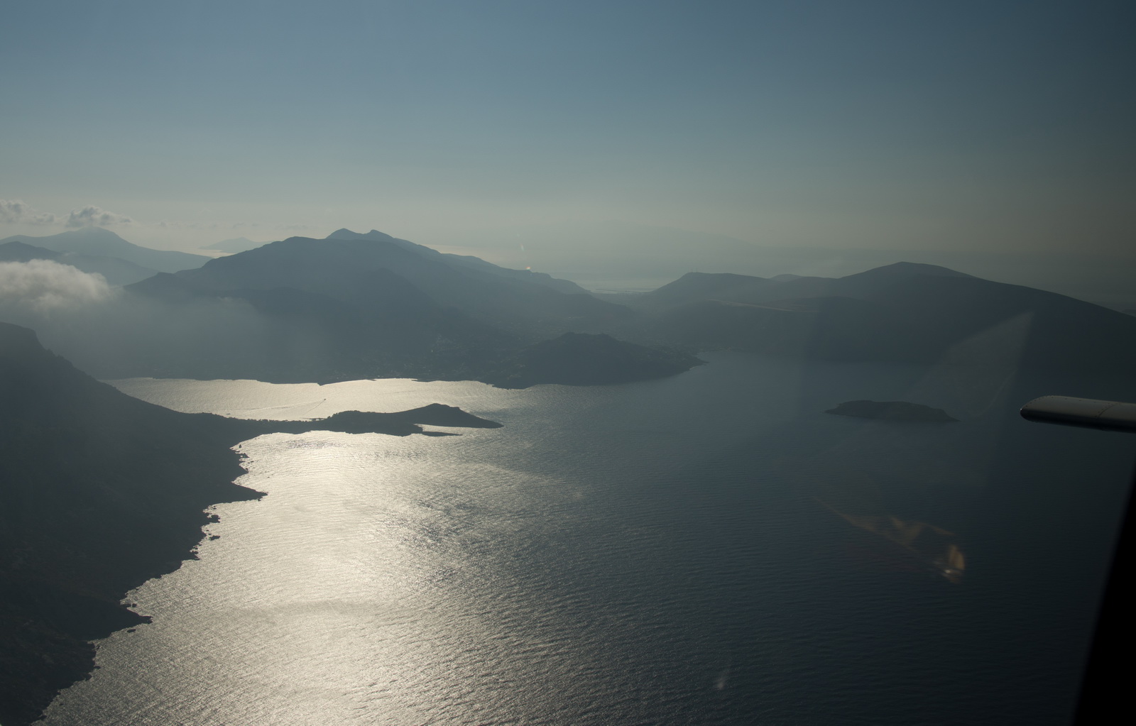
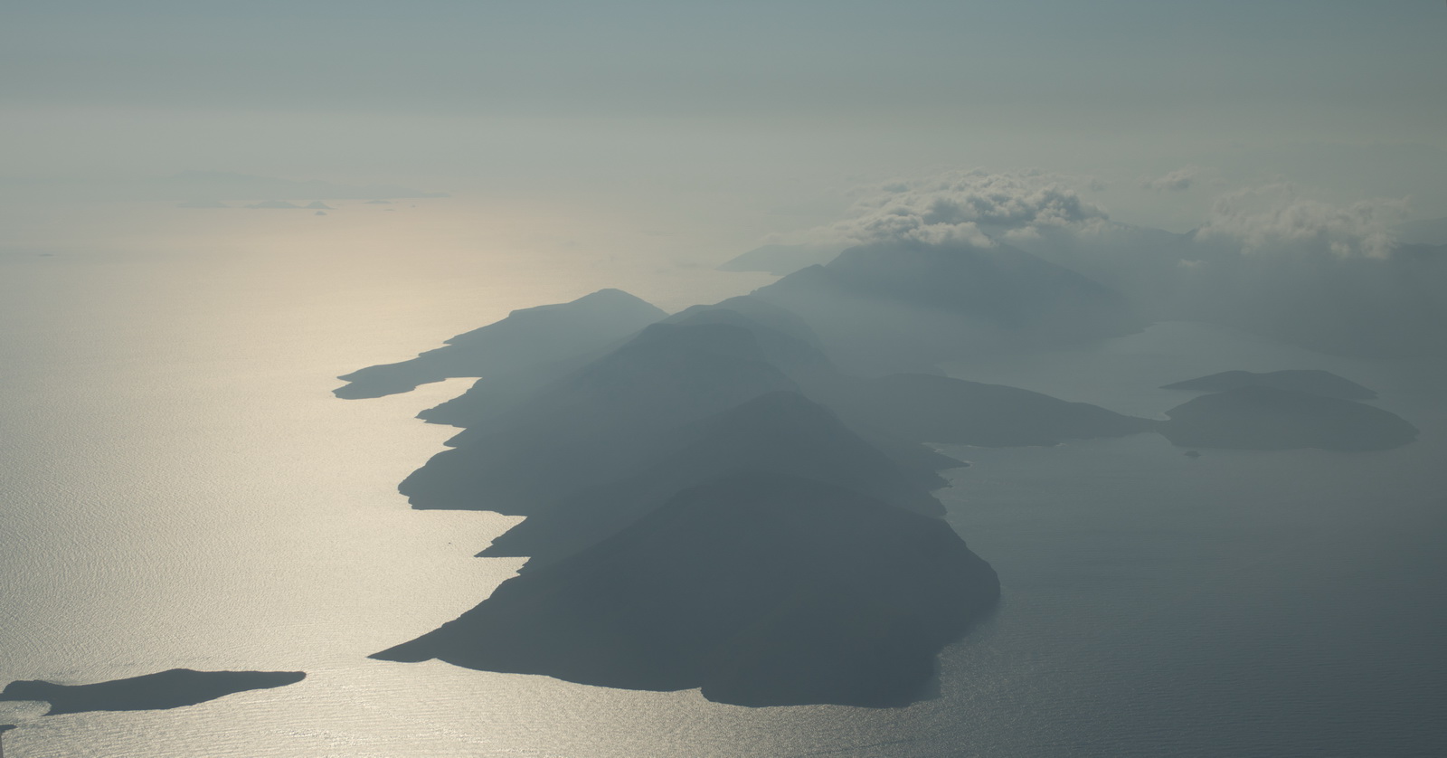
Unfortunately, again, not much of the scenic Croatian coastline and the many islands was seen, due to large buildups along the coast
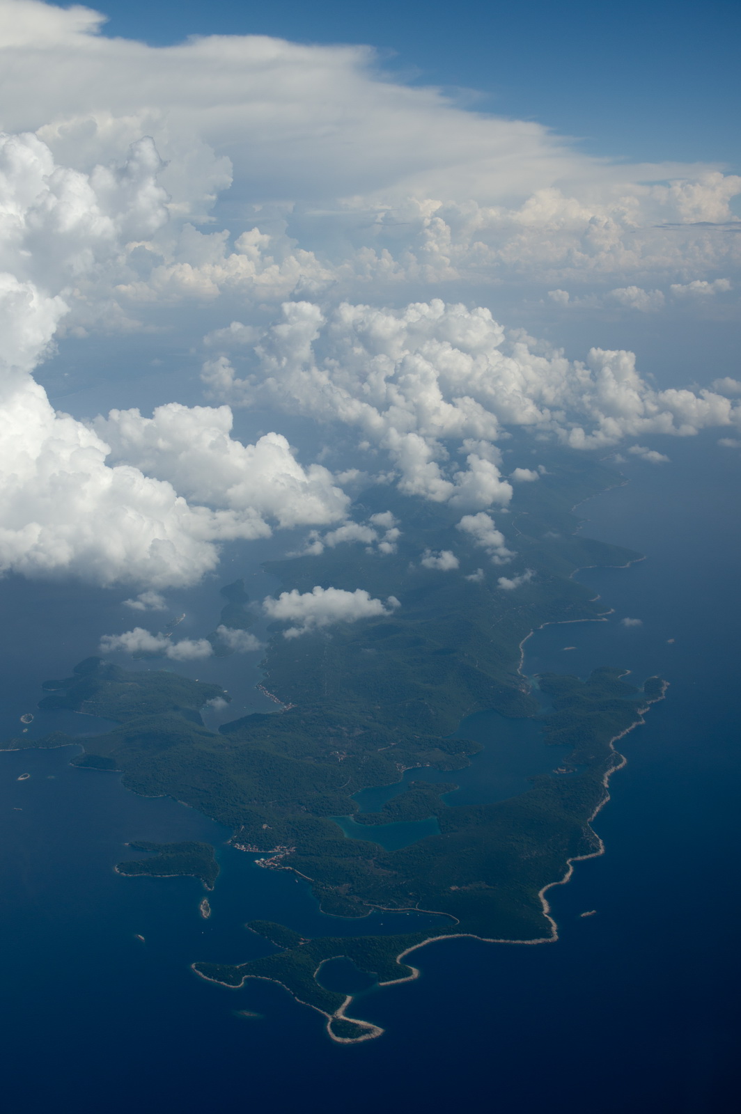
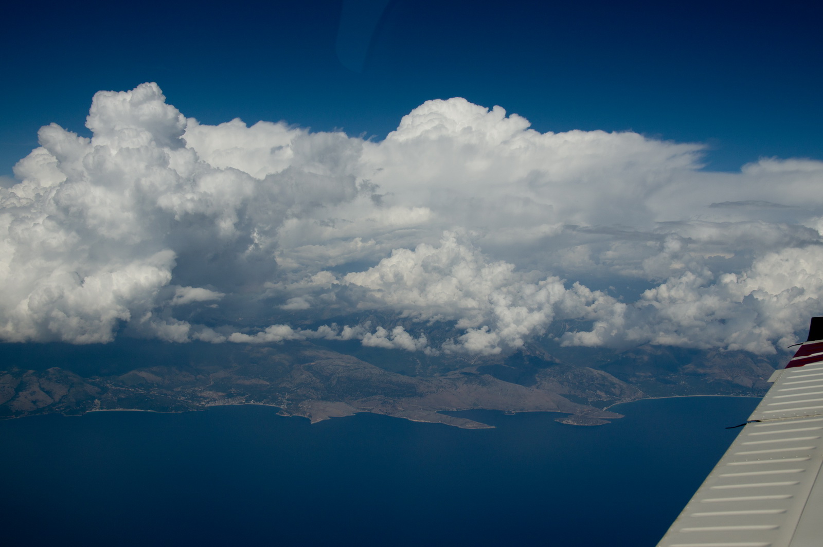
The stormscope showed plenty of activity in those clouds
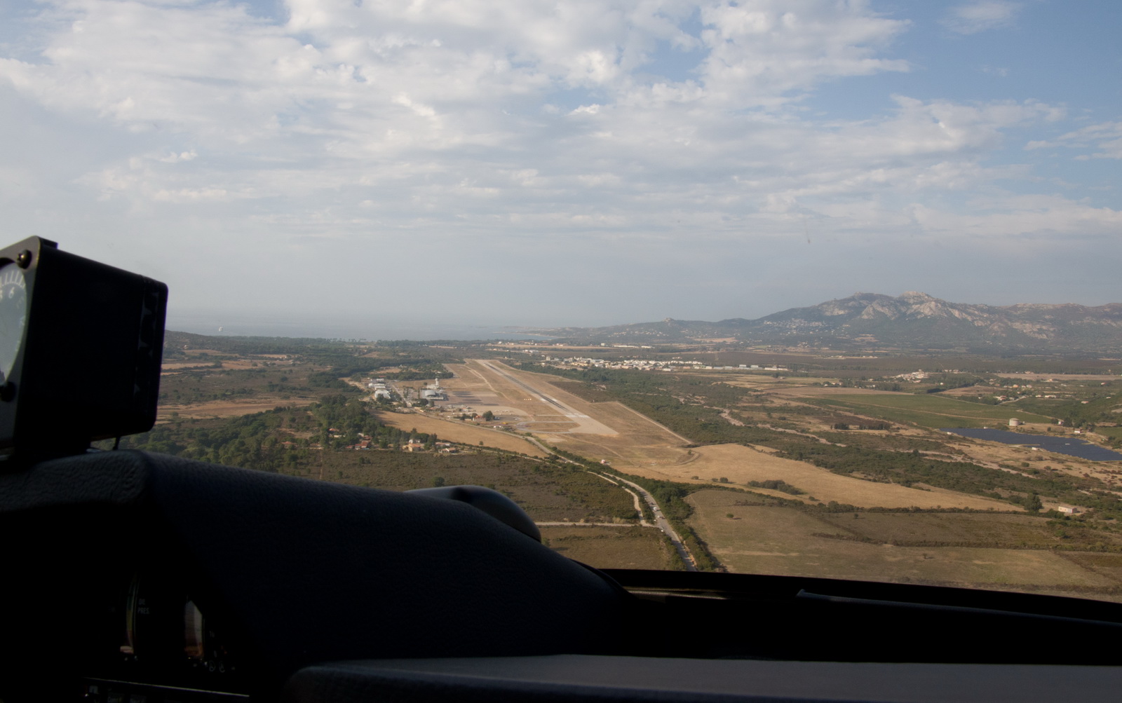
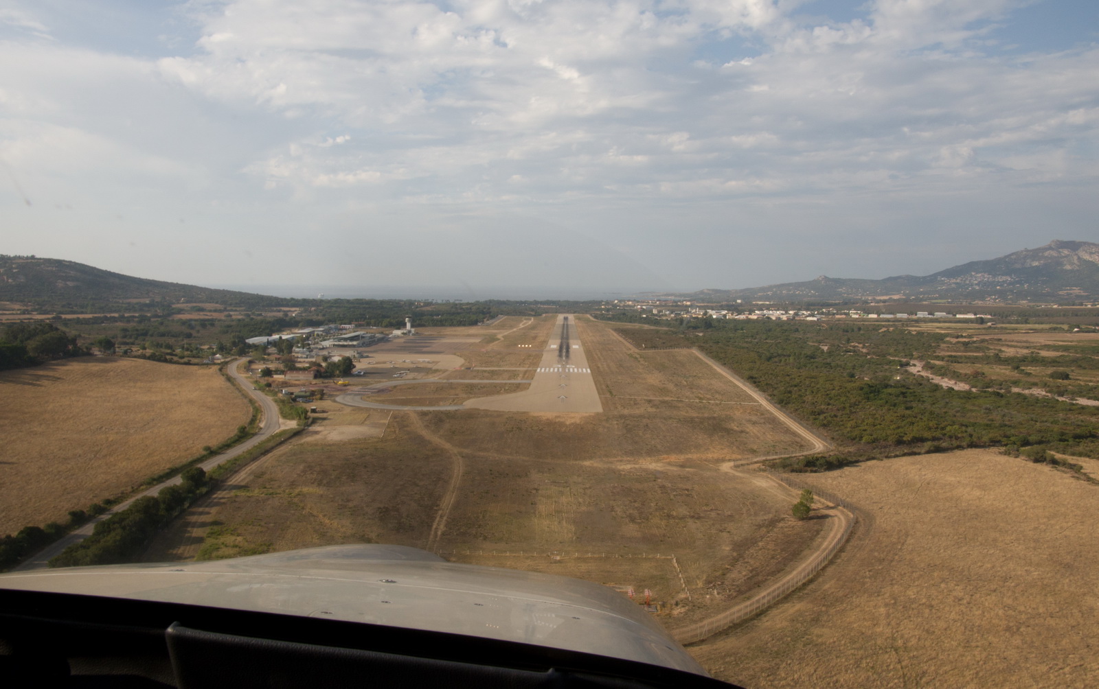
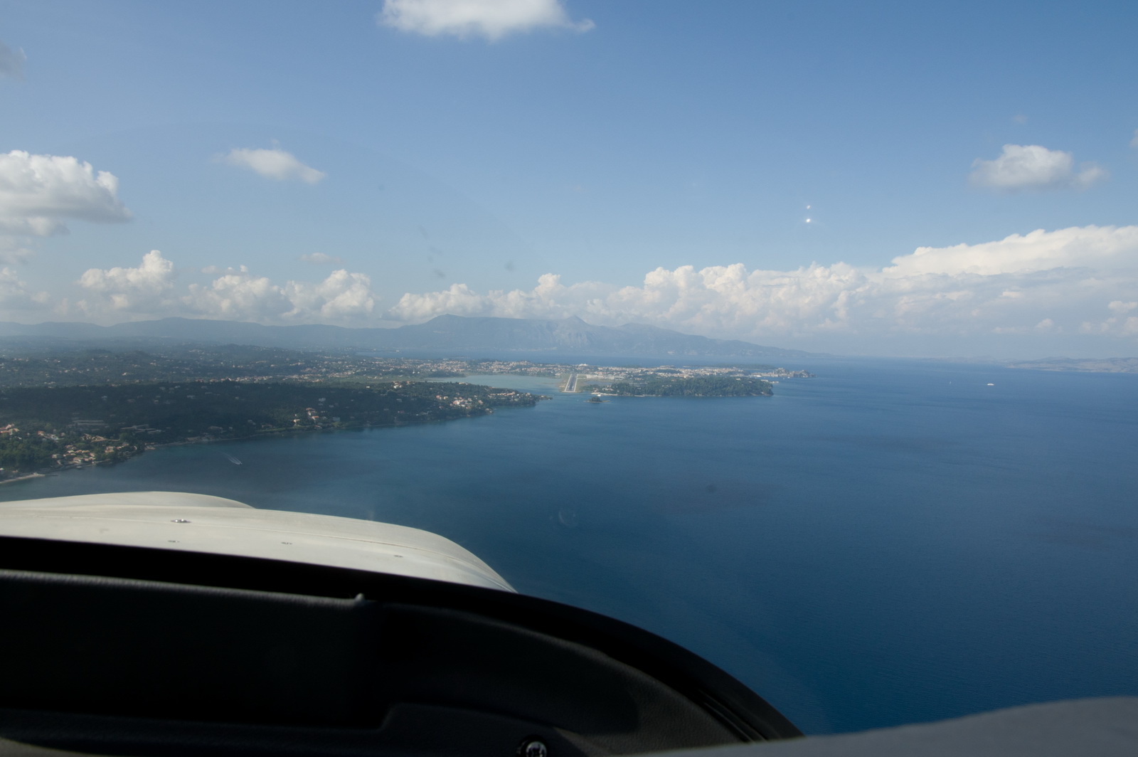
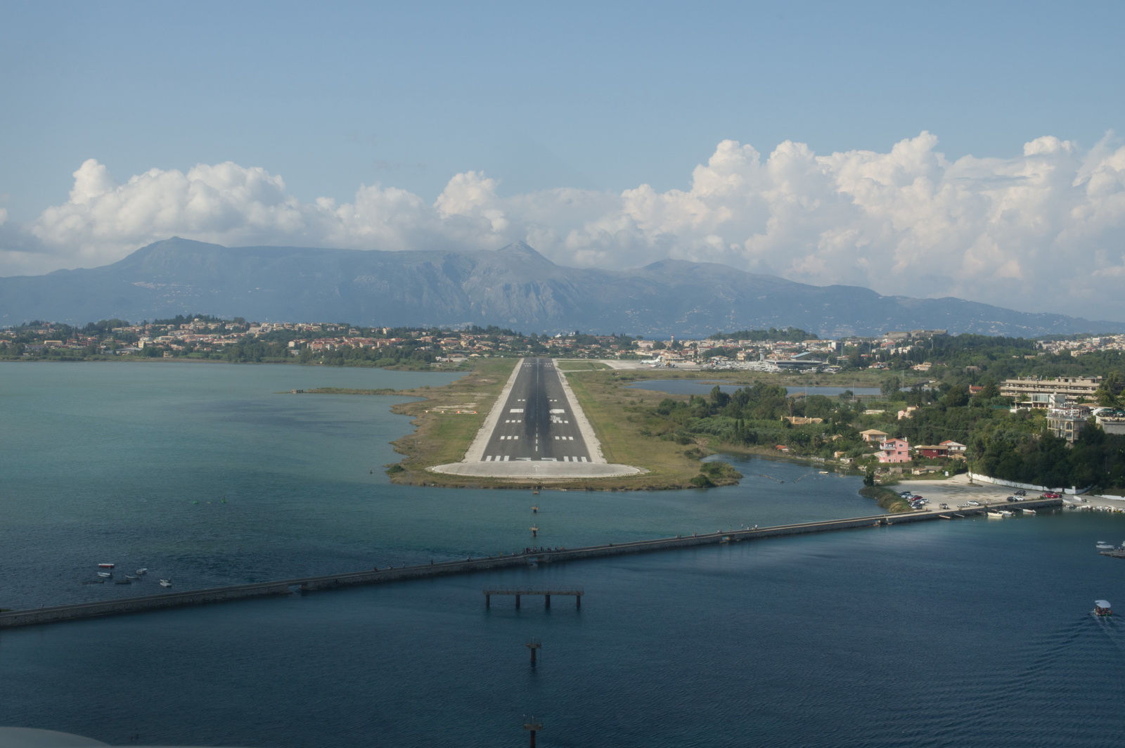
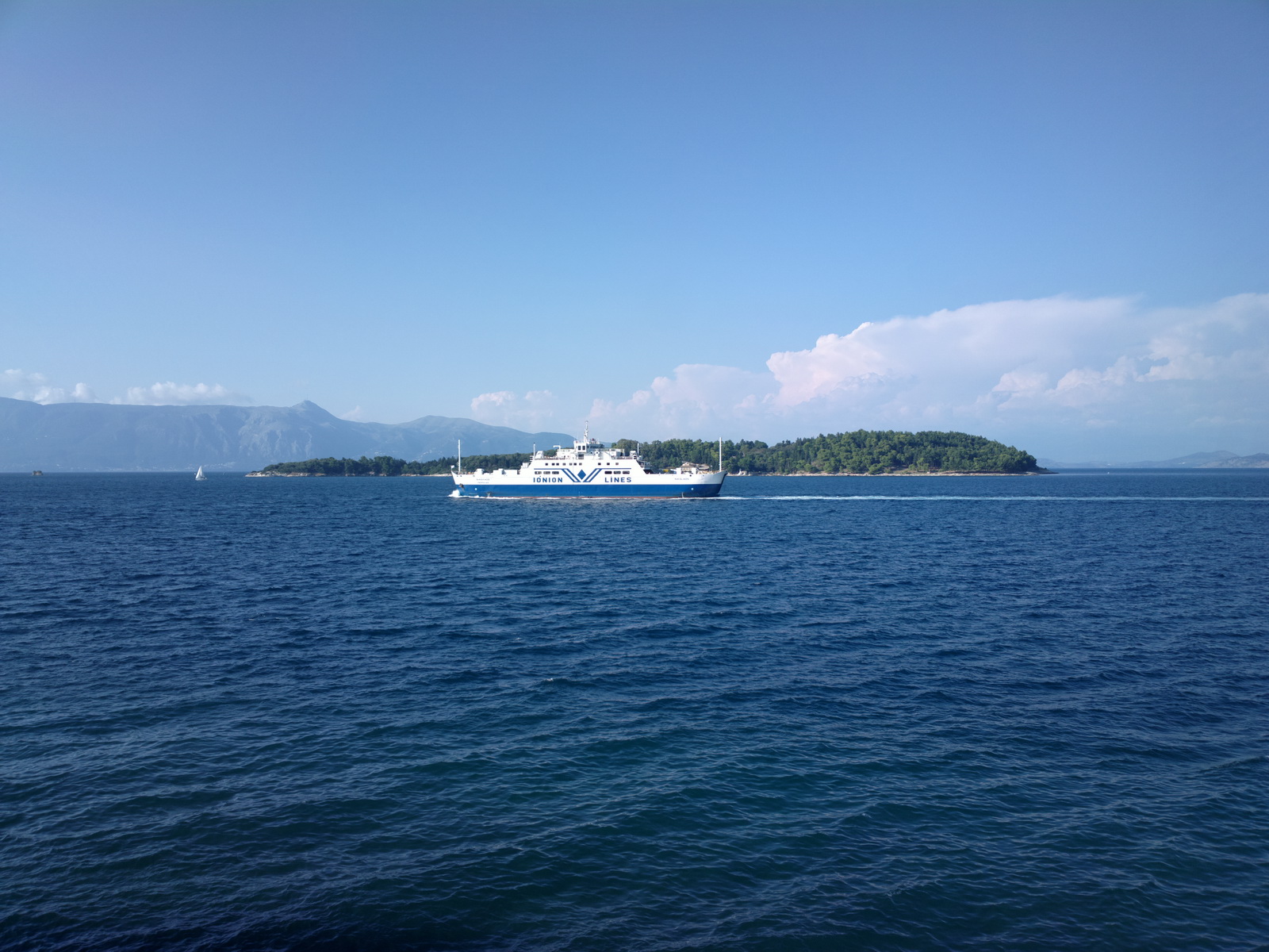
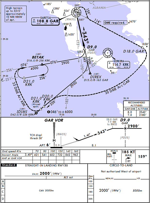
Finally here is Corfu, with the runway visible in the distance. We were cleared for the VOR Y approach, runway 35, intercepted directly onto the final approach track by vectors from the west
It is conveniently flown using the GPS in the OBS mode ![]() Almost nobody actually tracks VORs these days...
Almost nobody actually tracks VORs these days...
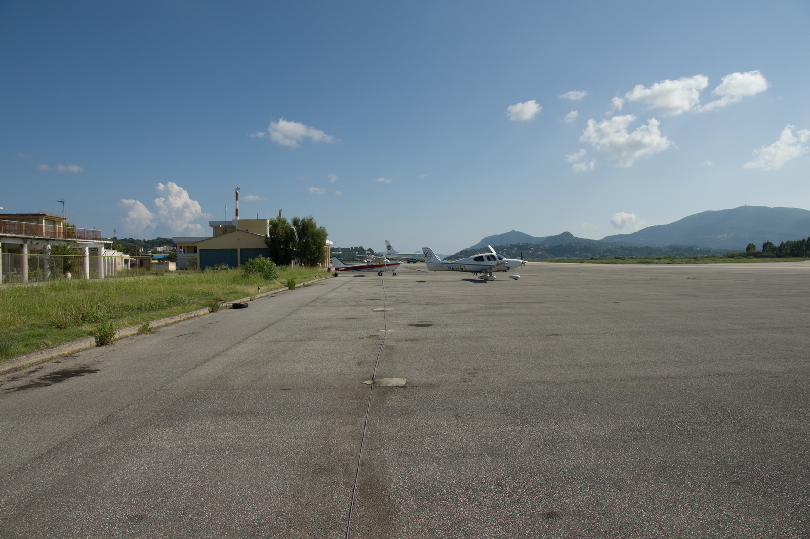
This is the GA parking area, in front of the ancient and long disused old terminal
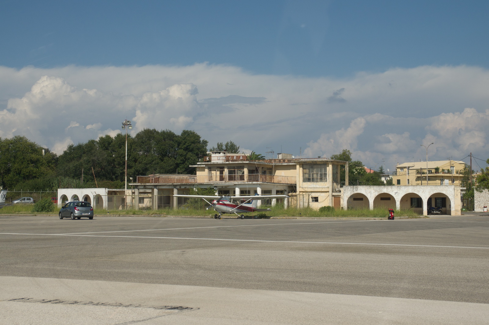
There is enough parking for about 50 GA aircraft but still the airport manager demands 48hr PPR to, as he once put it to me, "manage the apron capacity"
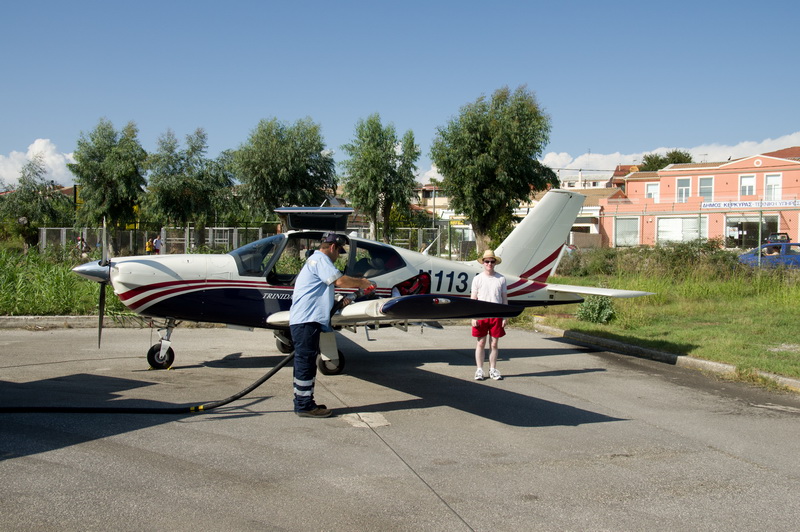
The fuel crew was super efficient and we were done within minutes. This was
the only airport on this whole trip which accepted my AIR BP fuel card, which
I try to keep going.... not sure why since every airport I have been to now
takes Visa or Mastercard. (Some non-international French airports are believed
to accept only the French TOTAL fuel card). 10
years ago things were harder and one airport might take cash only, another
Mastercard not Visa, another AIR BP only, etc. On the other hand, back then
you could wave an AIR BP card under the fueller's nose, say the word "commercial"
3 times, and you got duty and VAT-free avgas which was about half the price
as a result ![]()
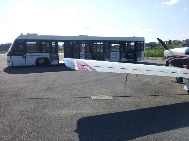
You get transport too...
This French pilot flew down all the way from northern France, with a road atlas which he showed us
It makes one wonder if perhaps we are sometimes too preoccupied with having
the right charts, GPS databases, etc... No, on balance, I would not want to
fly that way ![]() One begins
to understand why most ATCOs have no hair...
One begins
to understand why most ATCOs have no hair...
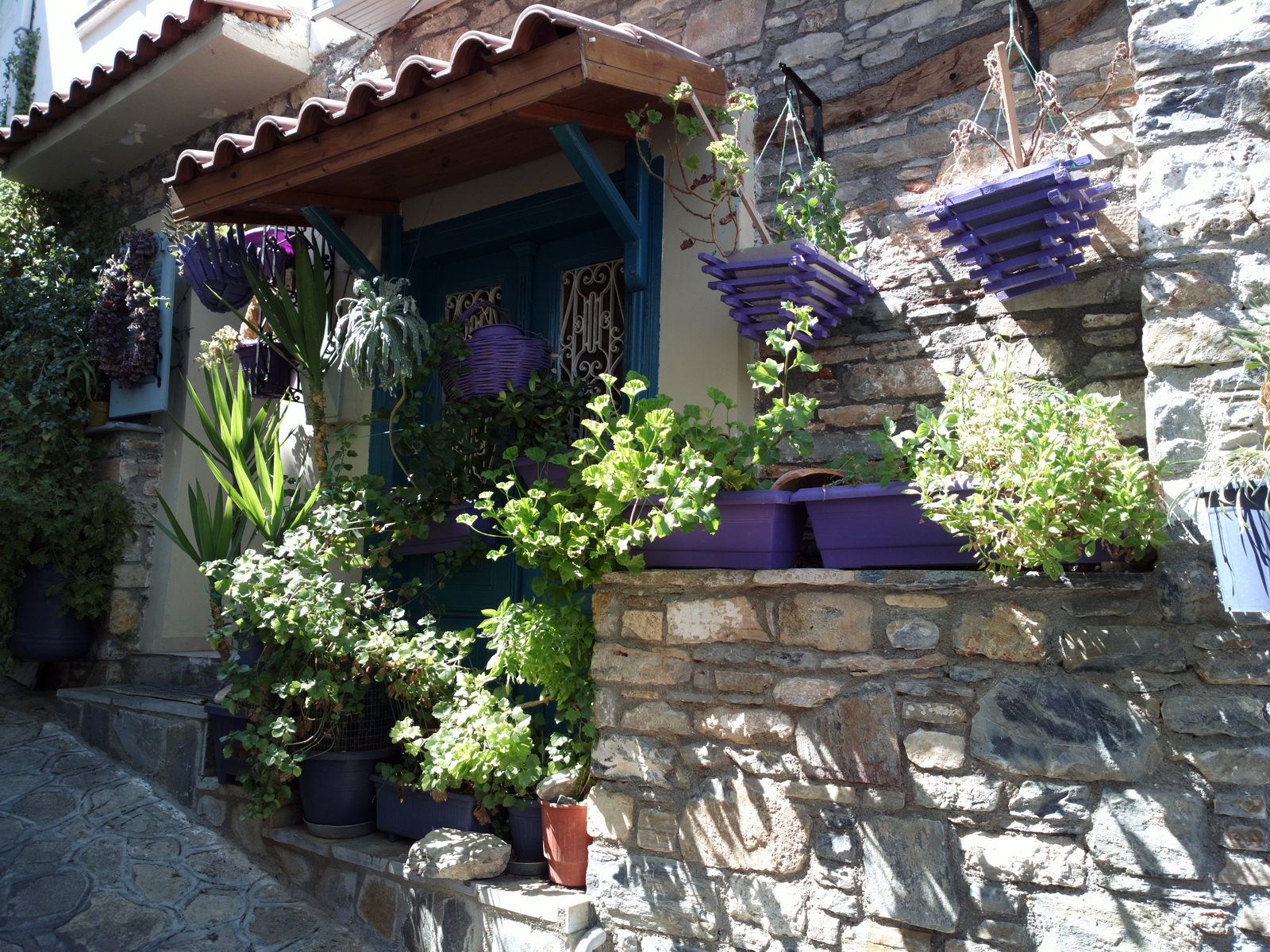
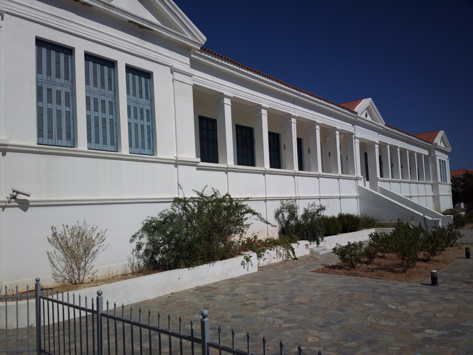
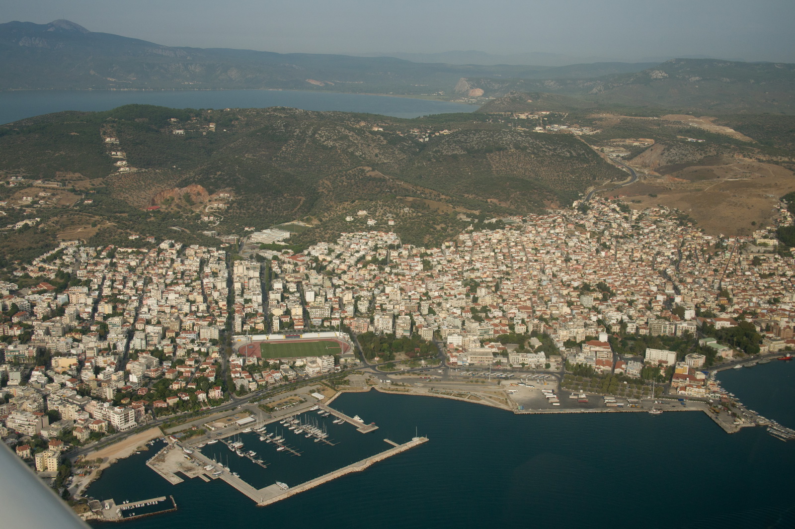
Corfu (specifically the town of Kerkira, which is next to the airport) is very nice, despite the masses of tourists. It probably achieves it largely by keeping the British "drink and shag everything and everybody, and puke up all over the street" crowd to the resorts in the south of the island.
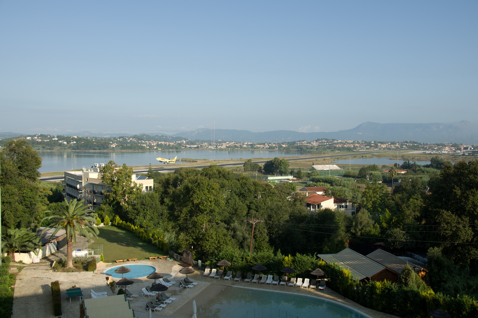
Our hotel had a fine view of the runway ![]()
One of the first jobs, of course, was to sort out a Greek data-only SIM card
![]() I put this into an
old E585 3G-WIFI modem and then I have "free"
WIFI everywhere, which saves the perpetual hassle with crappy WIFI in hotels,
cafes, etc. On every trip abroad, one finds that the deals change. Normally
I have a Cosmote SIM on which the deals were, historically, around €10
for 2GB, but this time we could not get any useful service in a Cosmote shop
so I got a Wind PAYG SIM which a really smart woman in the shop set up for me
(remove the PIN, register it, etc). It was about €17 for 5GB which is loads,
and it did work everywhere in Greece - even on Ikaria where my Vodafone contract
did not work at all. Contrary to all previous deals which tend to last 5-10
days, this one was good for 6 months. Greece requires a passport for any SIM
card purchase - something to do with anti terrorism laws - and there is a load
of form filling...
I put this into an
old E585 3G-WIFI modem and then I have "free"
WIFI everywhere, which saves the perpetual hassle with crappy WIFI in hotels,
cafes, etc. On every trip abroad, one finds that the deals change. Normally
I have a Cosmote SIM on which the deals were, historically, around €10
for 2GB, but this time we could not get any useful service in a Cosmote shop
so I got a Wind PAYG SIM which a really smart woman in the shop set up for me
(remove the PIN, register it, etc). It was about €17 for 5GB which is loads,
and it did work everywhere in Greece - even on Ikaria where my Vodafone contract
did not work at all. Contrary to all previous deals which tend to last 5-10
days, this one was good for 6 months. Greece requires a passport for any SIM
card purchase - something to do with anti terrorism laws - and there is a load
of form filling...
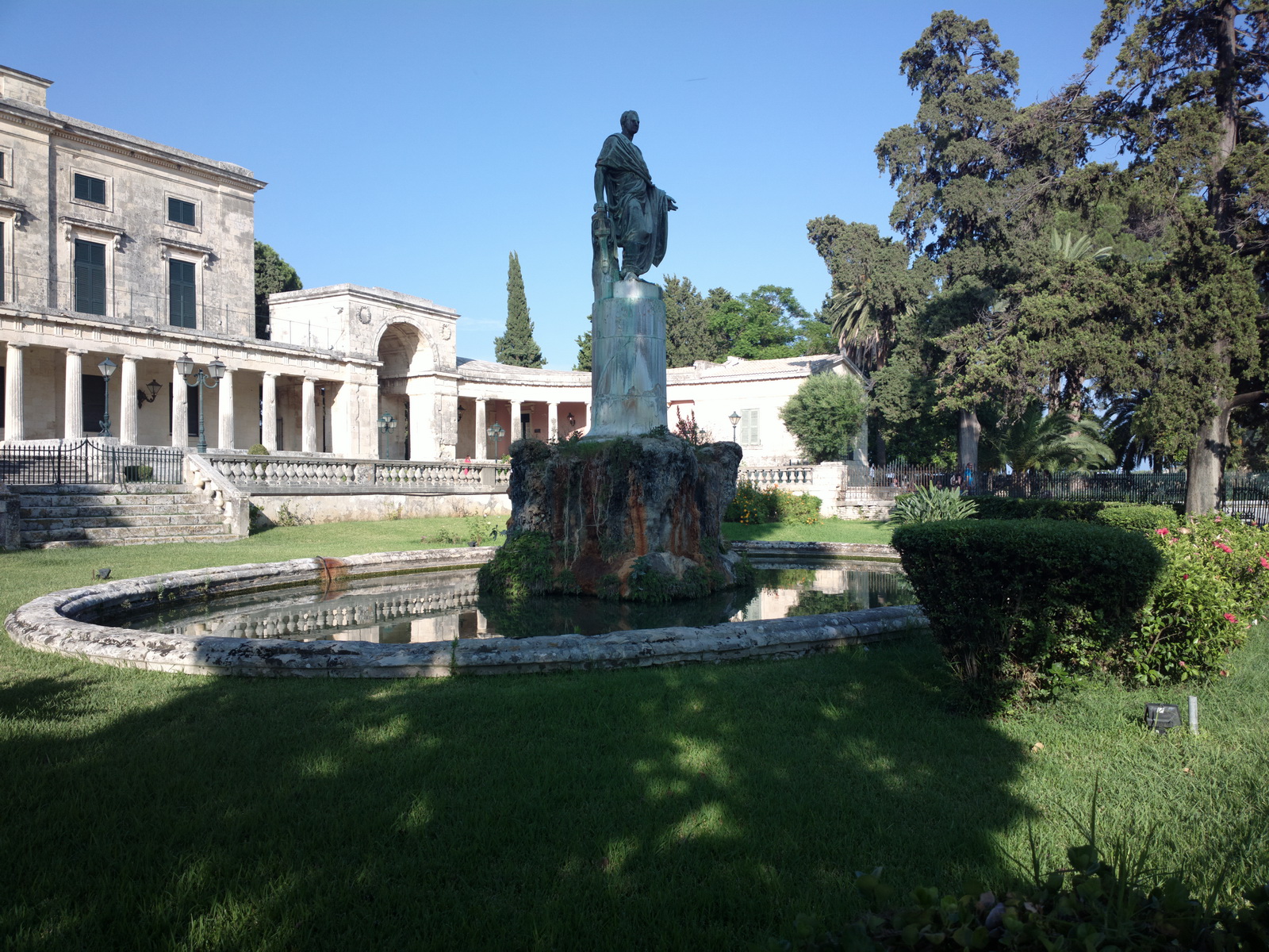
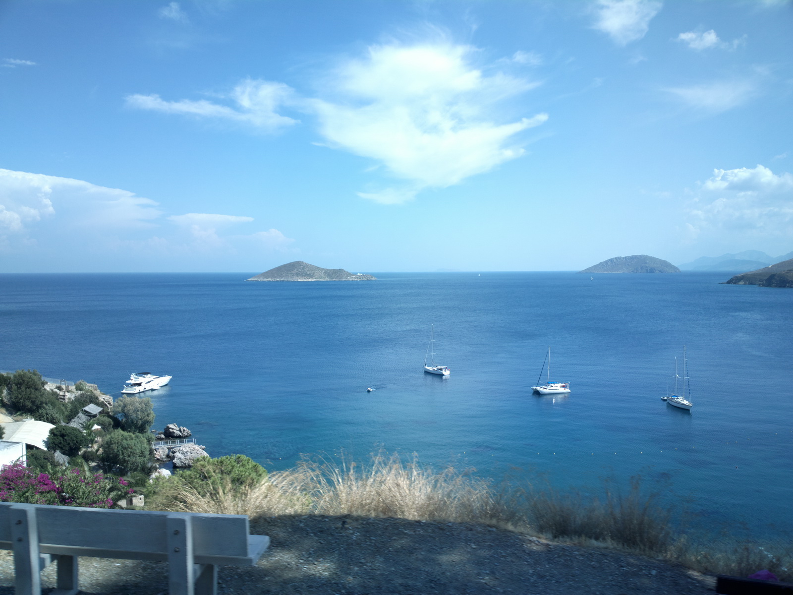
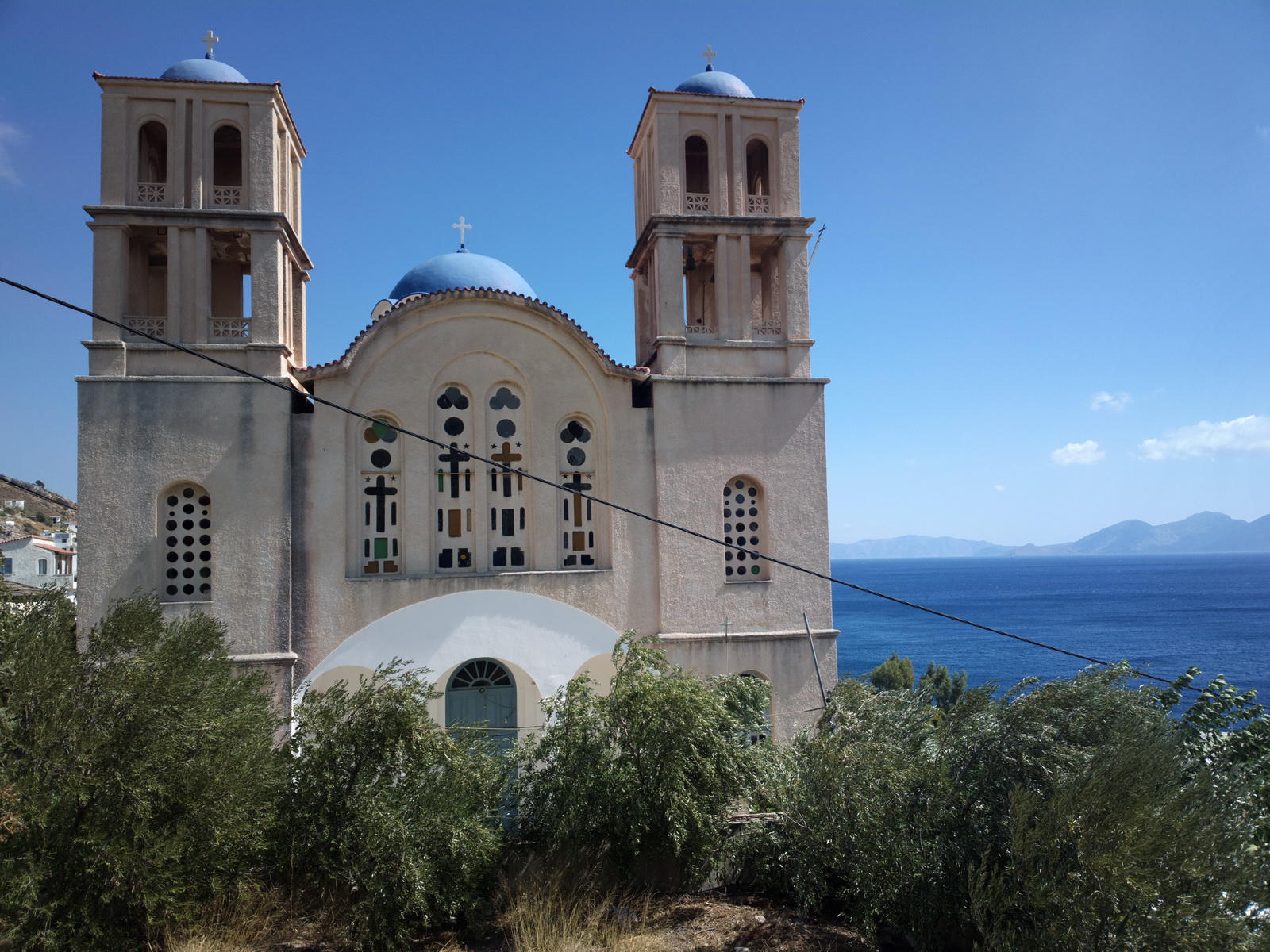
The old fortress is definitely worth a visit, for the views
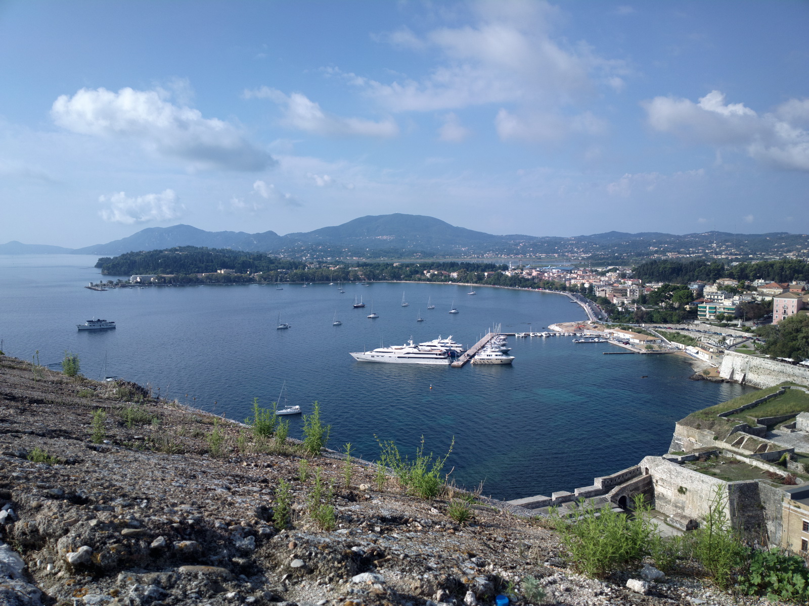
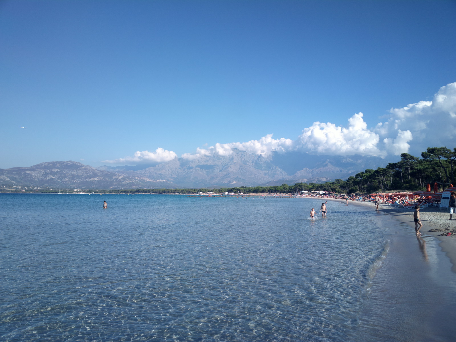
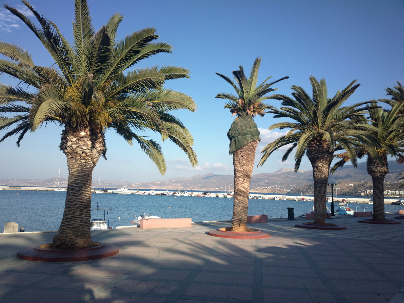
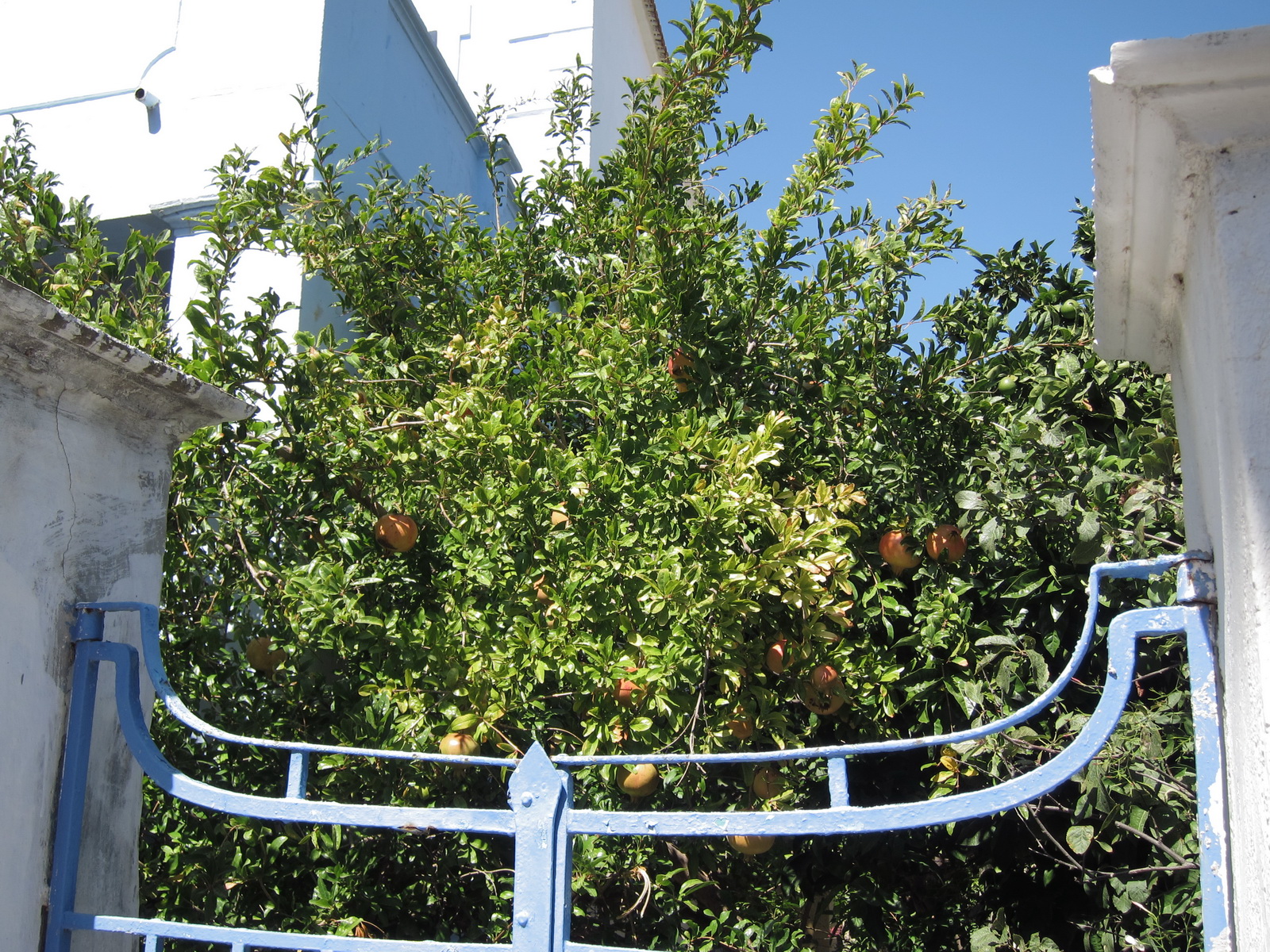
Corfu is the most northern bit of Greece and is more green than most of it.
There is a lot of Venetian architecture
The only negative point is that - very unusually for Greece - the food is often of poor quality and you need to look hard to find something nice. Some of the seafood didn't taste like food of any kind...
After 2 nights in Corfu, it's back to the airport. The formalities were done very quickly. Post-privatisation (some years ago) a lot has changed. There is still the necessary visit to the CAA office (airside) but you get taken there and back in a car and it's quick. Greece loves its paperwork, but it's fine if you get to the airport 1 hour before departure.
Corfu to Sitia
Sitia LGST is one of many Greek island airports whose opening hours are severely restricted. They open for the once or twice daily commercial flights which go around the islands and Athens. The opening hours are published only via notams and these are generally correct. This notam for LGST gives you the general idea. You have to depart so as to arrive hopefully in the middle of the opening slot!
LGKR MALED A14 ALANI M601 MIL A14 ALIKI A10 XAVIS LGST
FL100
Alternates: Iraklion LGIR, Samos LGSM
395nm GC, 414nm as filed IFR
In fact they like to see VFR routes filed on the same airways... see my 2004 VFR trip to Crete for an example.
Weather data: MSLP 0600 1200 1800. The IR image and sferics were both clear.The TAFs and METARs were good.
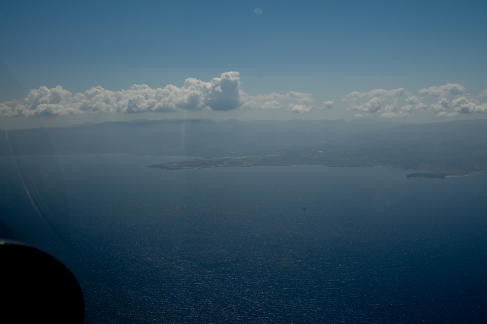
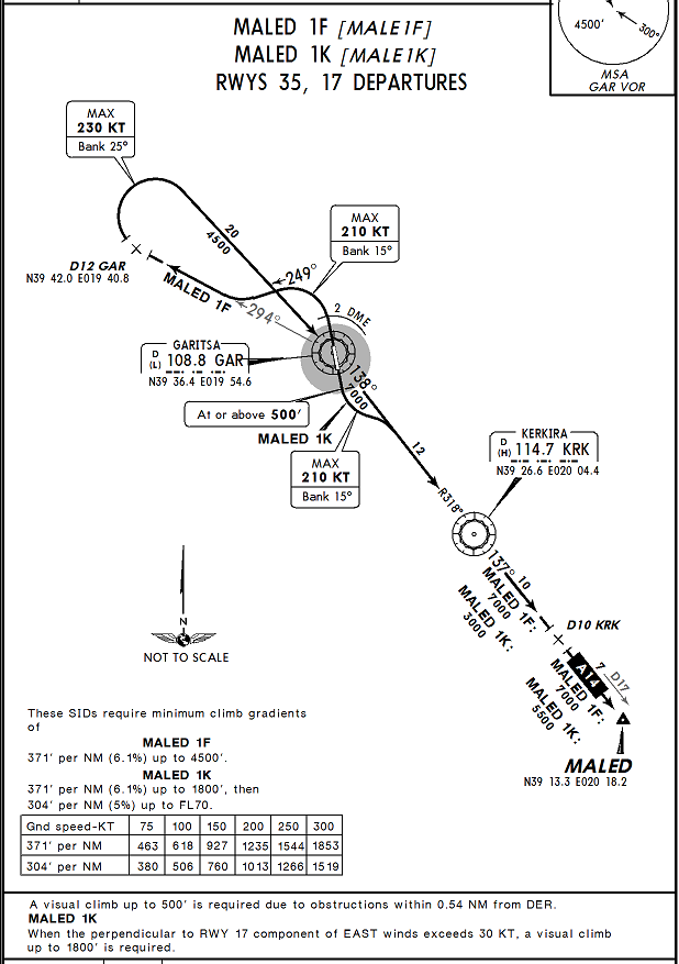
We got the MALED1K departure. Here is Preveza Aktion LGPZ
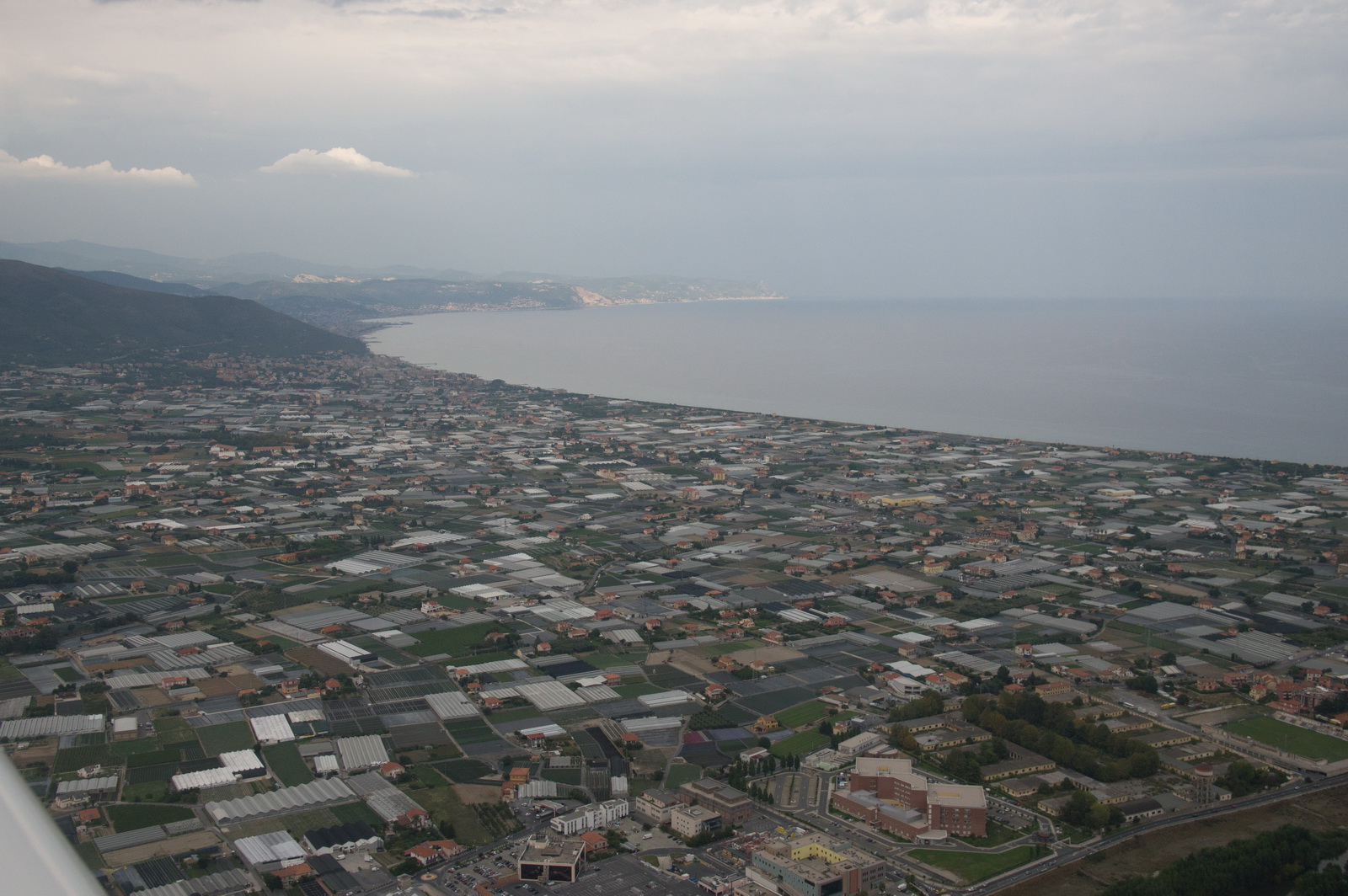
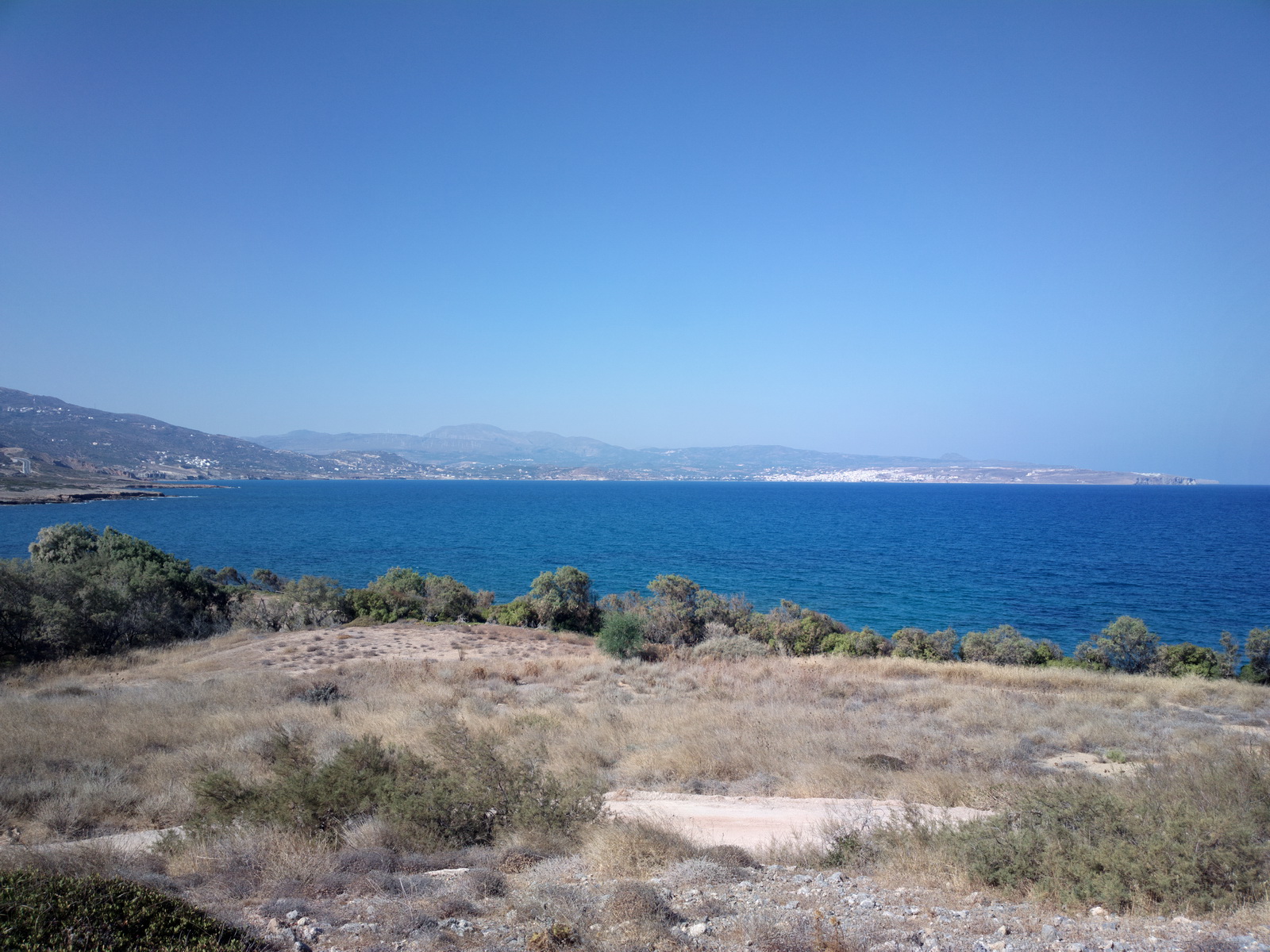
The flight to Crete was very hazy
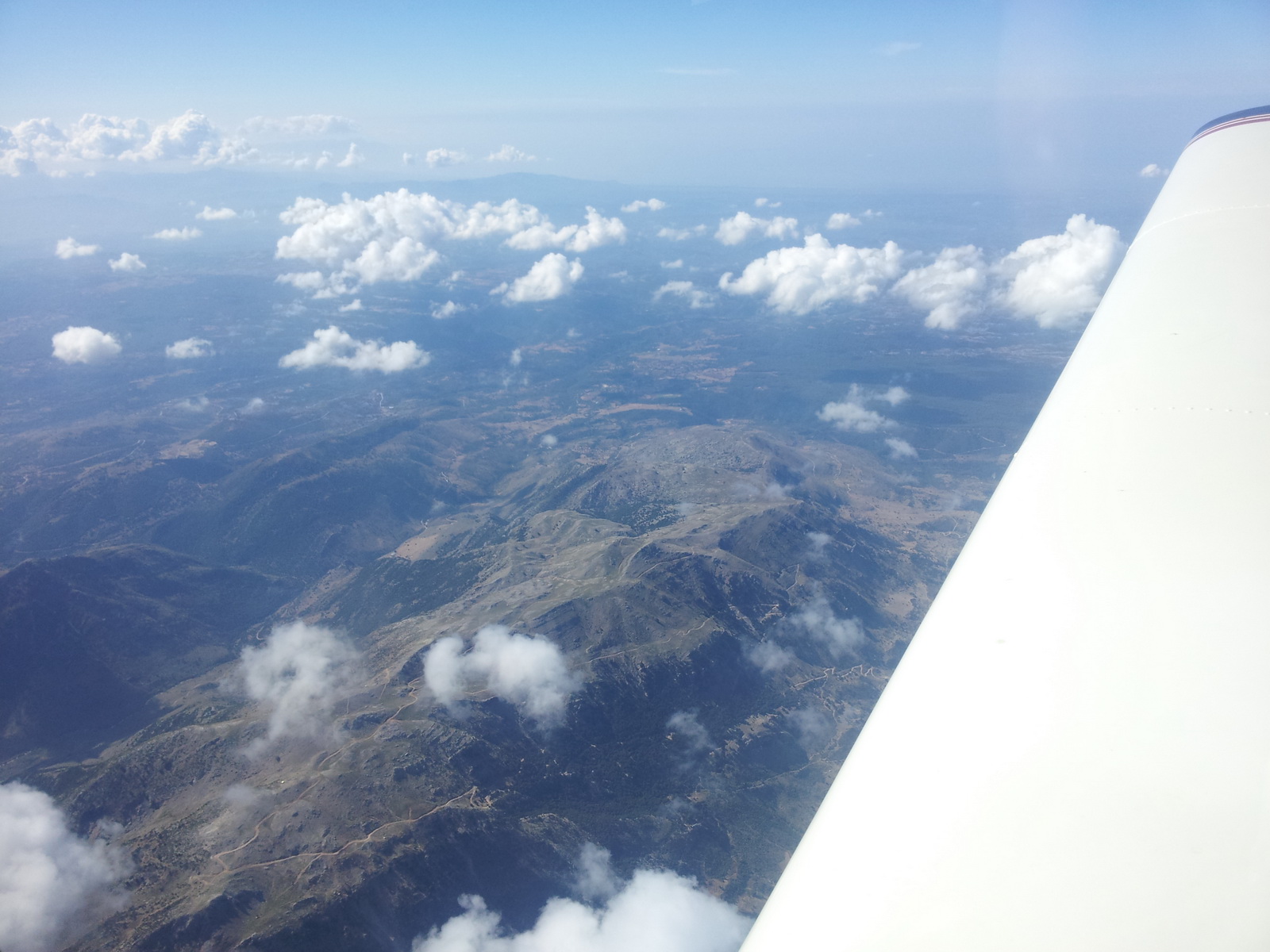
Some parts of Greece are green while others are almost barren
Plenty of fuel forecast for the destination - with 52 USG one could easily fly to Crete and back to Corfu without a refuel, which shows how good a TB20 is for flying around these parts of Europe where few airports have avgas...
It was filed for FL100 but we climbed to FL110 to keep above some of the buildups and this was just about right for the entire route
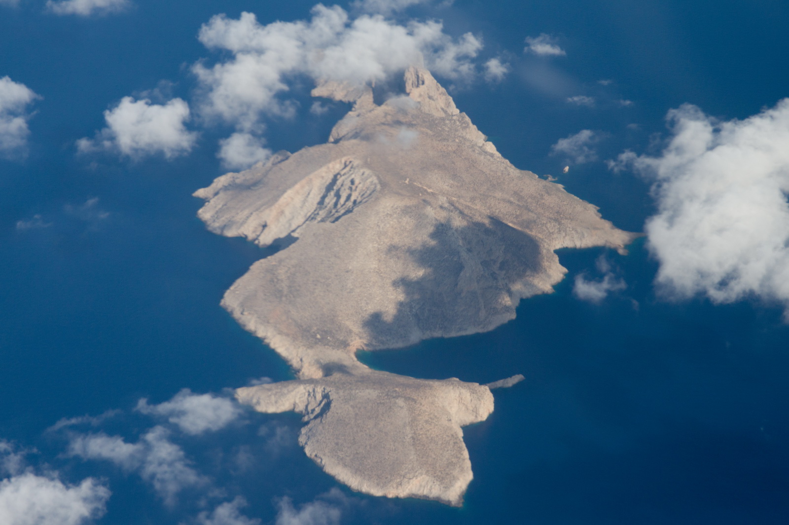
There is an interesting hole here - Sykia cave in Milos island
The beautiful island of Santorini, shrouded in haze which was difficult to even slightly reduce in Lightroom
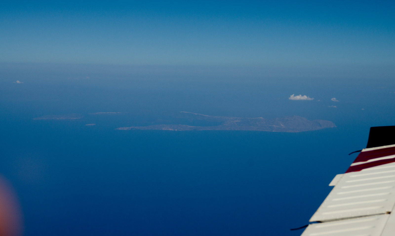
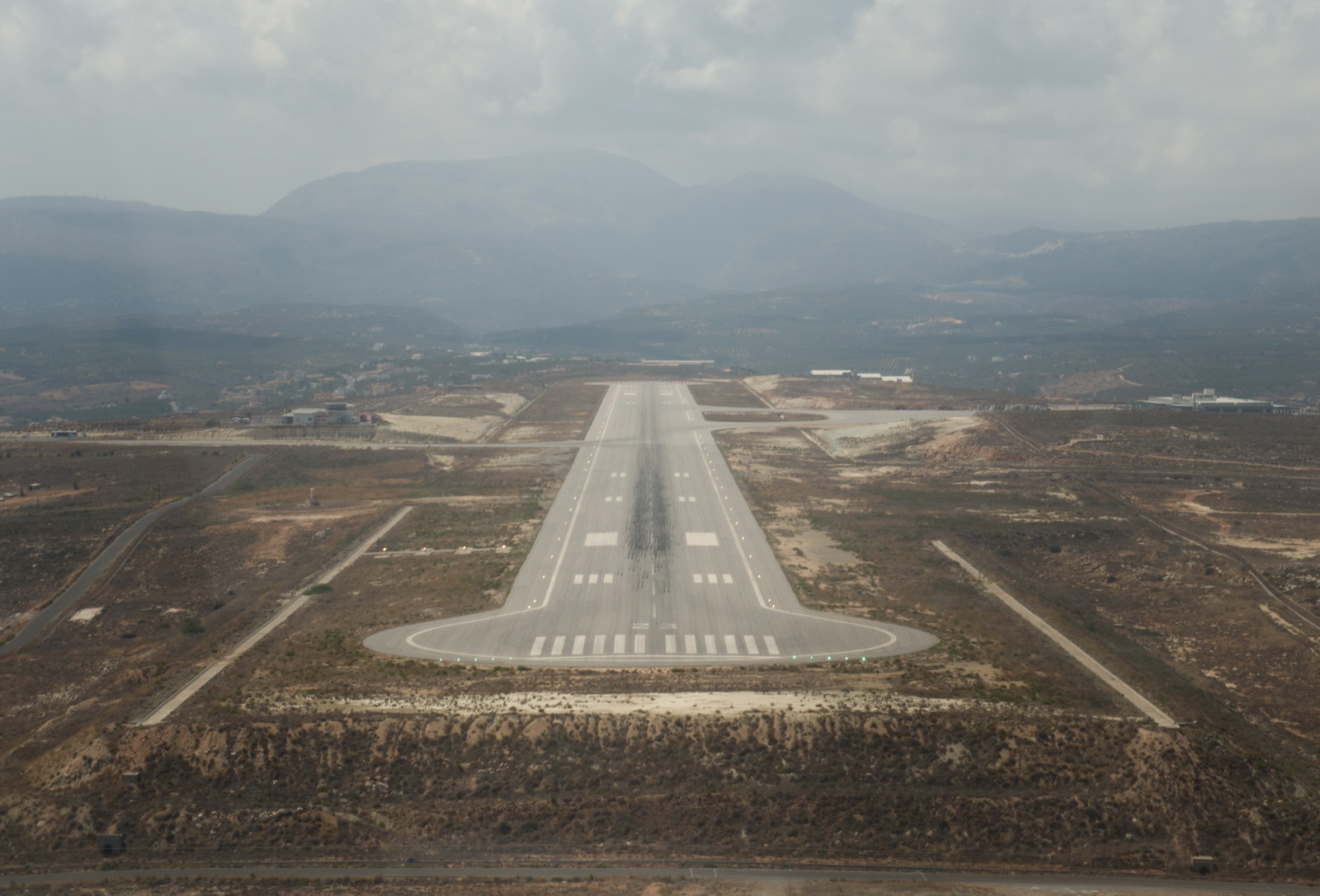
Finally, Crete...
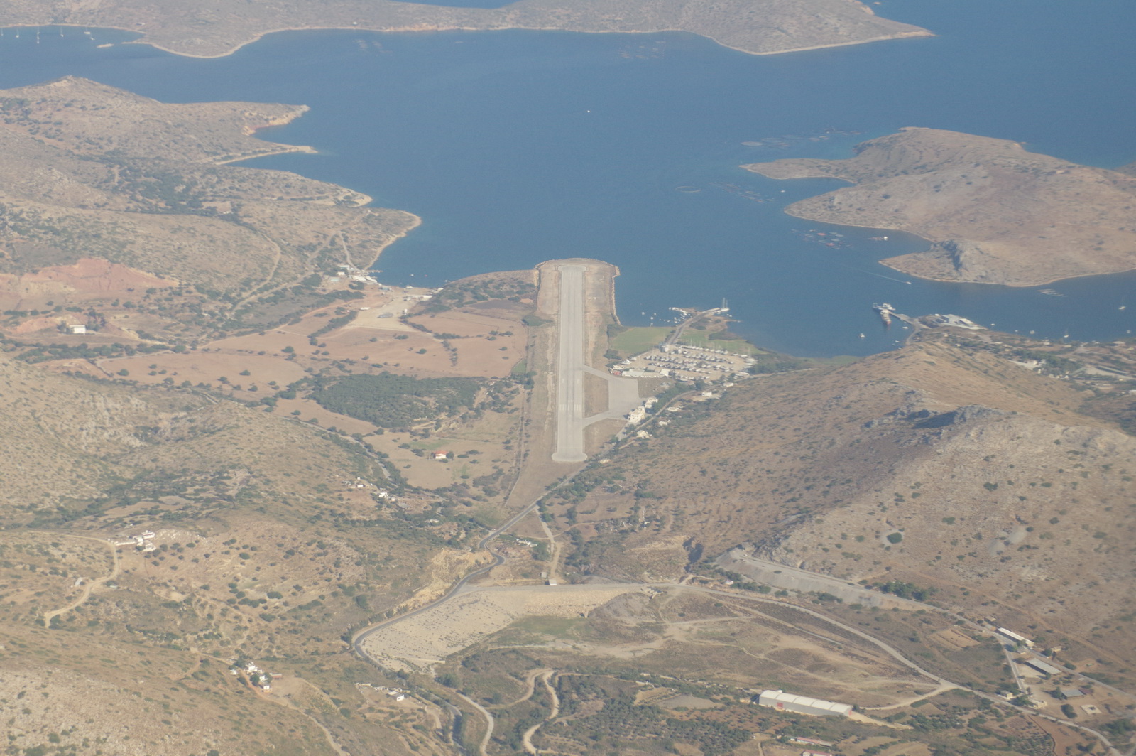
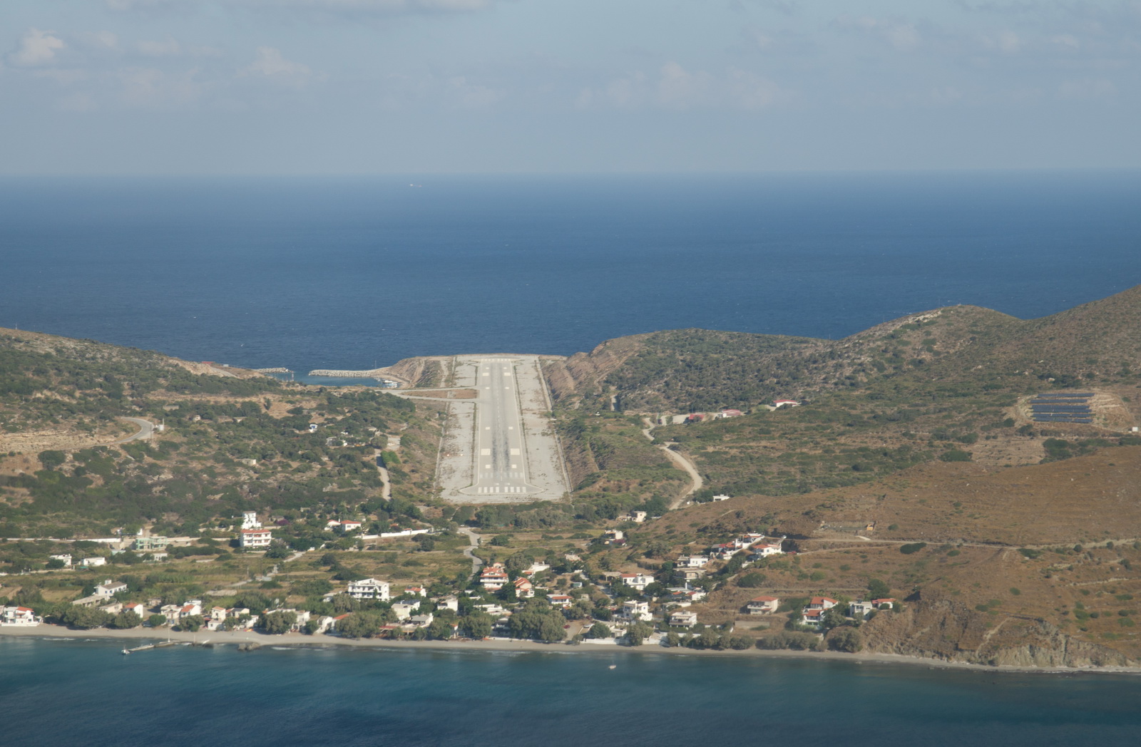
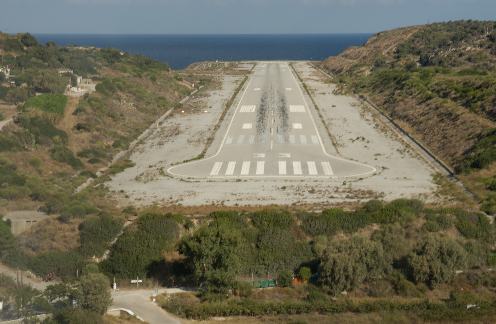
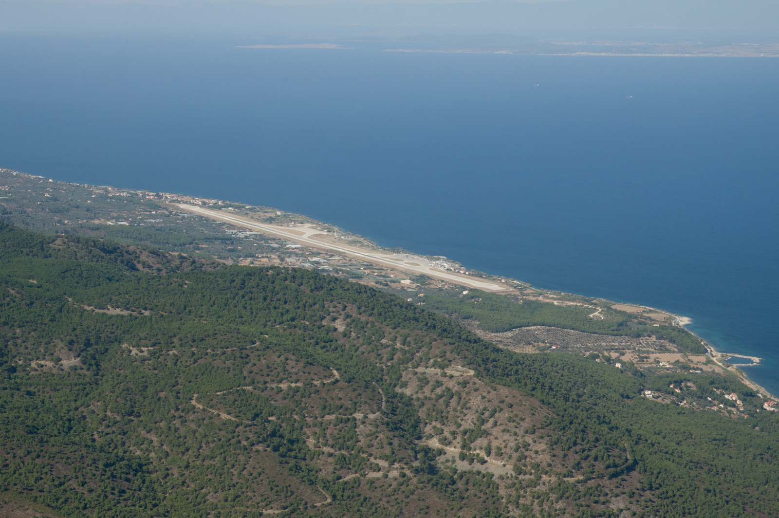
Sitia LGST
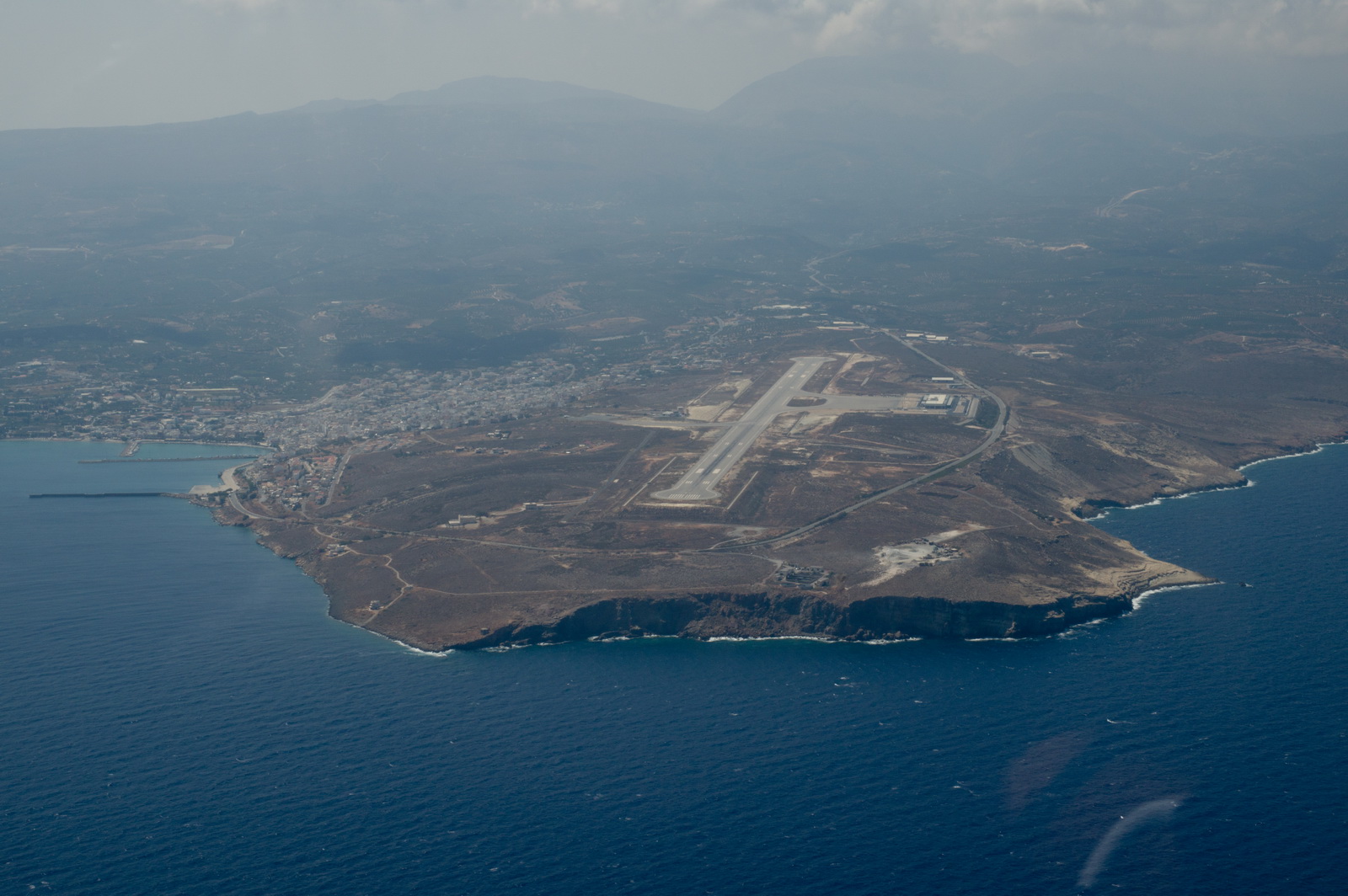
The runway is huge, though they can have a strong crosswind...
The actual route flown is shown in black:
![]()
So one does get some shortcuts...
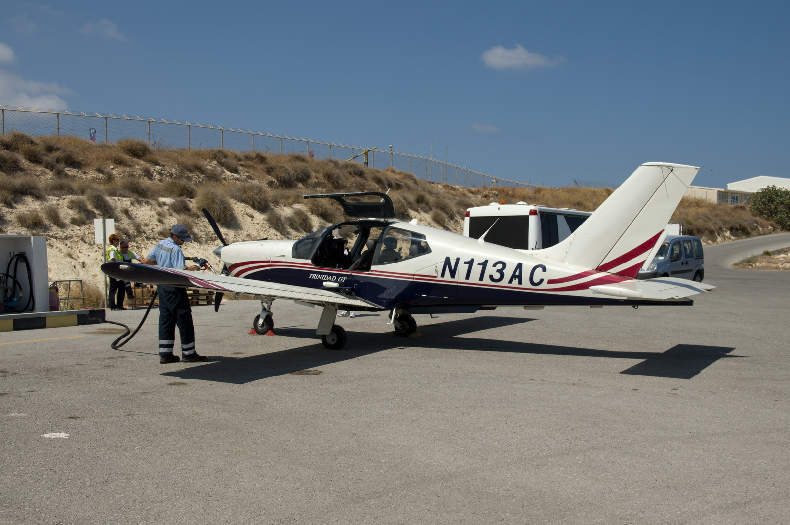
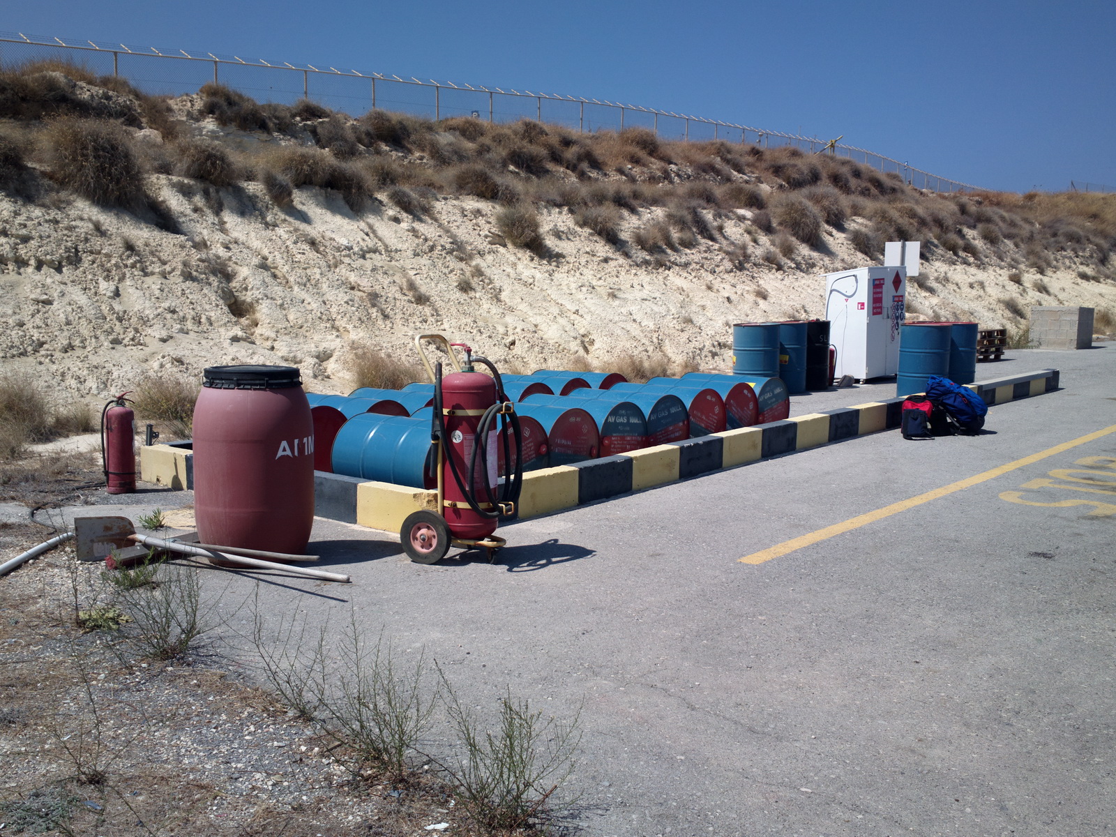
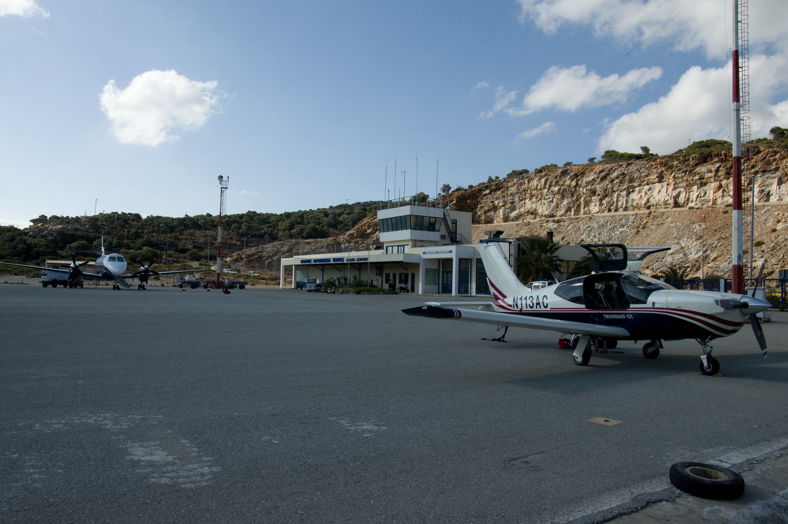
The fuel facility has not changed since my first visit in 2004. Avgas has an indefinite life if stored in sealed drums. The fuel here is the most expensive in Greece: €3.11/litre.
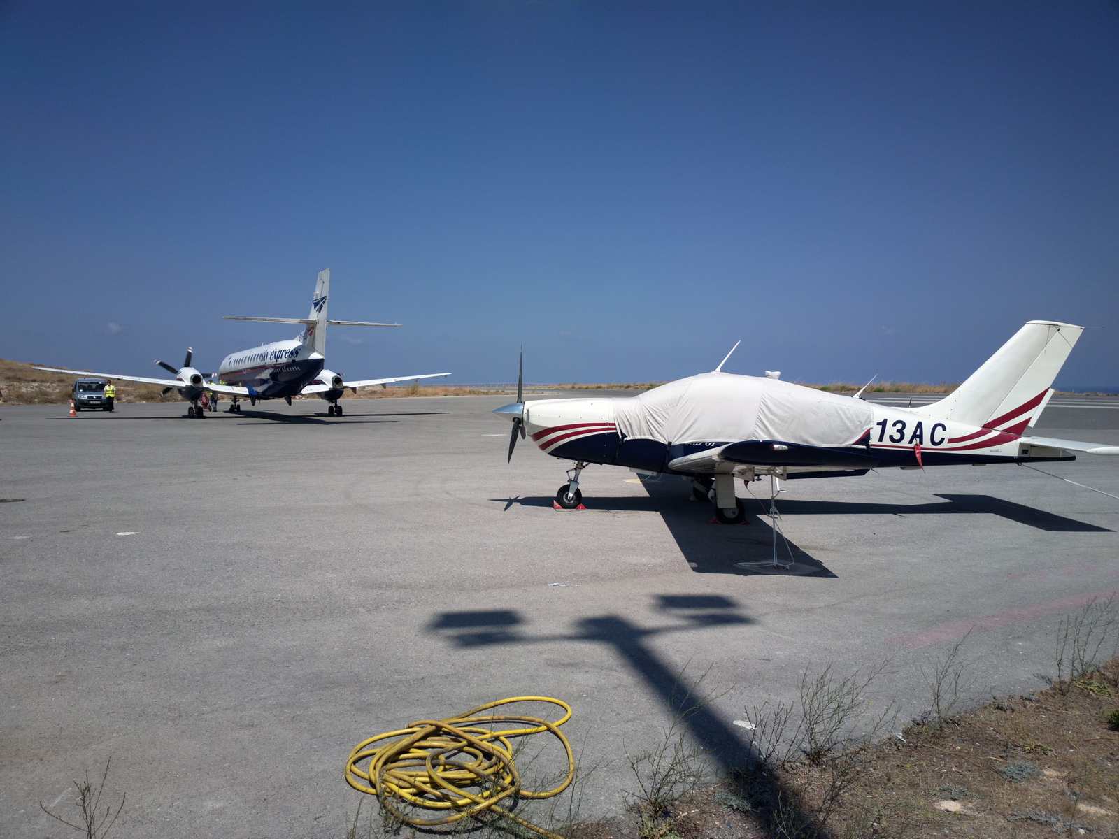
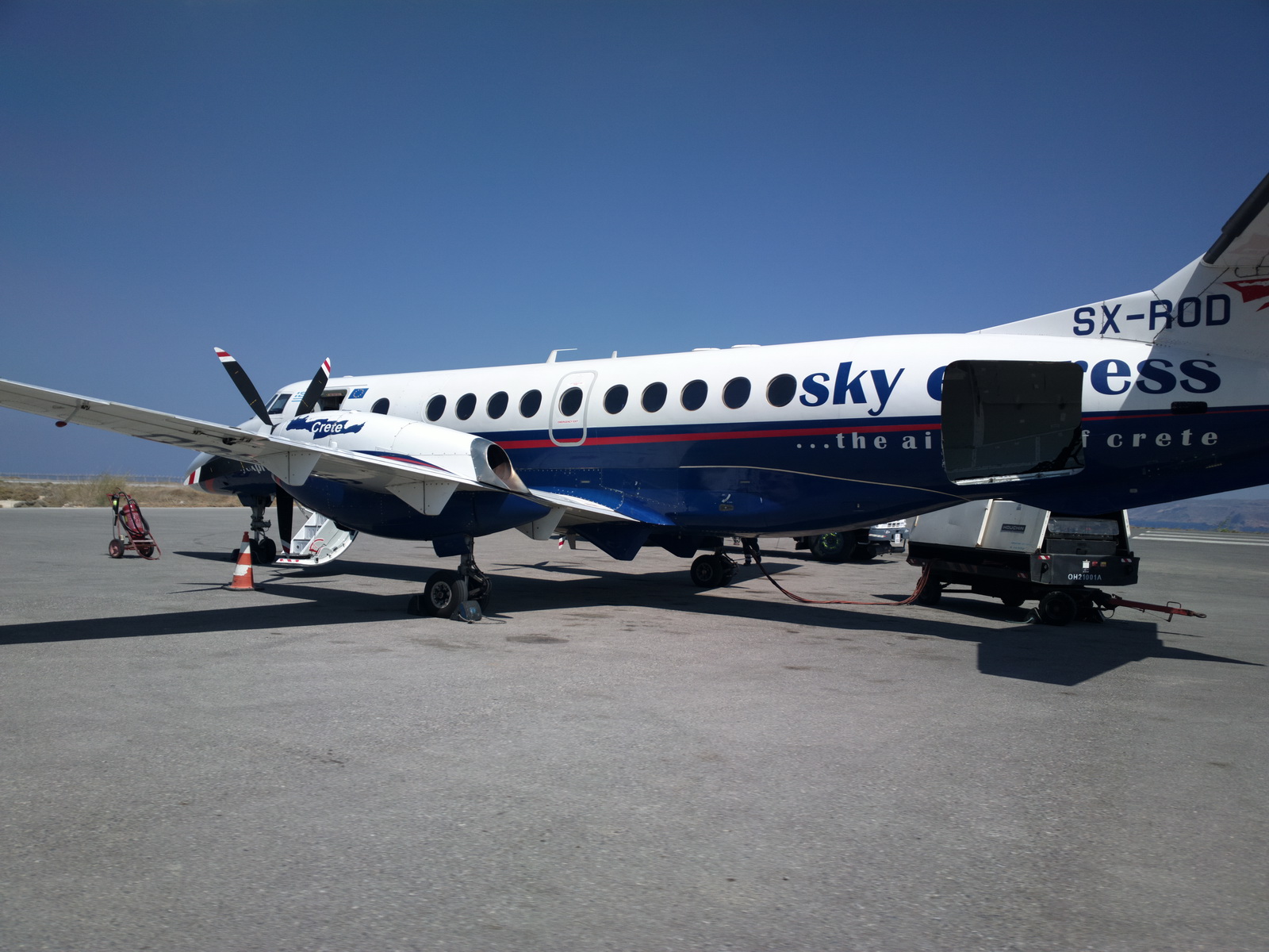
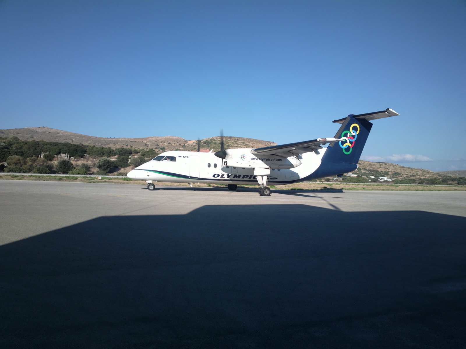
Soon we had company... these twin turboprops fly all over Greece, between Athens and the many islands. It's a small commuter airline
Tiedowns are taken seriously, even though it would take a hurricane to move a TB20 with full tanks and chocks
An interesting registration on this one - clearly somebody in the Greek CAA
either can't speak English or has a great sense of humour ![]()
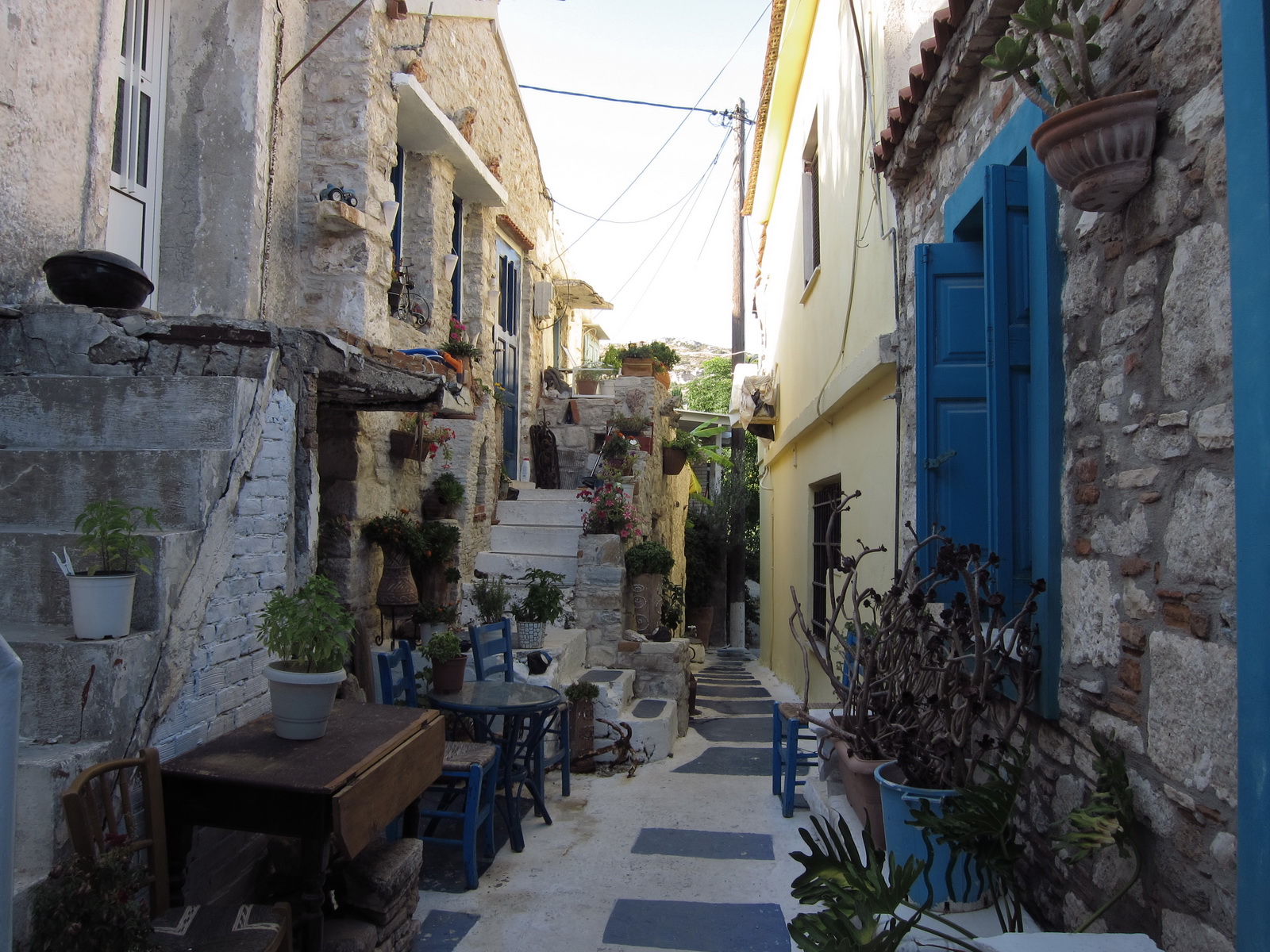
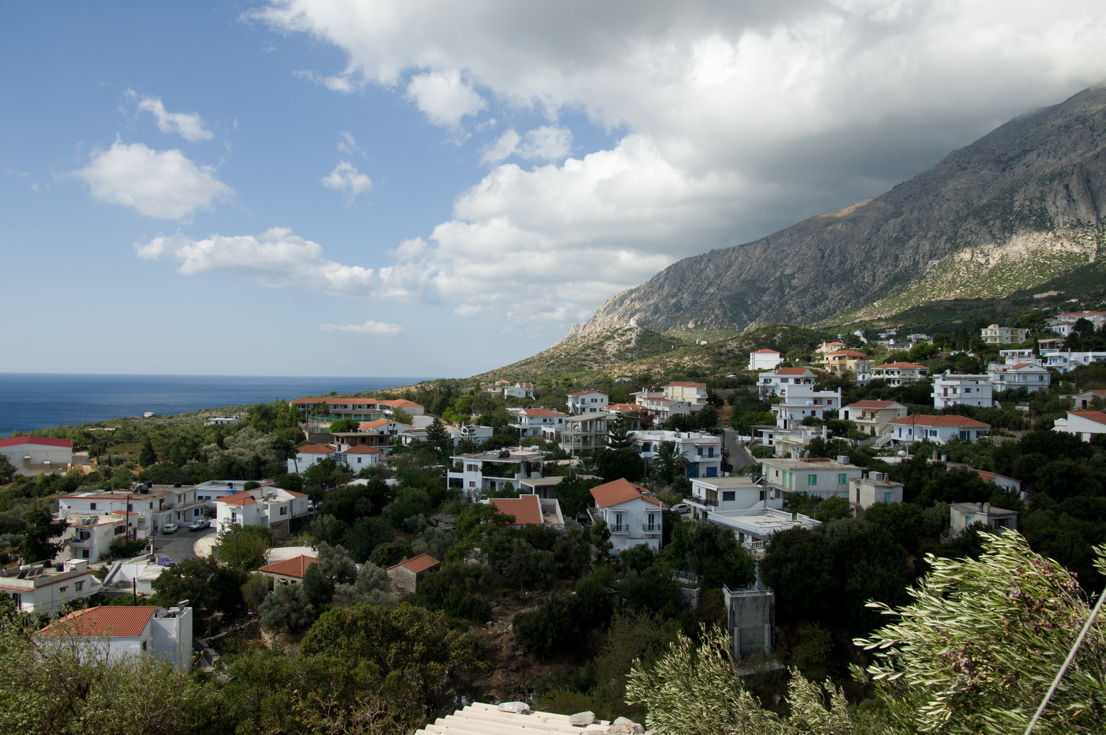
There is a very quick taxi ride down the hill into the town - Sitia
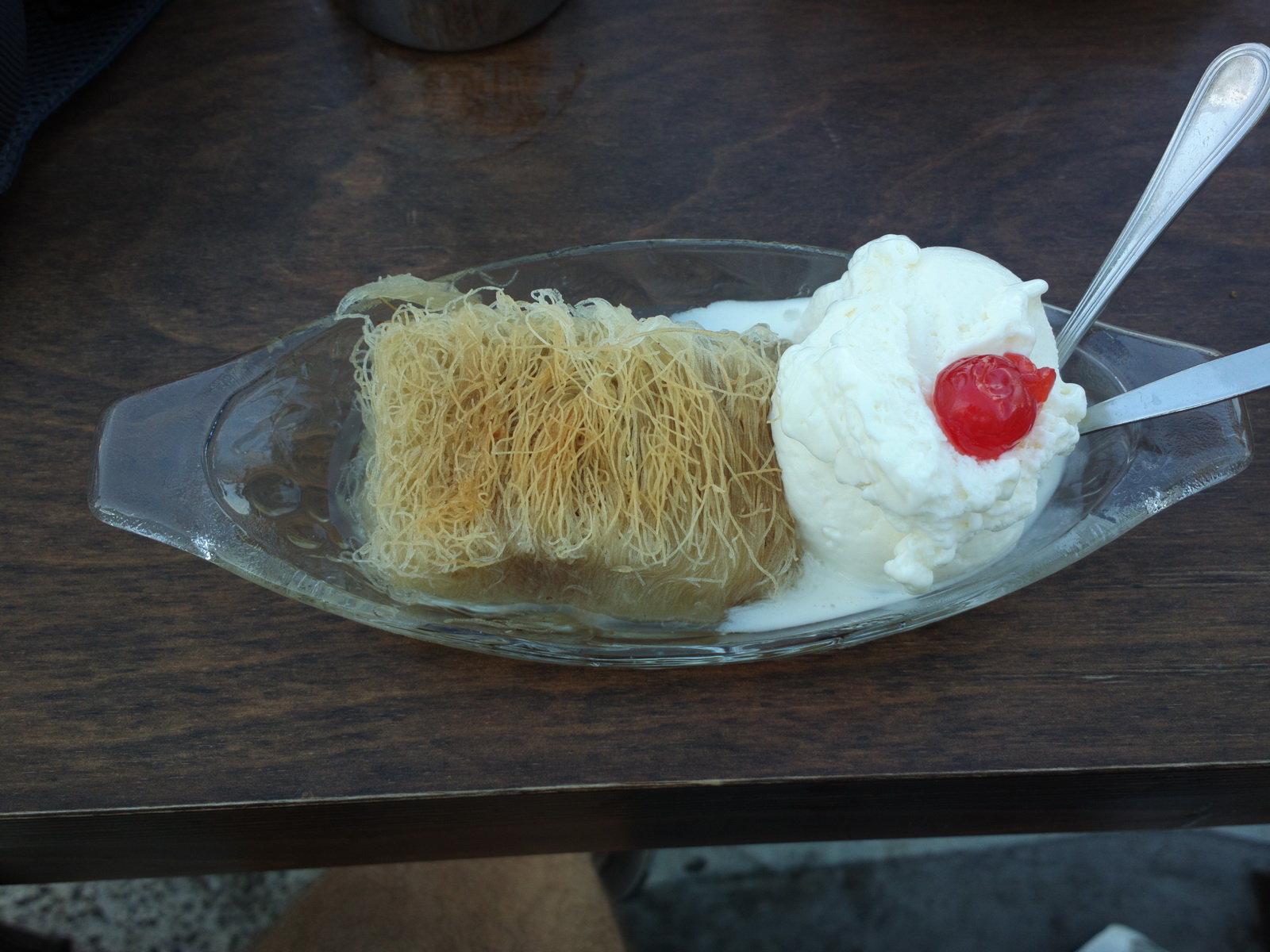
The world's best kataifi is found here, in front of the Itanos Hotel
We stayed at the excellent Sitia Beach hotel, though we were lucky to get the last available places...
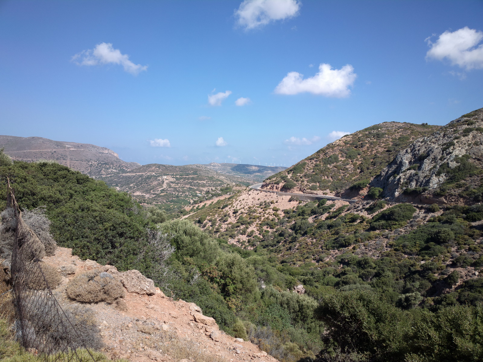
We rented a car and drove around a bit. Crete is rocky
and with lots of winding roads with sheer drops offering great views
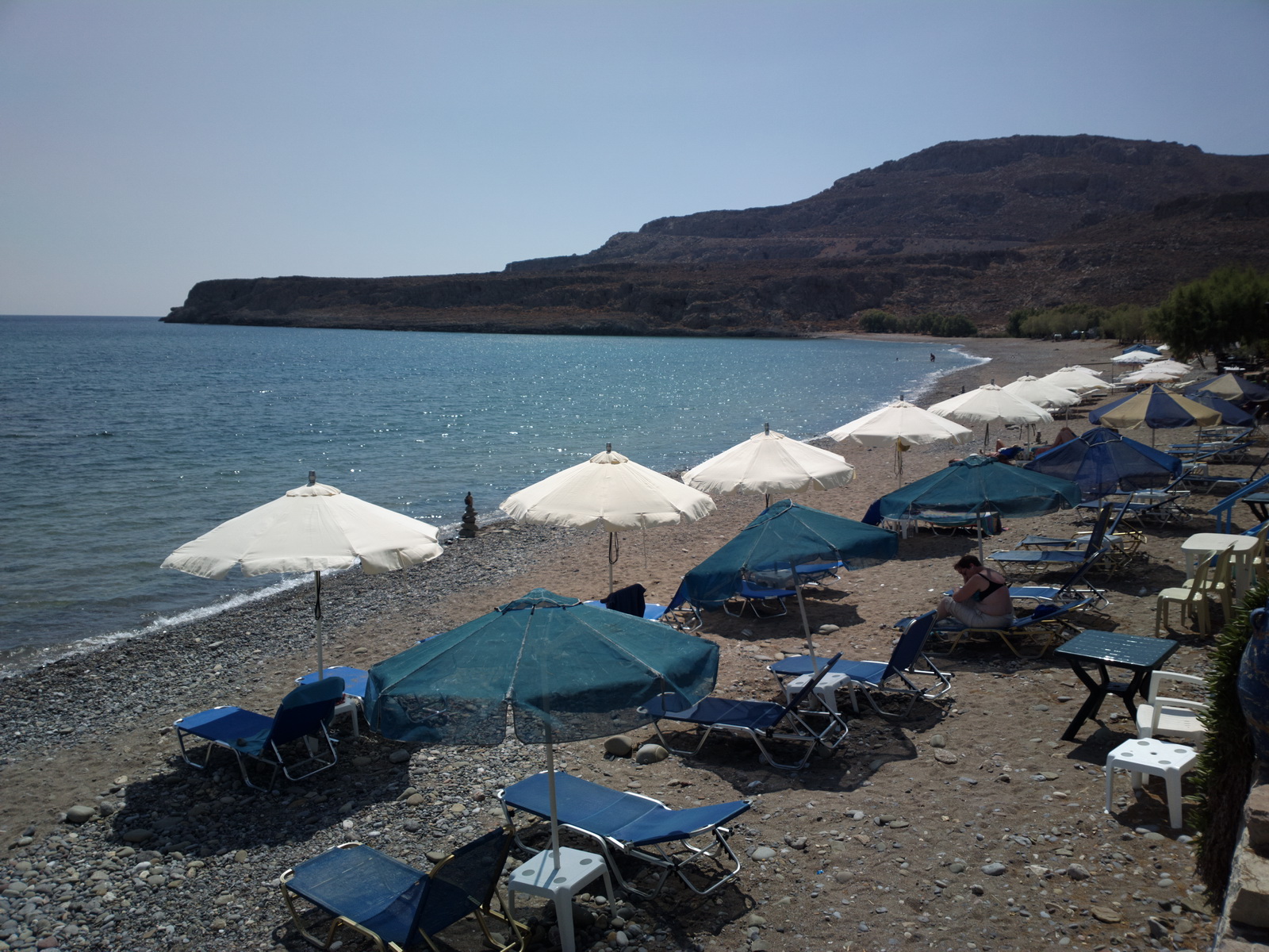
The beaches in eastern Crete have pebbles rather than sand. This is Zakros:
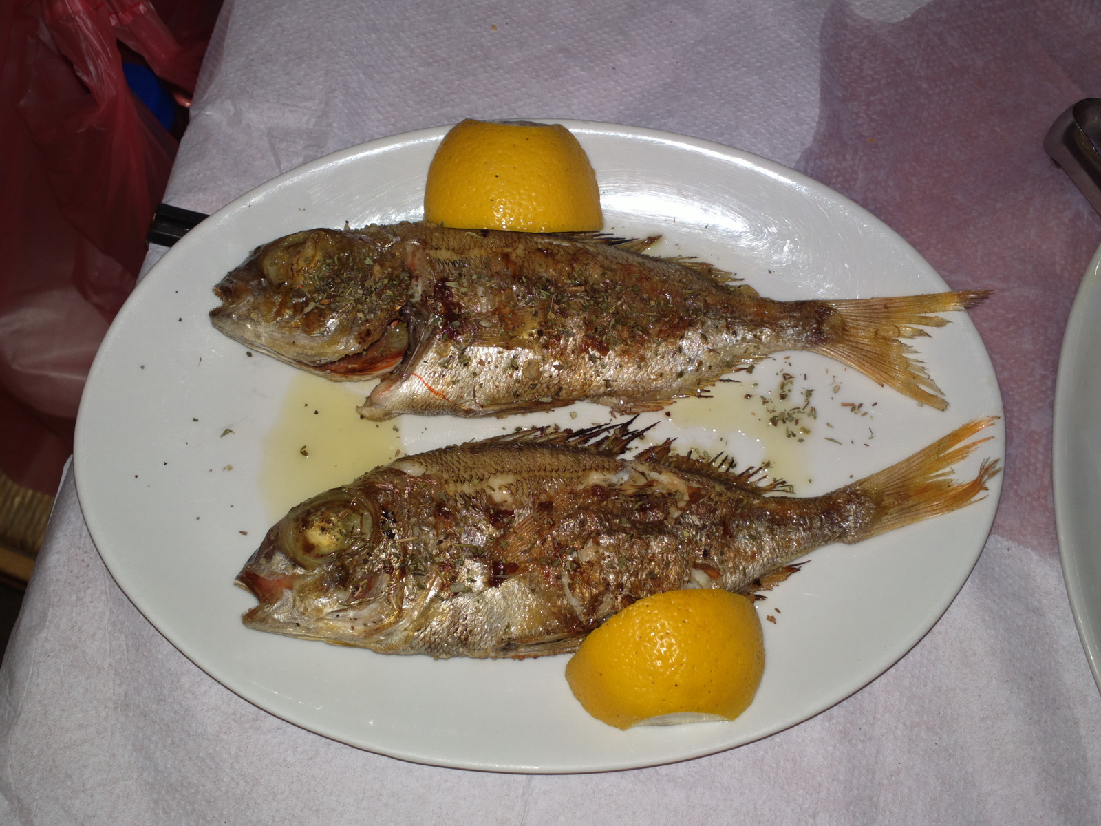
The food is outstanding, with a Greek salad and fish being my favourites -
the potato chips less so ![]()
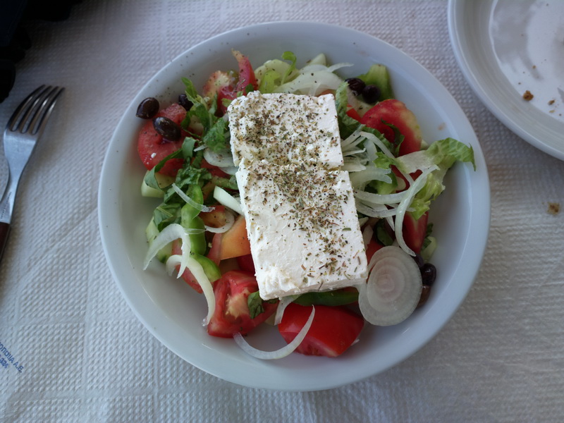
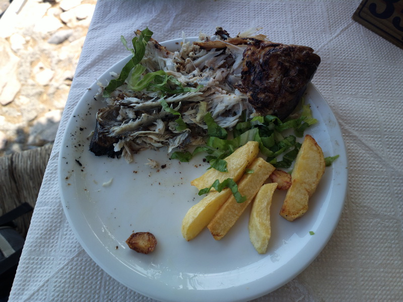
What you don't get is the N European sauces, salad dressings and other rubbish which is used to disguise poor quality basic ingredients.
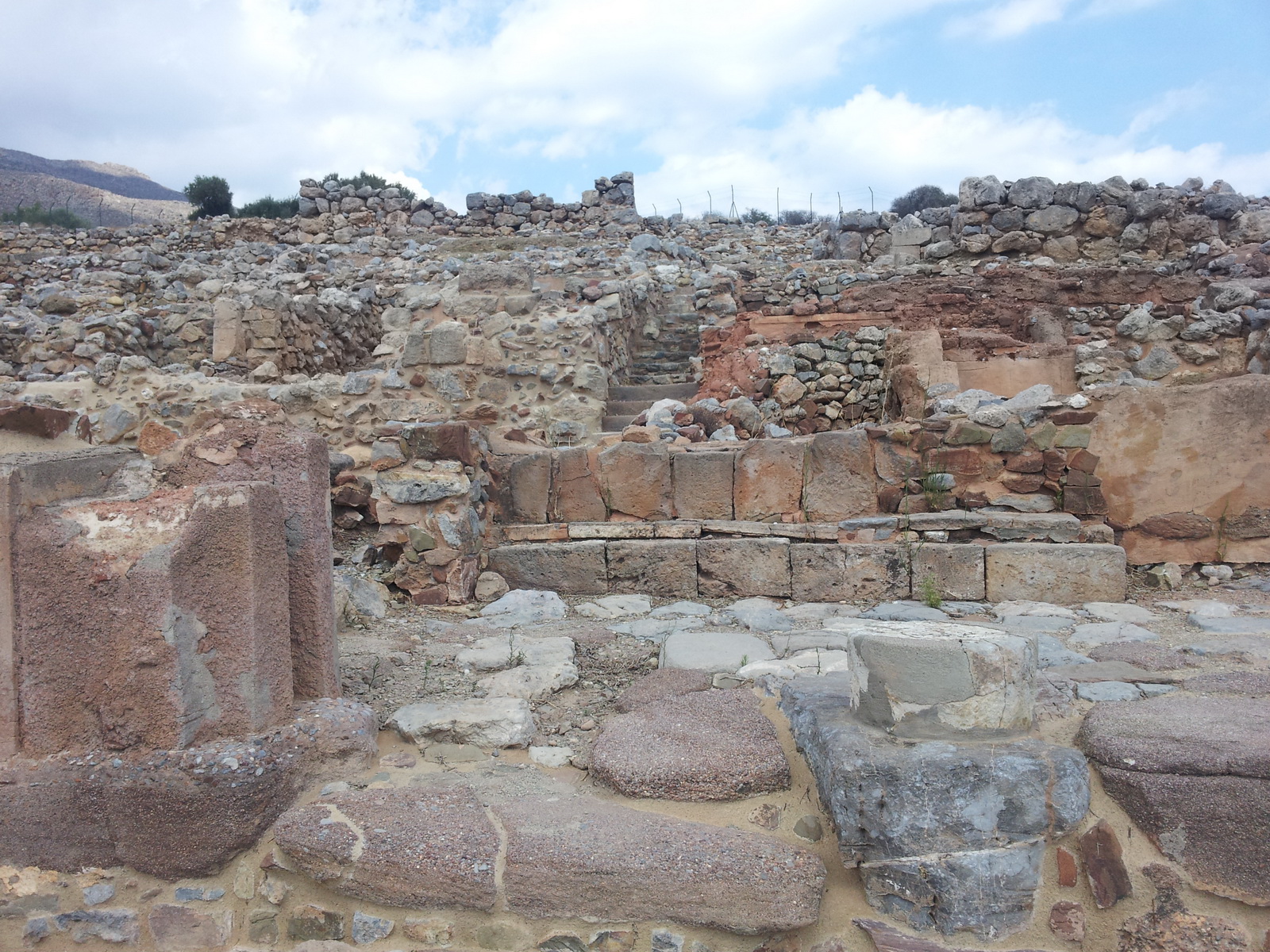
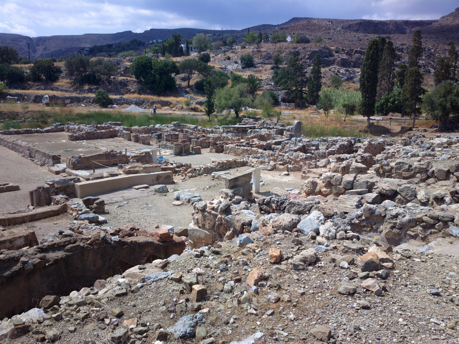
Greece and Crete in particular is full of archeological remains
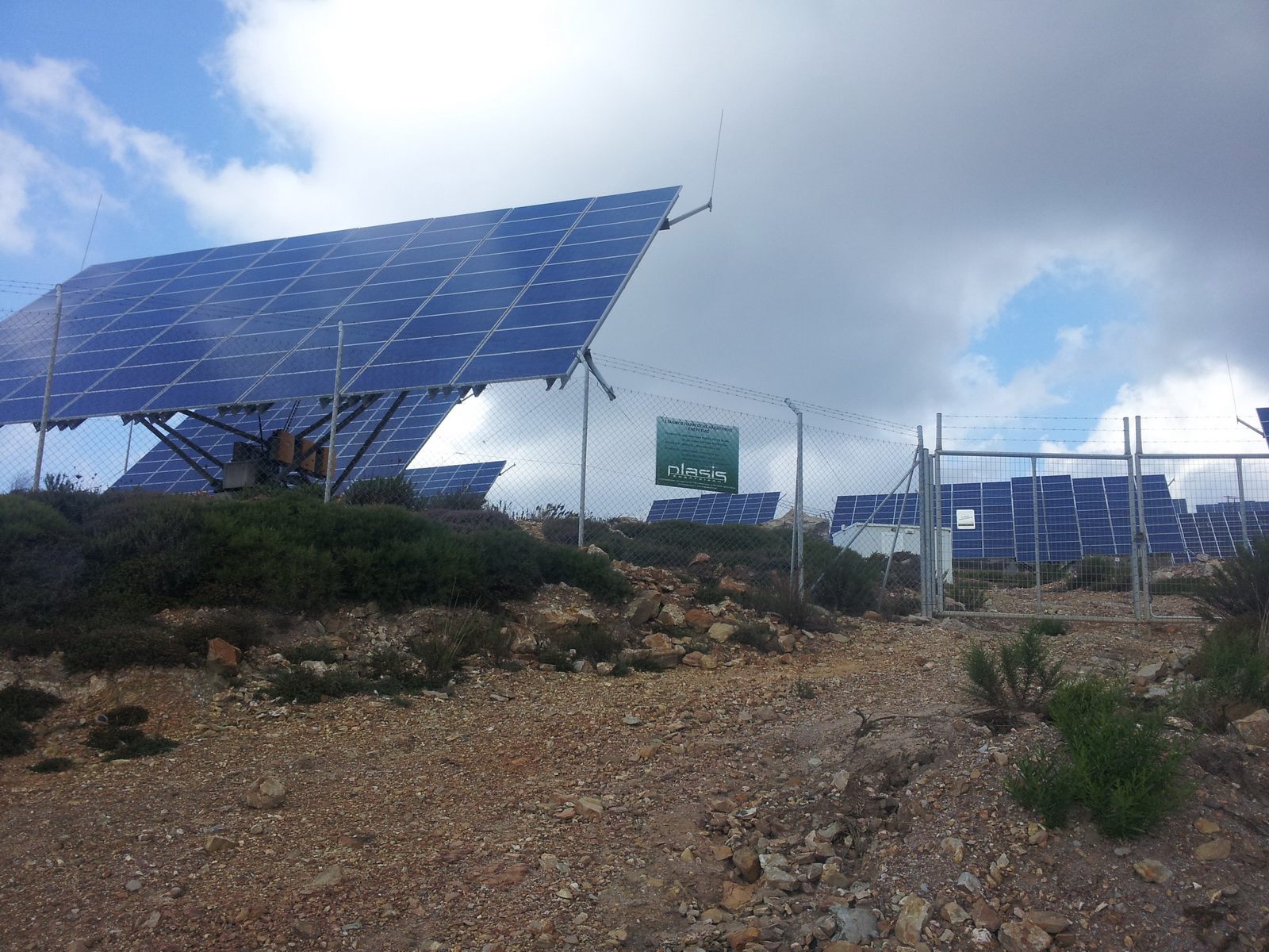
We found some huge solar (photovoltaic) panel installations... it wasn't clear what these could be useful for. Apparently, it was organised and project managed by specialized companies, the site owner gets a loan, installs the panels, sells the electricity generated to the power company to pay off the loan, makes a small profit and after 5-10 years starts making more profit when loan is paid off. Several years after the scheme was established and Greece became full of these schemes the electricity price dropped (even though the minimum price was was locked by contract!) and nowadays they just make the loan payments without profit...
Sunrise in Sitia on the day of departure
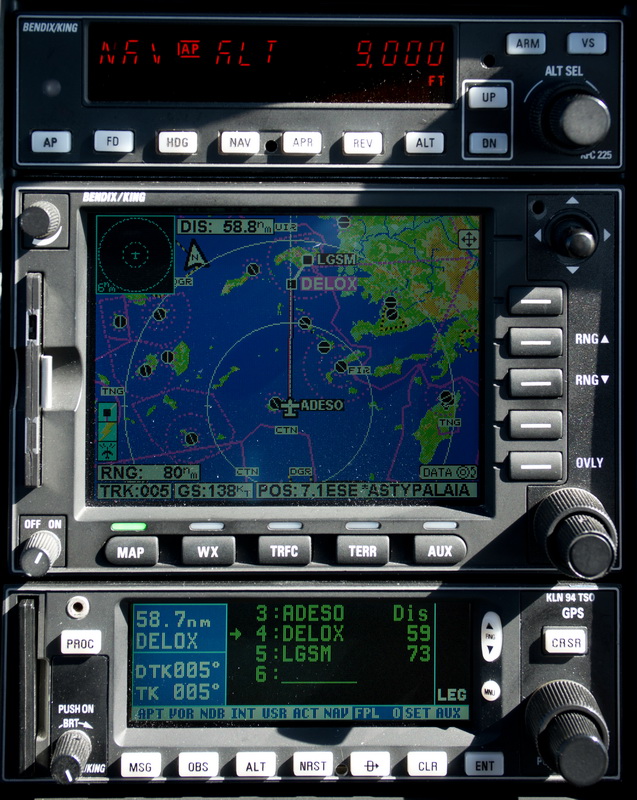
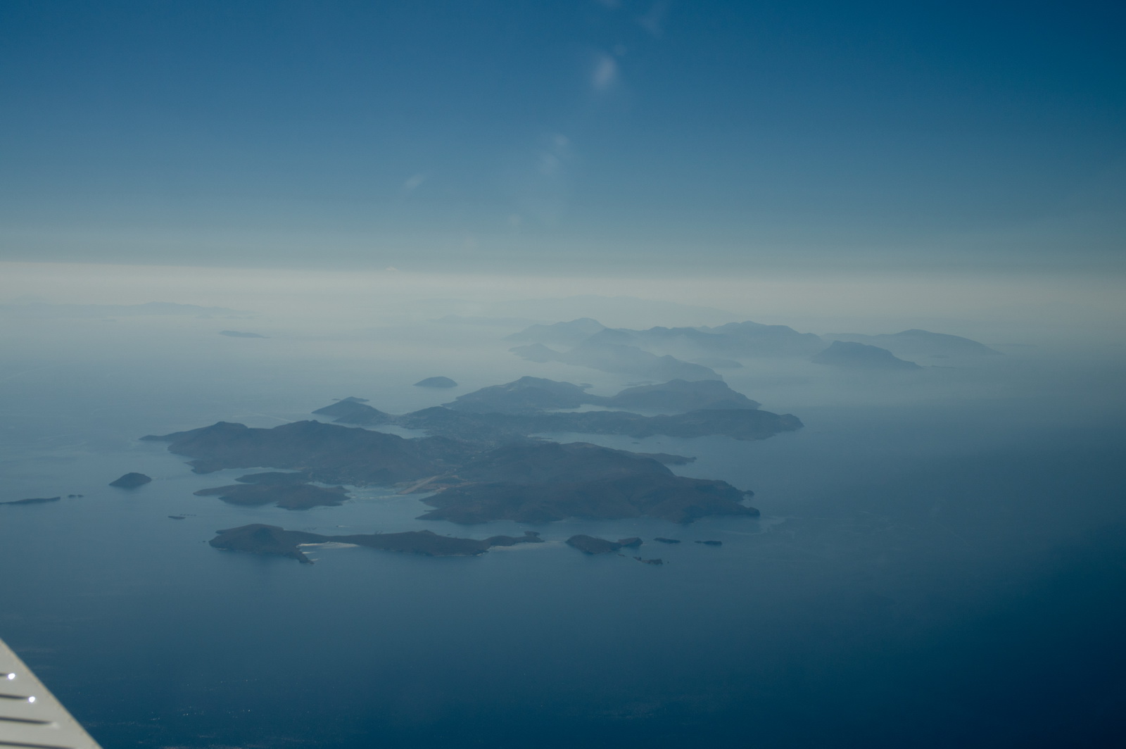
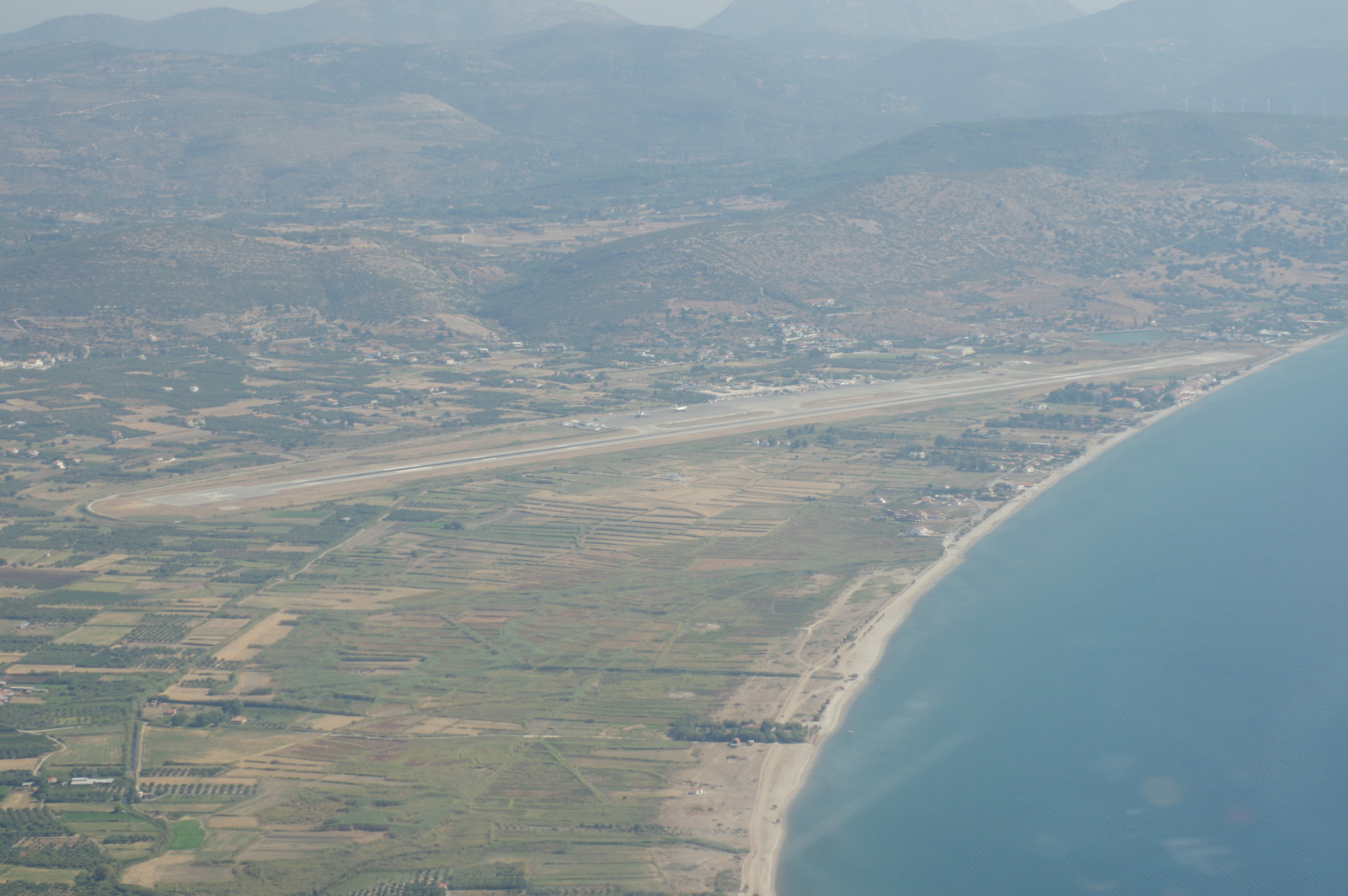
Sitia to Samos
This was flown IFR but really could have been done VFR just the same... The Eurocontrol route (pic below) is silly and one would not ever expect to actually have to fly it for real.
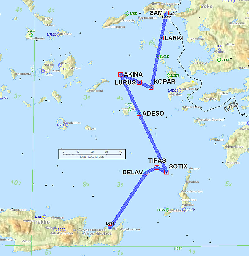
LGST DELAV V57 TIPAS N134 SOTIX N133 AKINA L995 KOPAR H59 LARKI LGSM
FL100
Alternates: Sitia LGST, Lesbos LGMT
212.0 NM (154nm GC, overhead: 38%)
Weather data: MSLP 0600 1200 1800. The IR image was clear.The TAFs and METARs were good. LGST is a curious case where you get no METARs but do get TAFs.
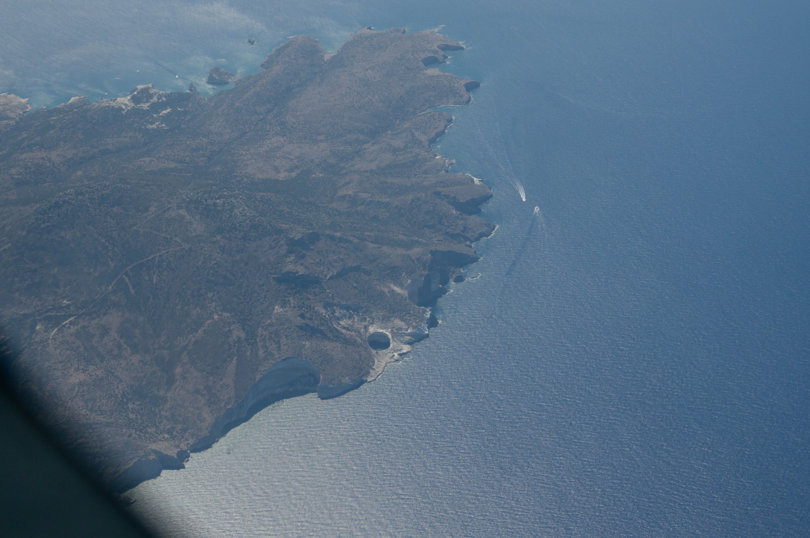
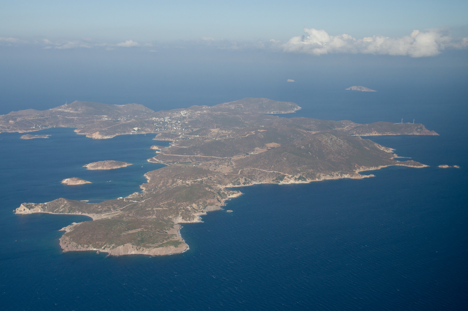
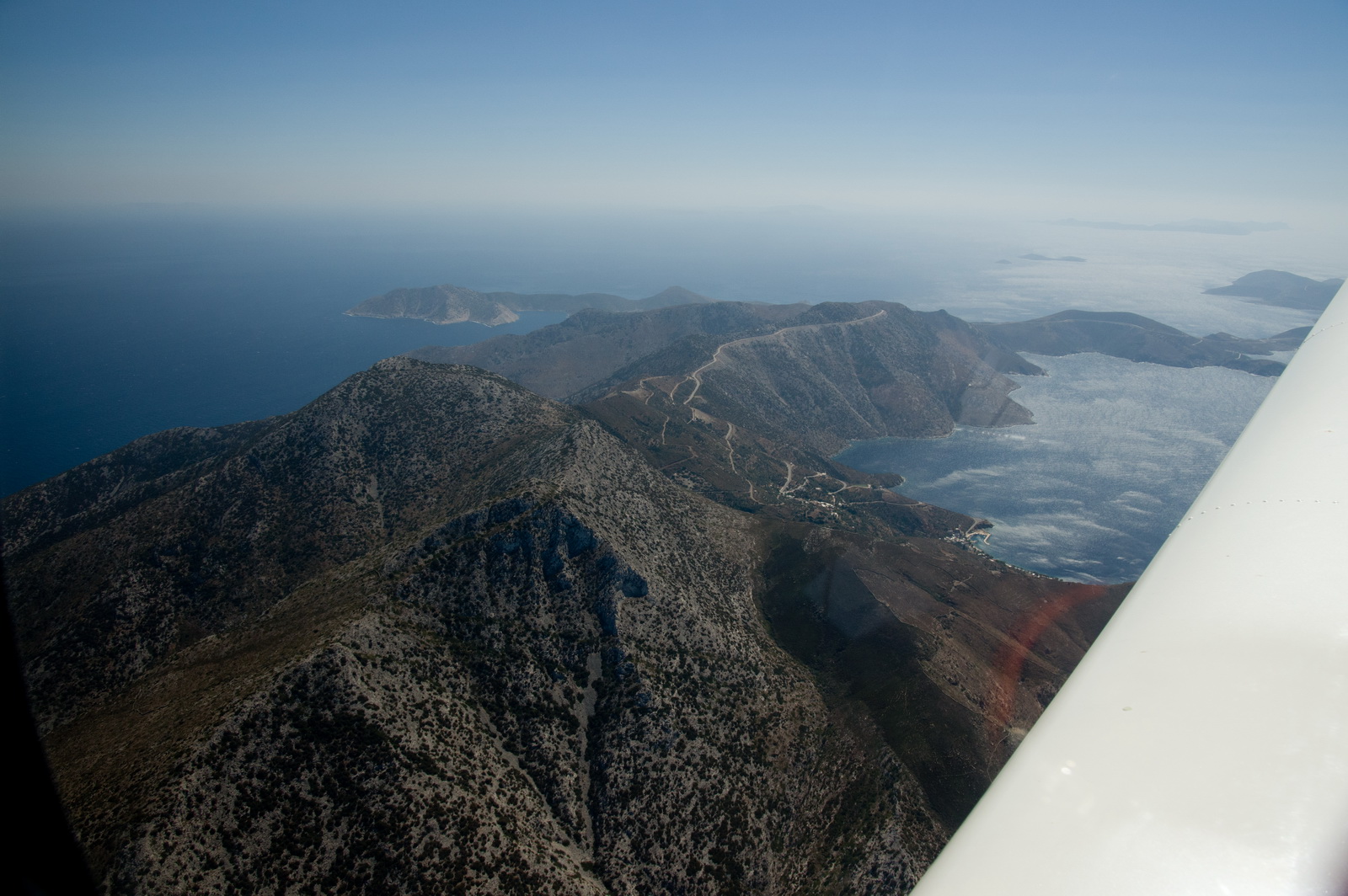
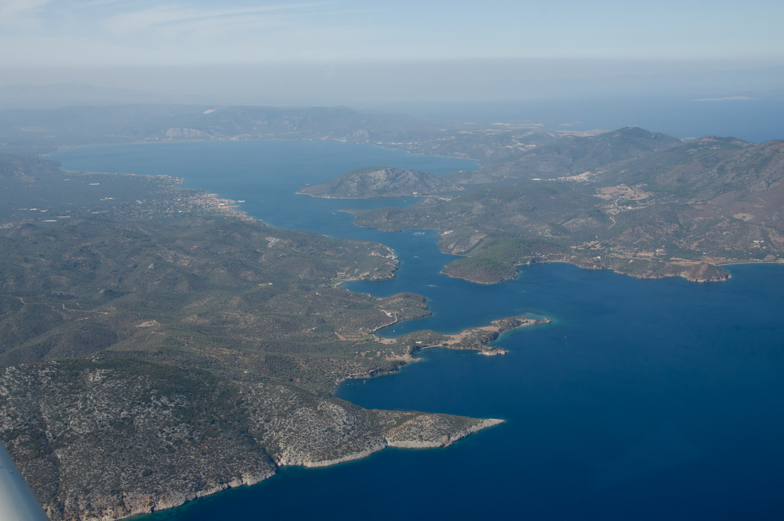
These uninhabited islands are just north of Sitia airport
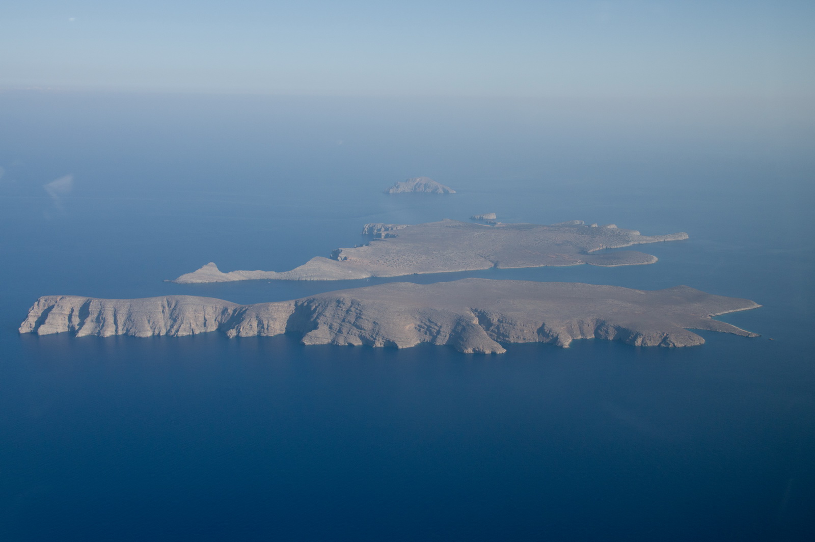
and this is further along on the way to Samos
More islands in heavy haze
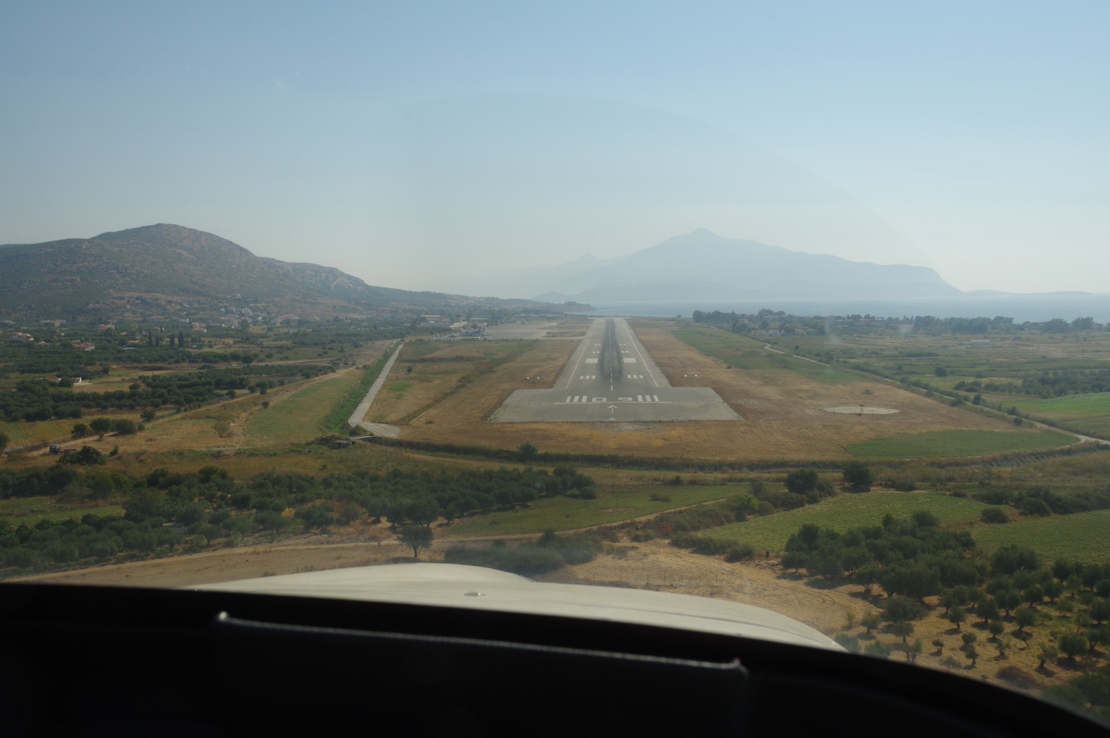
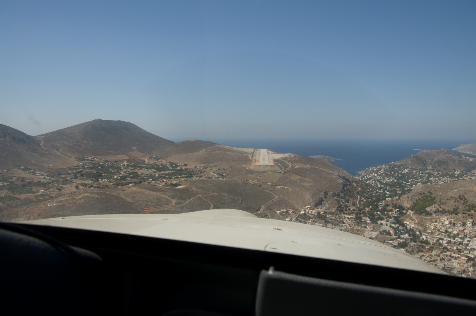
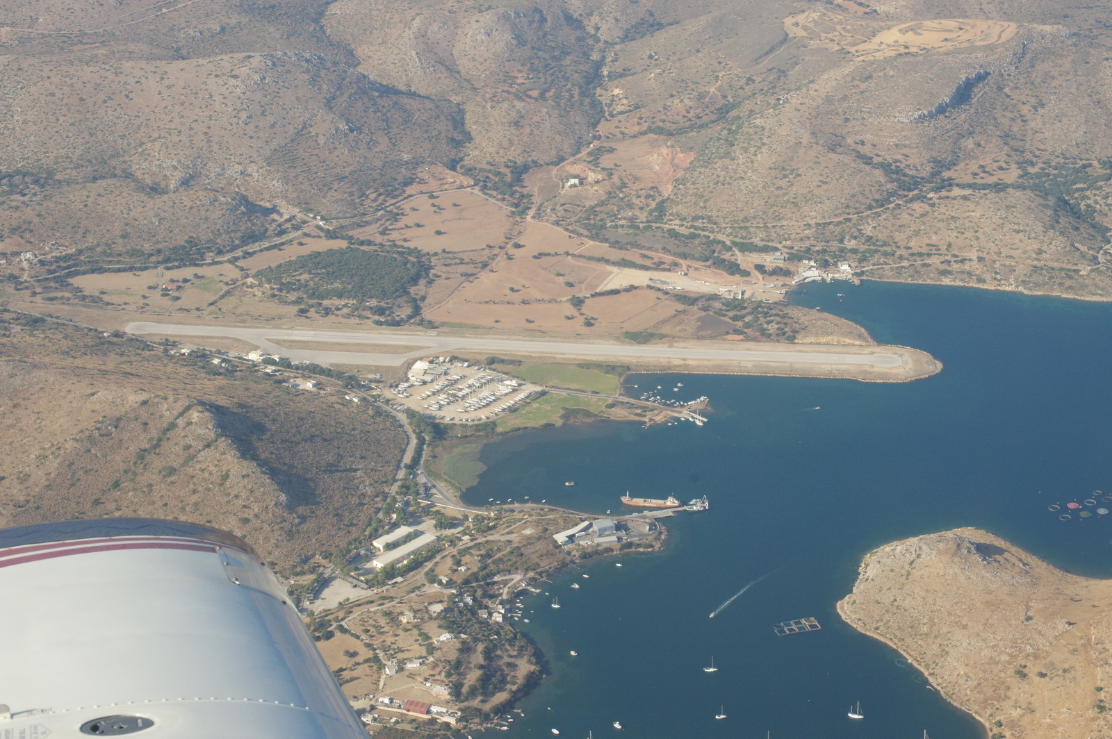
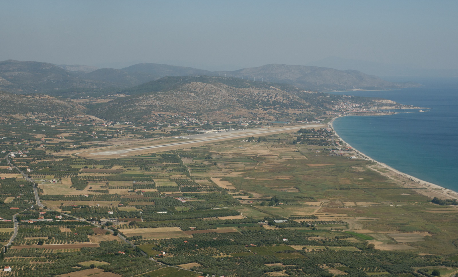
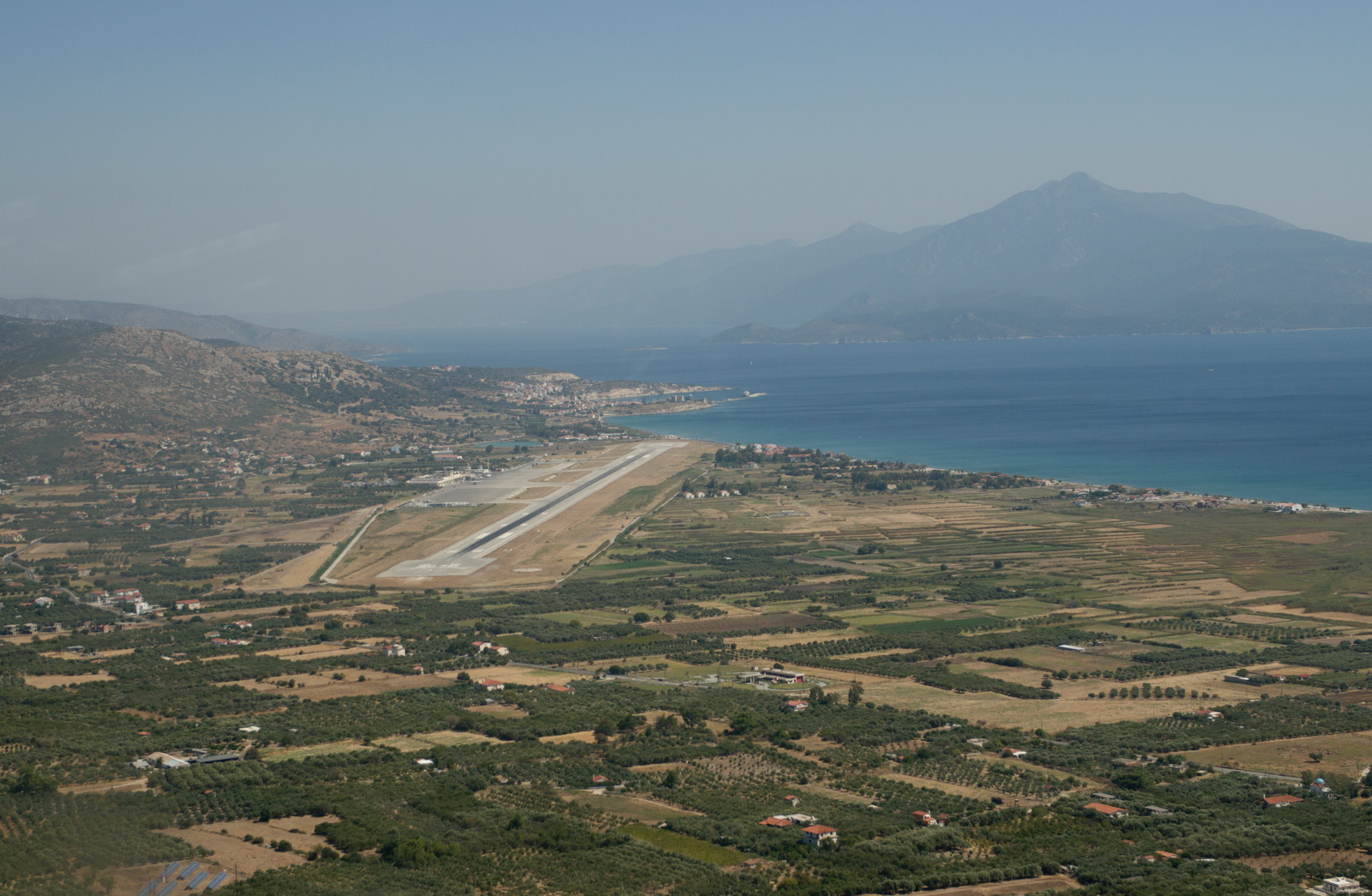
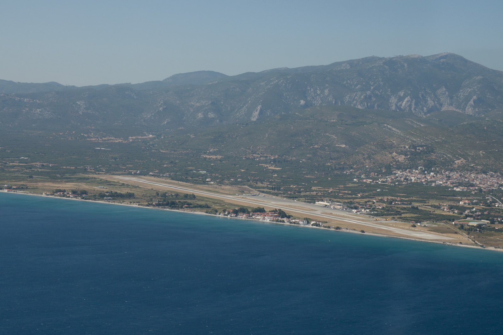
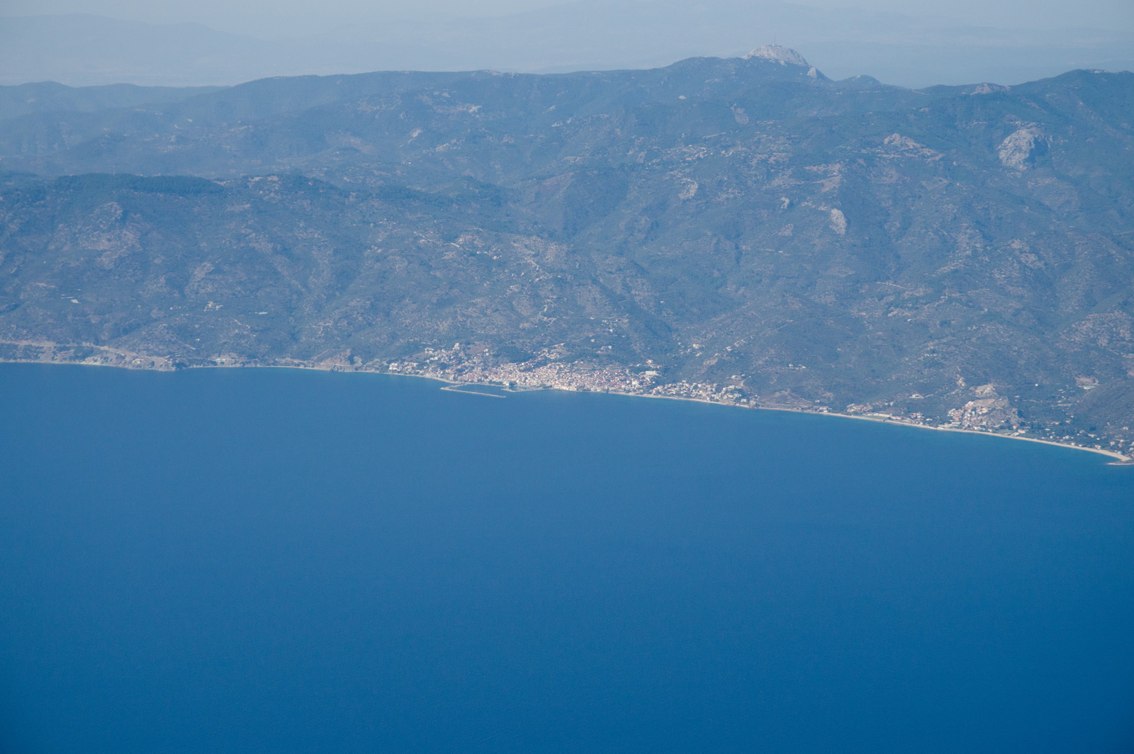
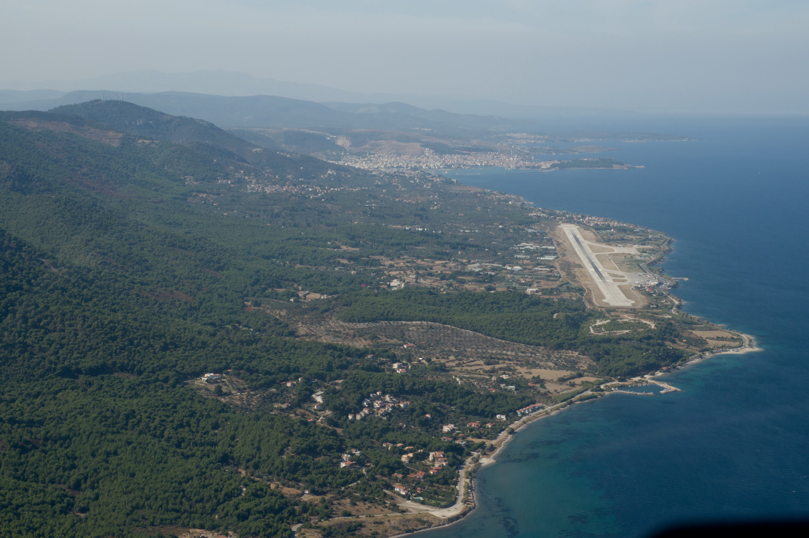
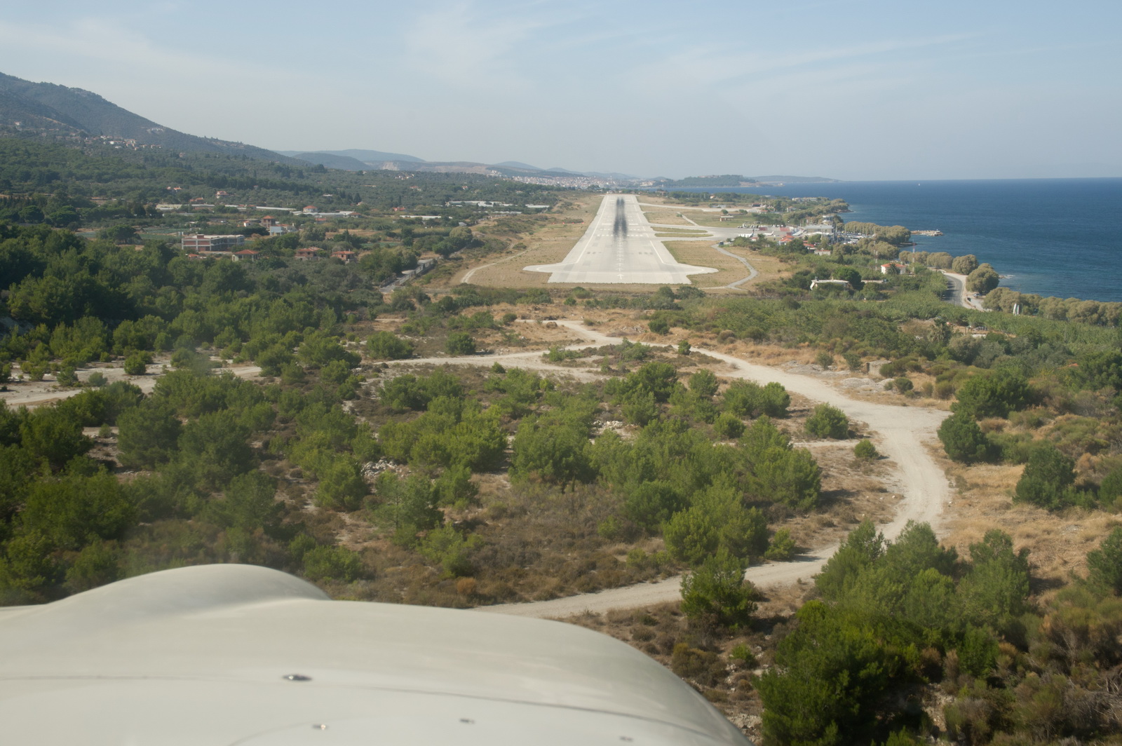
The Samos runway is just visible here
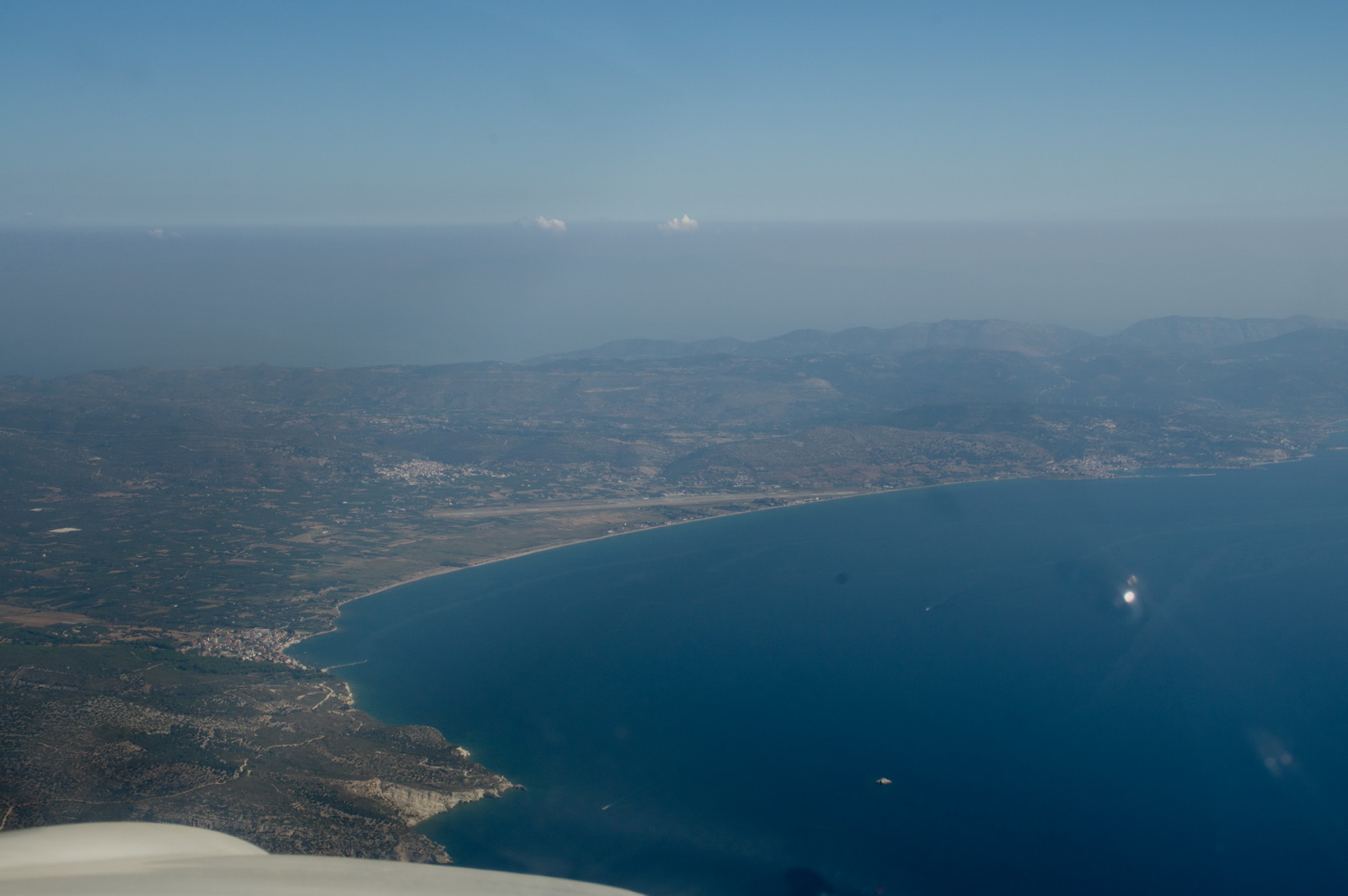
Right base
Actual route flown (in black):
![]()
The concrete could do with some weedkiller but otherwise the surface is good
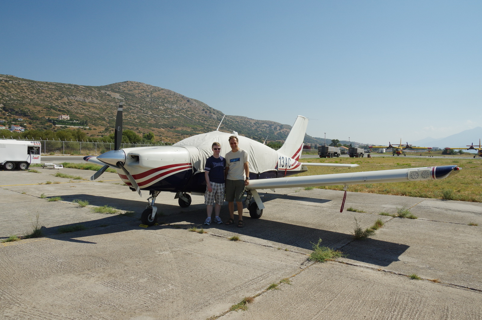
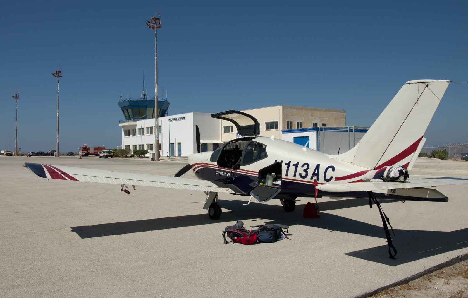
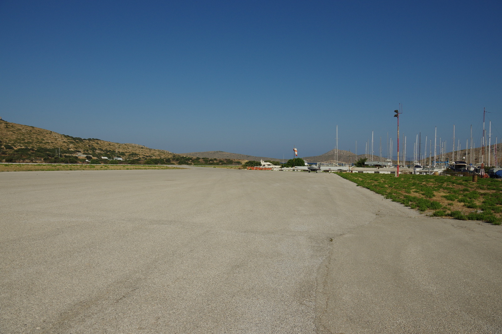
We were refuelled fairly quickly from a small towed bowser (the man assured us that the fuel is quality tested every day) and moved on. The apron has loads of room
This is what Greece is all (?) about - you either love it or hate it ![]() but I think it's great stuff
but I think it's great stuff ![]()
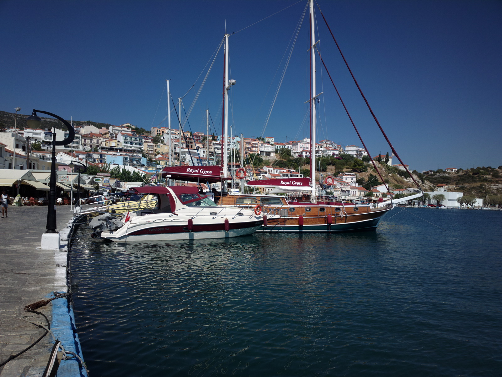
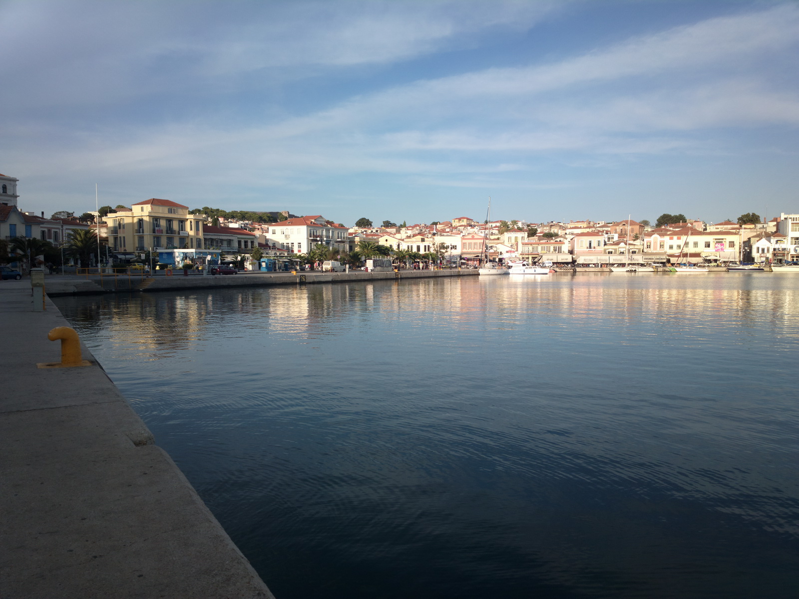
We stayed in the town of Pythagorio, named after the famous Greek guy
They just love their colours...
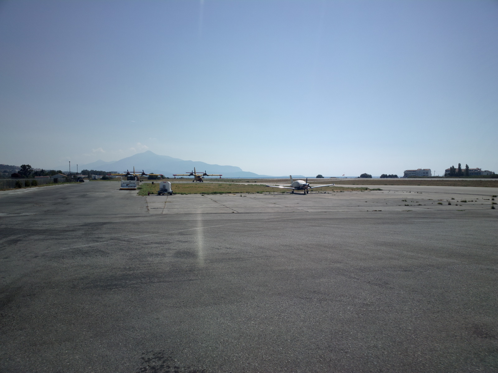
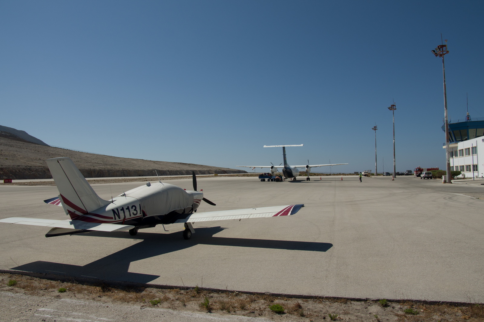
One of the larger airport customers on his way in
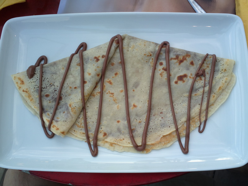
One has to try the unhealthy stuff once or twice
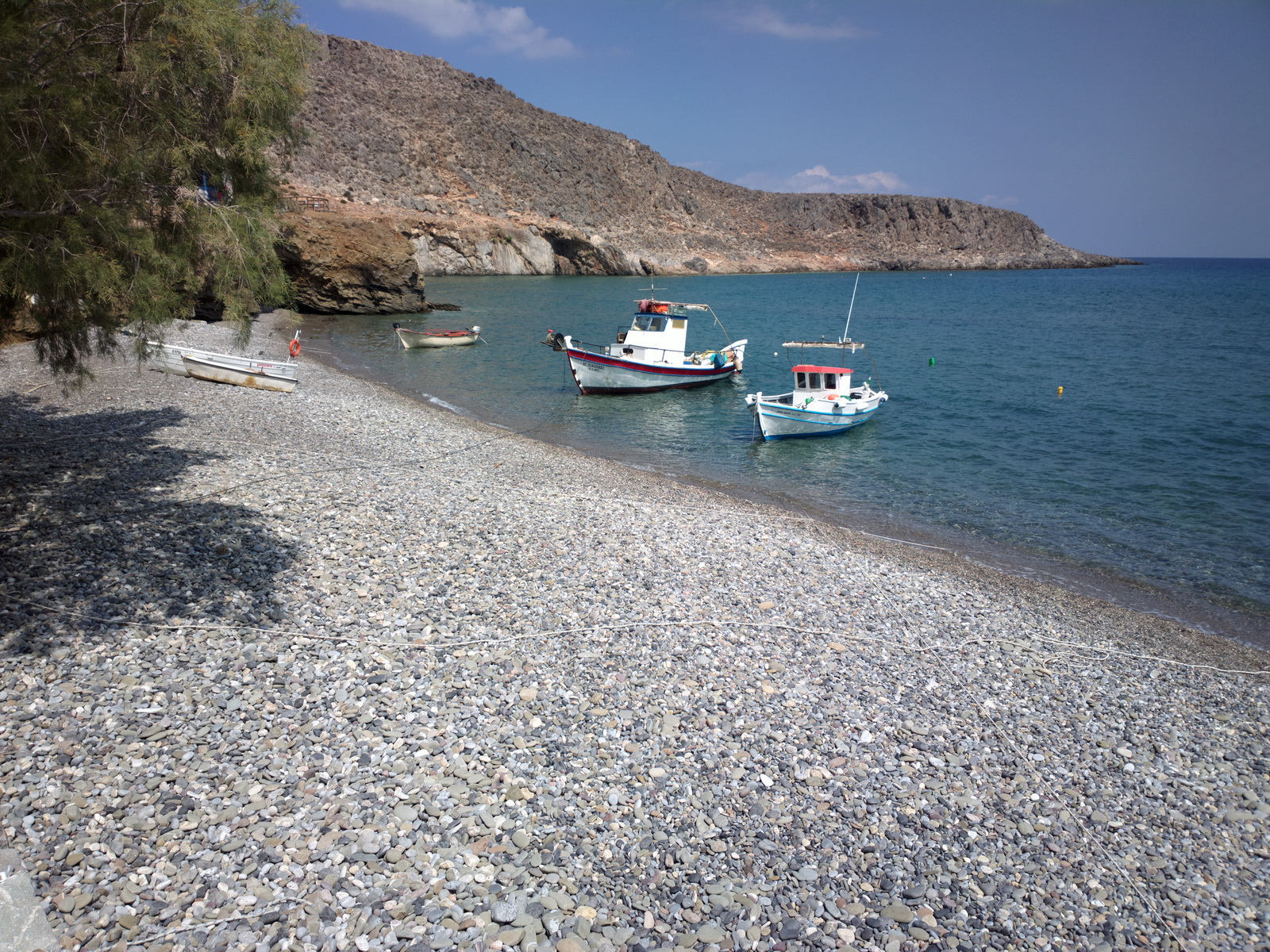
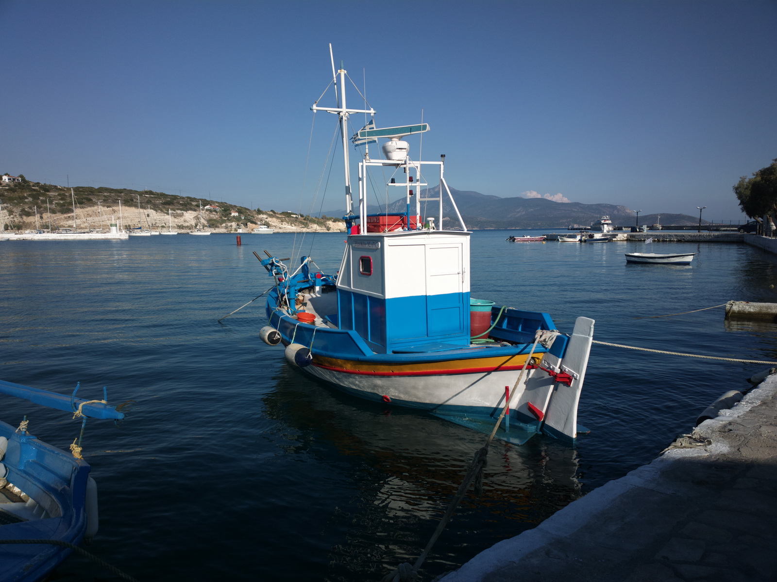
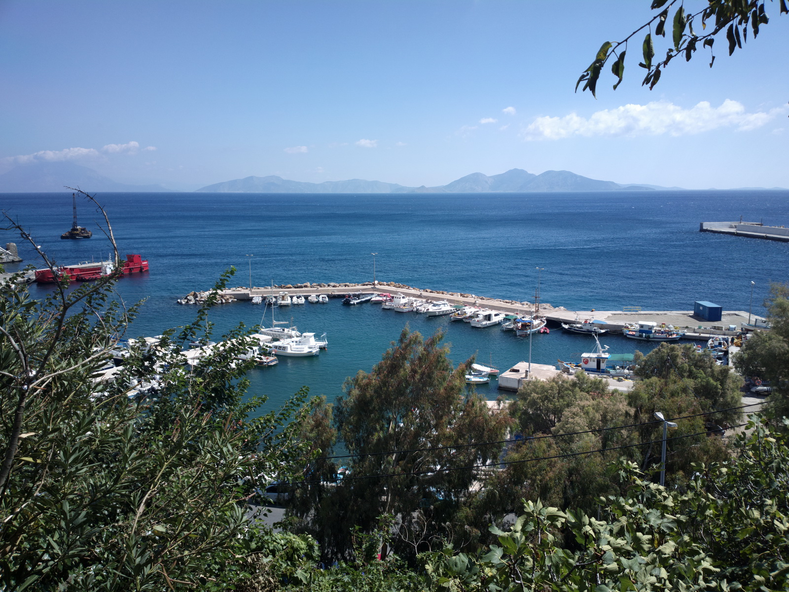
There are boat trips everywhere imaginable
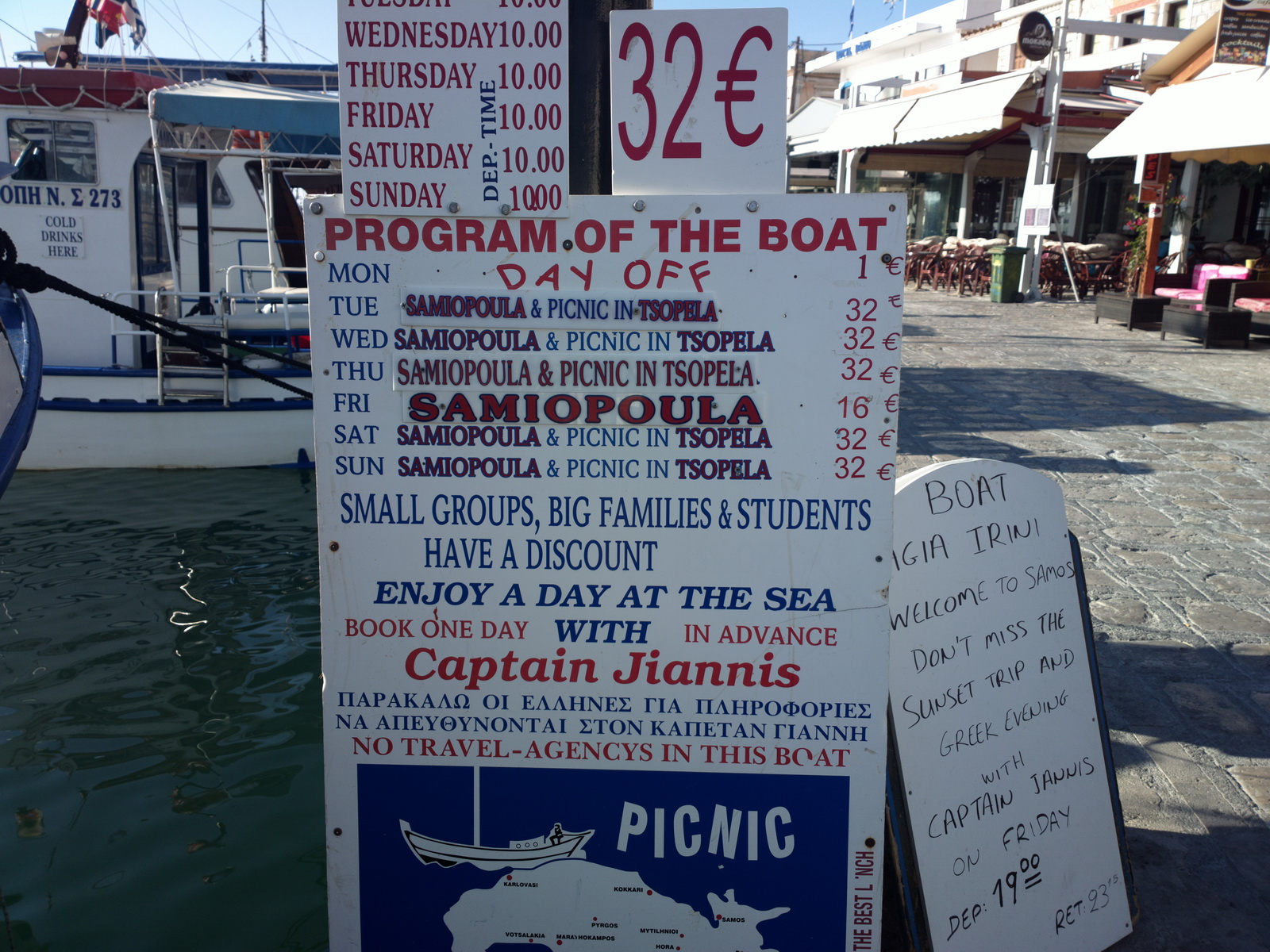
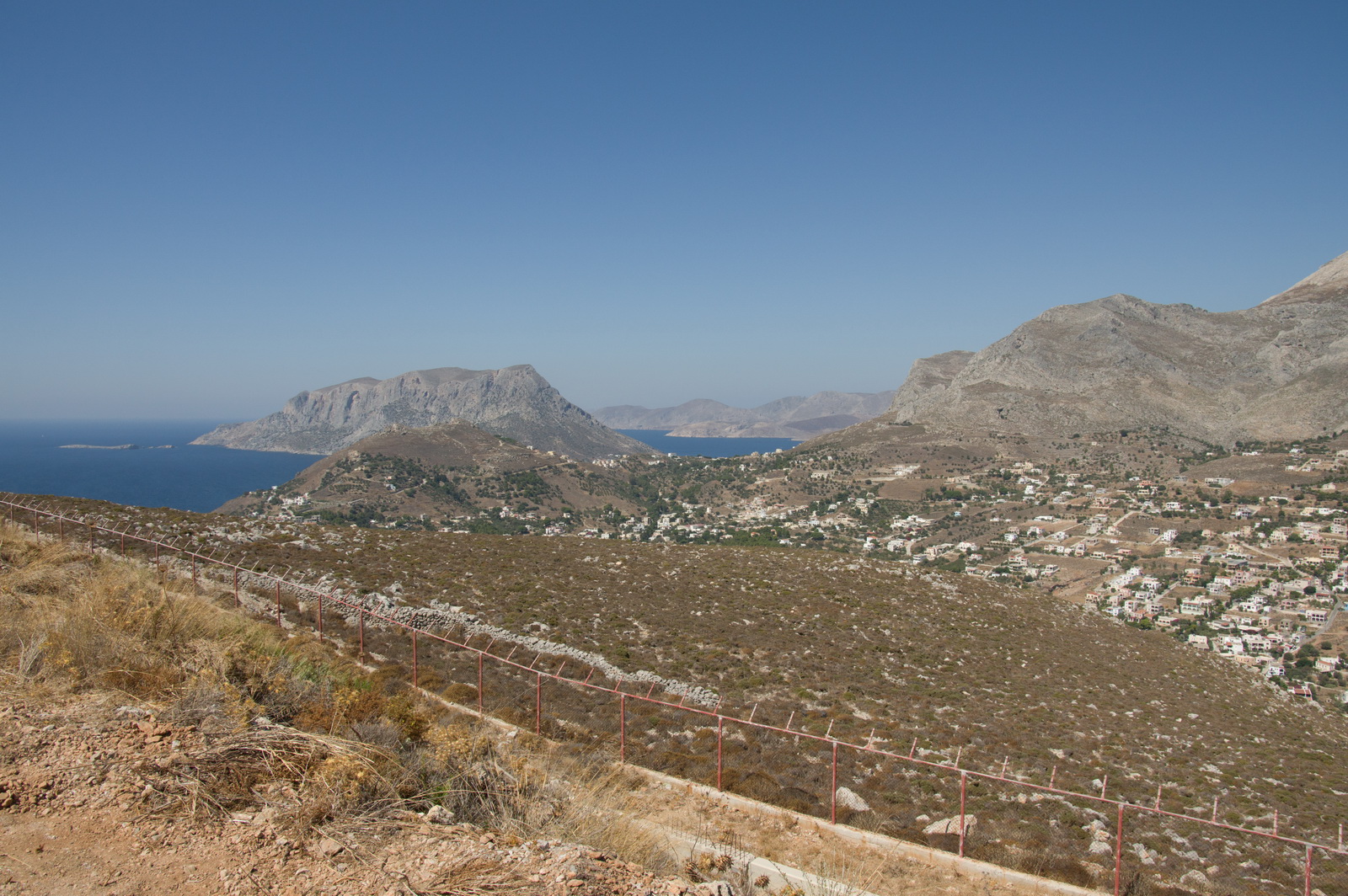
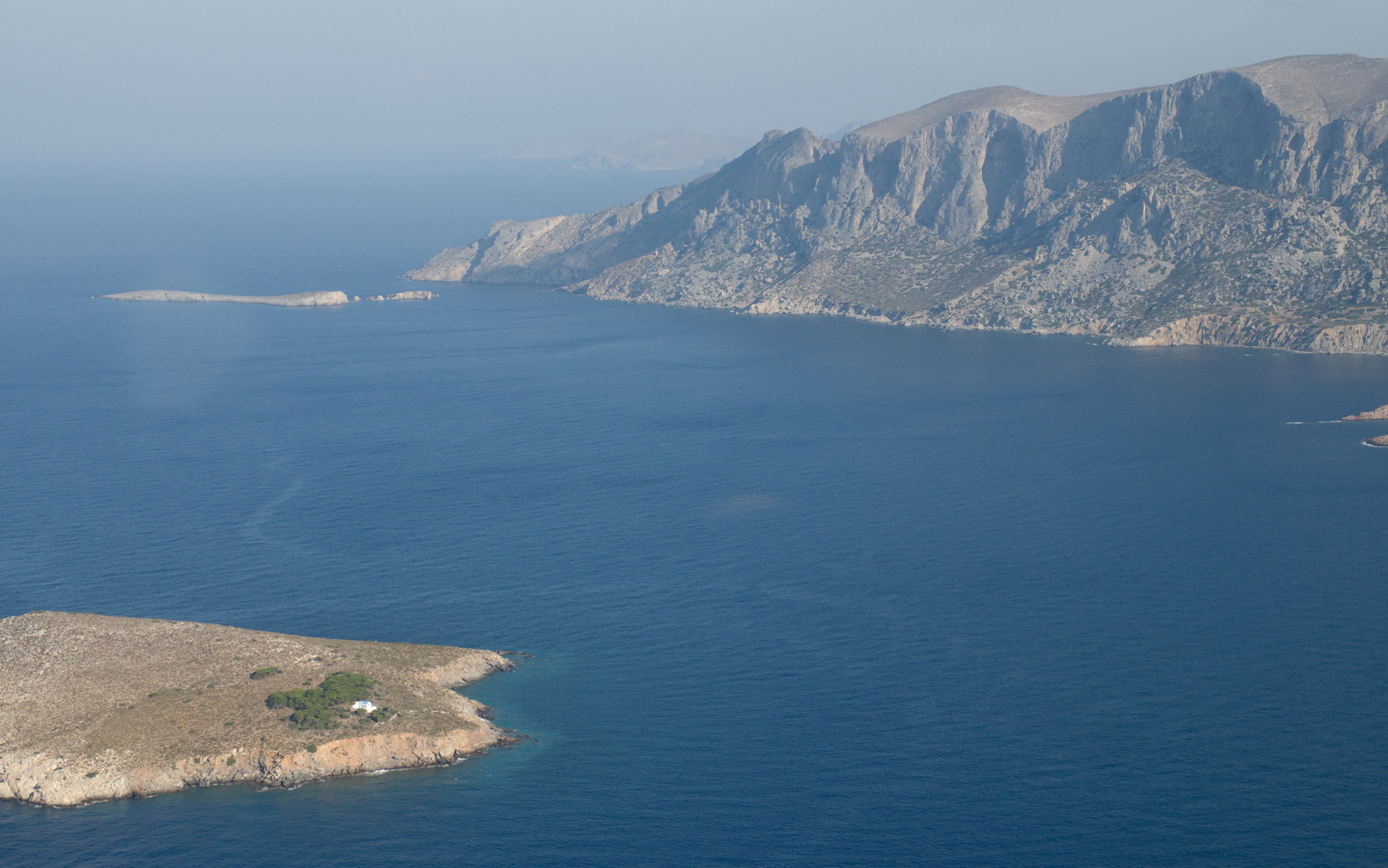
Samos to Kalymnos
The route was filed VFR, as a DCT
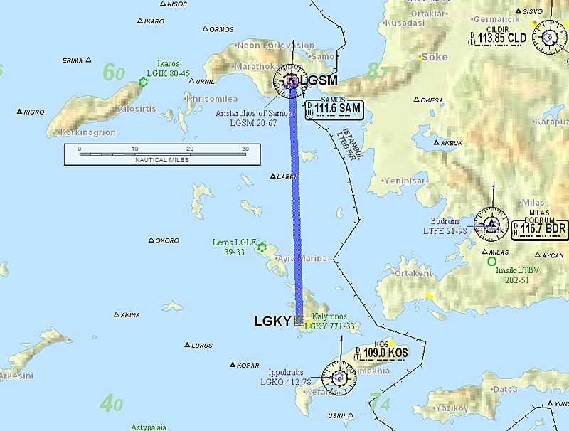
Alternate: Samos LGSM
Weather data: MSLP 1200. The IR image was clear.The TAFs and METARs were good. There is no weather data for Kalymnos.
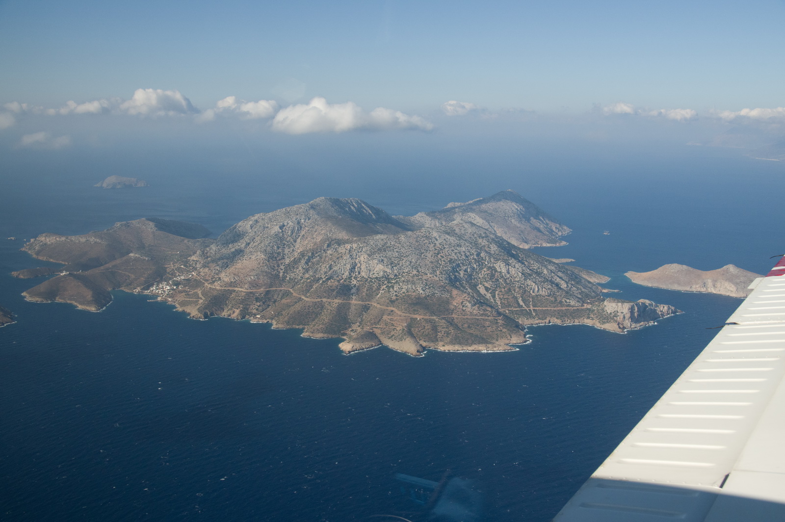
The whole route was flown at 5500ft. The flight passed numerous islands, mostly uninhabited
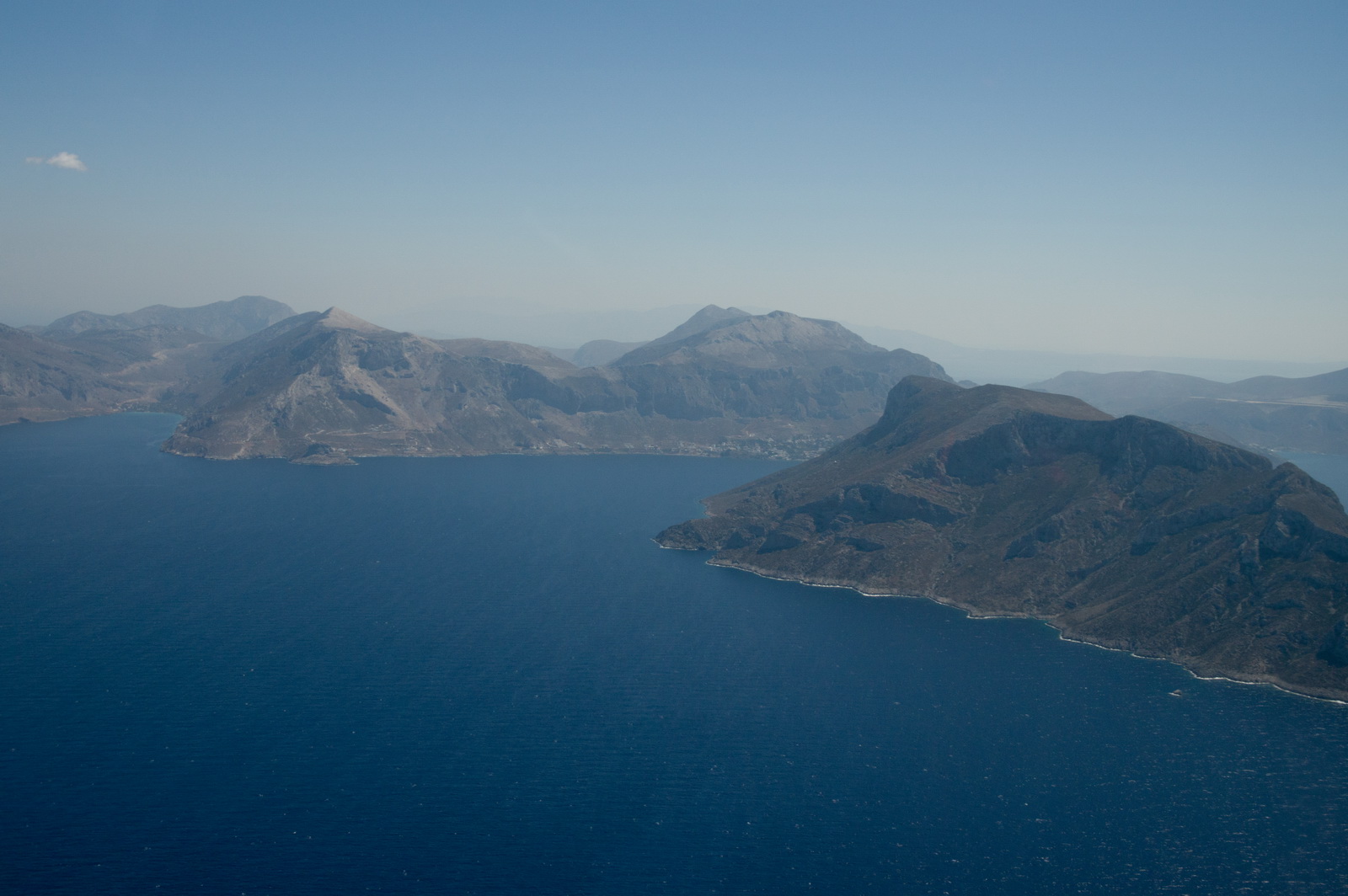
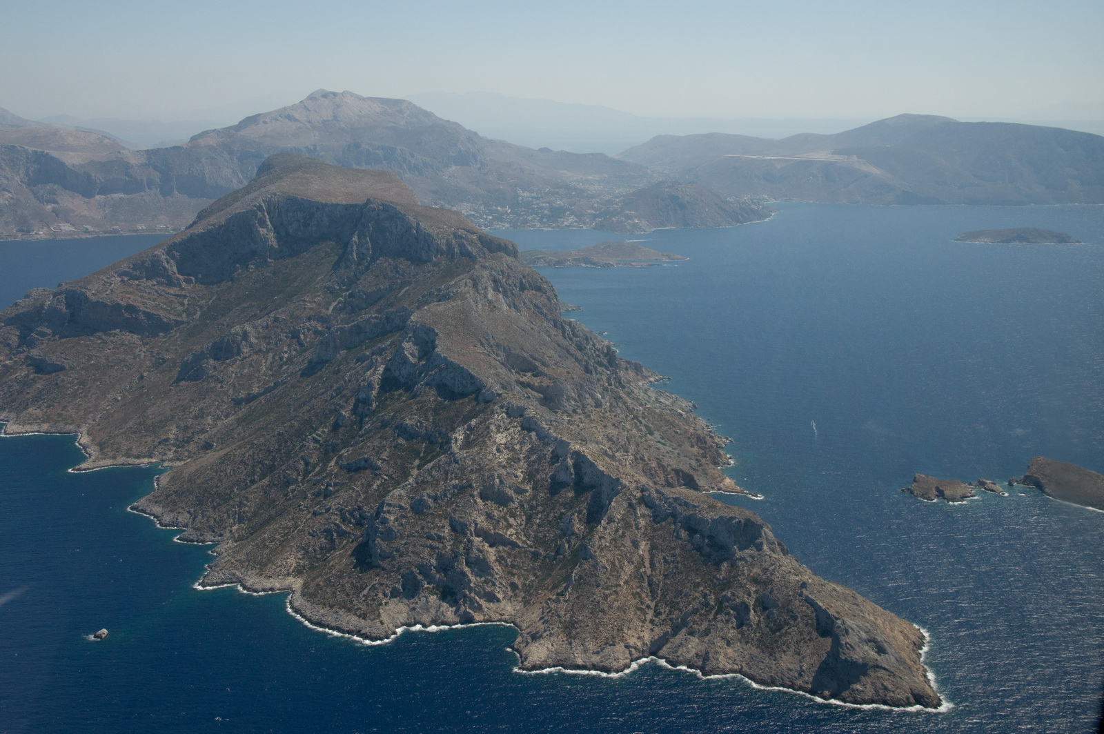
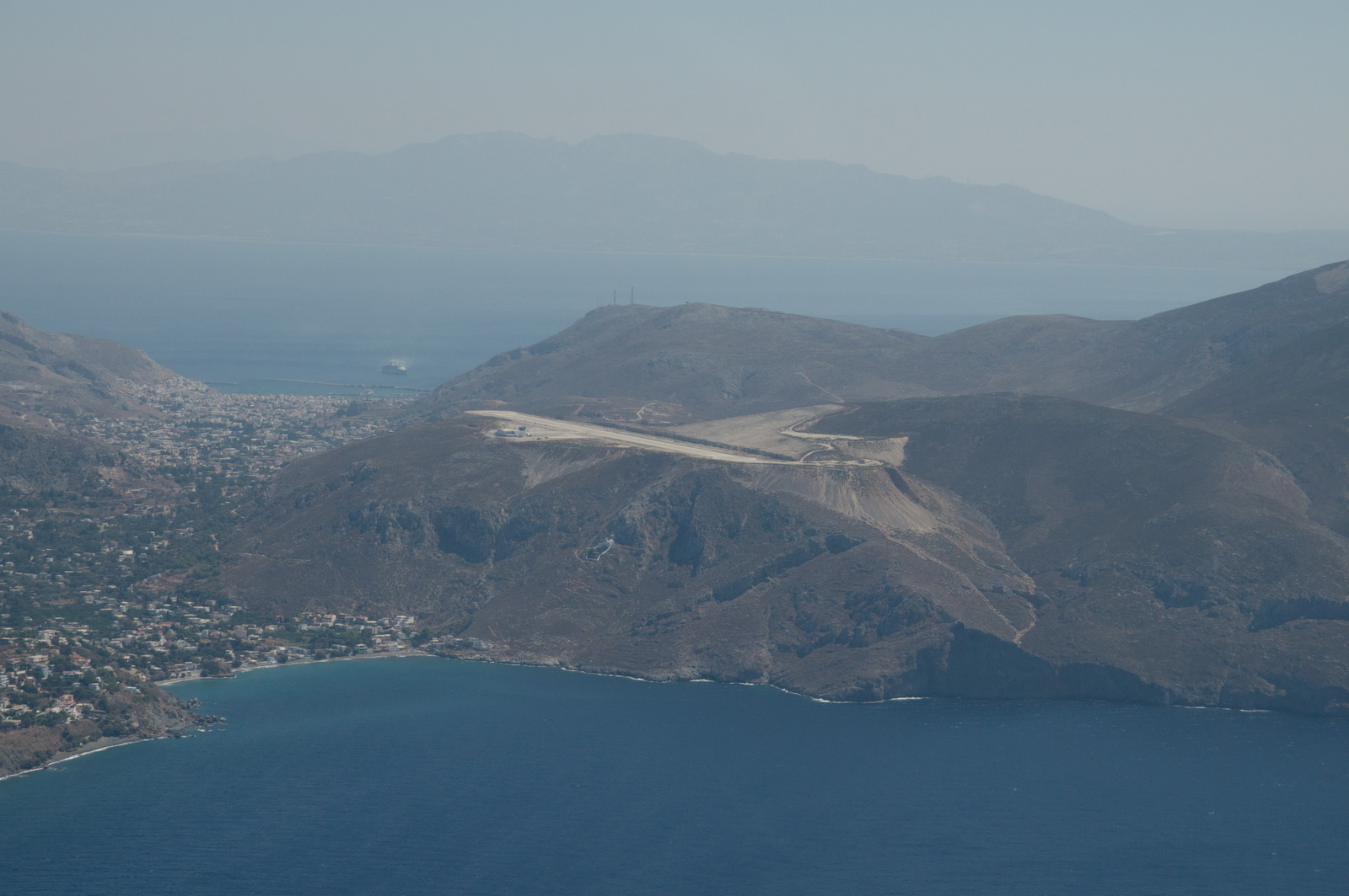
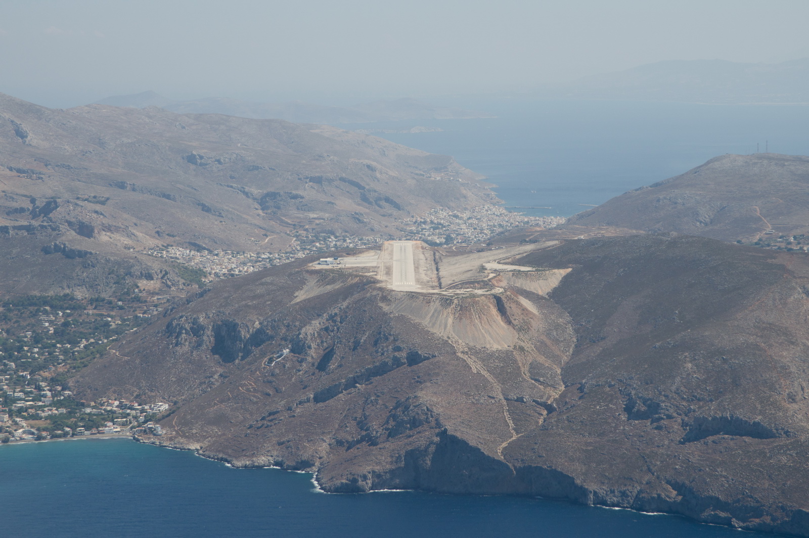
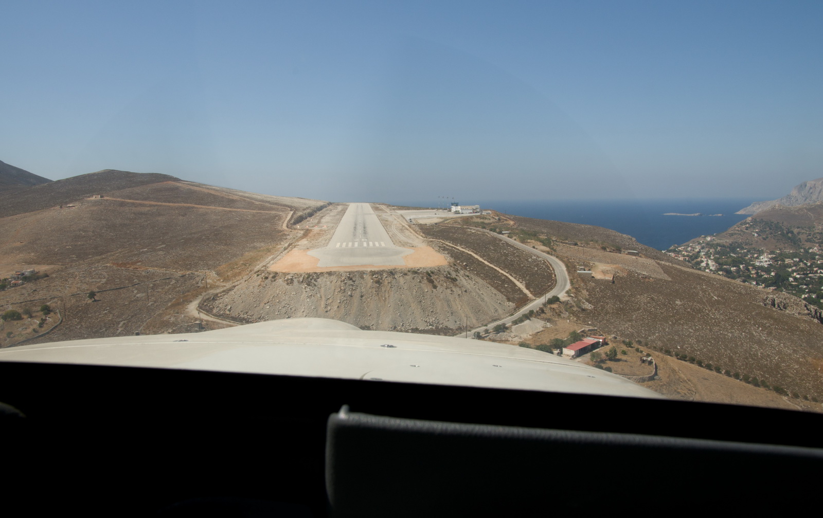
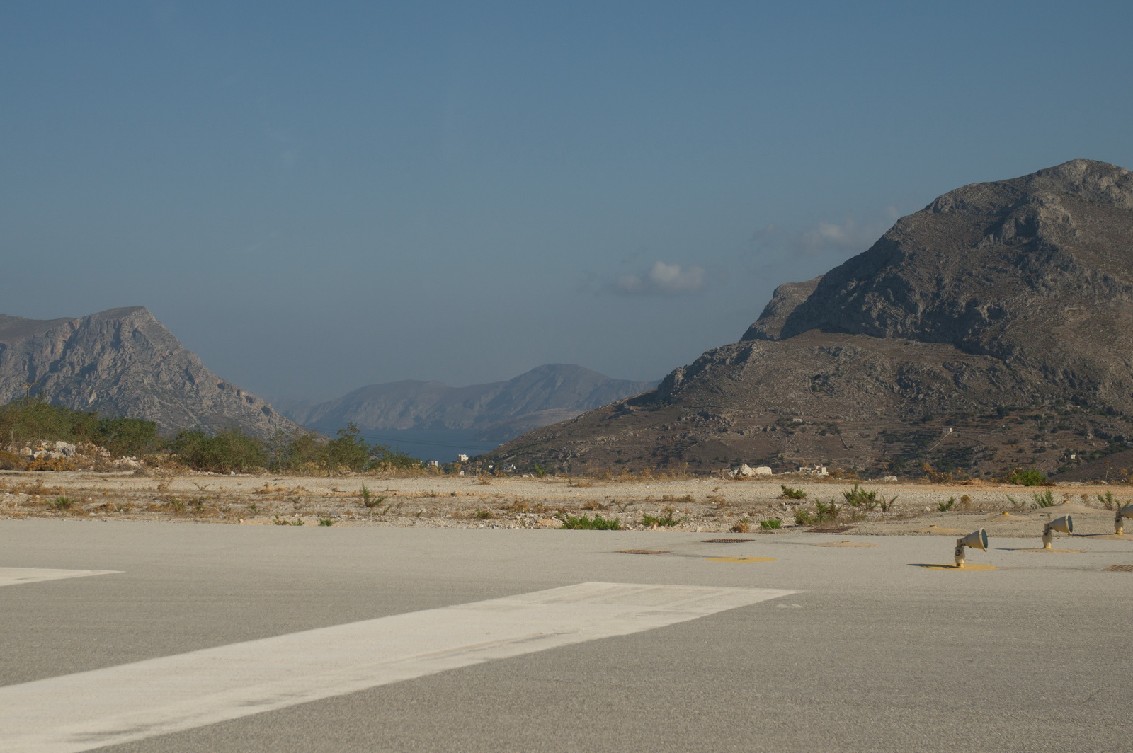
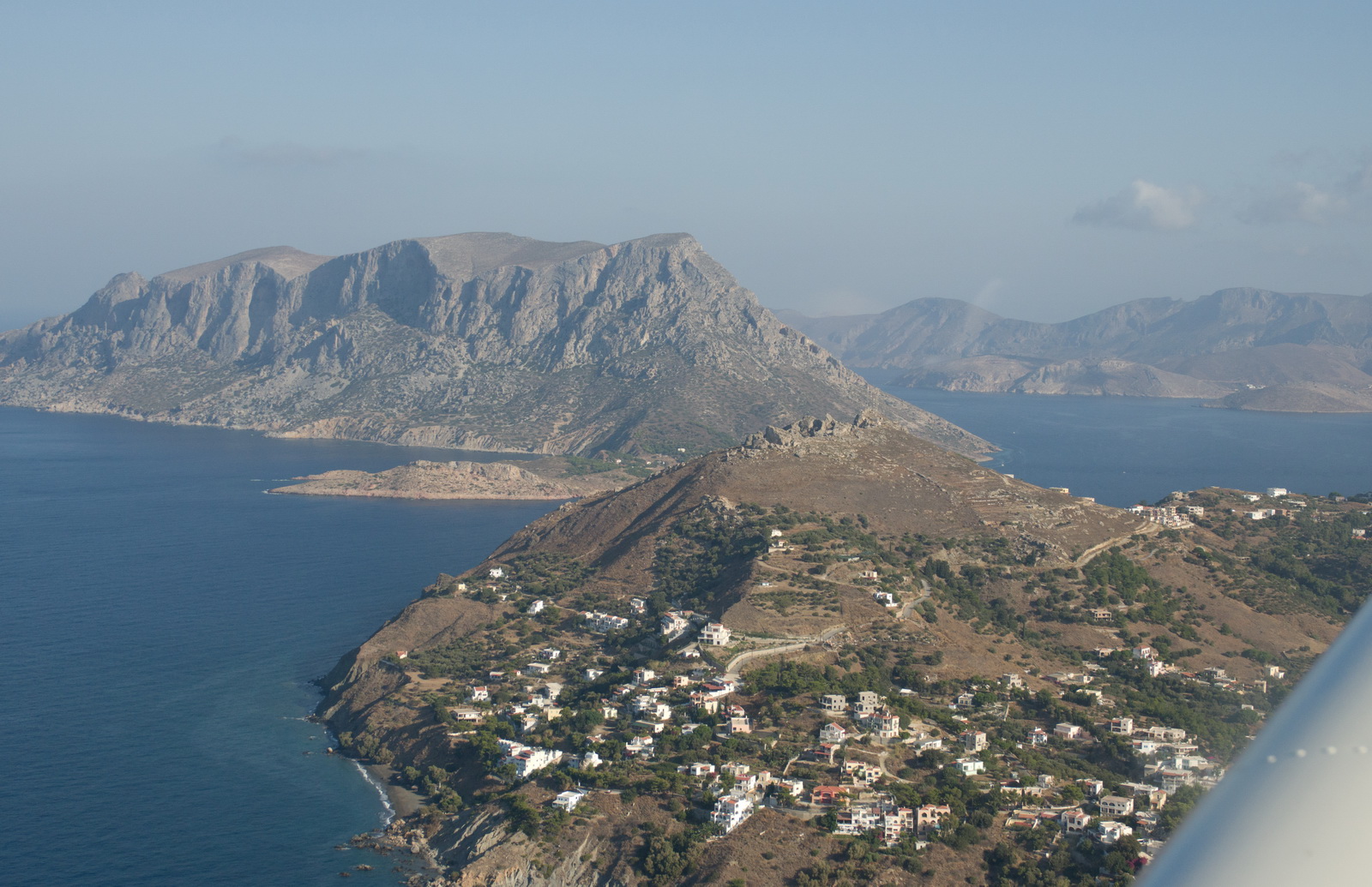
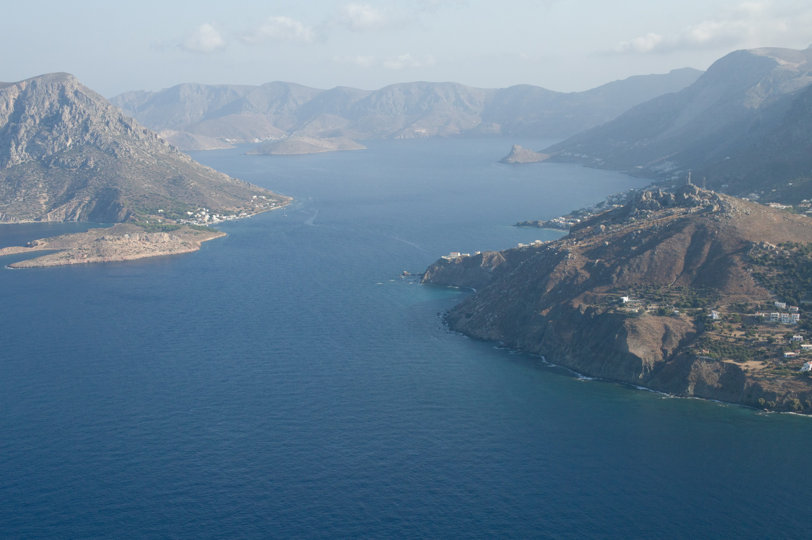
This is a good view of Kalymnos airport. It looks like they chopped off the top of a mountain, spread it out a bit, and built the runway on top
This would be the approach from the end opposite to the one in use
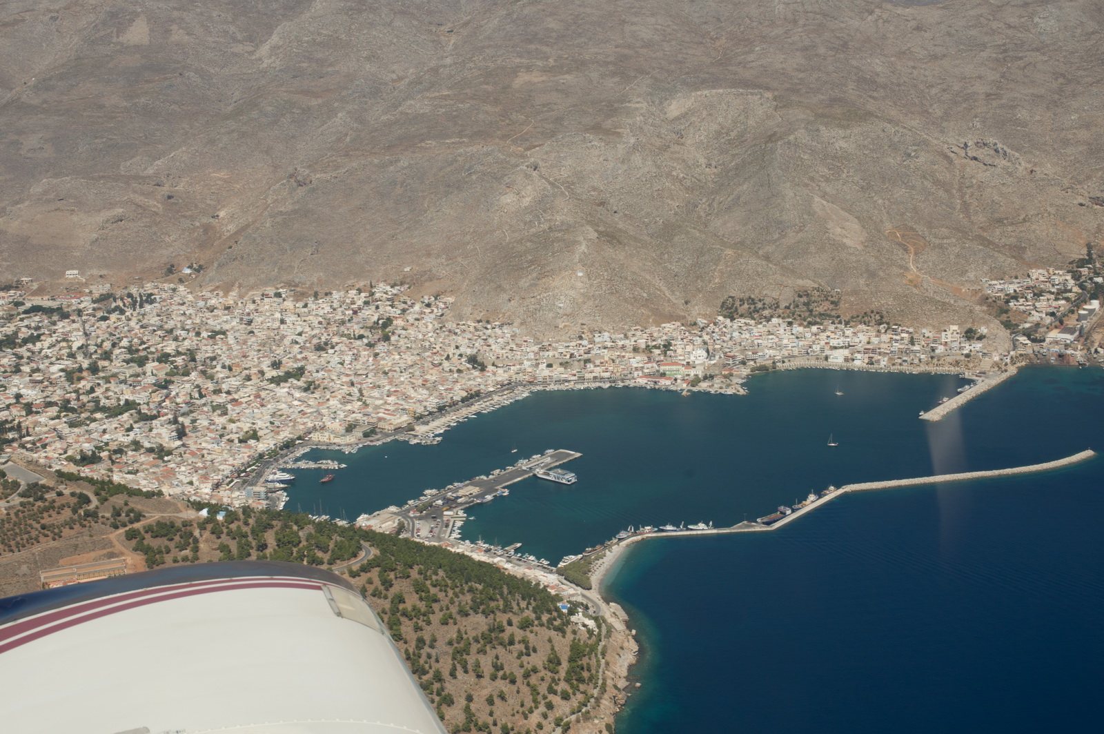
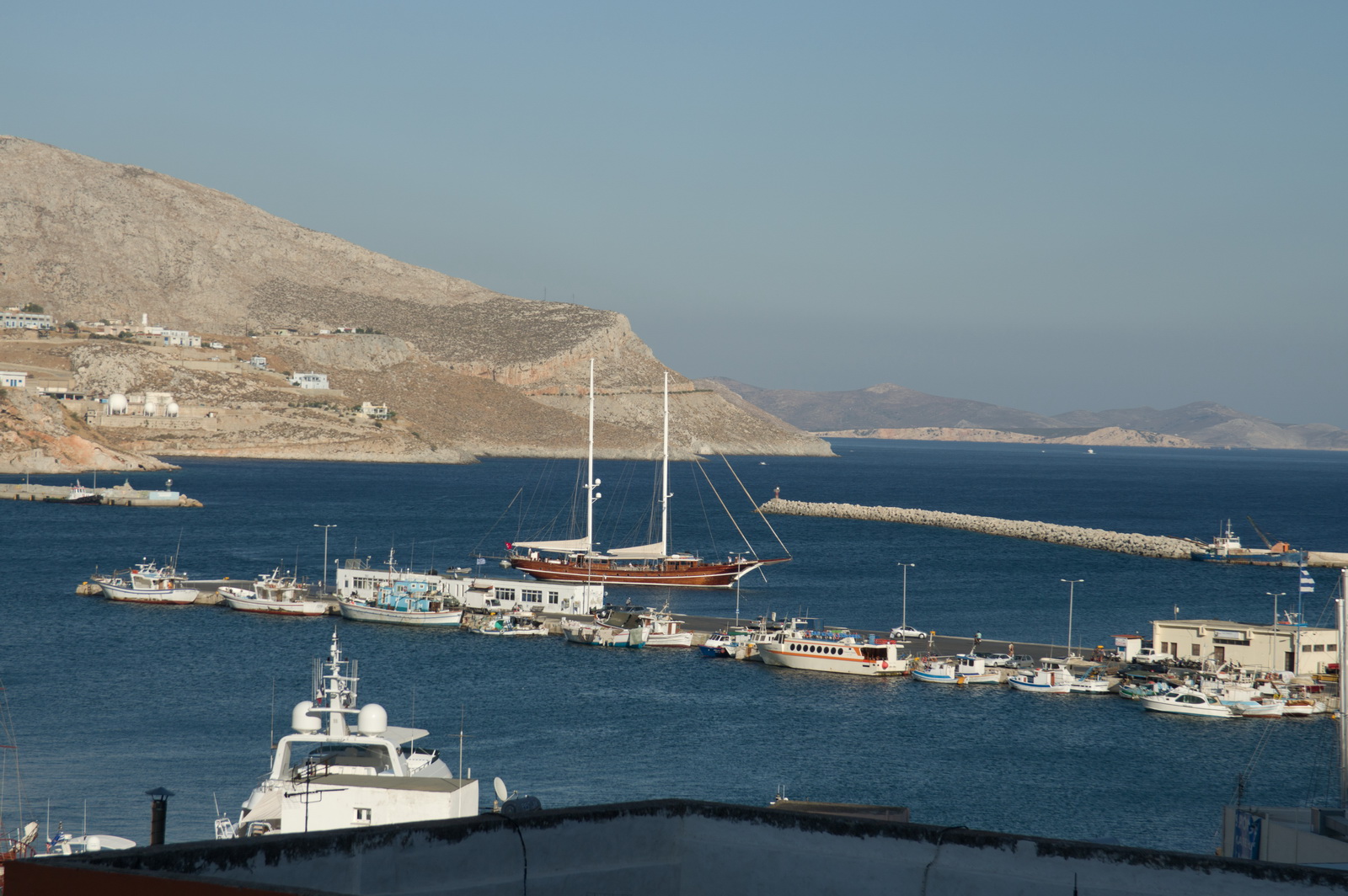
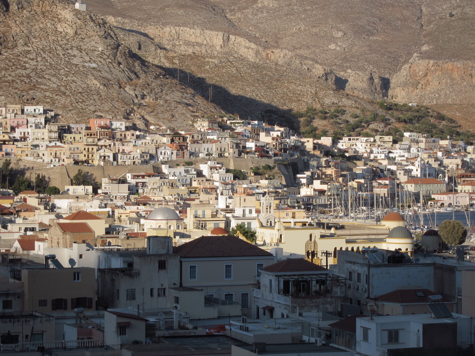
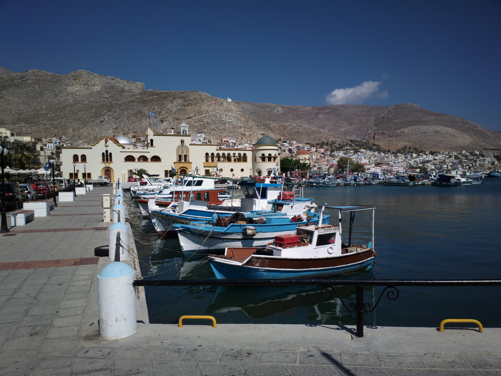
The town of Kalimnos
Final approach to Kalymnos LGKY
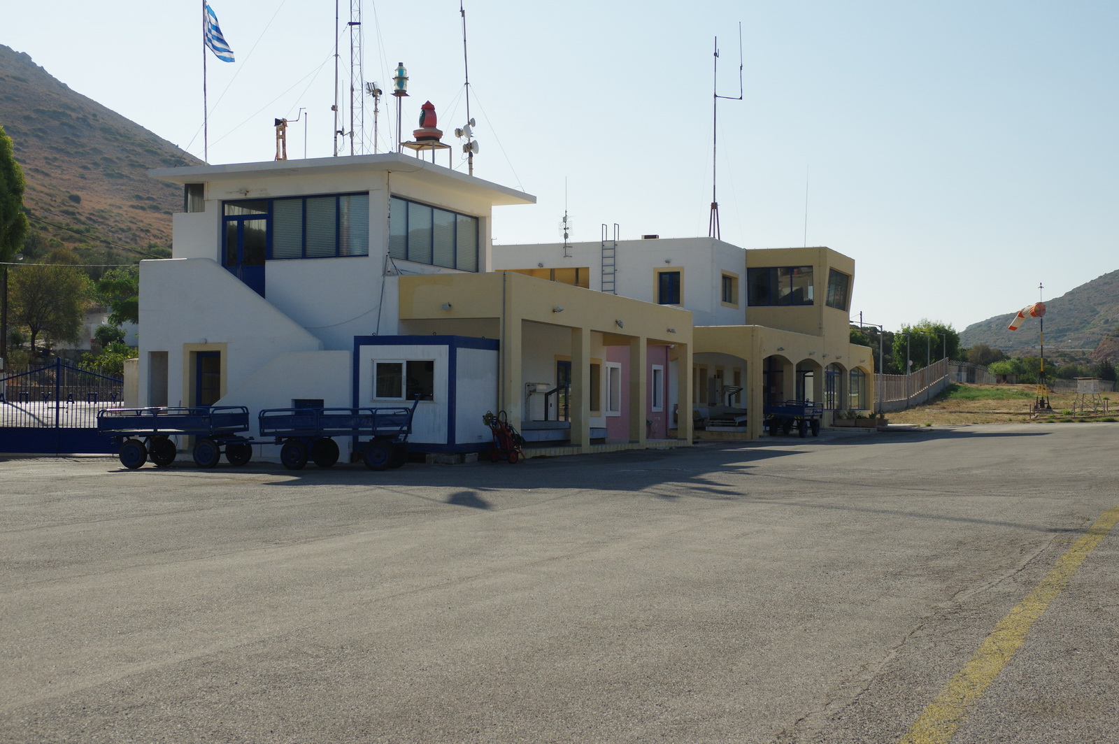
It's a small place
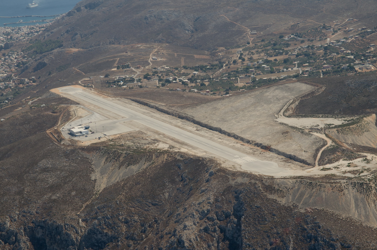
but like all Greek airports has the mandatory CAA office. The apron is big
enough for a major GA fly-in ![]() In fact the Greeks did have a fly-in
in 2006, when it was built, which explains why everything looked new.
In fact the Greeks did have a fly-in
in 2006, when it was built, which explains why everything looked new.
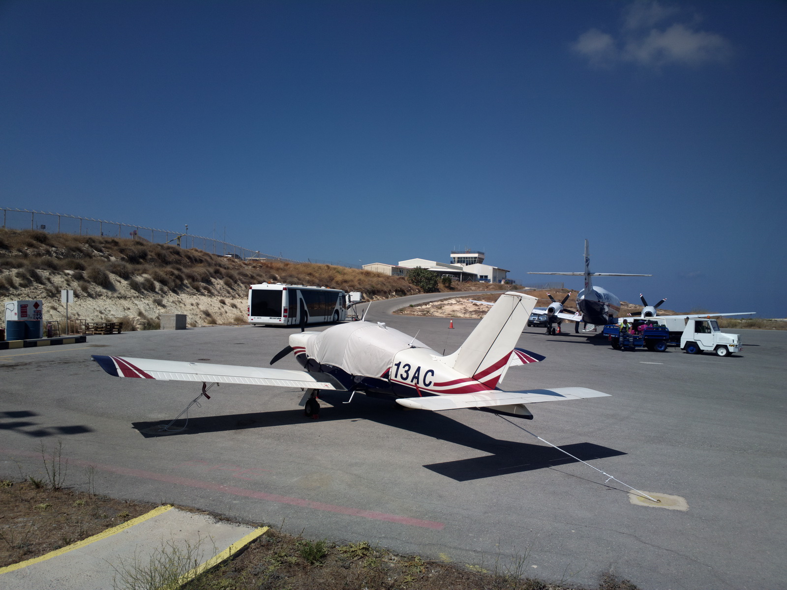
The obligatory twin turboprop arrived at the same time - clearly because we landed in the middle of the narrow time slot whose main purpose is for these commuter flights
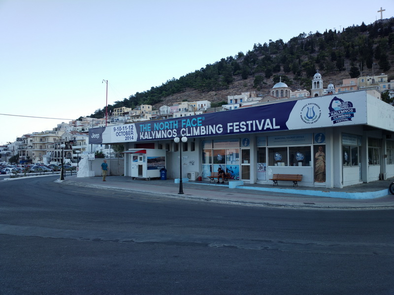
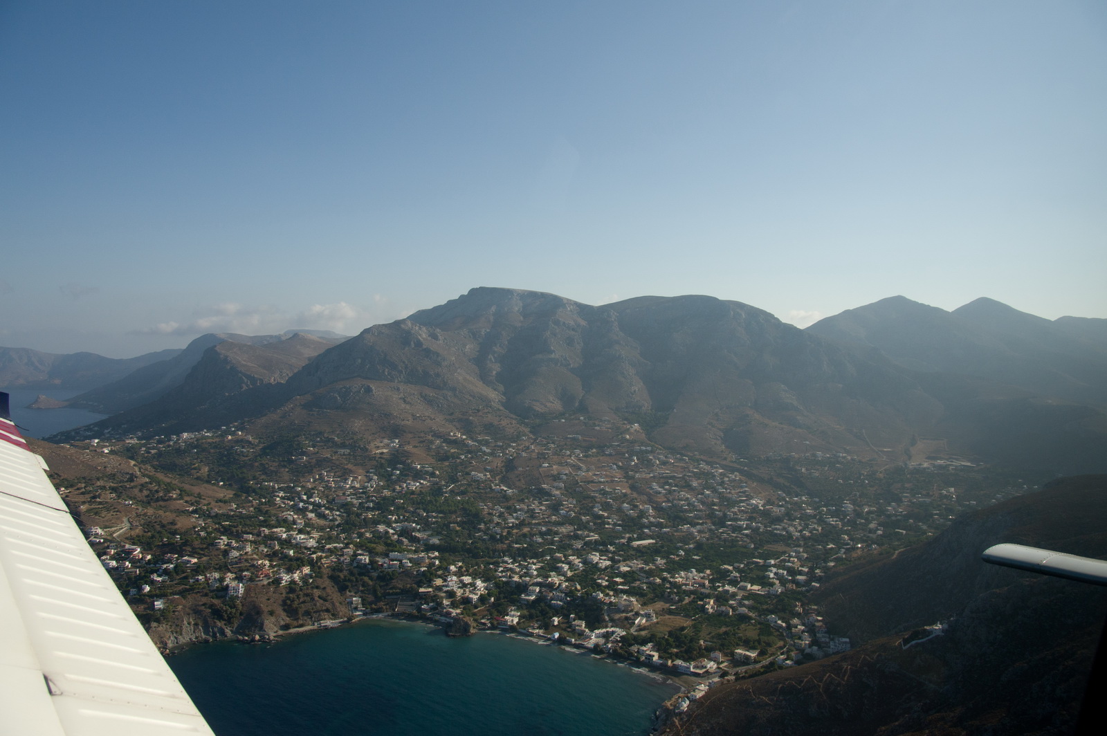
Kalymnos is relatively barren
Unsurprisingly, Kalymnos is well known for rock climbing
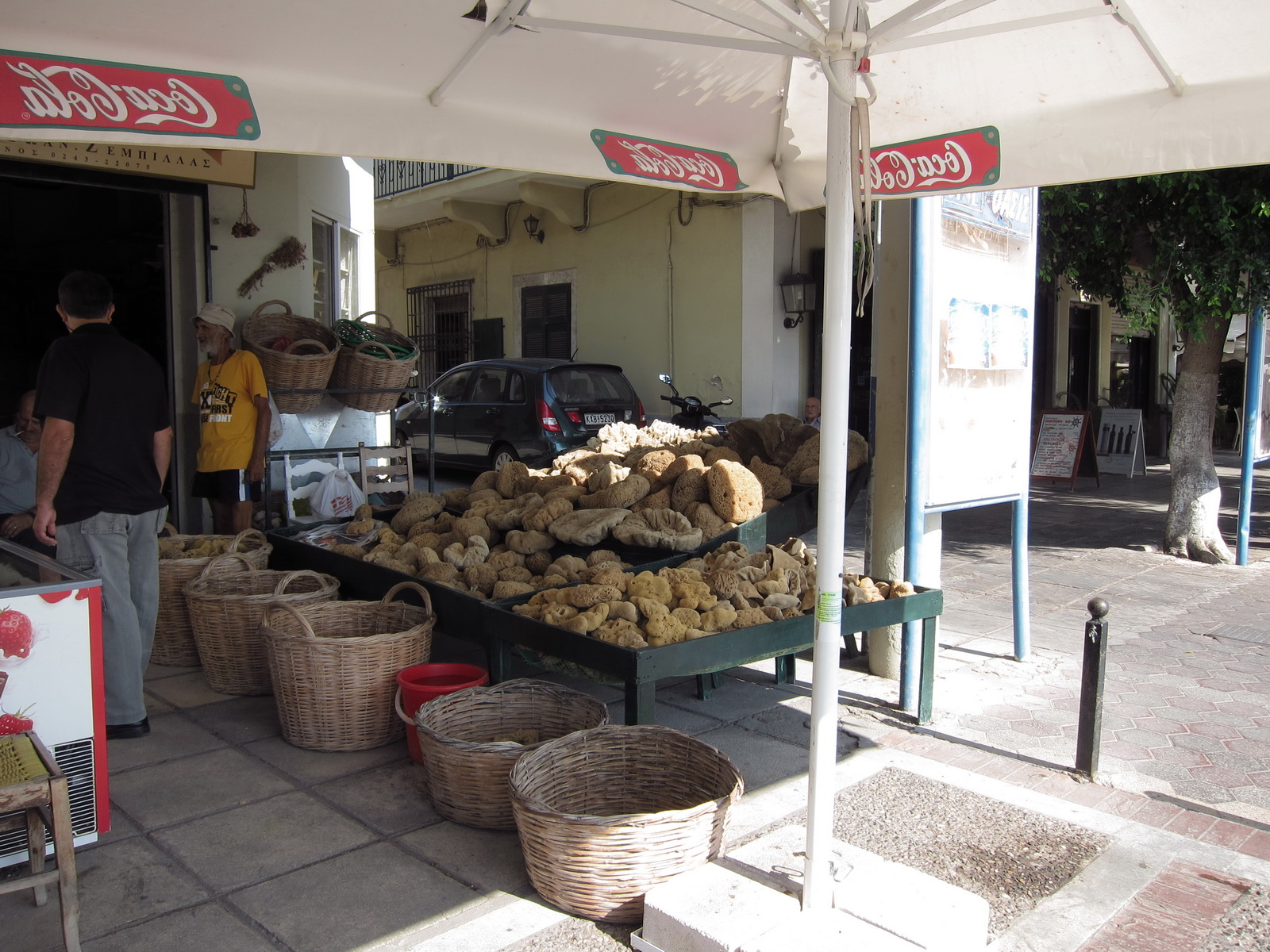
It is also known for its sponge industry
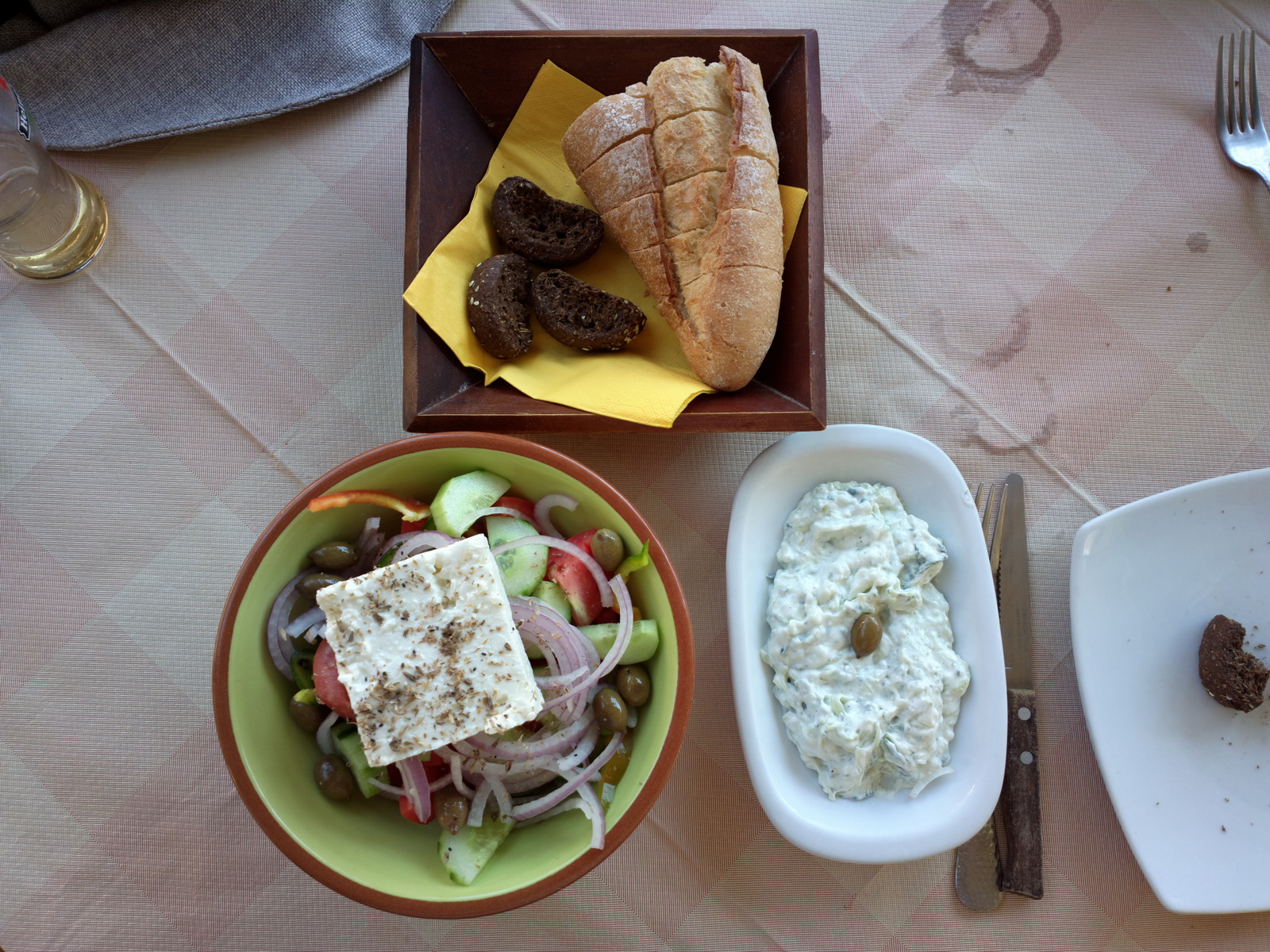
Food is excellent
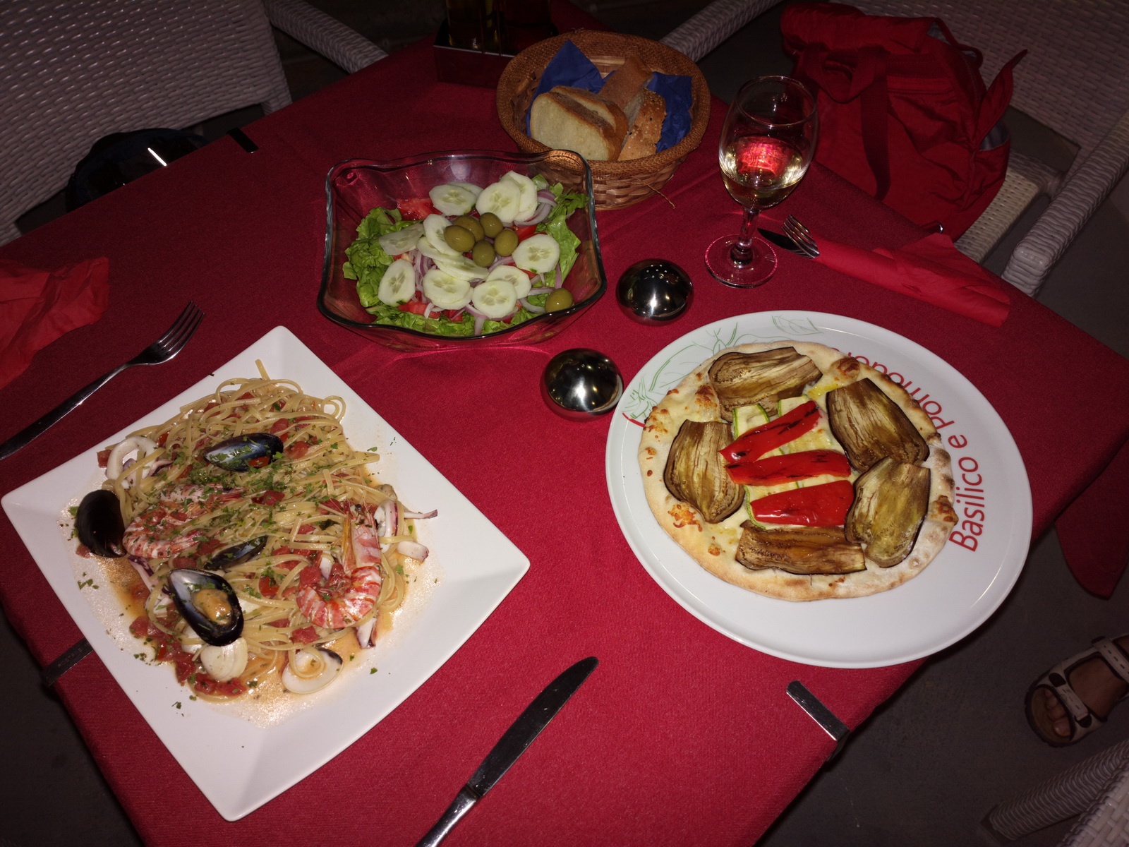
Justine and I had an excellent Italian dinner for our 11th anniversary
Highlights from Justine:
KALYMNOS/POTHIA
The archaeological museum is supposed to be well worth a visit, with some great sculptures and relics going back to neolithic times. Check opening times before setting out (we didn't and it was closed - the first of several museum disappointments on this trip). You need to follow the road signs to get there - it's located in the suburbs of Pothia, and a bit tricky to find.
The folklore museum in Pothia's main square has friendly, knowledgeable staff who will explain all about life on the island, and a great collection of local traditional costumes.
Sponge-fishing was the lifeblood of Kalymnos for hundreds of years, with divers travelling throughout the Mediterranean on journeys that took them away from home for 6 or 7 months at a time. Now that plastics have taken over in the bathroom, warehouses containing thousands of sponges can be found all over Pothia. Apparently if harvested correctly these amazing animals can regrow, and they are now being investigated for their medicinal properties - so maybe Kalymnos will find a new way to benefit from their ancient industry again one day.
Dramatic volcanic terrain makes Kalymnos a stunning location for hiking and diving, and there's a major rock climbing festival every October.
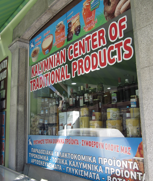
Kalymnos is famous for potent herbs and fantastic natural produce. A good place to buy is the Kalymnian Center of Traditional Products in Pothia. The owner is extremely knowledgeable and will tell you all about the various culinary and medicinal uses of local products. He stocks top-quality herbs, fruit, nuts, honeys and oils from all over Greece as well as all those of Kalymnos.
A chance conversation at the airport after arrival revealed that the notamed opening times for Kalymnos are incorrect. The Tuesday 0830-1200 slot is in fact gone now. This is really serious because everybody in Greece relies on the notams for airport opening times. Luckily it didn't affect us because we were planning to use the earlier slot that day.
Departure from Kalymnos:
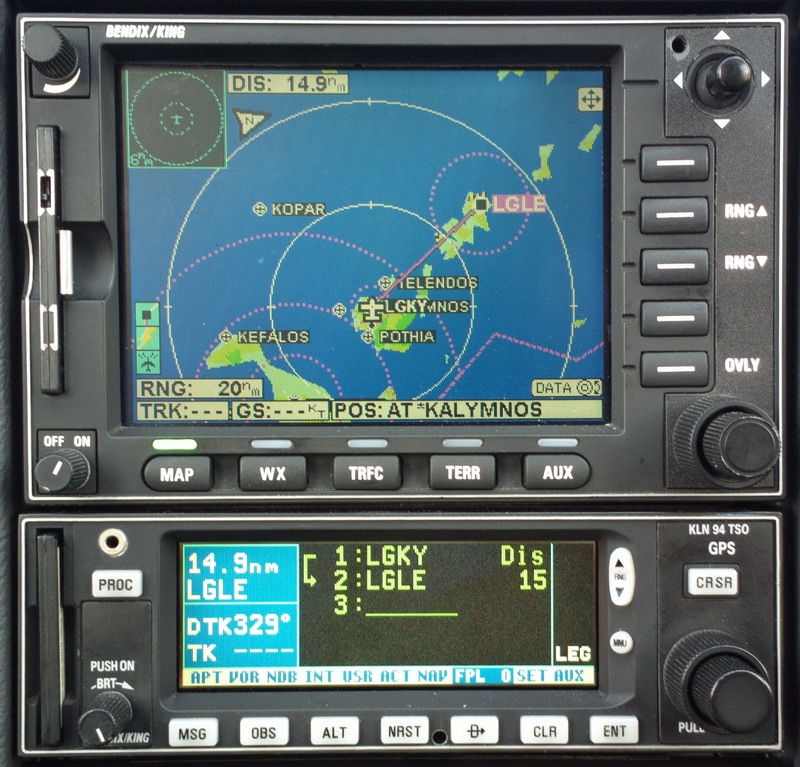
Kalymnos to Leros
The route was filed VFR, as a DCT
Alternate: Samos LGSM
Weather data: MSLP 0600 1200. The IR image was clear.The TAFs and METARs were good. There is no weather data for Kalymnos or Leros.
The route is trivial by aircraft (15nm) but would be a big time-wasting job by boat
The runway at Leros
LH downwind
Final aproach to Leros LGLE
With a large insect spattered on the windscreen
We got the packing to a fine art for these 2-night small island stays, with the main stuff being left in the aircraft so we had just small backpacks
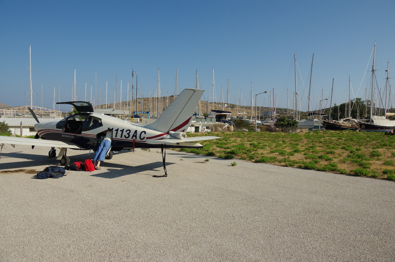
The apron is big... our aircraft is at the far right
It's a sleepy little place where nothing happened quickly - or even on time as we discovered later
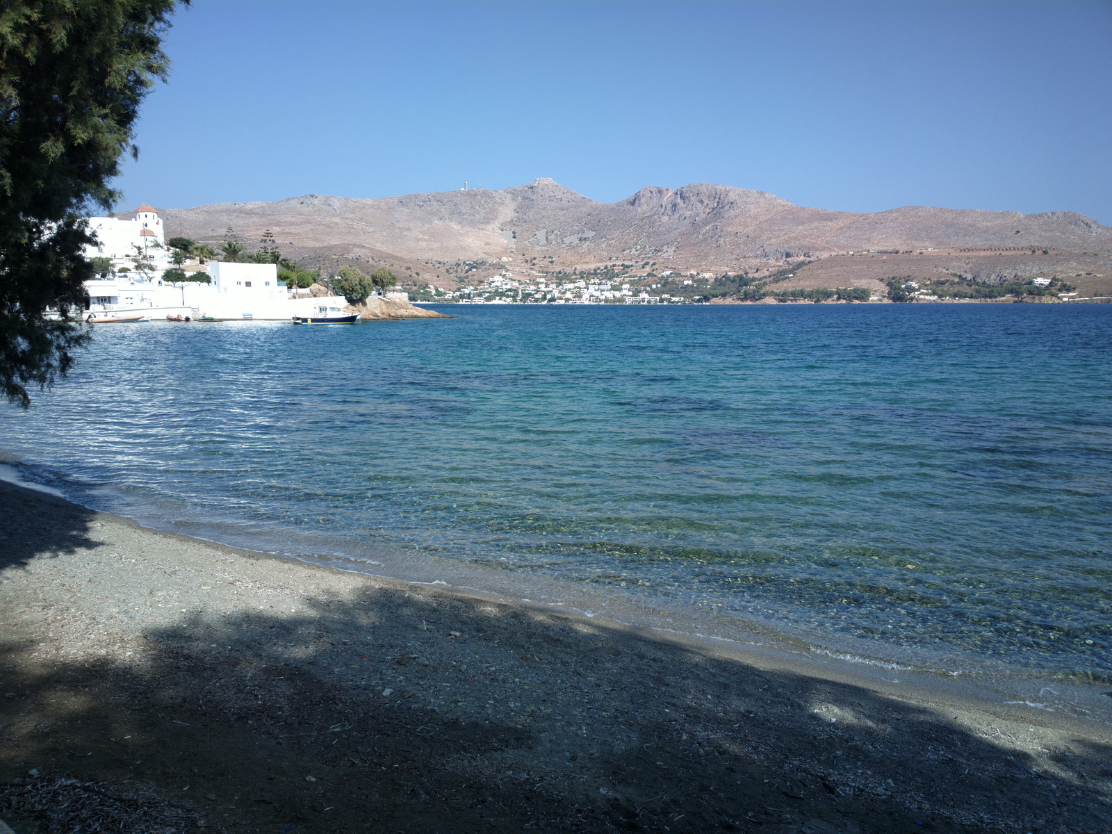
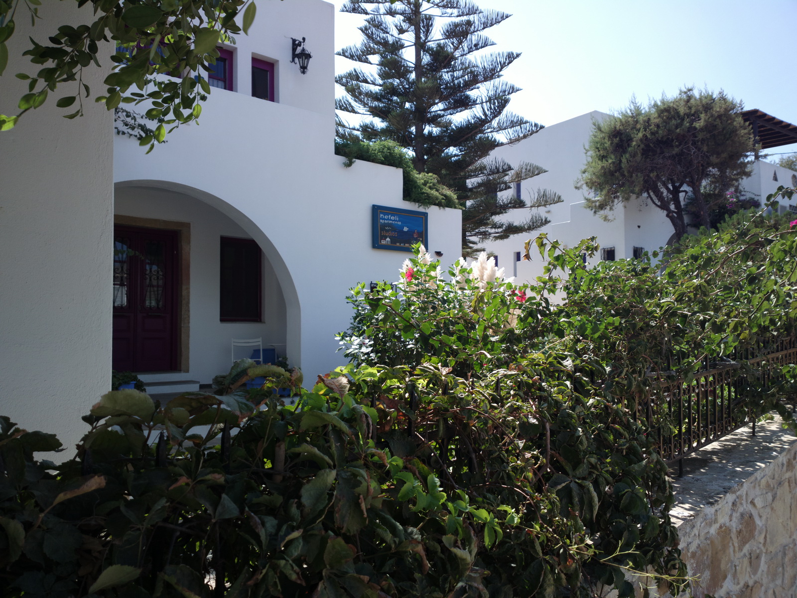
We stayed in a very nice hotel: Nefeli
with a nice beach right outside
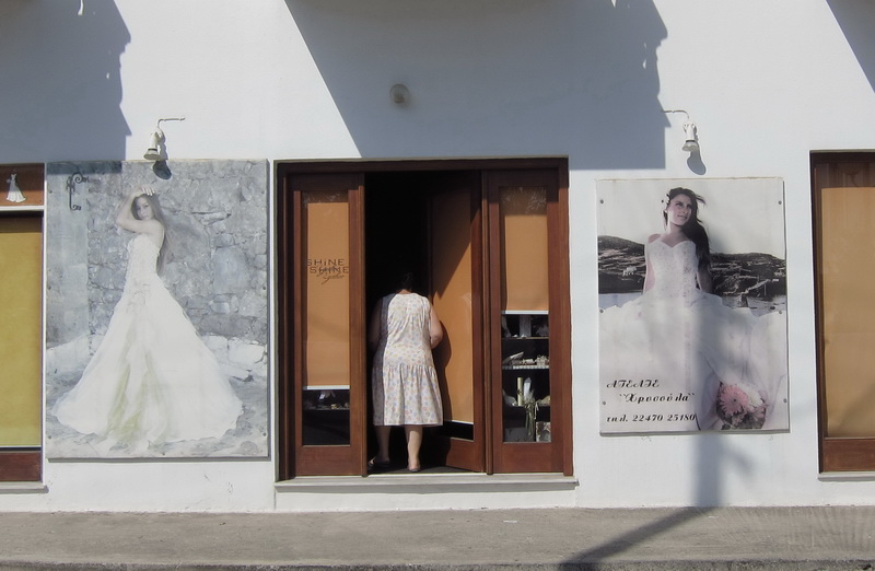
The Greeks like their weddings and even the smallest island has these shops
![]()
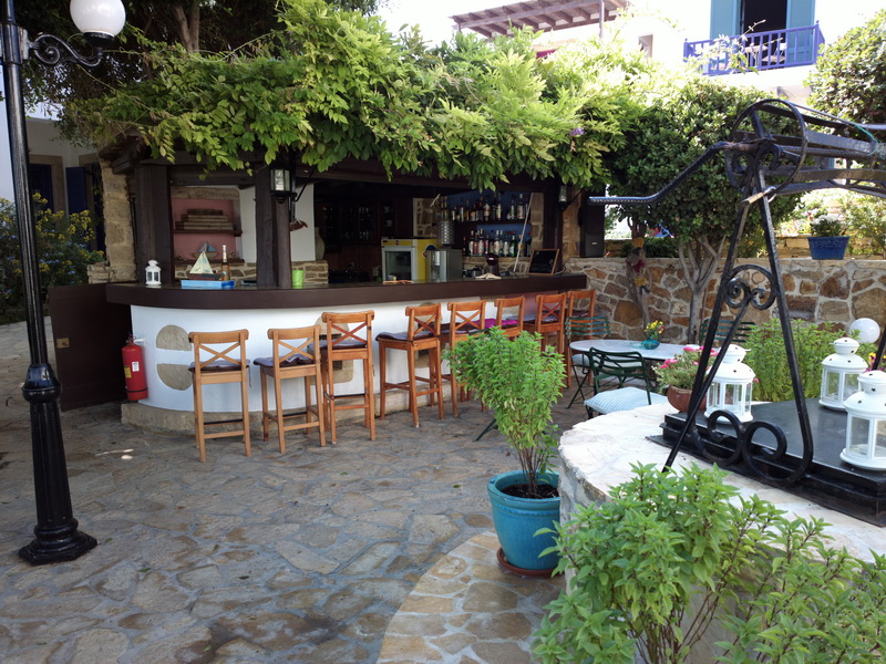
As always, lots of very nice little cafes
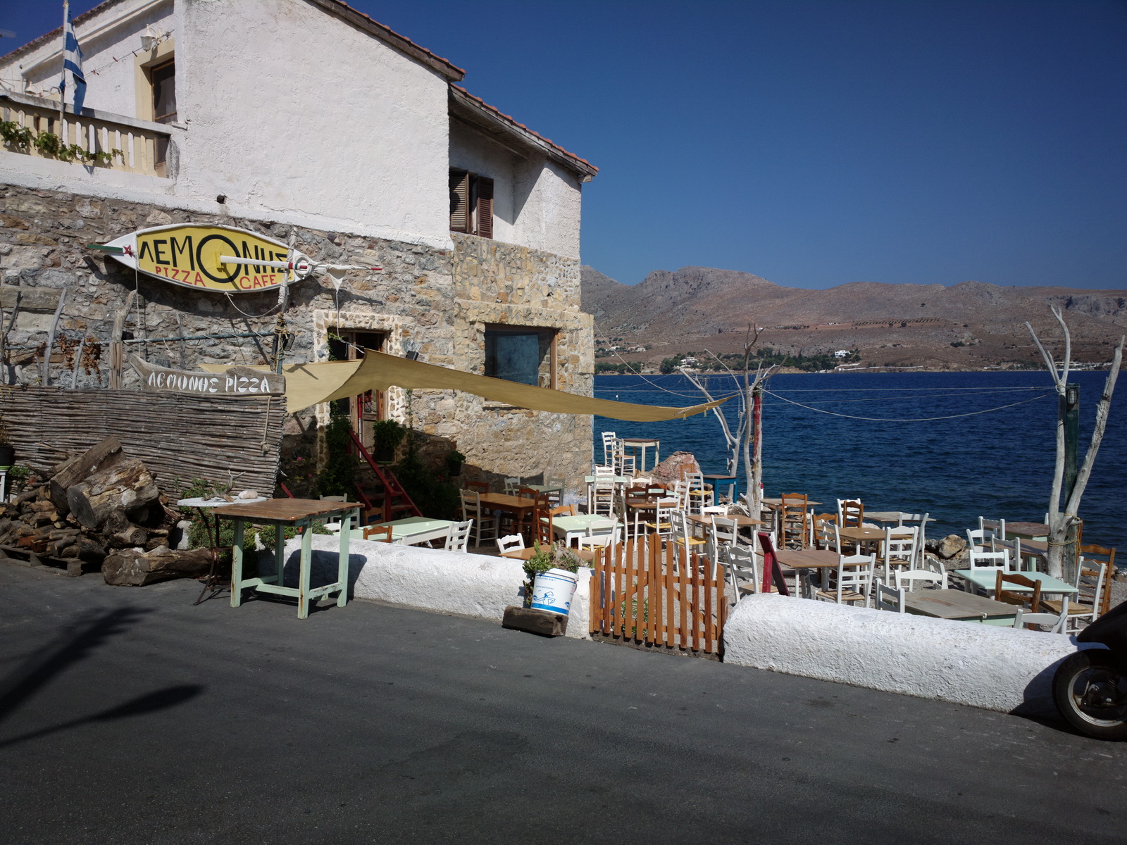
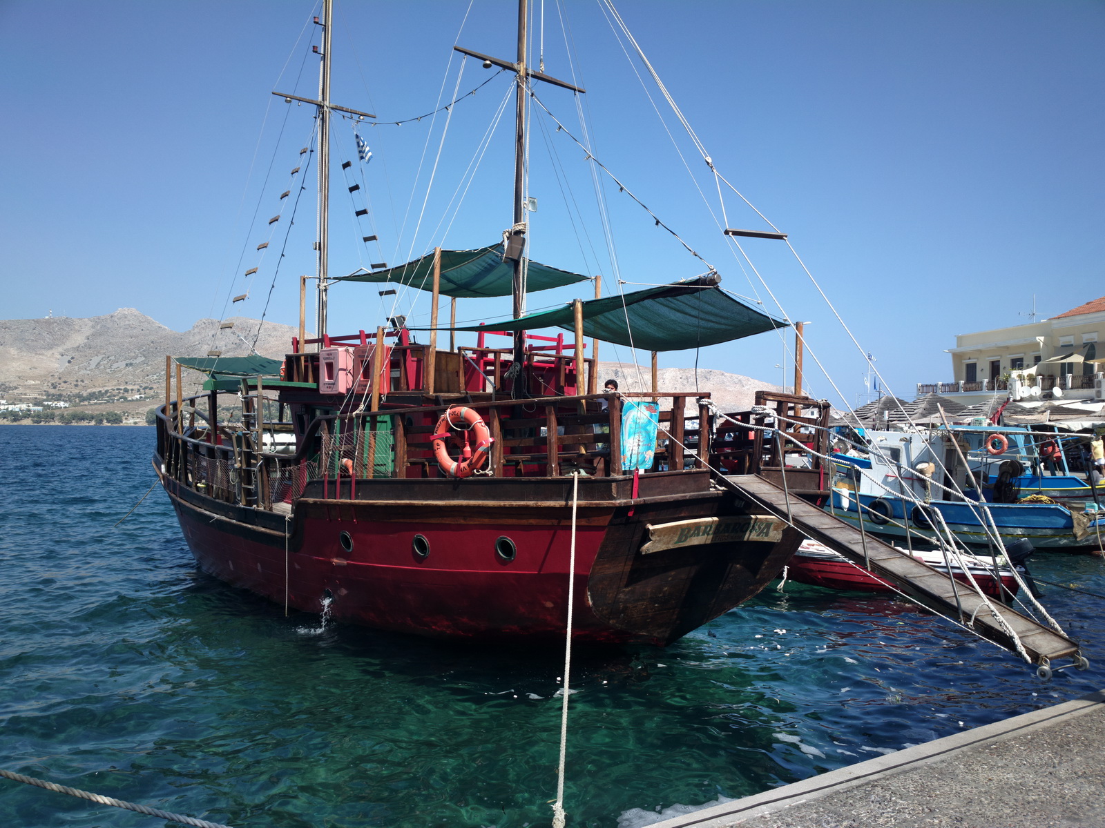
and boat trips to other islands
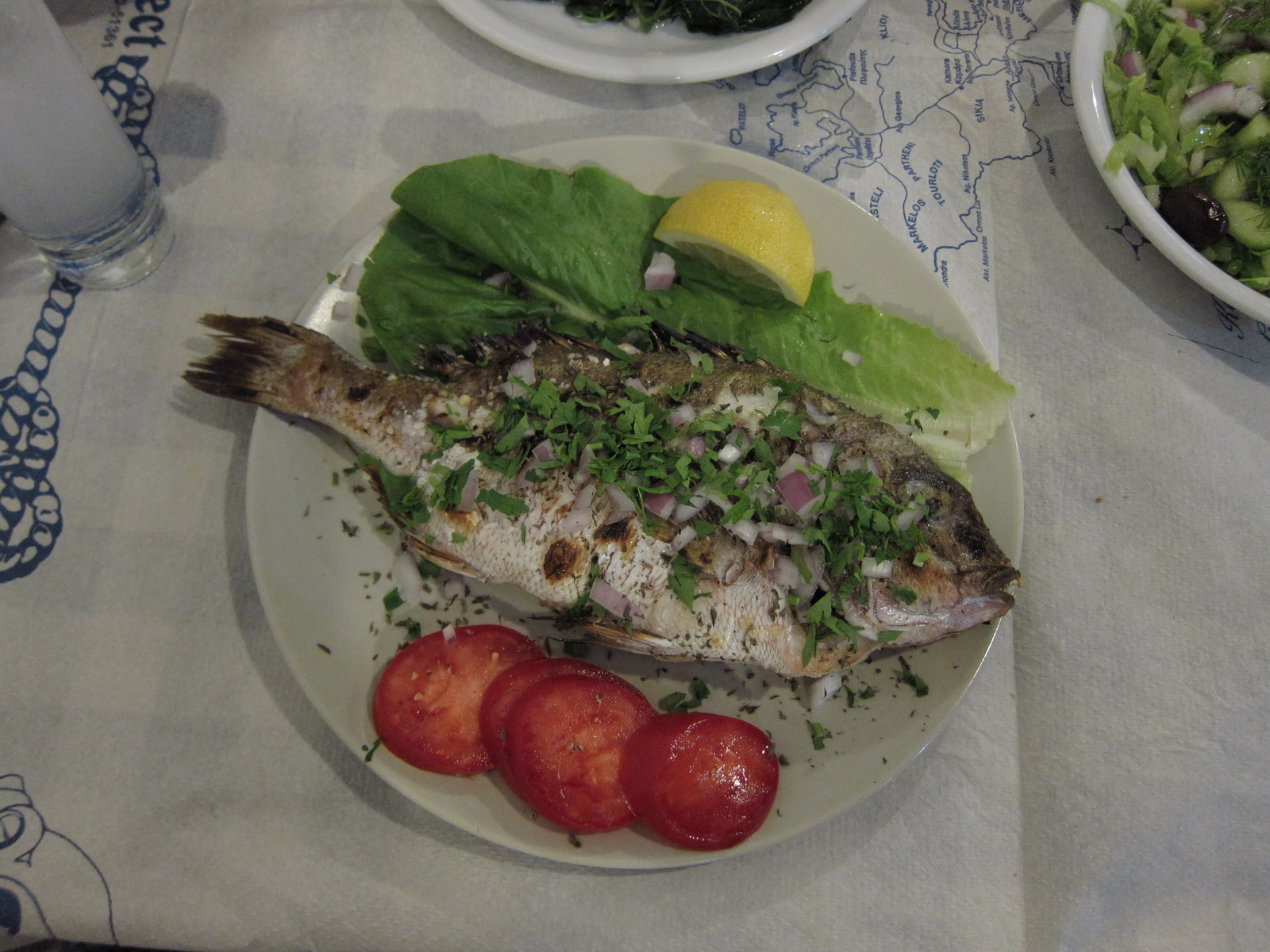
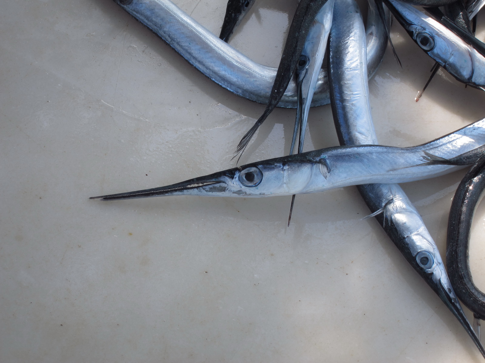
One of the many great things about being near the sea is that you get great fresh fish
The views are great all around
and there is more vegetation than on Kalymnos
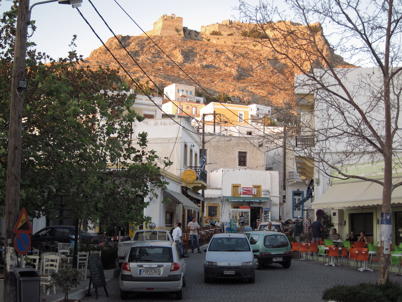
There is a fortress at the top of the hill
Highlights from Justine:
LEROS
The places to stay on Leros are Agia Marina (for restaurants, shops and nightlife) or Alinda (for beaches). You can walk between the two in under an hour but a bus is preferable as it's a busy road. Platanos, the capital, is a short, uphill walk from Agia Marina, and has great views and some nice laid-back cafes where the local gents hang out until their wives round them up for supper.
The sleepiness of Leros today belies its military past - a major battle took place here in World War II, and you'll find relics of the war all over. There's an Allied War Graves Cemetary on the outskirts of Alinda and a war museum in Merikia west of Lakki (only opens 9.30-13.30, and you need a car or taxi to get there).
You can take a day trip to Patmos (where St John the Divine wrote the Book of Revelations) from Agia Marina most days - but if you want to do this check the days early as soon as you arrive. There are one or two days a week when it's not possible.
A good way to blow your vacation sugar allowance is on a kataifi from To
Paradosiakon in Agia Marina. You won't regret it - at least not until your next
dental checkup. Seriously, this is the best bakery in the universe - even if
the staff are a bit miserable. Or maybe they just lost all their teeth…
Back at the airport, the same aircraft appeared to be following us around,
but actually it wasn't the same one ![]()
Another very simple VFR route
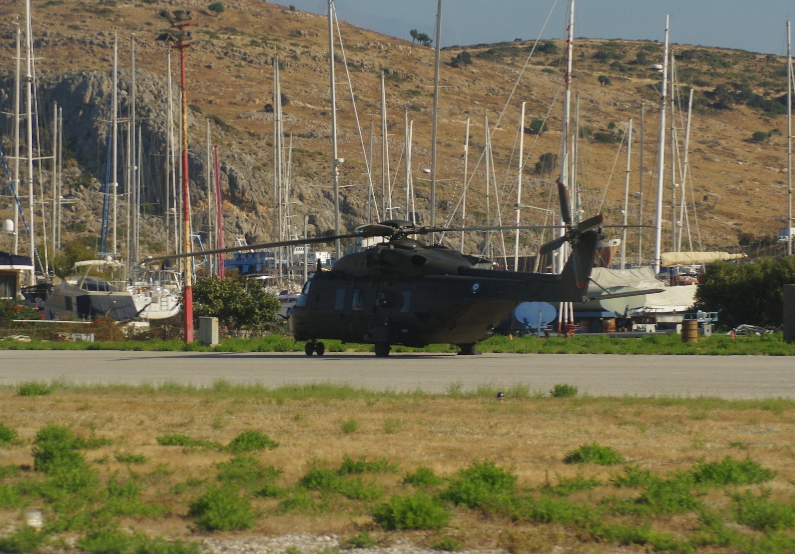
We were delayed at the airport for nearly an hour (kept inside the building) because a military helicopter landed
Finally we got going
Leros to Ikaria
The route was filed VFR, as a DCT
Alternate: Samos LGSM
Weather data: MSLP 0600 1200. The IR image was clear.The TAFs and METARs were good. There is no weather data for Leros or Ikaria.
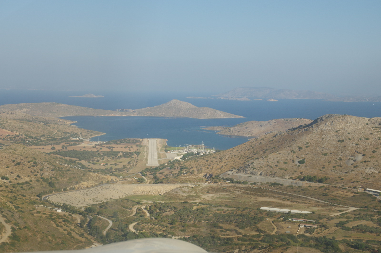
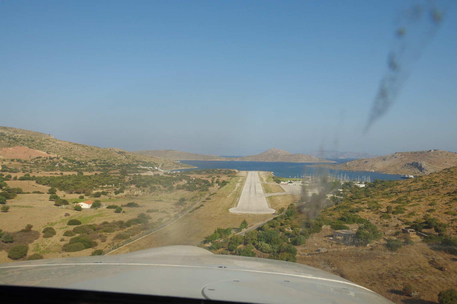
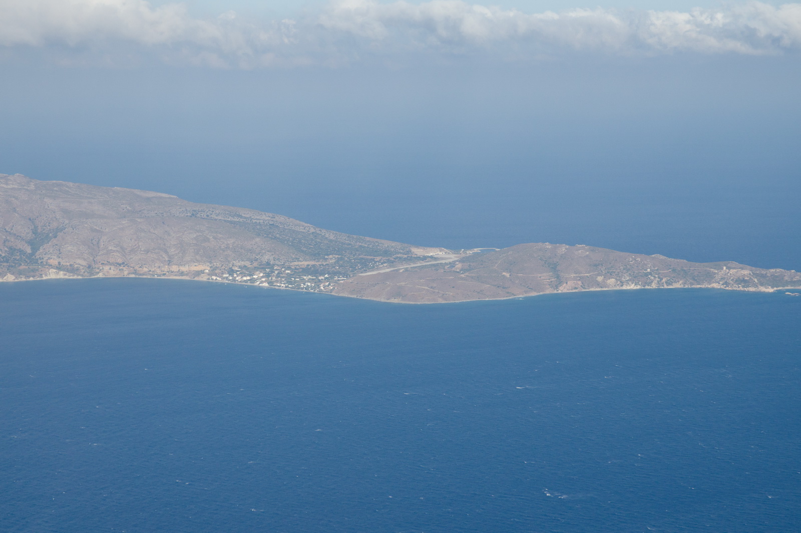
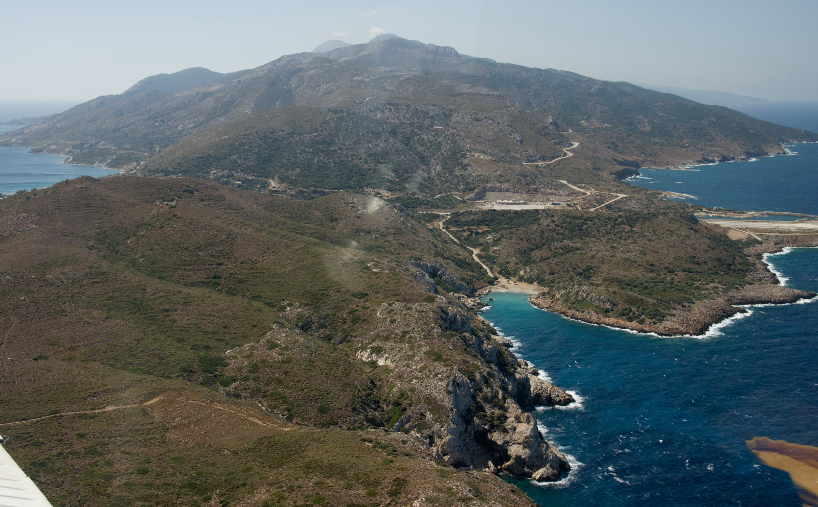
Here the Ikaria runway first becomes visible, from a sort of right base join at about 20 miles
The twin turboprop commuter aircraft was heading in at the same time. He was
getting some traffic information from the Ikaria tower but they didn't have
radar, so I ended up talking to the other aircraft directly. I told him I had
him on TCAS from about 10 miles, which made
him very happy, and since he was a lot bigger than me I let him land first ![]() He was flying some sort of full instrument approach.
He was flying some sort of full instrument approach.
Final approach to Ikaria LGIK
and there he is...
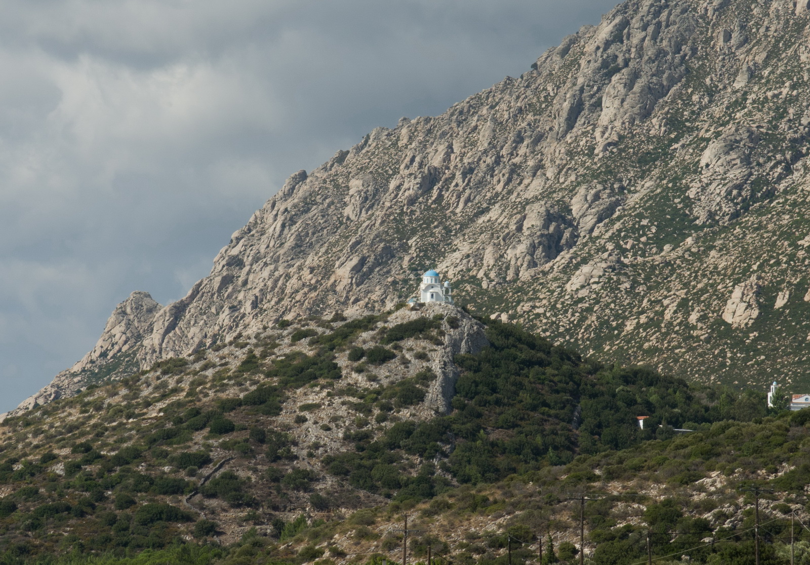
Ikaria is as scenic as the rest of the islands
We stayed in a very nice little hotel - Pyrgos
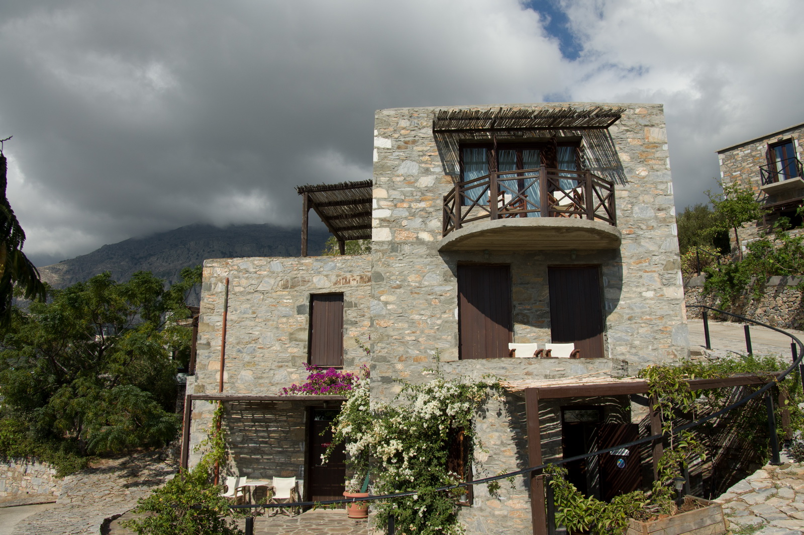
It wasn't dirt cheap but when you come to these very small places for just
2 nights, you want to stay somewhere comfortable. Greek hotels are very "basic"
and on the small islands the shower often doesn't work because it is solar heated
only and if somebody has a shower in the evening, they drain all the water out
![]()
This gives a whole new meaning to "fresh fish"
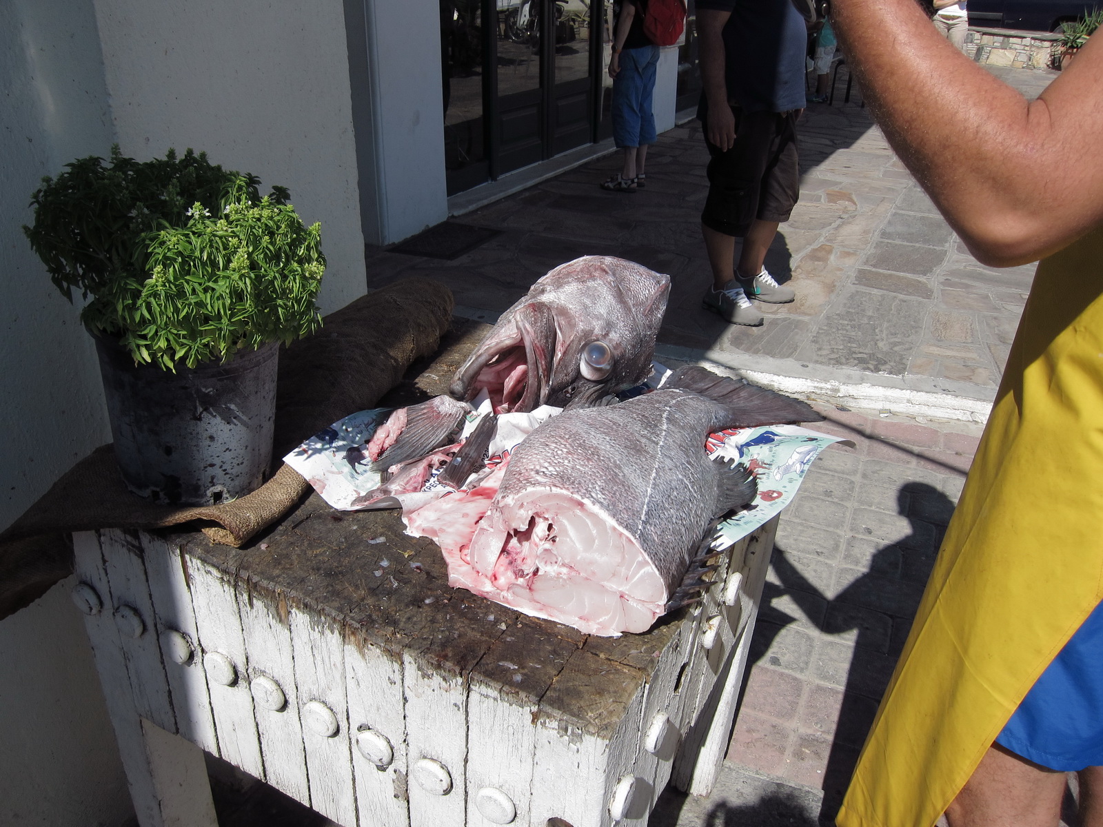
but even the little ones were delicious
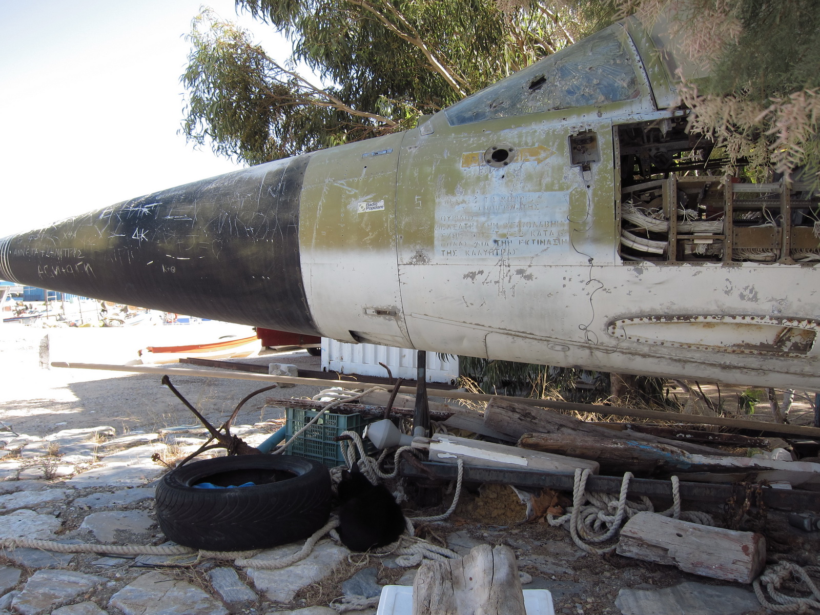
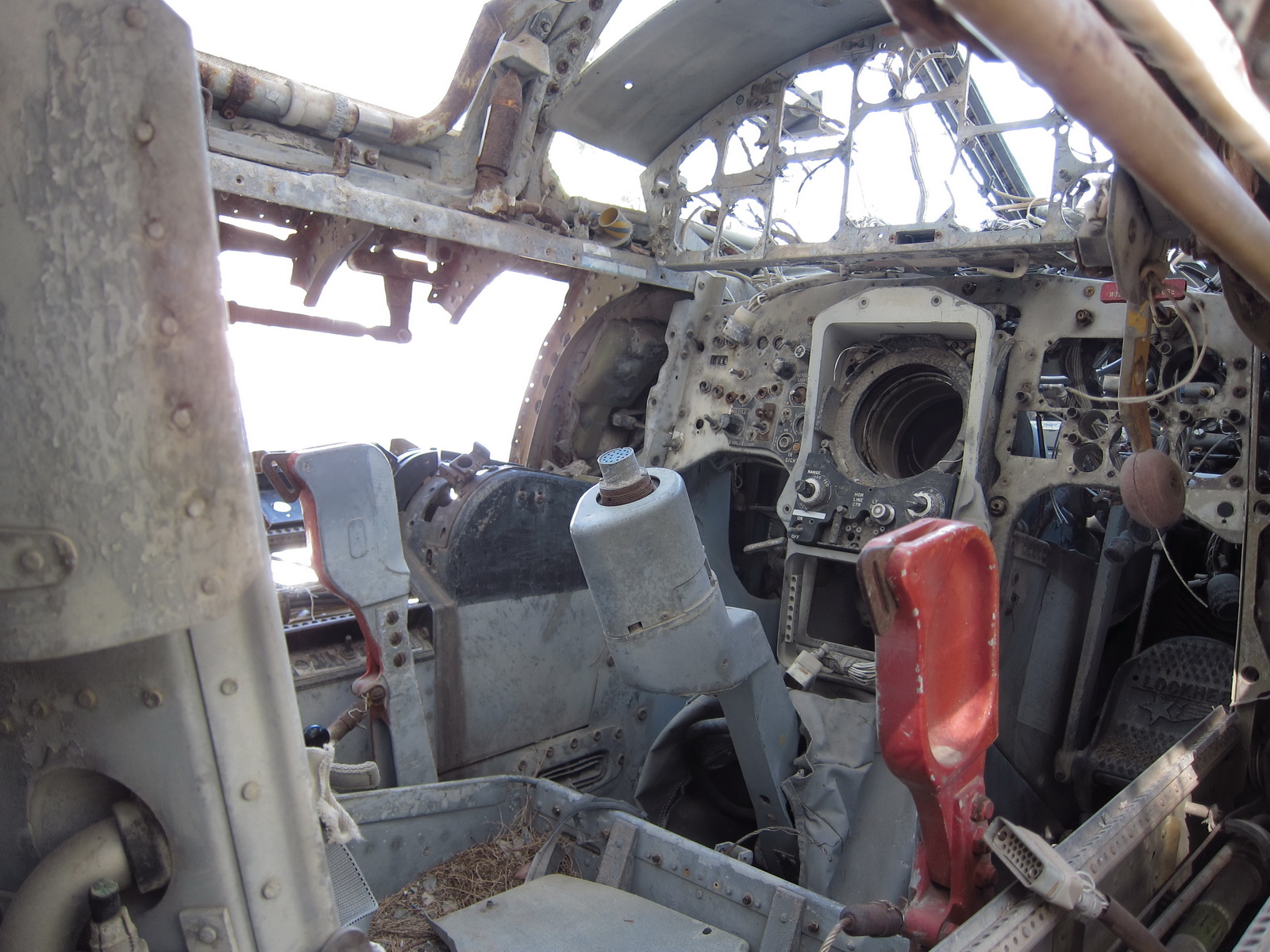
There is the front portion of a F-104 in the harbour
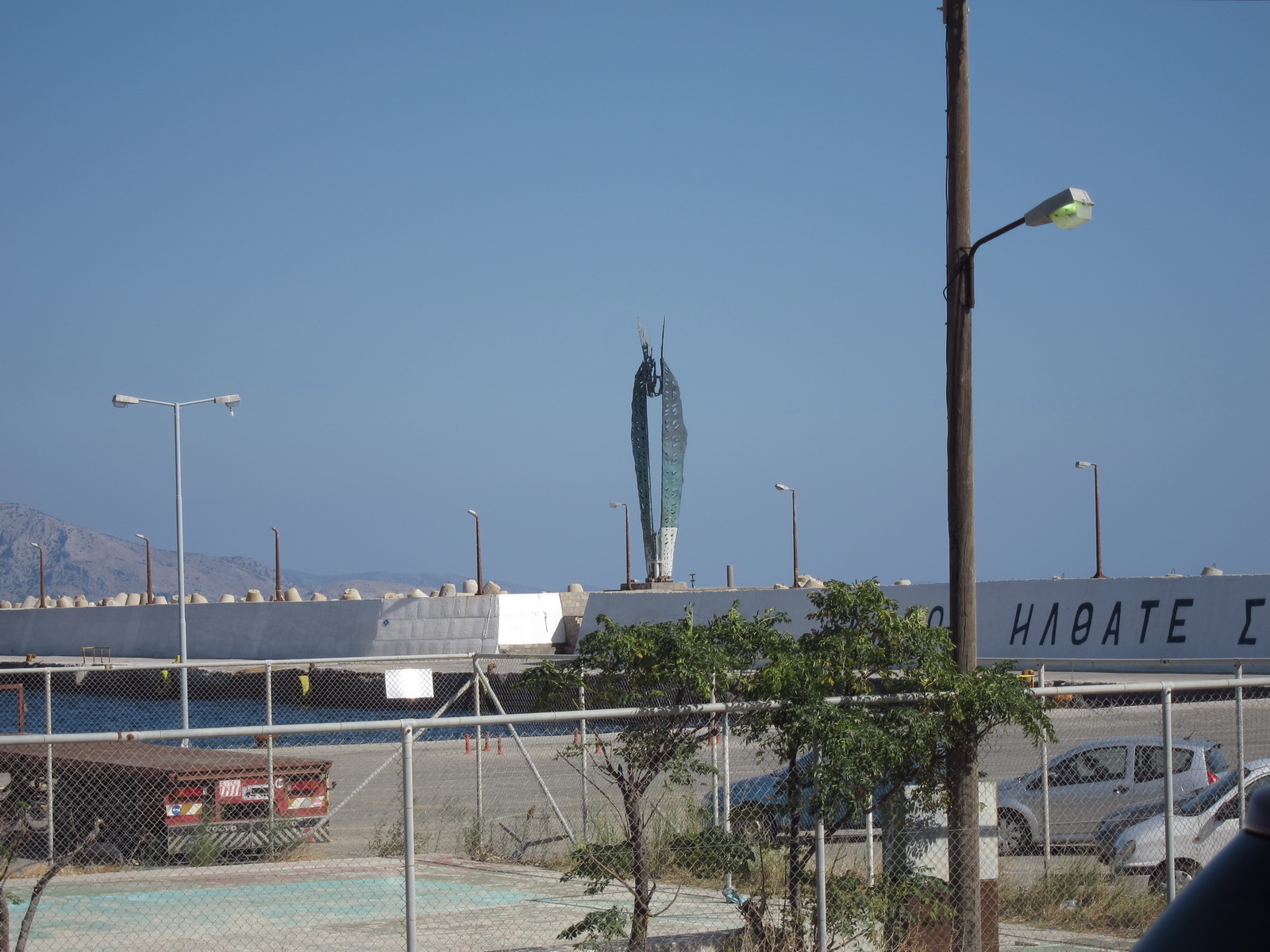
The famous "Ikaros" statue in the harbour
I owned one of these, 1983-1988!
We found no information on any bus services but buses do seem to exist - here is the proof:
We spent ages looking for a big archeological museum, and eventually found it
It was closed, despite "having opened" the year before. A few million € of EU money... The only sign of life was an archivist in an adjacent building.
Ikaria is perhaps the greenest of the three small islands
After landing, we were given the opening times timetable which I didn't look at at the time. When I did, it looked completely different to the notamed one I already had! It took me a while to realise that it was all in local time; that became apparent because everything was shifted by 3 hours. But I would have expected it to be in UTC because that is what aviation runs on. This became a possible issue for the flight from Ikaria to Samos where we had to be at a particular time to get fuel and then immediately fly on to Lesbos. My phone (Vodafone UK contract) did not have any voice or SMS connectivity on Ikaria - a rare thing in modern Europe; the only previous occasion was Albania in 2006 - so all I could do was email. We also tried checking the flight times to/from Ikaria and e.g. Athens, to try to verify the timetable from another direction. It was eventually resolved with enough cross-checks.
Ikaria has a reputation for its inhabitants living to a very old age but we
didn't see much evidence of it... Maybe it's true for the old generation but
looking at the stuff the younger people on there eat, they won't live for very
long at all... It is just a very laid back Greek island which is very laid back
even by the standards of Greek islands ![]()
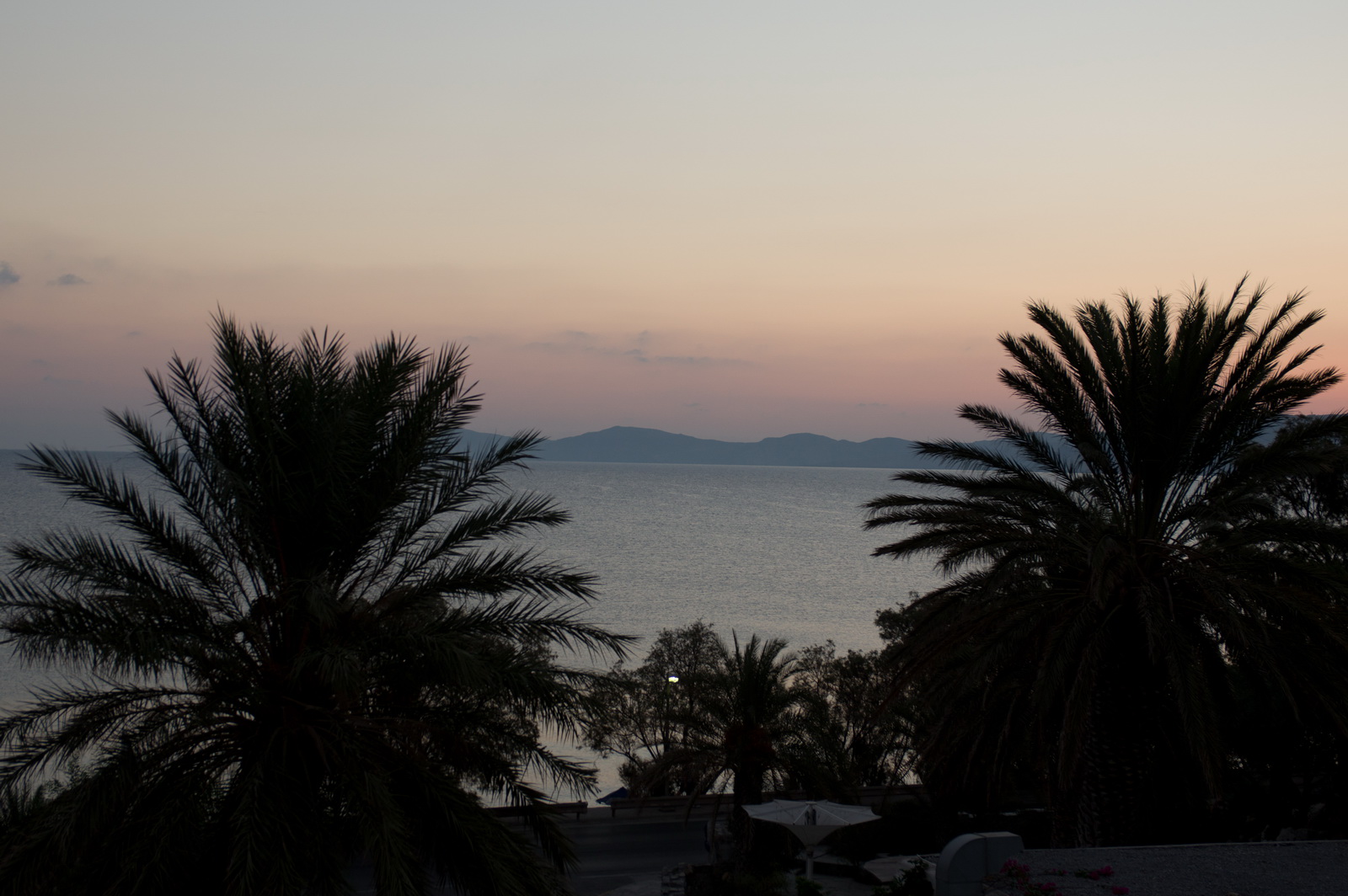
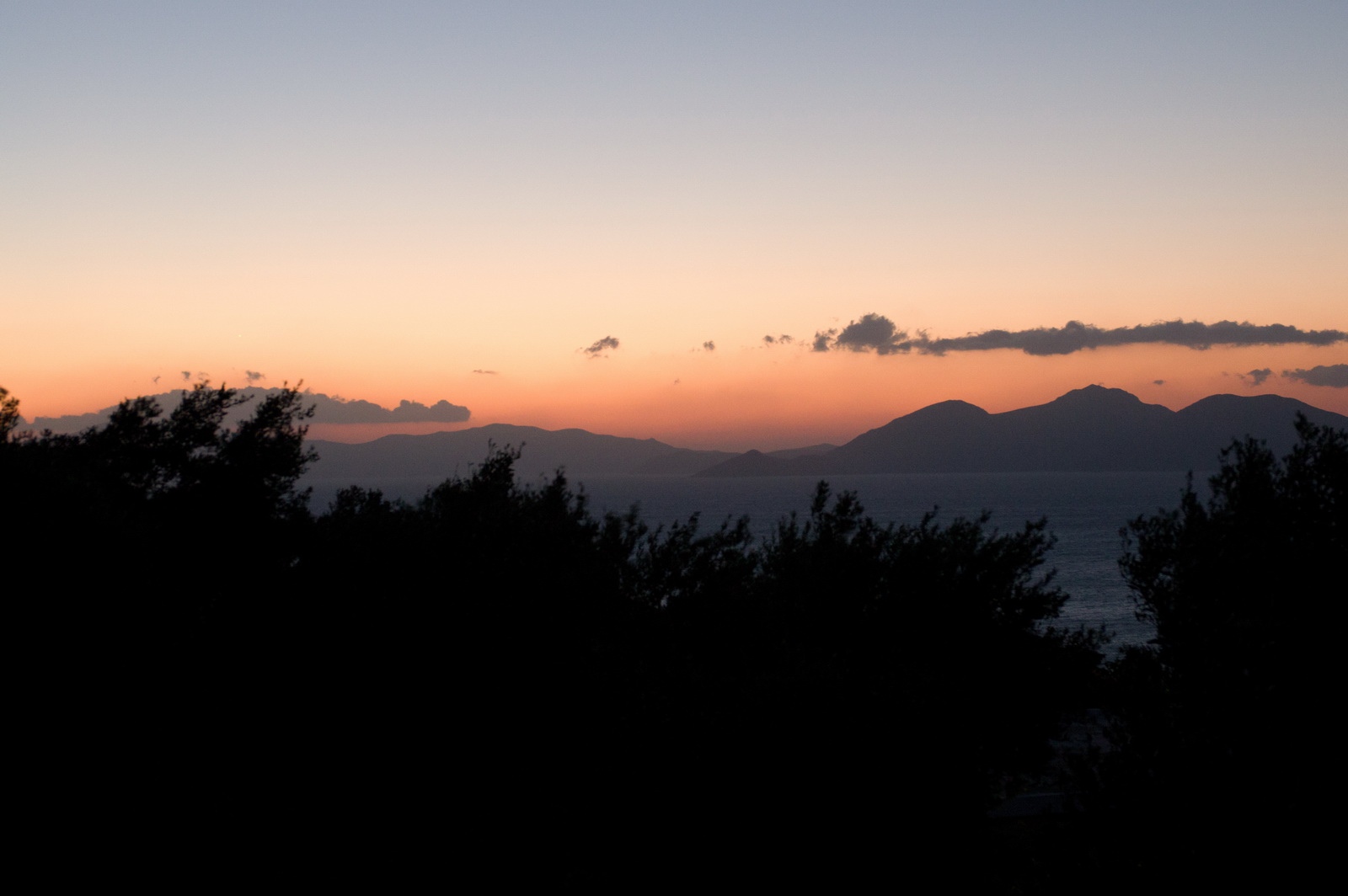
Last evening on Ikaria provided a great sunset over the nearby islands
From the air, you can see some lovely beaches
Highlights from Justine:
ICARIA
For such a small place (100 sq miles; pop. 8000) Icaria has an impressive variety of claims to fame. It is supposedly the first place to have discovered winemaking and birthplace of Dionysos, god of wine. When Icarus flew too close to the sun and melted his wax wings, Icaria was the island that sprang up at the spot he plummeted into the ocean. During the civil war of the 1940s and in the time of the colonels, Icaria was where the fascists exiled their communist opponents. More recently Icaria became famous as one of the 'Blue Zones' - regions renowned for the longevity and health of their inhabitants. Everybody here grows their own vegetables and every spare inch of ground has a fruit tree on it.
For all that there's not a lot to do on Icaria, so come prepared to chill and relax. The main town and port is Agios Kirykos, which has a reasonable selection of shops and services, albeit geared more to locals than to tourists. There are plenty of waterfront cafes and snackbars but only a few restaurants. If you plan to spend more than a few days self-catering is probably advisable.
If you like a challenge getting around Icaria may be the high point of your holiday. Buses do exist (we have seen them) but timetables are another matter. Crossing the island by taxi will not come cheap as it's mountainous and slow going. That said, the scenery is impressive and out taxi driver was delightful - friendly, informative and, best of all, cautious!
If you like hot springs there are several in and around Agios Kirykos. It's
probabl;y not advisable to swallow the water - it's slightly radioactive - but
apparently it does wonders for aching joints and muscles.
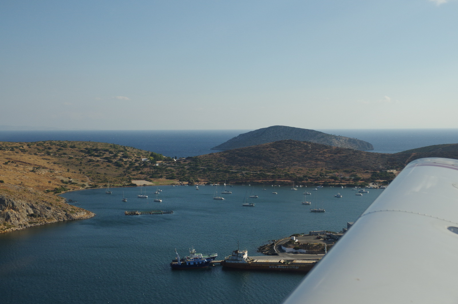
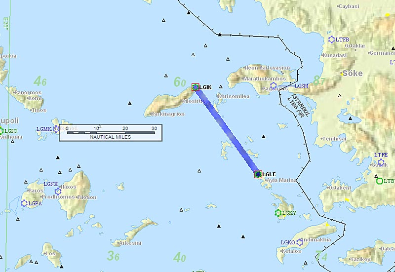
Ikaria to Samos & Lesbos
This was going to be a long day, because we were going to fly to Samos LGSM first for fuel and then immediately fly to Lesbos LGMT. The fuel man at Samos can be hard to find at certain times of the day so this was arranged in advance for an agreed time with Swissport handling. It was pretty important to get the fuel because I had to get Justine back to Lesbos for her airline flight back to the UK, and Lesbos has no avgas which would mean a flight back to Samos (or maybe Sitia again) for fuel, before leaving Greece.
The LGIK-LGSM route was filed VFR, as a DCT
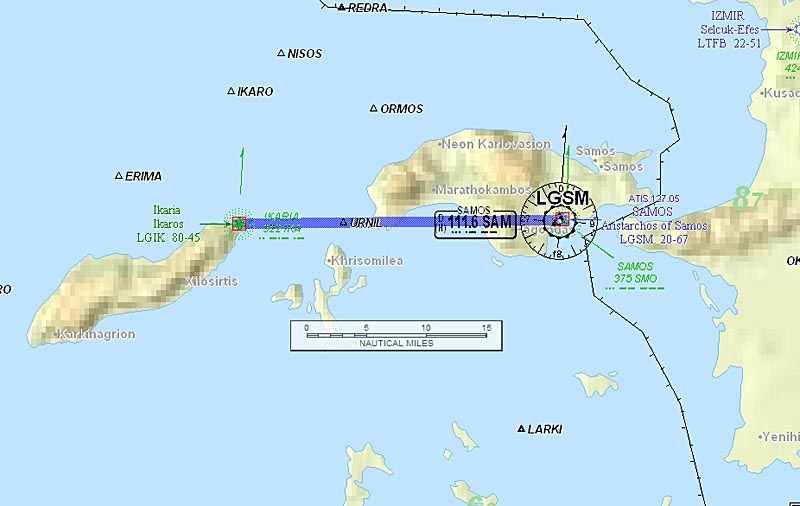
Alternate: Samos LGSM
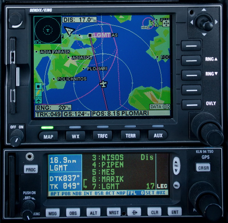
The LGSM-LGMT route was filed IFR, simply because I prefer to do longer routes IFR. This one passes close to Turkish airspace and there is no way to get a shortcut into it once airborne.
Also if someone ended up in Turkish airspace (or vice versa!) by accident there could be major trouble, as he would be "unknown" traffic with no flight plan, which results in a) calls to 121.5 for vacation of the airspace, and b) identification by air and... interception. That's another reason for going IFR... ATC will be watching you more closely. If you had filed for a VFR crossing of the piece of Turkey (which is possible) you would most probably have to fly low when passing abeam Izmir due to IFR traffic in the area. There are also a lot of Turkish/Greek F16 "dogfights" in that area, with the Turkish ones repeatedly probing Greek airspace, so ATC are nervous...
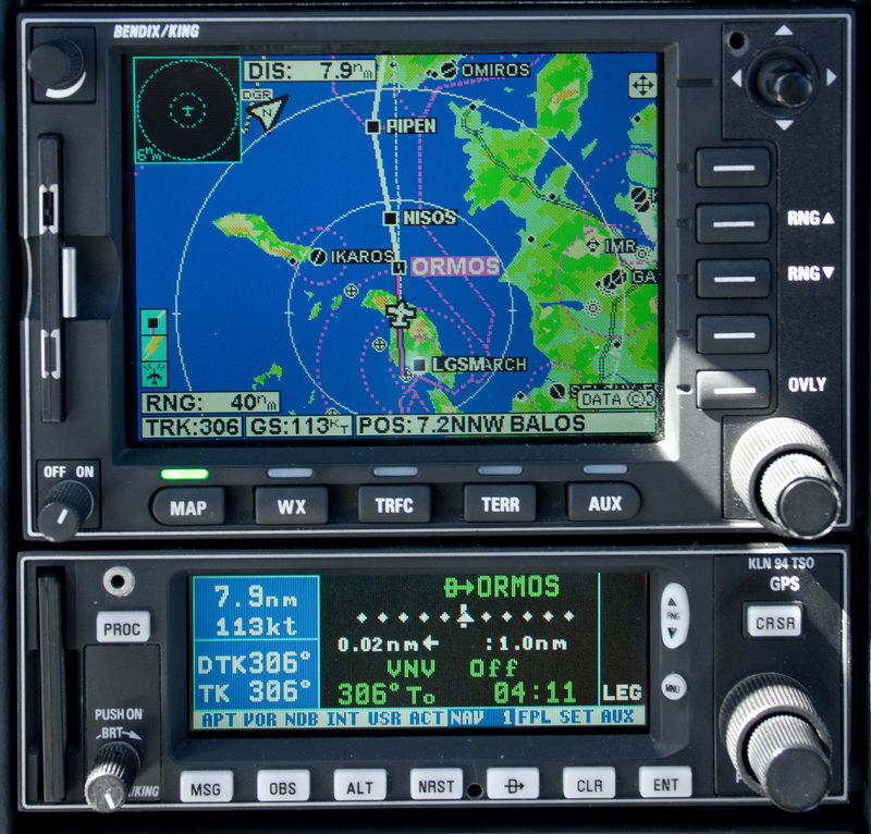
LGSM ORMOS H59 MARIK LGMT
FL080
Alternates: Samos LGSM
83nm GC, 118nm as filed IFR
Weather data: MSLP 0600 1200 1800. The IR image and sferics were clear.The TAFs and METARs were good. There is no weather data for Ikaria.
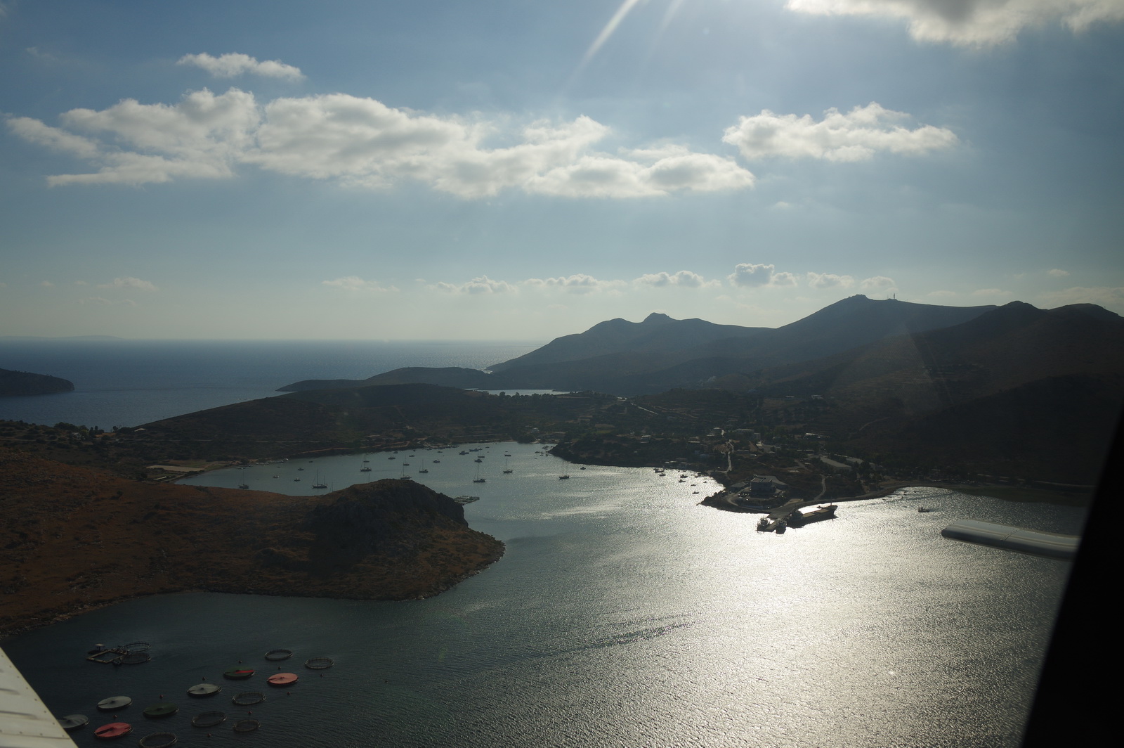
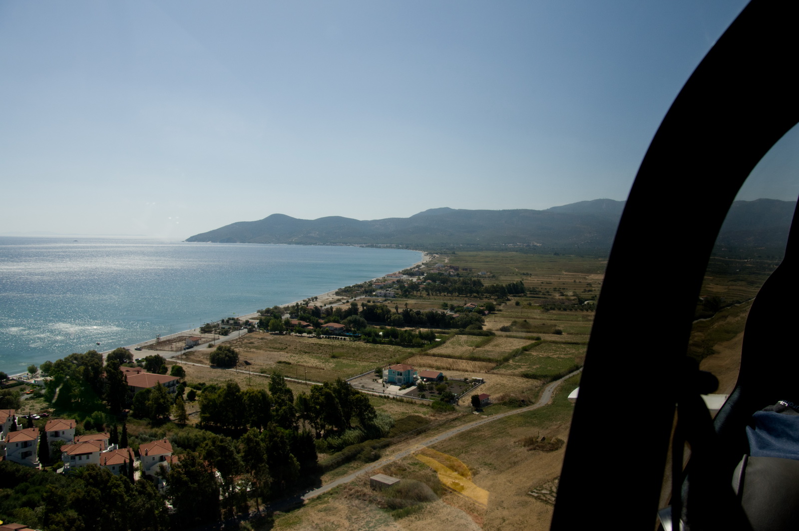
The Ikaria tower requested 3000ft max altitude as a "request by Samos" so we flew unusually low among the rocks
Back at Samos now, right base, after a very rough minute or two, in turbulence strong enough to disconnect the autopilot
My exhaustive planning of the Samos fuel stop (basically, making sure they knew we were coming and the fuel man would be there) paid off. We were refuelled fast, paid up with the very efficient Swissport people (with a small discount for a "tech stop" - the first time I have ever seen that for real, anywhere!) and were off right away to Lesbos, FL080 all the way
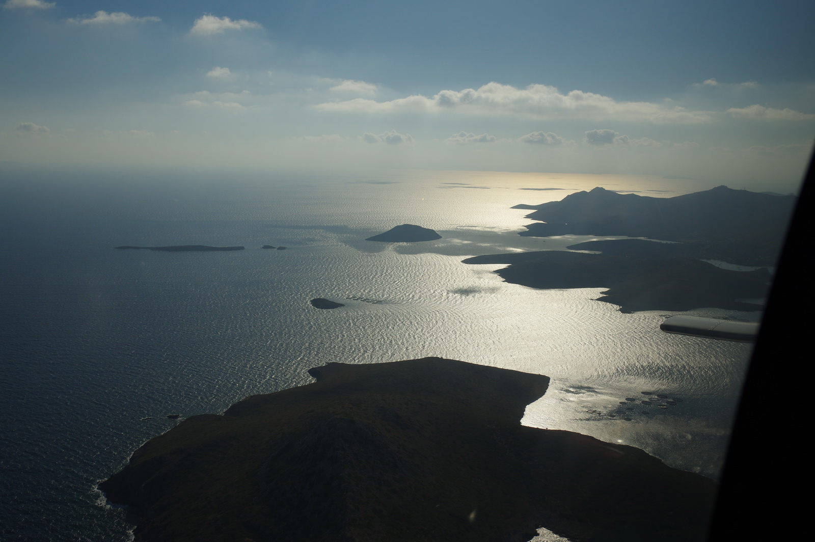
This was the rock which created the turbulence on the way to Samos earlier; the wind was flowing across it from right to left...

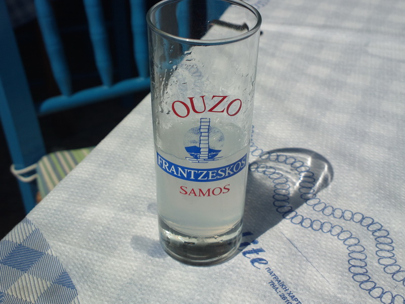
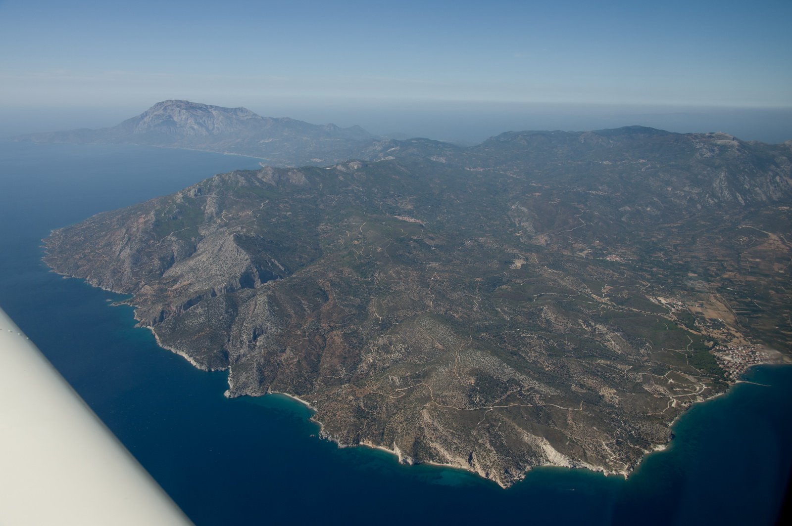
Nearly there... Plomari is where the best Ouzo comes from, apparently
and the Plomari town is in the centre of the picture below
Lesbos airport (Mitilini LGMT) is behind the hill on the right
A rather high left base but in aviation you can never be too high ![]()
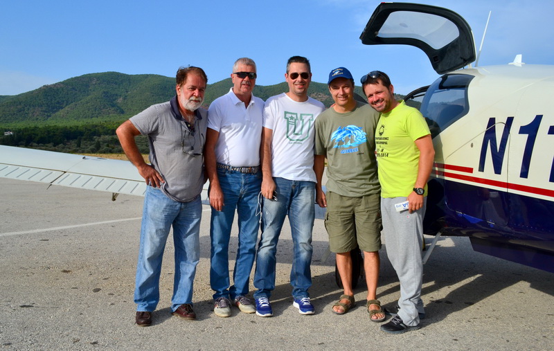
This pic was taken by a group of Greek pilots who we met up with later
We parked on an apron which is more or less dedicated to GA but has "official room" for only two aircraft because that is all that the markings were painted for! In reality it can park around 30 light aircraft
Militini is a "proper town" with everything you could want
Justine is a qualified nutritionist so once a month I am allowed one of these
The obligatory EuroGA.org sticker - a very kind Czech guy produced a quantity
of these, in very high quality, and you know where to find me ![]()
Just before departure from LGMT, this is me showing off the two EHSIs in the "reversionary horizon" mode
to some Greek pilot friends ![]()
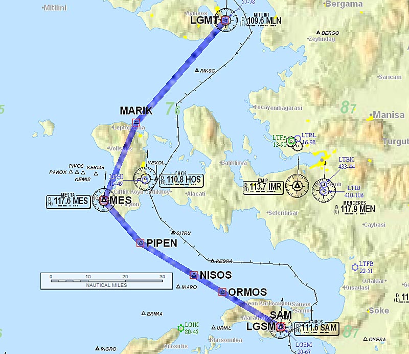
Lesbos to Zagreb
This was filed IFR
LGMT LSV H59 ERESO N128 VAL N131 DER P11 KOMAR L187 TEBLI LDZA
FL130
Alternates: Belgrade LYBE, Ljubljana LJLJ
614nm GC, 649nm as filed IFR
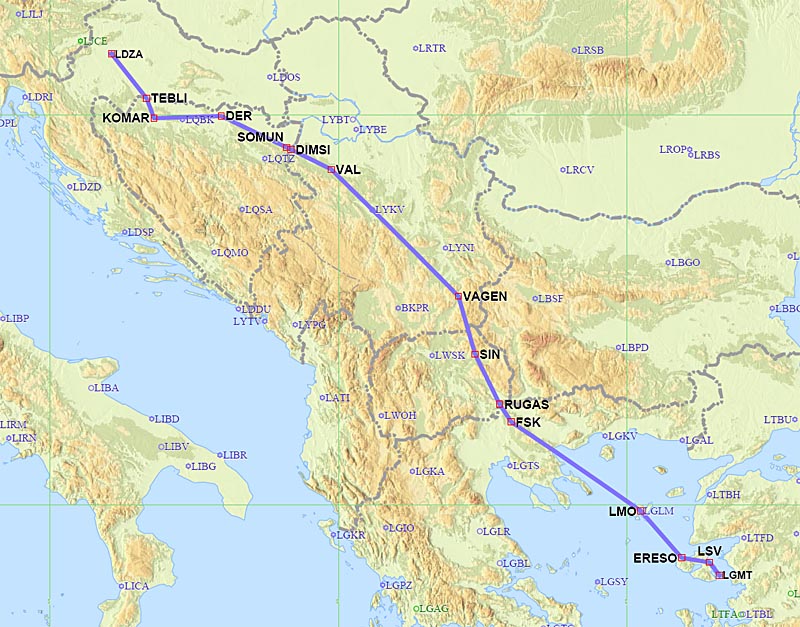
This leg was going to be tricky on fuel, because I would be departing Lesbos about 1hr short of full tanks. There are fortunately several good alternates along that route which could be chosen as needed according to the LFOB figure from the fuel totaliser.
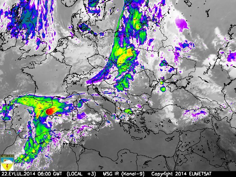
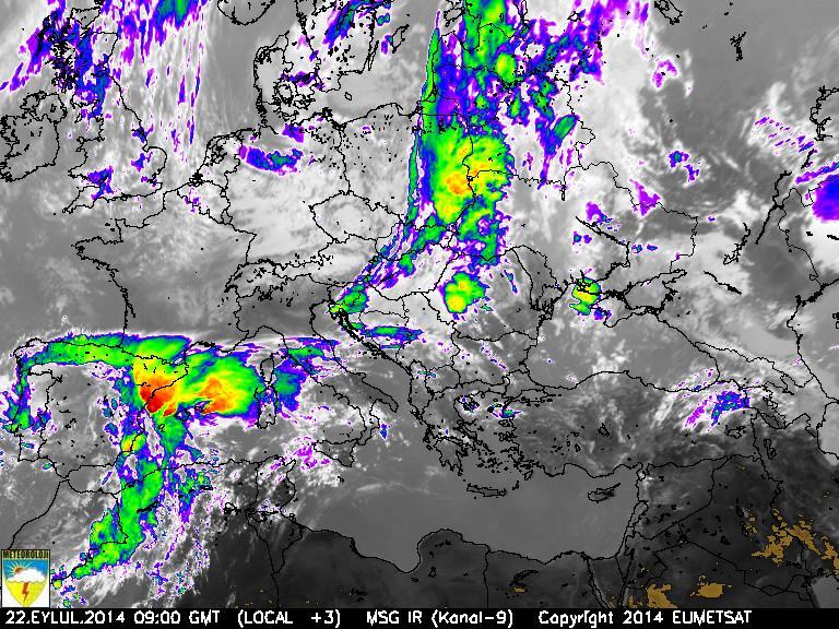
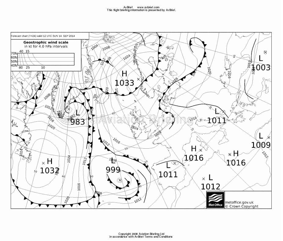
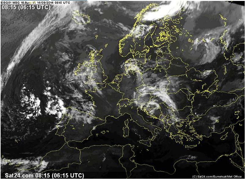
Weather data: MSLP 0600 1200 1800. The IR image showed high cloud in the northern Aegean.The TAFs and METARs confirmed this, with convective forecasts (SHRA/TSRA). Looking at the shade of grey along the route I would have estimated the cloud tops at FL150, plus or minus a few thousand feet so probably within the altitude capability of the TB20.
These 0600 and 0900 images from a Turkish meteo site are good although I got these only after the flight, and the site updates only every three hours
With just me inside, a steep departure
Mitilini
The last view of Lesbos
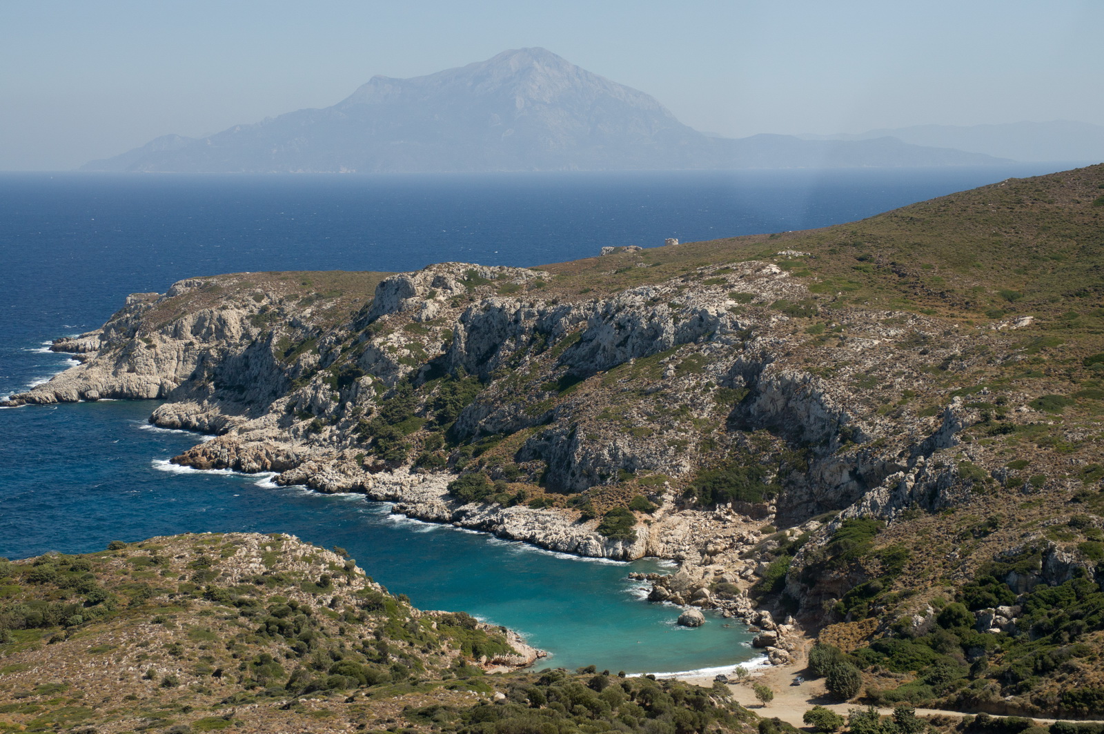
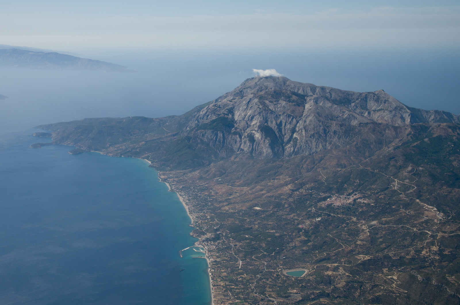
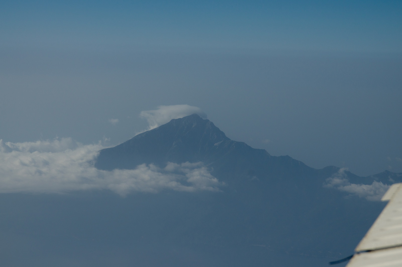
Mt Athos, south east of Thessaloniki
In cruise, initially at FL120
This leg was tricky with fuel because there was no avgas on Lesbos, so flying at the most economical power setting was necessary, but there was also a relentless headwind of about 35kt which never went away... The temperature, +4C at FL120 (ISA+13) didn't help performance. The fuel flow was 8.6 USG/hr for a 140kt TAS, +4C and 2200rpm.
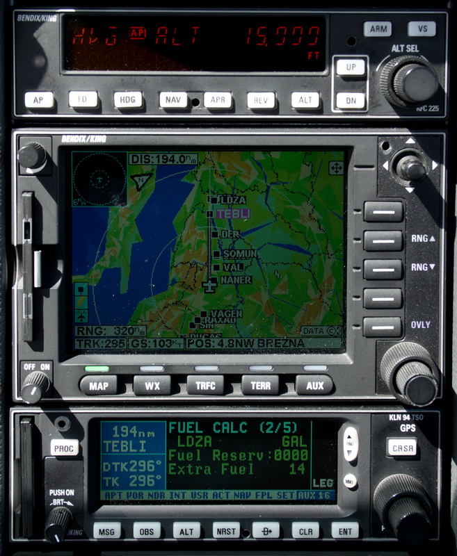
Here we are seeing 15 USG LFOB which is OK given there are plenty of alternates in the destination area. The main enroute alternate would have been Belgrade LYBE which at about €1/litre has avgas half the price of anywhere else in Europe!
To remain VMC I eventually had to climb to FL160 and just touching a bit of cloud at about -5C resulted in instant icing, as is always to be expected around that temperature
Commencing descent into Zagreb with about 120nm to run
There was a fair bit of convective activity around, but I flew as low as one could without actually going into it, because the headwind would normally be lower at lower levels (usually not by much though until one gets well below FL100).
and then it thinned out, just in time for a descent to the ILS
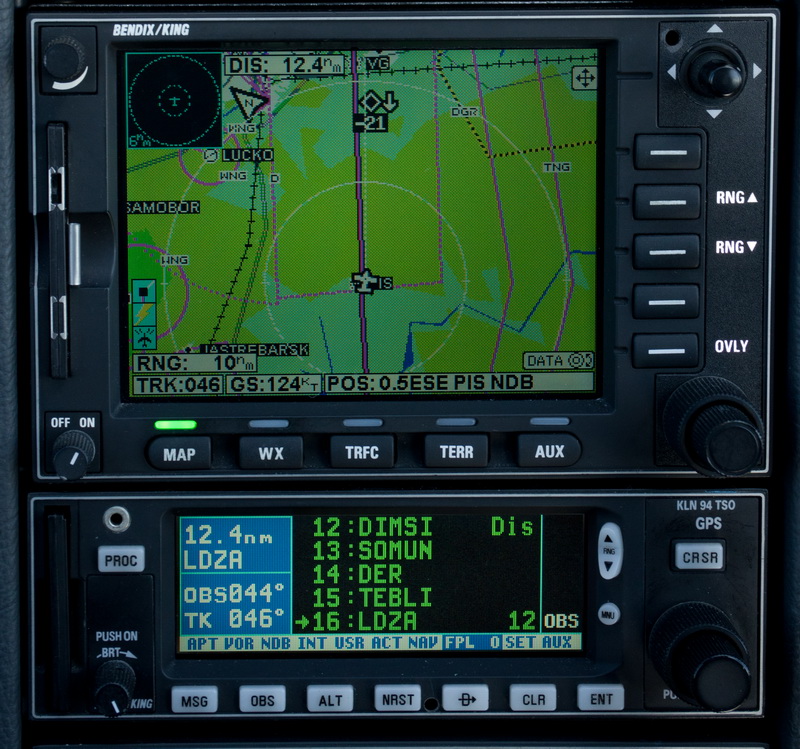
Established on the localiser, with three airliners ahead. The magenta line is the GPS, set up in OBS mode and with the LOC bearing, to act as a guide that things are going right...
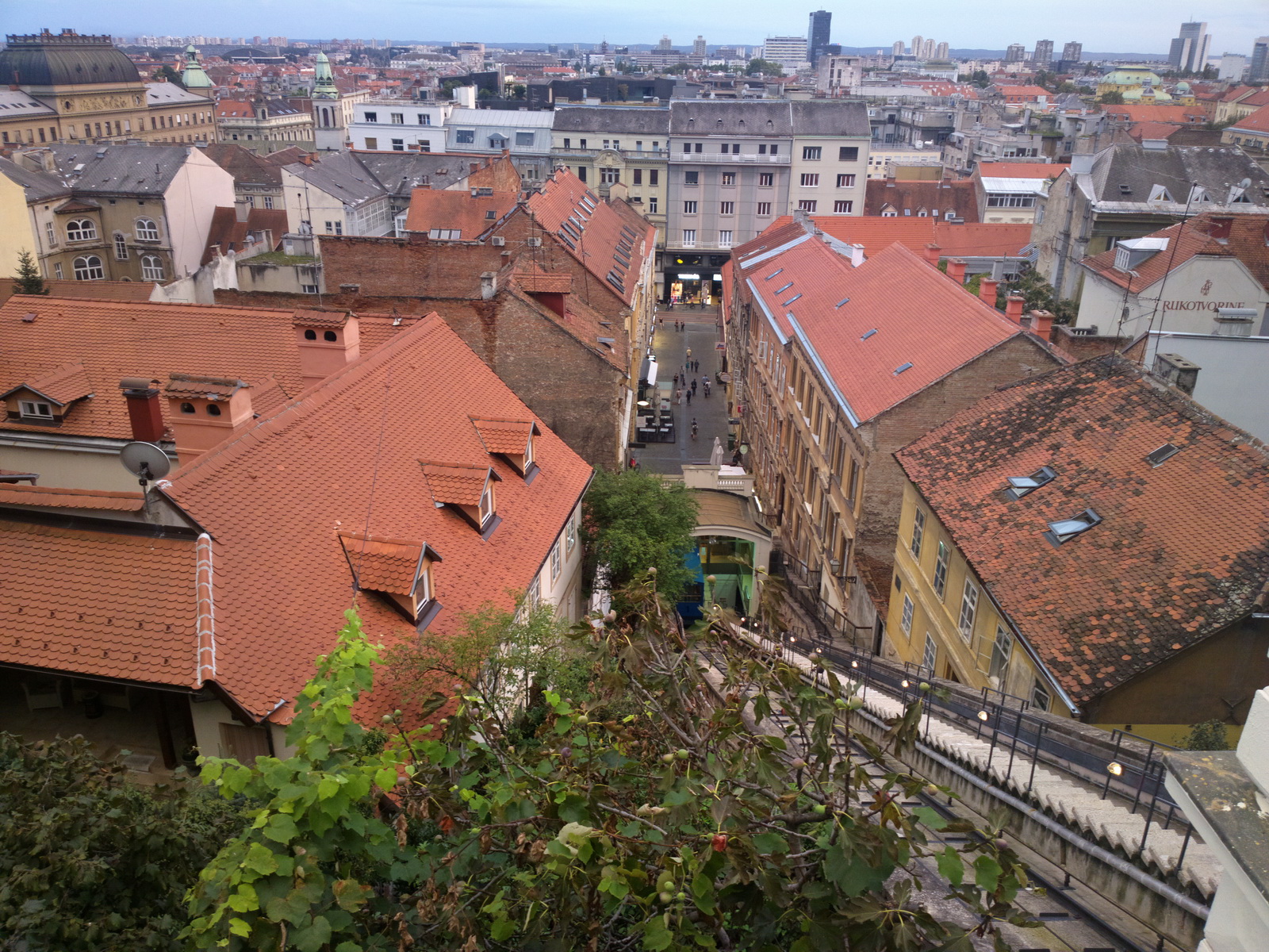
The GA apron at Zagreb is vast but there is no hangarage or apparently any other facility
Parked up for the 1-night stay with friends. It was really warm...
There was a massive downpour during the night which finally washed off the filth from the GA parking area at Calvi, Corsica.
The EuroFPL tracking feature broke some way into the flight (actual route in black):
![]()
That sort of thing can be scary for relatives watching the progress...
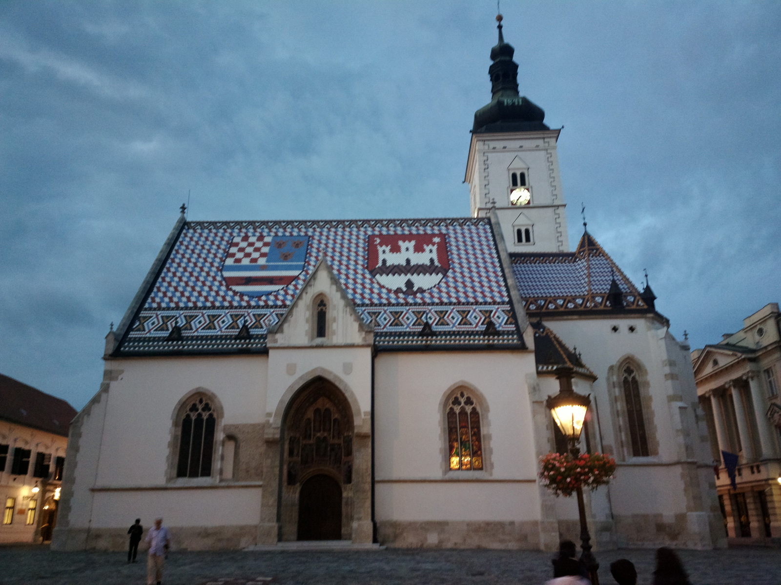
A few images of Zagreb:
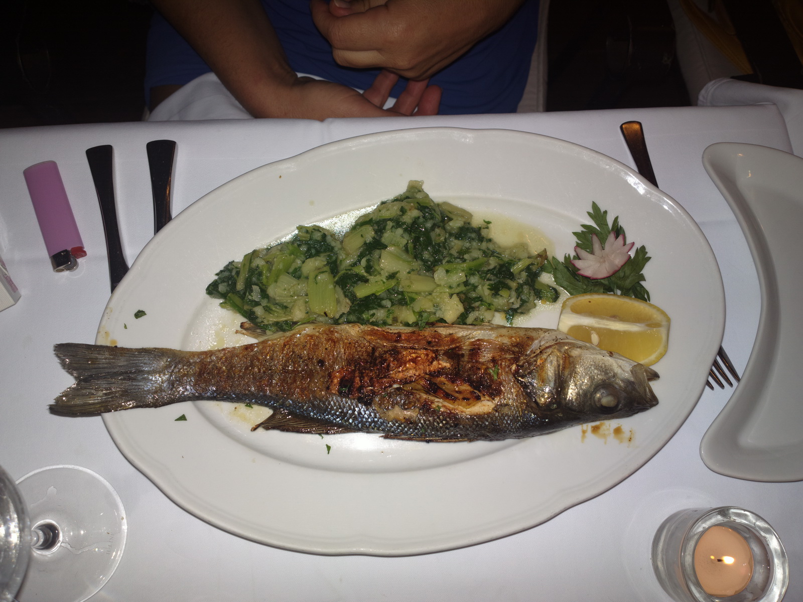
The fish was good too
Zagreb to Shoreham
This was filed IFR
LDZA OBUTI M19 GRZ L604 ANELA N869 DINKU/N0174F120 N869 DKB Z818 ETASA/N0164F070
Z818 RINEX Z12 FRANK Q762 RUDOT/N0166F080 Q762 LULAT Z104 GESLO N852 LNO L607
KONAN DCT LYD EGKA
FL160
Alternates: Lydd EGMD, Biggin Hill EGKB
719nm GC, 832nm as filed IFR
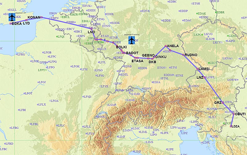
Fairly obviously my plan was to ask for a shortcut from LAMSI to DKB.
This leg was going to be tricky on fuel, because of the distance and the prevailing winds. There are fortunately several good alternates along that route (mostly in Belgium) which could be chosen as needed according to the LFOB figure from the fuel totaliser. The last one is Le Touquet (LFAT) or even Lydd (EGMD).
Weather data: MSLP 0600 1200 1800. The IR image and the sferics showed some high cloud north of the departure area, over Austria. The TAFs and METARs confirmed this. It did look like it may not be possible to outclimb this directly but since the sferics image was clean and the IR image did not show any concentrated convective weather in that region, the option of climbing to a low enough temperature to avoid icing (say -15C or colder) was reasonable.
There was some high cloud around, to the north but not in the immediate area of the airport
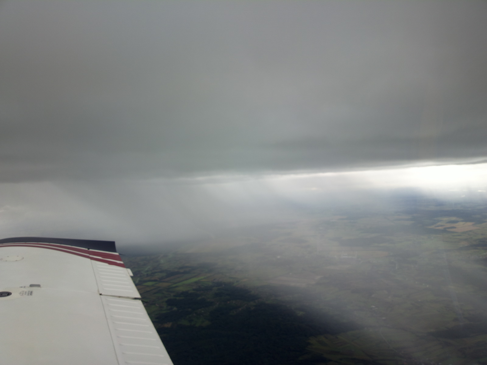
Some big downpours which I avoided climbing straight into (due to what is above)
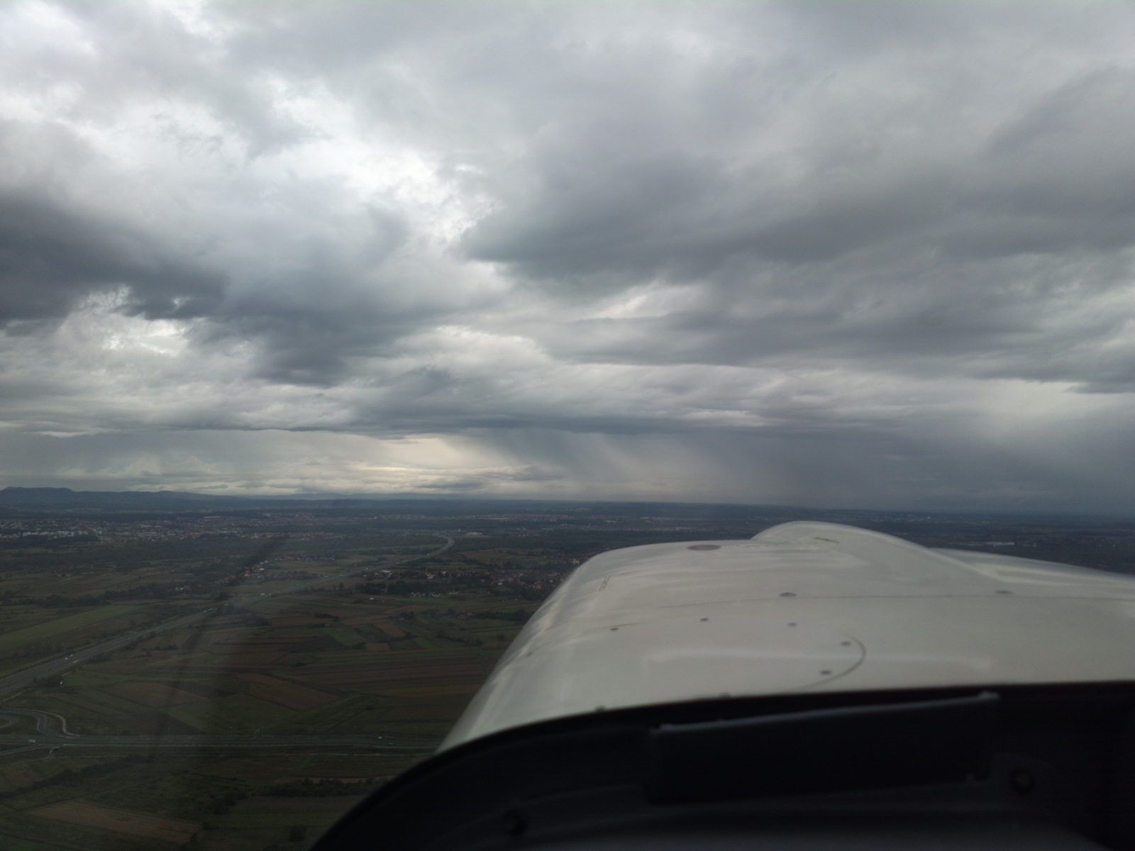
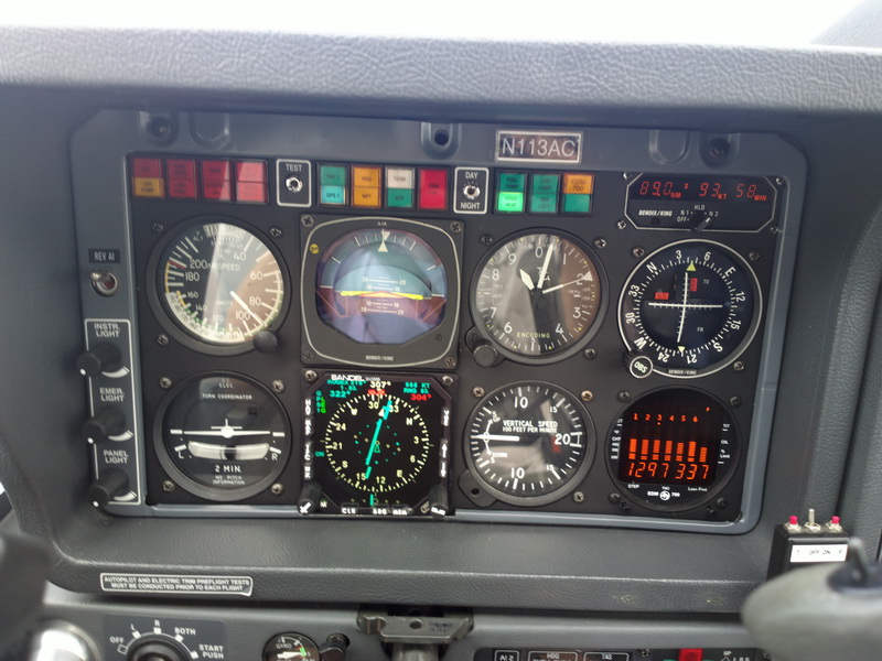
I was not able to climb to VMC on a direct track and had to double-back until I was high enough to get to a temperature at which icing cannot generally form - usually this is below -15C. Then some 20 mins were spent in solid IMC at FL190 in -21C. The EGT of 1297F is approximately 130F ROP which is the best power setting, necessary to reach FL190
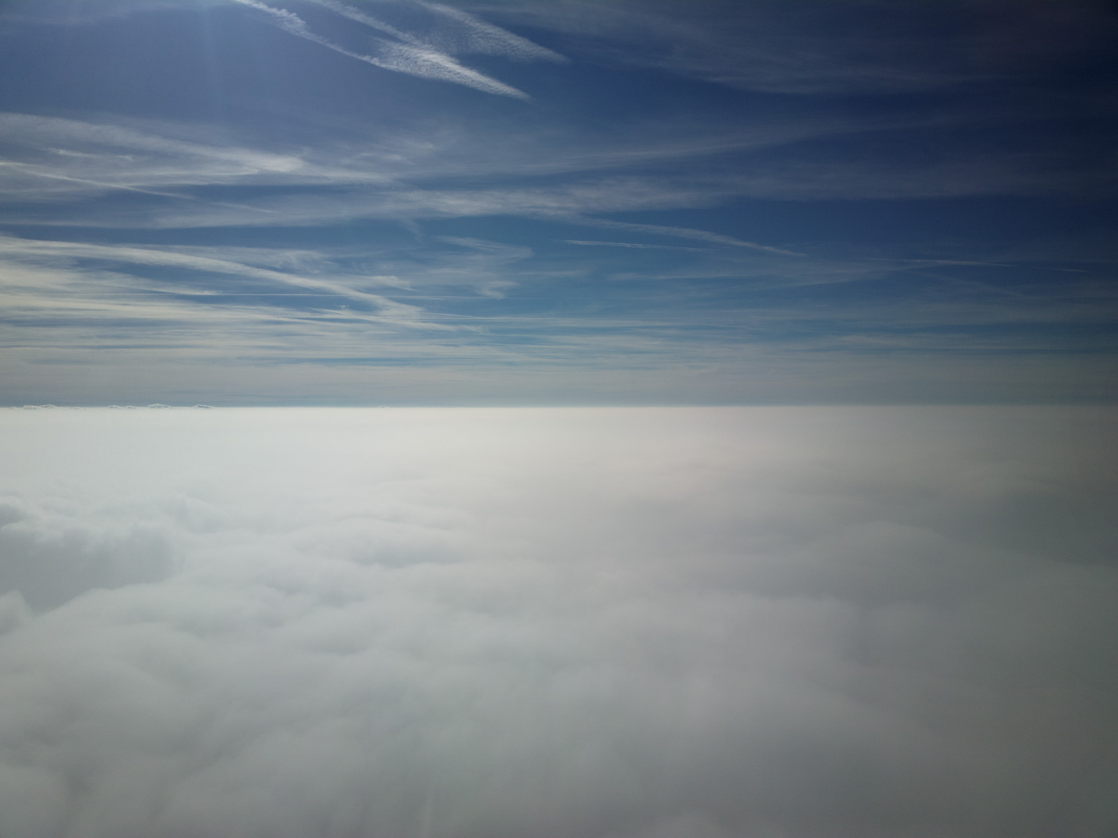
Eventually it cleared up - quite suddenly as expected from the IR image
But the headwind never stopped and I had about 40kt nearly all the way...
The LFOB stabilised at 14 USG early on and more or less stayed there for the rest of the flight...
I am not too keen on arriving with just 14 USG in the tanks (it is actually 1.5hrs' cruise which many pilots are very happy with, but I don't like it) so I got the weather over the satellite phone for various airports around the destination, to check there was no funny business (fog) going on
On this flight, German ATC were particularly unhelpful, citing "active
military airspace". On one occassion, one stroppy lady ATCO sent me a long
way off track saying that she had 20 Ryanairs to despatch in the next half an
hour. Perhaps I should have pointed out that airborne aircraft has priority
over aircraft on the ground ![]() (NOT a good idea). In reality they would all have been a very long way away...
(NOT a good idea). In reality they would all have been a very long way away...
There were scattered build-ups around and ATC cannot refuse a heading change "to avoid".
Nearly home...
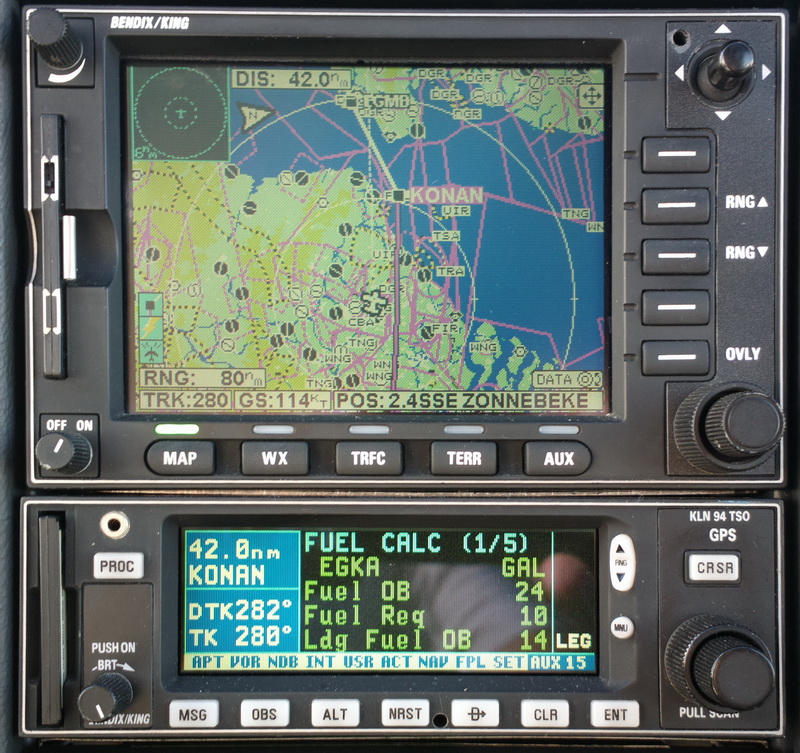
To optimise fuel, I did the last 300nm as a continuous descent at about -100fpm. The temperature was fine anyway (above 0C) but the cloud tops very conveniently came down anyway
One of the "tricks" to get the most out of the fuel is to run one fuel tank empty. I would never actually do that, but I have done measurements to establish the point at which the "low fuel" warning comes on, and by noting the time at that point and running on the same tank for a specific time I ran the LH tank down to 2.5USG, which was as far as I would dare go. At the subsequent pump fill-up at Shoreham this was verified by noting the fill for each tank separately. The LH tank actually had 2.9 USG, so with the final LFOB of 14.4 USG (coincidentally exactly the same as at Zagreb the day before) the RH tank had 11.5 USG at landing which definitely meets the requirements for IFR flight (alternate plus 45 mins). Normally I work with 20 USG as the minimum.
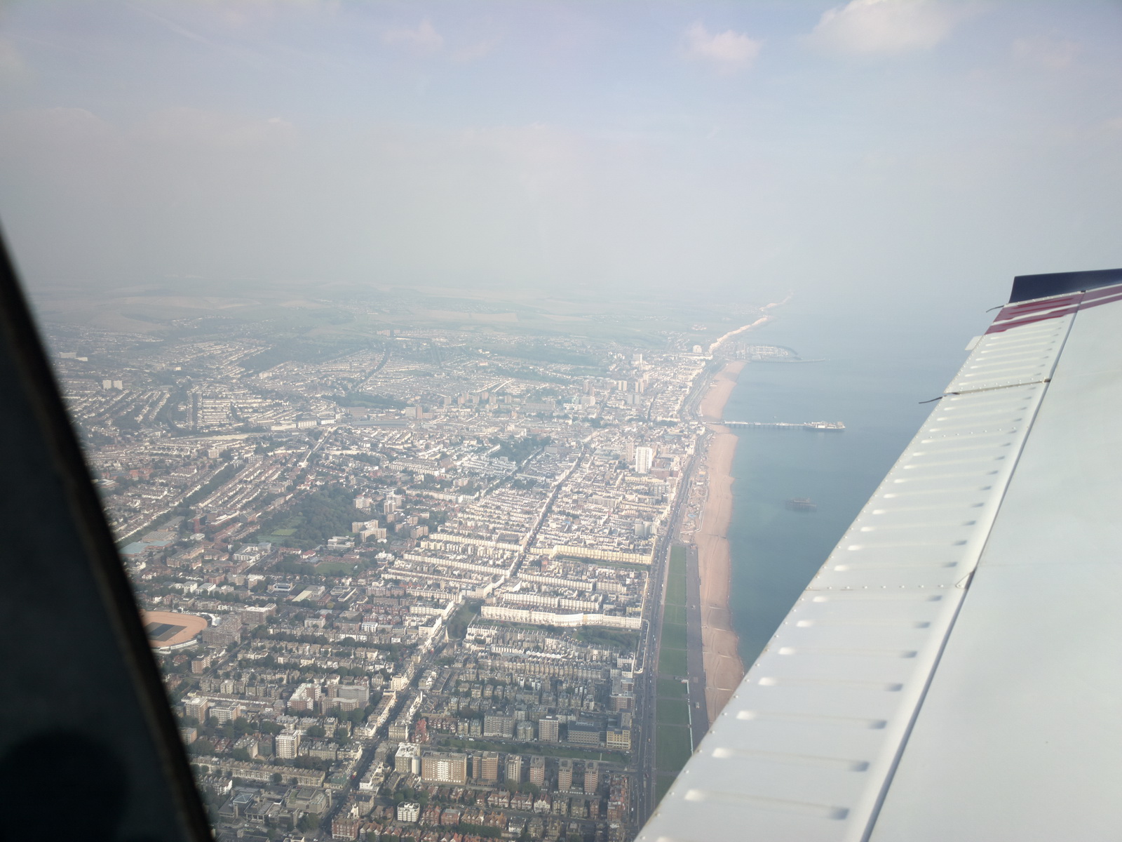
A lot of haze back in the UK, over Brighton
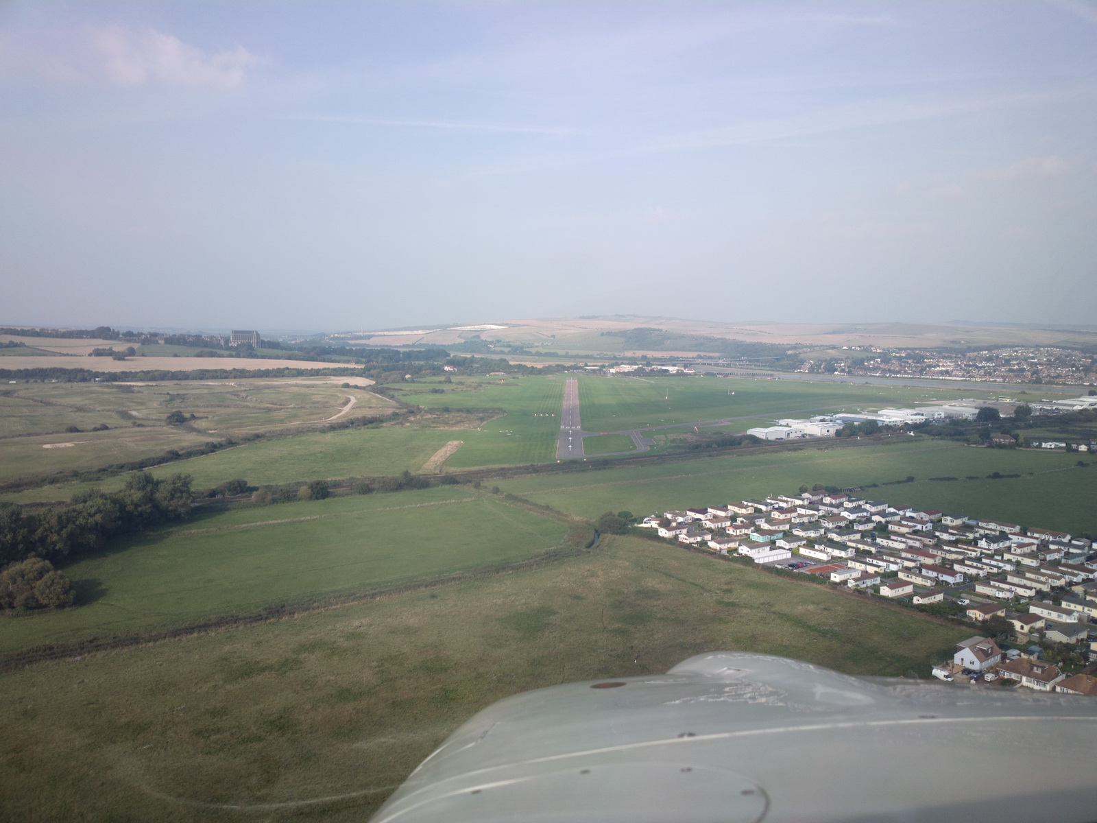
and finally home
At 7:15hrs airborne time, this was probably my longest ever flight and it was a real exercise in weather and fuel management.
The EuroFPL tracking shows the route actually flown (in black)
![]()
Zagreb / flight to Shoreham gallery
Track Logs
These are Oziexplorer track logs which, using various online tools, can be converted to KML / KMZ (Google Earth etc) files:
Shoreham-Albenga-Calvi
Calvi-Corfu
Corfu-Sitia
Sitia-Samos
Samos-Kalymnos
Kalymnos-Leros
Leros-Ikaria
Ikaria-Samos-Lesbos
Lesbos-Zagreb
Zagreb-Shoreham
Airport Charges
I have not kept all the receipts so this is just a selection:
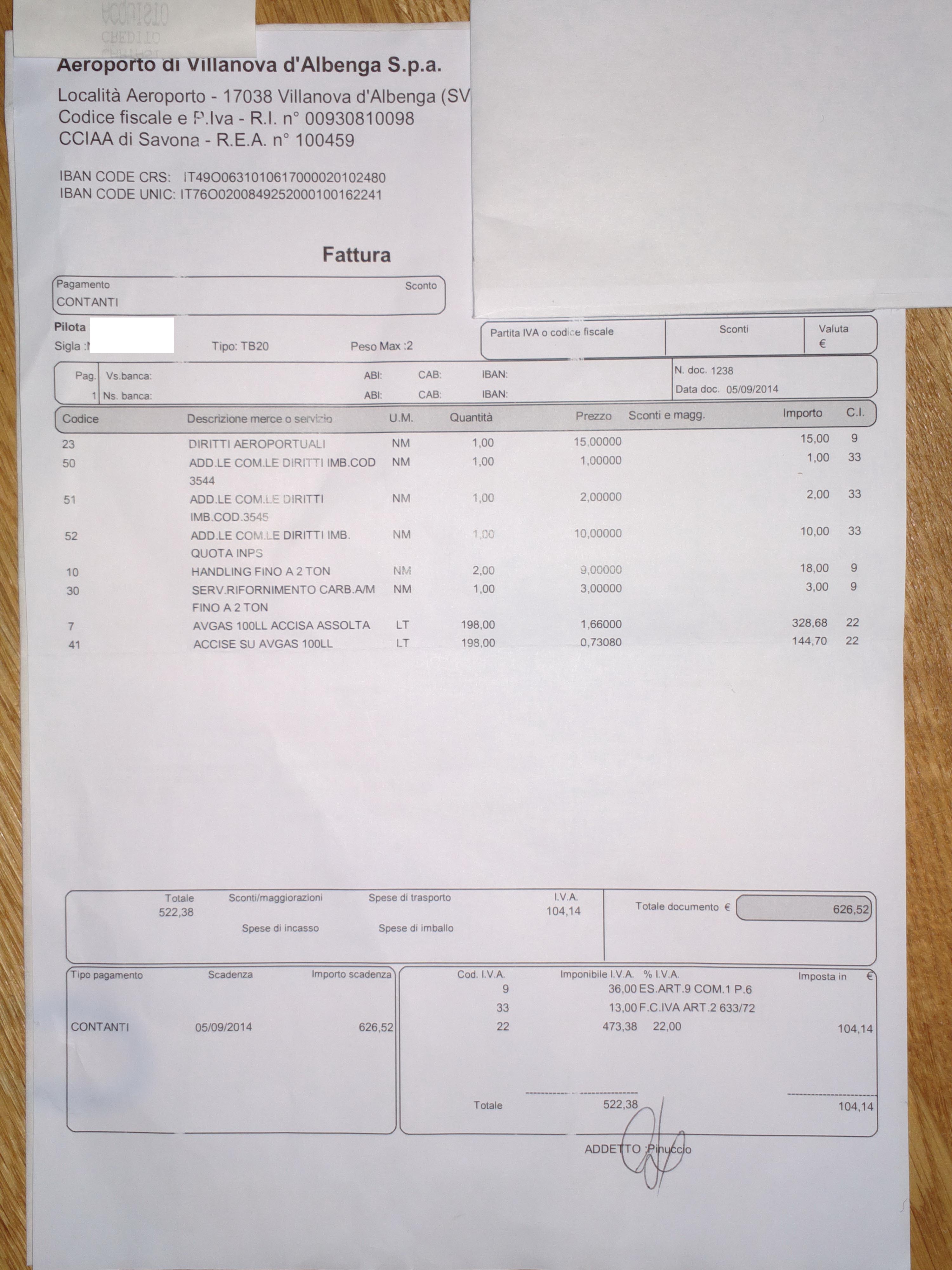
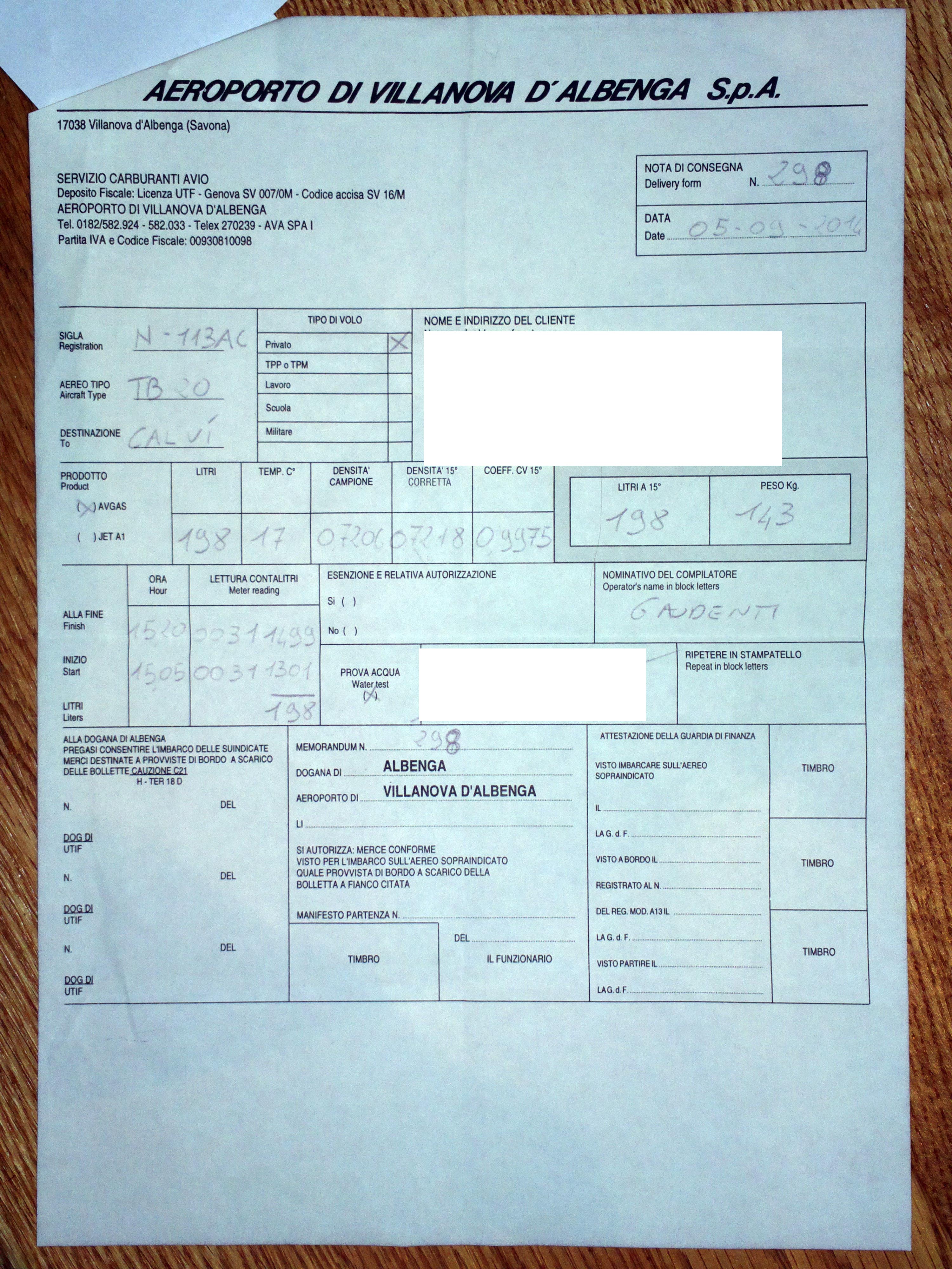
Albenga: Incomprensible 1 2
Calvi: €35.23
Corfu: fuel €2.80/litre
Sitia: handling €35, landing €7.34, CAA fees €0.90, VAT 23% 8.22,
total €51.29; fuel €3.11/litre (AIR BP)
Samos: about €50; fuel €2.80/litre
Kalymnos: €11 plus €12 passenger tax
Leros: €7.34 plus €12 passenger tax
Ikaria: about €10 plus €12 passenger tax
Zagreb: landing 628 HRK (€83); fuel 17.65HRK/litre
None of the Greek airports were outrageous on handling or landing fees - in the region of €50 for the bigger ones. All Greek airports impose a €12 tax per passenger, which can be avoided if your passenger has a pilot license (I believe this will work for only 1 passenger max).
There is a 50% discount on handling fees with Swissport or Goldair if you produce evidence of AOPA membership. US AOPA will also do. More details here (para 12).
Flight times (airborne times):
Shoreham-Albenga 4:40
Albenga-Calvi 0:50
Calvi-Corfu 4:40
Corfu-Sitia 2:45
Sitia-Samos 1:10
Samos-Kalymnos 0:30
Kalymnos-Leros 0:15
Leros-Ikaria 0:20
Ikaria-Samos 0:15
Samos-Lesbos 1:05
Lesbos-Zagreb 5:55
Zagreb-Shoreham 7:15
Greece remains perfectly accessible to GA but obviously an aircraft with a reasonably good range is required. You cannot usefully fly around Greece in a Cessna 150! Everyone was really friendly but I do wish they reduced the paperwork, most of which serves absolutely zero purpose. The GENDEC for example is just a pointless record of the flight and half of the airports either don't give it to you or never look at it. The only bit of paper which is needed is the invoice for the charges, and a receipt (a signature on the invoice, maybe) proving payment which the pilot should keep for at least a year in case the airport later claims that some fees were not paid. I have had that happen to me but only in northern Europe.
The aircraft performed perfectly and - amazingly for a trip of this complexity
- not a single flight was delayed or cancelled. The versatility is ideal for
this mission profile, although obviously a Jetprop
would be better for the long legs ![]()
The photos on this trip were taken with a mixture of a Pentax K3 (for most of the airborne pics), a Nokia 808 phone (40MP downsampled to 12MP), a Canon S95, and a Samsung phone. The Pentax pics were taken in both jpeg and raw and later I edited the raw versions in Lightroom to bring up the "blacks" a little, to remove the haze. All the others are unretouched except for cropping and geometric correction of some panel pics. The amazing Nokia 808 has transformed photography for me because I always have a very good camera with me, but the Pentax is always better for airborne work because of much better manual control and an improved ability to avoid reflections from objects in the cockpit.
No general aviation aircraft were seen airborne on the entire trip.
I owe many thanks to Kyprianos for the original tip about the three small islands,
to my other Greek friends for the great meet-up at Mitilini, to Colm and Jenny
for their great company and a lack of fear at FL190 with the stall warner coming
on, and to my girlfriend Justine for looking after me on the Greek islands ![]()
This page last edited 28th March 2018