 :
:Trip to Barcelona - July 2012
This article describes a straightforward IFR (airways) trip from Shoreham (EGKA) in the UK to Barcelona (Sabadell, LELL) in Spain, and back 2 days later.
Procedurally, the flight was very similar to other airways flights I have done. Other VFR and IFR trip reports can be found here.
I don't write up trips unless there is something new to write about and in this case it was mainly the IFR-VFR procedures at Sabadell.
I am omitting the general details of the aircraft, etc, which can be found in the previous articles, and these should be read first.
Here is a glossary for non-aviation readers.
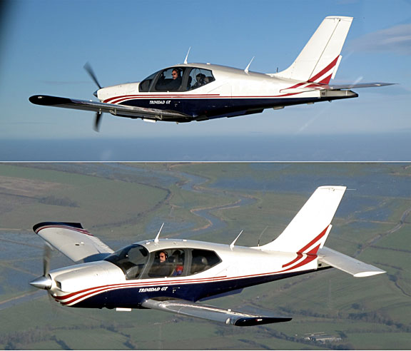
Aircraft
The aircraft is a 2002 Socata TB20GT which has a zero-fuel "book" range of approximately 1100nm and an economical cruise speed of 155kt TAS at 10,000ft. Extra economical cruise power settings can extend the zero-fuel range to 1300nm which, according to FAA rules, translates to approximately 1100nm with IFR reserves. It has a ceiling of about 20,000ft and is equipped with oxygen. It is not certified for flight into icing conditions but has a TKS de-iced propeller. This is the actual aircraft
:
Navigation equipment includes a KLN94 IFR GPS (approved for enroute IFR and GPS/RNAV approaches) and a KMD550 MFD and these are used for primary navigation. IFR flight in Europe at any meaningfully high altitude requires BRNAV certification which in the GA context is met only with a BRNAV approved IFR GPS installation.
The aircraft has a KFC225 autopilot which can track VOR/GPS/LOC/ILS and fly a preset altitude or a preset VS. There is an additional battery powered Garmin 496 GPS which also provides an audio terrain warning (TAWS) function with a European terrain and obstacle database. The TAWS function projects the current trajectory for 2 minutes and if there is a terrain conflict, one gets a "pull up" type audio warning whose tone gradually becomes more urgent. A WX500 stormscope is also installed. One of the radios has 8.33kHz channel spacing to legalise flight at 20,000ft although I have never been assigned such a frequency
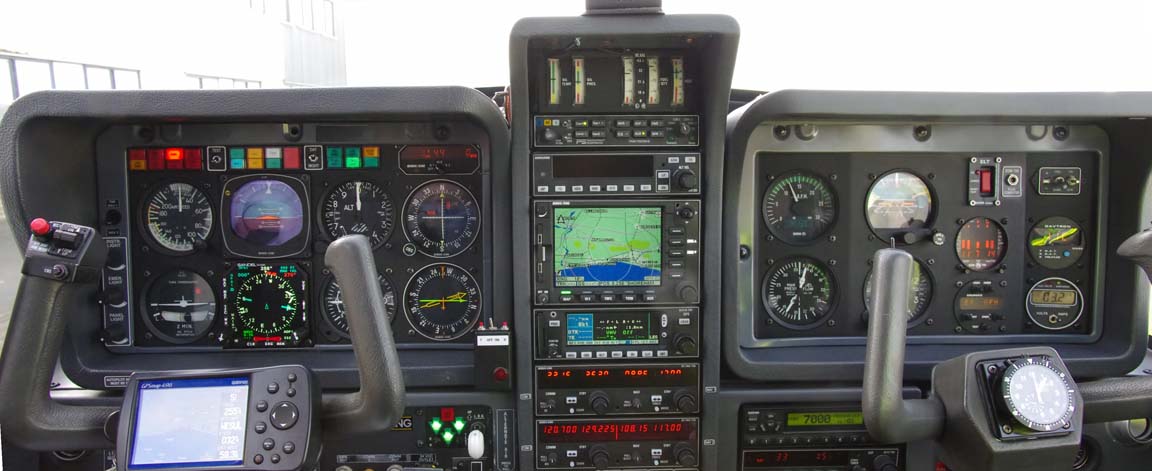
A Sandel SN3500 EHSI was recently installed which provides automatic waypoint sequencing to the autopilot so a whole route can be flown without HSI course pointer adjustment.
Which Barcelona airport?
There are several to choose from. The obvious "big" one is El-Prat
LEBL which is H24 with Customs, avgas, the lot. It is however very expensive
- of the order of €400 - and requires landing slots to be booked. One Spanish
pilot that I know personally advised me to not even think about landing at LEBL
unless I was on fire ![]() This document shows Spanish airport charges but the reality can be very
different as a result of mandatory handling. Another airport, more popular with
GA, is Girona LEGE which has Customs, avgas and an ILS but is a considerable
distance from Barcelona; probably 2 hours unless one has a car parked there.
Sabadell LELL is very popular and well organised but is VFR only. There are
other VFR-only airports in the area but they are further out.
This document shows Spanish airport charges but the reality can be very
different as a result of mandatory handling. Another airport, more popular with
GA, is Girona LEGE which has Customs, avgas and an ILS but is a considerable
distance from Barcelona; probably 2 hours unless one has a car parked there.
Sabadell LELL is very popular and well organised but is VFR only. There are
other VFR-only airports in the area but they are further out.
As the weather was likely to be VFR, I decided to file for Sabadell LELL with Girona LEGE as the alternate.
My normal procedure (more info) for "airport planning" is to email and fax, to all published contact details, all relevant airports several days in advance and see what comes back. In this case, none of them replied. Well, El-Prat did reply several days later (after I had departed) saying We are pleased to inform you that your e-mail has been sent to the department in charge. Remember that you can contact us for other information you may need and that was about as far as I got. Eventually I telephoned Sabadell (because I actually wanted to go there) and got through to a very helpful person, with subsequent very good comms by email.
Both Sabadell and Girona are "PNR Customs". Sabadell needed the pilot/passenger names and passport numbers and sorted everything in advance.
Weather
More detailed notes on IFR weather planning are in my earlier trip writeups here.
The first thing to look at are the MSLP charts. Simply avoiding the frontal patterns depicted on this chart normally works very well; it avoids the worst icing conditions and turbulence, and ensures cloud tops are almost never above FL180. It is a very good technique for long distance safe IFR flight in an aircraft which does not have heavy duty anti-ice equipment and radar, but flying to/from the UK with its frequent frontal systems it does result in the cancellation of a proportion of flights (perhaps 30%) which would have been possible had one been willing to "go up and have a look around".
However, there are non-frontal conditions which still involve widespread atmospheric instability and resulting heavy cloud with quite high tops. These tend to be either widespread instability caused by a number of Lows in close proximity (which tends to result in convective activity with tops to FL200 and occasionally higher, but with plenty of blue sky holes in between - example), or air mass thunderstorms which are common in the summer especially in southern Europe and which can pop up more or less anywhere.
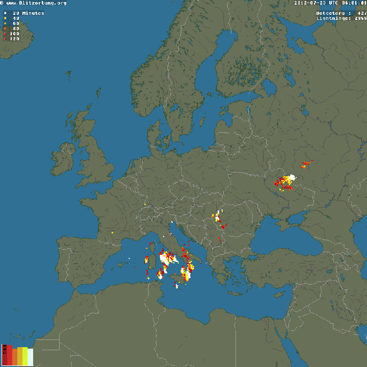
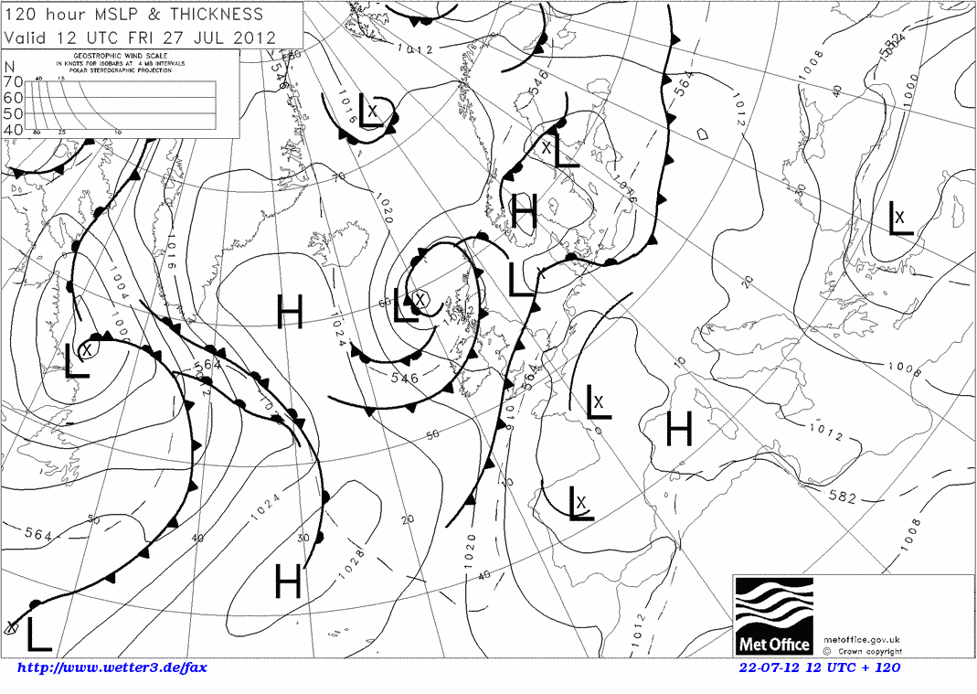
The following MSLP chart, which shows the approximate route in red, shows both of these conditions
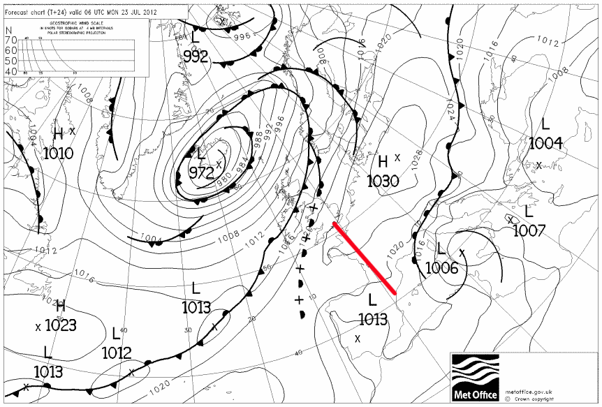
There is a lot of instability particularly to the east of Sardinia (the troughs invariably appear in the TAFs as a PROB30 TSRA or similar) and the high pressure whose centre is around East Germany / Poland can often produce impressive thunderstorms if there is enough heat and water around.
I tend to avoid enroute IMC because at Eurocontrol flight levels this tends to place one squarely into icing conditions, and turbulence is almost assured on any long flight. To judge whether any enroute IMC can be outclimbed, I use the IR satellite images
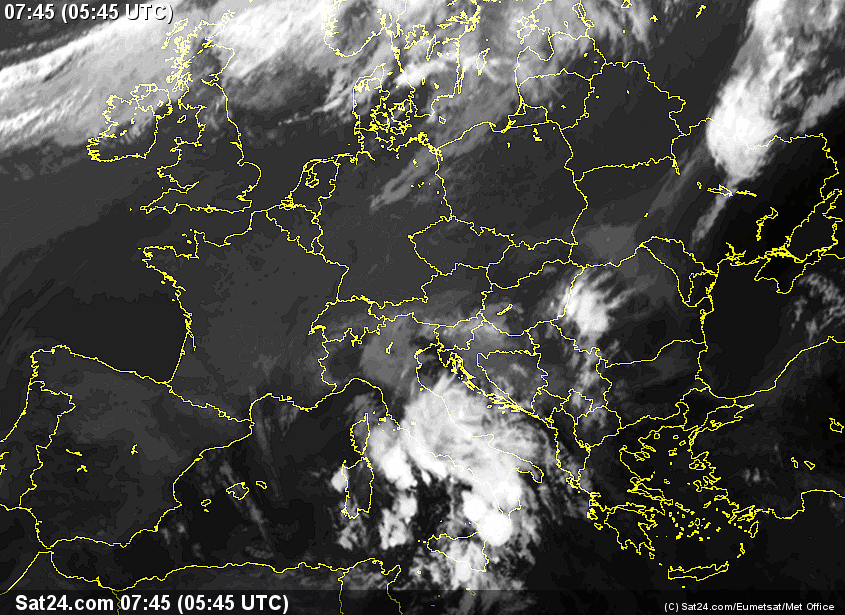
On these images, the whiter the cloud is the lower its temperature and thus the greater its altitude. High altitude cloud, say FL200 plus, shows up as something approaching solid white (e.g. the obvious thunderstorms over Italy in the pic above; the tops there will be at least FL300). IR imagery which contains a temperature scale (enabling a more accurate altitude estimate; if necessary by reference to altitude/temperature data which for some reason is a lot more accurate) does exist but I have not found any which is less than several hours old... I therefore use experience to judge where the cloud tops might lie. For example the bit of grey in east Germany is probably around FL150-180 and given that my aircraft can climb to FL190-200, this is not a problem if it is to be encountered enroute, after one has had a chance to climb up. I am not aware of any more precise way of doing it and to a large degree one is relying on the aircraft having a reasonable operating ceiling. I would not be doing this in a C152.
Some notes on this type of cloud tops forecasting are here.
The above IR image shows obvious correlation with the MSLP chart higher up, and this is confirmed by the sferics (lightning strikes) image
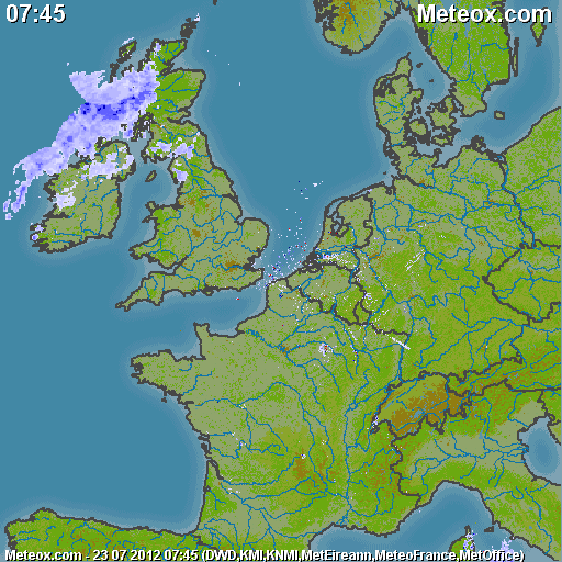
The weather radar, which in this case covers only down to souther France, was clean:
There are other radar sites which show Spain.
Obviously the weather for the proposed flight, on 23rd July, was very good.
Nobody wants to be hanging around a city when the weather is bad ![]()
For the return flight, 25th July, the weather looked very similar, but gradually degrading after that: 24 25 26 27. I like to have at least one day's leeway for a delayed return.
I cancel a lot of trips due to return weather issues because the instrument approaches at Shoreham have a high MDH (in prevailing winds, runway 20, 800ft+) and thus poor utility for getting back home. Also, as in 2010, the DME was out of service which takes out the instrument approach to 20, leaving the 02 and a circle to land to 20 only. There is a GPS approach but this has a similar ~800ft MDH and thus offers no greater utility, and perversely it is dependent on the NDB because that features in the missed approach procedure...
The TAFs and METARs were fine.
For good measure the SigWX charts for 0600 and 1200 looked fine. However these are of limited use for non-jet ops because a lot of information is missing. For example, a forecast of any CB activity in a given area removes any mention of other cloud types.
Preflight Procedures
IFR route design: The Eurocontrol (often interchangeably called CFMU or IFPS) IFR routings were generated and validated online in just minutes using FlightPlanPro (FPP). This routing tool has revolutionalised European IFR route development. It generates an initial route from its internal airway database; the route is submitted to Eurocontrol for validation (internet access is required) and is iteratively modified.
I then paste the validated airway route into Jeppesen Flitestar, from which
the plogs and other material (e.g. enroute chart sections) are printed out.
Provided that the flight is executed on more or less the filed route (plus or
minus say 100nm either side) there is no need to ever open the unwieldy printed
airway chart in the cockpit. This
trip report shows my workflow in detail, but actually there are numerous
other ways of doing the same thing. I print out everything needed for the flight,
but some pilots just rely on saving the route data on an Ipad and hope it keeps
working ![]() The following
route pics are screenshots from Flitestar, and any version of Flitestar (even
the Flitestar VFR Europe basic product) can be used to produce them, and the
relevant in-flight information.
The following
route pics are screenshots from Flitestar, and any version of Flitestar (even
the Flitestar VFR Europe basic product) can be used to produce them, and the
relevant in-flight information.
The outbound route:
EGKA
SITET A34 LMG G36 GAI B31 BERGA VFR
LELL
FL140
567nm (GC) 571nm (airways)
Alternates: LEGE, LEBL
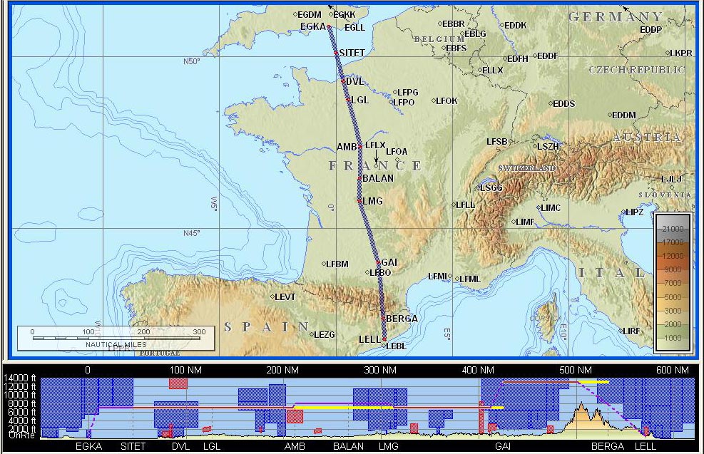
The filed level was FL140. The exact level does not matter; one can vary it according to weather. Normally I file for FL140/150 or higher as this yields better routings than lower down.
The above route is one of the most direct I have ever had, with an overhead of just 0.7%.
The return route:
LELL
SLL IFR B31 BCN G23 REBUL A29 AGN A34 LGL H20 DPE R50 ABB
T27 KUNAV Y8 WAFFU
EGKA
FL140
567nm (GC) 700nm (airways)
Alternates: EGHH, EGMD
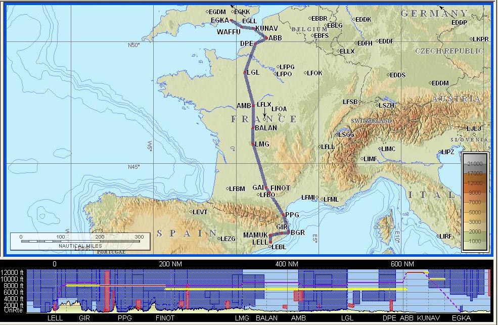
The above route is one of the least direct I have ever had to actually file, with an overhead of 23%. A number of routes are possible, including one which goes near BERGA (as the outbound route does) but all suffer from big doglegs. This is a fairly common occurrence with Eurocontrol routings, on which the average overhead is some 10%, and one tries to either do various hacks with DCTs or hopes to be able to eliminate doglegs on the actual flight. I have some notes on this here.
In this case I accepted the dogleg at the departure end, via PPG, to get a view different from the outbound route. On the actual return flight this was not flown, due to Spanish ATC not playing ball. At the UK end, the problem is caused by one-way airways, which ATC ignores anyway, so one can usually get a DCT from LGL to Shoreham.
Flight plan filing was done electronically, at zero cost, using EuroFPL for both legs. Today there are several ways of doing this but I continue to use EuroFPL because it is a data-efficient website which is usable over a slow GPRS/3G connection, works on my Nokia 700 phone, has a flight tracking facility which enables someone on the ground to monitor your progress, and (in the paid-for version) offers SMS facilities for delaying or cancelling the flight plan. I retain the free AFPEx site (available only to pilots with a UK address) as a backup system. More notes on electronic flight plan filing options are here.
Note: the Eurocontrol routings given here and elsewhere will most likely not work by the time you might try them because the precise form needed to get the route into the Eurocontrol (IFPS) computer in Brussels changes from one week to the next, and there are frequent differences between weekdays and weekends which are largely due to a lack of military activity on weekends.
Notams showed nothing of significance. On IFR flights I usually get airport notams only, because enroute issues are dealt with by ATC, and the route actually flown varies anyway. Airport notams are important because many "southern Europe" airports use the notam system to publish information which they know is incorrect in the AIP.
Fuel Planning
Fuel was not an issue on this flight, involving around 60% of the aircraft zero-fuel range. No conceivable wind could have caused problems, and there are many alternates.
Oxygen
In IFR, oxygen is as vital a flight planning issue as fuel. This flight was filed for FL140 and oxygen is practically and legally mandatory. Anyway, I never fly anywhere IFR without oxygen because doing so nearly halves the aircraft operating ceiling and discards by far the most attractive weather avoidance option: climbing to VMC on top. I also use oxygen anytime at/above FL100; the flow rate at FL100 is very low but it keeps you fresh and you don't arrive tired.
I now fly with the Mountain High O2D2 electronic demand regulator which works superbly. Over this trip, the pressure gauge on the 48 cu. ft. composite cylinder hardly moved...
The Flight
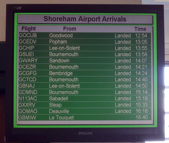
The Shoreham (Class G) departure clearance was: After departure left turn to SFD, remain outside controlled airspace, squawk 2254, contact London Control 133.175.
The initial base of controlled airspace in the area is 5500ft so one sets 5400ft as the target level on the autopilot...
On first contact, London Control asked for the customary squawk ident and then issued a clearance to enter controlled airspace, with a climb to 6000ft on track to SITET, then FL080 to ETRAT. Then I was transferred to Paris Control who gave me a climb to the FL140 filed level. This was followed by a 130nm DCT to KOVAK.
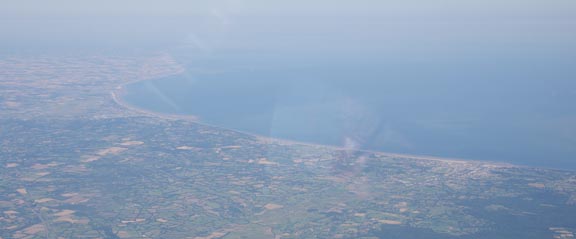
The conditions were CAVOK but - as usual in the summer - very hazy as shown in this unretouched pic of N France (I apologise for the window reflections)
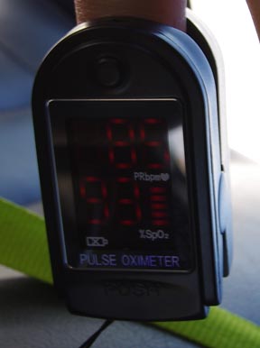
The Mountain High O2D2 electronic demand regulator was working superbly, as before, delivering 93% blood oxygen without any effort
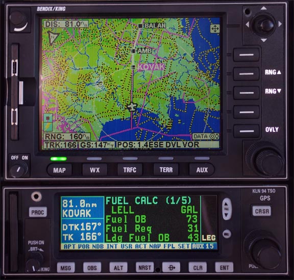
Early on in the flight at FL140, the landing fuel on board (LFOB) was showing 43 USG which turned out to be a pretty accurate estimate
The air was very warm; +1C at FL140 which is ISA+14. The actual altitude, from the GPS, at FL140 was 14870ft, which as a percentage increase roughly corresponds to ISA+14 being a 5% increase in the absolute temperature. The correspondence is not perfect because the increment over ISA is not going to be uniform all the way up to FL140.
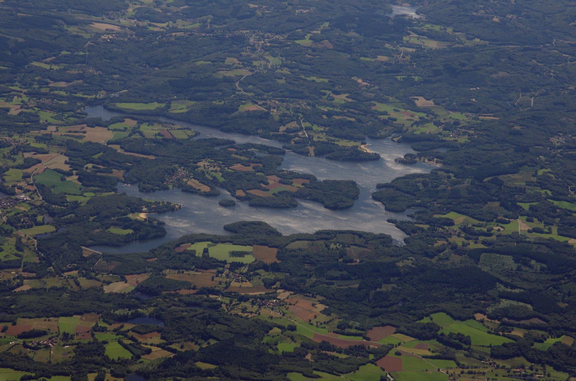
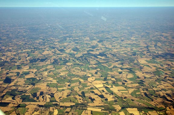
Northern France doesn't offer many photo opportunities; this interesting lake was one of the better ones
Another long DCT was a 147nm one to PUMAL. The whole French section was very quiet. There really is very little traffic in the lower airways (below FL200) everywhere in Europe.
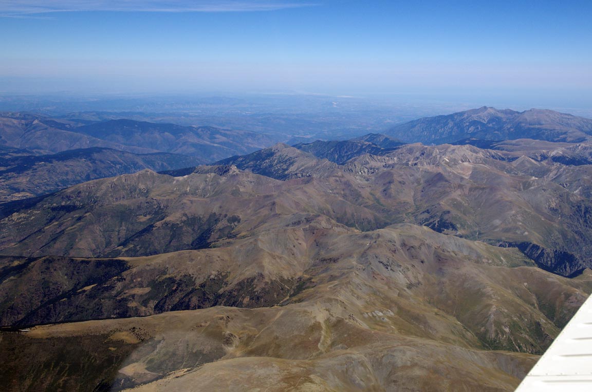
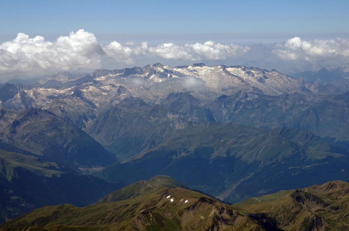
As the Pyrenees appeared in the distance, about 80nm away

some turbulence started to build up, which was not suprising as the tailwind had gradually increased to about 30kt. To minimise whatever might be coming I asked for a climb to FL170. The temperature at FL170 was -2C which is ISA+17 which was one of the warmest high altitude conditions I had ever seen. This visibly impacts aircraft climb and operating ceiling performance; FL180 would have been achievable but not a lot more than that.
However, for whatever reason, virtually no turbulence was encountered over
the Pyrenees, which was as per previous flights in that region, and remains
a bit of a mystery. We were about 7000ft above the terrain (which looks awfully
closer ![]() ) however...
) however...
Following a handover to Barcelona ATC, I saw some cloud buildups in the distance, immediately on the south side of the Pyrenees, with tops estimated around FL140
Not wishing to descend into these unneccesarily, and seeing they formed in
a narrow band, I left it to Spanish ATC (who being severely
underpaid were struggling as usual with directing various aircraft ![]() )
to give me a descent when they get around to it and hopefully later rather than
sooner. Looking at the VFR chart of the area, which I carefully studied before
the flight and had running as a GPS moving map, one might have expected a descent
to an area with low terrain, or over water. An example might be MATARO VRP,
to the east of the airport here, from
which one could proceed to the airport along the VFR route.
)
to give me a descent when they get around to it and hopefully later rather than
sooner. Looking at the VFR chart of the area, which I carefully studied before
the flight and had running as a GPS moving map, one might have expected a descent
to an area with low terrain, or over water. An example might be MATARO VRP,
to the east of the airport here, from
which one could proceed to the airport along the VFR route.
With 25nm to run and still at FL170 things got increasingly interesting... Eventually they issued a descent to FL150 and then, with 12nm to run, to FL140, followed by loads of progressive instructions of FL130, FL120, FL100, FL090, 6000ft. Note that the piece of the Jeppesen VFR chart in the link above has an error in that the "VFR prohibited" airspace caption is in the wrong place; see the yellow arrow. It would be stupid to prohibit VFR in the airspace containing the VFR routes...
The high TAS gain due to altitude, together with the northerly wind, an interesting ground speed figure was seen in the descent - 212kt
Pretty soon I was overhead the airport, so in the absence of ATC instructions
the only logical thing was to transition to flying the current heading. ATC
asked what my intentions were; I replied that I would like to land at Sabadell
at some point, as filed, please. I am sure this provided some entertainment
for the Ryanair crews ![]()
They then said I was expected to enter the hold at the SLL VOR. This was a suprise because it is not documented on any of the Sabadell airport charts. There is what appears to be a visual circuit on the VFR Approach Chart (VAC) but this shows "2000ft" which doesn't look right for a holding pattern. The AIP also shows this 2000ft visual circuit and does not mention anything about a holding pattern.
There is also the matter of the hold direction; unpublished holds are conventionally right-hand but a RH hold with an inbound track of 128 would have the protected area potentially reaching into the Barcelona LEBL airspace, so a LH hold looked more appropriate. With ATC evidently on the limit of their ICAO English language proficiency I flew a LH hold (which also aligns with the VFR circuit) and got no complaints...
Anyway, I turned back north to SLL and entered a LH hold. ATC the asked whether I was visual with the airport (which I was) and then whether I was ready to cancel IFR, which I confirmed. They then gave me a descent (in the hold) to 3000ft and a handover to Sabadell Tower who asked me to report at Point E, which is visible here, to the east of the airport. I had some difficulty locating Point E because the KMD550 MFD, which shows European VRPs, showed all the VRPs around Sabadell except this one. Fortunately I was running a VFR chart as a GPS moving map on a handheld device (under Oziexplorer) and this showed it OK. This was followed by a left base join for runway 13. I had picked up the weather for Sabadell earlier (in France) and the wind was 130/12 so this was expected.
There was a lot of haze around, with visibility given at 3500m. This pic, from left base, was slightly enhanced
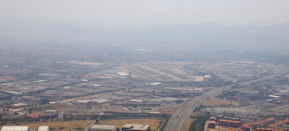
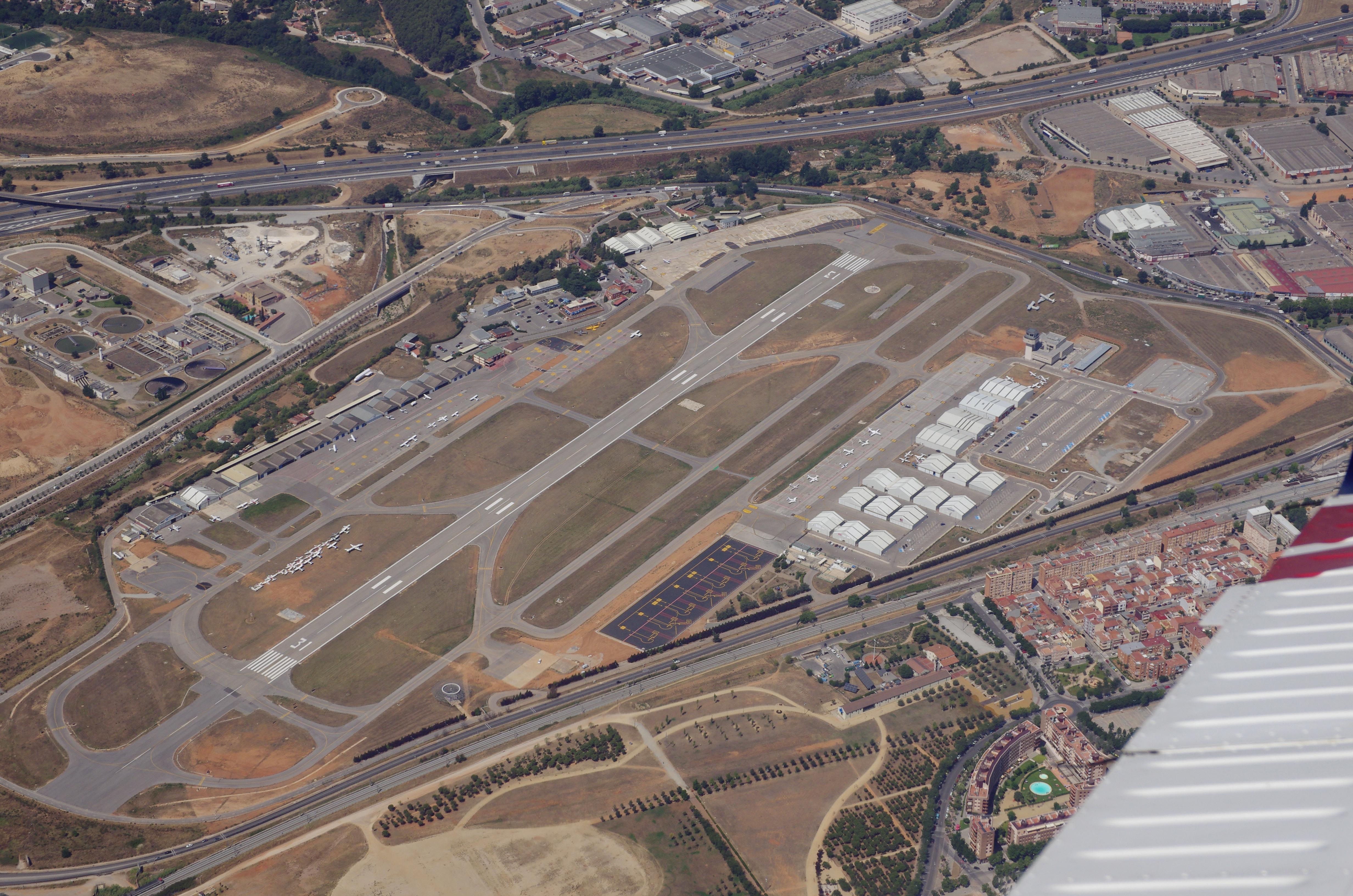
The airport is quite big, even though the runway is only just over 1000m
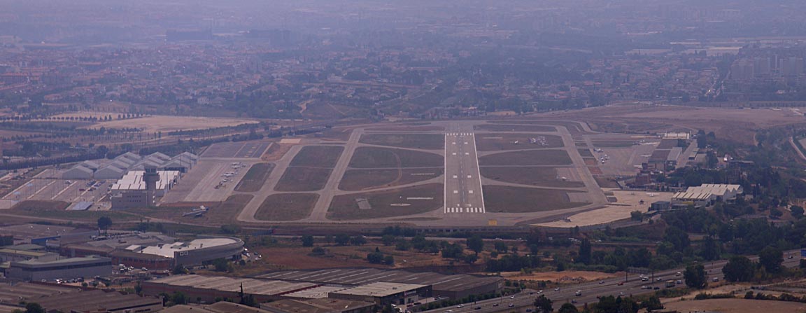
There is an impressive collection of aircraft "wreckage" next to the taxiway
While still taxiing I asked ATC for Avgas, which is always a good move. They
turned up immediately. My AIR BP fuel card was accepted, which is unusual nowadays.
I try to use it when I can, so I don't lose it, because it can be useful on
very rare occasions, with some self service pumps. The bowser was accurate to
within the error margin of my fuel totaliser (1-2%), which is not common in
that part of Europe ![]()
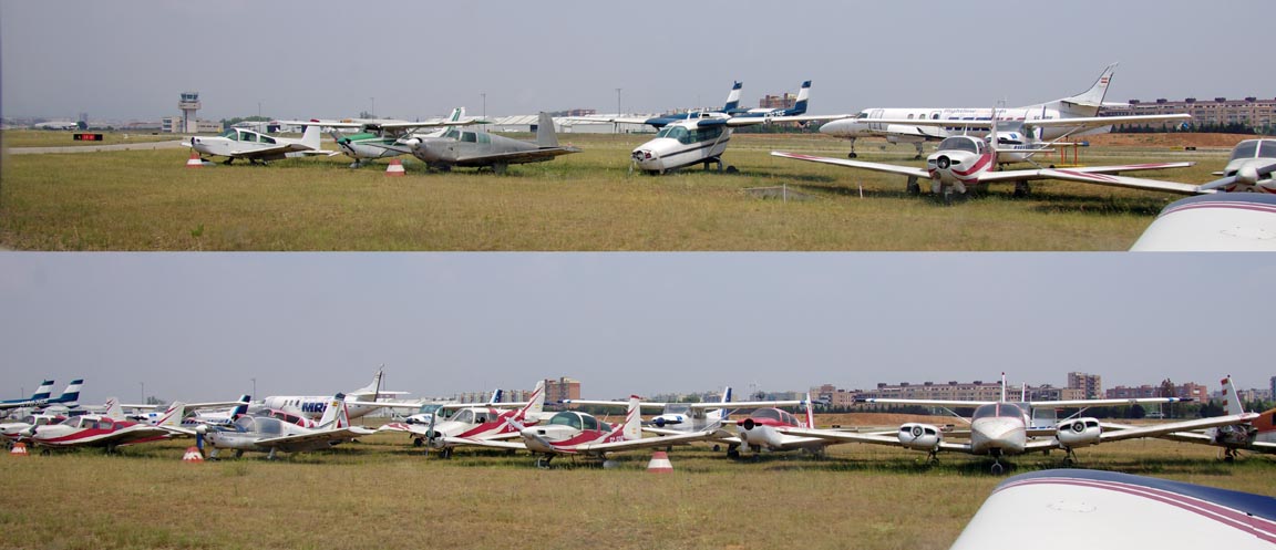
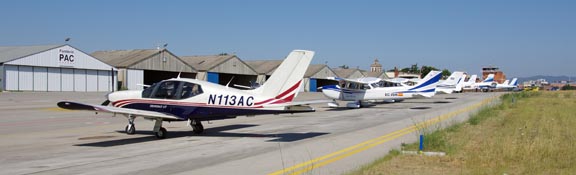
There is ample parking, well spaced out, and all of it is on a hard surface
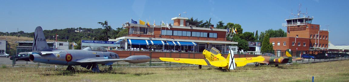
Various interesting "permanently resident" aircraft are around the place
There are two ways to get out of the airport. One is to go out conventionally, walking to the airport office and then getting a taxi etc. The other is to use the handling company. Normally, GA traffic tries hard to avoid handling because it is usually a ripoff, but in this case I was advised by a local pilot to use the 100ALAS handler which, for €80, does the landing, parking, and an aircraft-to-hotel car transport to Barcelona city centre, and apart from the convenience this saves around €80 on ripoff taxi fares. This company turned out to be truly excellent, delivering the smoothest process I had ever seen at any major airport, and I recommend them highly. Their number is +34937120781.
As an experiment I did a video of the entire flight to LELL using a window-mounted Canon G10 HD camera, in a specially constructed antivibration mount. The installation was completely standalone and no interaction with it was necessary during the flight. The video was obviously too long and mostly boring so, in a number of steps, the enroute section was speeded up 16x. The video is here.
Barcelona
There is plenty to see, of course, although at this time of the year (July) it was heaving with tourists. There is a huge amount of shops; all the usual brand names and more. The cathedral is impressive. The city is renowned for its pickpockets, which range from the conventional sort to children who pretend to be begging while stealing mobile phones from restaurant tables, so one needs to be careful.
The Return Flight
The MSLP charts 0600 1200 showed weather similar to the outbound flight, with good high pressure conditions. The TAFs confirmed it.
The IR satellite image was clean. The sferics picture was clean too.
The 100ALAS handling car arrived at the hotel exactly on time. The smoothness of the handling company was rounded off well by them having the credit card machine in the car. It is very rare that one comes across an aviation business which has discovered that customers are happier to part with cash when they are getting something for it.
I was expecting another "interesting ATC experience" on departure, and I got it. For runway 13, the airport charts (which, being VFR only, contain no IFR procedures) carry a "turn left on 069 heading to village Mollet". The request for engine start was met with a squawk of 5536. The departure clearance collected later was "after departure, climb to 4000ft on runway heading, until 3 miles, then turn back to the field". This suggested I was to take up the hold there.
After takeoff I was asked to report passing 3000ft, then handed to Barcelona who requested remaining in the hold until 6000ft.
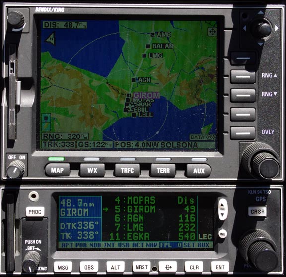
It is fairly easy to fly holding patterns with my avionics. One can hack it by turning the heading bug and watching the tracks on the GPS. Or one can do it "precisely" by setting the holding fix (SLL in this case) as a DCT on the GPS, setting the GPS to OBS mode, and tracking inbound to the fix using NAV mode, switching to HDG mode for the outbound leg, and re-intercepting the inbound track using HDG with NAV ARM. Current-model avionics, with roll steering to the autopilot, can fly holds entirely hands-off.... except that most of them cannot fly unpublished holds and this hold is very likely to be one of those i.e. not in the GPS database.
While in the hold I managed to get a relatively haze-free photo of the airport
Eventually I got out of the hold and got DCTs to REBUL, then USKAR. This is in the opposite direction to the filed route, and a very long extra distance to fly; about 50nm there and back. It is completely useless unless one is happy to fly back to the UK on a route similar to the arrival route. So, going along with that unspoken change of plan, I asked for DCTs to MOPAS then GIROM which continue straight up from USKAR, across the Pyrenees, and off we went. I think Barcelona ATC were just happy to get rid of me to the French and were not interested in dealing with the filed route which went off to the east.
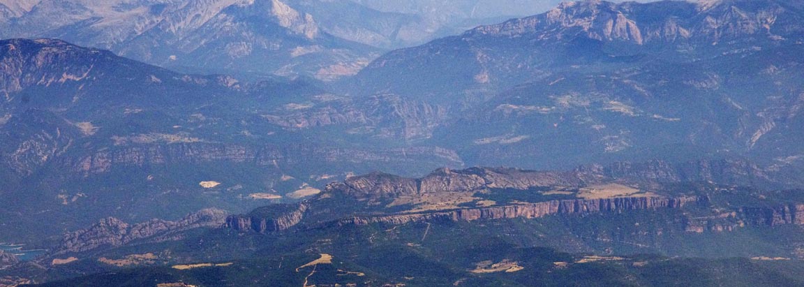
This time I crossed the Pyrenees at FL140. As on previous flights in the area (example) some interesting terrain was seen
French ATC picked me up without any issues.
Large parts of France do not exactly lend themselves to visual navigation ![]() This pic was heavily enhanced, due to haze
This pic was heavily enhanced, due to haze
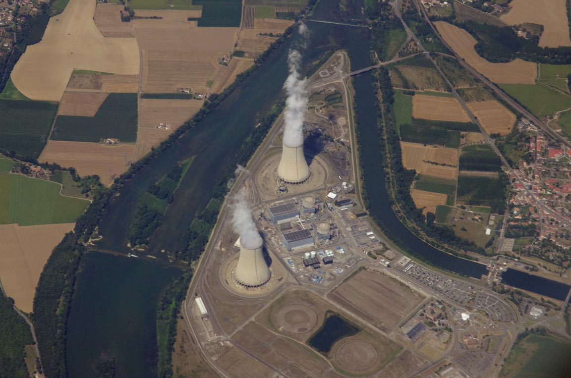
This is one of many French nuclear power stations which have prohibited airspace around them, but at FL140 I was well above it
At around the latitude of Le Mans, the KFC225
autopilot failed again, and again at the same
place where it failed in 2003, 2007 and 2008. As previously, the pitch servo
failed. The servos contain a serious design defect which causes them to self
destruct if the motor current limit circuit is activated for more than a few
seconds. Honeywell, who appear to no longer have any GA avionics design expertise,
have just implemented "Mod 11", which shorts-out the current limit
circuit with a piece of wire ![]() but this servo was "Mod 9". Clearly there is something down there
irradiating the aircraft with an intense radio emission (most likely a CW missile
tracking radar) and I would have saved myself a lot of money by switching the
autopilot completely off and hand-flying through there...
but this servo was "Mod 9". Clearly there is something down there
irradiating the aircraft with an intense radio emission (most likely a CW missile
tracking radar) and I would have saved myself a lot of money by switching the
autopilot completely off and hand-flying through there...
The handover to London Control was at ETRAT as usual, still well inside French airspace, and they left me at FL140 for a good while, which is always good over the Channel.
I was handed to Shoreham while still in controlled airspace, in the descent. Shoreham asked if I was arriving with a visual approach (which is a procedure under IFR); I replied No as the conditions were clear, so IFR was cancelled at that point.
Landing FOB was 36 USG which is enough for over 3 hours' extra flying.
The fuel price at LELL, via AIR BP, came to £2.18 per litre including all taxes; higher than UK but not excessively so.
Lessons Learnt
Flying IFR to VFR airports can be interesting ![]() Perhaps I should have asked Sabadell, when in contact with them, how one can
expect to land there.
Perhaps I should have asked Sabadell, when in contact with them, how one can
expect to land there.
This trip would have been possible under VFR but with some consideration to controlled airspace in Spain. Over France, the same route as filed here could be flown between FL065 and FL115, where the airspace is Class E.
The aircraft performed perfectly - apart from the autopilot issue.
Some notes on Socata TB20 ownership and operation are here.
Pilot: FAA CPL/IR + JAA PPL/IR, approx 1500 hours.
Any feedback, reports of dead links, corrections or suggestions much appreciated:
Contact details
This page last edited 12th August 2012
