Trip to Locarno, Switzerland - March 2011
This article describes an IFR (airways) trip from Shoreham (EGKA) to Locarno (LSZL), and back the following day.
Procedurally, the flight was very similar to most other airways flights I have done. IFR flying tends to follow a set pattern, with the main variable being the weather. Other VFR and IFR trip reports can be found here.
This trip was slightly different from normal IFR because Locarno has no instrument approaches, so the flight there was "IFR to VFR" i.e. a Y flight plan, and the return flight was the opposite i.e. a Z flight plan.
There is a nearby IFR-capable airport; Lugano (LSZA). However, the instrument approach has a steep (6.65 degree) ILS and requires a special pilot qualification. There are three levels (A,B,C) according to various conditions, and the lowest level (A) can be done as an online exam on the Lugano airport website. Passing the exam requires reading many pages of the Lugano AIP and briefing notes. Unfortunately I failed it twice, despite spending several hours reading all the stuff. Then, suspecting a browser issue (I use Firefox with some plug-ins) I tried it again with Internet Explorer and passed it immediately, but the certificate would not print out (it said you can print it only once), the confirmation email did not appear, and the Swiss pilot I was meeting up with confirmed with a phone call to the airport that they had no record of me passing the exam. So I decided to not bother. And, for VFR, Lugano has very little over Locarno; it has wider opening hours and perhaps a shorter notice for Customs, but it a lot more expensive. In any case, the weather was expected to be very good, which is always desirable when flying around the Alps.
Here is a glossary for non-aviation readers.
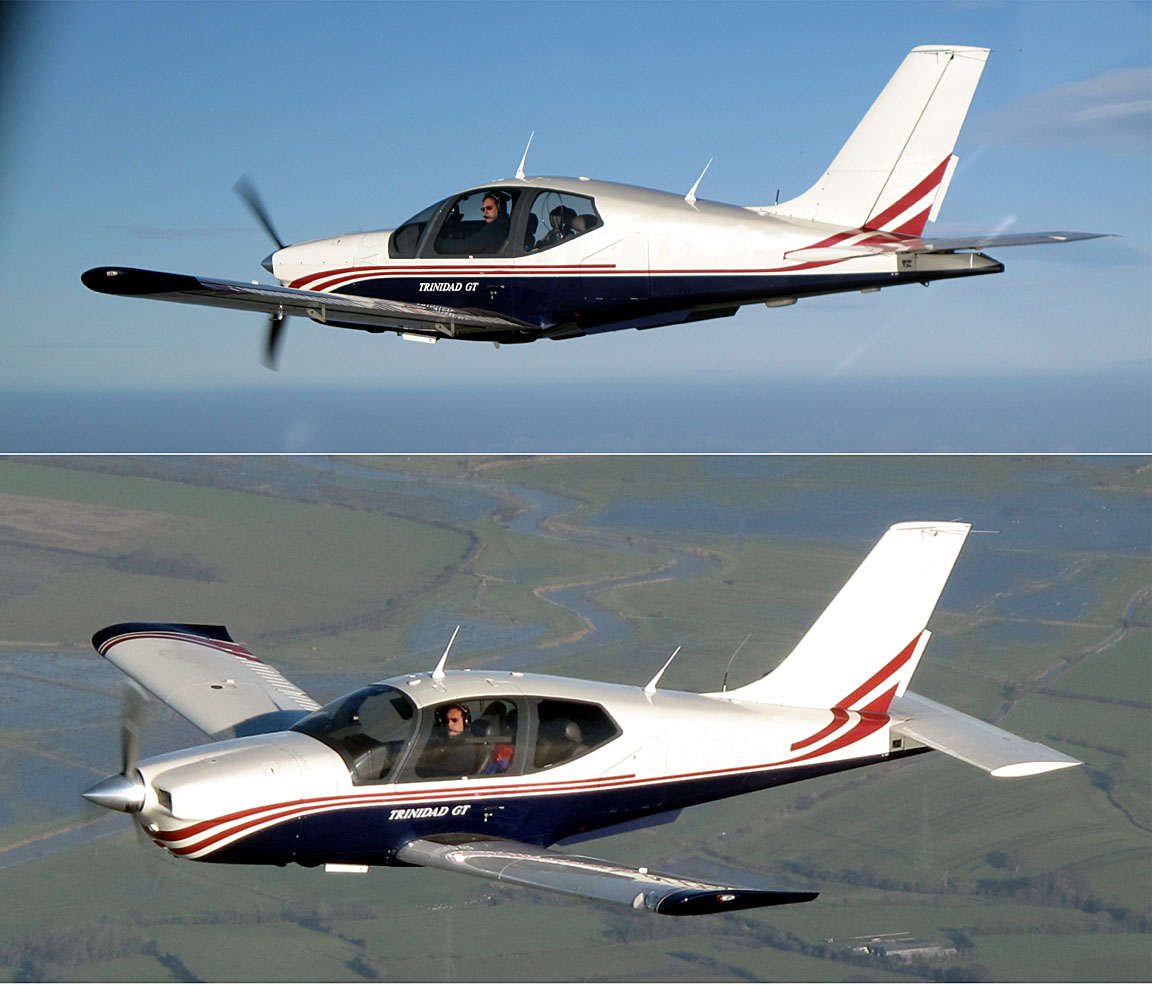
Aircraft
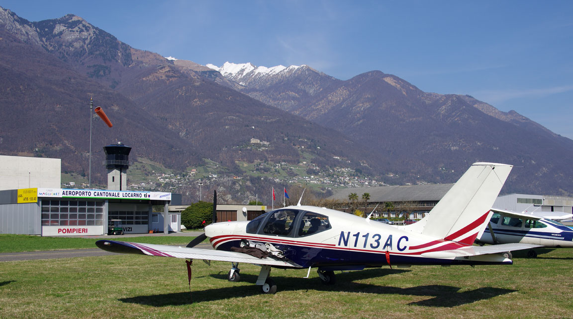
The aircraft is a 2002 Socata TB20GT which has a zero-fuel "book" range of approximately 1100nm and an economical cruise speed of 155kt TAS at 10,000ft. Extra economical cruise power settings can extend the zero-fuel range to 1300nm which, according to FAA rules, translates to approximately 1100nm with IFR reserves. It has a ceiling of about 20,000ft and is equipped with oxygen. It is not certified for flight into icing conditions but has a TKS de-iced propeller.
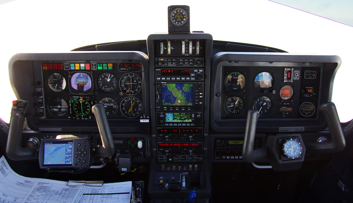
Navigation equipment includes a KLN94 IFR/BRNAV GPS and a KMD550 MFD and these are used for primary navigation. IFR flight in Europe above FL095 (generally) requires BRNAV certification which in the GA context is met only with a BRNAV approved IFR GPS installation. The most common means of BRNAV compliance is one of the Garmin 430/530 products but many other panel mounted GPSs have been approved.
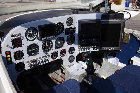
The aircraft has a KFC225 autopilot which can track VOR/GPS/LOC/ILS and fly a preset altitude, VS, or pitch. There is an additional battery powered Garmin 496 GPS which also provides an audio terrain warning (TAWS) function with a European terrain and obstacle database. A WX500 stormscope and two independent VOR and ILS receivers are installed. The aircraft is almost completely factory-standard but a recent addition is a Sandel SN3500 EHSI
Flight Planning Equipment
In this case of a trip spanning just two days, all planning and flight plan filing was done at home, before departure, on my PC. However, I always carry a laptop just in case. Nowadays it is easy to get TAFs and METARs on any modern mobile phone capable of WWW access, but unless one carries a huge "phone" a laptop is still much easier for anything complicated. The laptop has GPRS/3G internet access, via a bluetooth-connected mobile phone, which provides independence from airport weather briefing and flight plan filing services, and enables flights to be fully replanned if one gets stuck somewhere.
On a short trip like this, it makes sense to file even the return flight plan in advance, because cancelling or delaying it is much easier than filing it.
Weather
I normally avoid enroute frontal weather because the cloud tops tend to be above the aircraft ceiling (20,000ft).
The MSLP chart for the outbound flight 0600 1200 showed good stable high pressure conditions, and these were expected to remain for another day or two but not much longer 1200 1200 1200. The MSLP also indicated light winds, which is important for flight over mountainous terrain.
As expected, the 0600 1200 SigWx showed nothing significant. These charts show weather hazardous to jets and other commercial aircraft, and are much less useful to non-deiced GA pilots. Contrary to widespread belief, they do not show cloud tops. I barely look at the SigWx nowadays, and have never seen anything on them which was not obvious from the MSLP chart. They were recently crippled by the removal of frontal information, and by the removal of any cloud-related information in any area where CBs are forecast.
The IR satellite image on the morning of the flight showed no high altitude cloud along the route which is shown approximately in yellow
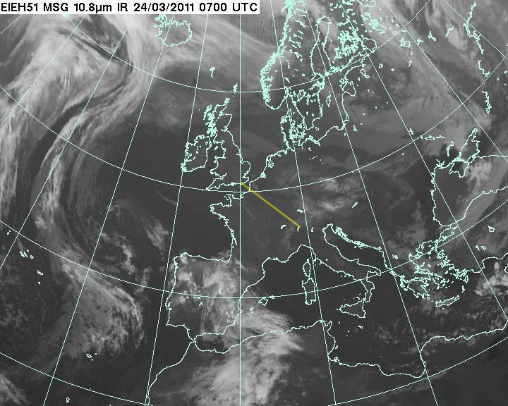
On these images, the whiter the cloud is the lower its upper surface temperature and thus the greater its upper surface altitude. Cloud with high altitude tops, say FL200 plus, shows up as nearly white, and "real" frontal weather, with tops of say FL300, is solid white. It is easy to relate the IR image with the MSLP chart and compare the fronts. IR imagery which contains a temperature scale (enabling a more accurate altitude estimate; if necessary by reference to altitude/temperature data which for some reason is a lot more accurate) is available but I have not found any which is free and less than several hours old...
When IFR, I always fly the enroute section VMC on top and have spent way too much time trying to understand cloud tops forecasting. An article on tops is here. However, tops forecasting remains far from reliable and is likely to remain so because commercial aviation has no use for that kind of data. Consequently, nowadays, my IFR go/no-go decision is made on the day, on the basis of the TAFs/METARs (for surface conditions) and the above satellite IR image (for enroute / high altitude conditions).
This simple but very effective system has never let me down in that I have never had a "rough" flight or had to turn back, although it does result in the cancellation of some flights which a bolder pilot would have embarked on and, due to the "scattered" nature of weather, would have got away with. The question is ... what about the ones he does not get away with? If you are in IMC, with several hours to run at that altitude, with no way to outclimb it, and things are getting "rough", or you start collecting ice in a big way, you have no way of knowing if things are going to get better or worse. I don't like to be in that situation. One should always have an escape route but if that is a diversion to some dump, what was the point? In N Europe, one can usually do the flight the following day.
On very long flights, the winds aloft also matter. I usually disregard tailwind for fuel planning purposes and use the forecast headwind directly. However, in Europe, the effective aircraft range is more often set by the availability of airports and suitable alternates that have Customs and Avgas. The effect of the actual wind does of course show up in the constantly updated landing fuel on board (LFOB) computation and this figure can be used for diversion decisions on the actual flight.
For good measure, the radar image and sferics (lightning) were obtained and both showed nothing.
This type of high pressure makes for excellent high altitude flying conditions but - in the winter, especially - it can be very mucky at low altitudes, and there is the risk of fog especially as the evening arrives and the air starts to cool towards its dew point. However, the temperature and dewpoint at LSZL were widely separated and previous days' weather reports did not indicate a risk of fog.
For alternates I prepared Malpensa (Italy), Zurich (Switzerland) and a couple of others. I expected to use up slightly over half the fuel so a return to Shoreham would not have been feasible.
IFR Route Design
Today, FlightPlanPro (FPP) is the tool of choice. It delivers good routings at least 95% of the time. The two routes for this trip were developed in seconds.
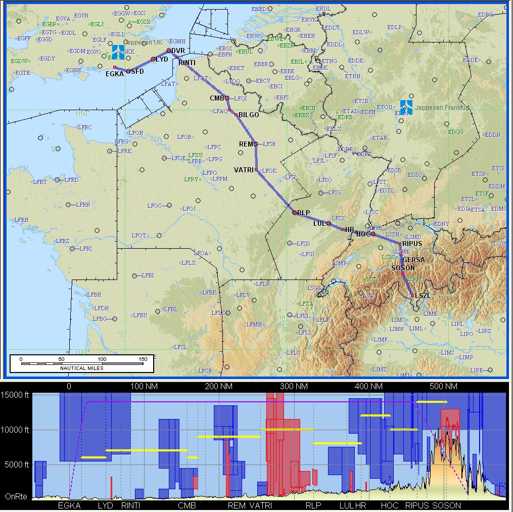
The outbound route:
EGKA (Shoreham)
SFD Y803 DVR L10 RINTI B3 RLP G4 HR/N0150F120 G4 HOC L613 RIPUS
N850 GERSA/N0150F130 N850 SOSON VFR
LSZL (Locarno)
FL100
459 nm (GC) 532 nm (airways)
Alternates: LSZA (Lugano), LIMC (Malpensa), LSZH (Zurich)
The return route:
LSZL (Locarno)
CANNE/N0150F130 IFR Z651 MANEG L613 HOC G4 RLP B3 BILGO H20 XORBI H40 ABB T27
GURLU Y8 WAFFU
EGKA (Shoreham)
FL130
459 nm (GC) 513 nm (airways)
Alternates: EGHH (Bournemouth), EGMD (Lydd), EGMC (Southend)
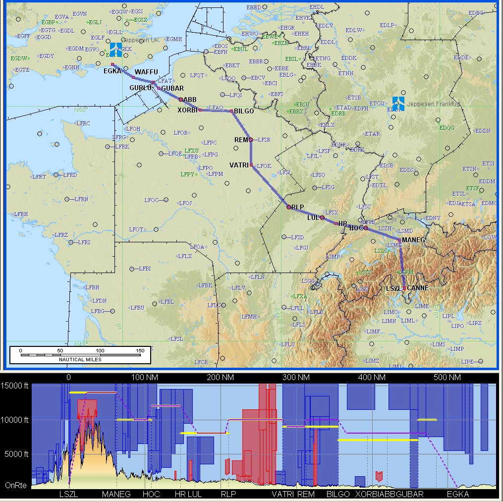
Beware: the terrain profile shown in the route illustrations (e.g. the one above) is not accurate. The Jeppesen Flitestar software contains large elevation errors. Also, the flight level shown in the profile diagram does not relate to the flight; filed or actual.
The difference between the two routes near the UK is because the airways in that area are unidirectional. I have no idea why they were designed that way because ATC disregards it anyway, but one has to get the route into the Eurocontrol computer somehow. There are hacks one can use (mainly involving the use of DCTs) but unless there is a big detour I am not usually all that bothered and prefer to ask ATC for shortcuts.
I normally file for FL140 or higher as this yields better routings than lower down, places the flight decisively in controlled airspace, and places the enroute section above the clouds most of the time. One can always ask for a "stop climb" once in clear VMC. On this trip there was very little to gain by filing above FL100 and anyway the outbound route contains step-ups to FL120 and FL130. The filed levels mean very little in practice, except that flight may not be possible below them on the day, due to military airspace etc.
Some notes on European airways route design are here.
Of course, FL130+ requires oxygen but I never fly anywhere seriously without oxygen because doing so nearly halves the aircraft operating ceiling and discards by far the most attractive weather/ice avoidance option: climbing to VMC on top. I also use oxygen anytime at/above FL100; the flow rate at FL100 is very low but it keeps you fresh and you don't arrive tired.
More detail on the usage of FPP and Flitestar are in this trip writeup. However, there are plenty of other ways to plan IFR flights; for example FPP alone, or EuroFPL alone, are quite capable of generating all the information actually required for the flight. I like to use Flitestar because of the nice mapdata and the ability to print off enroute chart sections which avoid the need to refer to the unwieldy printed airways chart. It is a rather clunky program though and I don't use most of its features.
Other Preflight Tasks
PPR (prior permission required) or PNR (prior notice required) is a frequent issue in Europe and does apply at Locarno where they want PNR for Customs, by fax, the day before the flight. There is no mandatory handling.
Flight plan filing was done electronically using EuroFPL. EuroFPL is a data-efficient website which is usable over a slow GPRS/3G connection, and it has a flight tracking facility which enables someone on the ground to monitor your progress. It also offers a facility for delaying a flight plan by sending an SMS message. More notes on electronic flight plan filing options are here.
Note: The Eurocontrol routings given here and elsewhere will most likely not work by the time you might try them because the precise form needed to get the route into the Eurocontrol computer in Brussels changes from one week to the next, and there are frequent differences between weekdays and weekends which are largely due to a lack of military activity on weekends. However, fragments of old routes can be useful even if the route does not validate as a whole anymore.
Fuel Planning
Fuel was not an issue on this flight, involving around 50% of the aircraft zero-fuel range. The winds were forecast around 10kt which was not an issue given the aircraft range and the availability of avgas at Locarno, all alternates, and many other airports in the area.
Outbound Flight
Shoreham is in Class G and thus unable to issue a clearance to enter controlled
airspace (CAS). One normally collects a provisional departure clearance from
the tower, but this flight was filed to depart at 0845 when the tower would
be unmanned. In such a situation (sometimes called a "farm strip departure"
![]() ) one calls up the
regional FIS service to pick up some kind of provisional IFR clearance, or at
least instructions on where to get the proper one from. In this case one calls
London Information on 124.60.
) one calls up the
regional FIS service to pick up some kind of provisional IFR clearance, or at
least instructions on where to get the proper one from. In this case one calls
London Information on 124.60.
There is a risk with this process because London Info can take a long time - anything up to 20 minutes - to come up with the handover to the IFR controlling authority (London Control). This is not a real issue if departing from Shoreham to the east / west / south because one can climb to around FL054 (the base of CAS) and that itself takes a little while, but it can be a problem if going north because (due to the Gatwick/Heathrow traffic) one then gets trapped in the Farnborough area, without a clearance to climb into CAS, which can be hazardous in IMC in icing conditions. One approach to this is to climb to the base of CAS (FL054) over the sea and then call up for the clearance; they are unlikely to request a descent.
On this occassion the departure was delayed by a few minutes and by the time I was airborne the Shoreham tower "came alive" so I got them to make the phone call to London Control in the usual way. At time of writing, Shoreham is previous-day-PPR for departures before 9am.
The initial clearance from Shoreham was "remain OCAS, direct SFD, squawk 0367, contact London Control 133.175". London Control then issued a DCT SFD FL100, and up we went...
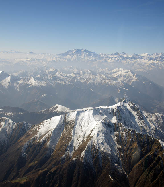
The weather was very hazy but fine. Here is a photo of the Lydd area, enhanced to remove the haze as far as possible
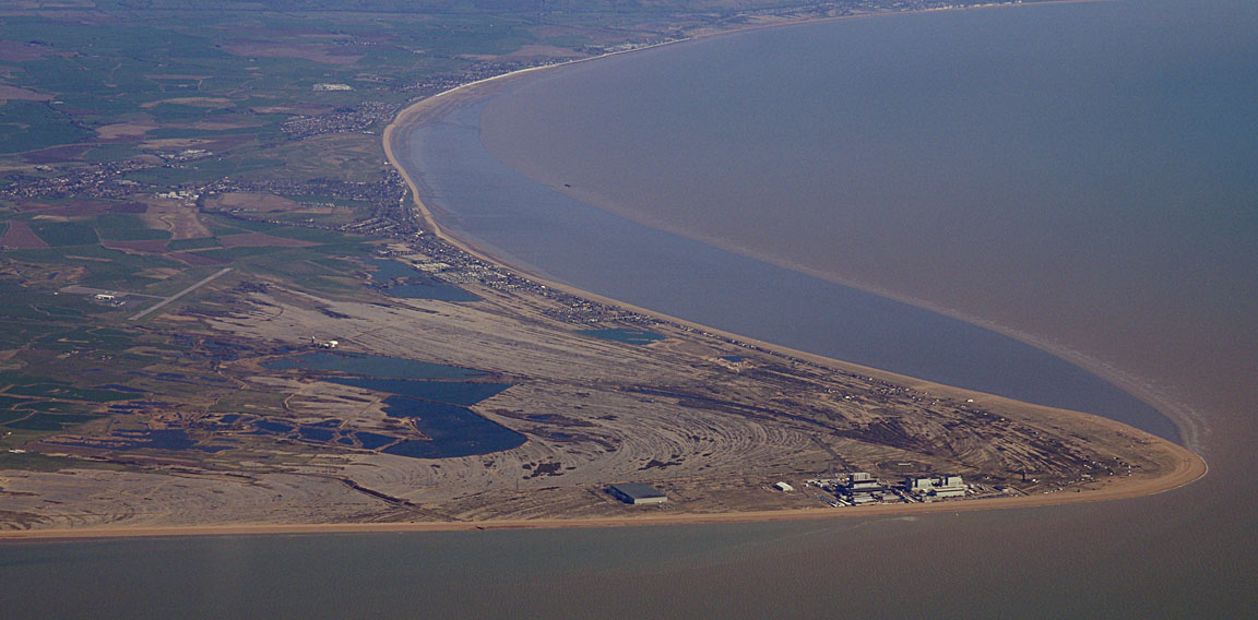
The top of the haze was almost reached at the FL100 cruise level.
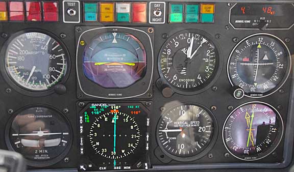
At FL100, -1C, the aircraft was doing about 150kt TAS, at MP=20" (wide open throttle), 2400RPM, 10.5 USG/hr (39.6 litres/hr)
This is not the most economical cruise but it is fast. A substantially better MPG is achieved at 2200RPM but the TAS is about 140kt.
London Control handed us over to Lille Radar. Had we been at FL120+ the handover would have been to Paris Control.
The rest of the flight was straightforward.
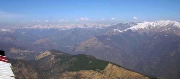
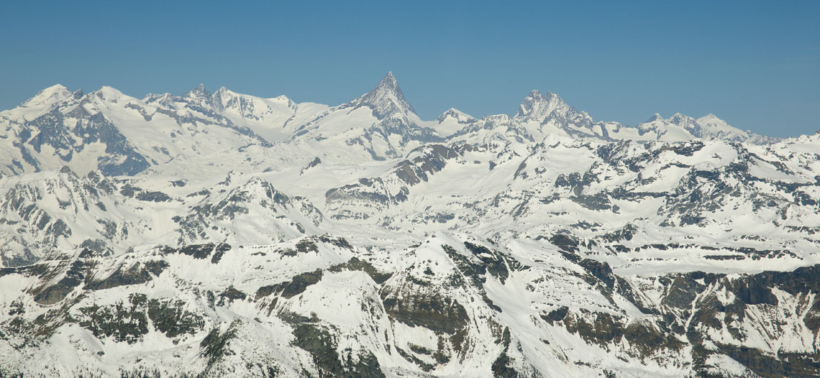
The Alps became visible at about 50nm
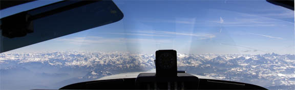
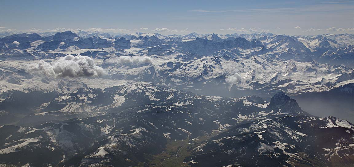
The filed route calls for an eventual climb to FL130 but I asked for FL180, to eliminate possible turbulence, to get a better view, and to provide better chances for a forced landing in the event of an engine failure. This is at FL180
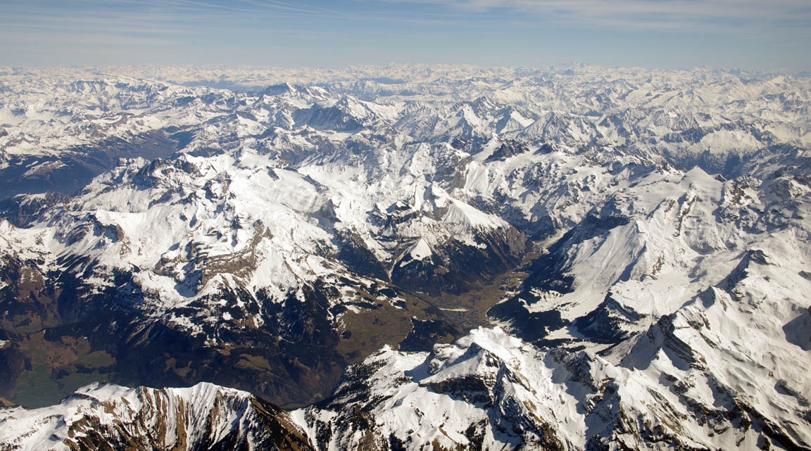
but some of the terrain does look rather "close" even from FL180
It is worth noting that this is not what is called "mountain flying" which normally involves flying right down in the canyons, under any cloudbase. Swiss private pilots are well taught in this technique and which canyons to avoid and when. I never do "mountain flying"; I just go straight over the top, at oxygen levels.
In general, from a decent altitude like FL160-180, the Alps offer plenty of emergency landing options. There are quite a few runways, loads of flat-bottomed canyons with agricultural fields in the bottom, and - in snow - lots of variously sloping surfaces. I think the Pyrenees offer much poorer options... The real problem is flying above a solid overcast, which I address by running a topo chart as a GPS moving map on the LS800 tablet computer. Not a great option but an option nevertheless, where there would be no options at all...
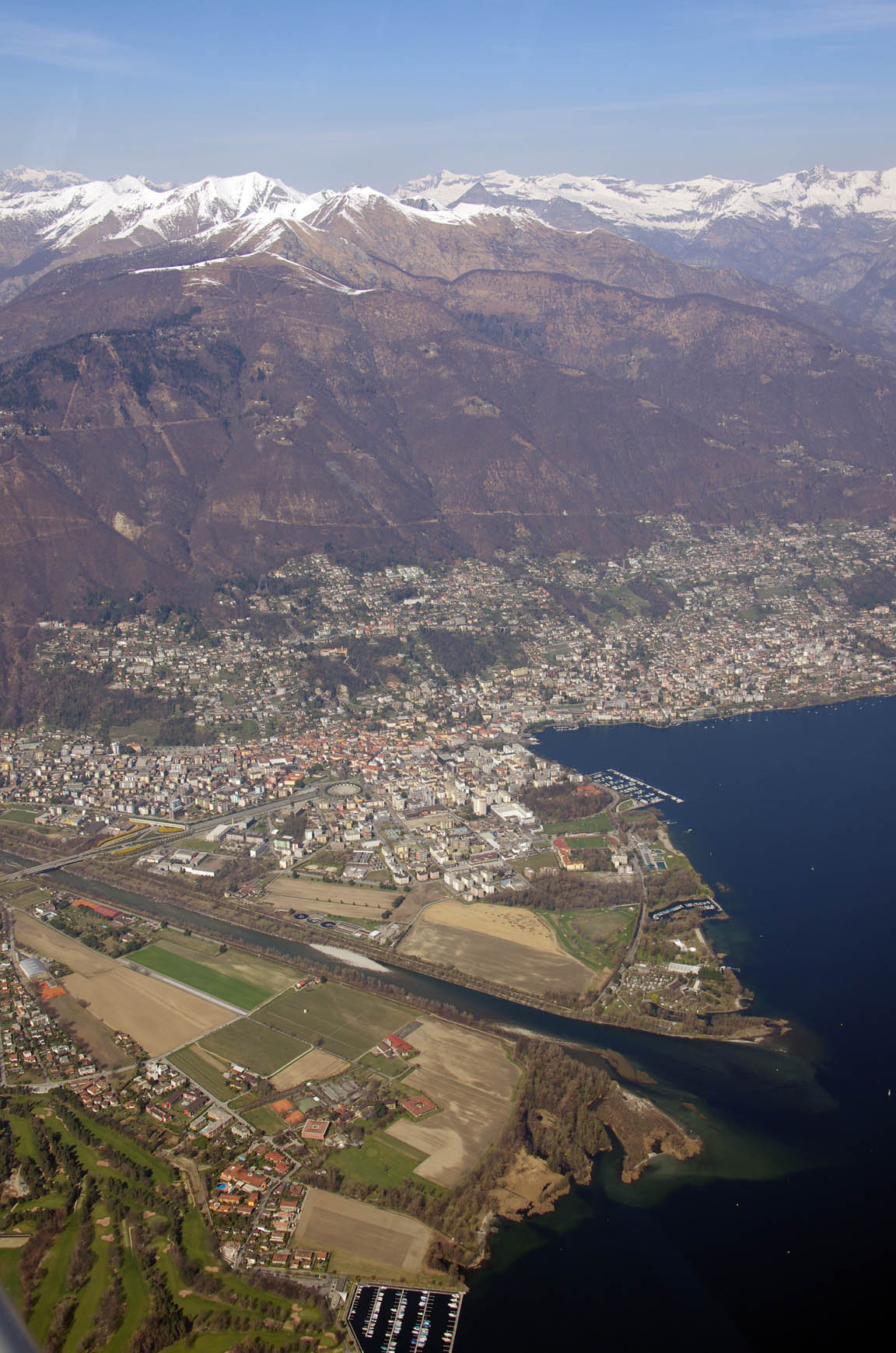
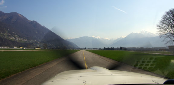
I was offered the IFR cancellation around MANEG but declined as the instant one cancels IFR one needs VFR charts (to avoid re-entering CAS, or other reasons) and I did not have wide area VFR charts to hand. I cancelled IFR with just a few miles to run and still at around FL130. The Locarno airport is just visible in the bottom left of this pic
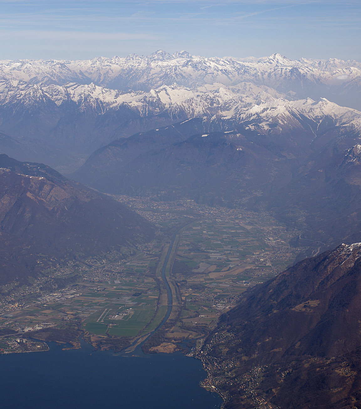
Lugano airport is in the next canyon down the road which looks quite similar and one can see this is not a place to make mistakes in real IFR conditions, especially if one's situational awareness comes wholly from conventional navaids... On a day like this it is easy and one just spirals down in many orbits, with the landing gear out to increase drag. A few views during the descent:
The current runway was 26 which is in the direction towards the reader in the above pic, so one flies into the valley and turns back, left base, to land. I was asked to report at some VRP which predictably I could not find and - unusually - it was not in the KMD550 GPS database, so I remained about 5000ft above the airport until ATC worked out where I was. There was other traffic below. This is the airport from the 26 downwind leg
Final approach on 26
and here we are...
The layout of the airport is a little odd in that there is a large military compound in the middle, the hard runway is one side of that, and GA parking is the other side of that. However, getting lost at airports is pretty standard....
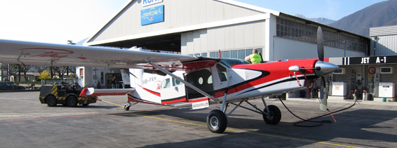
Locarno airport is laid back but efficient. The police turned up and checked my passport. Normally it is a really good idea to fill up immediately after landing, because most airports are keen to get you off airside, so asking for fuel before moving is a good tactic. But in this case the local pilot I met up with assured me that doing it the following day will be very quick. The office also confirmed one cannot pay for everything until before departure.
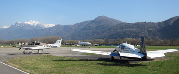
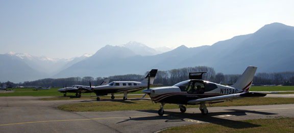
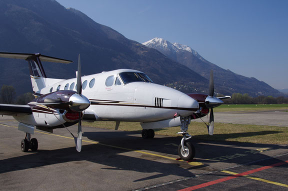
There is a wide variety of aircraft
My friend has a very impressive homebuilt canard aircraft
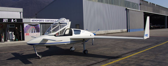
with the same LS800 tablet computer which I fly with, running Oziexplorer, except that his is panel mounted
Locarno hosts a regular canard aircraft fly-in.
Predictably there are no jets since the runway is just 800m. There is an interesting storage system in the hangar
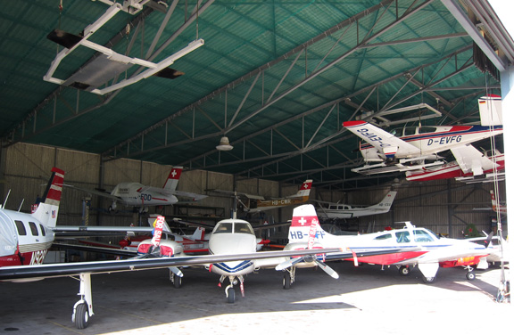
with a full-time man who moves the aircraft in and out. Swiss efficiency!
Return Flight
The return weather was as fine as the previous day's.
Locarno is VFR-only so it is a VFR departure. The tower issued a provisional IFR clearance of "after departure, turn north to CANNE, FL130, squawk 2740".
The scenery is awesome in every direction. This is taxiing along parallel to runway 08. One can depart in that direction too; there is a canyon or two which one can fly into, and there is also room to climb above the terrain, by orbiting if necessary
The runway 26 departure takes one out over the lake
Around 8000ft, one is above the immediate terrain
and it is time to turn to the north
With a VFR-to-IFR (Z) flight plan, it is very important to not delay in picking
up the IFR clearance, otherwise one is stuck outside/below CAS which is inconvenient
at best and could easily be dangerous if a climb out of e.g. icing conditions
is delayed. Some of the airspace in Switzerland is very messy, especially on
the Jeppesen VFR charts. And the infamous Swiss "ICAO" chart mixes
elevations in feet and metres on the same chart (their military use metres)
which has probably killed a few visiting pilots... I flew with that chart on
my 2004 Crete trip and wondered
why all the hills were so much bigger than they should be ![]() Note 5/2011: I am informed by a Swiss pilot that the Swiss ICAO chart is
now wholly in feet.
Note 5/2011: I am informed by a Swiss pilot that the Swiss ICAO chart is
now wholly in feet.
In this case I called up Zurich quite soon and was identified by them on radar, while flying in uncontrolled airspace towards MANEG which is in controlled airspace.
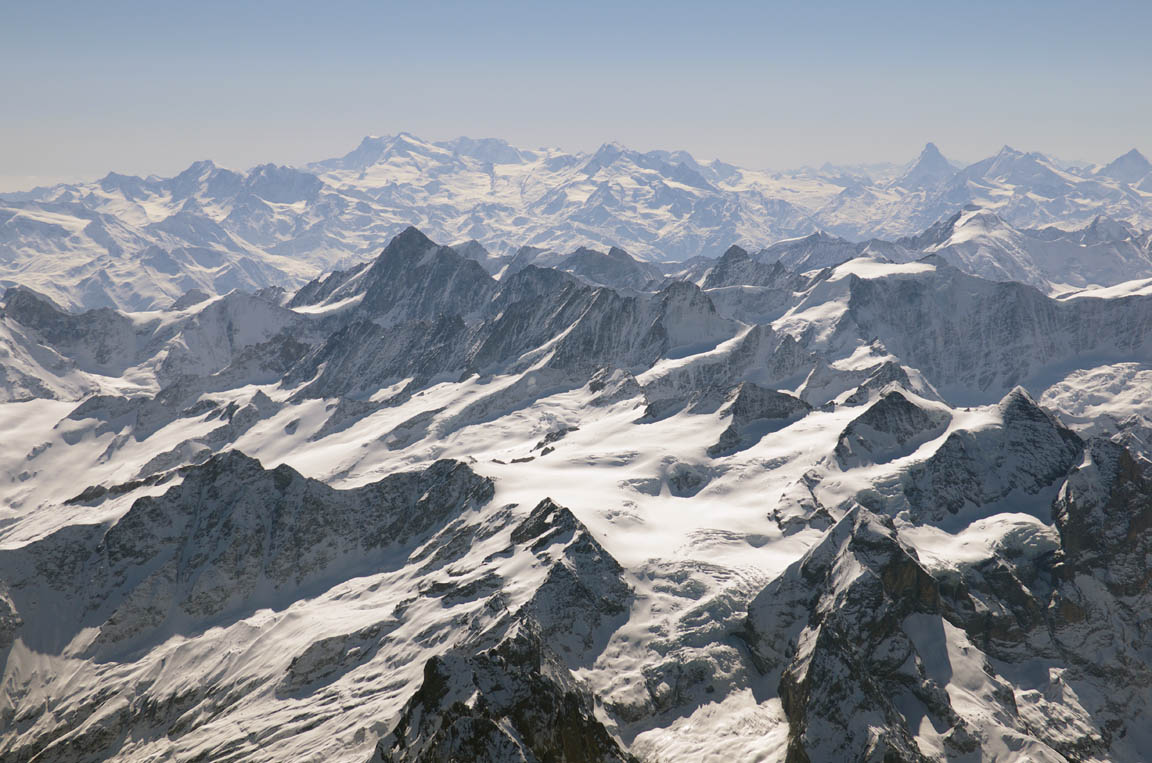
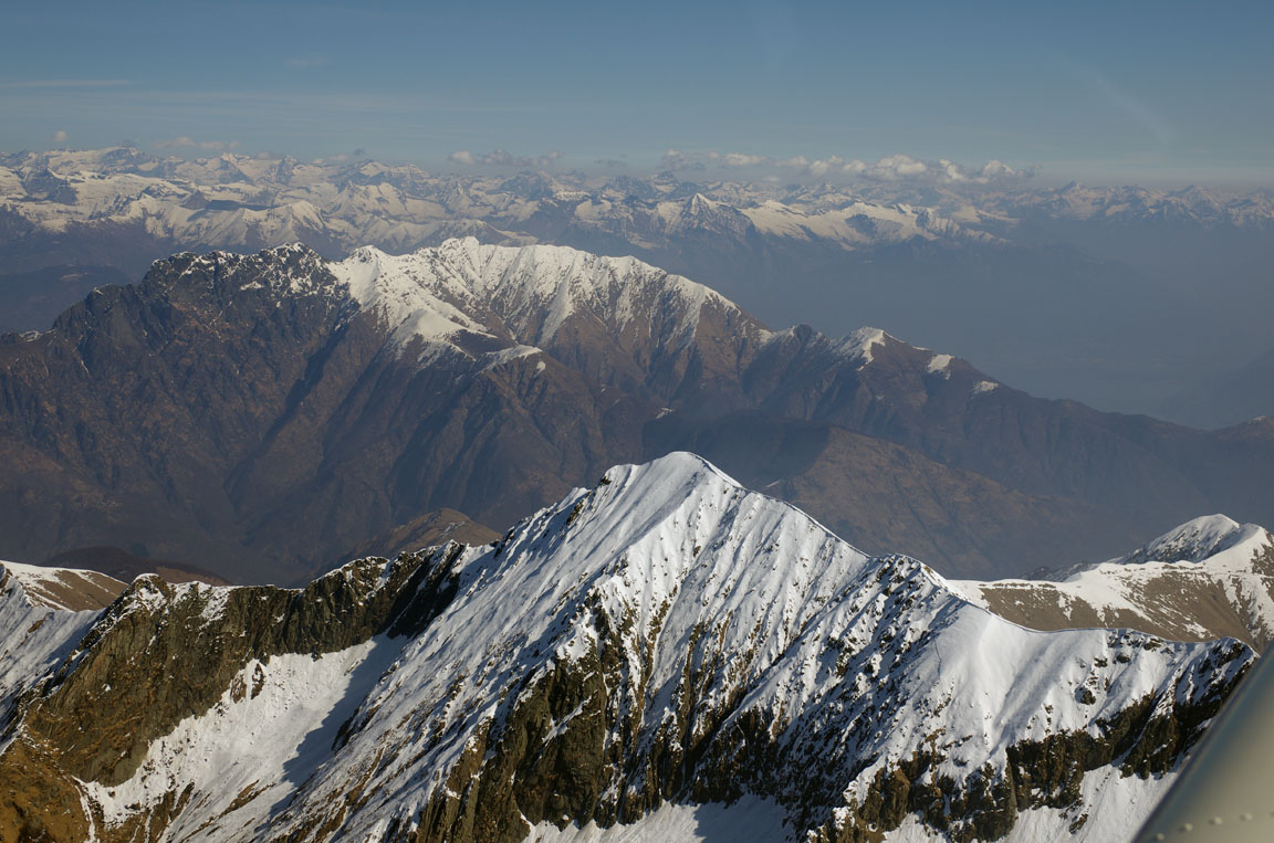
This time we climbed to FL140 and remained there for the entire flight home, remaining just above the haze layer. Some vaguely familiar scenery was visible in the distance
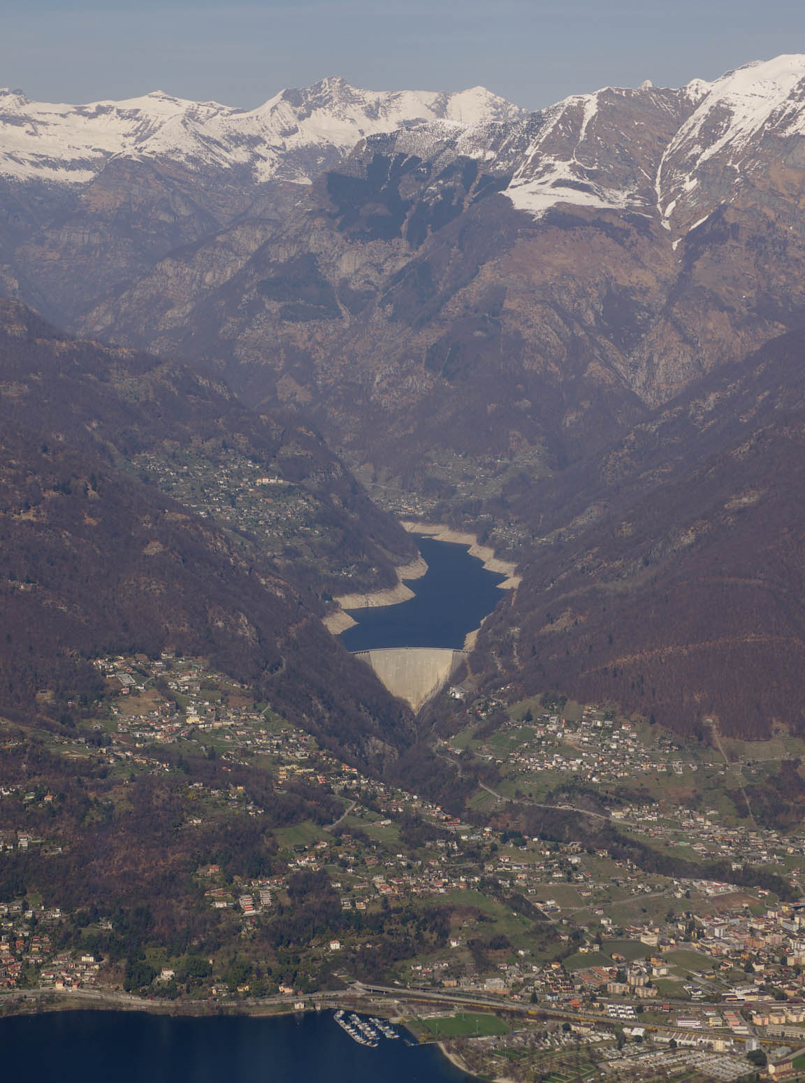
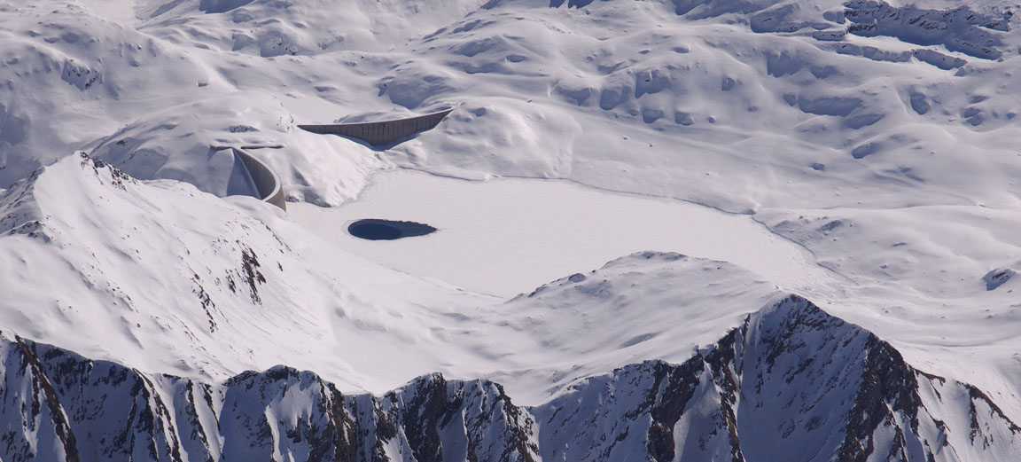
There are many dams in the mountains, with most of the reservoirs frozen on top at this time of the year
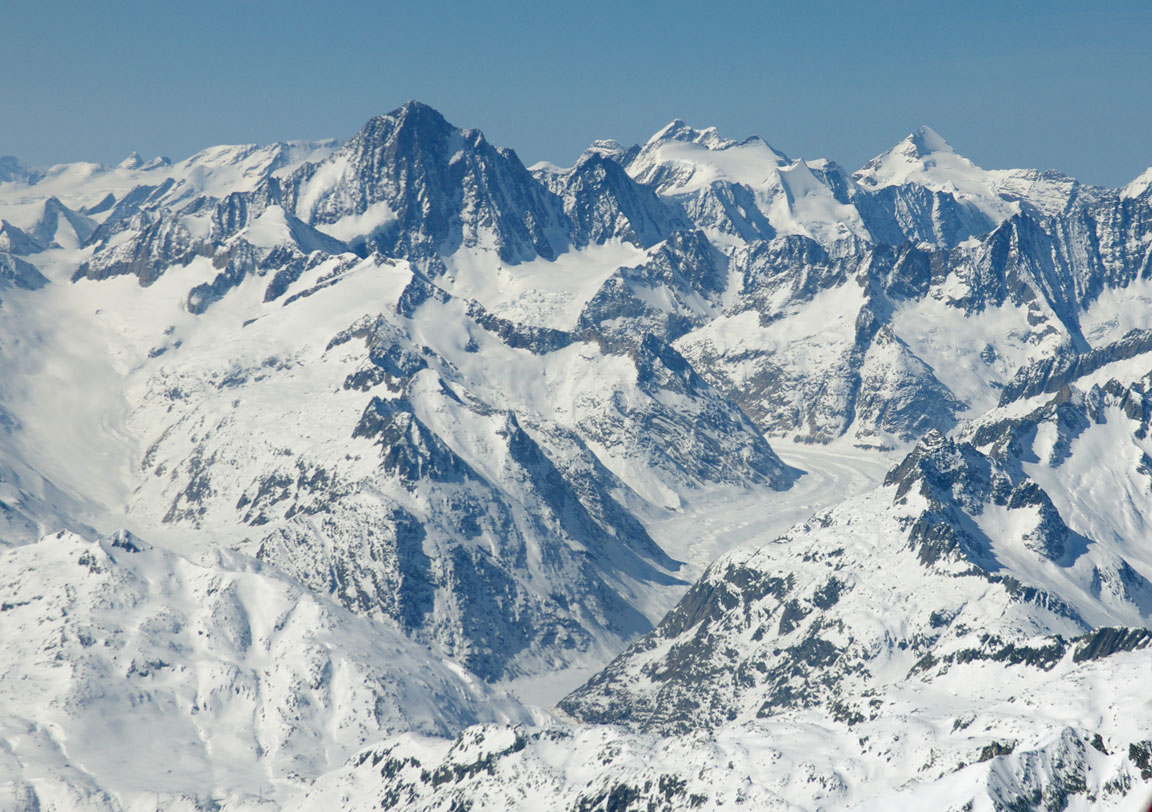
This was one of several glaciers
The Swiss do like digging tunnels
This is the last of the Alps
The remainder of the flight, mostly over agricultural France, was rather tedious...
Only one other aircraft was seen on this trip

The UK end was very hazy. This is an un-enhanced pic from about 5000ft
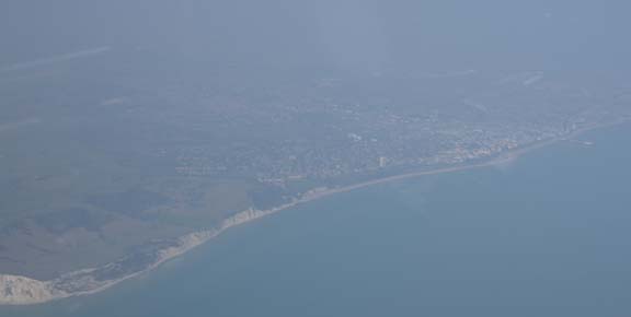
These are typical high pressure conditions. They provide great flying weather but keep many "traditional" (no GPS) pilots grounded, and make photography difficult. Most of the pics within this article were enhanced in Photoshop, using the Adjust Levels function and doing the R G B spectra separately, manually. The Auto Levels function is too primitive to produce good results in most cases of airborne haze. This is a time-consuming process however and the photos in the picture gallery below are mostly originals.
Around the French coast, Paris Control handed us to London Control who issued a "descend when ready" to FL090, then FL070, then a descent below CAS. It worked out just right for a more or less continuous descent at -400fpm all the way from the French coast to Shoreham.
All ATC were entirely professional and helpful.
Airborne times were 3:55 and 4:05. There was a bit of headwind during most of both flights but the return route was obviously a bit longer. Fuel burnt was 172 and 163 litres, with errors (against the Shadin fuel totaliser) of 1.7% and 0.7% at Locarno and Shoreham respectively.
The routes actually flown are shown below. They were plotted onto a very old ONC GNC4 chart which is the only one I have with the geographical coverage in one piece
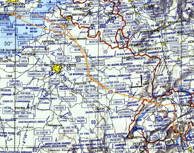
This image shows the arrival track (with its spiral descents), and the departure track to the south west.
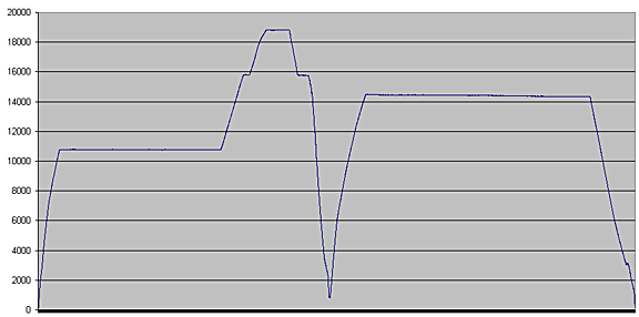
The altitude profile of the two flights is here. The altitude is GPS derived and is thus the actual altitude
Of course, this trip could have been done under VFR, but one would probably not have been cleared into some of the controlled airspace, especially the Swiss portions.
The aircraft performed perfectly. Some notes on Socata TB20 ownership and operation are here.
Pilot: FAA CPL/IR, approx 1300 hours.
Any feedback, reports of dead links, corrections or suggestions much appreciated:
Contact details
This page last edited 14th May 2011
