Trip to Dortmund - February 2010
This article describes a very straightforward IFR (airways) trip from Shoreham (EGKA) in the UK to Dortmund (EDLW) in Germany, and back the following day.
Procedurally, the flight was very similar to other airways flights I have done. Other VFR and IFR trip reports can be found here. IFR flying tends to follow a set pattern, with the main variable being the weather.
I have written up this trip because it makes a good example of a quick and easy IFR trip in Europe - around 2-3 hours each way - which is an easy distance to fly in any IFR touring aircraft, and the low level weather was categorically IFR-only which is not that common.
Here is a glossary for non-aviation readers.
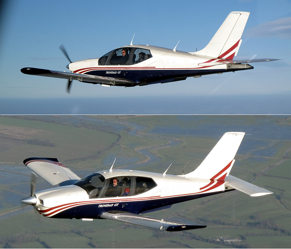
Aircraft
The aircraft is a 2002 Socata TB20GT which has a zero-fuel "book" range of approximately 1100nm and an economical cruise speed of 155kt TAS at 10,000ft. Extra economical cruise power settings can extend the zero-fuel range to 1300nm which, according to FAA rules, translates to approximately 1100nm with IFR reserves. It has a ceiling of about 20,000ft and is equipped with oxygen. It is not certified for flight into icing conditions but has a TKS de-iced propeller.
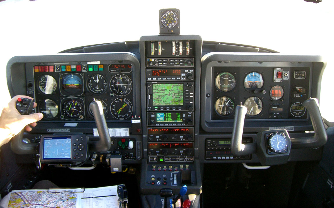
Navigation equipment includes a KLN94 IFR/BRNAV GPS and a KMD550 MFD and these are used for primary navigation. IFR flight in Europe above FL095 (generally) requires BRNAV certification which in the GA context is met only with a BRNAV approved IFR GPS installation. The most common means of BRNAV compliance is one of the Garmin 430/530 products but many other panel mounted GPSs have been approved. BRNAV can also be met with the old KNS80 (with an antenna filter to meet FM Immunity regs) but this product will not alone function in today's "everything is RNAV" environment where one is routinely sent to a VOR which is a great distance away.
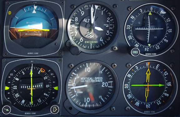
The aircraft has a KFC225 autopilot which can track VOR/GPS/LOC/ILS and fly a preset altitude or a preset VS. There is an additional battery powered Garmin 496 GPS which also provides an audio terrain warning (TAWS) function with a European terrain and obstacle database. A WX500 stormscope is also installed. One of the radios has 8.33kHz channel spacing to legalise flight at 20,000ft although I have never been assigned such a frequency.
Flight Planning Equipment
In this case, being a very short trip, all planning and flight plan filing was done at home, before departure, on my PC. I carried a laptop just in case. Nowadays it is easy to get TAFs and METARs on any modern mobile phone capable of WWW access, but a laptop is still very handy for anything more complicated.
The laptop has GPRS/3G internet access, via a bluetooth-connected mobile phone, which provides independence from airport weather briefing and flight plan filing services.
On a short-duration trip like this, it makes sense to file even the return flight plan in advance, because cancelling or delaying it is much easier than filing it.
Weather
More detailed notes on weather planning are in this trip writeup.
I normally avoid frontal weather because the cloud tops tend to be above the aircraft ceiling (20,000ft). This trip was planned similarly but while there were no fronts, there was widespread low level cloud and poor visibility - perfect IFR weather!
The outbound flight was on a Sunday and the return flight on the following day. MSLP charts for Sunday Monday Tuesday showed reasonable conditions - no fronts - for the two days, with no deterioration on the day after. I cancel quite a lot of trips due to return weather issues because the instrument approaches at Shoreham have a high MDH (in prevailing winds, runway 20, 800ft) and thus poor utility for getting back home.
The MSLP charts also indicated light winds, with a general easterly airflow.
As for SigWx, the 0600 Sunday one showed nothing significant. These charts show weather hazardous to jets and are much less useful to non-deiced pilots. Contrary to widespread belief, they do not show cloud tops.
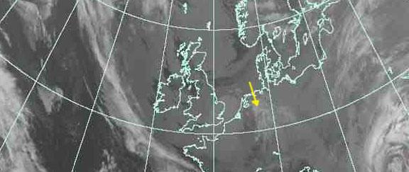
The IR satellite image on the morning of the flight showed no high altitude cloud along the route (shown approximately in yellow)
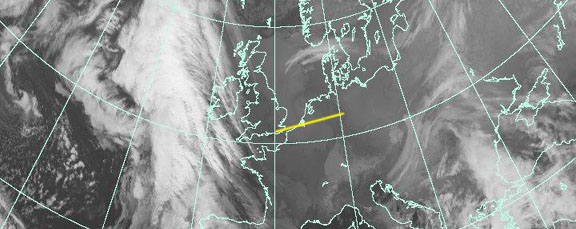
On these images, the whiter the cloud is the lower its temperature and thus the greater its altitude. High altitude cloud, say FL200 plus, shows up as something approaching solid white. IR imagery which contains a temperature scale (enabling a more accurate altitude estimate; if necessary by reference to altitude/temperature data which for some reason is a lot more accurate) is available but I have not found any which is free and less than several hours old...
Finally, on the morning of the flight I got the TAFs and METARs which showed low cloud and visibility but not bad enough to prevent an ILS approach. Dortmund weather showed a possibility of the weather being below minima but it was forecast to clear by the ETA, and there were other diversion options - including diverting all the way back home.
The GFS data from NOAA showed nothing unexpected - low cloud and surface temperatures around freezing for the arrival, and below freezing for the departure the following day.
For a relatively stable airmass like this, an early morning departure can benefit from the 0000Z ascent data which becomes available around 0100Z. This comes from real weather baloons and shows cloud tops (and temperatures, etc) accurately for the places and times involved. Cloud bases are visible too but if one is looking at OVC005-type conditions, not with sufficient resolution to be useful. It is available from the University of Wyoming, among other places. The following images 1 2 3 indeed correspond with what was encountered on the flight, and this 1200Z one turned out to be spot on for the arrival time too. Unsuprisingly, this 1200Z one for the following day's return flight departure time was also spot on.
From experience, I know that in this type of totally non-convective cloud one would expect structural icing from zero to minimal - assuming an exposure of minutes rather than hours. A few thousand feet of such cloud is fine to climb or descend through but I would never do it for the enroute section because one is almost sure to collect too much ice if one spends hours in any IMC between 0C and say -20C. If VMC is not reached pretty soon, the plan is to turn back and land. However, I would not do any of this without the TKS de-iced propeller because not only does this preserve engine power but also the TKS fluid spray keeps the windscreen clear.
For good measure, the radar image was obtained which showed nothing. Nothing was expected anyway, in this kind of cold stratus cloud. One would also expect structural icing to be from nonexistent to light. GFS data for Shoreham also indicated surface temperatures for the return flight to be slightly above freezing (+3C) which provides a further level of assurance because one can melt off any ice, by flying at a low level before landing.
A general article on cloud tops is here. Despite a number of techniques available (mostly derived from the U.S. GFS weather model) I am increasingly tending to use the IR satellite images; they are very reliable and easy to obtain. They amount to a reasonable "cloud tops METAR" and if used together with the radar image, one gets a pretty good picture of what is going to be up there. However, this approach works only if one sticks to my principle of flying only VMC enroute, and turning back if this cannot be achieved. In 4 years of IFR flying around Europe, I have not yet had to turn back.
Preflight Procedures
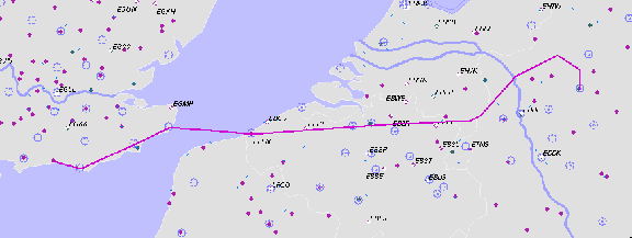
IFR route design: The Eurocontrol (often interchangeably called CFMU or IFPS) IFR routings were generated and validated online in just minutes using FlightPlanPro (FPP). This routing tool has revolutionalised European IFR route development. It generates an initial route from its internal airway database; the route is submitted to Eurocontrol for validation (internet access is required) and is iteratively modified.
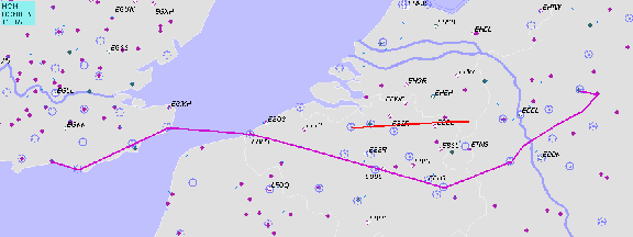
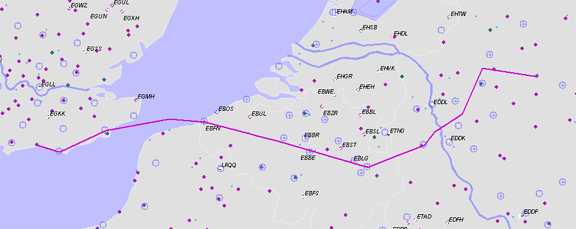
The outbound route:
EGKA (Shoreham)
SFD R803 DVR L9 KONAN L607 KOK DCT NIK L179 MEVEL Z841 DOMEG
EDLW (Dortmund)
FL110
300nm (GC) 333nm (airways)
Alternates: EDLP (Paderborn Lippstadt), EGKA (Shoreham), EGHH (Bournemouth),
EGMD (Lydd)
The filed level was FL110. The exact level does not matter; one can vary it according to weather. The IR images mentioned earlier indicated fairly low cloud tops; probably below FL100. Normally I file for FL140 or higher as this yields better routings than lower down but on this occassion it made no difference.
The EDLP alternate was suggested by my friend who I was meeting up with.
Interestingly, generating the same route for Monday yields a very different result
which illustrates how European airway routes can vary between weekends and weekdays.
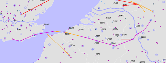
The return route:
EDLW (Dortmund)
BAMSU R15 LNO L607 GOLEX/N0150F090 L607 KONAN DCT LYD R803 SFD
EGKA (Shoreham)
FL160
300nm (GC) 334nm (airways)
Alternates: EGHH (Bournemouth), EGMD (Lydd)
This one was filed for FL160 because lower levels produced poor routings. Of course, FL160 requires oxygen but I never fly anywhere seriously without oxygen because doing so nearly halves the aircraft operating ceiling and discards by far the most attractive weather avoidance option: climbing to VMC on top. I also use oxygen anytime at/above FL100; the flow rate at FL100 is very low but it keeps you fresh and you don't arrive tired.
All these routes have a ~11% overhead, which is fairly normal for Eurocontrol routings. If I get something substantially worse - overheads of 20% to 40% are not uncommon - I have a closer look at the routing and maybe try filing it at a high level e.g. FL180, or try a really wide level range e.g. FL080-FL180 and allow FPP to play around with it. The above EDLW-EGKA route is for FL160 but contains a drop down to FL090; that drop is never actually flown because ATC doesn't care about it, and one could probably fly that whole route at a single level, anywhere between FL090 and FL190.
PPR (prior permission required) was a possible issue. Dortmund is "Customs PNR"; I sent them a message the day before using the free text messaging facility in AFPEx (see below); they did not respond but my impression of Germany is that they are a lot more pragmatic about this than e.g. Italy which is quite capable of sticking a finger up and summarily refusing a landing clearance even if the said airport has a 24hr-manned Customs/Police station next to the runway.
Flight plan filing was done electronically, at zero cost, using EuroFPL. Normally I file flight plans using the AFPEx AFTN messaging tool, but EuroFPL has two advantages: it is a data-efficient website which is usable over a slow GPRS/3G connection, and it has a flight tracking facility which enables someone on the ground to monitor your progress. EuroFPL also generates a comprehensive briefing package. More notes on electronic flight plan filing options are here.
Note: the Eurocontrol routings given here and elsewhere will most likely not work by the time you might try them because the precise form needed to get the route into the Eurocontrol (IFPS) computer in Brussels changes from one week to the next, and there are frequent differences between weekdays and weekends which are largely due to a lack of military activity on weekends.
Fuel Planning
Fuel was not an issue on this flight, involving around 60% of the aircraft zero-fuel range and that is assuming one diverts all the way back to the departure airport. The TB20 has a really great range, but this may well be needed when one is looking at widespread poor low level conditions.
The Flight
The Shoreham (Class G) departure clearance was: "remain outside controlled airspace, FL050, on track SFD, squawk 3406, contact London Control on 133.175".
The initial base of controlled airspace in the area is FL055 so one sets FL054 as the target level on the autopilot...
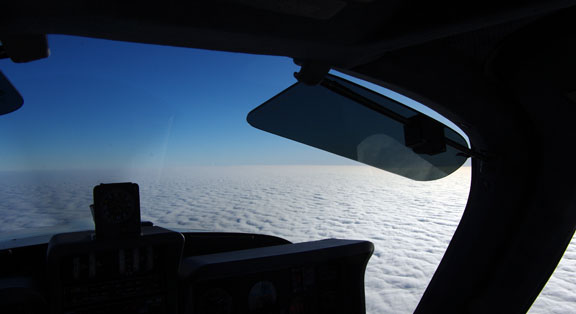
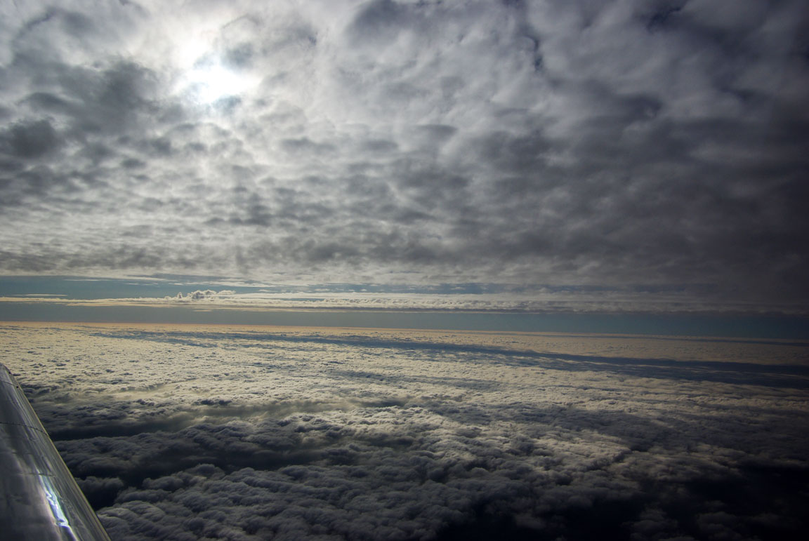
There is quite a bit of sunshine about but on the assigned track the flight was in solid IMC within a minute or so.
On first contact, London Control asked for the customary squawk ident and then issued a clearance to enter controlled airspace, on track SFD and then airway R803, climb 6000ft on QNH 1024. This was most unusual, in respect of both the airway name being used and the altitude rather than e.g. FL060. R803 runs SFD-DVR so this was simple enough, but the only time ever that I've been asked by ATC to follow a named airway was in Spain.
Shortly afterwards they authorised a climb to FL090 and then the filed FL110 which worked out just right relative to the cloud tops

As expected, about 1mm of ice was picked up during the climb. The propeller TKS kept the front window completely clear.
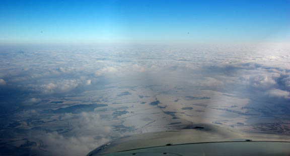
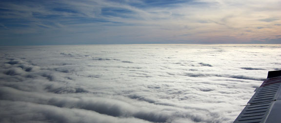
Shortly afterwards the cloud cover became solid and remained that way for most of the flight
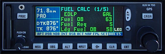
Upon levelling off and the cruise speed stabilising, the GPS-linked fuel totaliser computed a Landing Fuel on Board (LFOB) figure of 59USG
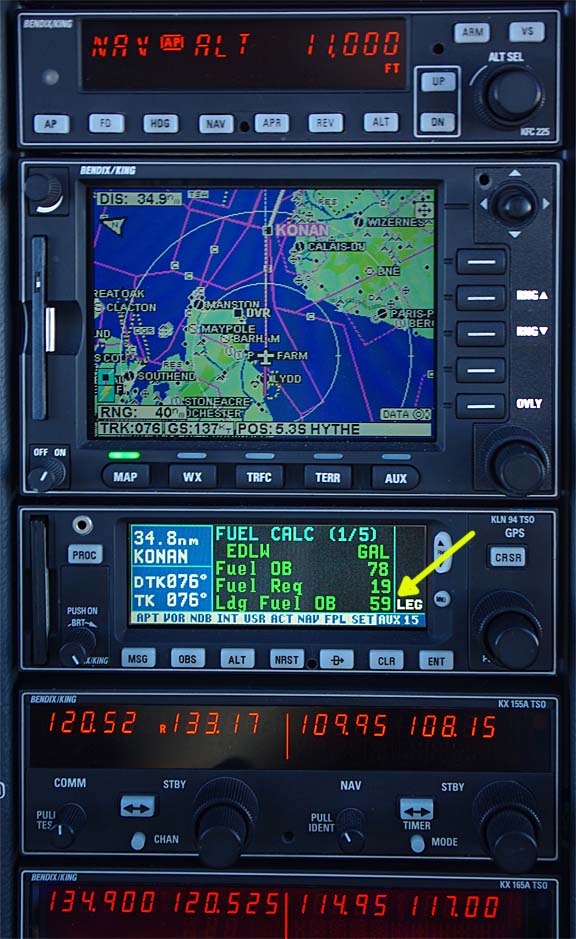
Later on, with the new destination (see below) loaded into the flight plan, the "59" became "58" and this shows that this system delivers a reasonably accurate LFOB figure very early in the flight
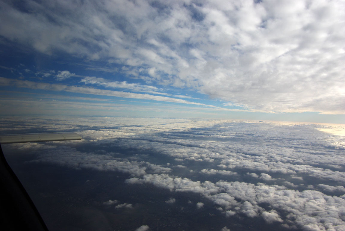
With about 100nm to go, the cloud cover thinned out a little in places

but this was of little relevance to the low level weather...
At FL110, LOP, TAS was 145kt (19.5" MP, 2200rpm, 9.6GPH). With 86.2USG usable fuel, the zero-fuel range is thus nearly 1300nm, plus or minus a bit for the extra fuel burnt in the climb and other factors.
On this flight, there were known risks on the low level weather so it was highly desirable to find out nice and early where one was going to go. Normally I can get METARs/TAFs via a Thuraya satellite phone
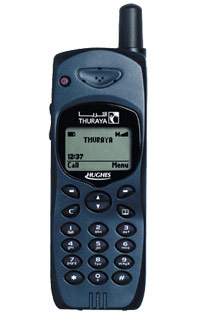
connected to an LS800 tablet computer (more details here) but this failed to work. Subsequently I discovered the reason: I had lent the original phone and the SIM card to a friend who is working on a related software project so I bought another set, but a "virgin" Thuraya SIM card doesn't work until one has made a voice call with it (and selected some options from an automated menu) but this was not done before the flight... So, on the very flight where this would have been most useful, it did not work...
So the only way to check the destination weather was to ask ATC - starting with Brussels. They were mostly too busy and while they accepted the enquiry they didn't come back to me. Eventually, with about 80nm to run, I was able to get Dortmund weather which was as expected below CAT I ILS conditions:
EDLW 050/05 200M BR BKN001
and the main alternate which was fine:
EDLP 020/06 5000M BR BKN008
Dortmund ATIS specified "CAT II low visibility procedures" so even if one was a cowboy and was going to fly the ILS under 200M BKN001, it would be quite visibly illegal. Anyway - why bother when one had enough fuel to go another ~ 1000nm (Dubrovnik, approximately) and there are plenty of alternatives. I had printed approach plates for about 5 airports in the vicinity, including Dusseldorf, Cologne, and could have easily flown back to the UK.
Dortmund was forecast to improve but with 50nm to run there was no sign of this, so I diverted to Paderborn/Lippstadt EDLP. Langen Radar handled this immediately, with a ~100nm DCT to EDLP, as usual rendering any Eurocontrol routings in the area meaningless. Curiously, Thuraya SMS messages did appear to work and I texted my friend about the diversion.
The route to Paderborn passed almost overhead Dortmund and I found out later that Dortmund cleared up around that moment. However, it would have been too late to change because Thuraya text messages are notoriously unreliable and a subsequent SMS may not have been delivered.
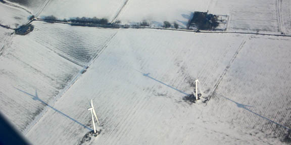
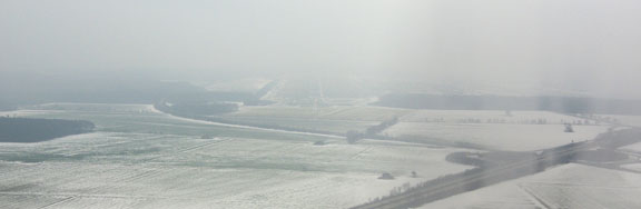
The descent was rapid, 5000ft, then 3500ft, then 3000ft direct to the localiser. In the descent, one could see a lot of snow through gaps in the cloud
The ILS was flown coupled, on the autopilot; this pic was taken just after glideslope intercept. The HSI (bottom left) and the CDI (top right) are driven from independent ILS receivers. The autopilot runs from the HSI only but on all ILS approaches involving "real IMC" I monitor both indicators. The autopilot does a perfect job and is specified down to 200ft
The above pic does show one slight mistake: the heading bug should have been set to the current heading right after localiser stabilisation was achieved.
I fly all "real IFR" on the autopilot, preferring to do hand flying practice on local flights in Class G, in IMC, where there is no ATC who might be wondering what one is doing... There is no doubt I could fly these approaches manually but they would not be as perfect and I would certainly not be taking any pictures!!
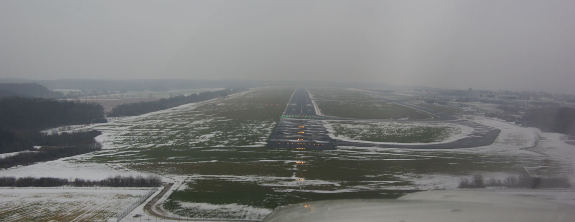
Eventually the very first sight of the runway appeared (in the middle of the pic - very hard to see here)
The following pic was taken just before the autopilot was disconnected at about 300ft
Again I expected 1-2mm of ice but picked up none at all.
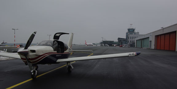
Paderborn has hangarage, which was welcome given the forecast overnight temperature of -6C and a risk of an aircraft parked outside being covered in ice by the morning... all very civilised. No fuel was required but everything was sorted within 10 minutes. A policeman looked at my passport and that was it.
Return Flight
The first job was to work out a valid Eurocontrol route because I had diverted. I should have really done that back home! Flight Plan Pro was having problems; possibly related to incomplete SID data for EDLP, but I quickly found that a fairly obvious DCT hack worked: the route from EDLP passes close to the original departure of EDLW so prefixing the original route with DOMEG DCT... yielded a route which validated. DOMEG 1X is one of the SIDs for EDLP, going off in the "right" direction. The return route thus became
DOMEG DCT BAMSU R15 LNO L607 GOLEX/N0150F090 L607 KONAN DCT LYD R803 SFD
I use the very efficient EuroFPL validation site; the original Eurocontrol validation site was modified in 2009 (apparently in an unsuccessful attempt to stop the iterative route generation tools working) and is now Java-bloated and virtually unusuable on GPRS which is by far the most commonly available mobile internet option. 3G - when you can get it - doesn't help much, given the silly cost of downloading megabytes of data on a PAYG roaming connection.
The TAFs and METARs showed nothing suprising, with OVC006 possible at the destination.
The IR satellite image showed some dispersed high altitude cloud but as the other information was clear, this was probably very thin cloud which would not be an issue. In any case, with experience it was judged to be well below the aircraft ceiling.
The formalities at Paderborn took about 1 hour, which included getting the aircraft out of the hangar. The total cost was Euro 80 of which the hangarage was Euro 20. I filed the flight plan, again with EuroFPL, and again over GPRS (there was "unsecured" WIFI in the very pleasant pilots' lounge but it would not connect), only after everything else was sorted.
The only SID which joined up to the filed route was DOMEG 1X. This was quite interesting because - in common with some other German airports - this SID is published as both a conventional and an RNAV SID, with the same name in both cases. Departing from runway 06, the RNAV version uses waypoints LP101, LP102 and LP105 and these are in the KLN94 GPS database, so one can choose to fly either version. Legally speaking, one should not fly an RNAV SID/STAR unless loaded wholly from the GPS database but I cannot see it matters in this case if one sets up the navaids to fly the conventional version. I know of no law which says - for private flight - that specific equipment must be used. If the only available SID was an RNAV one, a suitable RNAV-capable and approved GPS installation would be required. If the only available SID was a PRNAV one, PRNAV-approved aircraft and PRNAV-approved crew would be required, but I don't know of any European airport which is 100% PRNAV.
The departure clearance was "Cleared to EGKA, DOMEG 1X, squawk 2527, Langen Radar 125.225, 5000ft". I had filed the flight plan with an overly generous margin and asked how much earlier (than filed) I can depart. The answer was suprising: 30 minutes!
The departure was straight into IMC again, within a minute or so.
Despite the expected 1-2mm, no ice at all was picked up this time.

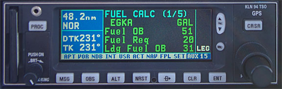
At the top of climb and after the cruise speed had stabilised, the LFOB figure was computed at 31USG. The actual figure after landing was 30.6USG.
The return flight was mostly above a broken/solid layer around FL100, and under some very thin cloud around FL150. This thin cloud was obviously what appeared in the IR image
Curiously, one of the waypoints given by Langen was BRB. I loaded it as a DCT and instantly found it was about 700nm away... I have since checked and there are several BRBs in the world but the others are much further still. The spelling was checked twice, with no resolution. Eventually I asked for a different waypoint; they gave me a heading to fly instead followed by a DCT KOK which was about 125nm away. In retrospect the waypoint was probably BUB (Brussels), which is curious as Langen Radar are normally ultra-competent...
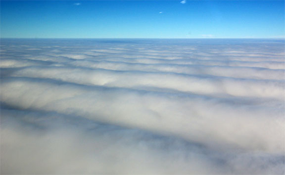
Some great cloud patterns were seen
I'd like to know what causes these wavy patterns. They were closely spaced and not due to any airflow over terrain below. This was at FL130
The near-constant sunshine was very welcome but one has to descend eventually...
Shoreham weather was obtained from London Control (Brussels wouldn't do it)
EGKA 020/12 5000 BR -RA SCT005 BKN009 +3C
which was fine given the northerly wind would mean an instrument approach to runway 02 which has a usable MDA of under 500ft. Had the wind been southerly (by far the more common scenario) I would have diverted to Lydd or Bournemouth where there is an ILS. Neither of these is attractive; Lydd is in the middle of nowhere, leaving a hotel as the best option, and Bournemouth is both expensive and a long train ride home. One could park a TB20 at Split, Croatia (900nm away) and get an Easyjet flight to it once a week, and it would still cost less than a week's parking at Bournemouth...
20nm before passing Lydd, London Control gave me a DCT to Shoreham.
In UK airspace, London Control like to initiate a descent early - around Lydd - but given the thickness of the cloud (from ~ 600ft to ~ FL100), the tops temperature of about -14C, there was an obvious risk of icing if one flew 60-80nm in this stuff, and the risk is simply not worth taking when there is no point. Twice they asked for a descent but each time I asked to remain at FL130 "due weather", adding that icing conditions were expected below but a descent around Seaford (SFD) would be fine. They expressed some doubt that would be possible due to Gatwick arrivals; I looked as hard as I could all around but never spotted another aircraft anywhere, and a 737 is visible from many miles away. Unsuprisingly, it all worked out fine and just before SFD I asked for a continuous descent, -1000fpm minimum, below controlled airspace. Initially, ATC authorised a descent to FL060. Down we go...

Due to the very smooth stratus cloud tops, it was clear there would not be significant turbulence below, so the descent was done at 160kt (Va=130kt) which, relative to say 100kt, helps to increase the TAT (total air temperature; static air temperature adjusted for aerodynamic heating) by about 2C. As expected, a few mm of ice was collected on the way down - an insignificant amount for a TB20 - but it mostly melted off during the instrument approach.
The 02 NDB/DME approach was almost down to the minima, with a cloudbase of about 600ft. Of course, it was flown using the GPS, set to 0.3nm full-scale, using its OBS mode, periodically checking the ADF. This enables a very precise stabilised approach to be flown, avoiding the large NDB errors typical of coastal NDBs.
During the landing flare I got some bird strikes, from quite large birds, but luckily there was no damage to the aircraft and more importantly not to the propeller. No debris was found on the propeller and a blade runout check was within 0.5mm which is a tiny fraction of the allowable amount. Next time I see so many birds on the runway, I will fly the missed approach... this kind of thing is not worth ~ £15000 for a new propeller and an engine shock load inspection, with the downtime involved especially if using a reputable engine shop in the USA. The engine and propeller manufacturers lay down guidelines for this king of thing and damage to even one propeller blade can force a replacement of the propeller hub, which (predictably, perhaps) leads to a new propeller as the most economic option...
Refuelling after landing showed an error of just 0.13% between the FOB computed by the fuel totaliser and the pump (bowser) reading. Anything within 1% is perfectly acceptable.
In the winter, I am flying with about 0.3% Isopropyl Alcohol (IPA) in the tanks. IPA, max 1%, is recommended by Socata for operations in cold humid ground conditions followed by high altitude (low temperature) flight. However, at higher altitudes there isn't a whole lot of difference between winter and summer: on this flight I saw -15C at FL130 and on another flight in the summer I saw -29C at FL190. Given an apparent total lack of fuel icing reports on Socata TB aircraft, the case for IPA (if indeed there is one) probably doesn't change according to the time of the year. There are other fuel additives apart from IPA (e.g. PRIST/EGME) which are used in much smaller proportions (making them easier to carry on long trips) but they are toxic and corrosive.
Both flights were tracked using the EuroFPL aircraft tracking facility which accesses a feature provided by Eurocontrol. Some example snapshots can be seen in this writeup. This is a very nice feature which enables friends/relatives to keep an eye on where you are, although a text message from a satellite phone can be more useful to someone waiting for you. Curiously, the tracking facility did not show my diversion; the aircraft was shown to have "landed" at Dortmund.
No other aircraft were seen anywhere near my cruise level. At "GA levels", say FL100-FL200, the enroute airspace in Europe is a virtually empty void. The only aircraft seen were making contrails around FL300 plus, and this included the overflight of some of Europe's busiest terminal airspace! The Eurocontrol routings tend to route GA traffic away from the busy terminal areas anyway.

This trip would have been completely impossible under VFR.
All ATC were entirely professional and helpful.
The aircraft performed perfectly. Some notes on Socata TB20 ownership and operation are here.
I cannot help reflecting how good the "1990s" avionics I have are for European IFR. Many pilots with similar equipment are spending 5 digits on substantial "glass panel" avionics upgrades which do little more than what I have in the 2002 TB20, and they usually end up tearing their hair out over various weird and irritating equipment interoperability issues, autopilot interface issues, and certification issues. One operationally relevant enhancement would be to replace the KLN94 (and one of the two radios) with a Garmin 430/530 and get the whole lot approved for PRNAV and GPS approaches, but there are some interoperability limitations with the KMD550 MFD, and anyway PRNAV approvals are right on the edge of current avionics shop competence. Accordingly, I have decided to not do any significant avionics upgrades unless I can get PRNAV approval.
Pilot: FAA CPL/IR, approx 1100 hours.
Any feedback, reports of dead links, corrections or suggestions much appreciated:
Contact details
This page last edited 19th February 2010
