
Trip from Shoreham EGKA, UK, to Syros LGSO, Greece, via Brac LDSB and Mali Losinj LDLO in Croatia, July 2025
This article describes a trip from Shoreham, UK, to Syros in Greece. Originally we intended to go further to Chios LGHI but were unable to get the the permission in the available time.
Within this writeup are also HD videos of the four flights, edited to include the ATC interaction. These should be of help to anyone working towards an IR, or new IR holders who have not yet ventured out of the UK. A lot of work goes into editing these videos ![]()
The planning for a trip like this needs to be started perhaps a week ahead, where one shoots off emails to the various airports and sees what comes back. Many email addresses, especially in Greece, are dud. Brac and Mali Losinj are generally easy; just an email. Brac on this occassion had a "strict PPR" notam due to being flooded with a load of turboprops for a TBM fly-in but this was manageable. Greece is something else however! Every runway in Greece is "strict PPR" and you obtain the permission from the handler who obtains it from his CAA office (yes, Greece has a CAA office at even the smallest island airport ![]() ) and organises police presence if required. Greece also implements passport checks even for most internal flights, which is a contravention of Schengen. This PPR system is rigid as to dates and times and getting these changed can be tough.
) and organises police presence if required. Greece also implements passport checks even for most internal flights, which is a contravention of Schengen. This PPR system is rigid as to dates and times and getting these changed can be tough.
Brac is ideally located for flying on to Greece. It has Customs/Immigration and avgas. Along with Mali Losinj, these two are perfect stops in Croatia which has many great destinations. Other Croatian locations e.g. Split and Zadar have become difficult for GA, although Dubrovnik still works great, at a price of some €200. Pula and Rijeka are also OK. The two Croatian stops on this trip followed a well proven formula but I had not been to Greece for several years and despite having visited many Greek destinations - especially islands - had never flown to Syros or Chios.
The original plan was Shoreham to Brac, then Brac to Syros, Syros to Chios, and then (since Chios is not a port of entry) leaving Greece perhaps via Ioanina LGIO. Another option was Croatia to Samos LGSM (fuel, entry into Greece, 1-2 nights) and then to Chios; more expensive due to Samos being "fraported".
The Greek port of entry situation has not changed much with Schengen. Greece signed it but mostly disregards it. So you still need to enter/exit Greece via ports of entry. The international airline airports are obviously ports of entry but most do not have avgas; the main exceptions are Corfu, Iraklion, Sitia, Rhodes, Athens and Samos. In the last year or two, Syros joined the list which is really useful. Sitia nowadays closes at 0900Z every day which makes it nearly useless. Athens is a huge sprawling noisy dump where you don't really want to stay. Samos and Rhodes operate the EU Greek money extraction scheme ![]() and I've paid around €400, and Corfu can be even more, depending on your luck. The amount varies a lot and reports indicate one can get it down to €200 or so but the procedure depends on which handler you use and is poorly documented. Syros and Kithira (which has no fuel) are ports of entry but only to/from Schengen airports, which is OK now that Croatia is in Schengen.
and I've paid around €400, and Corfu can be even more, depending on your luck. The amount varies a lot and reports indicate one can get it down to €200 or so but the procedure depends on which handler you use and is poorly documented. Syros and Kithira (which has no fuel) are ports of entry but only to/from Schengen airports, which is OK now that Croatia is in Schengen.
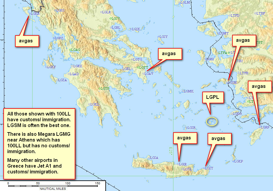
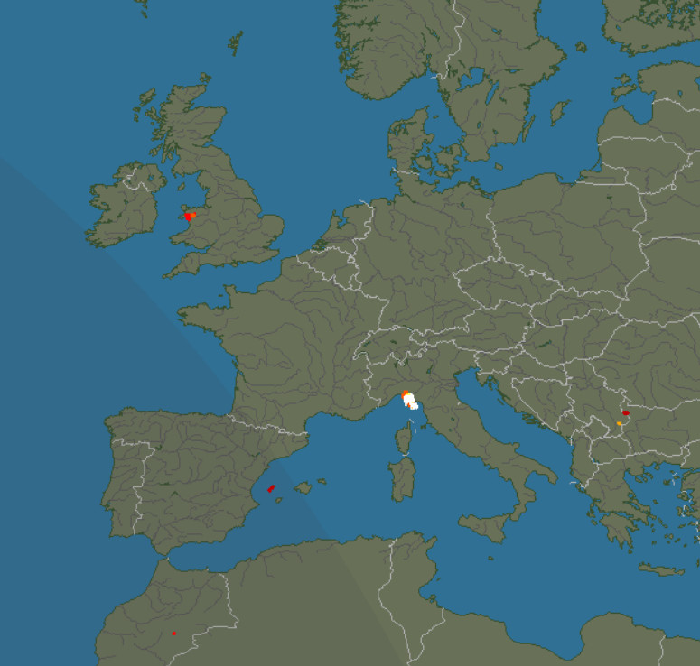
This diagram, from a 2017 fly-in to Astepalea LGPL, shows the general situation, with the omission of Syros
I have already done most Greek islands that have a runway – here – and most of them were visited in the good old days, 2015 or before, before the fraport “fundraising scheme” was implemented.
The problem was that, due to weather, the exact day for flying to Greece was not known until we were on Brac. If flying with a constrained timetable (basically anybody who is not retired) to get a reasonable, say 90%, despatch rate out of the UK to the south-east and over the Alps, you need to allocate a 2 day slot. But the Greeks were totally unable to give a permission covering say 2 days. They need the exact date and time. Brac can, and did. So I didn’t get very far while still at home.
Later, once on Brac, the weather was assured, so I knew the dates and started on the Greeks again. The Syros PPR (Skyserv handling) was easy. What you need to watch is that the handler, who organises the police/customs attendance for the 2x €40 scheme, has no flight plan visibility, so if you change the EOBT to anything different, it won’t work, and you can imagine what happens if you also get a CTOT!. The Chios PPR was never achieved; the handler (Goldair, as recommended by AOPA Greece) just could not get anything out of the CAA office (or so it seemed; they also can’t read emails). It seems that Greek officialdom has got worse over the post-2015 fraport era, on the principle that “look at how fraport are ripping everybody off, but people still pay it, so why can’t we have more of the same for ourselves”. And maybe Chios just has some difficult people there? When I earlier tried to get PPR for the flight Samos to Chios, they wanted to coordinate for the flight between the two also, and wanted the times! It has been suggested that a better way is to shoot off emails and chase them up with phone calls, but AFAICT you still need exact dates and times.
So I replanned the trip to Brac (4 nights) – Syros (3 nights) – Losinj (2 nights; we have been there before), which also shortened the overall time by a few days. This was better anyway since the temperatures were extremely high: around +35C peak! Only Mali Losinj was cooler (by the time we got there). This is another lesson learnt: check the surface temperatures! It was never a problem on previous trips. The option to go to Chios was left open until the very last day but Goldair completely shafted us.
Here is a glossary for non-aviation readers.
Accommodation
With GA travel, there is no short-notice cost penalty so you can stay at home until the destination weather is good. AirB&B and Booking.com provide good solutions for accommodation and are widely used by pilots.
Booking.com is mostly normal hotels although many apartments appear on it also,
hence it tends to be "hotel prices". I use Booking.com as
the standard way to look for hotels. It is generally better than AirB&B
for short-notice trips because you get a guaranteed booking right away whereas
with AirB&B you "request" the apartment, and many AirB&B hosts
play silly games and take up to 24hrs (the max allowed time) to respond, presumably
in the hope of getting a longer-duration booking. AirB&B offers an "instant booking" facility on some properties however and this is supposedly non-cancellable. The other
thing with AirB&B is that if you go too downmarket you can get nasty surprises; in one €40/night apartment in Athens we
had sewage coming up through the floor! The really bad accommodation experiences do tend to be with AirB&B, probably because you usually don't get the exact address in advance and the host meets you on some street corner, presumably after they checked you out from a distance! I've had some bad cases in Greece, including one quite scary one, and I am a male ![]() It is pretty obvious that AirB&B is set up to facilitate tax evasion, which is the norm in southern Europe anyway. So, when looking for an apartment for
several people, I normally look at apartments priced around the cost of a single
hotel room - say €100/night. However, if you have a few days to play with,
AirB&B is usually much better value for money; in most cases one can get
a whole 2- or 3-bedroom apartment for the cost of a €100 tiny hotel room.
Another issue with Booking.com is that most of the establishments offer only "1 room
remaining" (to make it look like they are nearly fully booked, to scare people into
booking something fast) which makes it impossible to book for a group; this
is obviously solved by googling for the hotel and contacting it directly. Normally
the hotels prefer that anyway because Booking.com takes a cut of around 25%.
But occassionally one finds a lower price on Booking.com, and bizzarely I have
never managed to get a lower price by booking directly!
It is pretty obvious that AirB&B is set up to facilitate tax evasion, which is the norm in southern Europe anyway. So, when looking for an apartment for
several people, I normally look at apartments priced around the cost of a single
hotel room - say €100/night. However, if you have a few days to play with,
AirB&B is usually much better value for money; in most cases one can get
a whole 2- or 3-bedroom apartment for the cost of a €100 tiny hotel room.
Another issue with Booking.com is that most of the establishments offer only "1 room
remaining" (to make it look like they are nearly fully booked, to scare people into
booking something fast) which makes it impossible to book for a group; this
is obviously solved by googling for the hotel and contacting it directly. Normally
the hotels prefer that anyway because Booking.com takes a cut of around 25%.
But occassionally one finds a lower price on Booking.com, and bizzarely I have
never managed to get a lower price by booking directly!
In some countries the above two booking services are noticeably unpopular (I believe, due to the perception of being "American") and little appears on them. More here. Also in some niche destinations the accommodation is advertised only via their local tourist office (which has a website, and charges the hosts zero or negligible commission); examples are Alderney and the Scilly Islands. The latter in particular is difficult with just a few overpriced low quality hotels and with lots of B&Bs which are booked by the same people every year and are not advertised.
On this trip everything was done with booking.com since we did not want to wait for a reply.
Pilot
FAA CPL/IR, EASA PPL/IR, ~3300hrs.
Aircraft
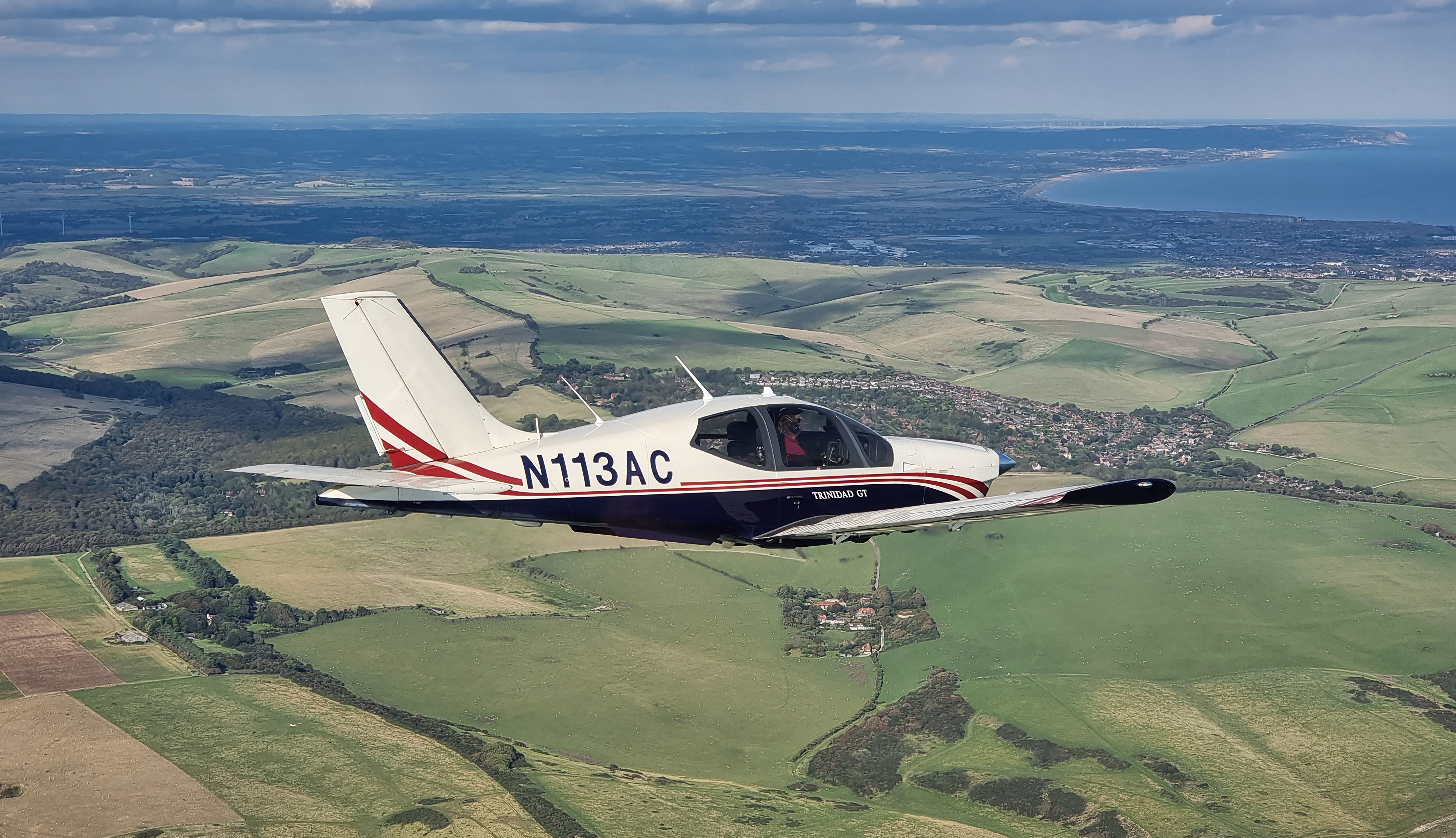
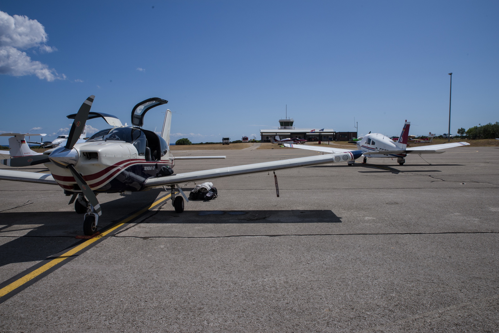
The aircraft is this 2002 TB20GT; one of the last made before production ended. This photo is from 2023:
In January 2018 a full TKS ice protection system was installed. This was a big job, with numerous nontrivial aspects, but the end result was well worthwhile in expanding the operating envelope, by enabling safe penetration of non-convective icing conditions - basically icing layers which can be climbed or descended through fairly quickly. It was good to discover afterwards that the TKS system did not affect the cruise speed - something of a problem on other TB20 / TB21 installations where a speed loss of 5-7kt had been reported. There is a payload loss of 50kg (with a full tank of fluid) which makes the TB20 a 2-seater if doing a trip with a lot of stuff. The system is totally effective against any icing conditions I have encountered but in those conditions it will empty the tank in around 1 hour! And the sticky fluid makes a mess; it is best to wash the aircraft down after such a flight with some hot water.
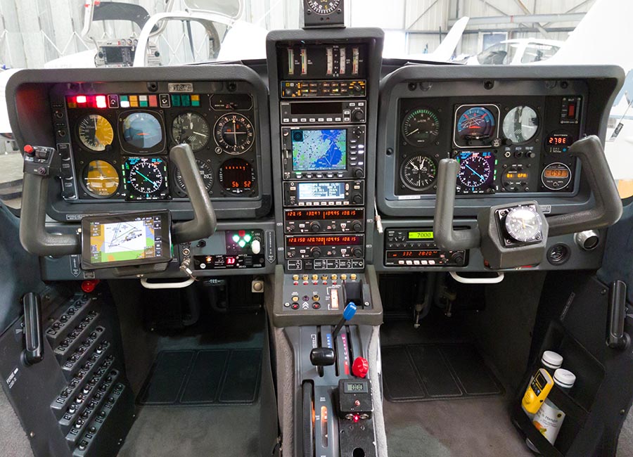
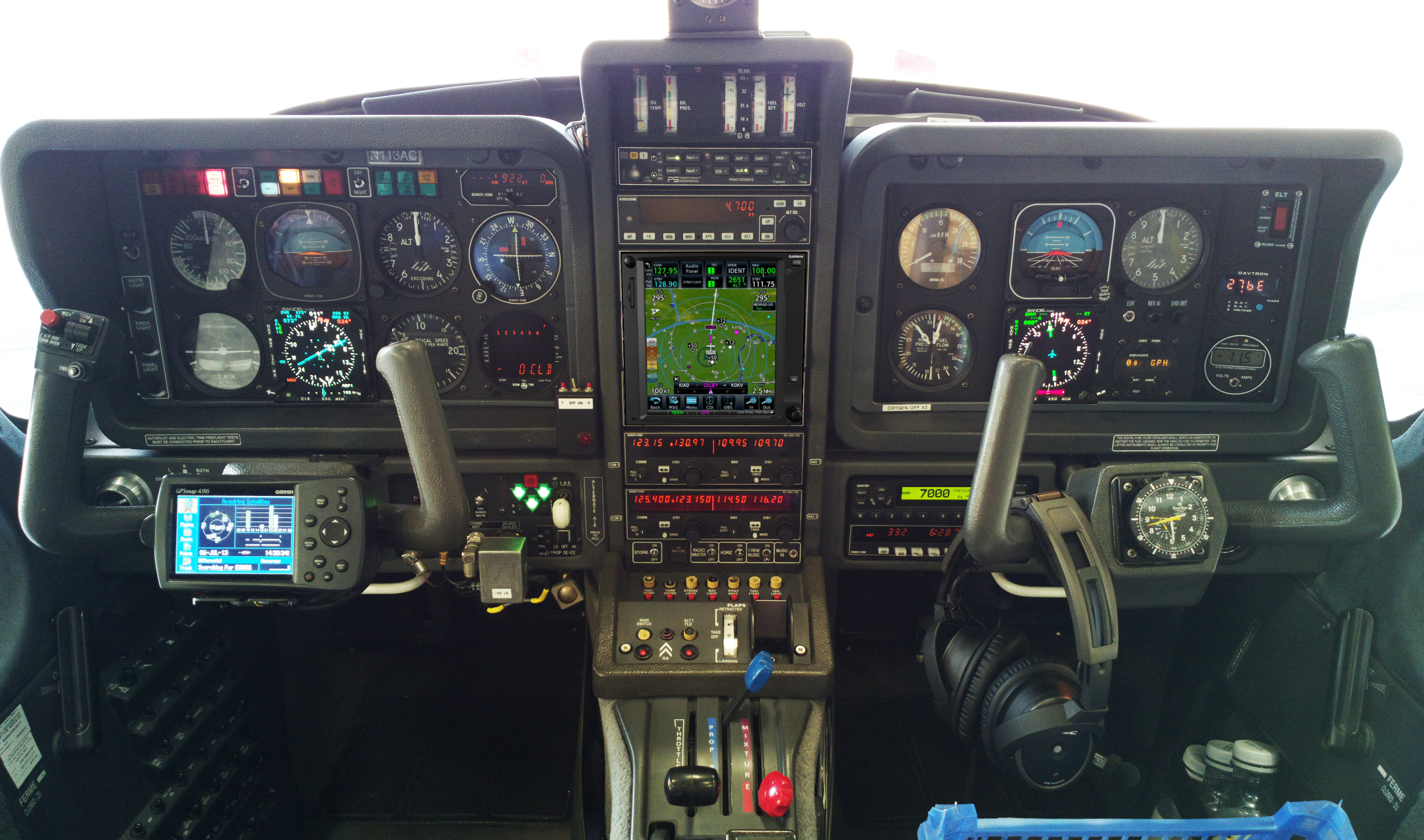
The aircraft is equipped for BRNAV (RNAV 5) and can fly ILS and GPS/LNAV approaches using the autopilot. This is sufficient for current European IFR flying. The cockpit is largely as delivered in 2002, with a Sandel EHSI installed in 2011 on the LH side and with the RH side later reworked with another Sandel EHSI and arranged to form a usable "pilot panel" so the aircraft can be flown from the RH side.
I have no LPV capability but LPV is not yet (to me) operationally
relevant in Europe especially if flying to/from the UK which normally needs
an airport with Customs/Immigration. Also the UK dropped LPV when Brussels withdrew the "safety of life" authorisation, as a revenge for brexit ![]() although the effect of that loss is minimised by having modern avionics which can fly a 3D-guided "+V" approach which is practically the same thing but with nonprecision minima. France is ahead of most countries in removing
ILS approaches (from airports not served by airlines) and replacing them with
LPV. Adding LPV capability
(which also gives you the very useful "+V" advisory glideslope on
most GPS approaches) could be done with a cheap-and-dirty solution of a used
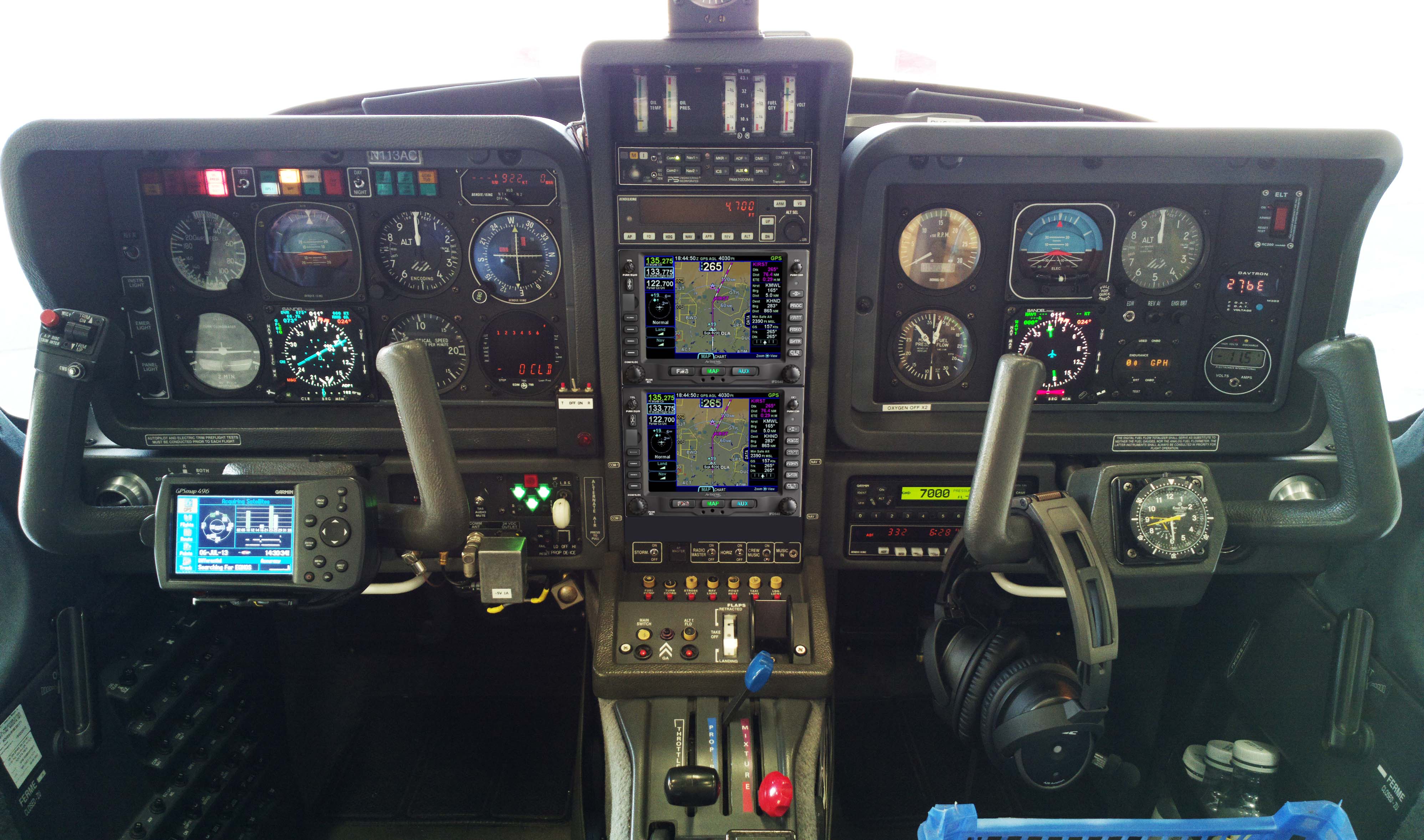
GNS430W, but that would leave various dysfunctional loose ends, and a decent installation would be a Garmin GTN650+GTN750 (or just
the 750) or Avidyne 2xIFD540 (the foregoing
links are photoshopped mockups) and these jobs would cost about 30k but much
more importantly I don't know of any installer who I would let loose on my aircraft
on which I value the virtually 100% uptime!
although the effect of that loss is minimised by having modern avionics which can fly a 3D-guided "+V" approach which is practically the same thing but with nonprecision minima. France is ahead of most countries in removing
ILS approaches (from airports not served by airlines) and replacing them with
LPV. Adding LPV capability
(which also gives you the very useful "+V" advisory glideslope on
most GPS approaches) could be done with a cheap-and-dirty solution of a used
GNS430W, but that would leave various dysfunctional loose ends, and a decent installation would be a Garmin GTN650+GTN750 (or just
the 750) or Avidyne 2xIFD540 (the foregoing
links are photoshopped mockups) and these jobs would cost about 30k but much
more importantly I don't know of any installer who I would let loose on my aircraft
on which I value the virtually 100% uptime!
The aircraft has an operating ceiling of 20,000ft in ISA conditions. I have taken it to 21,000ft but in the fairly common summer conditions of e.g. ISA+15 it will reach at most 18,000ft at MTOW.
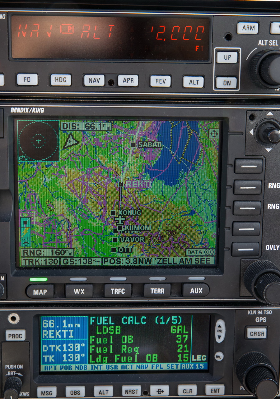
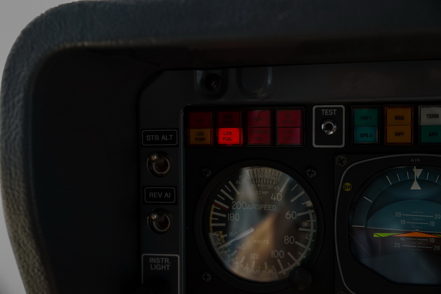
This is the current panel, with the Aera 660 GPS on the LH yoke; this is wired to the intercom to provide a GPWS function with audible warnings in the headsets, as well as providing an emergency "DCT box" for navigation following a total loss of electric power. The Aera 660 is shown running the Garmin Safetaxi product which makes it a lot harder to get lost at a big airport ![]() Unlike most tablets (the Ipads especially) this GPS never shuts down in sunlight so its utility can be much greater than running e.g. Foreflight on my Ipad Mini 5 which shuts down regularly...
Unlike most tablets (the Ipads especially) this GPS never shuts down in sunlight so its utility can be much greater than running e.g. Foreflight on my Ipad Mini 5 which shuts down regularly...
The Golze ADL150 satellite weather receiver was also installed in January 2018. This gives simple but usable graphical weather data for most of Europe, plus tafs and metars. With an upfront cost of around €500 and monthly costs of around €30 this is one of the best add-ons one can install in any aircraft used for reasonable distances and at significant altitudes where there is no 3G/4G reception. The Golze app runs on both Android and IOS, on phones and tablets.
There is an Avidyne TAS605A TCAS-1 traffic warning system, which displays TAS (Mode A/C/S) and ADS-B targets within about 15nm (TAS) and 25nm (ADS-B). It is set to show traffic +/-3000ft and on this entire trip, no other aircraft were seen while enroute. In the UK you tend to see traffic but if you fly abroad, say FL100, you will probably see nothing for hours; such a low GA density there is in Europe.
Routes
The IFR routes were developed with the Autorouter which was also used to file the flight plans. This facility is currently free. The only other options for autorouting are RocketRoute (over €200 a year) and Foreflight (around €100/year for the basic version). Foreflight dominates the US market but has not produced a European version of their Ipad app so the functionality could be better. For VFR flight plan filing I use EuroFPL. I also use EuroFPL for filing IFR flight plans as a backup, or for unusual situations e.g. where a specific ETA must be filed (to fit inside a purchased airport slot) and the Autorouter aircraft performance model does not allow that. The lack of a realistic backup for the Autorouter is a concern to many pilots.
In case the Autorouter disappeared while on a trip, I generate the routings before leaving home and send them to myself on Telegram, or save them in a file which I email to myself. Then I could use one of the other flight plan filing tools (e.g. EuroFPL, or at worst AFPEX) to file the flight plans. This is not 100% reliable because a flight planned route may no longer be valid a week later, but it usually works, or may just need a little tweak.
Some notes on IFR in Europe are here.
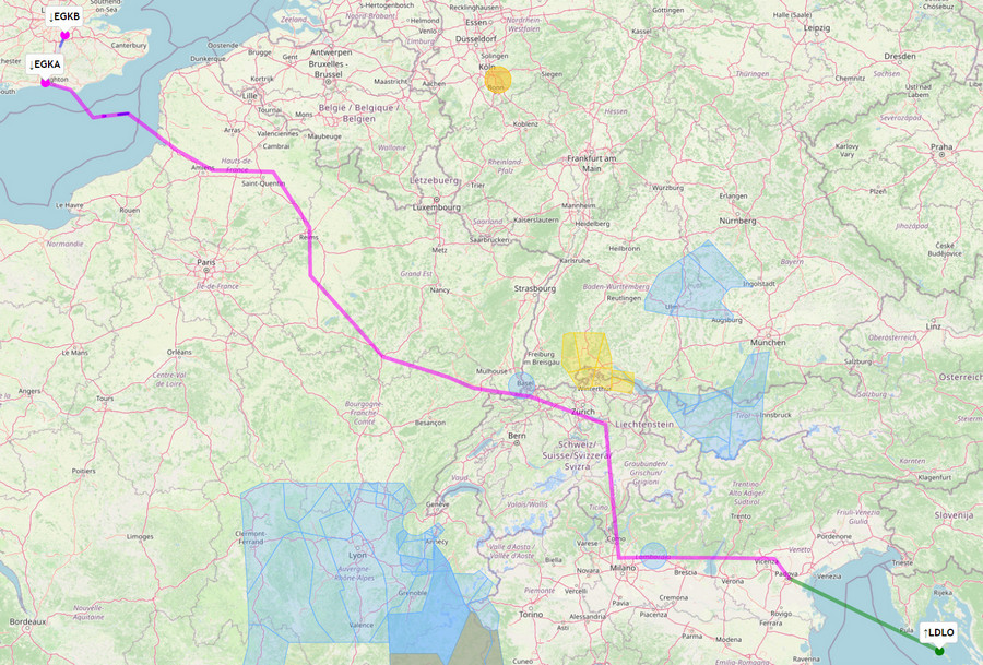
This is the first leg, Shoreham to Brac
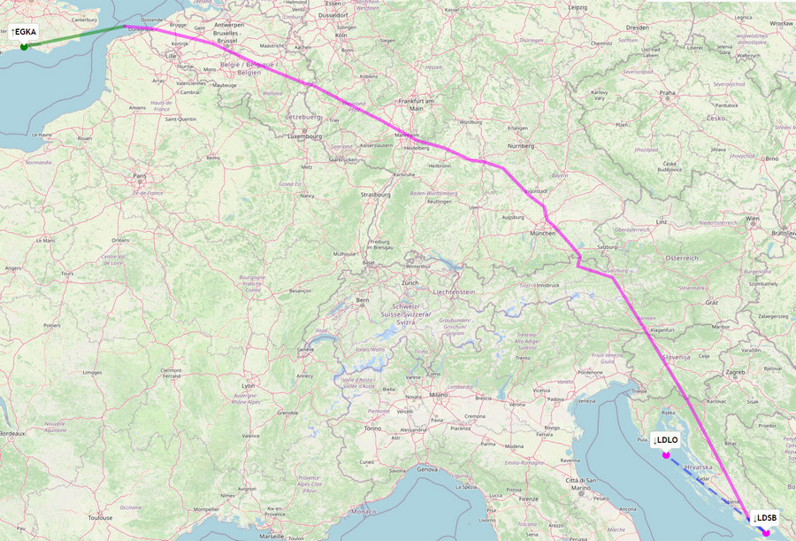
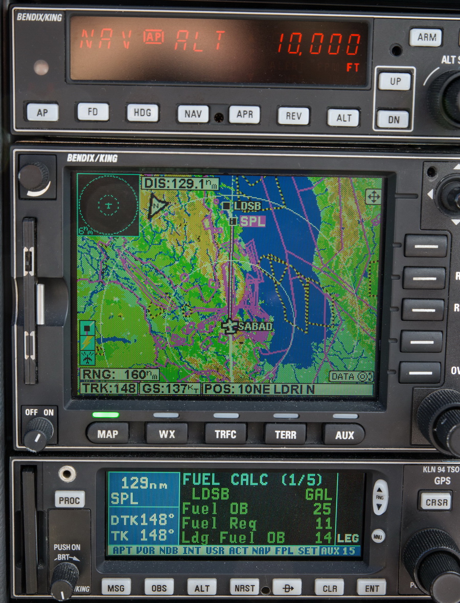
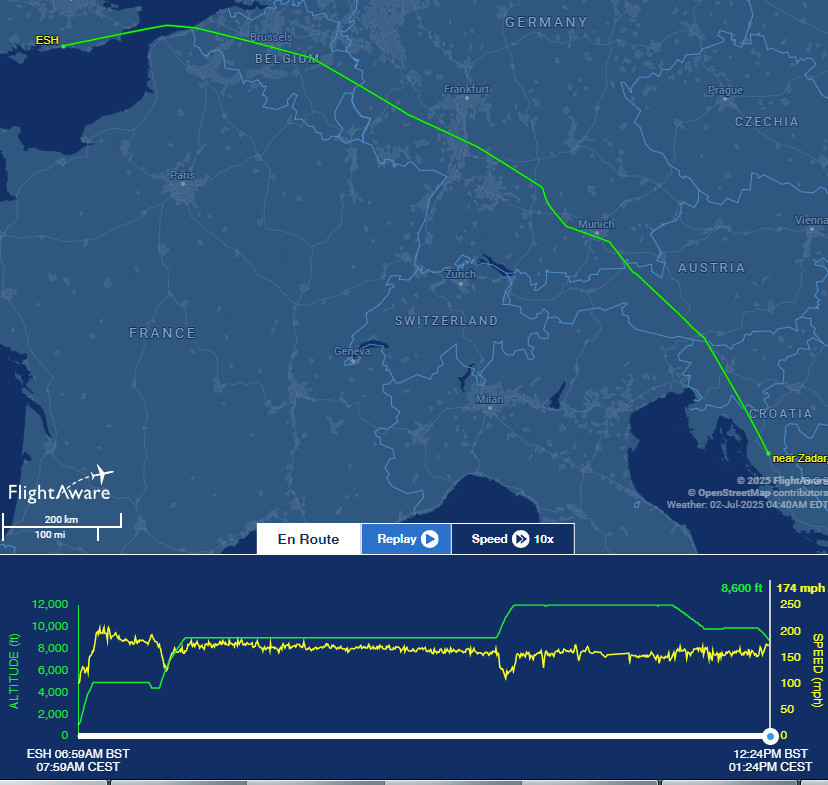
EGKA N0146F050 KONAN/N0146F090 IFR L607 DENOX/N0151F090 DCT ADIXO DCT ARCKY L607 SUXIM DCT ABDAP DCT GISNO DCT ABUKA DCT ROLSO DCT GEBNO/N0151F110 Z818 DKB P605 AKANU L603 OLETU Z106 BAVAX M867 PITAR/N0152F120 DCT KUMOM/N0150F120 DCT KONUG DCT REKTI/N0150F110 DCT SABAD/N0152F110 L862 SPL SPL6N LDSB
889nm as filed
827nm GC
Alternate: Mali Losinj LDLO
For the above flight I normally prefer this route which is much more scenic
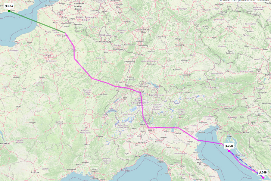
but it was not possible on this occassion due to very bad weather in the eastern Alps. Obviously on this route I work hard to get shortcuts ![]() and there are some good tools for that, as you will see later on.
and there are some good tools for that, as you will see later on.
The next leg, Brac to Syros, is relatively straightforward
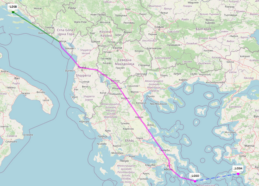
LDSB N0152F110 TAZ/N0152F110 IFR L187 LASTI L607 LEBGA/N0152F120 L607 TRN/N0150F170 N141 DOBAR/N0144F170 N137 BITLA N132 ROPOX B1 ATV L995 KEA/N0149F170 LGSO
538nm as filed
516nm GC
Alternate: Samos LGSM
The next leg, planned but not flown since we could not get PPR for Chios, was just this short flight
Since Chios is not a port of entry, the next stop would have been Samos, at some €400.
Next route was Syros to Mali Losinj. This was worked out on the same day so the routing shows the day's Eurocontrol restrictions
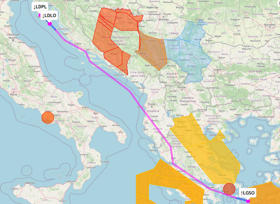
LGSO N0150F120 KEA1B KEA L52 KOR L53 GARTA L611 RODON/N0150F100 L611 UVODI/N0152F100 L862 SPL Y88 MINTU MINTU3A LDLO
672nm as filed
642nm GC
Alternate: Pula LDPL
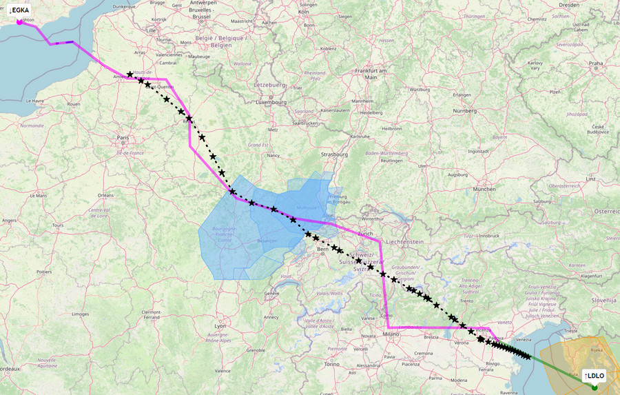
And finally, Mali Losinj back to Shoreham. This route involves extensive harrassment of ATC for shortcuts ![]()
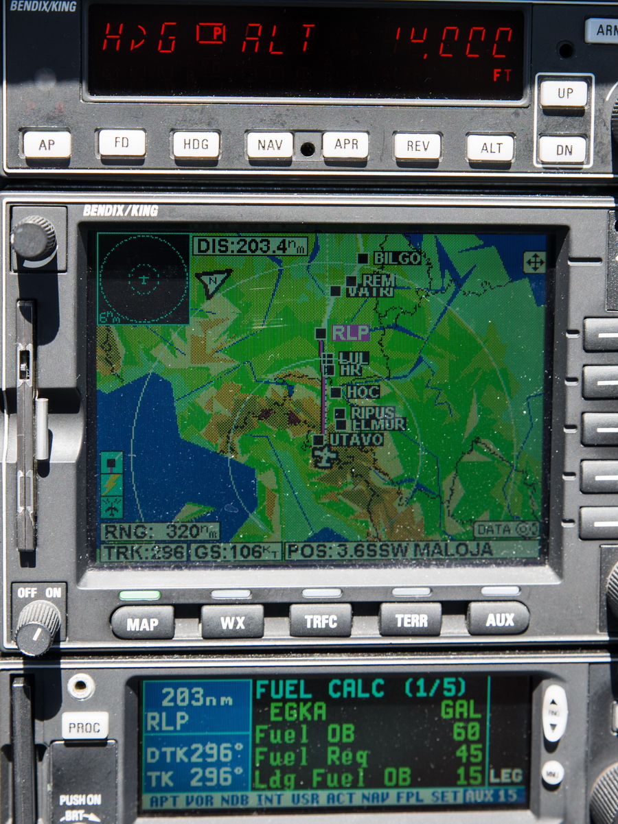
LDLO N0152F100 INBUT/N0152F110 IFR N503 VIC L615 PEXUG/N0152F140 L615 DESIP/N0147F140 N851 ELMUR L613 MANEG/N0147F120 L613 DITON/N0150F100 L613 HOC/N0152F100 Y112 RLP B3 REM/N0152F120 B3 BILGO/N0150F120 H20 XORBI H40 ABB N20 ELDAX DCT HARDY DCT SFD EGKA
797nm as filed
701nm GC
Alternate: Biggin Hill EGKB
In-Flight Data
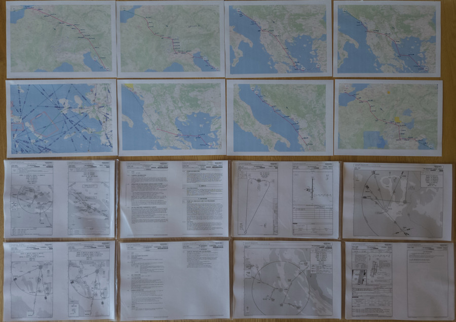
Many pilots fly "fully electronically" nowadays but for any significant trips I always prepare a printed paper package comprising of the route pic, a plog (a waypoint list; this is rarely used since the route picture shows most of the waypoints, and the flight is done with GPS navigation), and the terminal charts for the departure, destination and alternate(s). For terminal charts for unplanned airports I have a collection of PDFs on various devices including my phone. The advantage of paper is that the battery can't go flat ![]()
Weather sources
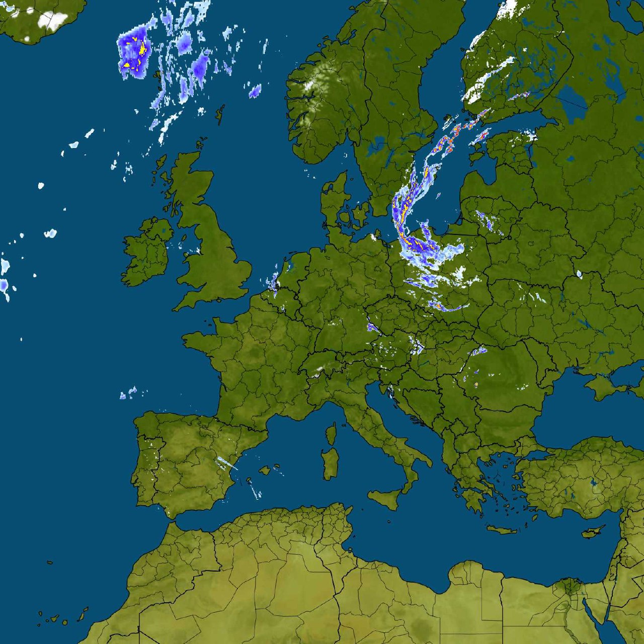
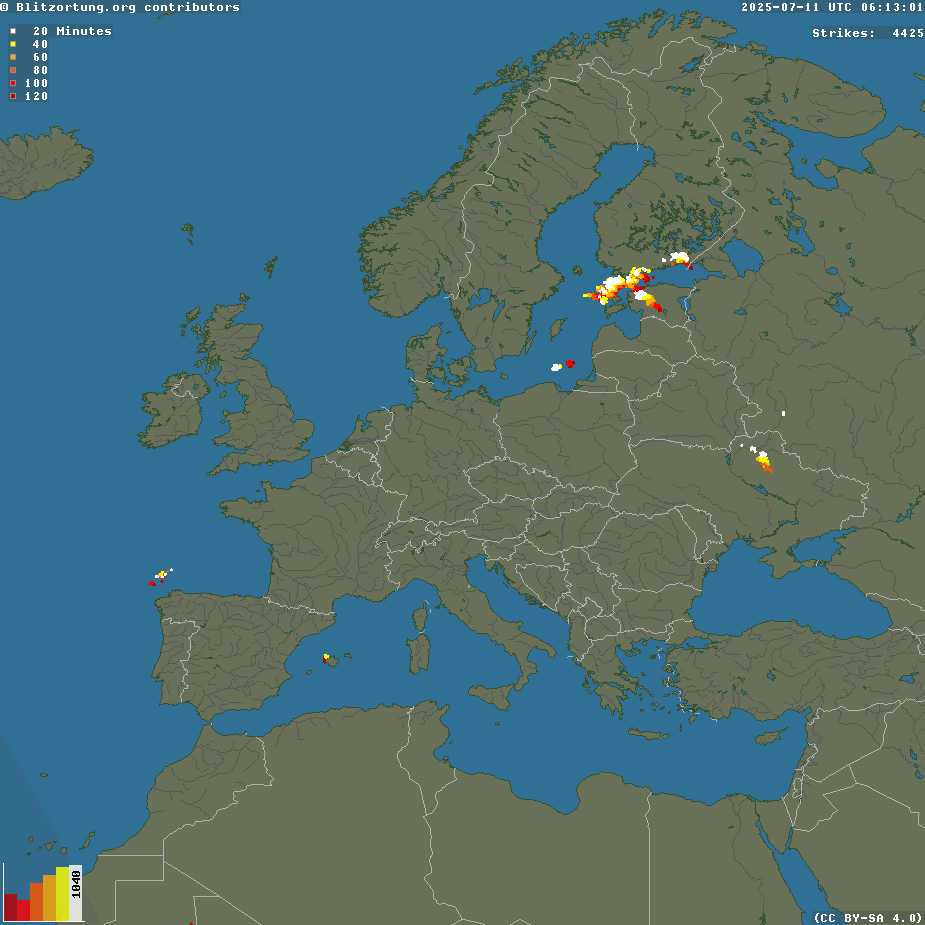
For many years I have been using tafs, metars, radar, IR (infra red) images for cloud tops, sferics (lightning) for convective activity, and the UK MO MSLP charts for the general picture.
The Windy.com website is a new addition to the set of weather tools and is proving to be nothing short of a revolution. It offers several European weather models, all of which were previously "commercially secret" and ECMWF is generally the best one, and all of them are better for Europe than the GFS model which was universally used by pilots beforehand. European weather data has always been tightly guarded so everyone used GFS, which was freely provided by the US. Somehow, Windy.com is able to offer these new weather models. The wind visualisation at different levels is very good; of course it is no more accurate than the weather models but it offers an easy way to assess which route is likely to get the worst or best winds. In reality I have found it to be within 10kt, usually. For IFR pilots, the "rain" layer is perhaps the most useful one for a "quick and dirty" check for whether a flight will be nice, or a challenge.
Cloud tops forecasts remain elusive and you are doing well if the forecast is within a few k feet.
Shoreham to Brac 2nd July 2025
Usually the first flight out of the UK is the most challenging, and having a two-day departure slot really helps. On the route chosen, away from the western Alps, the weather was ok.
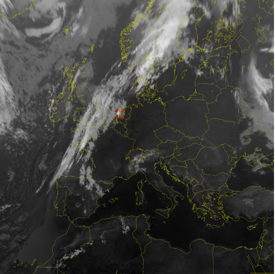
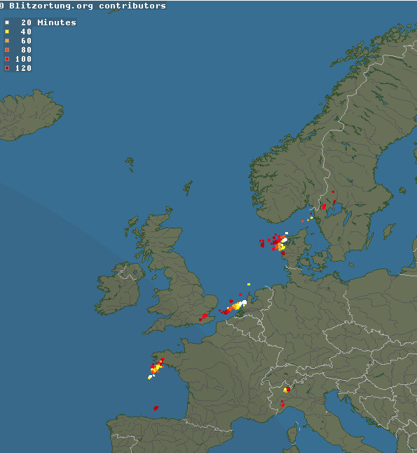
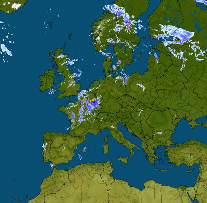
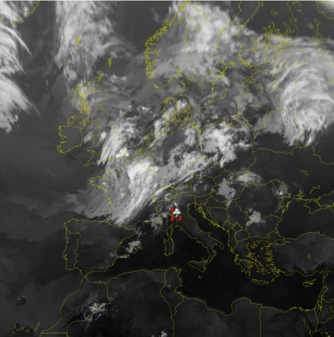
TAFS/METARS MSLP Radar IR Sferics
Then I got a big shock on the morning of the flight. Eurocontrol suspended the flight plan due to it being invalid (some new restrictions appearing overnight; this is generally rare but happens more often these days). The Autorouter failed to pass on the SUSP message from the previous evening (not the first time it has done that) only passing on the 2nd one in the morning, which I got minutes before the taxi was collecting us. It offered a suggested route but that went via the stormy region over the Alps… So after some abortive attempts at re-routing I decided to try a drastic measure: re-file the route entirely VFR and hassle ATC for IFR clearances all the way down to Croatia. For this filing I used EuroFPL because the Autorouter got stuck and never offered the Edit route option. I don’t think you can edit a route on it before it has tried to produce one by itself, but could be wrong; I just had the phone. With EuroFPL you can just file anything, and obviously a VFR FP will always be accepted.
The result was interesting. Out of Shoreham it was VFR anyway, 5000ft OCAS, due to no tower (we departed 0700L, 1hr before airport opening, under their indemnity scheme; Brac normally closes 1400Z but on this particular day it closed later) so I got London Info to open the FP (London Info is not much use for anything else since they have to pretend they have no radar). The UK in any case allows IFR in Class G non-radio so you can depart legally into almost any conditions. Ostende was the next one and they cleared me to their CAS at 4500ft. But soon I got IFR and a climb FL080 etc. After that IFR was continuous, so somehow that VFR route was converted to IFR, disregarding the earlier Eurocontrol objections. More here. The “problems” were clearly totally spurious. It was a very useful lesson on how to deal with this nonsense; ATC is able to tactically manage traffic enroute - 99% of the time. But it was really stressful at the time.
One has to be careful flying outside CAS in the UK. A few years ago the UK adopted an aggressive "100% bust them all" policy, with every infringement, no matter how brief, of controlled airspace, danger area, ATZ, being followed up and the pilot being busted for it. Details here. Their clear aim is to reduce these pilot errors to zero. They don't "get" that the vast majority of infringements are minor pilot errors which are an inevitable part of flying outside controlled airspace, especially given the UK's disjointed ATC services. Some pilots get warning letters, many get sent to a 1-day "infringements course" (which costs £300-£500 and is mostly full of experienced pilots who got caught because they were using Mode S, some business jet pilots and even some instructors and examiners) and if you infringe again within 2 years of that course you are likely to get your license suspended, for many months and with no appeal. A very long discussion can be found here. Nowadays this "course" runs over Zoom video so it is cheaper. As a result, many pilots are flying with transponders off (which is not legal) or with transponders removed or non-functioning (which is legal). The data is now published by the CAA here and it shows that infringements have not reduced. The CAA originally wanted to keep this scheme secret but were forced via multiple FOIA applications (they lost some appeals) to publish it.
After the start of Belgium the flight was just like a normal IFR flight. I doubt anybody down the route was aware what happened ![]()
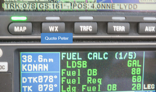
Initially we had about 15kt of tailwind which produced a nice landing fuel on board (LFOB) figure of 20USG
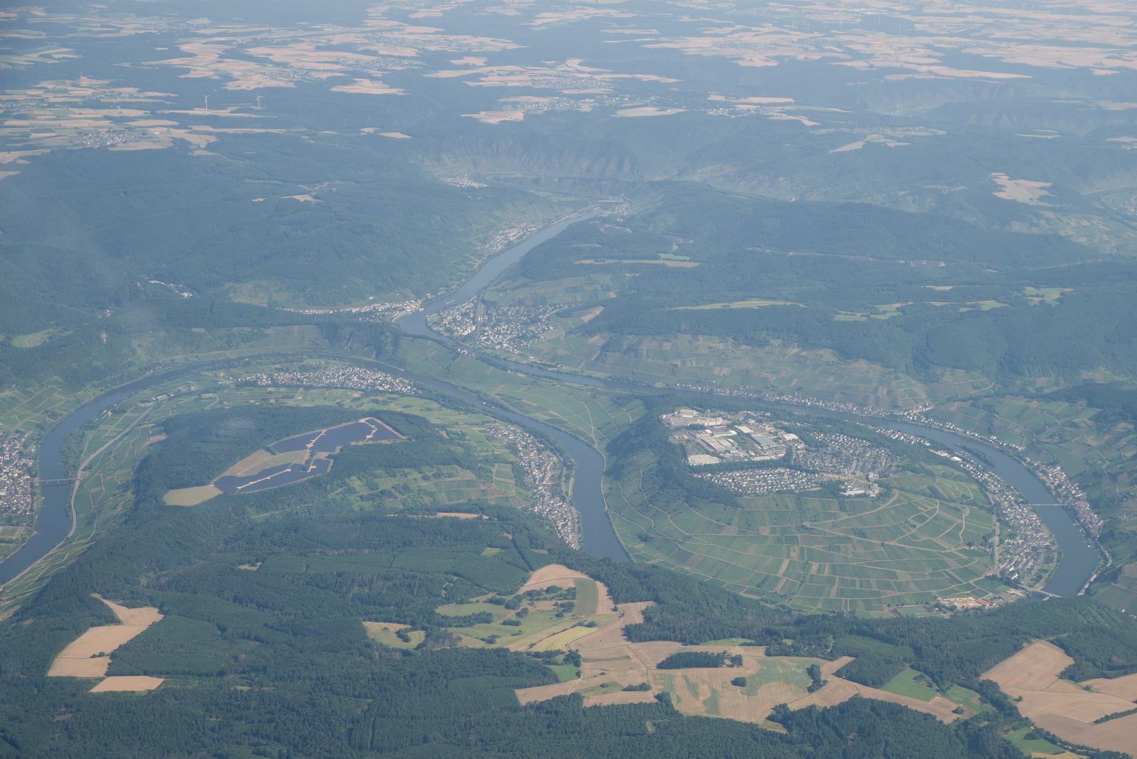
The famous river in Germany. Being an IFR pilot on this occassion, I have no idea of the name ![]() Probably the Moselle River, and a hazy photo
Probably the Moselle River, and a hazy photo
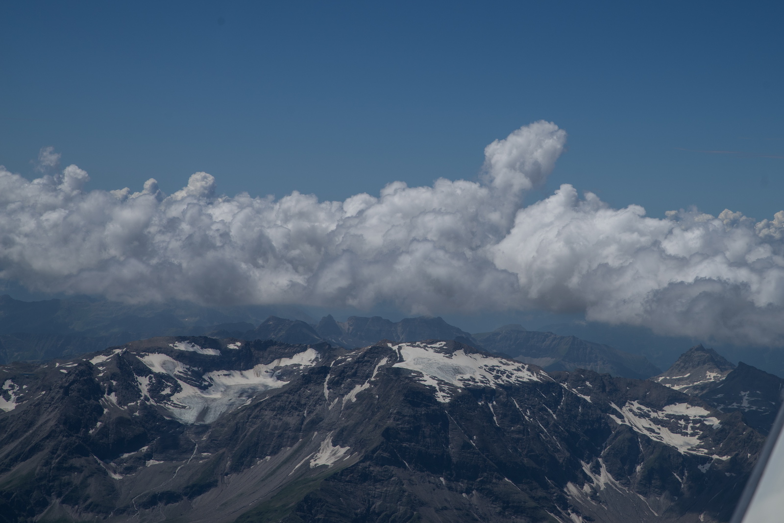
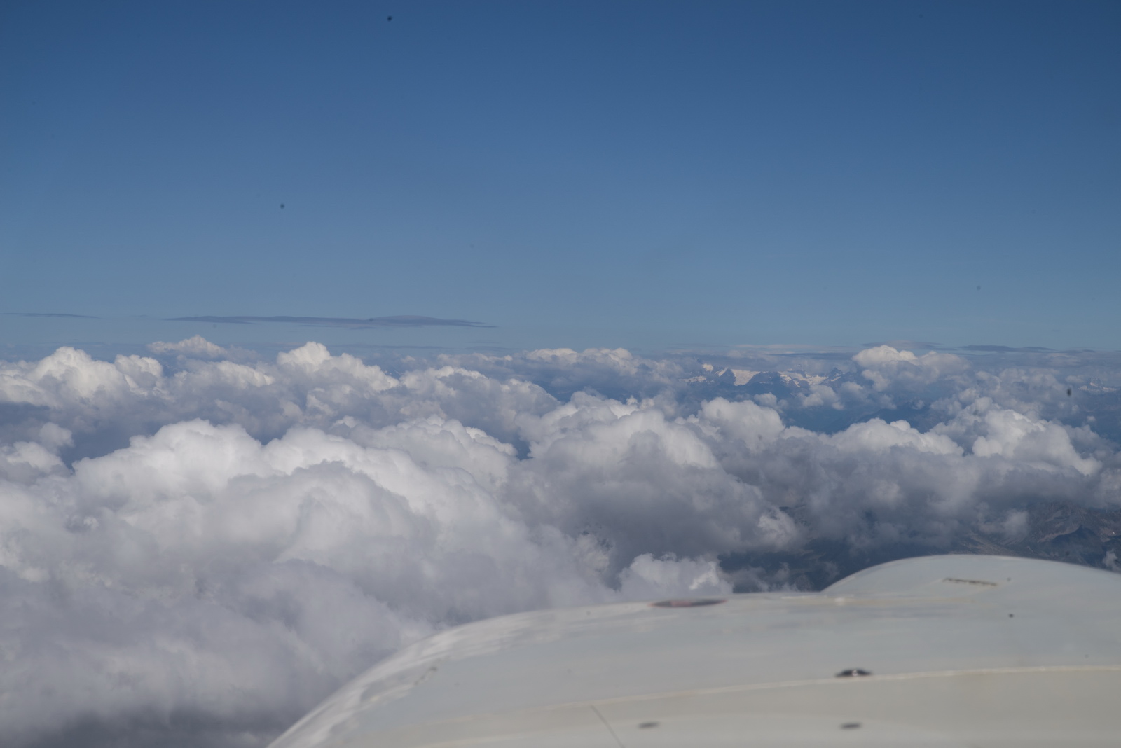
At this time of the year, not much snow until you get to the high Alps. I used the old trick: cancelled IFR for the Alps, which enabled FL120 rather than FL150, for much better pics ![]()
There is usually a bit of strategy involved. You need to ask ATC for the climb early enough; if you leave it too late you can get out of options. Also with ATC a lot of stuff is in the "fait accompli" department so if you can get one unit to clear you to say FL120, the next one will accept that, even if they would not have accepted your FL120 request. ATC almost never force you to descend. Well, the Swiss have done so when some "military exercise" popped up, but then you can take your time, especially if obstacle clearance is an issue.
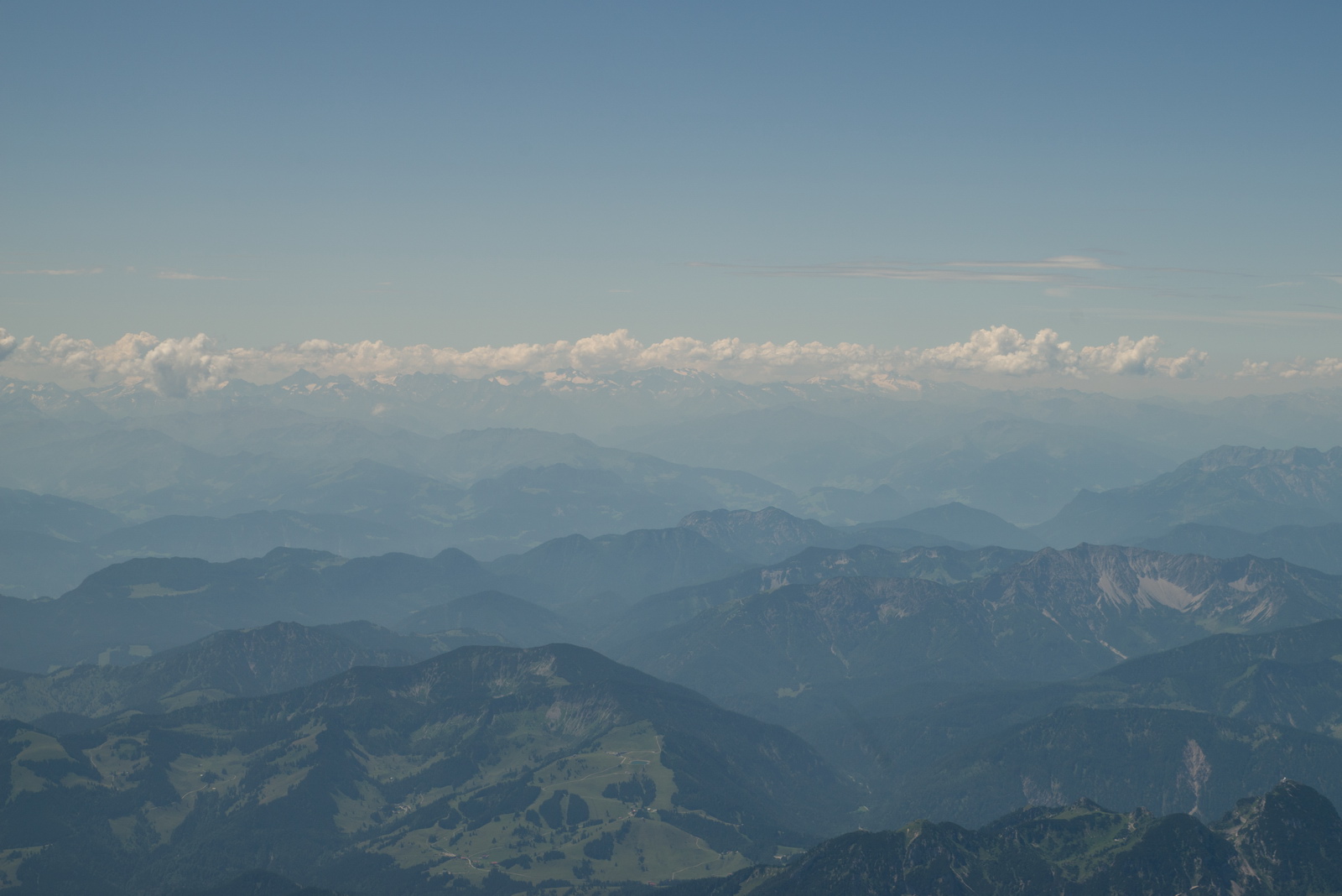
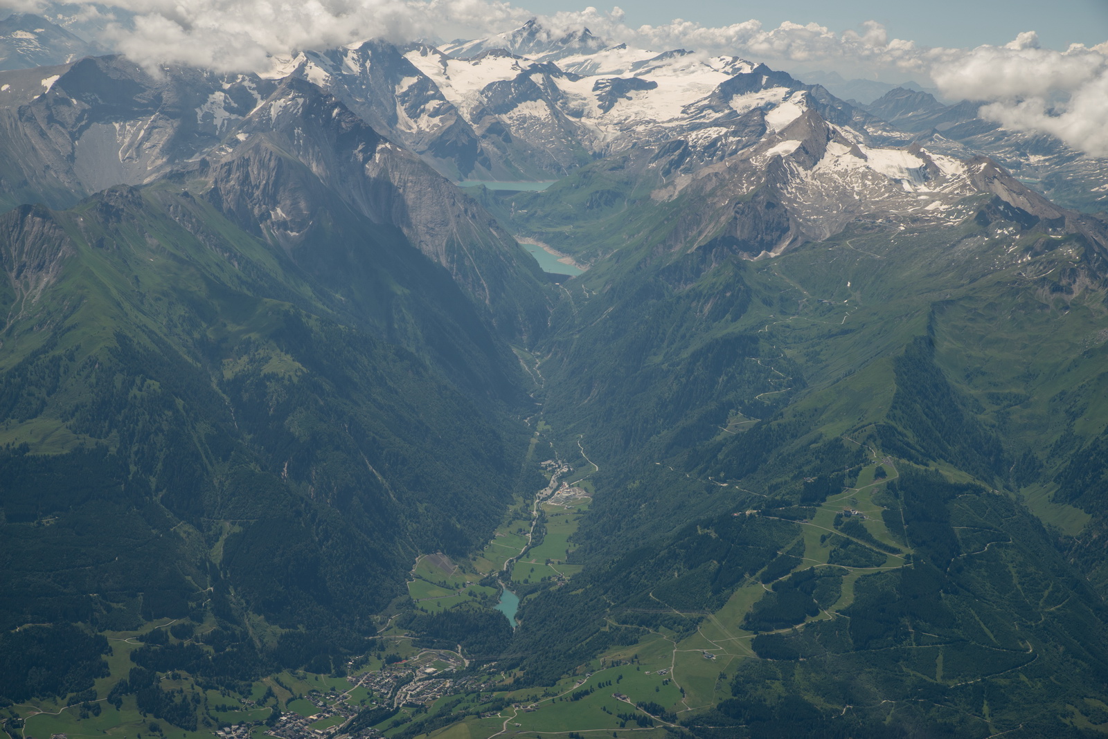
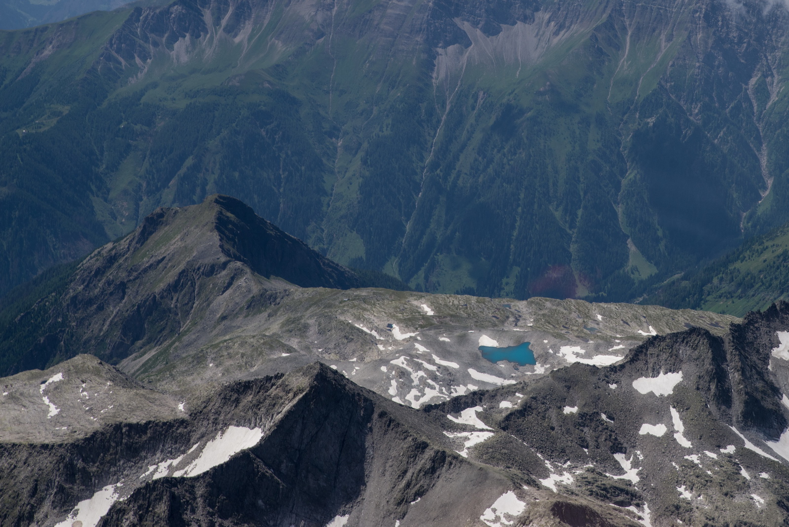
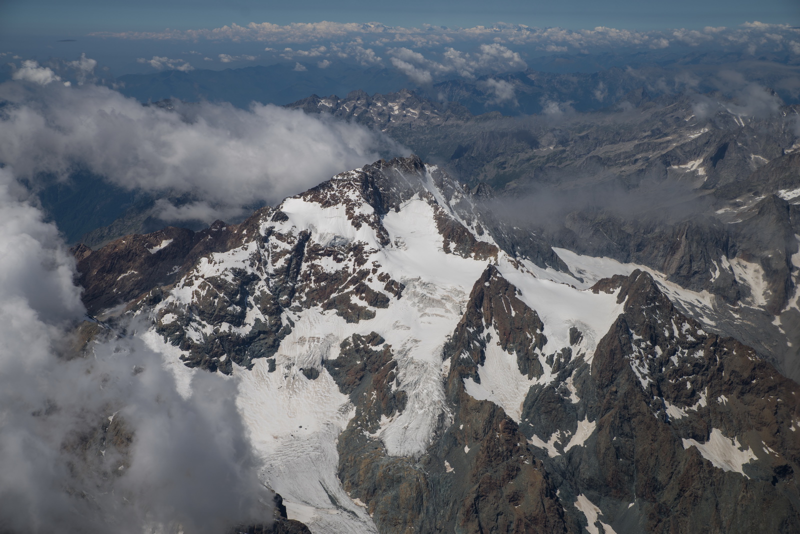
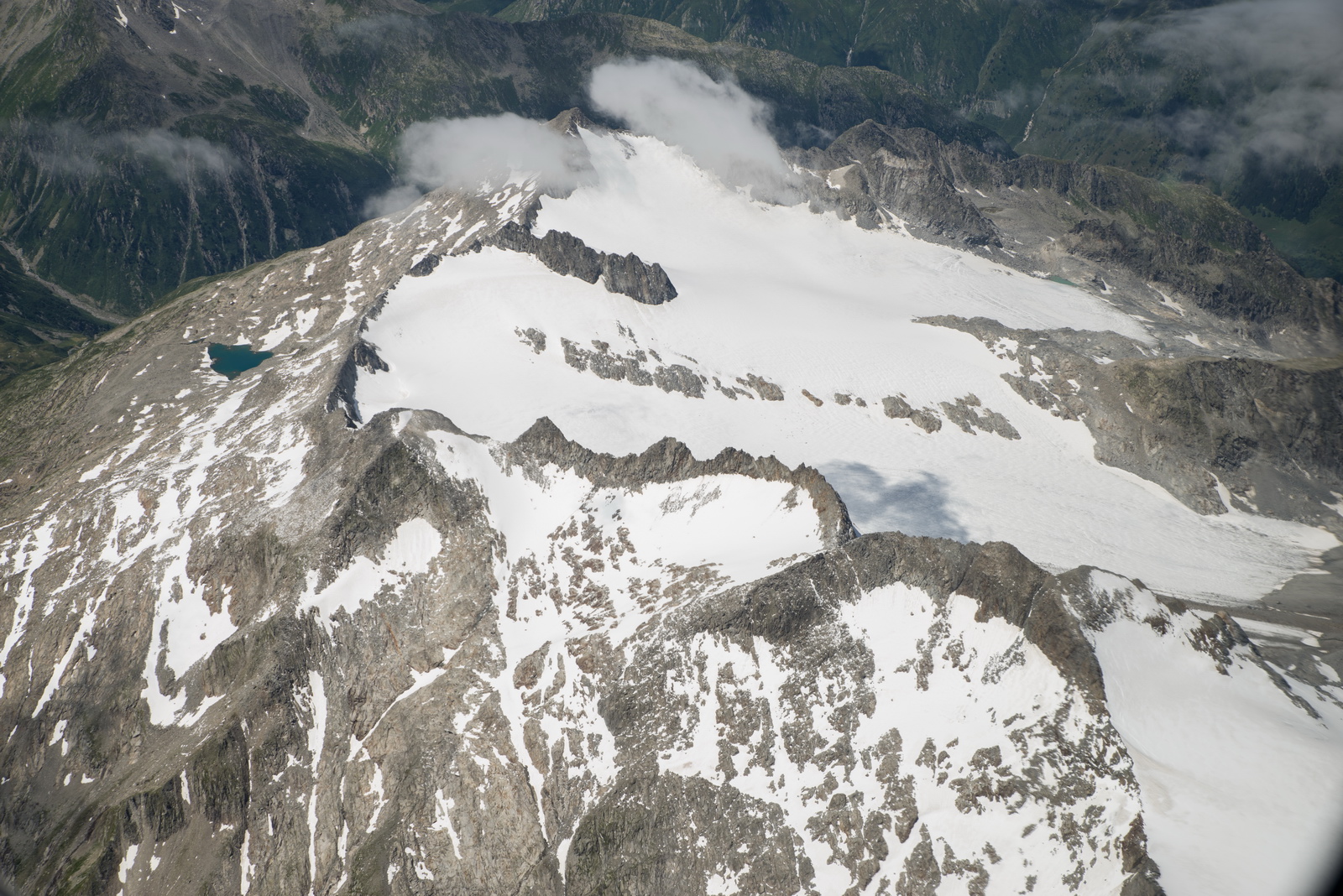
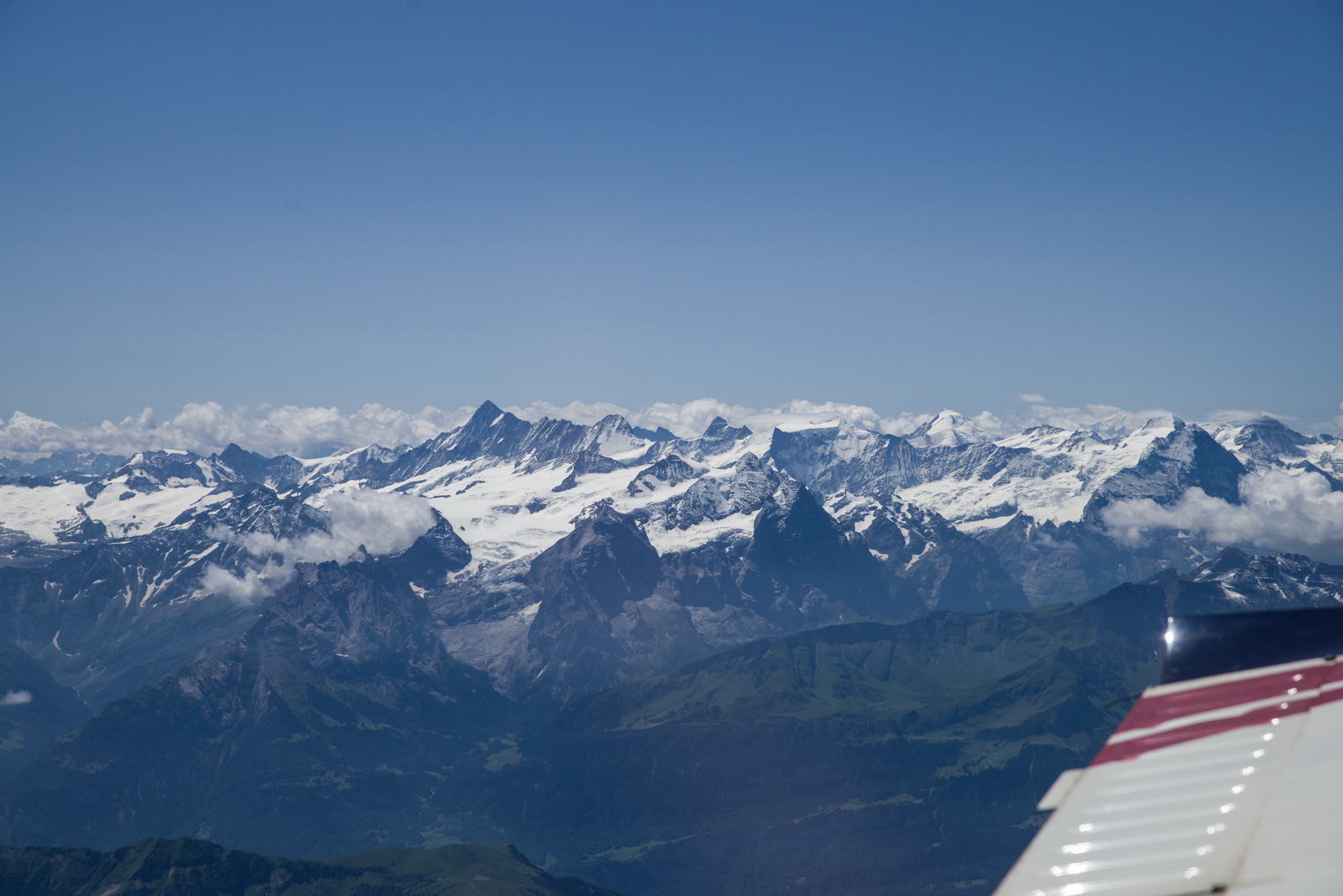
Now we see some higher mountains. At FL120 some of them would be a problem but we were routing to the east of the big stuff
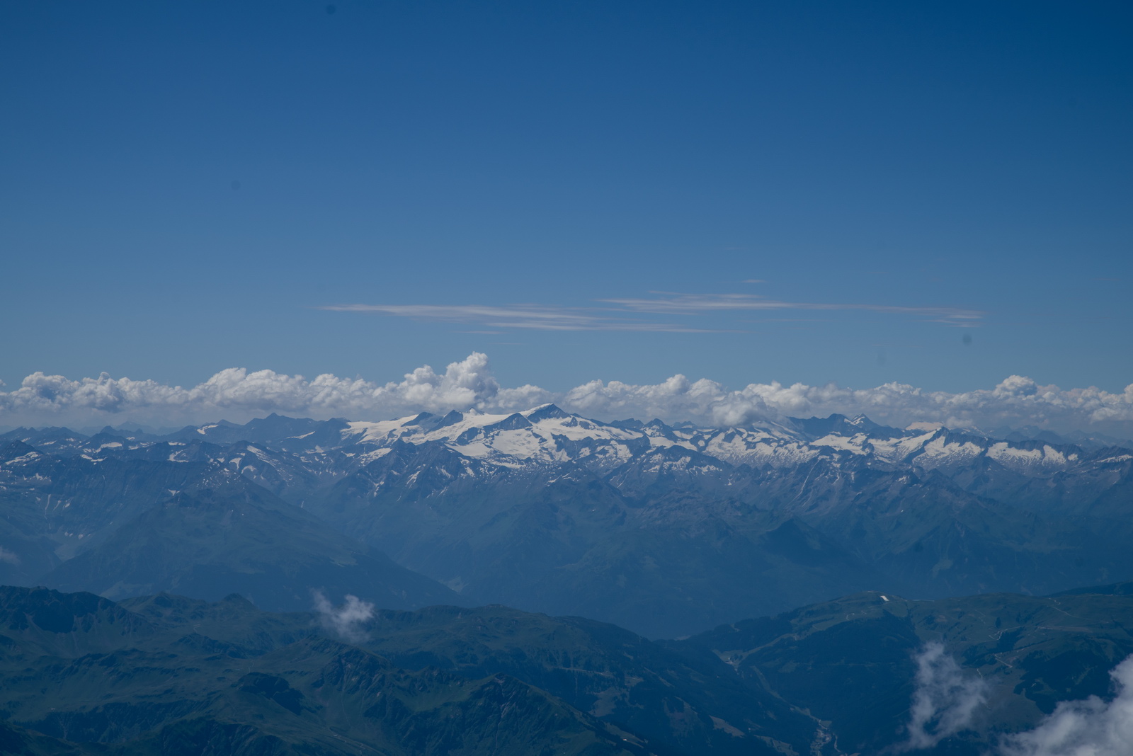
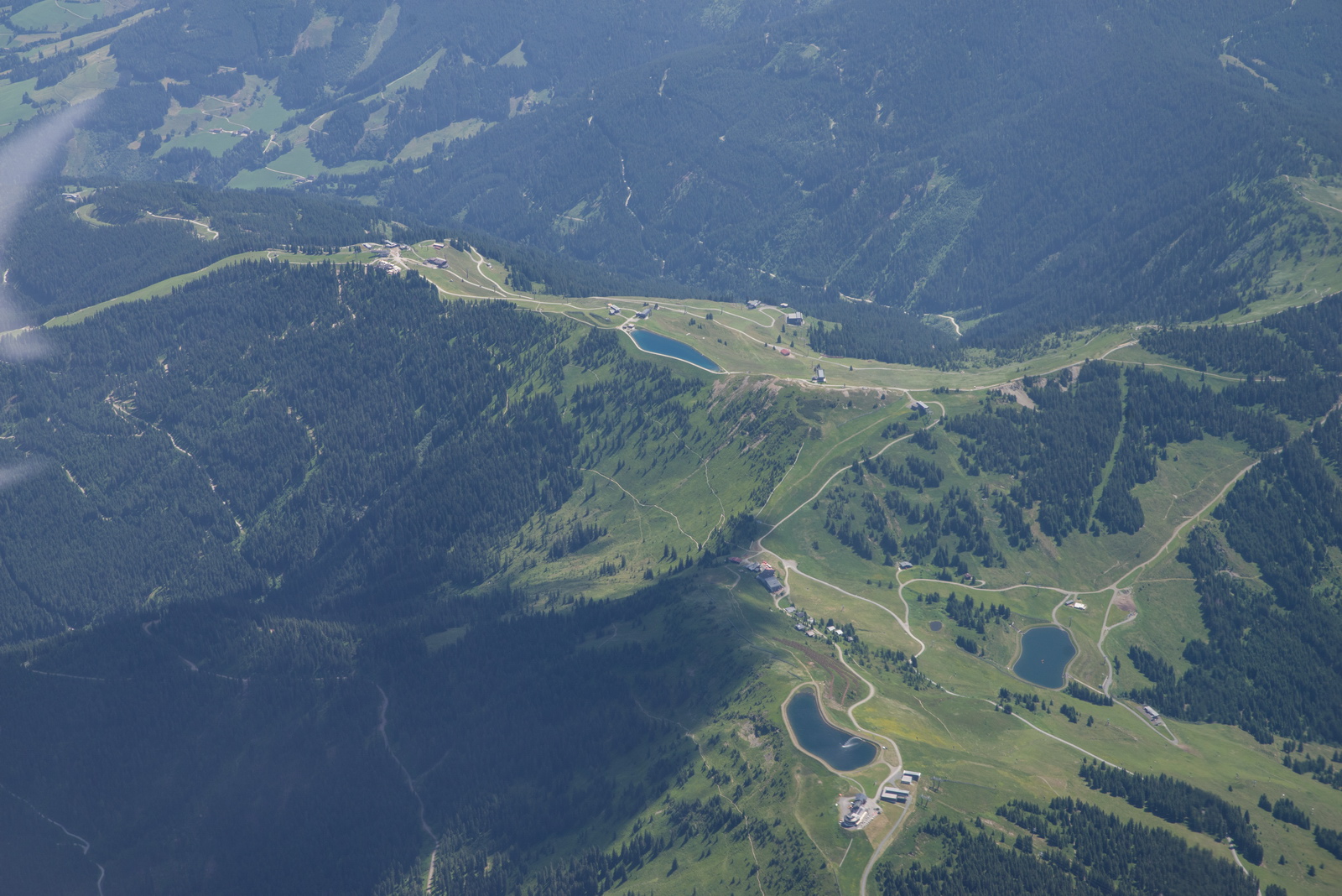
Some ski runs there ![]()
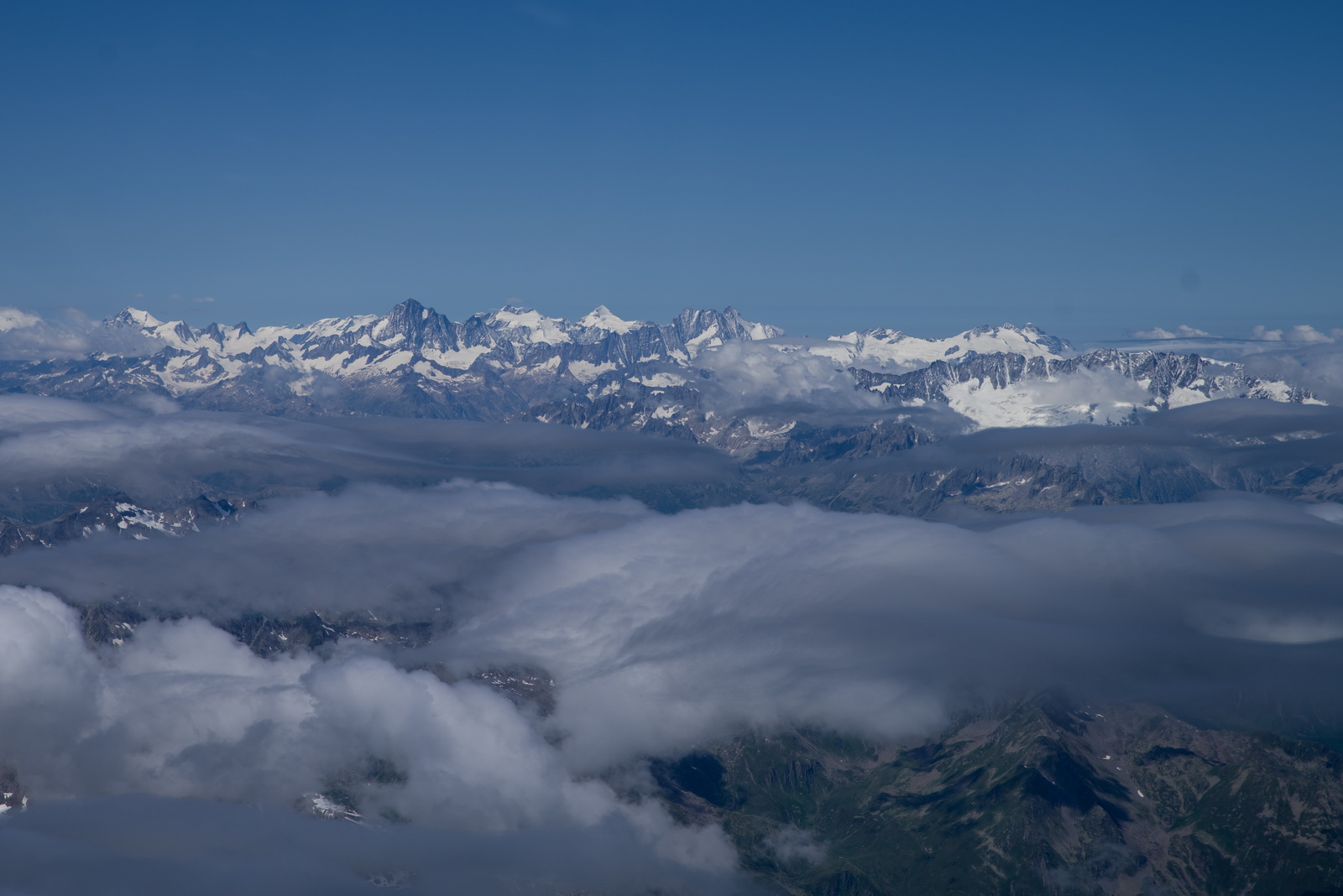
Crossing the Alps now, FL120. Tailwind dropped off hence the 15 USG LFOB
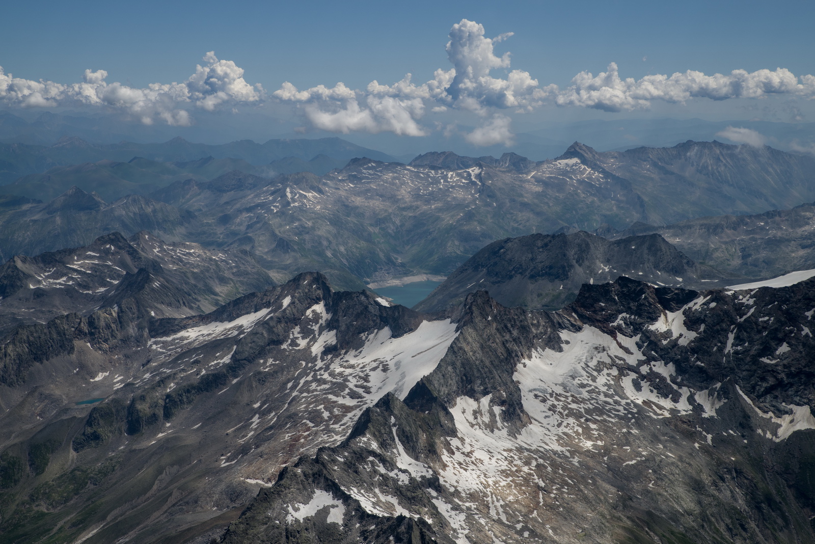
I never get tired of the Alps ![]() You could fly the same route 10 times and it will look different each time...
You could fly the same route 10 times and it will look different each time...
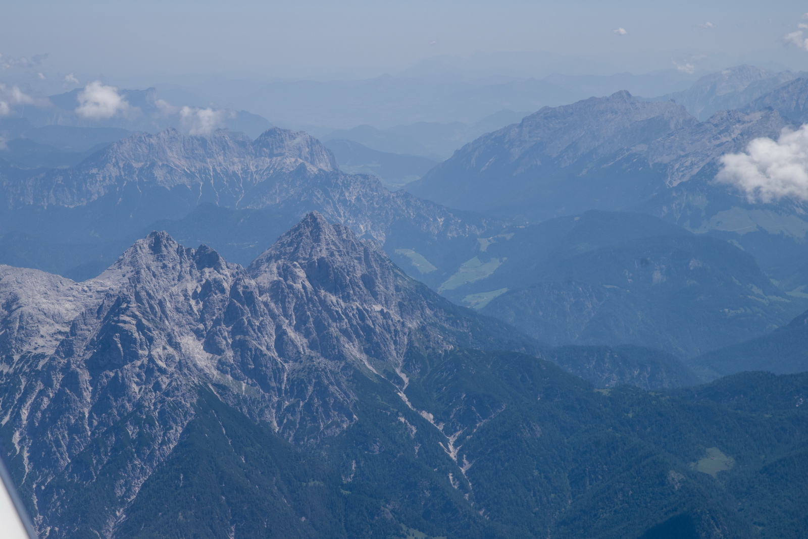
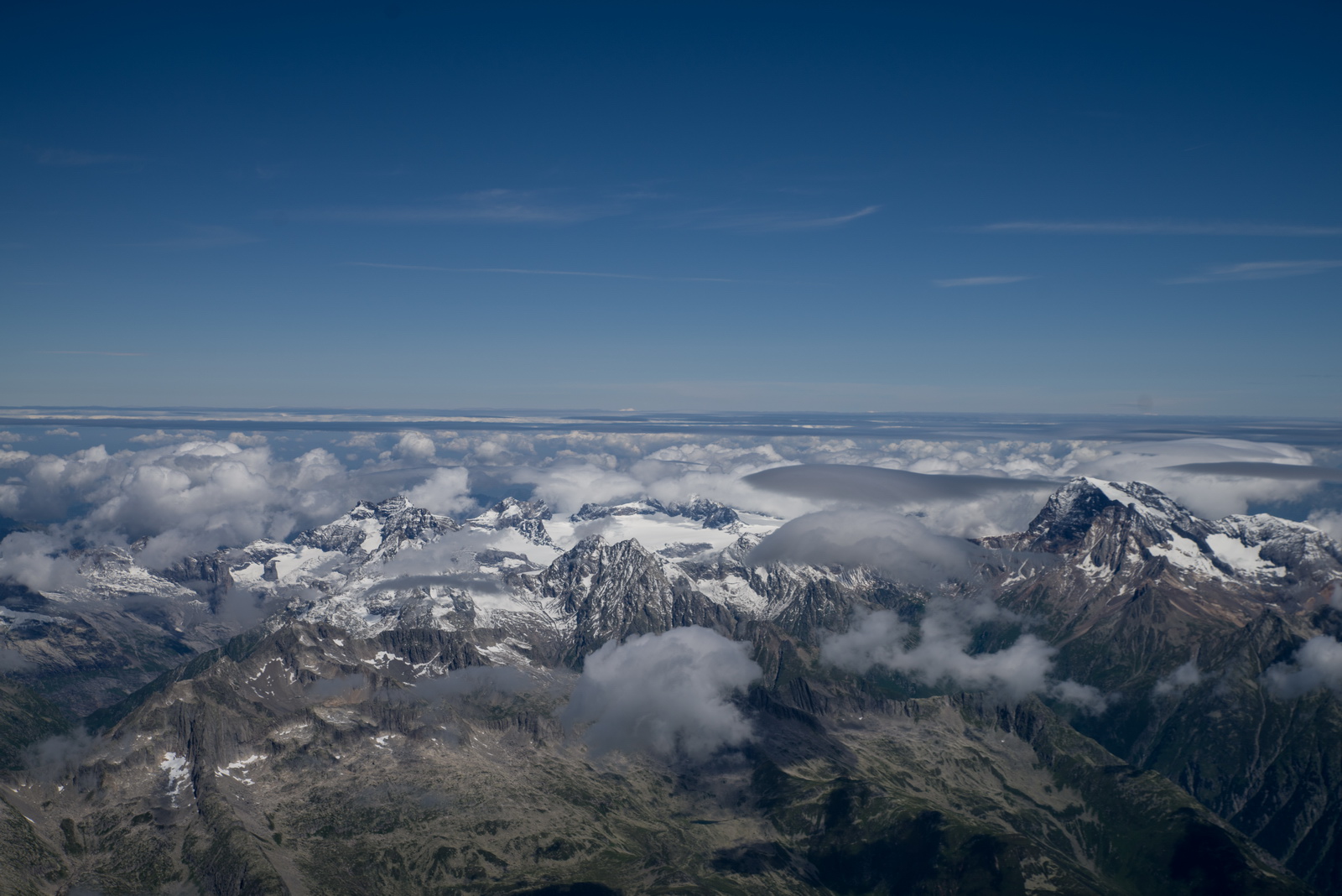
The end of the mountains is approaching

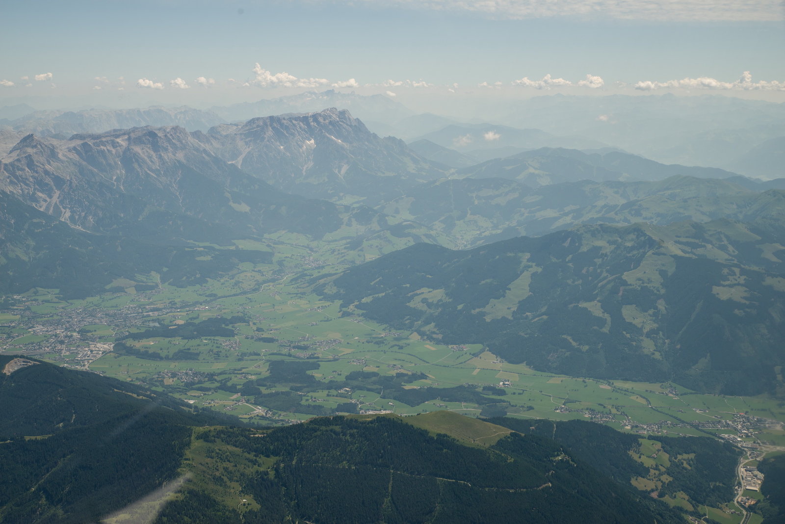
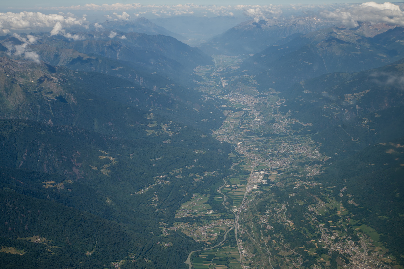
Northern Italy
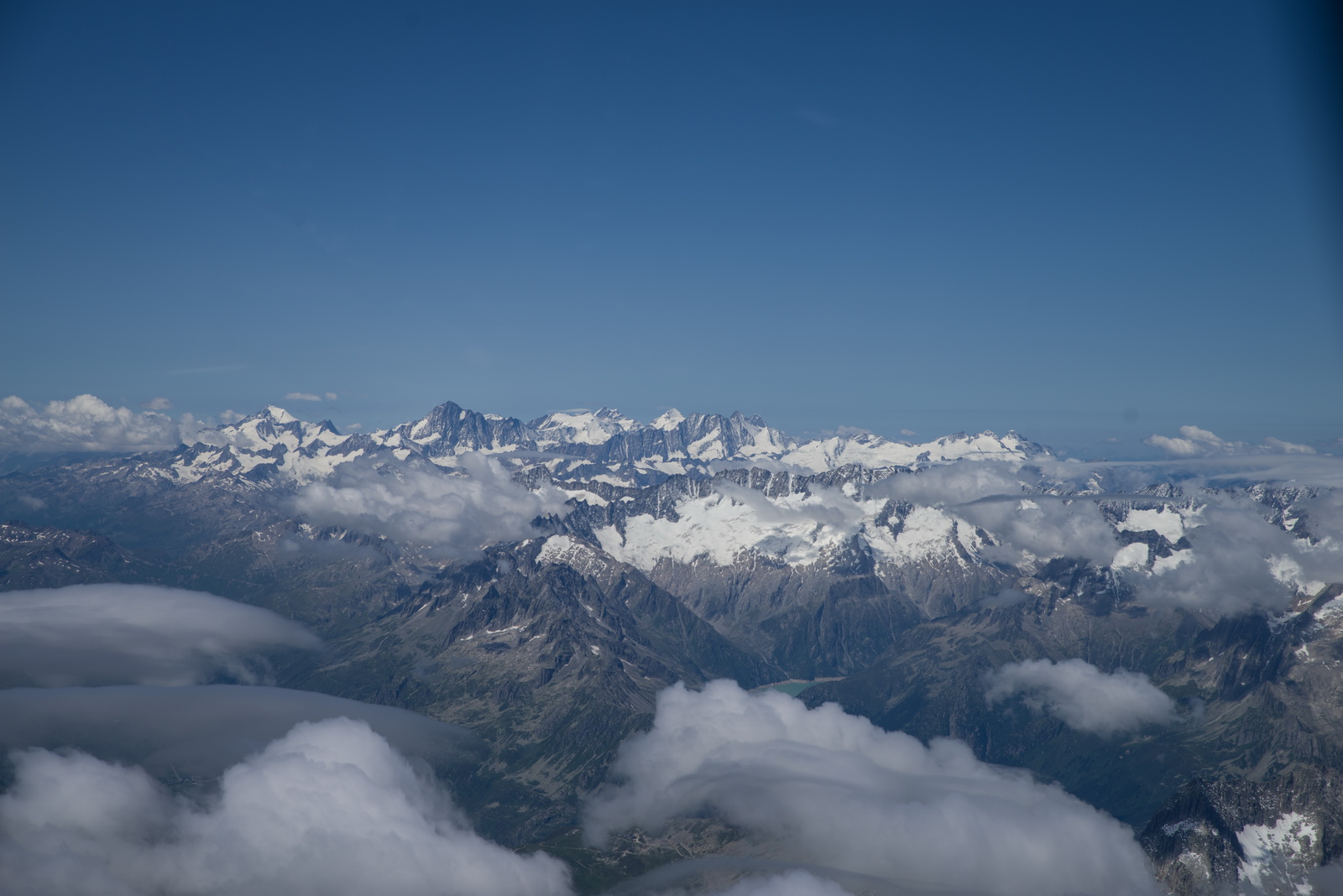
This is the less scenic way to go to Brac, not seeing the Adriatic islands, but we had to avoid the bad weather over the western Alps
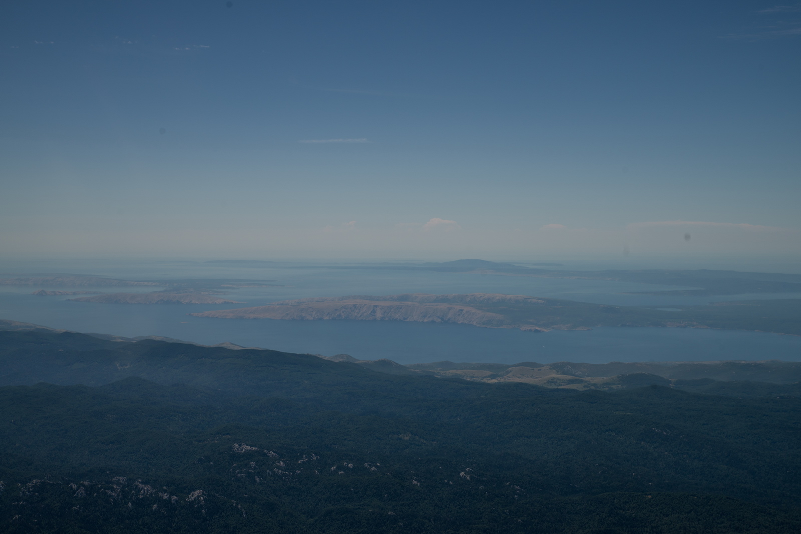
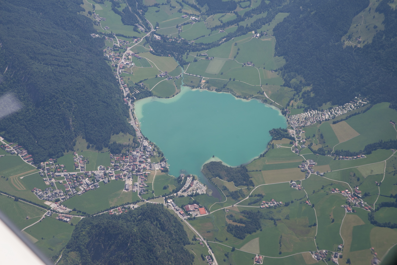
Split, and its airport
Positioning for right base into Brac. There was headwind later in the flight so the LFOB shrunk to 14 USG, which is OK given the good alternate situation down there and the good weather.
The coast of Brac facing the mainland of Croatia. There are some lovely villages there, as well as some heavy duty hiking routes
Track actually flown:
Video of the above flight. I am nowadays uploading to both Vimeo (better quality) and Youtube. Vimeo has recently got scared of some dumb European regulation and has removed any means of seeing the videos if your IP is in Europe, unless you have the direct URL to it.
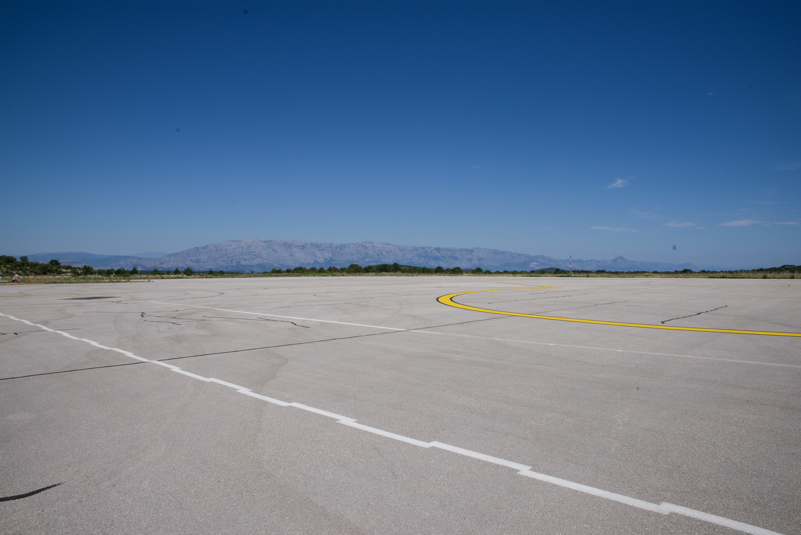
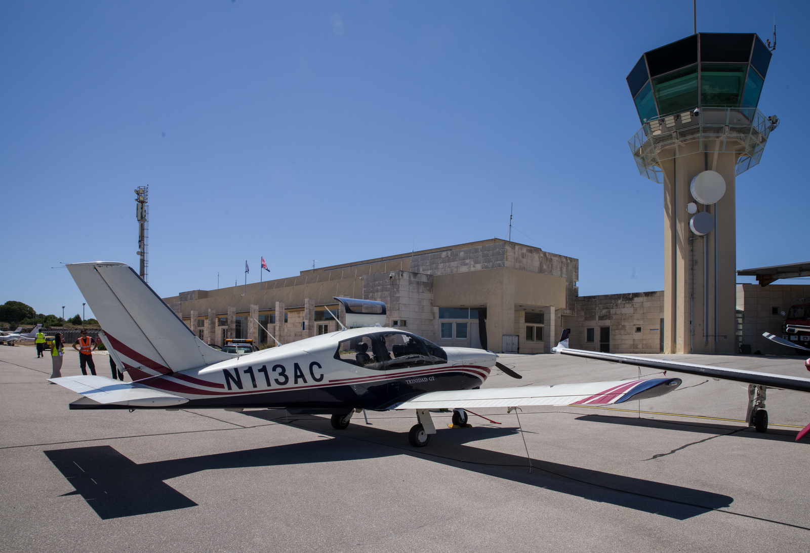
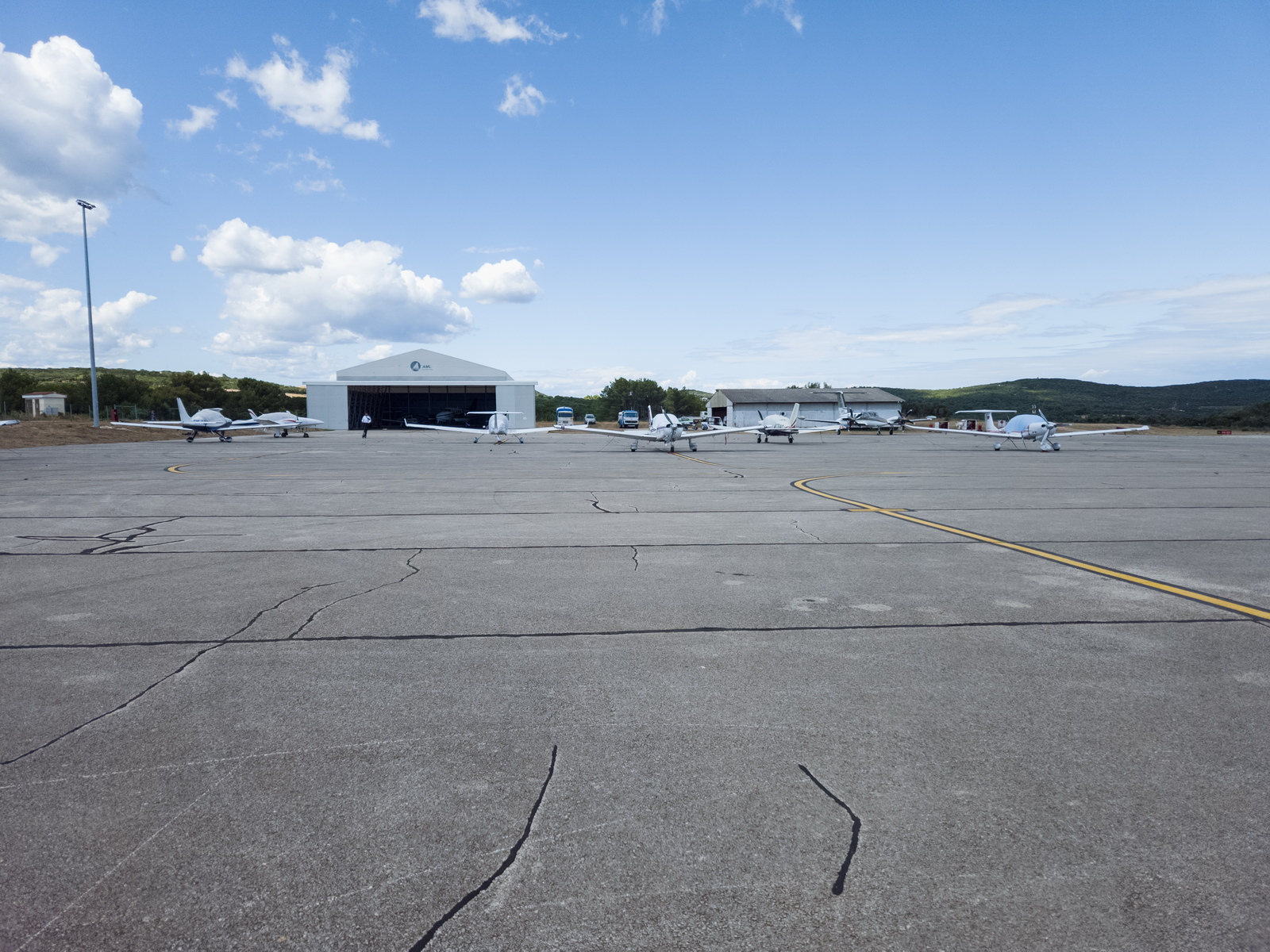
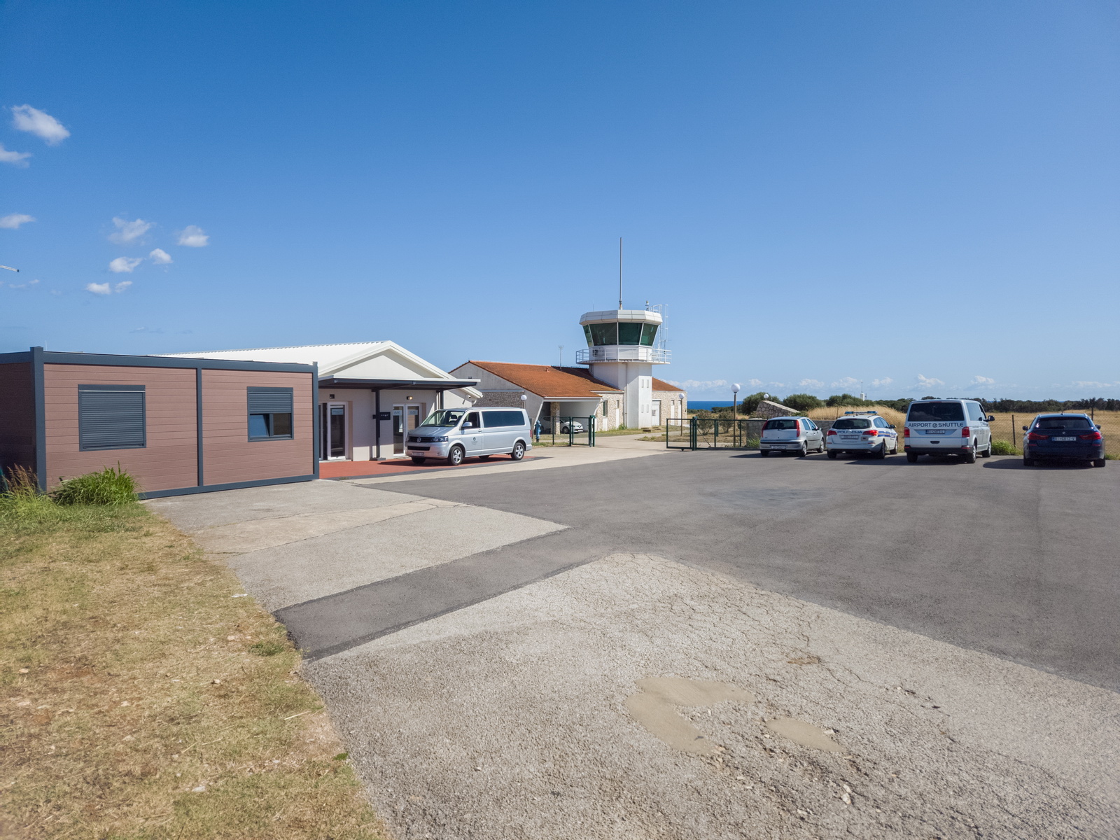
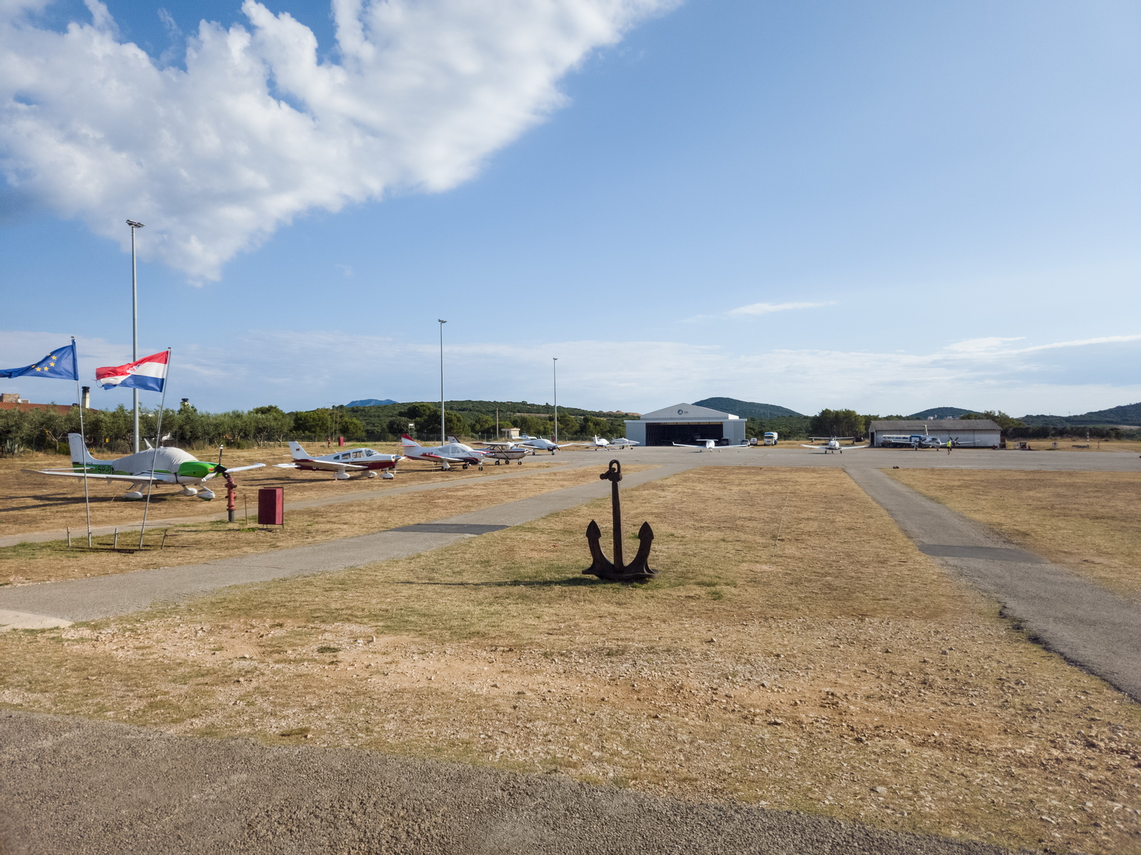
Their vast apron which sometimes “fills up” with bizjets – here
Parked up - great service ![]() The all-female office runs the place with super efficiency
The all-female office runs the place with super efficiency ![]()
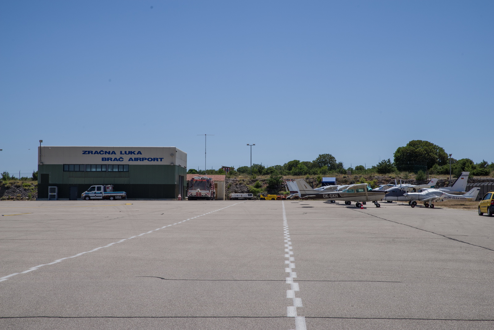
This is the old terminal building - up to about 20 years ago
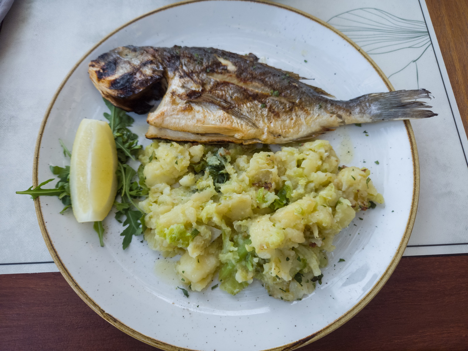
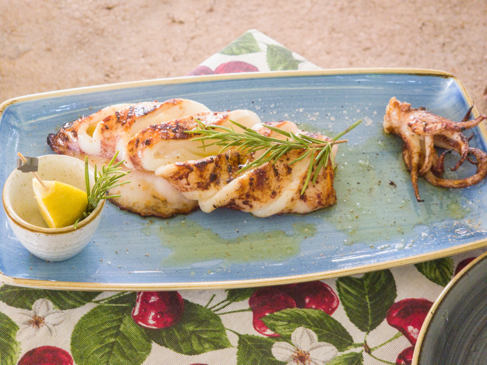
Not wasting any time and getting a fish down the road in Bol ![]() It is actually possible to walk down the hill from the airport into Bol; there is a nice path which takes 3hrs and I did it in 2022, but obviously not with luggage
It is actually possible to walk down the hill from the airport into Bol; there is a nice path which takes 3hrs and I did it in 2022, but obviously not with luggage
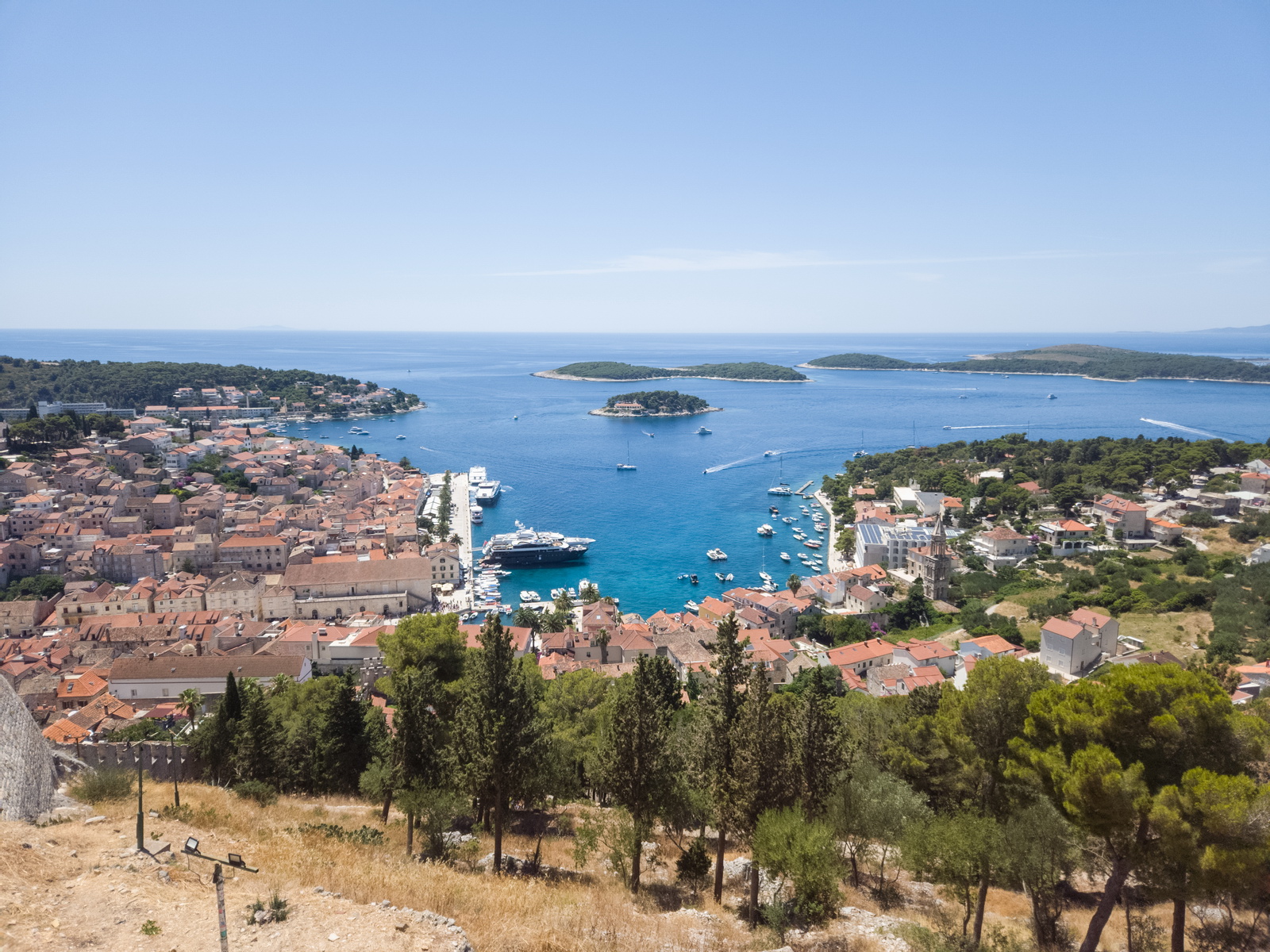
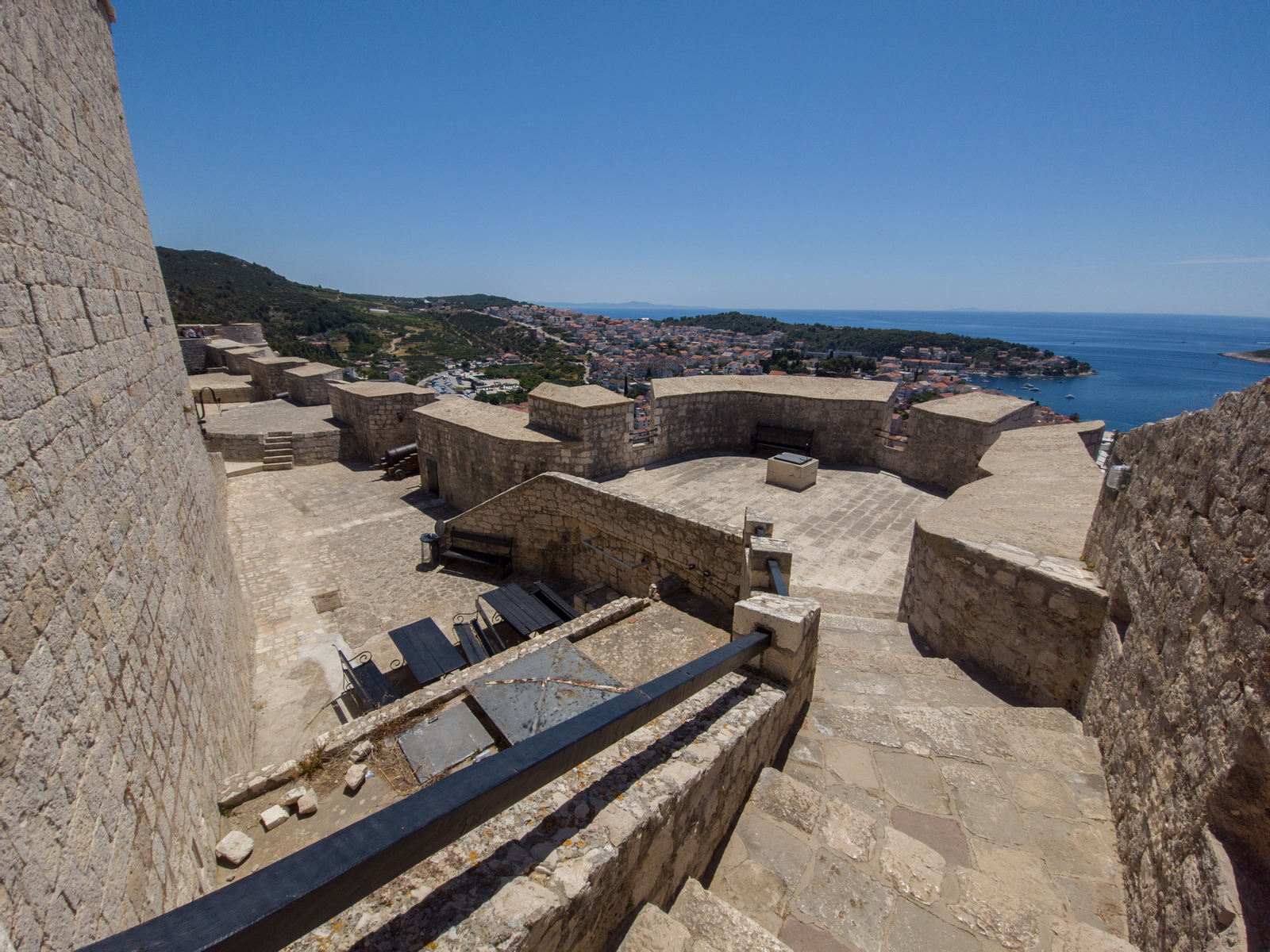
Normally Brac would have loads of places to visit and go hiking. Unfortunately the temperature of +35C curtailed the activities. It was too hot for us. This was another lesson learnt: check the forecast and if in doubt do not go in July! We stayed at the Villa Daniela which is ideal. Normally I would have rented a car and driven around, with a walk down to Blaca. So we did the usual… a boat trip to Hvar and a walk up to the castle. In the harbour you see ladies in bikinis, hanging out on yachts, who use satellite phones so everybody knows they have good funding ![]()
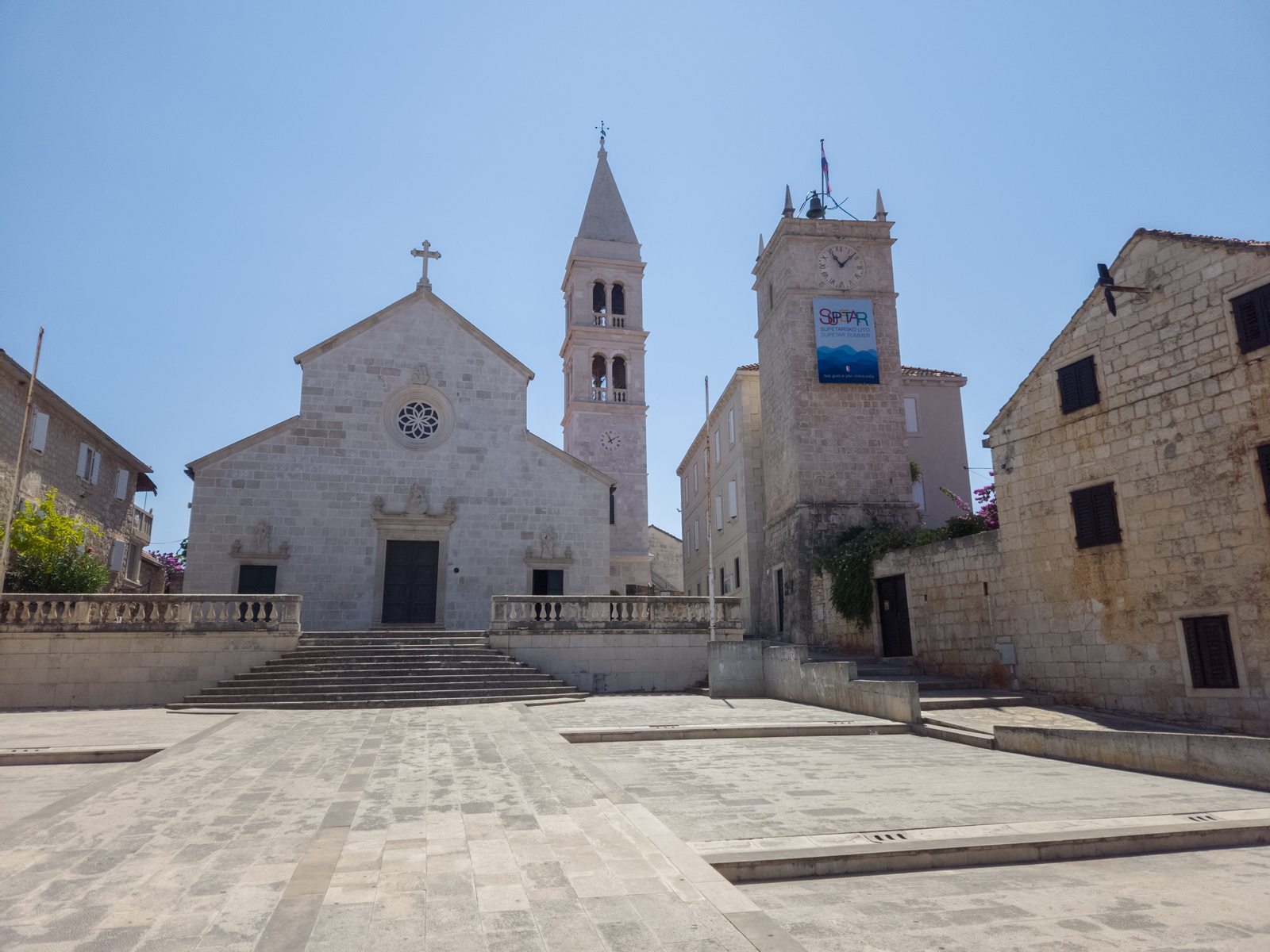
The restaurant in Supetar where we had the big 2016 fly-in
Supetar main square. They have great processions there
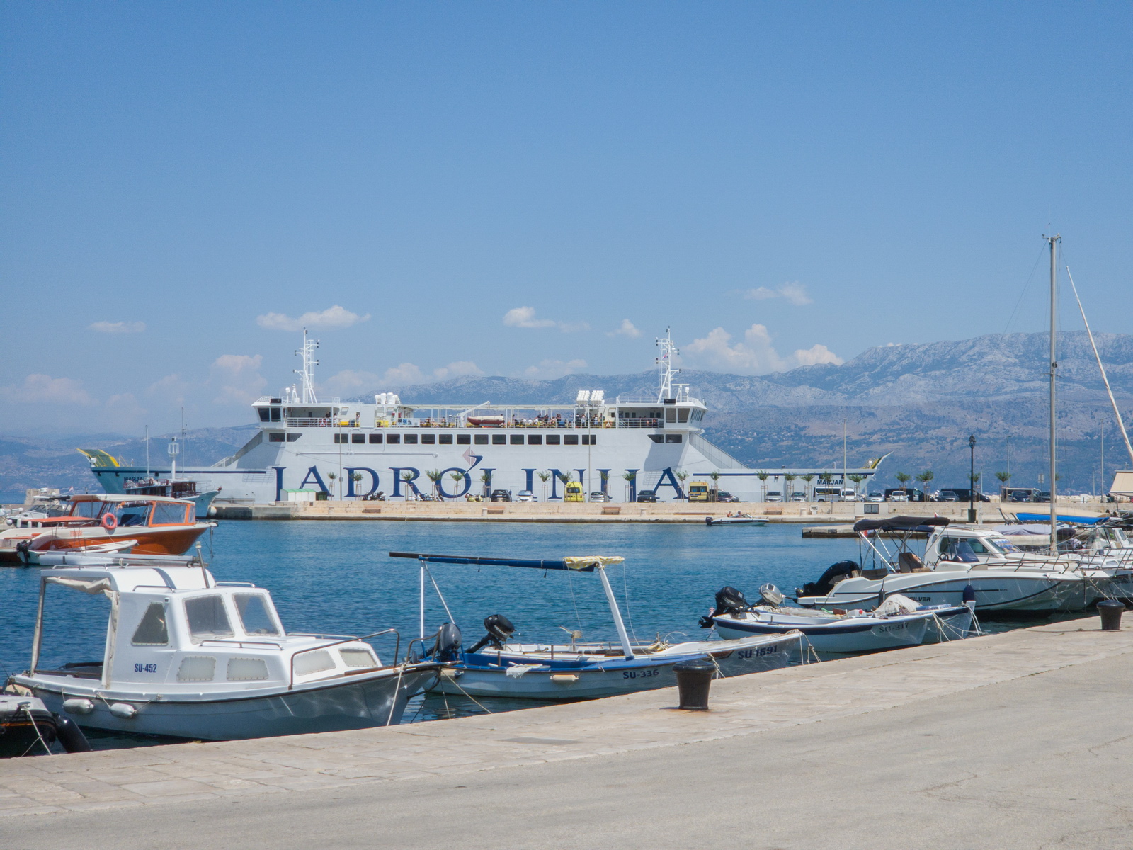
The ever-present Jadrolinia boats
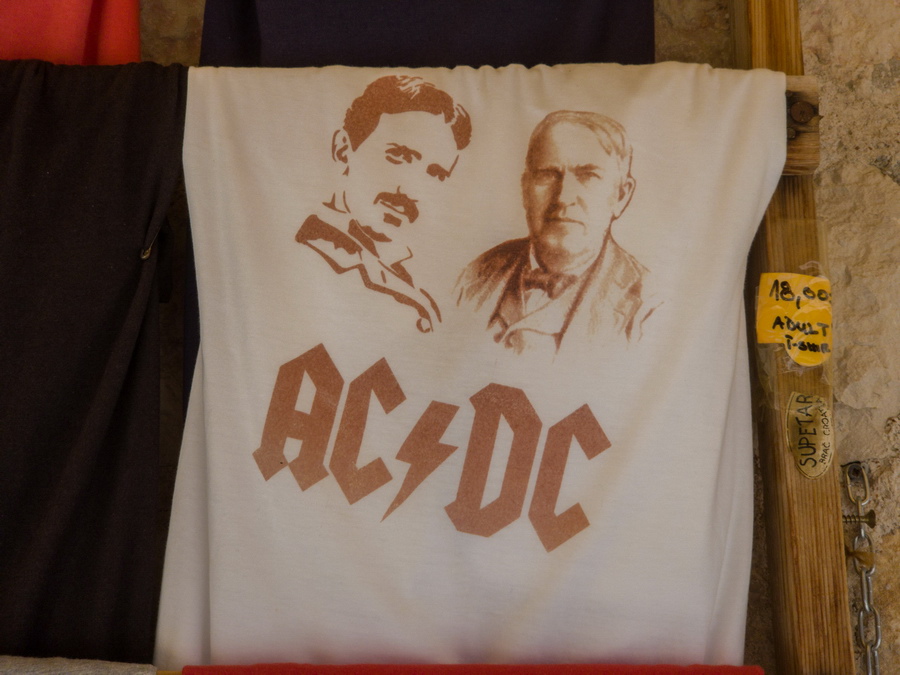
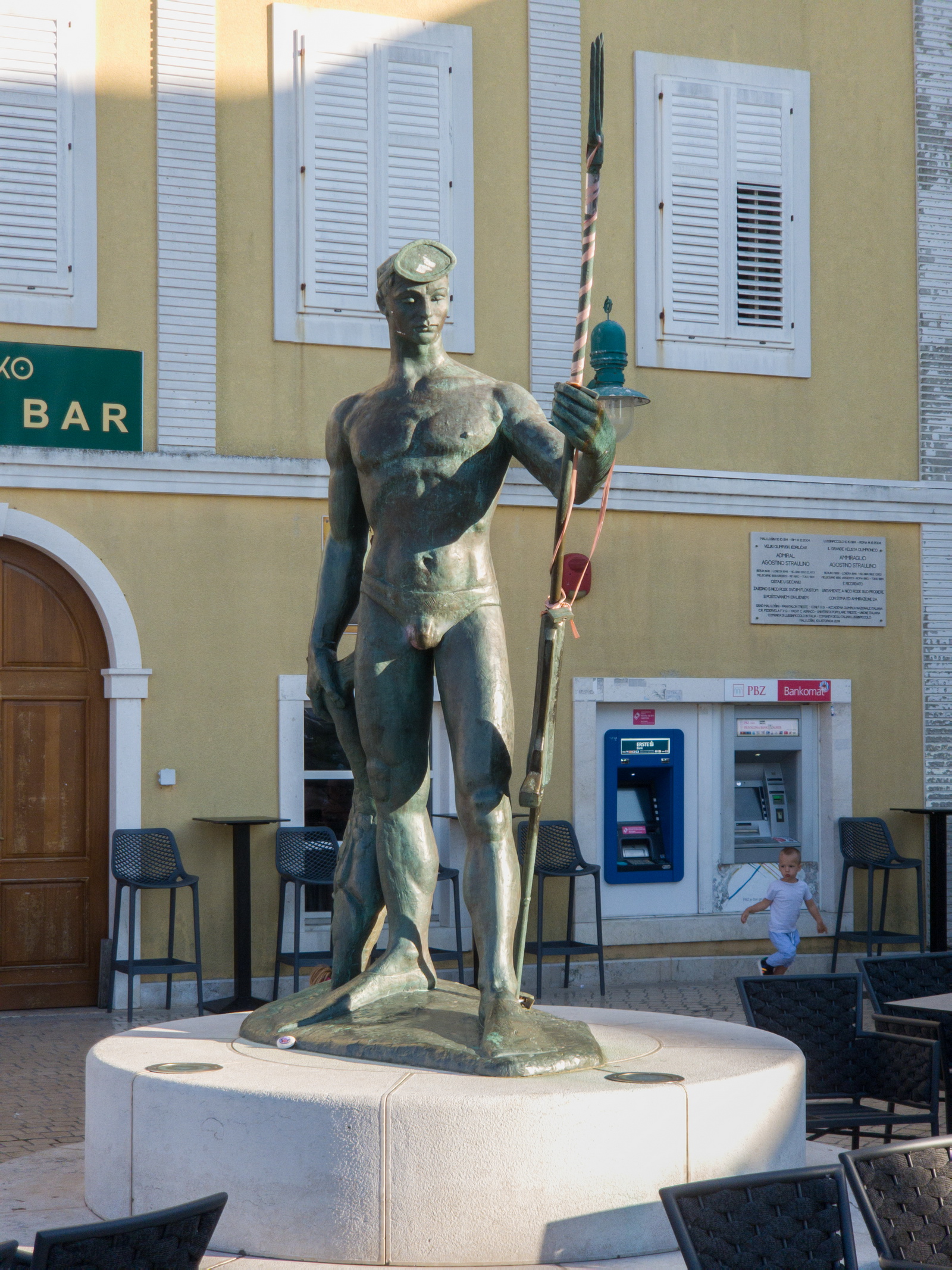
You need to be into electrics to get this one; let's say Mr Tesla (no, not the current one with a mental age of 5 who likes to blow up rockets ![]() ) is very popular in former Yugoslavia. He's on the left
) is very popular in former Yugoslavia. He's on the left
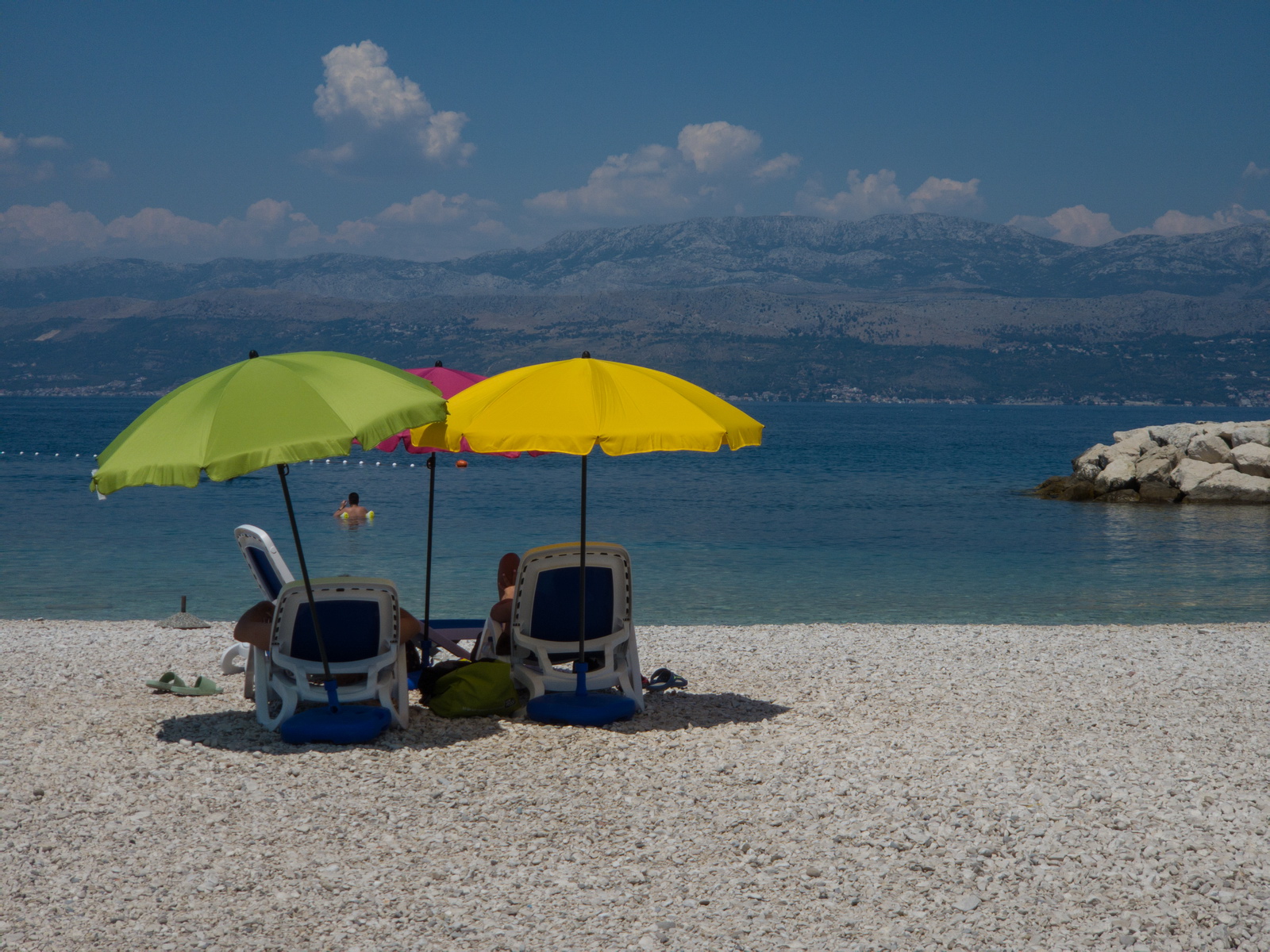
Supetar beach
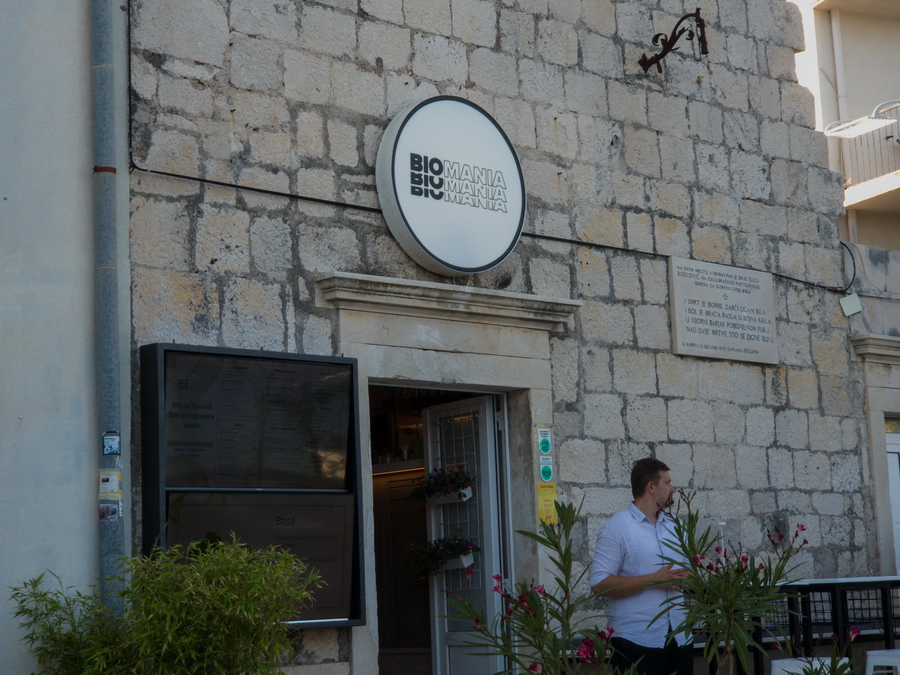
This a very nice veggy restaurant in Bol

Brac to Syros 6th July 2025
The weather was ok.
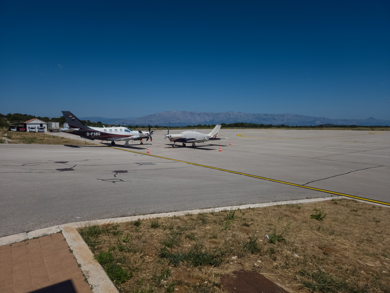
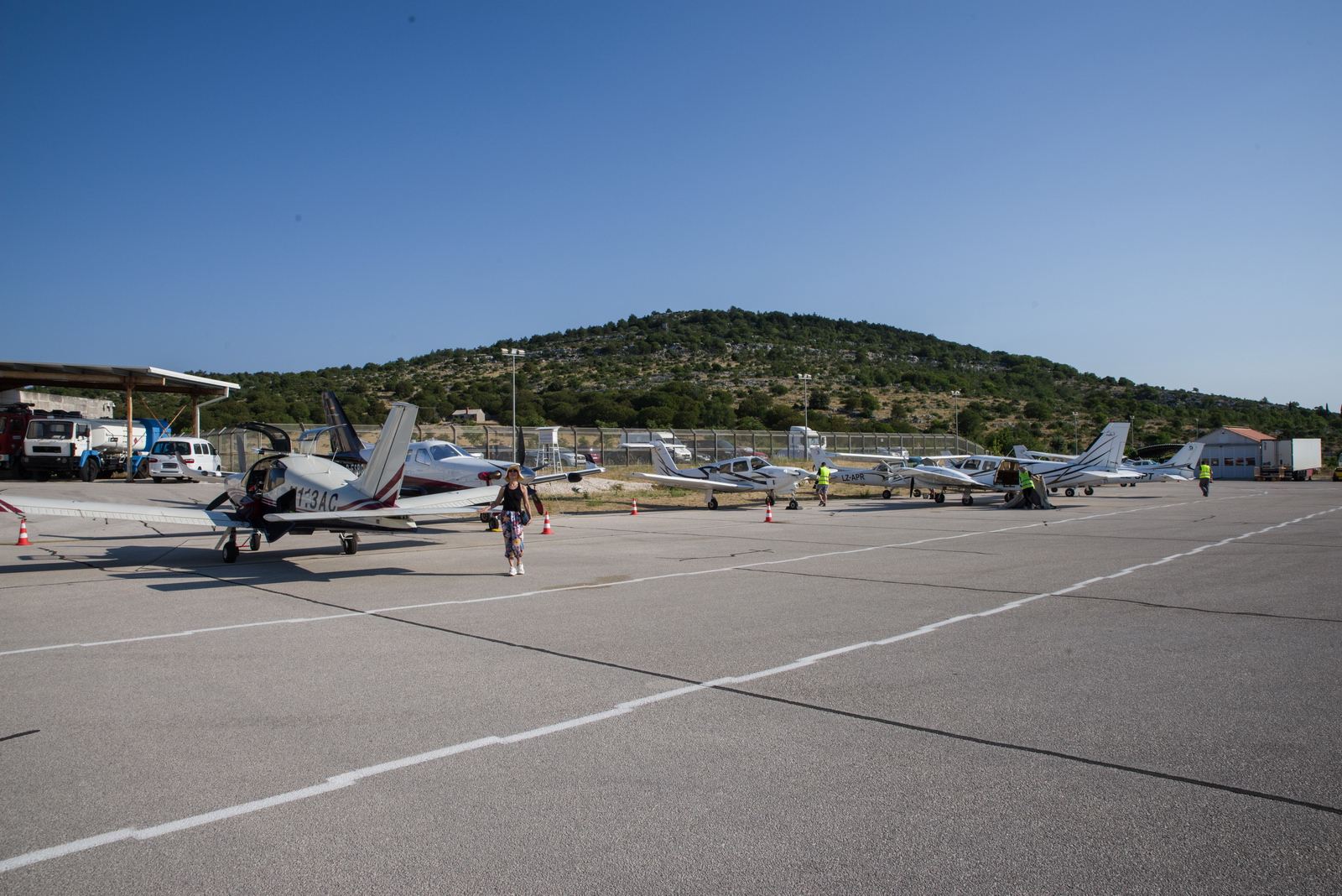
Departure day was a bit more busy. A number of planes were leaving at the same time
I noticed a fuel loss due to evaporation of 10-20 litres, and I would normally have topped the tanks off but the next leg was not long enough to need that. I would have definitely wanted full tanks if going back to the UK!
More fun was with starting the engine. The 3 days of +35C heat (probably +60C under the cowling) put a load of vapour into the fuel system and cylinders 1 and 6 didn’t fire for a good minute, which seems fairly normal in GA (engines coughing for ages is often heard) but I am not used to it in the TB20. It didn’t happen again on this trip…
Departure was straight out over the sea. No obstacles there, and I once did this with the cloudbase being about 20ft; the tower was “VMC on top” and could not see me ![]() The famous sand horn at Bol down below varies in size from one year to the next and right now it is quite small
The famous sand horn at Bol down below varies in size from one year to the next and right now it is quite small

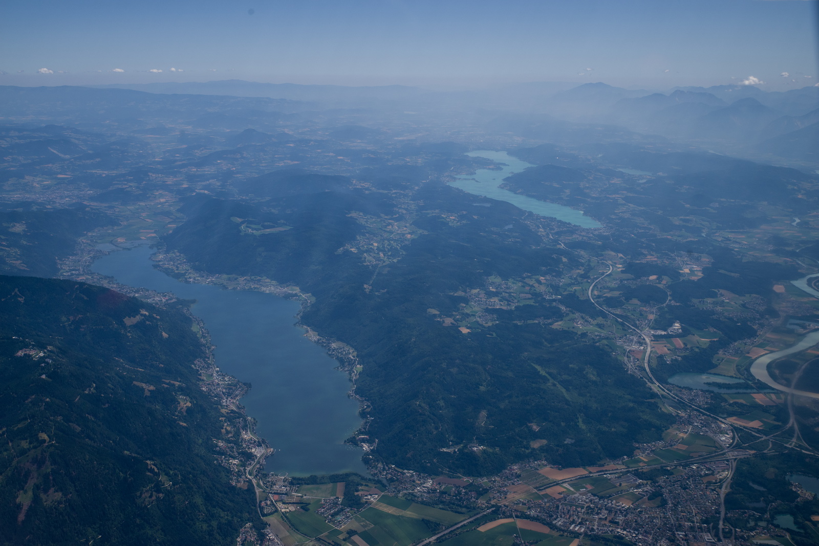
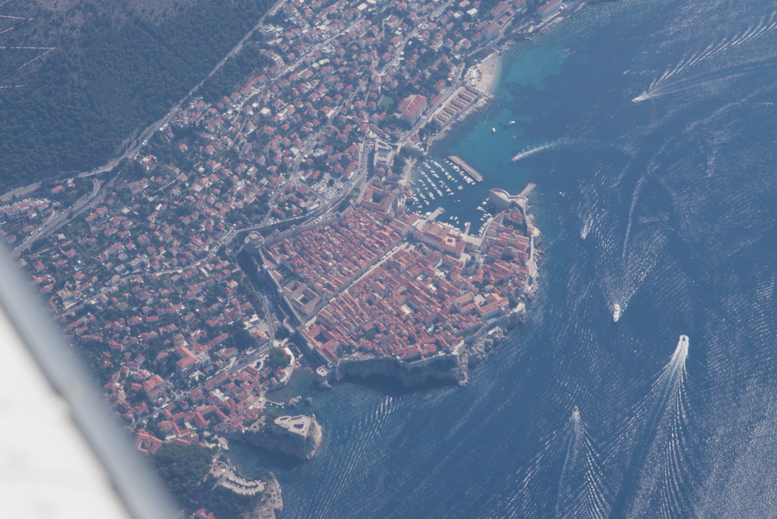
Croatian ATC is outstanding and everything just works. I picked up the IFR clearance and got some long shortcuts. This is the old town of Dubrovnik from FL120 and hazy
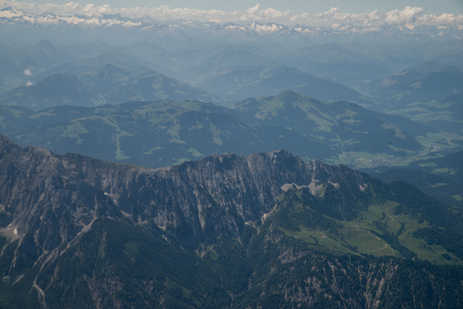
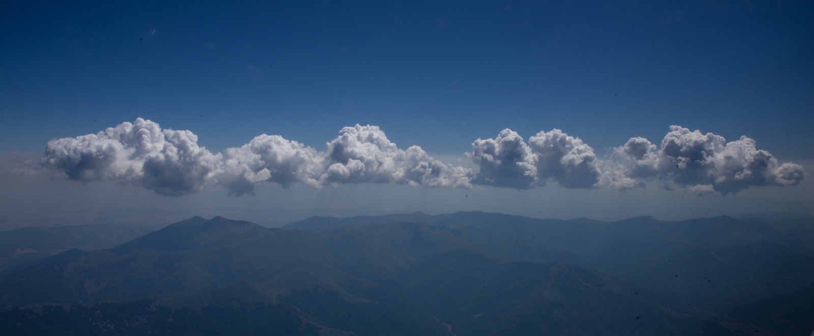
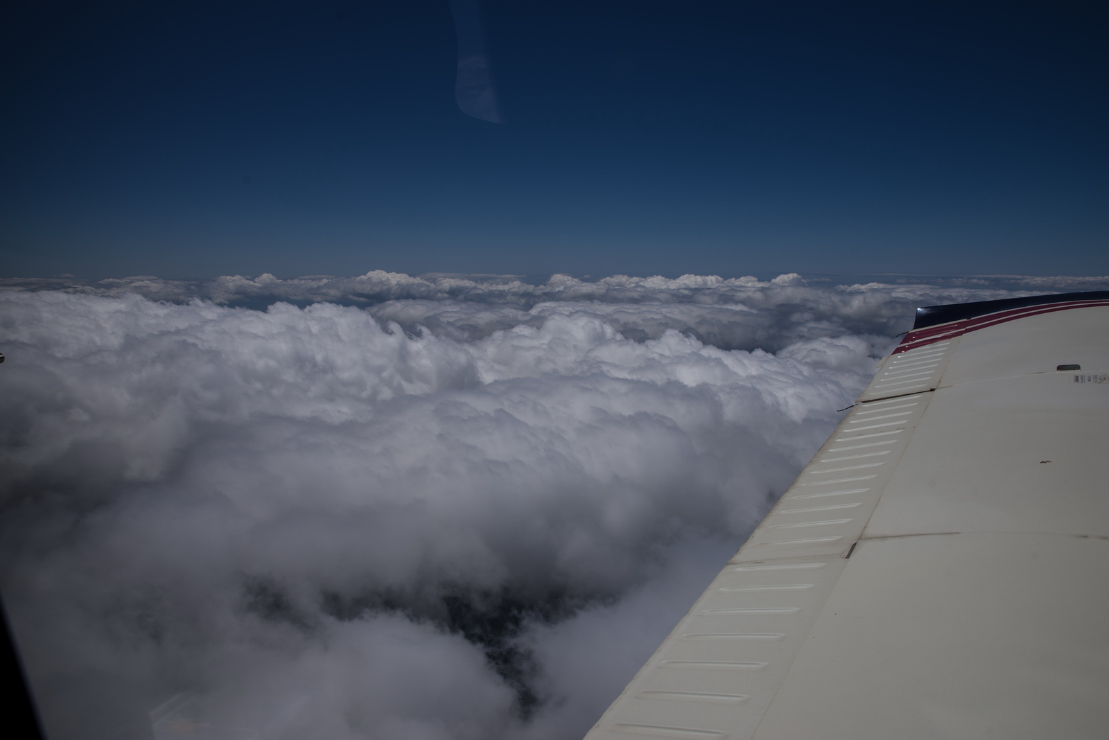
The buildups over the mountains before Greece are already starting. This is why I always try to depart early; it is not until late evening that they come back down, and then you are up against airport closing times, trying to get into the hotel, etc.
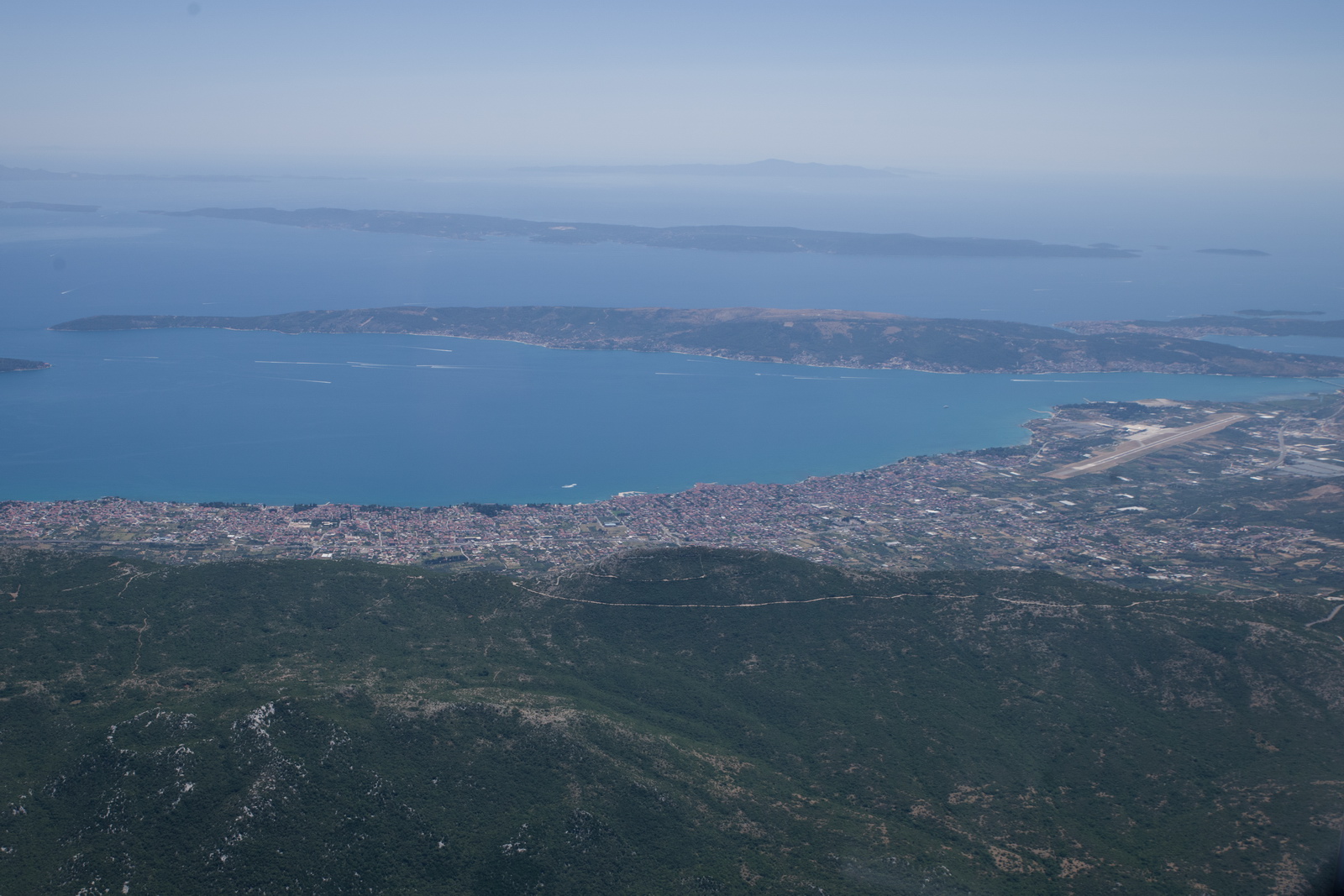
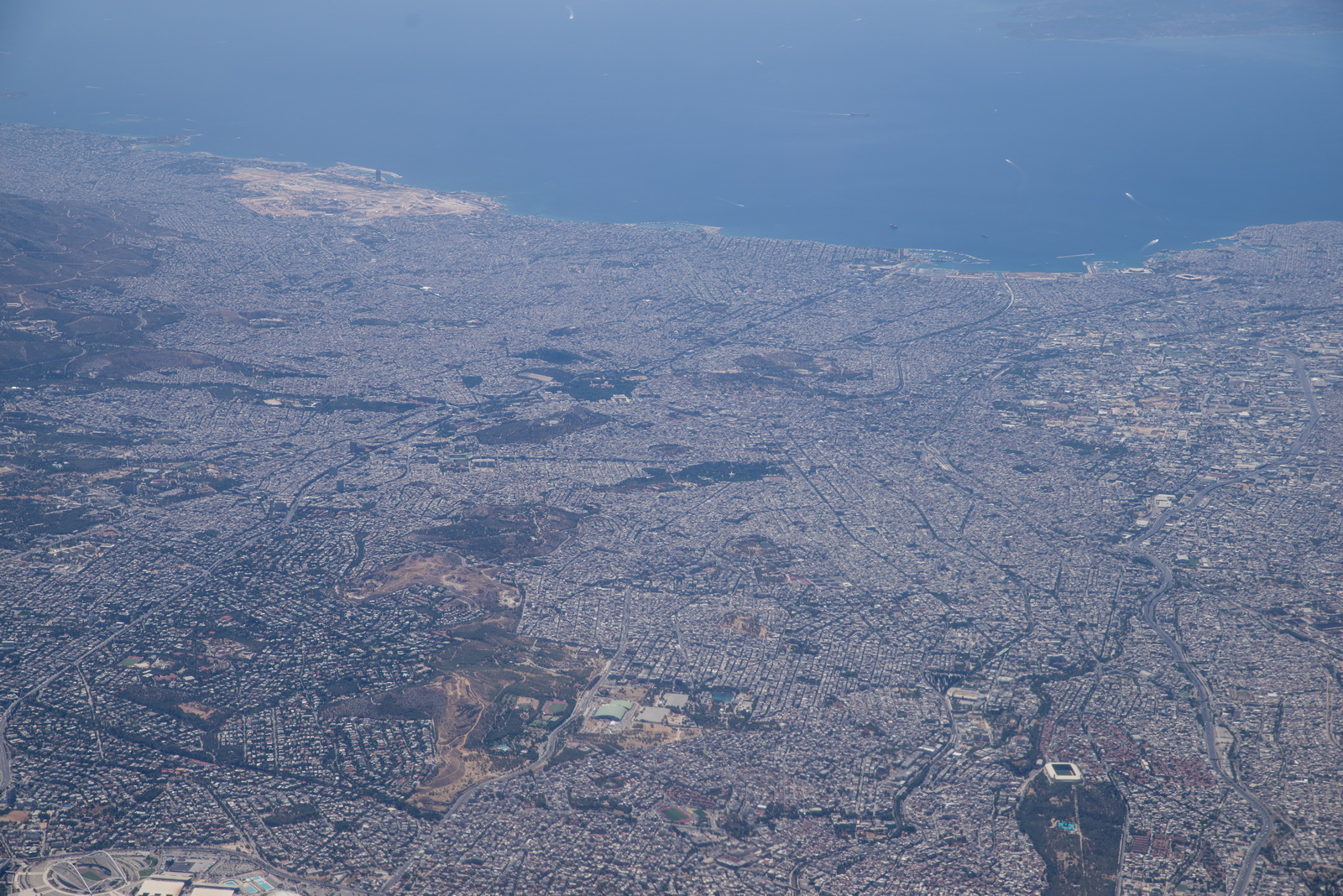
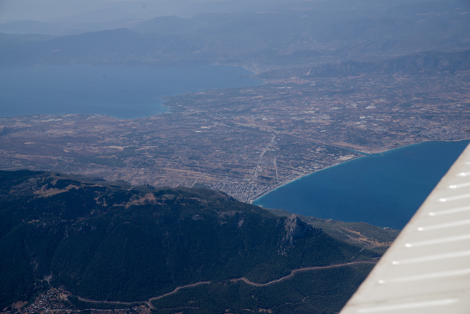
Athens. Whoever is in charge of property development will have collected enough bribes to be running a private 787 ![]() One can use Athens LGAV airport (not fraported) for a customs and avgas stop; it is roughly €200. But I tend to combine stops with a bit of sightseeing, and Athens is best done with Easyjet! Getting a decent place to stay, under say €200 a night, can be a challenge, too. Also my experience of ATC at LGAV was machine-gun speed and so heavily accented I could barely understand them.
One can use Athens LGAV airport (not fraported) for a customs and avgas stop; it is roughly €200. But I tend to combine stops with a bit of sightseeing, and Athens is best done with Easyjet! Getting a decent place to stay, under say €200 a night, can be a challenge, too. Also my experience of ATC at LGAV was machine-gun speed and so heavily accented I could barely understand them.
The Greek / Aegean landscape. Very blue water… very beautiful. You would never guess that on the ground you find the most friendly people in Europe, and at the same time the biggest job creation scheme this side of Brussels ![]() Greeks love paperwork and inflexibility. They are also often not good with email and prefer phone calls. It is important to realise this when flying within Greece! A big plus is that English is widely spoken, so you don't get the issues you get in e.g. Spain, France, Italy where you are expected to learn the local language.
Greeks love paperwork and inflexibility. They are also often not good with email and prefer phone calls. It is important to realise this when flying within Greece! A big plus is that English is widely spoken, so you don't get the issues you get in e.g. Spain, France, Italy where you are expected to learn the local language.
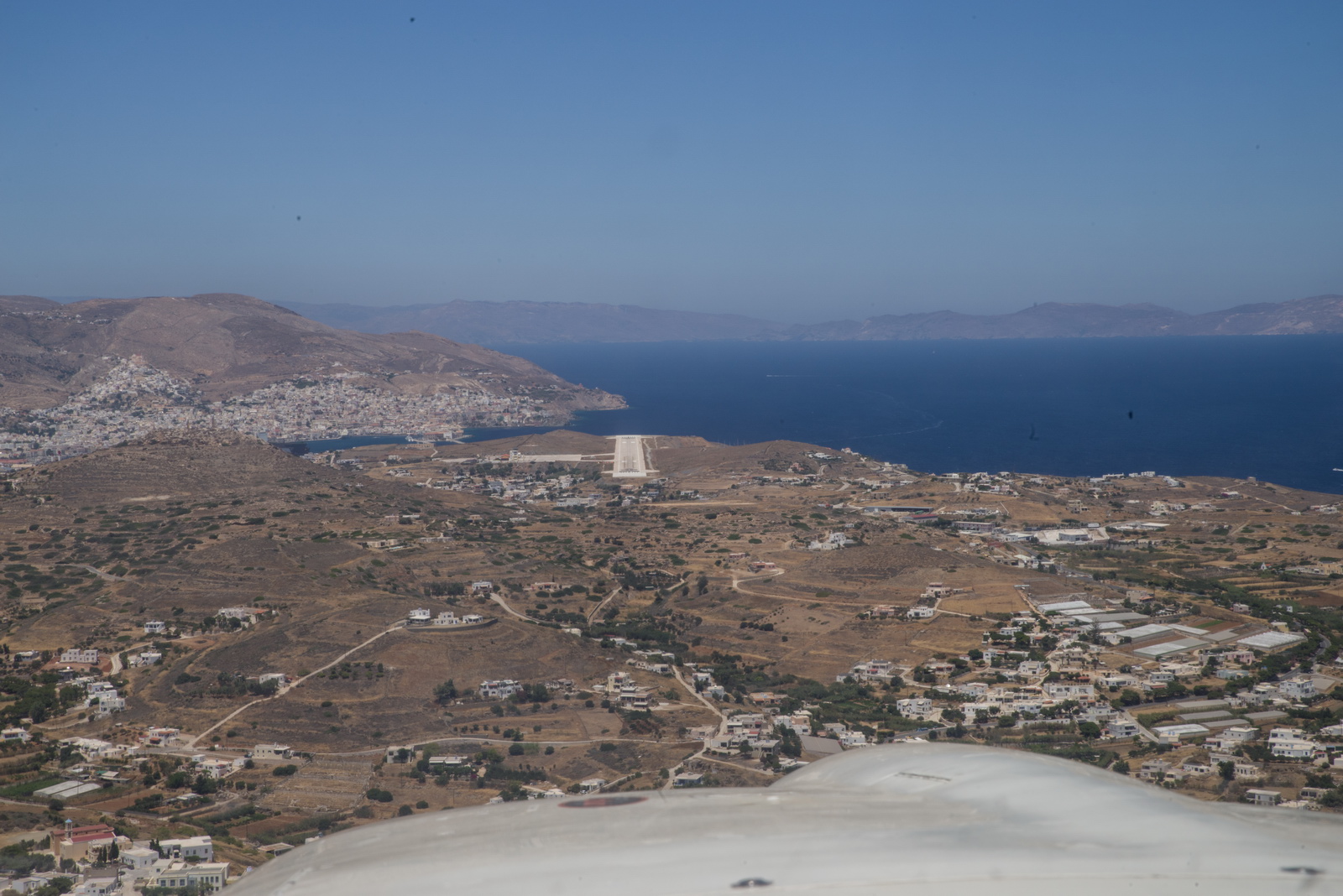
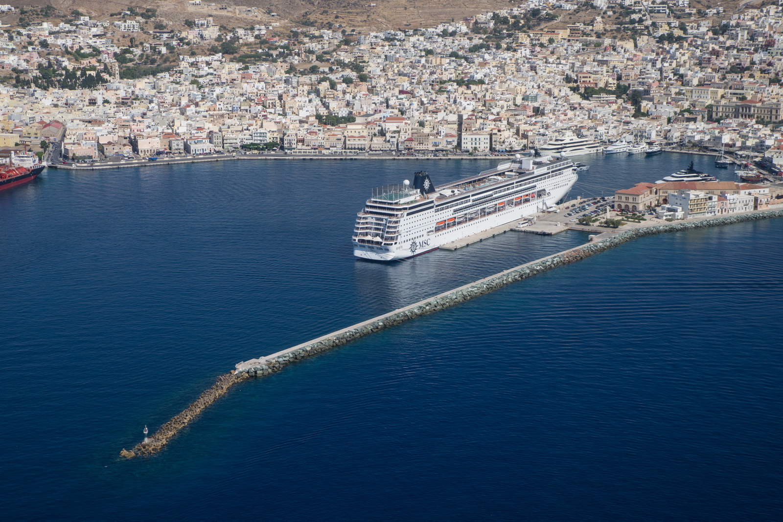
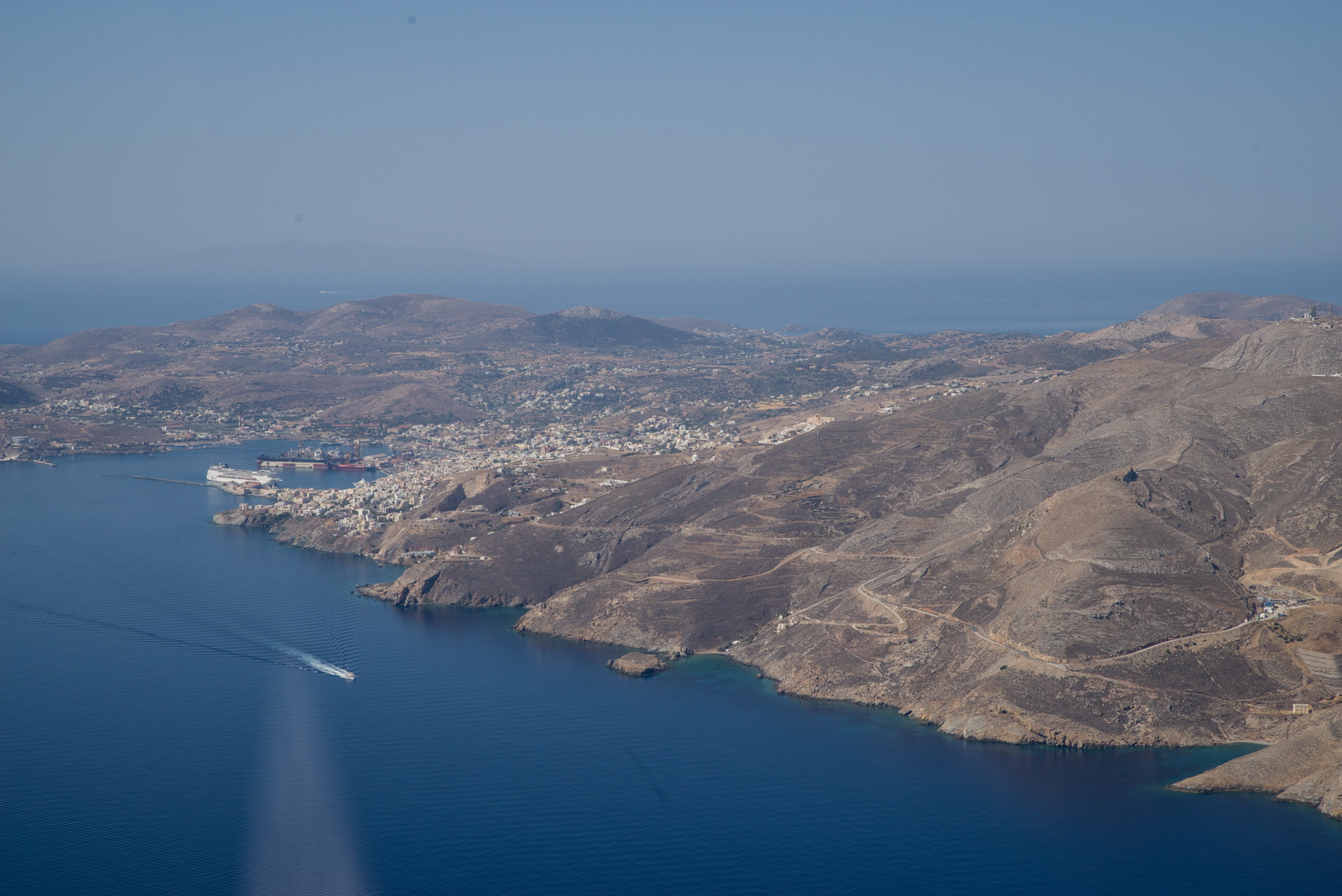
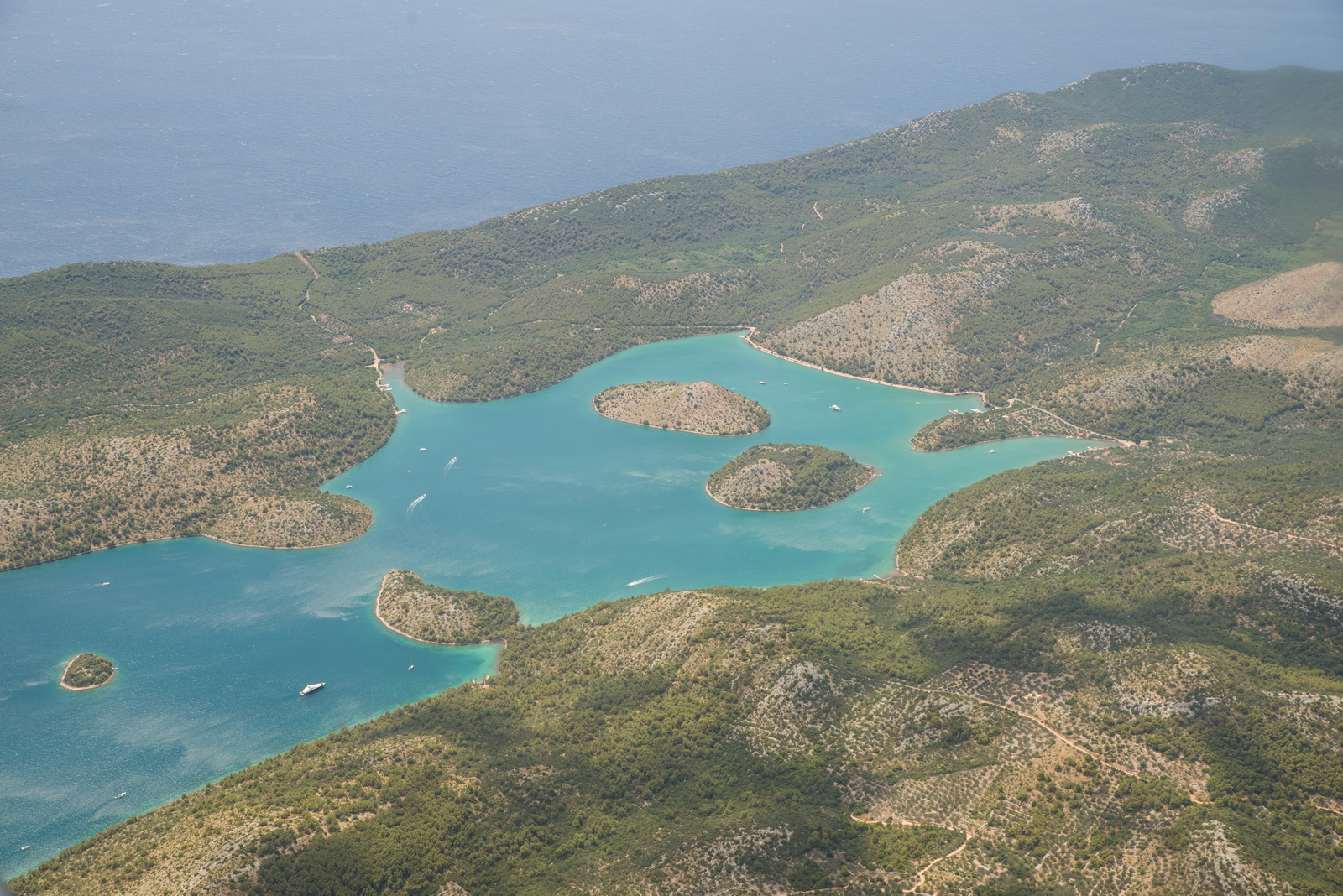
Syros, and the runway is visible on the other side of it. We are positioning for a left base
Final, runway 36
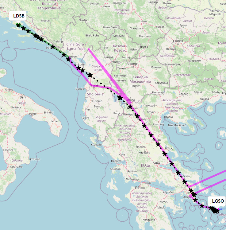
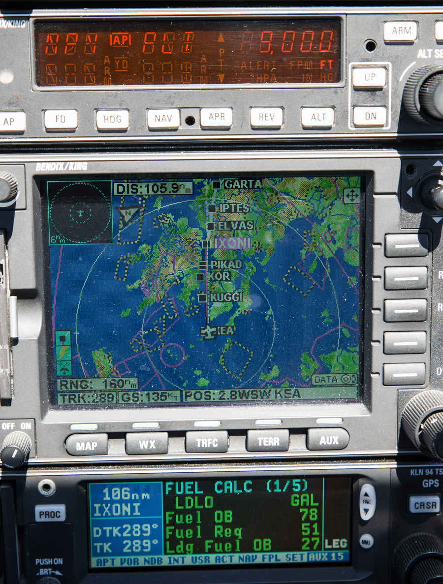
Track actually flown. Apologies for the corruption in the filed route (magenta)
Video of the above flight. I am nowadays uploading to both Vimeo (better quality) and Youtube. Vimeo has recently got scared of some dumb European regulation and has removed any means of seeing the videos if your IP is in Europe, unless you have the direct URL to it.
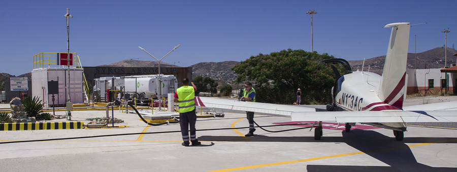
Fuelling was quick. They insisted on gluing huge red AVGAS stickers onto one (just one) wing, which they took photos of, and peeled them off afterwards ![]() The glue was very strong though! There is already a sticker saying avgas 100LL...
The glue was very strong though! There is already a sticker saying avgas 100LL...
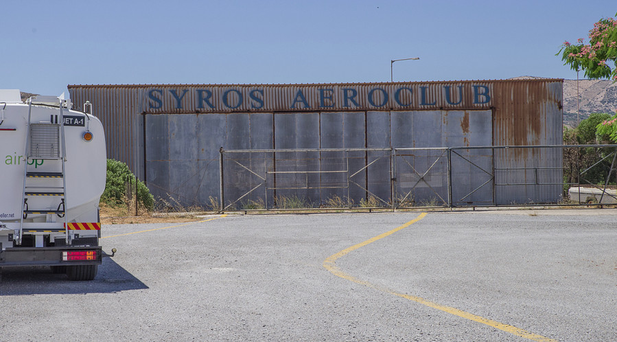
A mysterious building. Reportedly disused since the 1990s and nobody knows what to do with it since the landowner has died or can't be traced
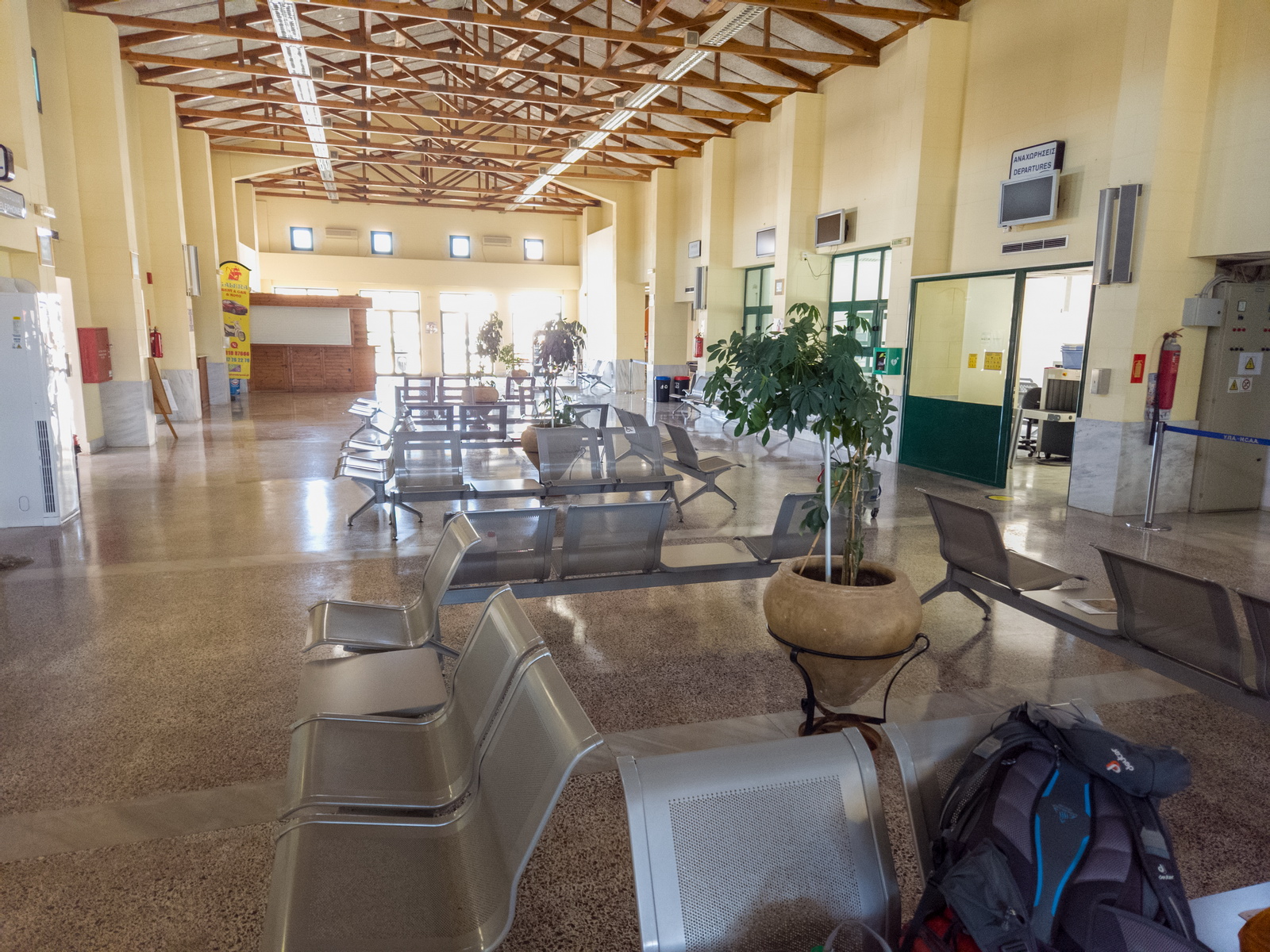
The passenger terminal. The aircon was not working; it had just been installed but not yet turned on ![]()
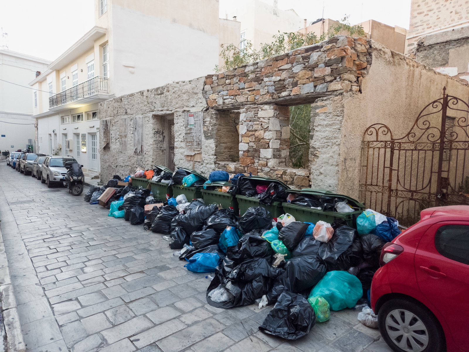
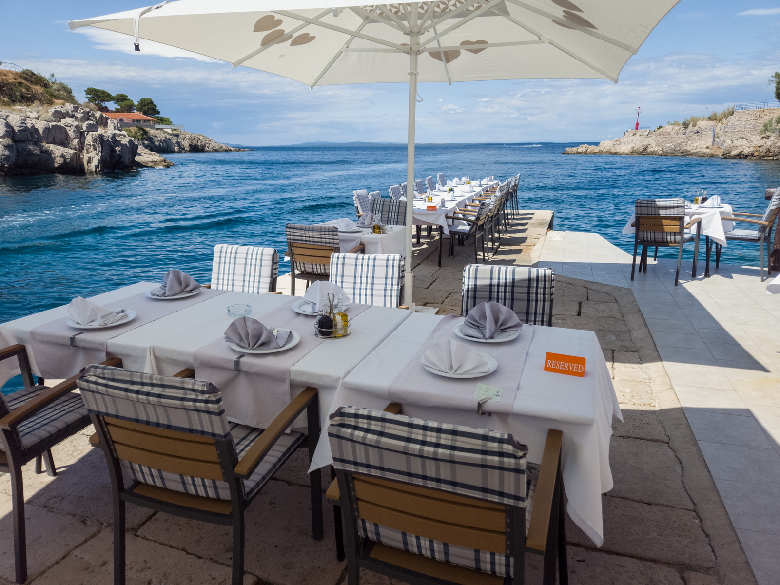
Syros is definitely scenic although 3 days pretty well covers it ![]()
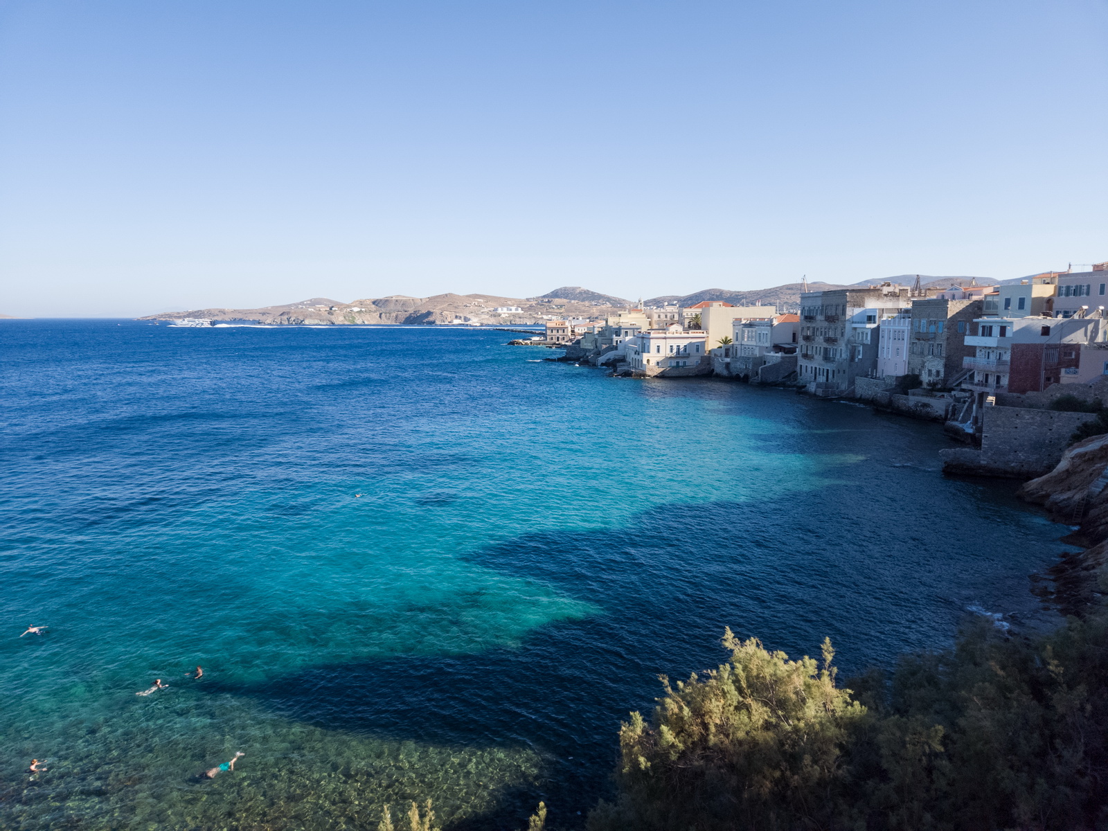
This is Greece, too...
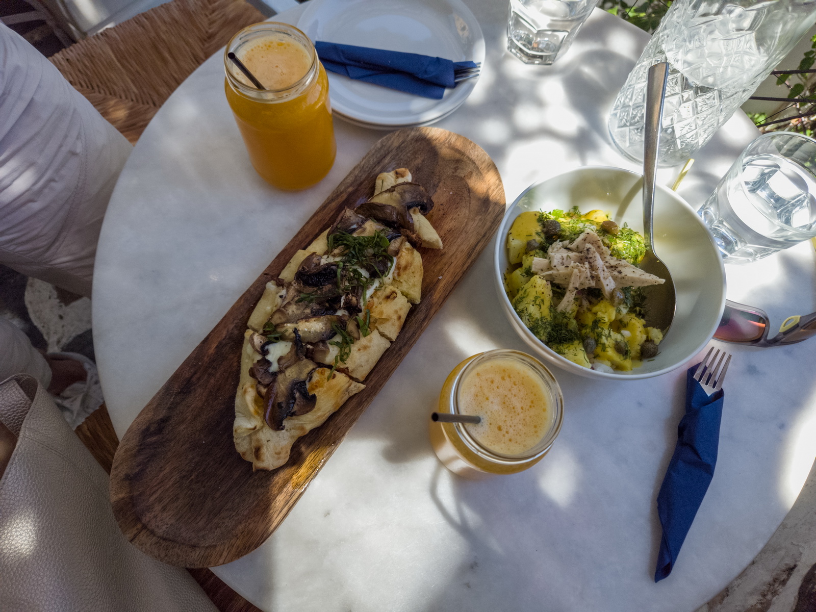
Up the hill is Anasyros with lots of fun places
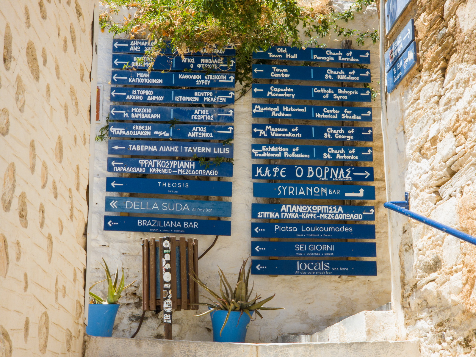
and some great cafes
The $300M boat owned by Mr Mittal (previously by some ex USSR “businessman”) was anchored in the harbour. I asked one of the crew whether their navigation is just GPS (like most ships) and what do they do about jamming. The reply was guarded, basically saying “what we have cannot be jammed”. They must have INS. But speaking to other “super yacht” crews there, they had only GPS but also use seabed contour charts which, with sonar continuously watched, confirms your position.
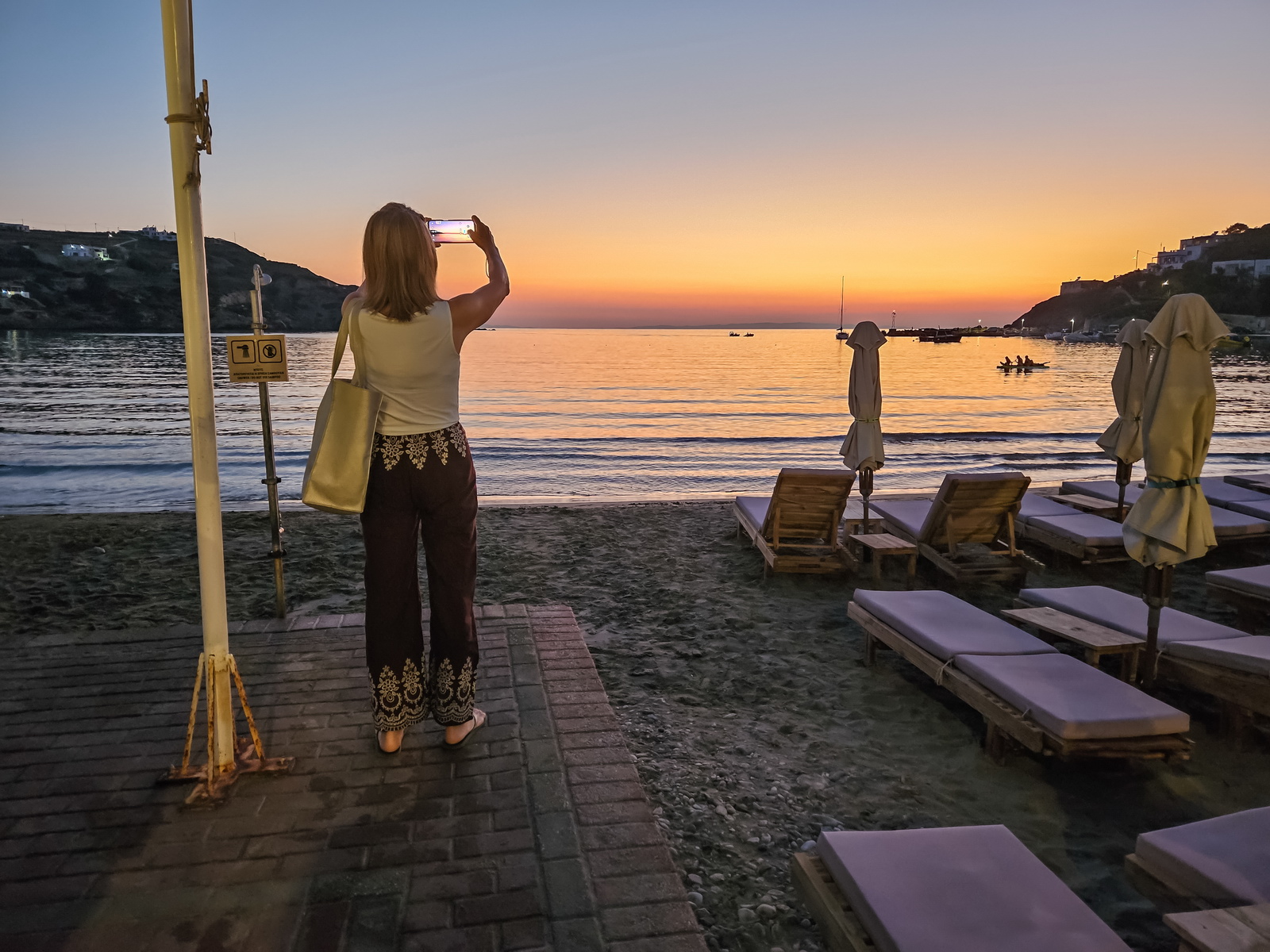
A photo of Sally taking a photo of the sunset. Probably somebody was taking a photo of me taking that photo ![]() This was the west coast of Syros. Taxis on Syros were incredibly cheap, with most rides being €5-10.
This was the west coast of Syros. Taxis on Syros were incredibly cheap, with most rides being €5-10.
Syros to Mali Losinj 9th July 2025
The weather was ok.
Having scrapped the Chios visit due to the incompetent handlers there… Departure back to Mali Losinj.
We had more trouble here. I changed EOBT to 30 mins earlier, not realising one needs to get a fresh permission! The handler at Syros does not see flight plans and does not talk to the tower (which is pretty unusual, if not totally unique) and the police/customs were not going to turn up until the original EOBT. At the same time I got a CTOT due to some Greek ATC strike staff shortage, which constrained the departure slot to -5mins to +10mins. I could have delayed (the Autorouter makes it easy) but then would have got another CTOT of unknown size. The result was that I had to push the handler to get their fingers out. They were waiting for the police so I pointed out that the policeman was 20m away! After passport check, we could go and prepare the plane. But they could not produce the invoice, since this was done by somebody somewhere off-site who emails the invoice to the handler! This arrived just in time. So we paid and went out to the plane. The CTOT time limit was approaching fast and the airport worker who went out with us was on the radio and eventually gestured that we can go without meeting the customs officer(s) – presumably customs authorised this. I had earlier made the point pretty forcefully that when going intra-schengen none of this is needed but they just shrugged their shoulders.
Cleared 4000ft to KEA and handed over the Athena Info right away
LFOB looks OK considering the obligatory headwind on this route. Again, there was a loss of ~10L due to evaporation.
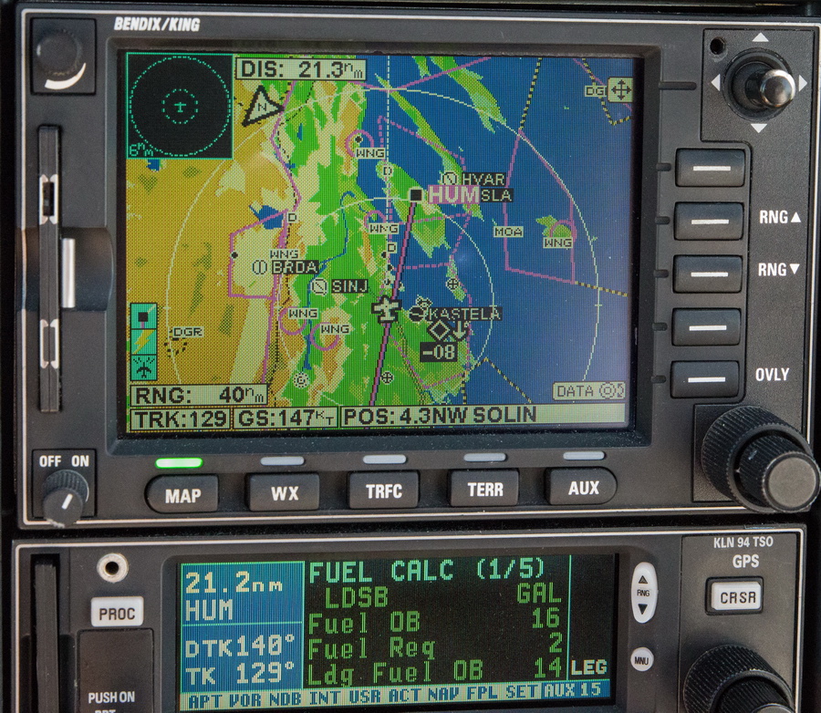
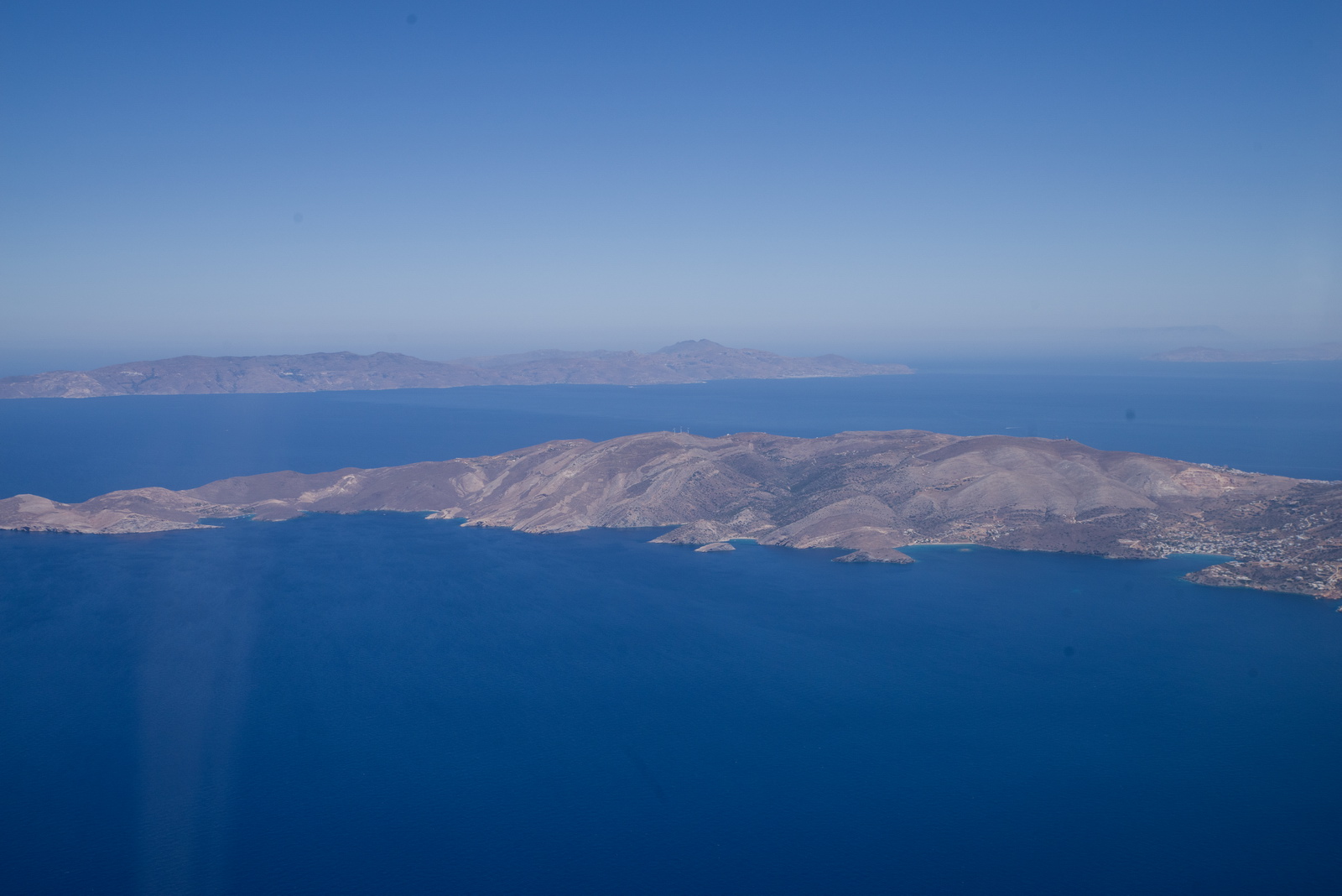
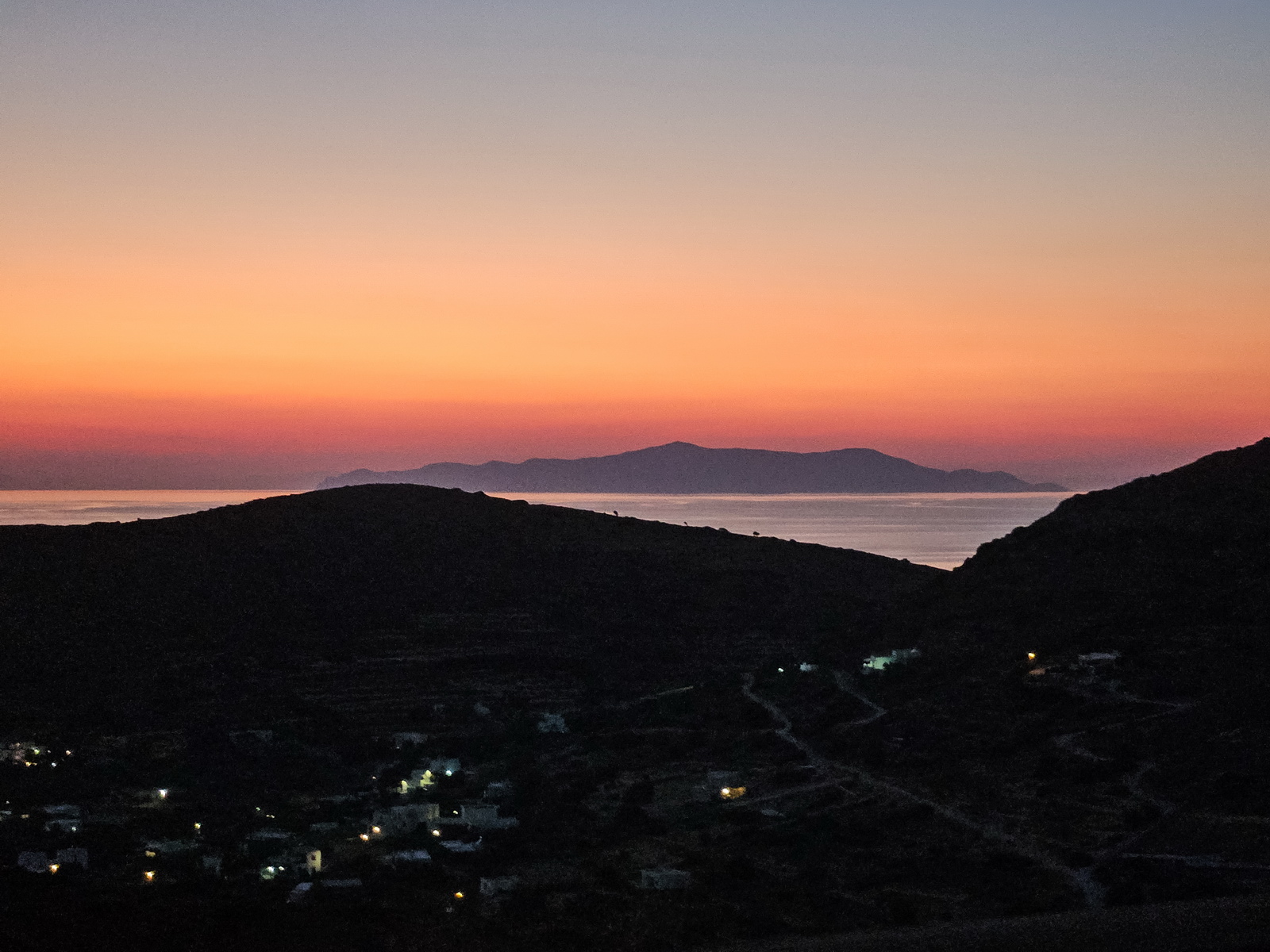
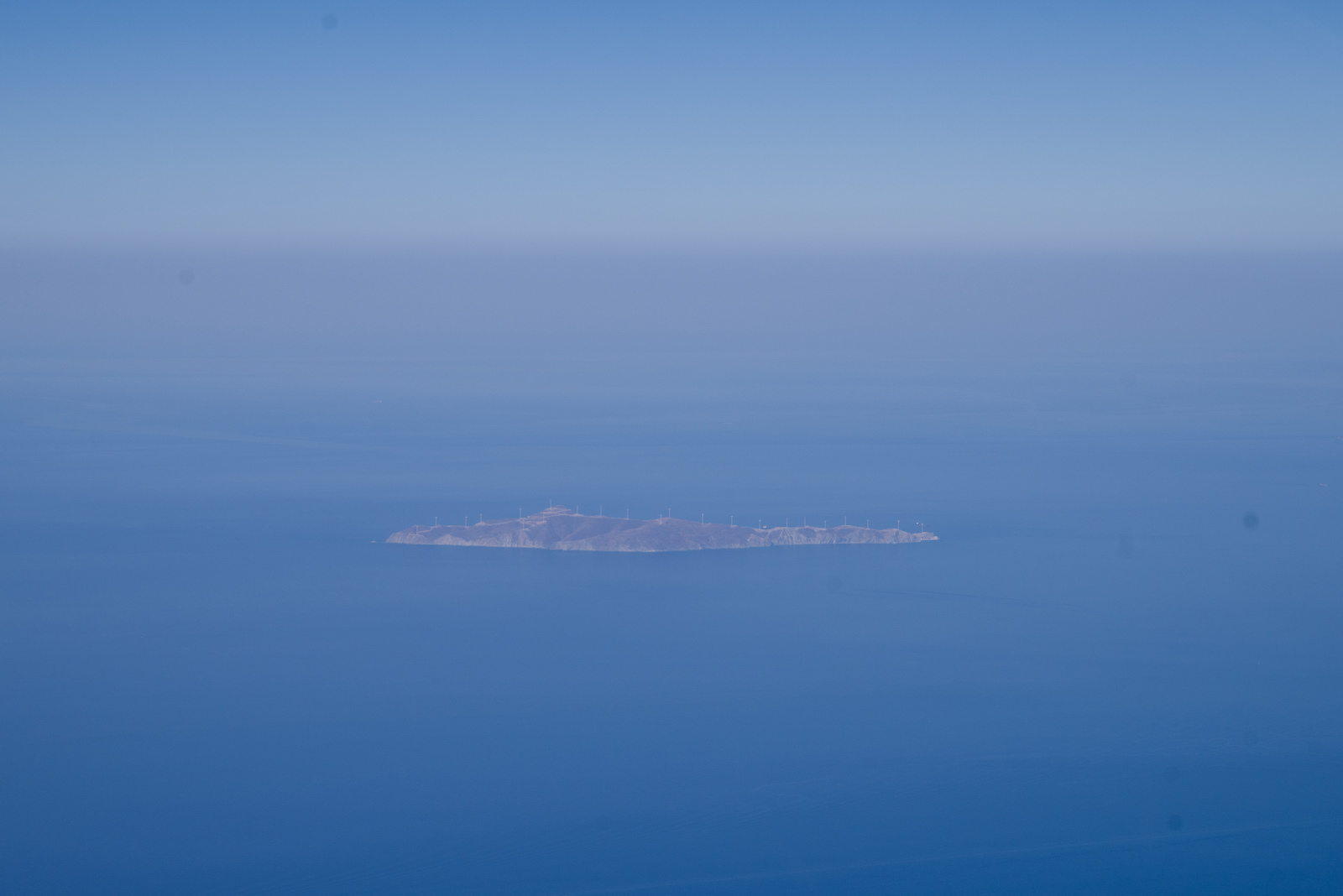
This is the wind turbine island which is connected to Greek mainland with 36km of 150kV 3 phase 80kg/metre HV cable ![]() One hopes they have a budget for repairing the turbines; most Greek wind farms have some % of blades that fell off and stayed off. 20km from Hydra; Leonard Cohen would have wondered about it
One hopes they have a budget for repairing the turbines; most Greek wind farms have some % of blades that fell off and stayed off. 20km from Hydra; Leonard Cohen would have wondered about it ![]()
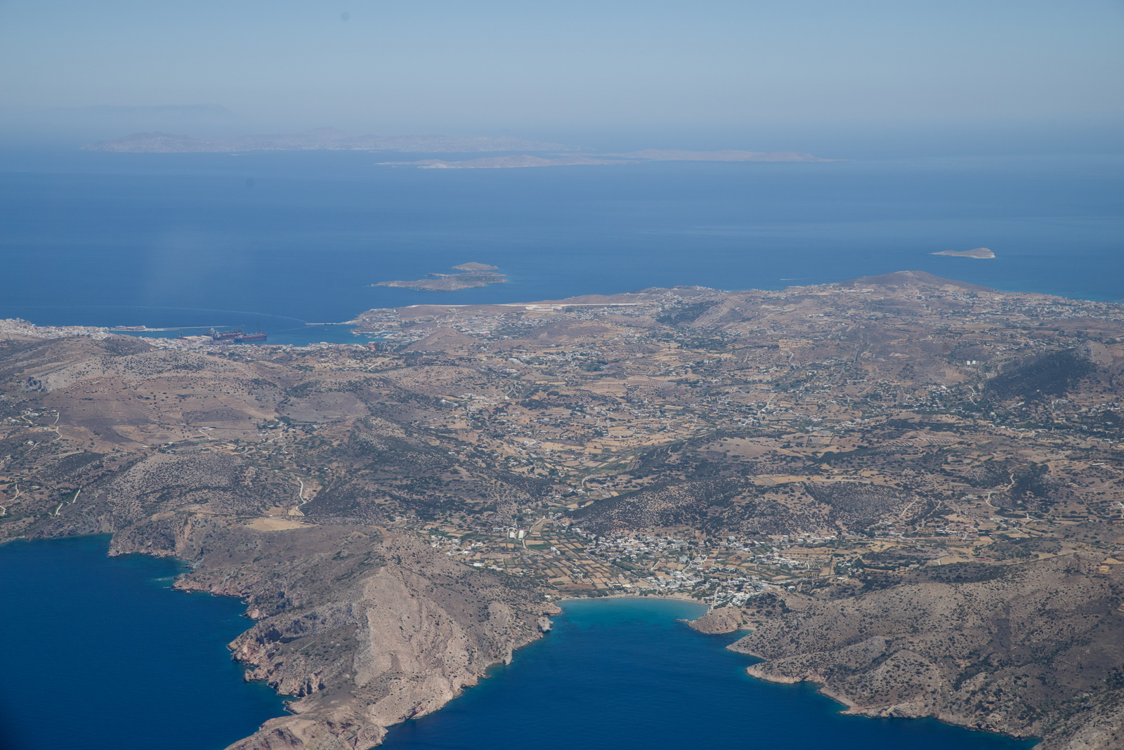
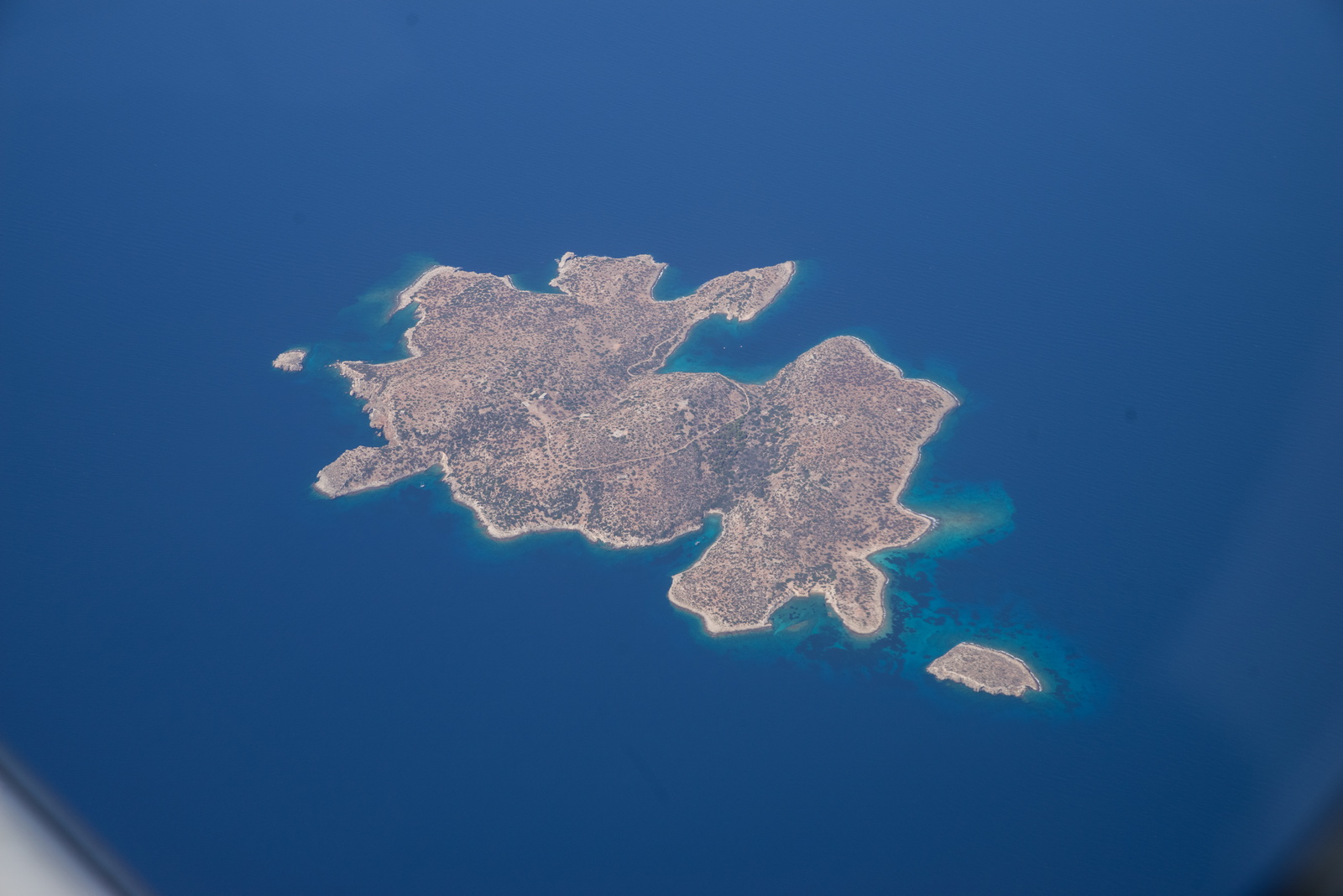
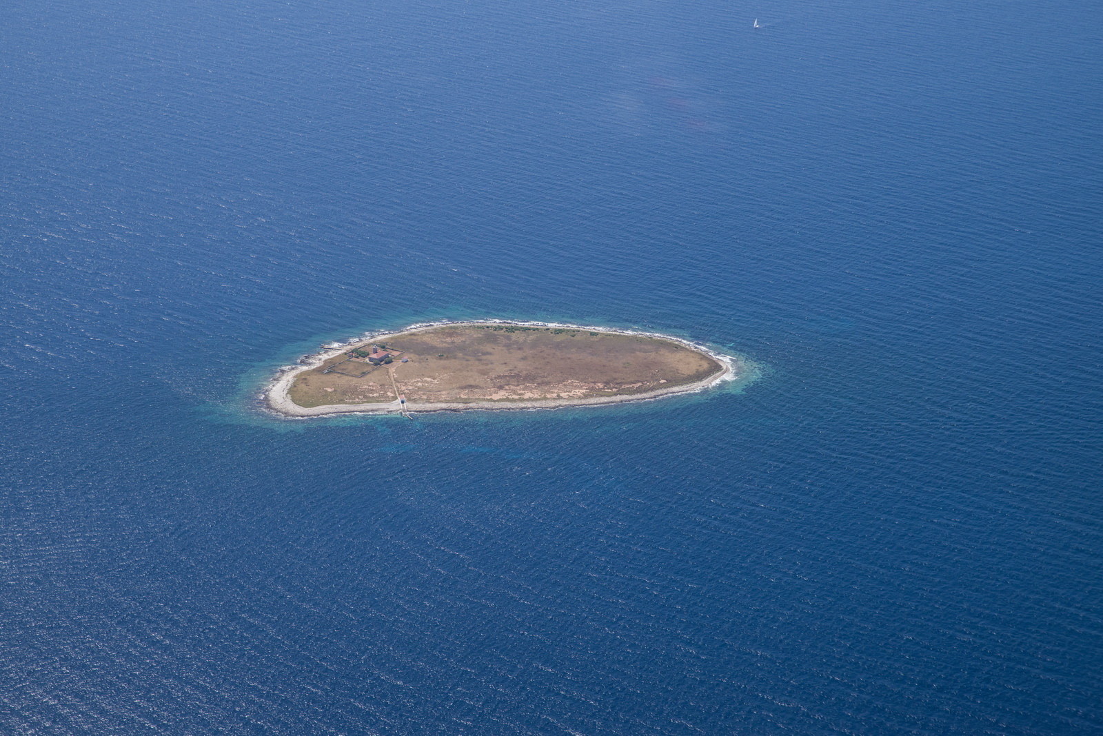
Some random Greek island, probably uninhabited
The famous Korinthos canal
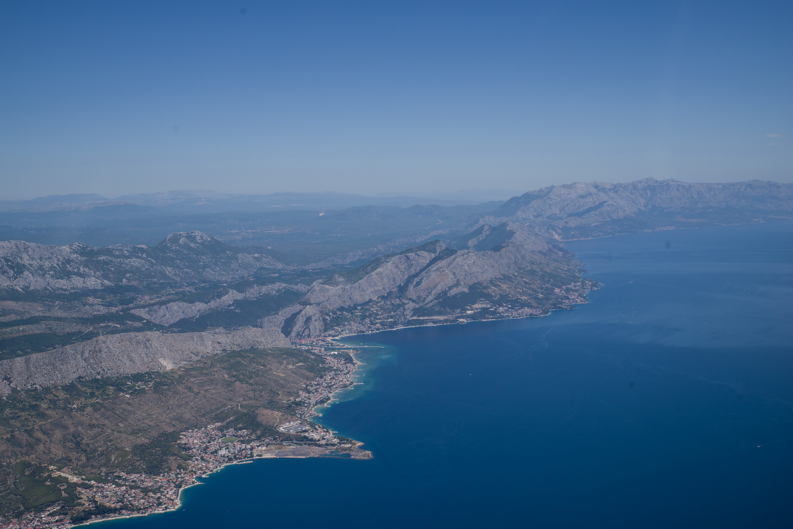
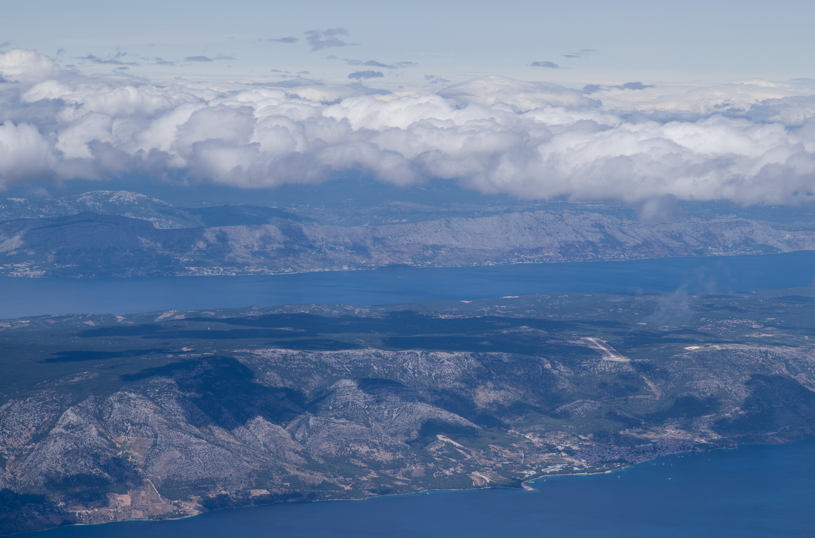
FL120 is mandatory for entering and leaving Greece under IFR, apparently, on this route, and it was just right for the cloud tops
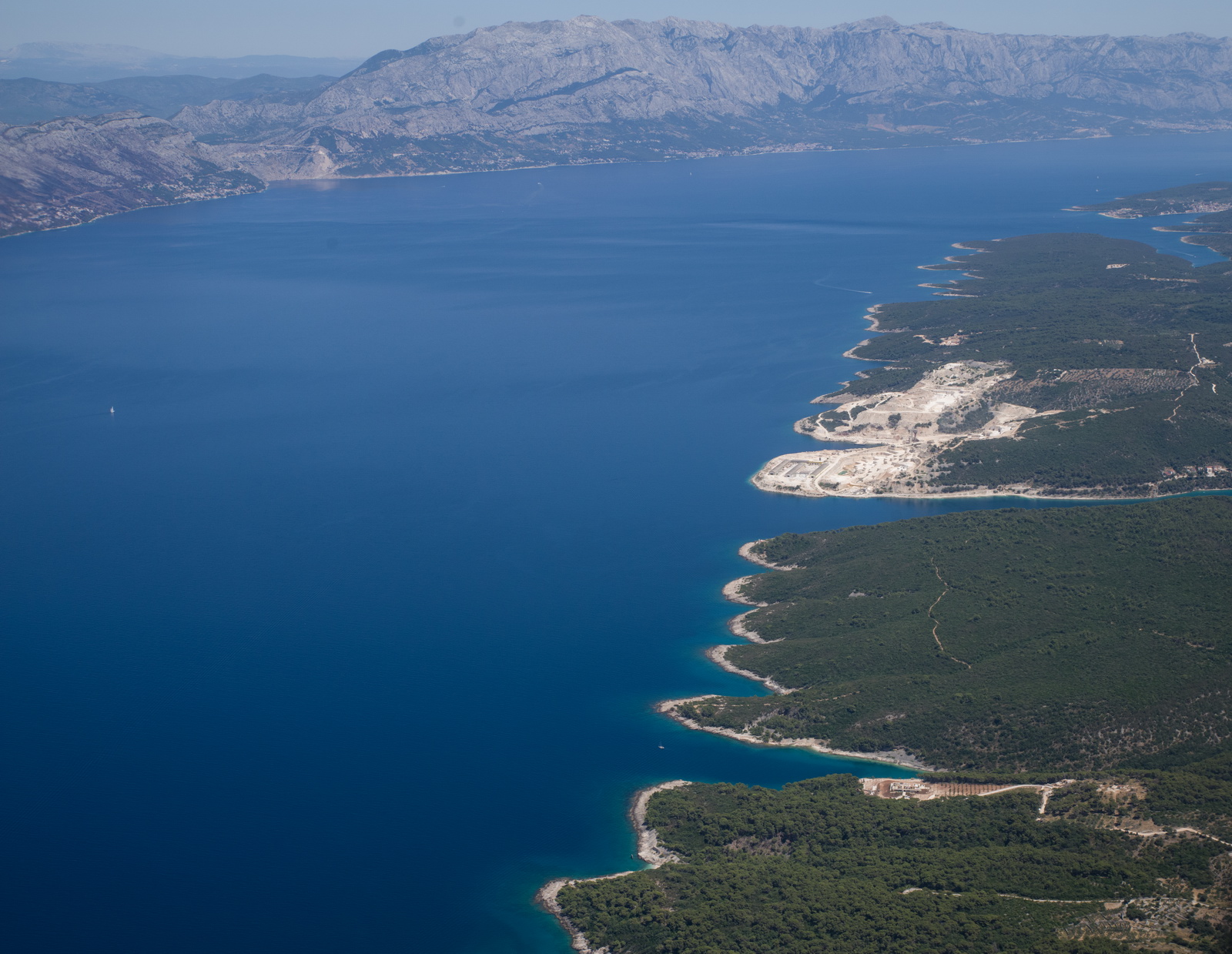
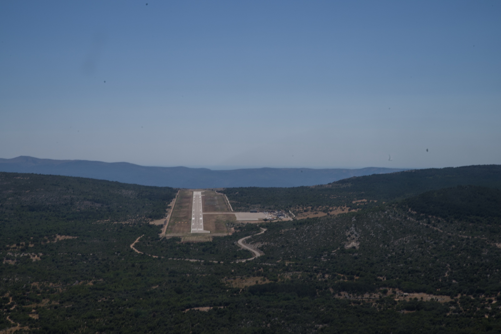
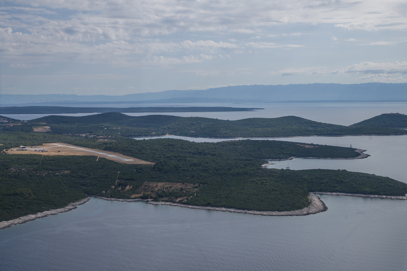
Now in the Adriatic and passing Brac island. You can see the airport.
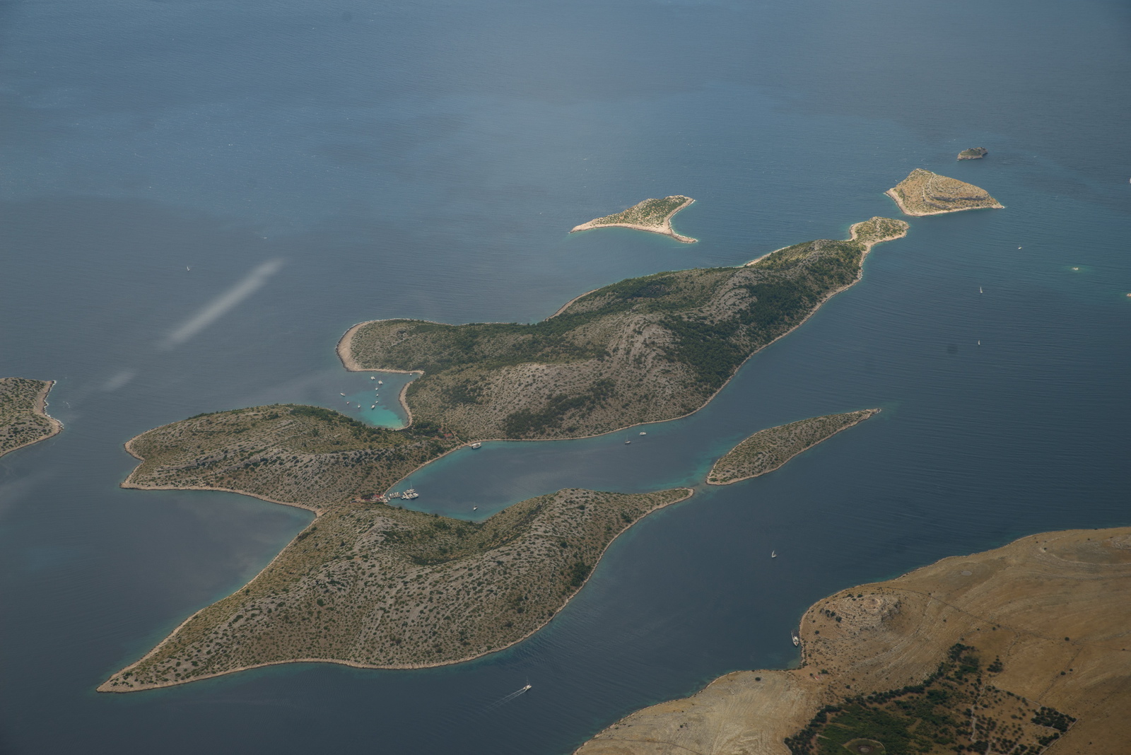
Nature (wind?) makes the weirdest shapes
Mali Losinj tower was unmanned and I unsuccessfully tried to call some pilot(s) there re the current runway but nobody seemed to speak clear enough English! So I lined up on 02 and watched the GS versus IAS… Earlier tried to spot the winsock(s) but failed… admittedly from 2000ft it was not so easy. The wind turned out to be a few kt right across the runway.
Track actually flown:
Video of the above flight. I am nowadays uploading to both Vimeo (better quality) and Youtube. Vimeo has recently got scared of some dumb European regulation and has removed any means of seeing the videos if your IP is in Europe, unless you have the direct URL to it.
Parked up – the familiar view
The airport is really helpful and pragmatic and has in the past managed to park 60 light aircraft! Police were not interested in a Greek arrival – quite correctly!
The cafe/restaurant is outstanding. They tell you they have no food because you arrived too late, but that just means they can't offer you the back end of a bull ![]() They produce fantastic seafood salads
They produce fantastic seafood salads
With a gurl in the plane one never actually starves, but this is too good to pass by ![]()

They have a taxi service.
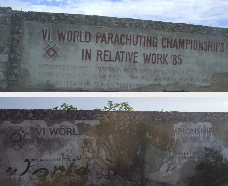
The writing on this wall, just outside the airport, is gradually decaying – 2007 versus today
We managed to find a huge apartment – Apartment Emma – on booking.com. A rare find, especially at a decent price! This is the view from the dining room
The usual treat for the ladies ![]() Even in communism they knew how to get attention!
Even in communism they knew how to get attention!
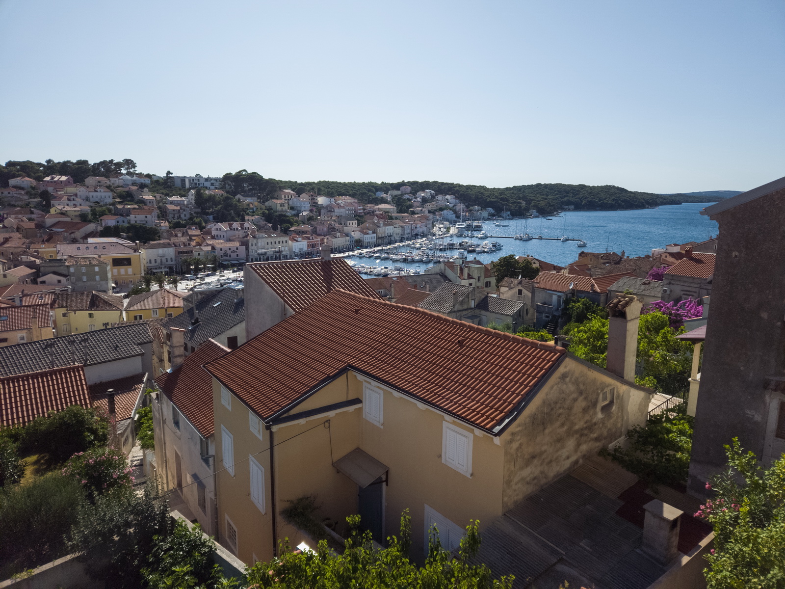
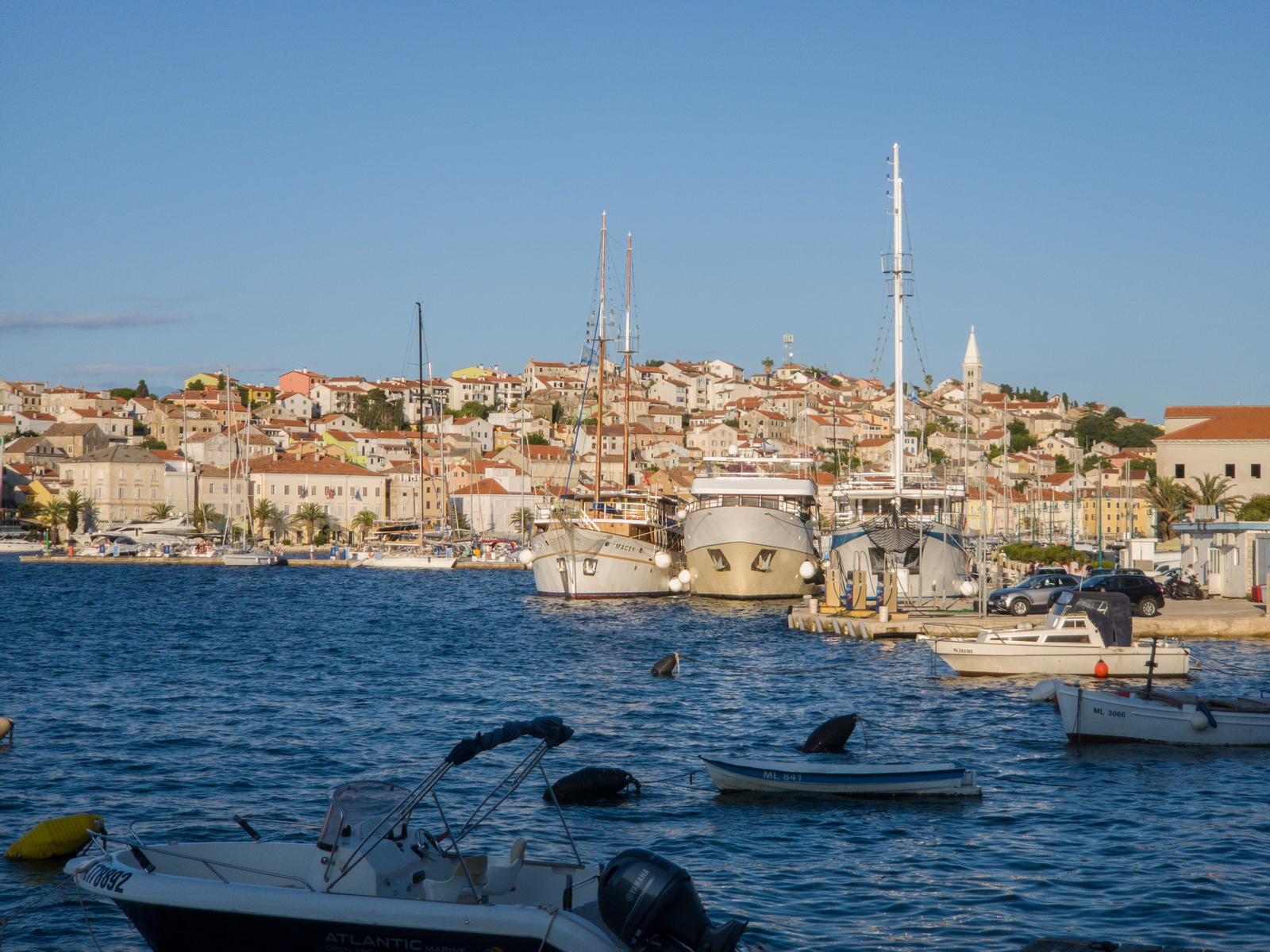
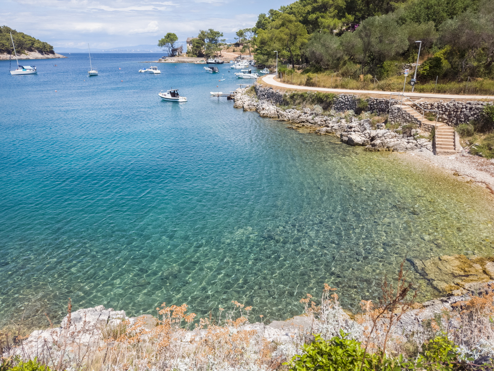
Mali Losinj harbour
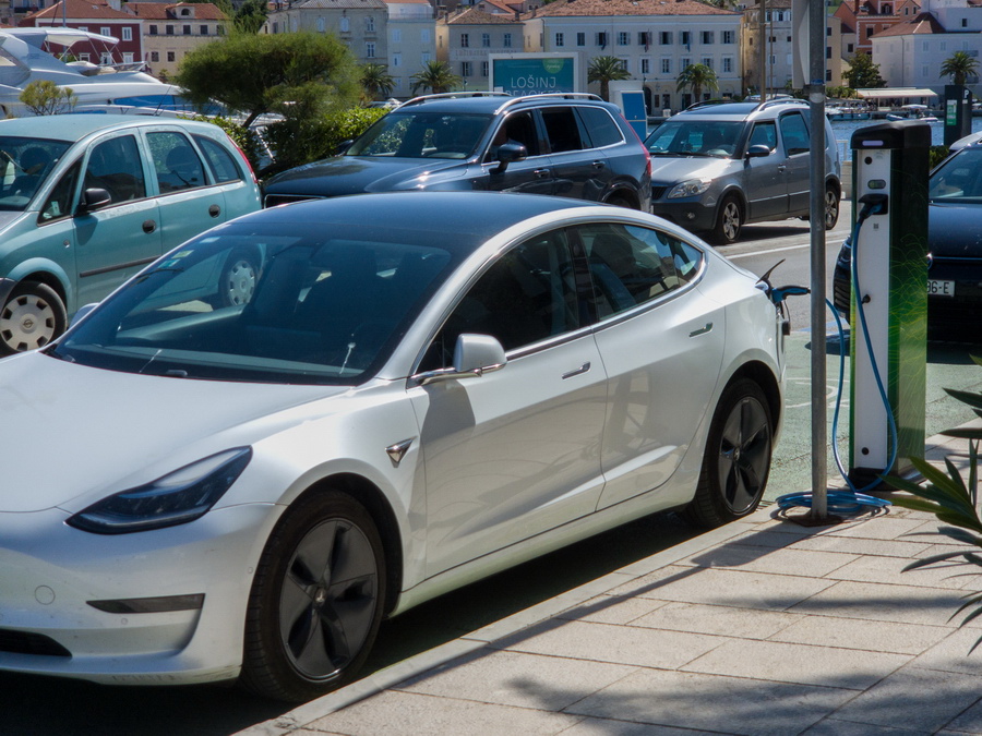
Now this is getting really modern - a car charger! Admittedly, the car will never go flat driving around here ![]()
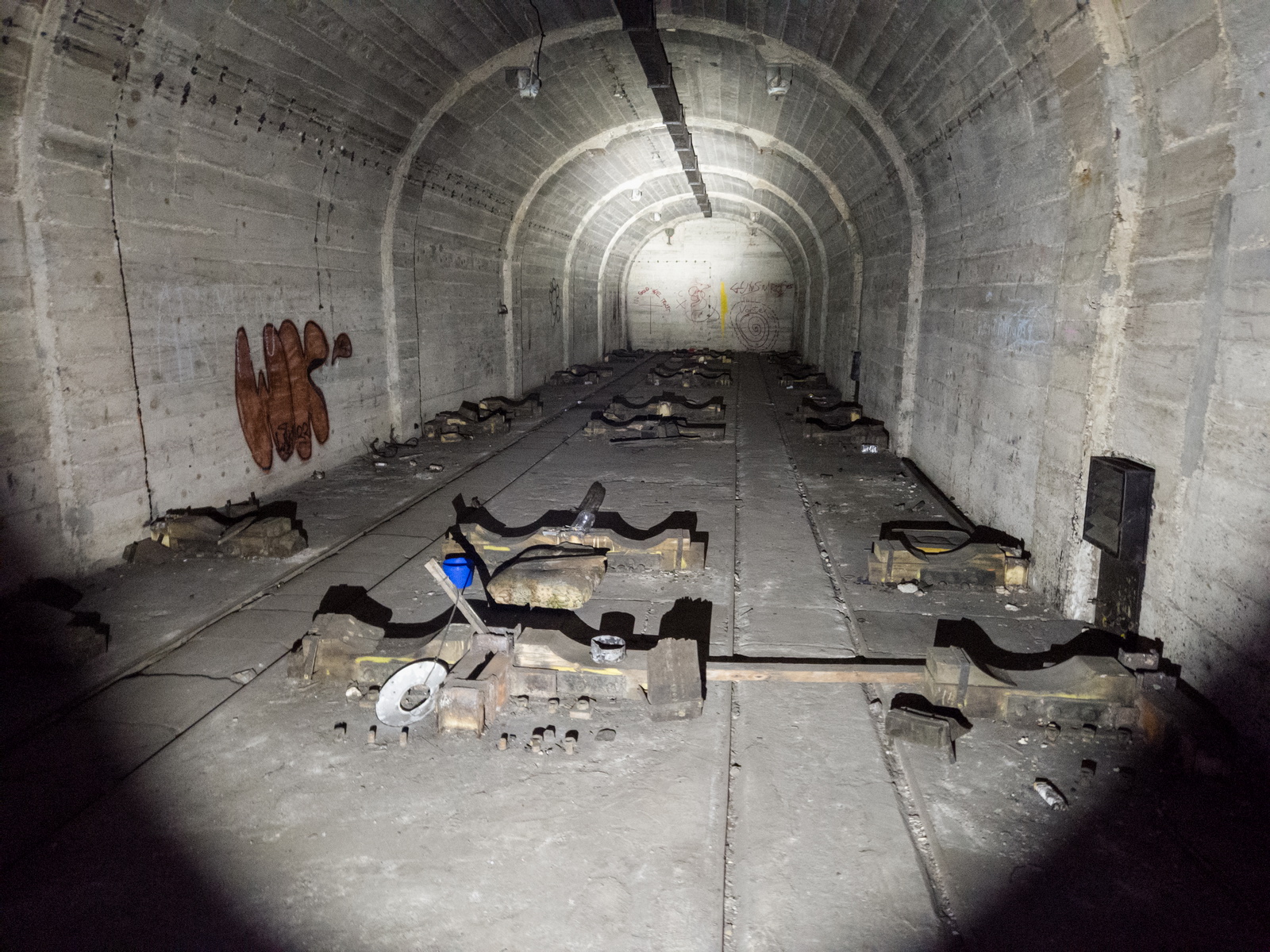
I always check out the torpedo (Yugoslavia had torpedo boats) service workshop ![]()
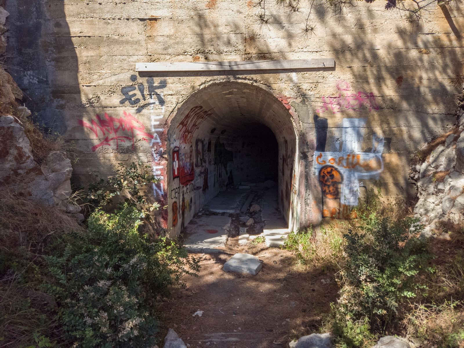
You must have at least two torches or other light sources, otherwise you would definitely never get out. It is a long tunnel under the hill, with many side tunnels
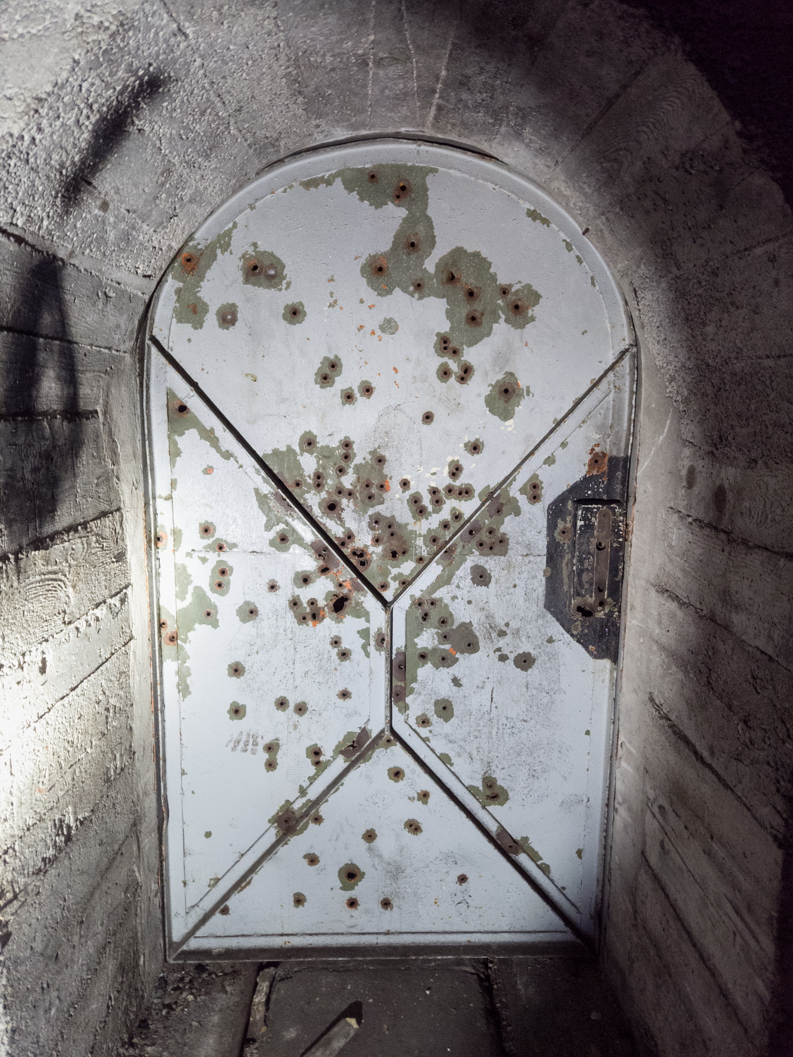
Genuine bullet holes - presumably people were just messing about ![]()
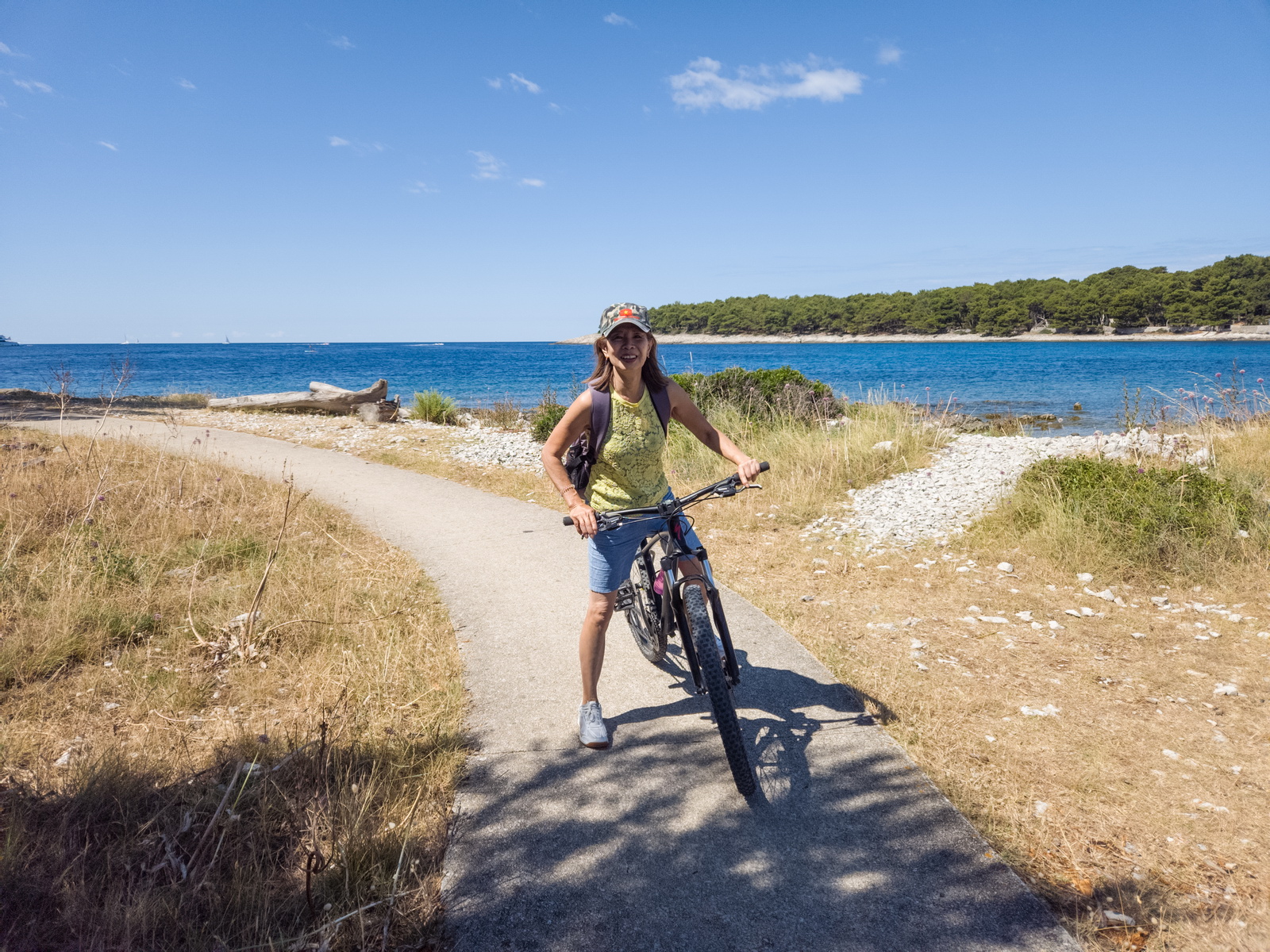
Mali Losinj has some nice bike tracks around the coast, and renting bikes is a great way to get around. Temperatures were much better, too...
This is in Veli Losinj, just around the coastal track. I’ve taken my A&P/IA/ATP/CFII aircraft mechanic here a couple of times; without him my life would be much harder ![]()
There is a lot more on Mali Losinj but this time we had just 2 nights. That was a mistake, too... I have various other reports here.
Nice weather on day of departure. Flights to/from the UK tend to be the hardest. This time we are going back via France. So, as nearly always happens with France, I got a French strike “staff shortage” CTOT, but it was only about 30 mins.
Goodbye Croatia, probably until 2026... These visits are always special. I come from Czechoslovakia and find a lot of the "historical scenery" strangely familiar
Mali Losinj to Shoreham 11th July 2025
The weather was ok.
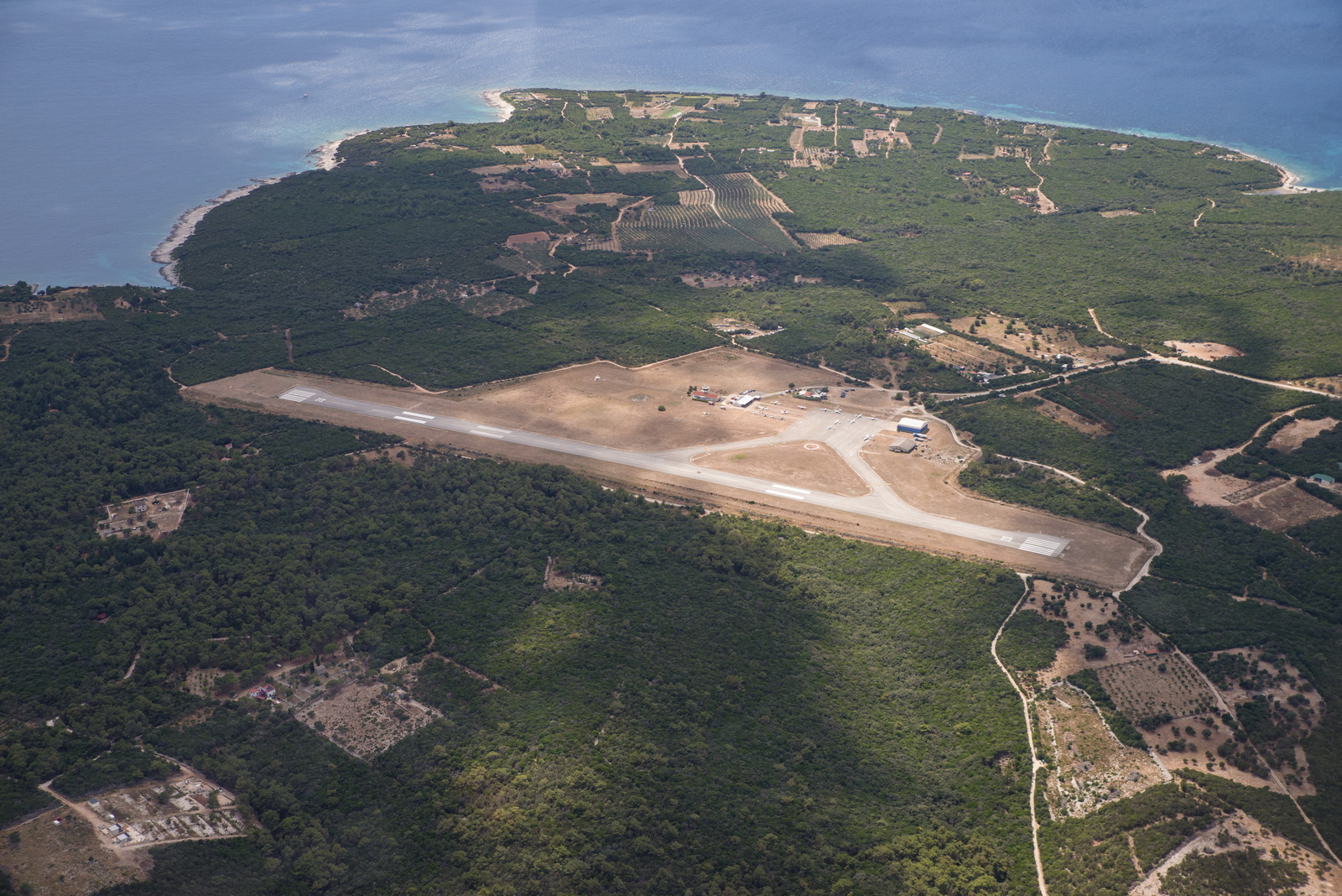
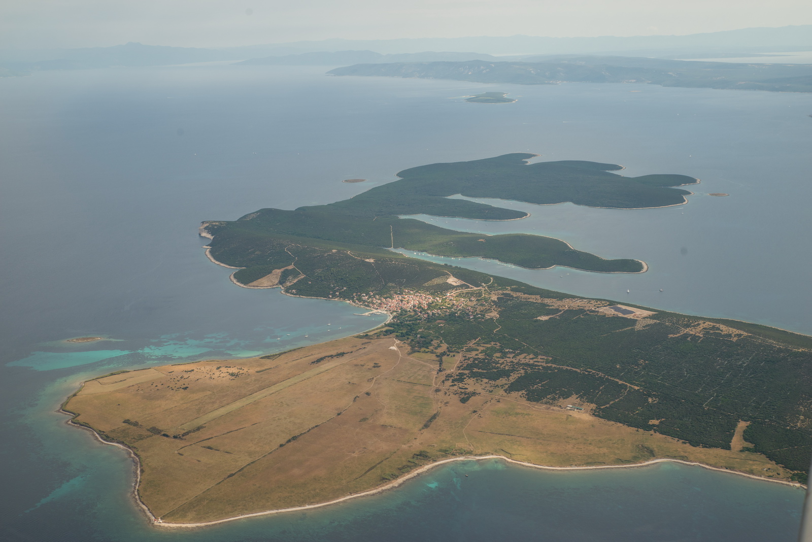
Just up the road from Mali Losinj, the little "dirt strip" airfield Unije. No fuel, no customs... This time no aircraft visible. The Unije village is next to it.
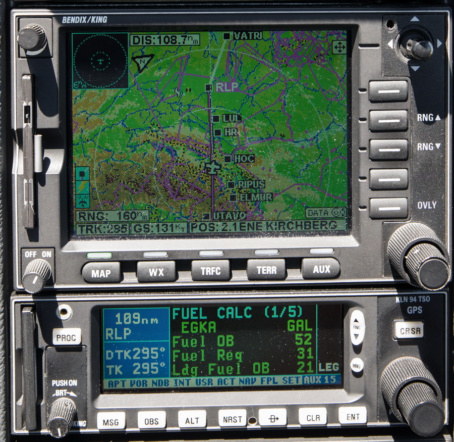
Obviously I wanted mega shortcuts on this route, in the obvious places over the Alps. In France you almost never get any good ones (due to 99% strict military airspace in the east) but over the Alps it usually works. One trick is to be at FL160+ and the other is to cancel IFR. Given the ~20kt headwind I chose the latter, which amazingly worked even with the Italians. They just said "if you cancel IFR you can go anywhere". I queried this, with my proposed direct route and they repeated the "anywhere" bit. So, FL120, we went
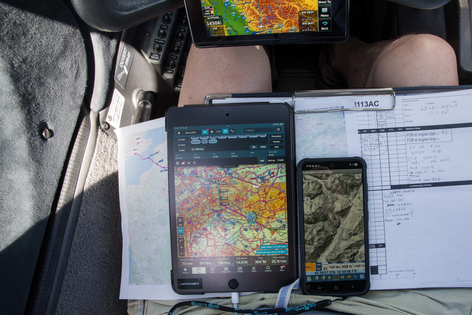
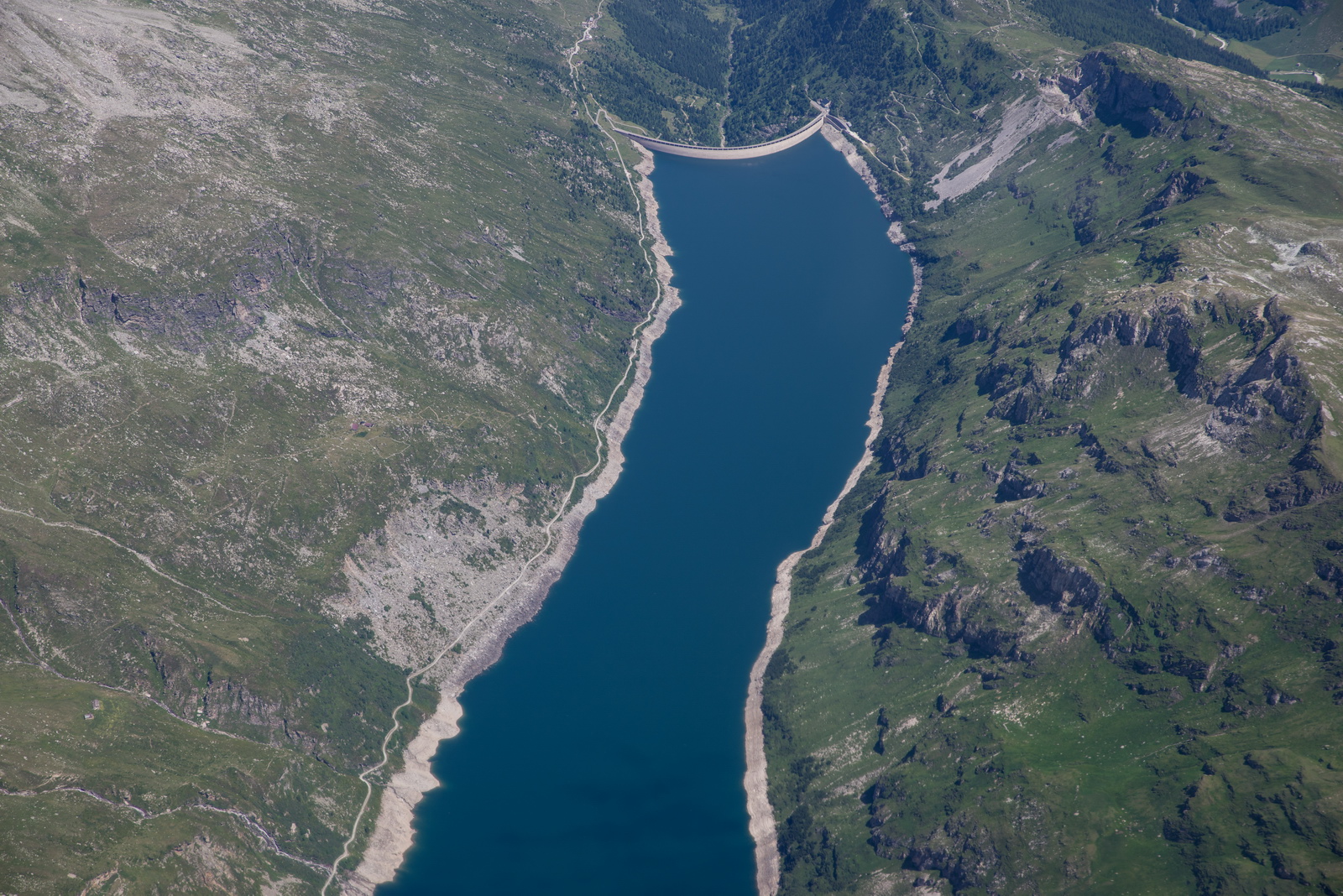
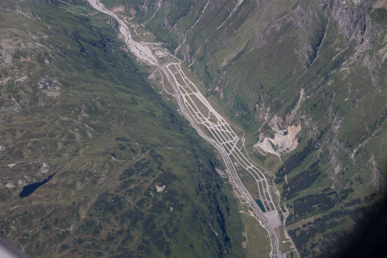
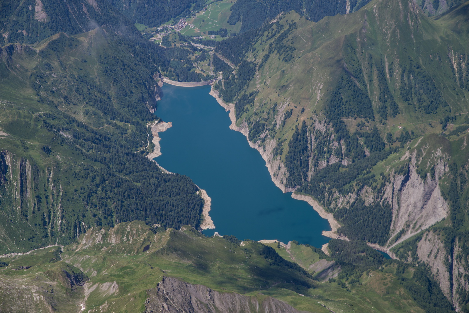
The conditions on the Alps crossing were mostly VMC in that ground below could be seen. In case of engine failure above cloud I run a topo map on the phone (under Oziexplorer; I generated the 50GB mapdata many years ago using a google terrain scraping tool (MOBAC - Mobile Atlas Creator) and img2ozf) so working out which canyon to glide into should be easy. This imagery is seen on the Android phone. There is no way to run it on the Ipad which is much less flexible and was purchased purely to run Foreflight. I no longer do the Alps crossing in IMC; the temperature was -4C so TKS would be needed and it lasts only just long enough. On this route one can do a specific strategy of climbing in N Italy, heading west, until one can see right across the Alps, and then head across above the cloud.

At times there was some headwind of ~30kt which produced LFOB of 15 USG but this later improved
This pattern was a mystery
I think Jungfrau is visible, in which case Monch and Eiger should be too, if you know the mountains...
Those clouds look lenticular but the air was totally smooth
Goodbye Alps ![]()
Headwind dropped off to about 10kt. From many years of flying, it is obvious that French ATC is scared of coordinating with their military, presumably in case they get their head bitten off, so shortcuts are almost never granted. I still do always ask and keep asking and sometimes one gets a little bit...
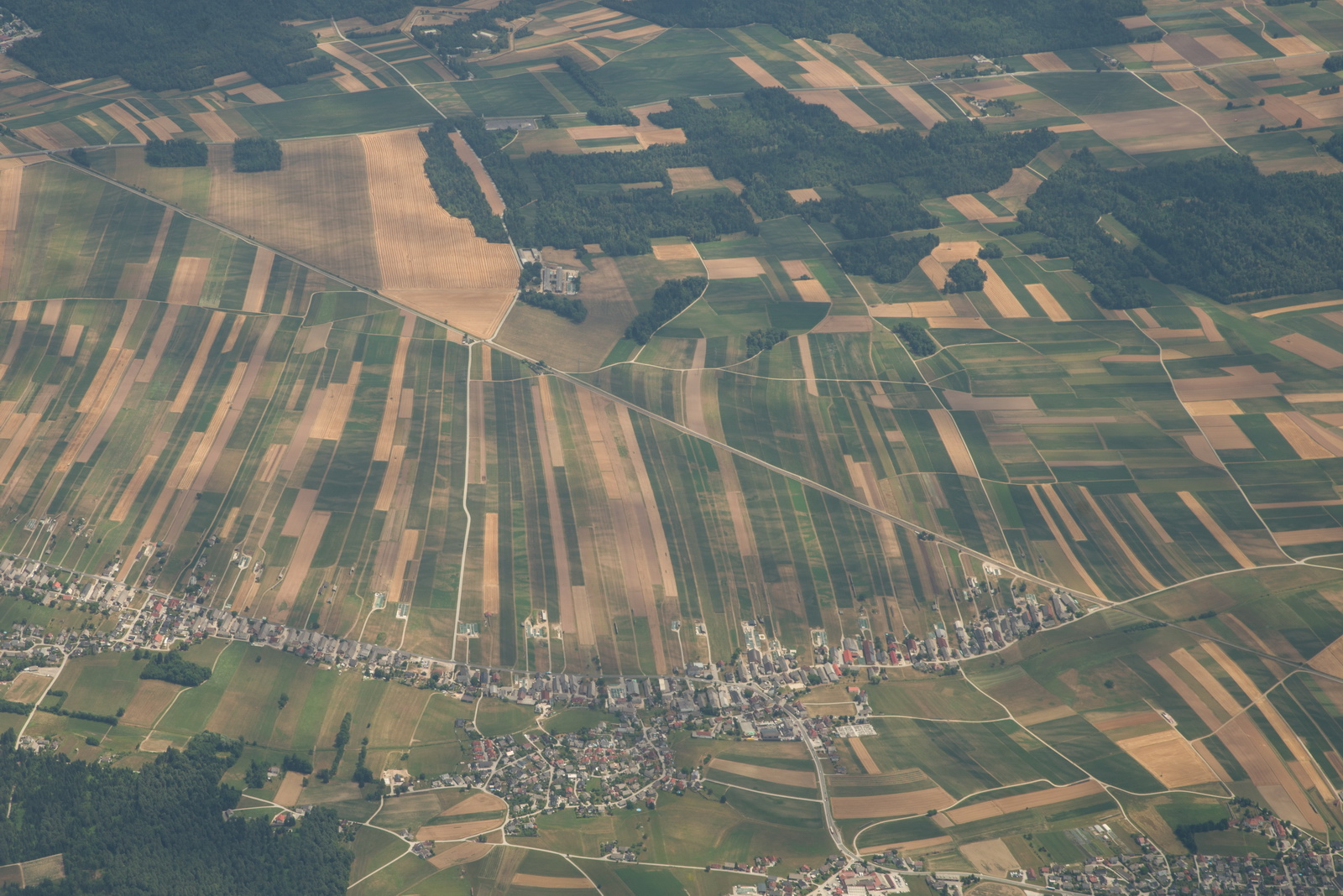
The 2hrs of flying over the northern half of France are tedious. Just thousands of fields as far as the eye can see.
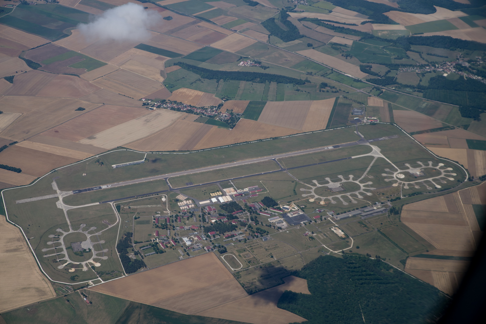
Here is Vatri - a military/civilian airport in NE France. I've never been there; reportedly it is quite expensive, and popular with bizjets
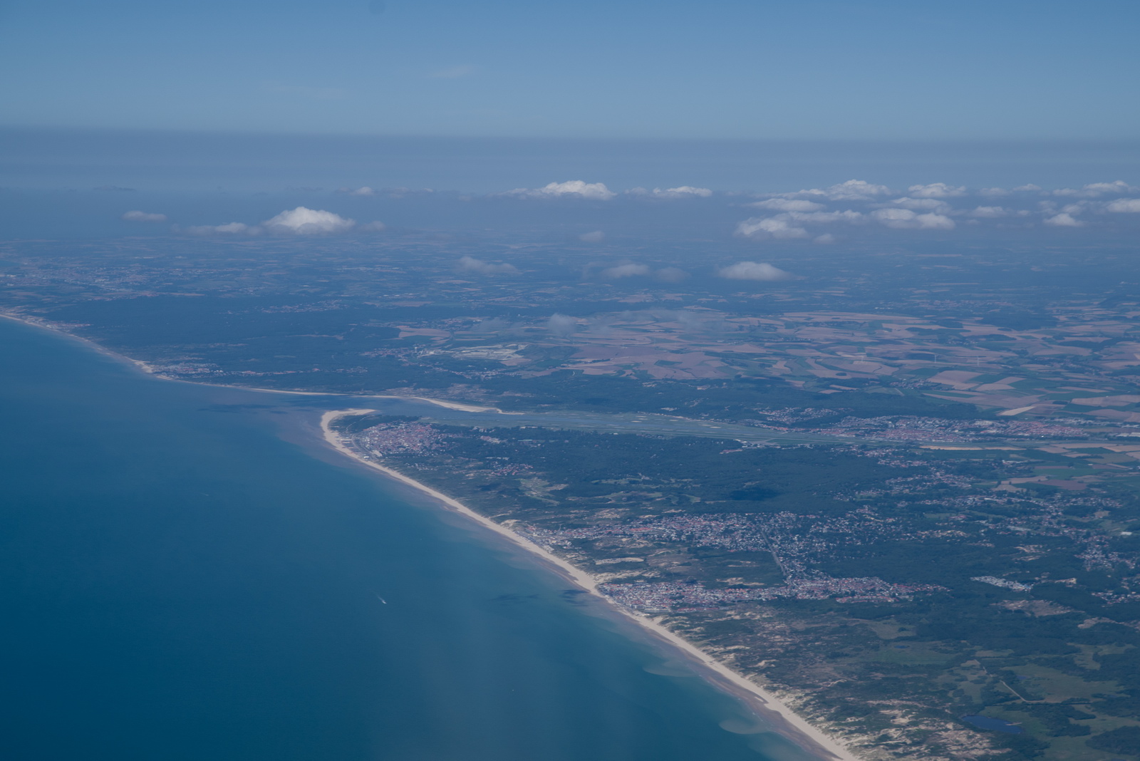
Le Touquet LFAT. Should have landed there for a couple of hours – see here. I had forgotten to file the GAR form and got a really aggressive "meeting" with the border police in which Sally was handled in a very unacceptable way by a half crazy policewoman. I could have diverted to Le Touquet and filed the GAR, then waited for 2hrs and flown on to Shoreham. The border force would have been pissed off (because they watch you on the radar tracking sites) but could not have done anything about it. The only issue is that this airport is FR-only during lunchtime so technically it is illegal to go there if you don't speak French! Some French airports have enforced this in an unpleasant way. I did land at Le Touquet during this FR-only time many years ago and the tower stayed silent and nothing happened.
I cancelled IFR around BILGO because that enables a DCT EGKA; you talk to Lille who get rid of you to London Info as soon as possible ![]() London Info is of no use and the smart thing is to call up Lydd EGMD instead (or at least set up a listening watch on their frequency) since the S&R heli is based there.
London Info is of no use and the smart thing is to call up Lydd EGMD instead (or at least set up a listening watch on their frequency) since the S&R heli is based there.
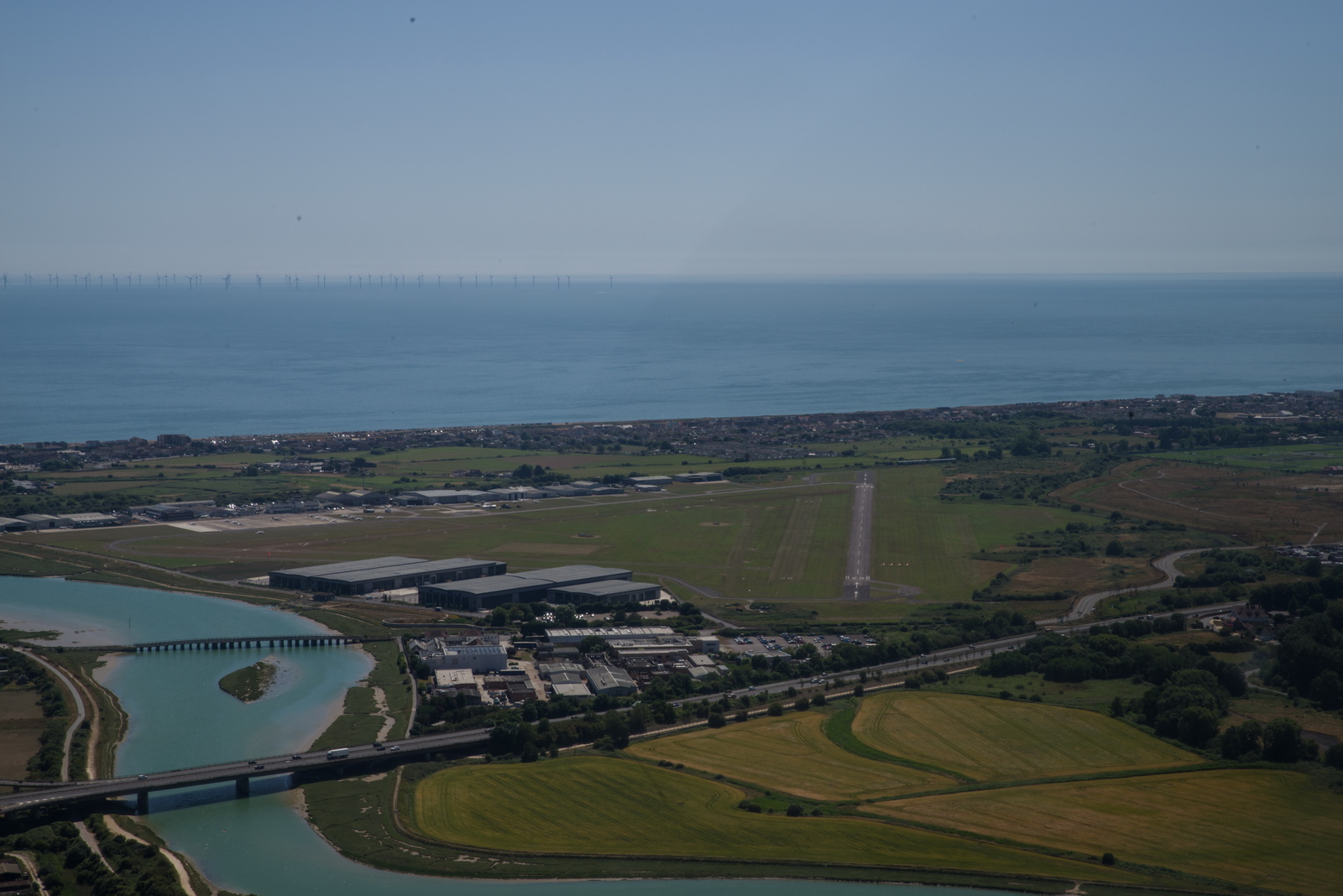
On long flights I run down one tank until the LOW FUEL light comes on. It happens at 8 USG in that tank. I then fly on (say 10 USG/hr) for another 20 mins and switch tanks for the final time. Looking at the IAS this was in the descent into Shoreham
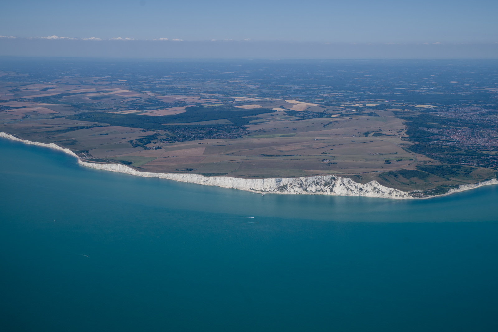
One can understand how the returning WW2 bomber crews felt seeing these cliffs, although they were not landing at Shoreham ![]()
It was a great trip but it was equally great to be back home and to normal temperatures ![]()
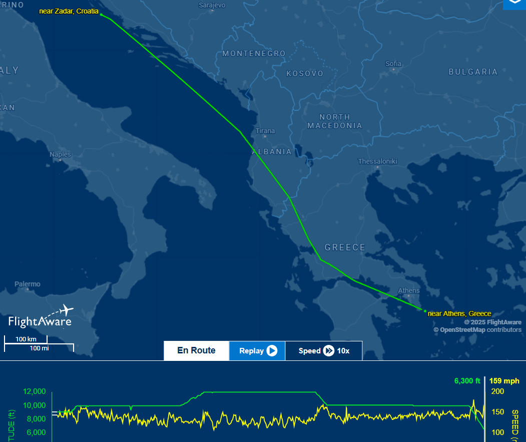
Track actually flown. This is interesting in that it disappears where we were VFR, except when having cancelled IFR over the Alps where it continued. Weird... There would be a track on Flightaware but I did not save it and it is long gone.
Video of the above flight. I am nowadays uploading to both Vimeo (better quality) and Youtube. Vimeo has recently got scared of some dumb European regulation and has removed any means of seeing the videos if your IP is in Europe, unless you have the direct URL to it.
Mali Losinj to Shoreham Gallery
There is always something...
The biggest thing was filing Shoreham to Brac as VFR and obtaining an IR clearance ASAP on the way. Just amazing how well that worked. It was a great solution to a very stressful problem and should work again, unless you are doing it on a route on which ATC is going to be difficult.
Similarly, cancelling IFR (weather permitting, obviously) over the Alps produces much better crossings. But only sometimes, and with many caveats e.g. Swiss military, Zurich Class C FL130+, etc. This time it all worked.
The Autorouter is a great tool but when it doesn't pass on Eurocontrol messages, you can get properly screwed. I don't know what is/was going on with it. The developers used to be on EuroGA but vanished c. 2018 and, according to reports, they sometimes respond to support tickets and sometimes not, possibly depending on who filed it...
The temperatures were too high for us to enjoy Brac and Syros, and Chios would not have been much better. We should have spent much more time on Mali Losinj.
The Greeks much prefer phone calls to emails so always send off an email and then right away phone them, and keep phoning them. Emails just confuse the hell out of them.
Flight times (airborne times)
Shoreham EGKA - Brac LDSB 6:10
Brac LDSB - Syros LGSO 3:50
Syros LGSO - Mali Losinj LDLO 5:30
Mali Losinj LDLO - Shoreham EGKA 5:45
Landing fuel on board (US gallons)
Brac 13.7
Syros 40.3
Mali Losinj 22.7
Shoreham 21.3
For an idea of the meaning of the above reserves, the fuel burn enroute ranges from 11.7 USG/hr at low level to 8.5 USG/hr at FL160. Although weather is the main factor, you need much more reserve fuel in some parts of Europe than in other parts.
Oxygen
An oxygen system is practically necessary for IFR in the Eurocontrol system. Occassionally, the weather is nice and one can fly at FL090 or so but most people would still get tired after several hours. Also many routings are not available below oxygen levels, due to controlled airspace structures, and in some cases terrain.
On this entire trip the usage was around 20% of the 48 cu. ft. cylinder, for 2 persons. Without oxygen I would have not done the trip because one cuts off the top half of the aircraft operating ceiling (one cannot climb above most cloud) and in the wrong conditions could spend most of the flight in icing conditions and turbulence. The Alps also cannot be crossed without oxygen unless you go "VFR" and have very good weather.
The Value of an IR
On this trip, the flights could have been done under
VFR although on different routes, and with climbing "VFR" through some cloud layers ![]()
Photo Galleries
The gallery in this report was generated with Juicebox
which has a free version with various limits (e.g. up to 50 photos) and a $45
version (the one I have) which does everything. It runs on Adobe Air and seems to have issues
with large galleries on a win7 64bit machine so I run it in a winXP compatibility
mode ![]() It delivers good
results but has some annoying features e.g. stripping off EXIF data, which should
arguably be preserved, or at least be configurable. It also can't process images
over 4096 pixels wide which a lot of modern cameras do exceed so I have to downsize them a bit first.
It delivers good
results but has some annoying features e.g. stripping off EXIF data, which should
arguably be preserved, or at least be configurable. It also can't process images
over 4096 pixels wide which a lot of modern cameras do exceed so I have to downsize them a bit first.
Gadgets
No trip report can be complete without this bit ![]() However, I didn't bring much this time. The photos were shot mostly with a Samsung
S23 phone. My Pentax K1 DSLR camera was used for airborne shots, and at Syros.
However, I didn't bring much this time. The photos were shot mostly with a Samsung
S23 phone. My Pentax K1 DSLR camera was used for airborne shots, and at Syros.
All photos were taken in DNG raw format and processed in Lightroom to crop and remove some haze. This avoids the fashionable but ridiculous enhancements (over-saturation and over-sharpening) which the phone makers do. The other program I use is ACDSEE PRO which is easy to use on any randomly chosen picture folder to batch resize/rename everything. It is also my standard photo viewer. Lightroom workflow is formal, but it is good for uniformly processing lots of photos and professionals use it a lot. For example, I apply +20% vibrance and +20% clarity in Lightroom, to all RAW images. On phone pics I bring down highlights a bit, because phones tend to over-saturate highlights.
In theory one could do everything needed on a trip with just the S23 phone. It can be used to get weather, file flight plans, run the ADL150 app, and of course do all the normal comms with other people. It can even take good enough photos. It is however too painful to use for much typing, or viewing approach plates. So, for ground tasks, on all significant trips I carry a Dell XPS13 laptop which makes everything much easier, especially route replanning. One cannot beat a laptop for productivity; I have the older XPS13-9360 version with a 1920x1080 screen which is does basically everything anyone could ever need and with the quad core I7 processor is very fast - good enough for movie editing/rendering and faster than most of today's ~3GHz desktop computers. I run Foreflight in-flight and this required an Ipad; I have the Ipad mini 5 which also acts as a "backup phone" with VOIP installed, for outgoing calls only. It does also have a £8/month contract SIM card so it has mobile data (stupidly, Apple block voice and SMS on an Ipad, so VOIP is the only way, whereas an Android tablet works fine as a phone). I also have VOIP on the S23 phone, again usable only for outgoing calls and handy at home (on WIFI) where there is almost no GSM signal. Foreflight can display the free AIP terminal charts and these are georeferenced, but the Ipad cannot be relied on because it readily shuts down in a warm cockpit, due to overheating, and it blocks the display of terminal charts which are older than a few weeks, so one needs to diligently update it before a trip (the update is > 5GB). So I fly with printed terminal charts (Jeppesen) for all planned airports and diversions. It can surprise one how, when things go wrong, a lot of functionality can go up in smoke all at the same time!
The app for the ADL150 satellite weather receiver runs on the phone, the Ipad, and also on an old Samsung T705 tablet on which I have proper topographic data for the Alps and the Pyrenees, for flying over the mountains above cloud. I normally also carry this tablet but it isn't turned on except for when in mountains.
This page last edited 12th October 2025