Trip to Friedrichshafen - April 2010
This article describes a very straightforward IFR (airways) trip from Shoreham (EGKA) in the UK to Friedrichshafen (EDNY) in southern Germany, and back 2 days later.
Procedurally, the flight was very similar to other airways flights I have done. Other VFR and IFR trip reports can be found here.
The Friedrichshafen event was a big airshow/exhibition - the biggest such GA event in Europe by far. I have been there previously - in 2007. As on the previous occassion, IFR slots have to be booked some weeks in advance for both arrival and departure, but the process was slightly different: last time the slots had to be paid for; this time they were free but had to be reconfirmed shortly before the trip. All very well organised! VFR flights did not need slots.
Accomodation was another issue. Even months ahead, the local hotels were charging silly money for the relevant weekend - 400 euros/night being quite common. Luckily, a friend TB20 owner was exhibiting at the show and had booked very reasonably priced rooms at a hotel about 20 mins' drive out of town, and kindly provided vehicle transport for us.
Here is a glossary for non-aviation readers.
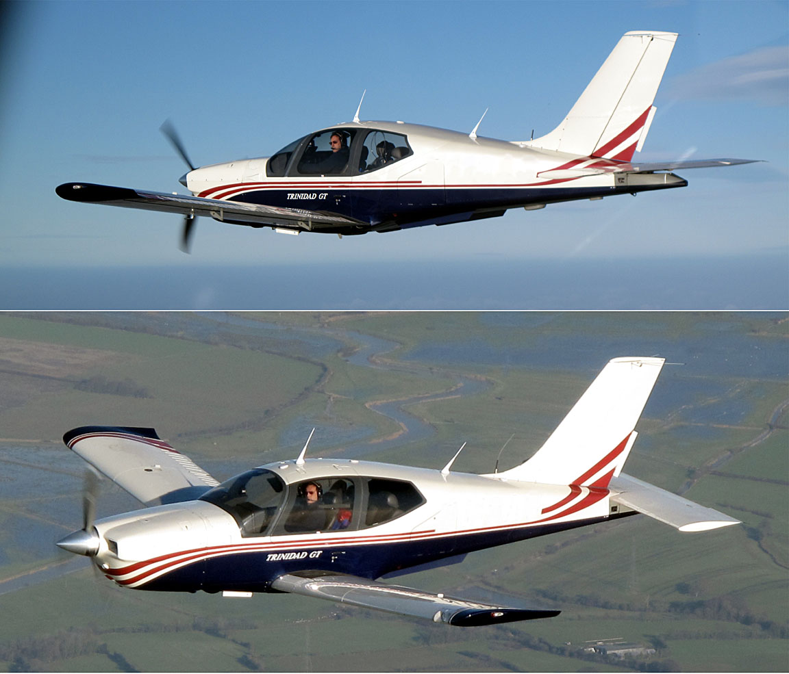
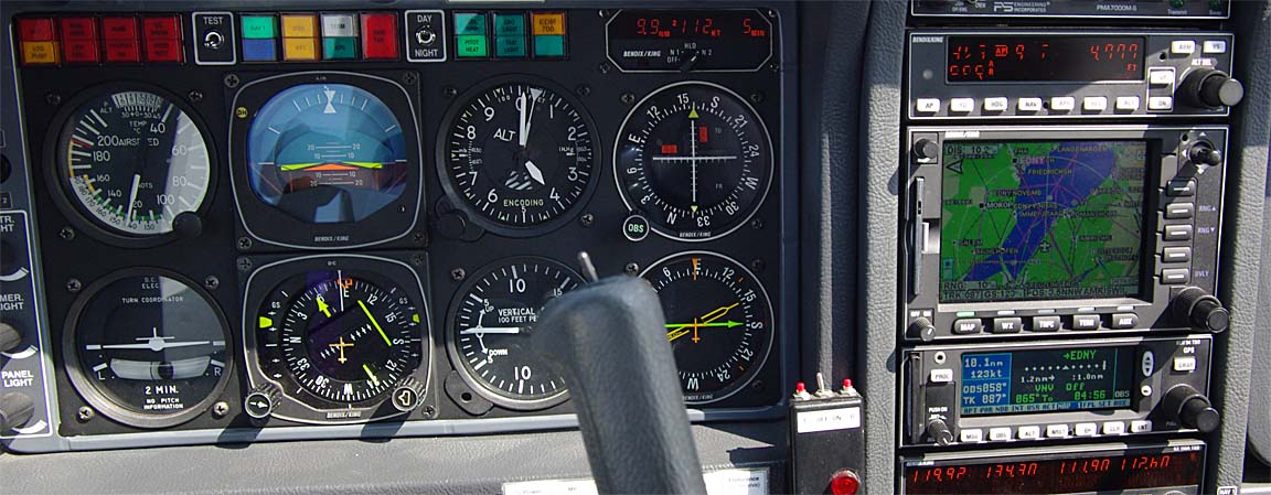
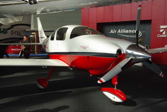
Aircraft
The aircraft is a 2002 Socata TB20GT which has a zero-fuel "book" range of approximately 1100nm and an economical cruise speed of 155kt TAS at 10,000ft. Extra economical cruise power settings can extend the zero-fuel range to 1300nm which, according to FAA rules, translates to approximately 1100nm with IFR reserves. It has a ceiling of about 20,000ft and is equipped with oxygen. It is not certified for flight into icing conditions but has a TKS de-iced propeller.
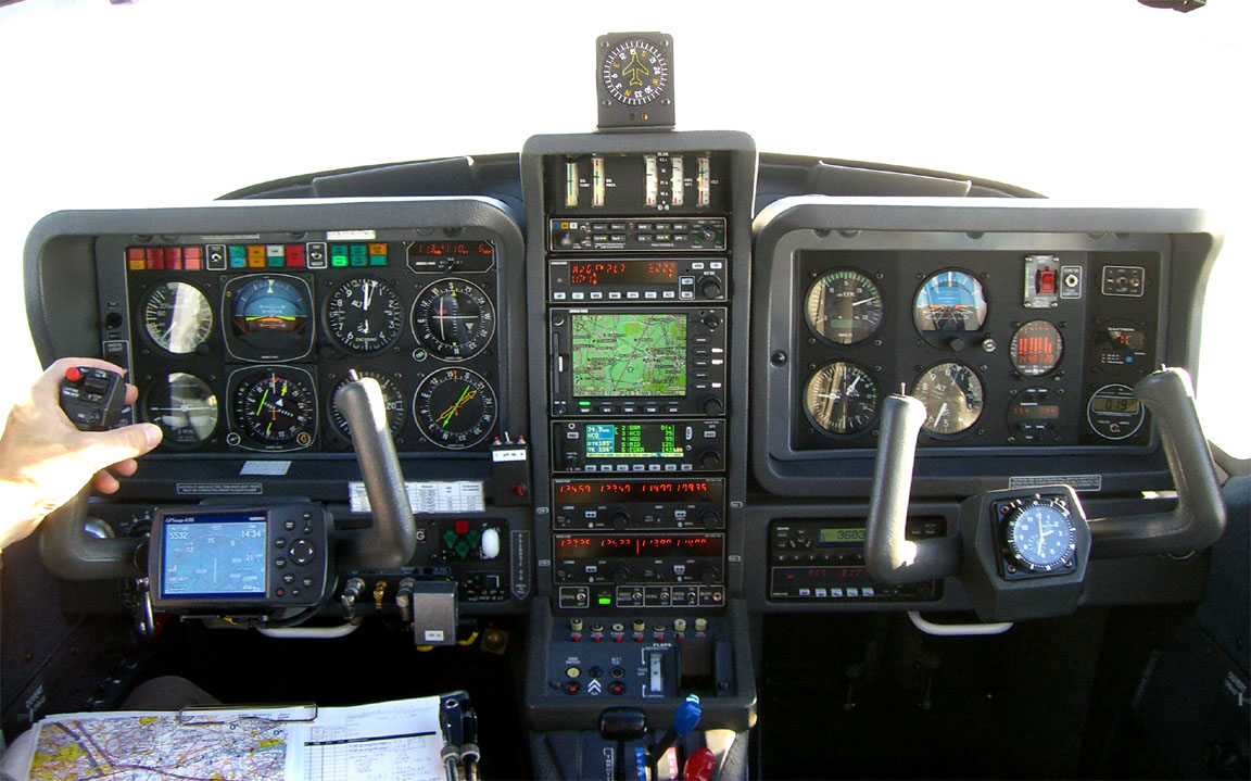
Navigation equipment includes a KLN94 IFR/BRNAV GPS and a KMD550 MFD and these are used for primary navigation. IFR flight in Europe above FL095 (generally) requires BRNAV certification which in the GA context is met only with a BRNAV approved IFR GPS installation. The most common means of BRNAV compliance is one of the Garmin 430/530 products but many other panel mounted GPSs have been approved. BRNAV can also be met with the old KNS80 (with an antenna filter to meet FM Immunity regs) but this product will not alone function in today's "everything is RNAV" environment where one is routinely sent to a VOR which is a great distance away.
The aircraft has a KFC225 autopilot which can track VOR/GPS/LOC/ILS and fly a preset altitude or a preset VS. There is an additional battery powered Garmin 496 GPS which also provides an audio terrain warning (TAWS) function with a European terrain and obstacle database. The TAWS function projects the current trajectory for 2 minutes and if there is a terrain conflict, one gets a "pull up" type audio warning whose tone gradually becomes more urgent. A WX500 stormscope is also installed. One of the radios has 8.33kHz channel spacing to legalise flight at 20,000ft although I have never been assigned such a frequency.
Flight Planning Equipment
In this case, being a short trip, all planning and flight plan filing was done at home, before departure, on my PC. I carried a laptop just in case. Nowadays it is easy to get TAFs and METARs on any modern mobile phone capable of WWW access, but a laptop is still very handy for anything more complicated, and if the pre-filed route or flight plan has to be discarded then everything has to be re-generated from start, and a laptop with mobile internet is the only practical way to do this.
The laptop has GPRS/3G internet access, via a bluetooth-connected mobile phone.
On a short-duration trip like this, it makes sense to file even the return flight plan in advance, because cancelling or delaying it is much easier than filing it. In this case, the arrival and departure were both governed by slots which were booked a long time in advance...
Weather
More detailed notes on IFR weather planning are in my earlier trip writeups here.
However, I am gradually simplifying the weather planning process, to include some new techniques. There are essentially two parts to weather planning: looking ahead a few days to see which day is likely to be OK for a flight (and for the return flight, too), and making the final go/no-go decision shortly before the flight. These two sometimes interact; for example if one must be at the destination on a specific date, or a passenger must be back at work by a certain date, one may make a "cancel" decision several days ahead (and take an airline, etc), but - because weather forecasts, particularly the high altitude conditions which affect IFR flights, are notoriously unreliable - one should not normally cancel a flight until the actual weather data has been examined on the morning of the flight.
For the first part - looking a few days ahead - I use the MSLP charts. Simply avoiding the frontal patterns depicted on this chart works very well; it avoids the worst icing conditions and turbulence, and ensures cloud tops are almost never above FL180. It is a very good technique for long distance safe IFR flight in an aircraft which does not have heavy duty anti-ice equipment and radar, but it does result in the cancellation of a proportion of flights which would have been possible had one been willing to "go up and have a look around".
For the second part - the final go/no-go decision - I favour another simple method: check the TAFs and METARs for the departure, destination and alternate airports, and then use IR satellite images to estimate the cloud tops.
For a few years I have been using more sophisticated techniques involving cloud top forecasts. Some notes are here. Unfortunately, the reliability of these is too poor for frontal (convective cloud) conditions, and in between fronts there is little need for accurate tops forecasts provided that one has an aircraft with a practical ceiling of at least FL160.
The outbound flight was on a Friday and the return flight on Sunday. A review of the MSLP charts during the preceeding few days consistently showed good weather for the outbound flight, but a widely varying picture (at the German end) for the return flight...
The final pair showed an occluded front over EDNY, but it was obvious that the situation was not reliably forecastable...
I cancel quite a lot of trips due to return weather issues because the instrument approaches at Shoreham have a high MDH (in prevailing winds, runway 20, 800ft) and thus poor utility for getting back home. Also, the DME is currently out of service which takes out the instrument approach to 20, leaving the 02 and a circle to land to 20 only. There is a GPS approach but this has the same 800ft MDH and thus offers no greater utility. But in this case the UK end did not have a problem.
The MSLP charts also indicated light winds, with a general north-easterly airflow.
As for SigWx, the 0600 Friday one showed nothing significant. The 1200 Friday one (obtained after the flight) was similar. These charts show weather hazardous to larger aircraft and are much less useful to non-deiced pilots. Contrary to widespread belief, they do not show cloud tops, and ICAO recently made them even less useful by suppressing information which might be used to derive cloud tops data if there are any CBs forecast in the same area.
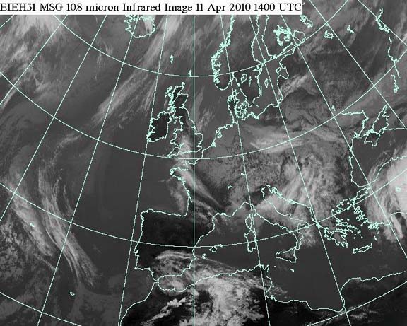
The IR satellite image on the morning of the flight showed no high altitude cloud along the route (shown approximately in yellow)
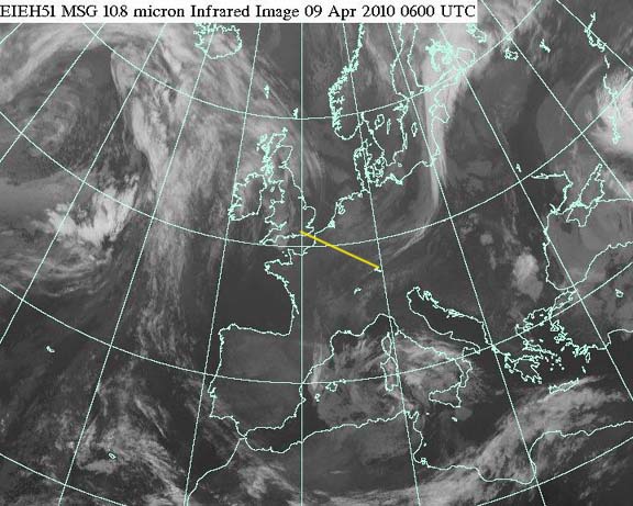
On these images, the whiter the cloud is the lower its temperature and thus the greater its altitude. High altitude cloud, say FL200 plus, shows up as something approaching solid white. IR imagery which contains a temperature scale (enabling a more accurate altitude estimate; if necessary by reference to altitude/temperature data which for some reason is a lot more accurate) is available but I have not found any which is free and less than several hours old...
Finally, on the morning of the flight I got the TAFs and METARs which showed perfectly reasonable weather.
The GFS data from NOAA showed nothing unexpected.
For good measure, the sferics (lightning) data and a radar image were obtained and both showed nothing of interest.
Preflight Procedures
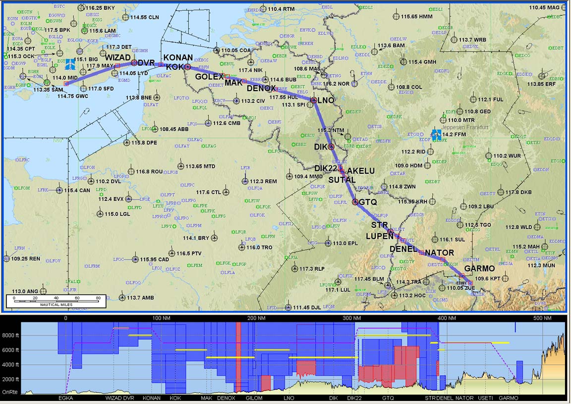
IFR route design: The Eurocontrol (often interchangeably called CFMU or IFPS) IFR routings were generated and validated online in just minutes using FlightPlanPro (FPP). This routing tool has revolutionalised European IFR route development. It generates an initial route from its internal airway database; the route is submitted to Eurocontrol for validation (internet access is required) and is iteratively modified.
The validated airway route is then pasted into Jeppesen Flitestar, from which the plogs and other material (e.g. enroute chart sections) are printed out. Provided that the flight is executed on more or less the filed route (plus or minus say 100nm either side) there is no need to ever open the unwieldy printed airway chart in the cockpit. This trip report shows this workflow in detail.
The outbound route:
EGKA
DCT WIZAD R8 DVR L9 KONAN L607 LNO N852 SUTAL R7 LUPEN Y711 NATOR T733 USETI
T732 GARMO
EDNY
F130
428nm (GC) 482nm (airways)
Alternates:
The filed level was FL130. The exact level does not matter; one can vary it according to weather. The IR images mentioned earlier indicated fairly low cloud tops; probably below FL100. Normally I file for FL140 or higher as this yields better routings than lower down and on this occassion the routing did indeed improve dramatically above FL120.
The return route:
EDNY
TRA L856 HOC G4 RLP B3 BILGO H20 XORBI H40 ABB T27 GURLU Y8 WAFFU DCT
EGKA
F140
428nm (GC) 476nm (airways)
Alternates: EGHH (Bournemouth), EGMD (Lydd)
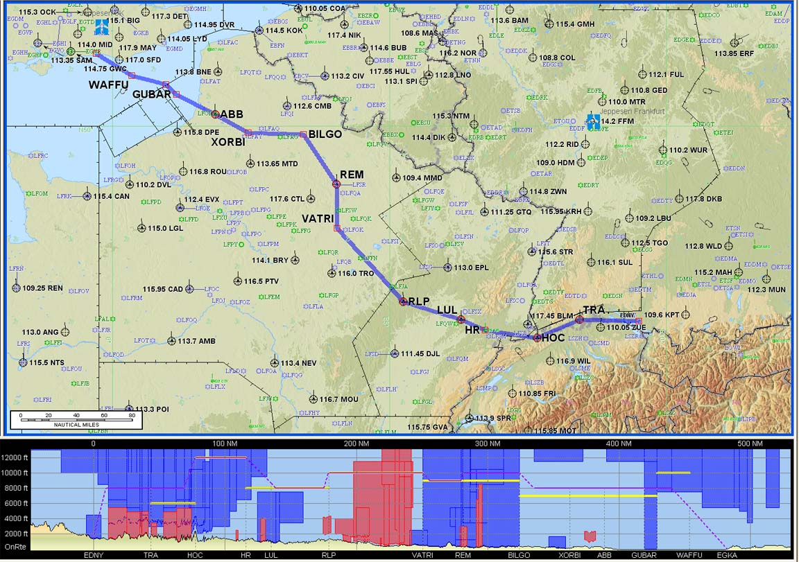
All these routes have a ~12% overhead, which is fairly normal for Eurocontrol routings. If I get something substantially worse - overheads of 20% to 40% are not uncommon - I have a closer look at the routing and maybe try filing it at a high level e.g. FL180, or try a really wide level range e.g. FL080-FL180 and allow FPP to play around with it.
PPR (prior permission required) was not an issue because the slots at EDNY were pre-booked.
Flight plan filing was done electronically, at zero cost, using EuroFPL for the outbound flight plan and using AFPEx for the return flight. Normally I file flight plans using AFPEx, but EuroFPL has two advantages: it is a data-efficient website which is usable over a slow GPRS/3G connection, and it has a flight tracking facility which enables someone on the ground to monitor your progress. It can also be accessed from an internet cafe computer. One EuroFPL disadvantage is a lack of a telephone helpdesk; another one might be that it is IFR only. On this occassion I used EuroFPL because the parents of one of my passengers were interesting in tracking the route. More notes on electronic flight plan filing options are here.
Due to the existence of AFPEx and EuroFPL (both of which appeared in 2009) I no longer use Homebriefing.com which, last time I looked, had "enhanced" their website to waste about 2MB of data in pointless graphics which could cost anything up to £20 to download, especially if on a roaming GSM connection outside the EU.
Note: the Eurocontrol routings given here and elsewhere will most likely not work by the time you might try them because the precise form needed to get the route into the Eurocontrol (IFPS) computer in Brussels changes from one week to the next, and there are frequent differences between weekdays and weekends which are largely due to a lack of military activity on weekends.
Fuel Planning
Fuel was not an issue on this flight, involving around 75% of the aircraft zero-fuel range and that is assuming one diverts all the way back to the departure airport!
Oxygen
In IFR, oxygen is as vital a flight planning issue as fuel. This flight was filed for FL130/140 and oxygen is practically and legally mandatory. Anyway, I never fly anywhere IFR without oxygen because doing so nearly halves the aircraft operating ceiling and discards by far the most attractive weather avoidance option: climbing to VMC on top. I also use oxygen anytime at/above FL100; the flow rate at FL100 is very low but it keeps you fresh and you don't arrive tired.
In this case, two 14 year old children were aboard. One of them has flown in the TB20 many times. Some years ago I bought a quantity of child-sized cannulas but the fittings on these were for the old Aerox 1st stage regulator. My present two-person demand-regulator oxygen system uses a large Mountain High composite cylinder but the Mountain High 1st stage regulator on that cylinder has outlet connectors which are incompatible with the Aerox child cannulas... The MH regulator has four outlets but, to avoid swapping cannula fittings for this unusual trip, I also carried my two small Aerox cylinders and fitted the Aerox 1st stage regulator to one of these. Child cannulas are plain cannulas (no reservoir) and thus have a high (inefficient) oxygen flow rate, and this cylinder just made the two flights at FL090/FL140 but would not have made them at FL130/FL140, so the second one would have been used for the return flight.
The Flight
The Shoreham (Class G) departure clearance was: After departure left turn to SFD, climb FL050, remain outside controlled airspace, squawk 0571, contact London Control 120.175.
The initial base of controlled airspace in the area is FL055 so one sets FL054 as the target level on the autopilot...
The local weather was clear but substantial cloud cover ahead was apparent during the climb.
On first contact, London Control asked for the customary squawk ident and then issued a clearance to enter controlled airspace, with a climb to FL090 on present track.
Shortly afterwards they authorised a climb to FL090. By then the cloud tops were visible and I asked for a "stop climb" at FL090. We remained at FL090 all the way to destination, just above the cloud tops. Given that this route could not be filed below FL130, this demonstrates yet again that the permissible Eurocontrol routings are usually complete nonsense...
Once level in cruise, the landing fuel on board (LFOB) figure, which is re-computed by the GPS/fuel totaliser system, stabilised at 50USG and remained there (indicated by the yellow arrow below)
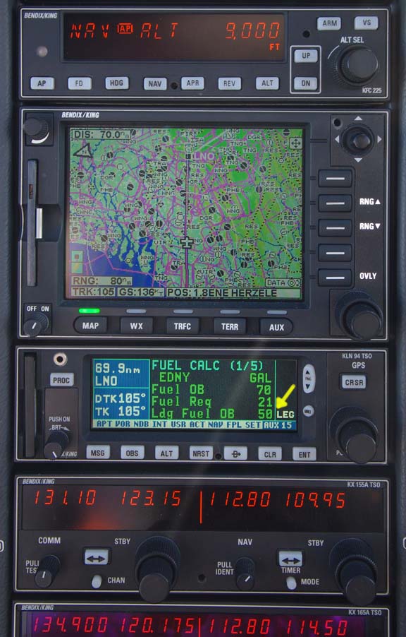
A very similar LFOB figure was computed for each leg of this trip and in both cases the actual figure after landing was within 1 USG of the figure computed at the start of the cruise section. The error between the Shadin fuel totaliser itself and the airport pump was an astonishing 0.01% against the bowser in Germany (obviously this was luck; not even the Germans are this good...) and about 1% against the pump back in the UK.
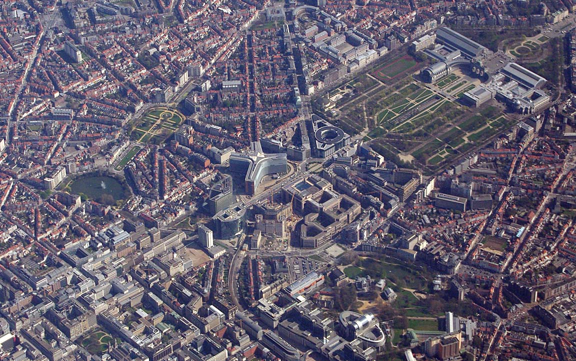
The cloud cover was often broken. This is Brussels
Otherwise, FL090 was just right...

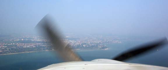
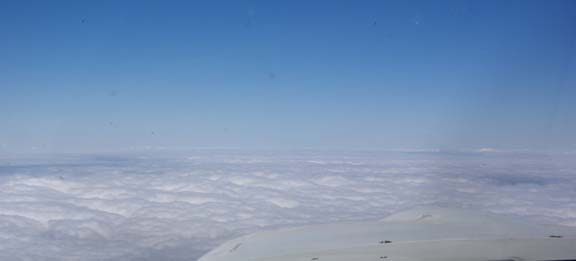
Into Germany, there was a lot of haze which meant that the Alps were never visible

I had been far too generous on the airborne time and once in cruise it became evident that we would arrive about 40 minutes before the start of the arrival slot. This was a problem because the airport may have actually been closed - for aerobatics, etc. So I slowed down to a very economical speed of about 120kt (TAS) but we still arrived way too early. Fortunately the concern about the airport being closed was unfounded...
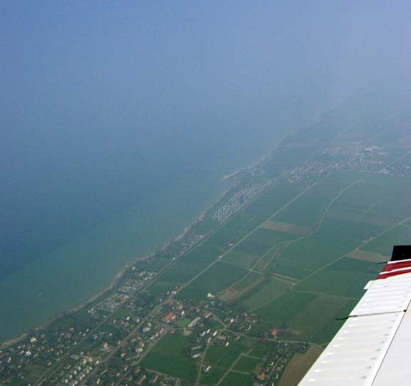
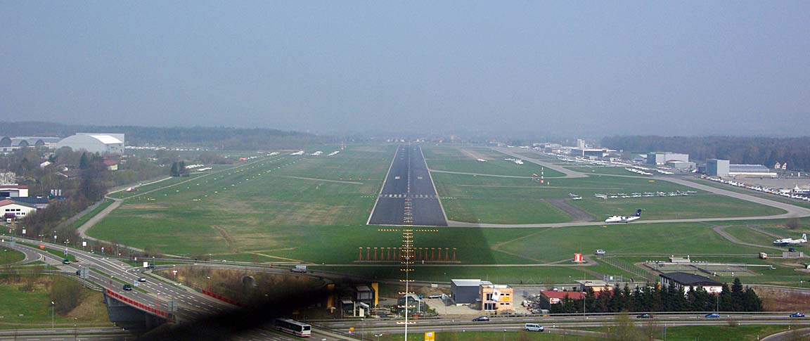
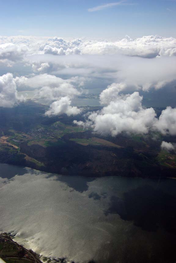
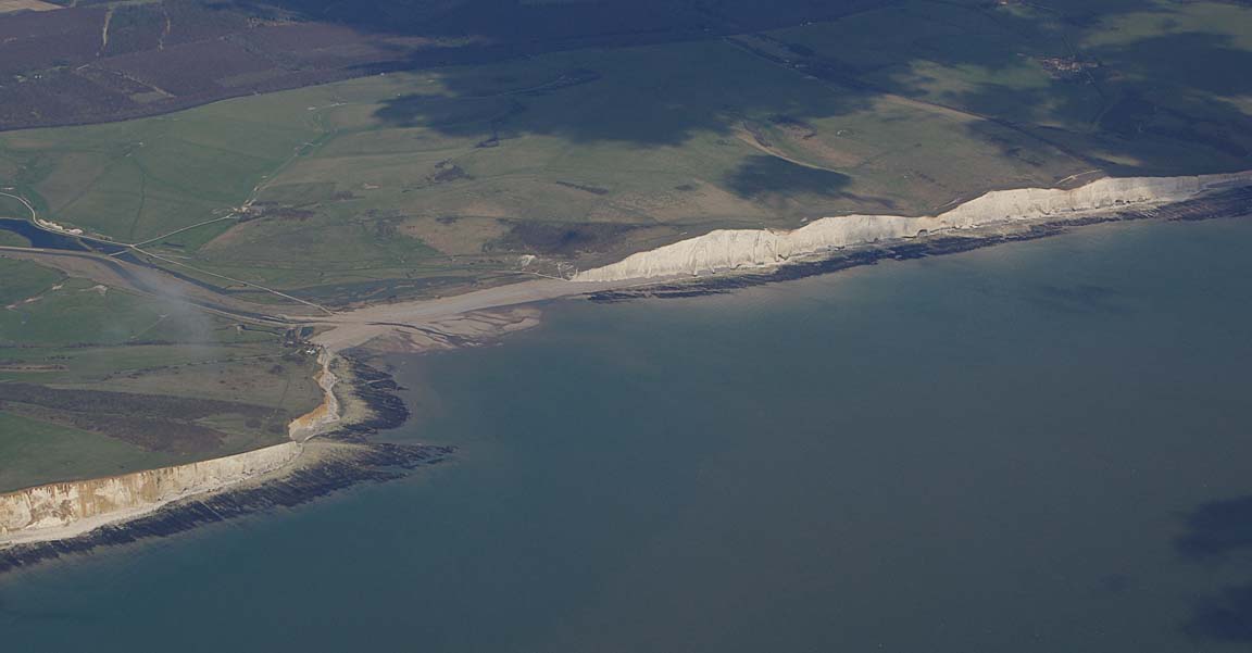
The final approach into Friedrichshafen is over Lake Constanz
The following pic shows the aircraft just before localiser intercept, at the ILS06 platform altitude of 4000ft and about 10nm to run. The HSI is driven from the #1 ILS receiver and the GPS/MFD shows the same track using the OBS mode of the GPS. The autopilot is set to intercept and track the ILS, but if this was a non-precision approach (i.e. VOR or NDB) then the autopilot would be set to intercept and track the GPS magenta line instead
For UK pilots, this ILS approach is curious in that the DME distances are taken from the FHD VOR/DME, not from an "ILS DME" which is more common elsewhere. However, this is not unusual in Germany so one must read the approach plate and not assume the "usual".
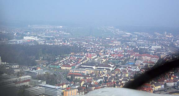
Due to the haze, the runway did not become visible until about 4nm - it is barely discernible in the following pic
This looks a bit better...
During the final approach, the ATCO made a very strange comment about my speed being "obviously close to the stall". I watch the IAS like a hawk during approaches - a failure to do this is a killer - and it was just over 120kt at localiser intercept and then never below 80kt until the flare. I suspect he did not know the difference between IAS and GS, and GS is what his radar would have been showing...
For the show, the airport employs a quantity of unconventional "follow me" vehicles...
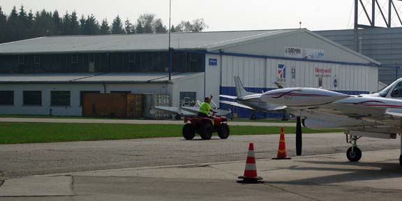
The place was noticeably less hectic than in 2007 and we were parked inside some kind of jet engine testing bay
which was really effective in blocking the wind.
I requested Avgas on the radio and the Avgas truck turned up within a few minutes. The price was at the top end of the EU price range. VISA cards were OK, but not AIR BPs.
Administration was well organised and we paid for landing and parking at the entrance. With the return flight plan filed already, there would be little to do on departure.
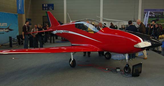
The Show
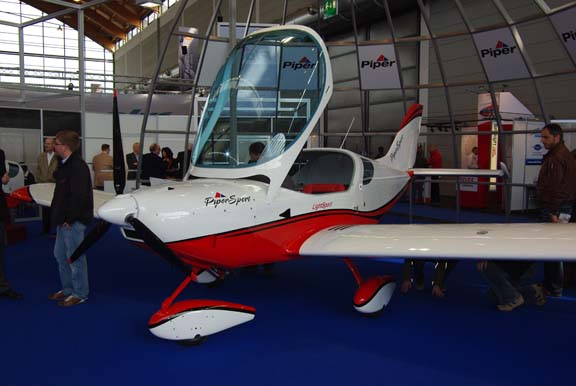
The show has something for everyone, including radio control models. In GA terms, the stuff ranges from a huge selection of "light/sports" types, most of which are sure to never make production...
through to the lighter end of certified GA
with the traditional very small selection of piston IFR touring aircraft (Mooney and some others were notably absent)
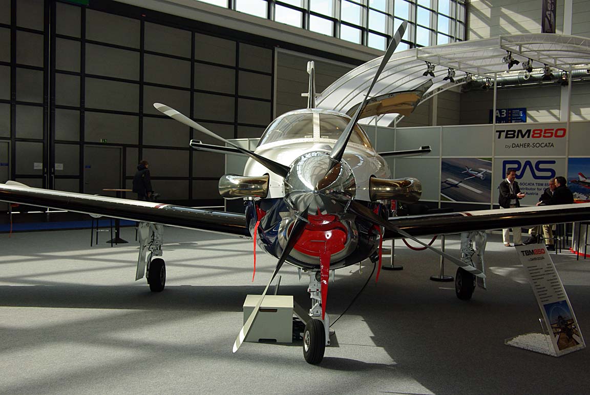
and then the usual turboprops like the Pilatus PC12 and the very nice TBM850
and finally getting to the 7-digit price tag hardware...

There were many new engine prototypes on display, but there always are... looking for someone to sink a few million into the venture.
However, very little changes from one year to the next and, as with most of these events, the value is very much as a meeting place with friends from far away...
The Return Flight
The MSLP charts for Sunday Sunday again showed a varying forecast. The SigWx showed some weather (areas 13 and 14). The TAFs concurred with a PROB40 of some rain i.e. convective weather. However, on the day it was just fine, with widely scattered cloud which could be easily avoided in the climb.
The really relevant data for the enroute section was the IR satellite image which showed nothing of relevance.
There was nothing to do administratively, as I had paid for everything after landing. As always at Friedrichshafen, a bus transports people to the aircraft almost no matter where one is parked; the airport has no real "GA terminal". The show is at the opposite side of the airport anyway so a bus is the only option. Again, this process was much more efficient compared to 2007.
The departure was also far less hectic than in 2007, when we waited for best part of an hour to get out. This could be due to a lower attendance but it also appeared that a lot of aircraft departed before Sunday. The departure clearance was collected in the traditional way. The allocated SID TRA2E was an RNAV SID - for departures to the west, Friedrichshafen no longer has any non-RNAV SIDs - but the KLN94 GPS copes with these OK because its database contains all the waypoints... in this case NY063, NY071, ENIBI and TINOX were loaded very easily.
It appears common in Germany to not receive an initial level in the departure clearance. One has to read the SID... it contains the levels (sometimes the minimum levels) to climb to. We were handed over to Zurich almost immediately after getting airborne, but as I know to my cost a pilot who doesn't read the whole plate is going to get plenty of suprises anywhere...
There was a lot of heavy cloud around but the departure track luckily avoided it without having to ask for heading changes
This time, the filed level of FL140 was only just enough to stay above it
This stuff would have been bumpy as hell had we been flying in it...

The low outside temperature provided an opportunity to test the freshly overhauled elevator trim mechanism which was found to freeze solid - right after an Annual service - quite readily at these temperatures. It was just fine this time...
This is what a lot of long range European IFR flight looks like - if you do it right! Very often it is doable as a VFR flight down below the cloud... for those willing to risk a convergence of terrain and cloudbase and a resulting turn-back. Equally often it is doable as a less picturesque but much more relaxing and suprise-free VFR flight above the cloud... for those willing to take a chance on ATC allowing a transit of what is almost universally controlled airspace. All my pre-IR long trips were done VMC on top. But nothing beats straight IFR; controlled airspace becomes completely irrelevant during the enroute section, but of course still needs to be considered if going to/from airports which lie outside controlled airspace.
An IR satellite image for 1400 (taken after the flight) showed this cloud, which seems to have developed during the late morning.
One side window became steamed-up during ground taxi and in the low temperatures airborne it froze into interesting patterns

which did not clear until about an hour later.
As always, I asked for shortcuts and this time got some suprisingly good ones. The best one was approximately from HR to REM - 157nm - which was no doubt possible only because it was a Sunday and the extensive French military airspace was inactive.
Finally, over the Channel the cloud thinned out

and the flight ended in good VFR conditions
Suprisingly although not for the first time, London Control handed me over to Shoreham while still descending through FL110.
The flight was tracked via the EuroFPL website. A few example screenshots: 1 2 3. This is a nice feature if someone on the ground wishes to monitor the progress of the flight.
This trip would have been possible under VFR but there would have been some tricky cloudbase issues along the way.
ATC were entirely professional and helpful.
The aircraft performed perfectly. Some notes on Socata TB20 ownership and operation are here.
I cannot help reflecting how good the "1990s" avionics I have are for European IFR. Replacing the KLN94 with the only realistic alternative - a Garmin 430/430W or 530/530W - would deal with the "RNAV SID/STAR" issue, at a cost of just into 5 digits. Yet, these units do not (reportedly) deal with the "transition" STARs which are appearing at some European airports (e.g. Vienna LOWW) and they introduce subtle interoperability issues with my KMD550 MFD which I want to retain for its excellent VFR mapping data.
Pilot: FAA CPL/IR, approx 1200 hours.
Any feedback, reports of dead links, corrections or suggestions much appreciated:
Contact details
This page last edited 15th April 2010
