Flight from Shoreham EGKA to Salamanca LESA, Spain, November 2014
Salamanca is a very scenic city in Spain.
This trip was planned for July 2014 but didn't go ahead then. This had an unintended benefit: the daytime temperatures in July were around +36C but now, end of October, they were a much more comfortable +25C.
This writeup is a simplified version of my normal ones in which I go into a lot more detail of each trip.
Pilot
FAA CPL/IR, JAA/EASA PPL/IR, ~1800hrs.
Aircraft
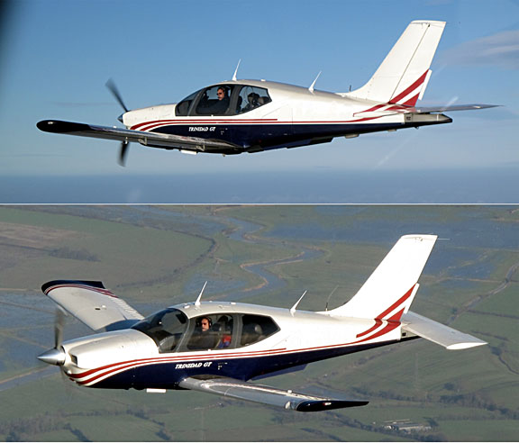
The aircraft is a 2002 TB20GT
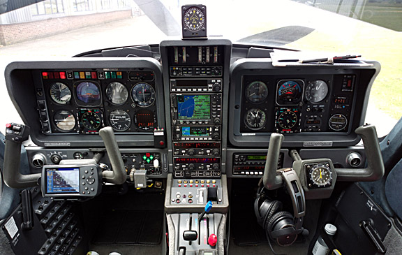
It is equipped for BRNAV (RNAV 5) and can fly ILS and GPS/LNAV approaches using the autopilot. This is sufficient for all practical European IFR flight.
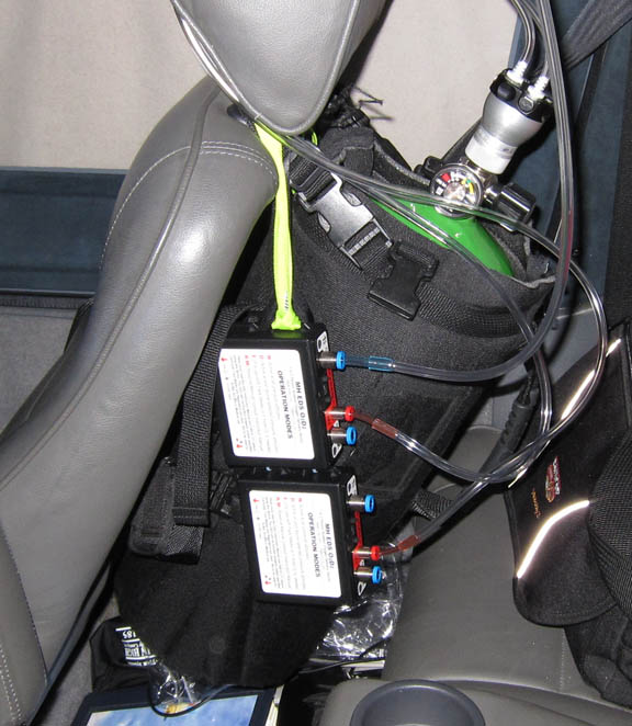
Oxygen is used on all IFR flights, with the Mountain High O2D2 electronic regulators and cannulas
European IFR is only marginally feasible without oxygen, due to the minimum practical Eurocontrol routings. This trip was filed at FL100-110, which is OK for legal non-oxygen flight (although after a few hours most people will be very tired), but I had to climb to FL130 to stay above convective weather.
Routes
Salamanca has Customs so can be flown to directly from the UK. There is a prior notice for Customs of about 2 hours.
The routes were developed and filed using the EuroGA autorouter.
FL100
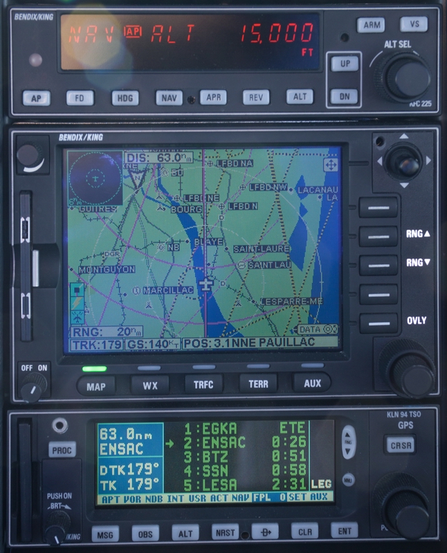
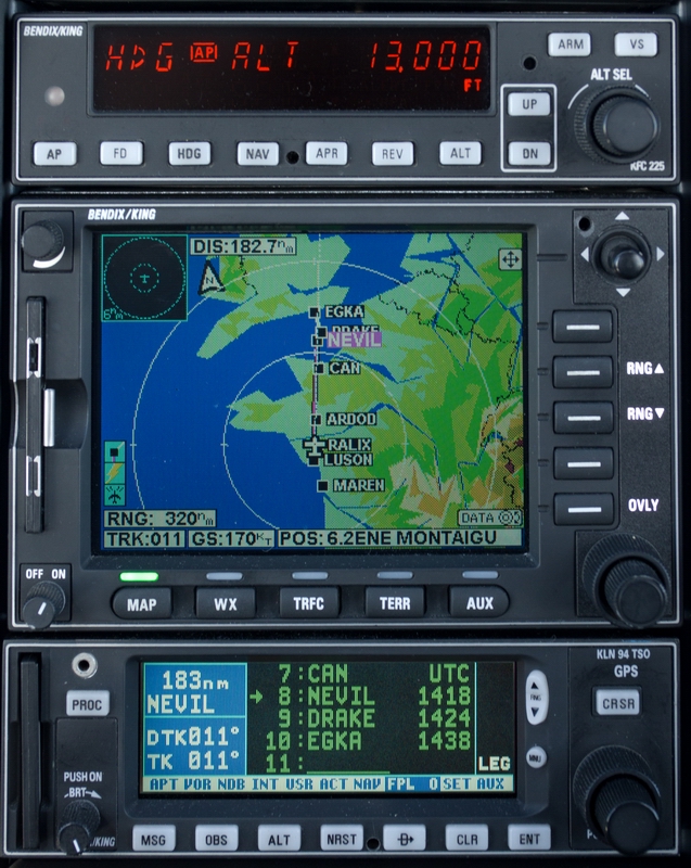
EGKA F040 DRAKE DCT NEVIL DCT CAN DCT BULOX DCT ARDOD DCT RALIX DCT RL
DCT MAREN DCT ASKAN DCT BRS DCT OSGOT DCT URUNA R10 SSN B190 DGO G52 NEA G52
ZMR/N0152F100 DCT BBI LESA
FL110
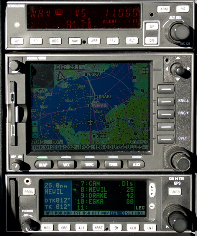
LESA ZMR G52 CUCAS G52 DGO B190 SSN R10 URUNA DCT OSGOT DCT BRS DCT ASKAN
DCT MAREN DCT RL DCT RALIX DCT ARDOD DCT BULOX DCT CAN DCT NEVIL DCT DRAKE EGKA
Weather
The weather was chosen to be very good. There is no point in going to a city
for sightseeing purposes in bad weather ![]()
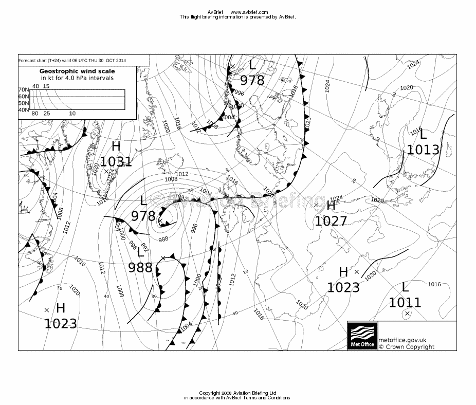
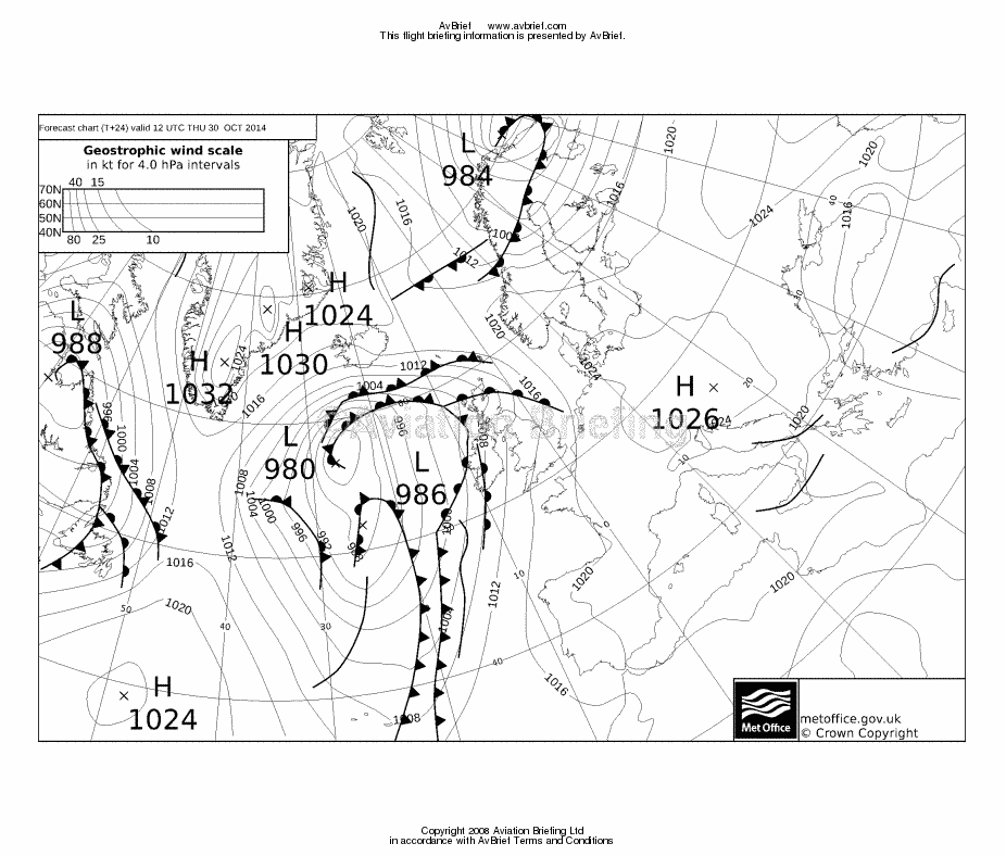
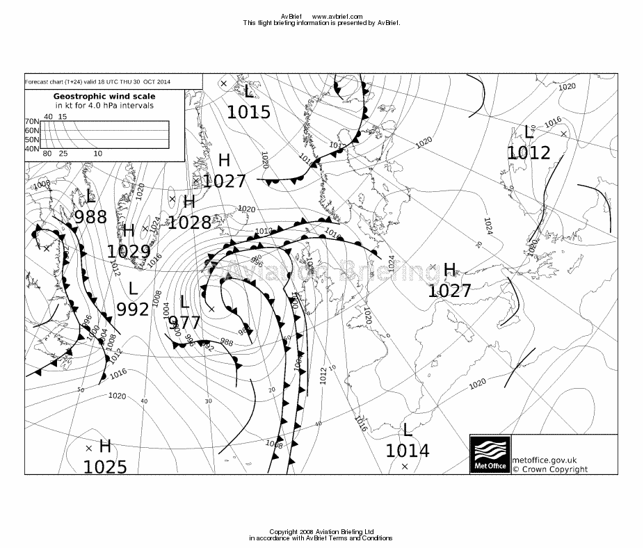
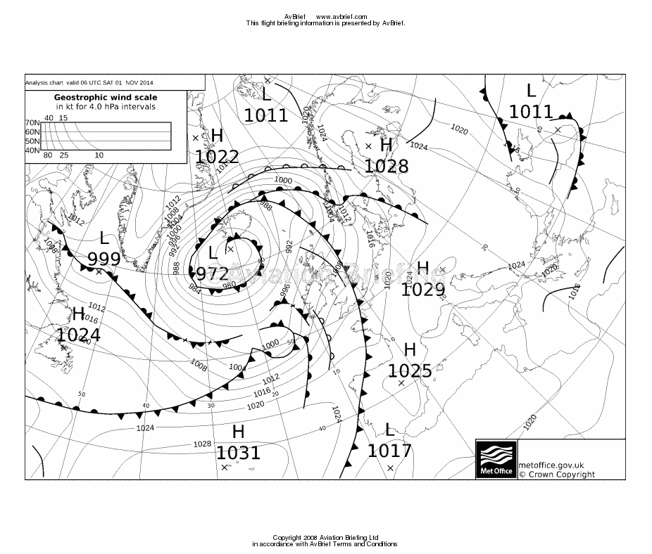
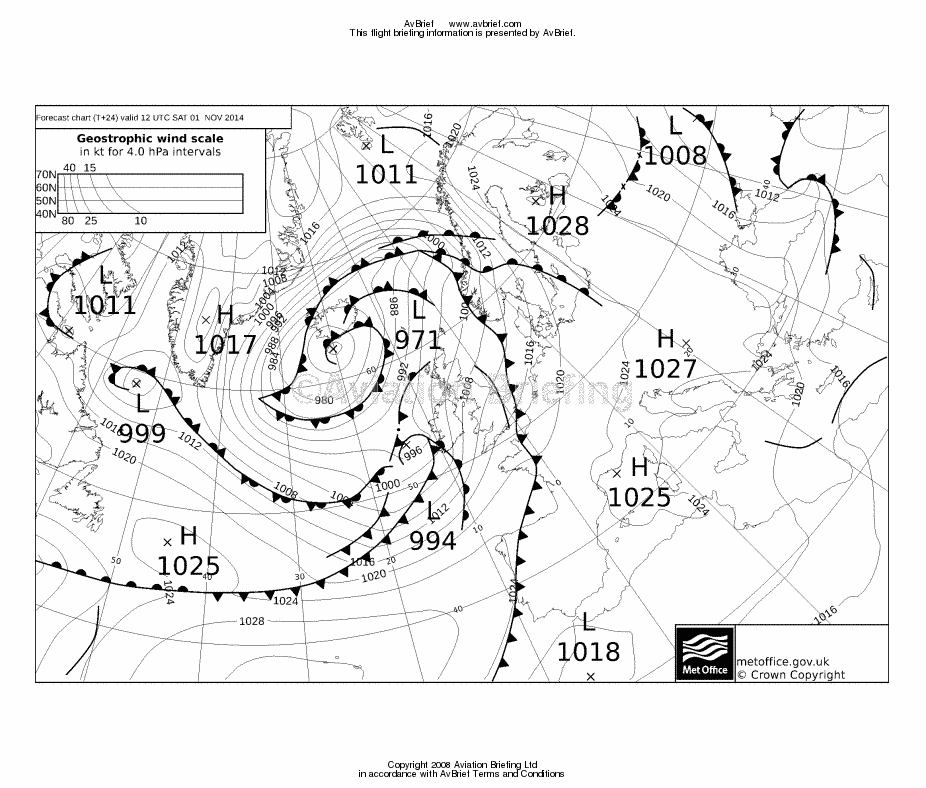
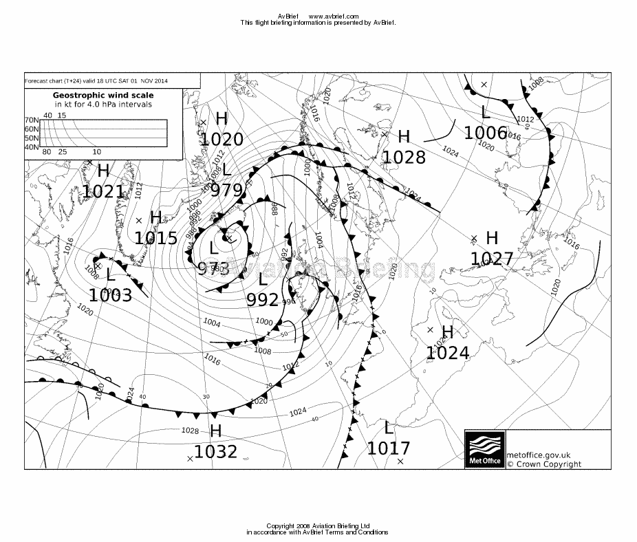
The 0600 1200 1800 MSLP charts for the outbound leg were clean. The charts for the return route, 48 hours later, indicated bad weather was on its way but that it would not arrive until later.
The TAFs & METARs were clean.
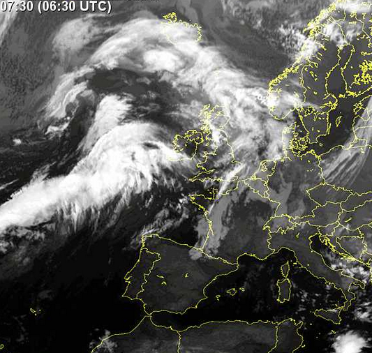
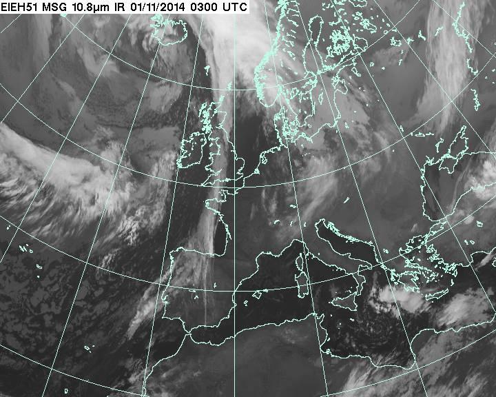
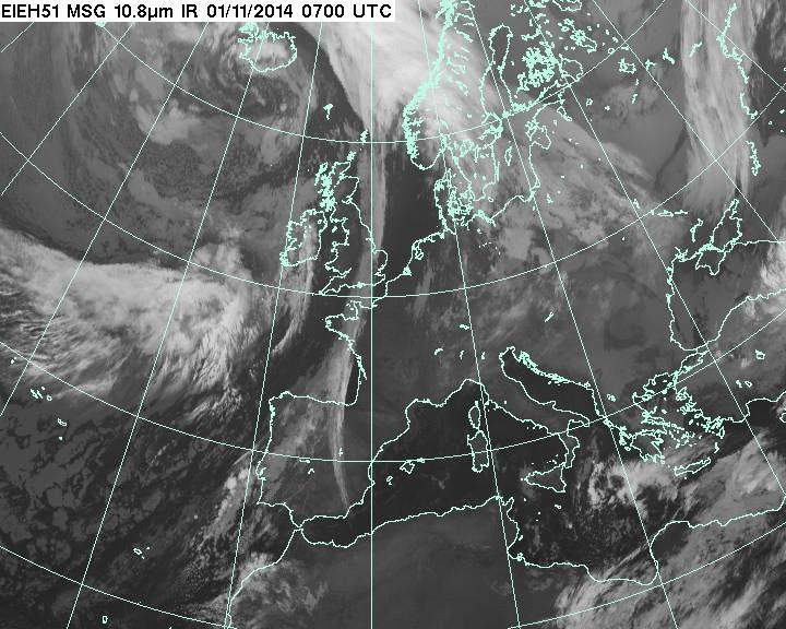
The IR image indicated some high cloud enroute but the grey shade indicated the tops would probably be around FL150 so within the TB20's altitude capability. It did also indicate high cloud close to the departure area. Another IR image confirms the very high cloud there. However, it would be possible to climb up underneath this, on the way to France, while keeping below the 0C level (about FL100) and with no terrain affecting the lower level route.
The radar image showed some stuff in a different position; this time to the left (east) of the route.
The wind forecast showed light (almost indeterminate) winds for the outbound leg and a good tailwind for the return leg.
The return weather, for 2 days later, was possibly a problem but the option was left to return after just 1 day if necessary.
Airport PNR/PPR
Salamanca is approximately 2hrs PPR for Customs. This is due to the police who need to check the passports of anybody arriving from or departing to a non-Schengen country. Since some southern European countries I have been to are known to enforce this totally strictly - to the point of refusing a landing clearance if they cannot find the notification on the correct desk, even if the policeman is sitting right there at the next desk - I did not take any chances, and asked a Spanish speaking colleague to translate an email, which was sent to several published email addresses (and fax numbers) for the airport. I received an email reply which asked for the flight dates and times, and then received the permission to fly there.
An extra dimension is that Salamanca has a military side to it and such airports can be problematic. I recall going to Hania in Greece which needed 5 days' notice for both arrival and departure, which borders on the ridiculous because one cannot forecast weather that far ahead.
Outbound Flight
There was a bit of fog around in the morning and lots of dew. The aircraft cover was soaked and I got soaked wrapping it up… Normally the aircraft is hangared but for an 0800 departure it has to be left overnight, and I wanted to depart early to get the maximum time at Salamanca in case I had to return the following day.
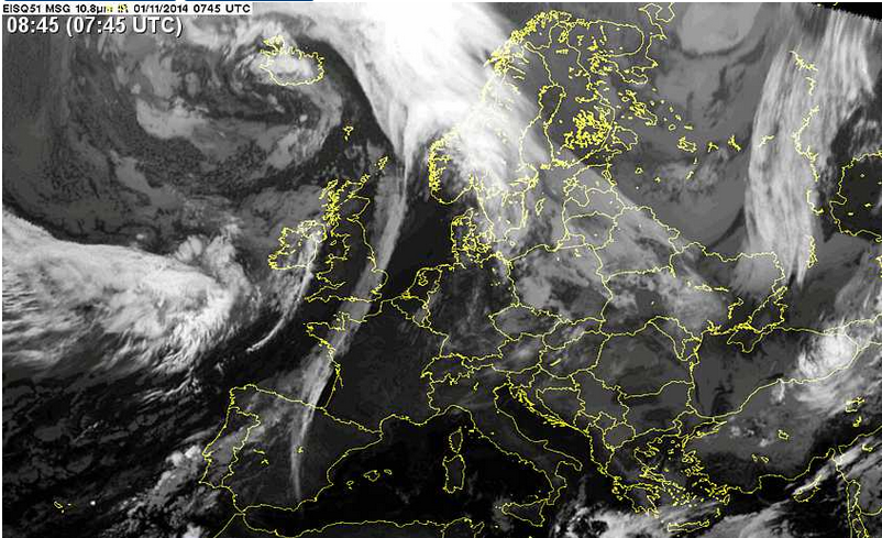
The flight departed 0800Z and a subsequently saved 0900Z IR image
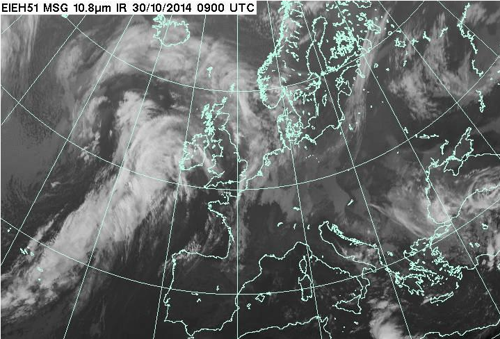
shows that the higher cloud had moved to the east, which is exactly what was found on the flight. This shows the band of weather to the left
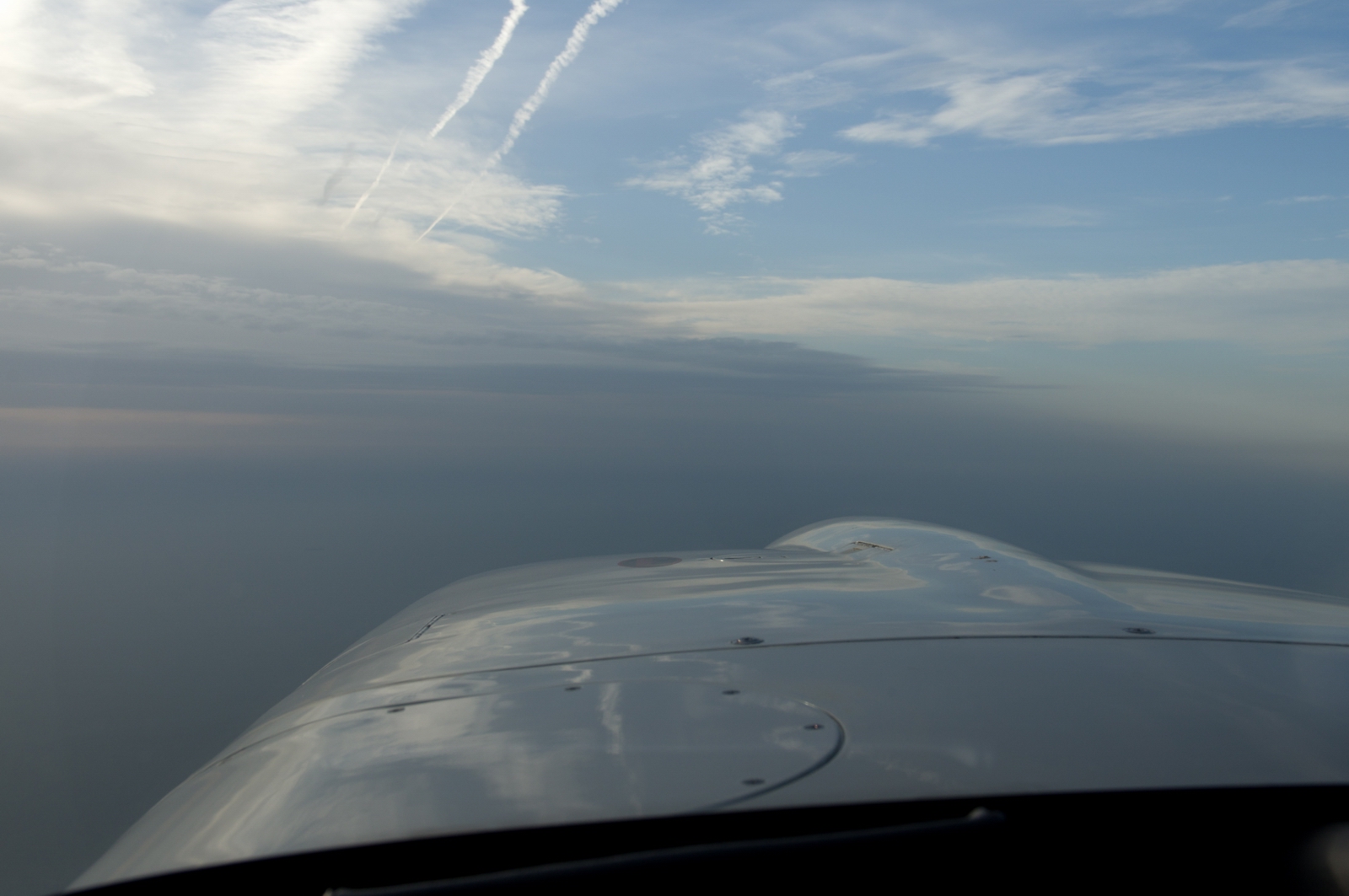
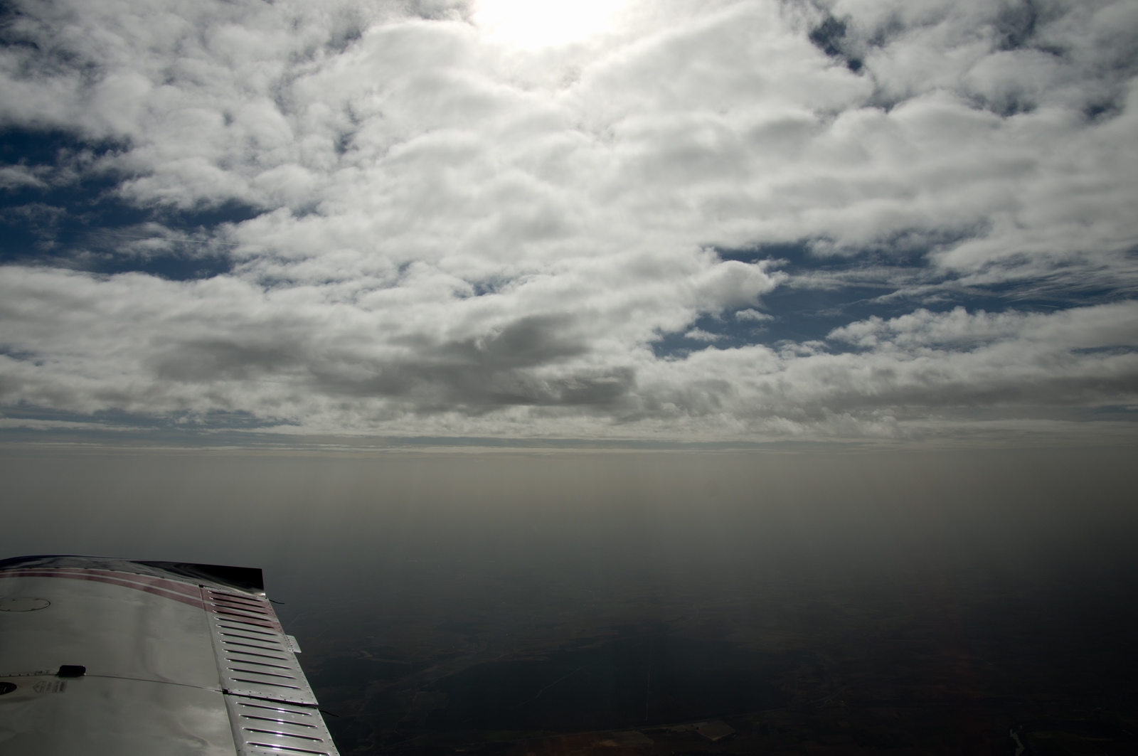
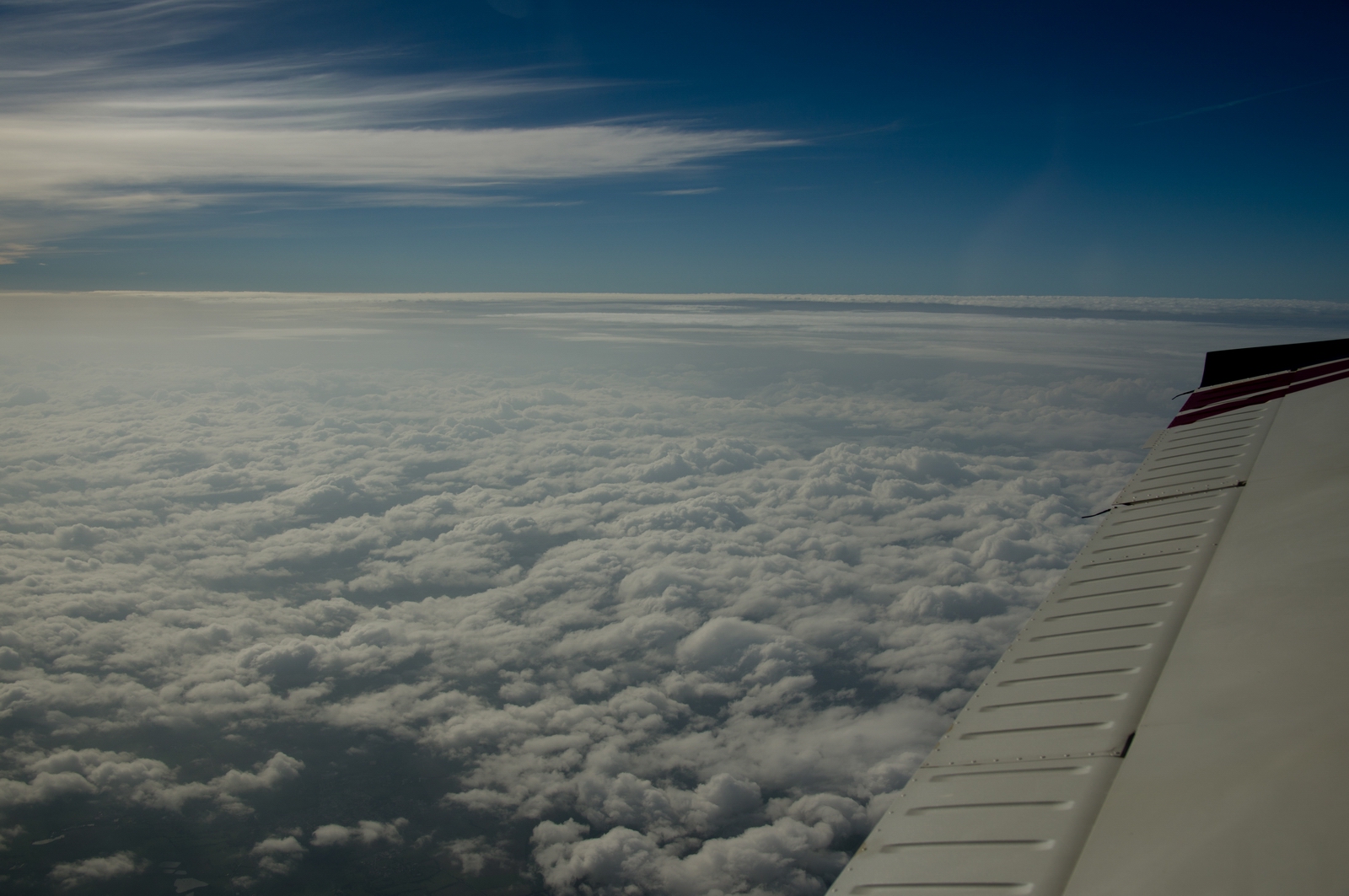
This looked pretty good and it's always good to see clear blue sky ahead at an angle which can be outclimbed
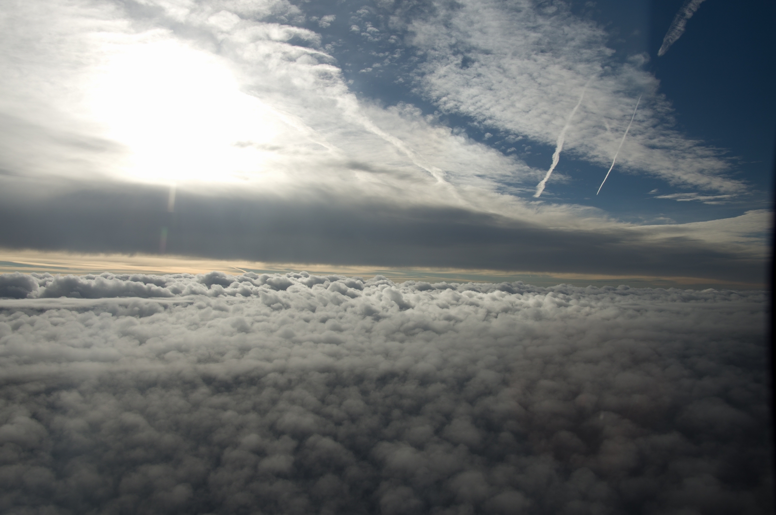
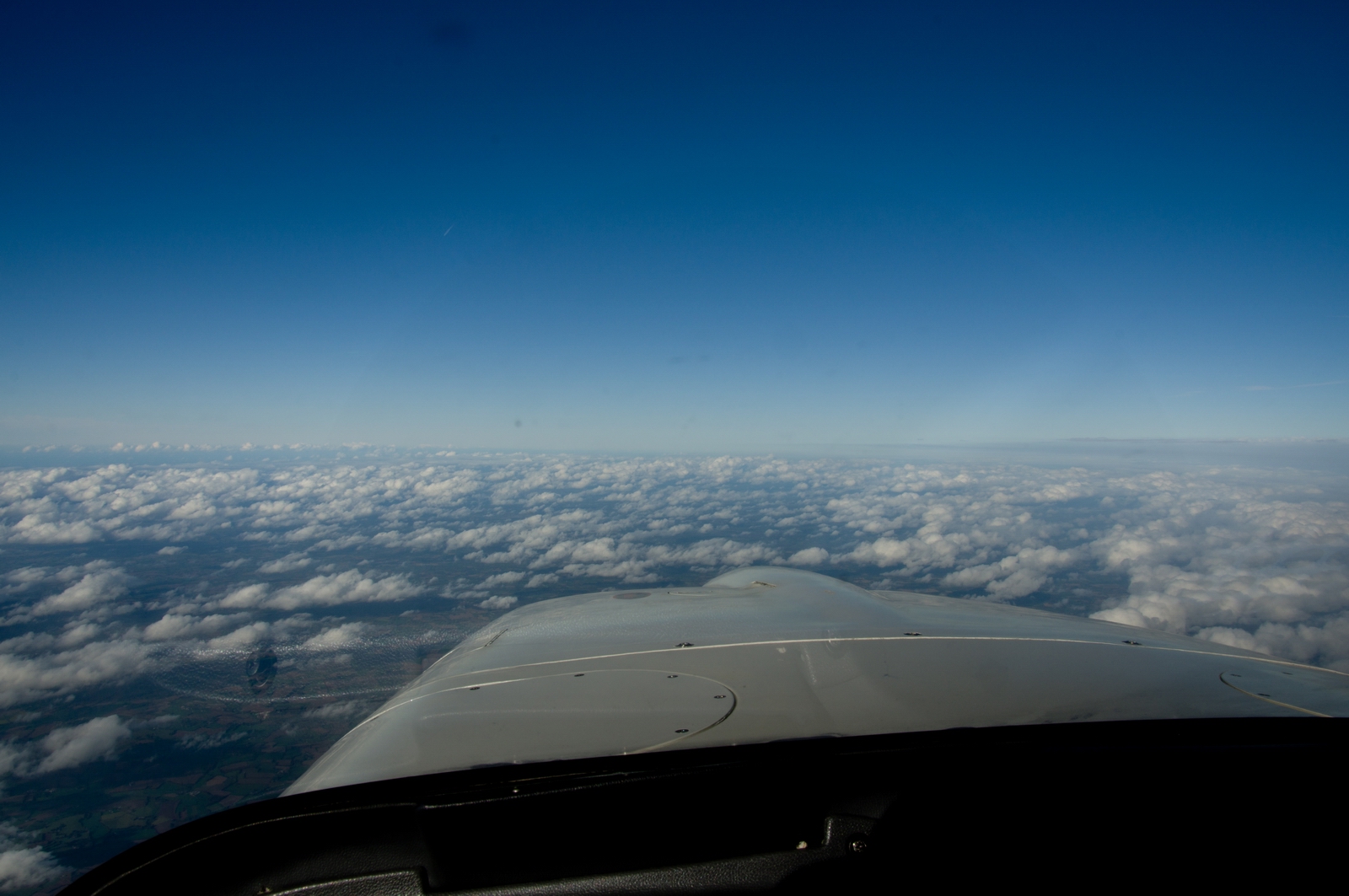
Most of France was crossed just above a layer like this, and a climb to FL150 did the job fine
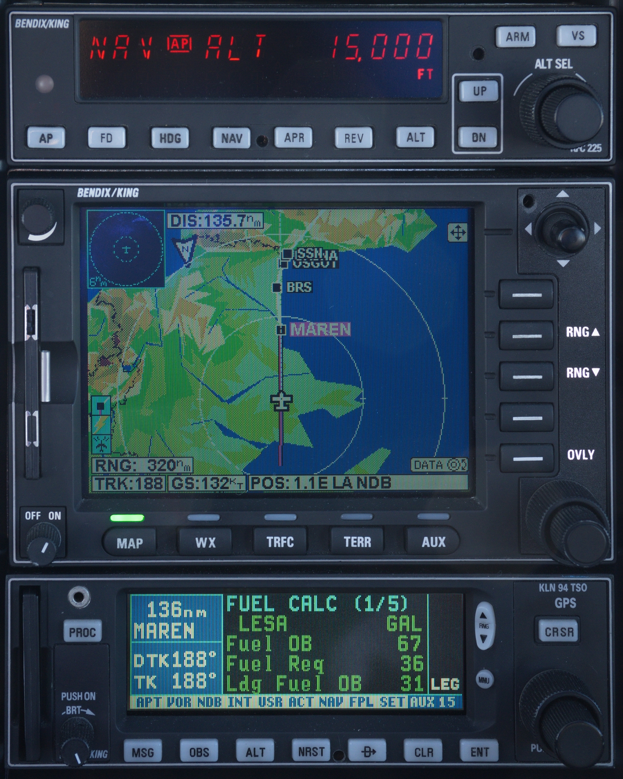
I got a shortcut to MAREN of about 260nm. The LFOB turned out to be spot on; I landed with 31.4 USG – enough to fly on to somewhere in Tunisia, at least...
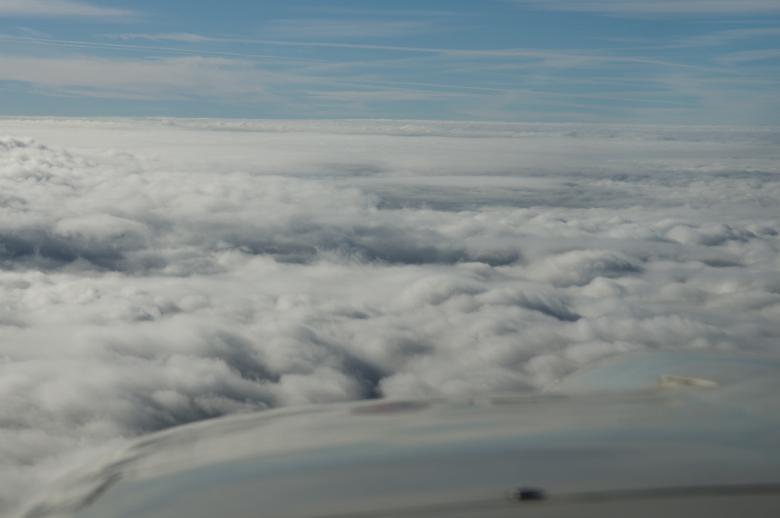
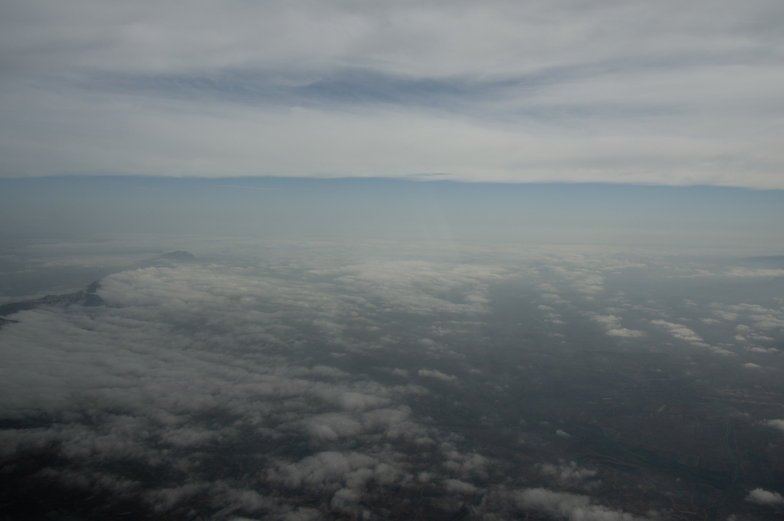
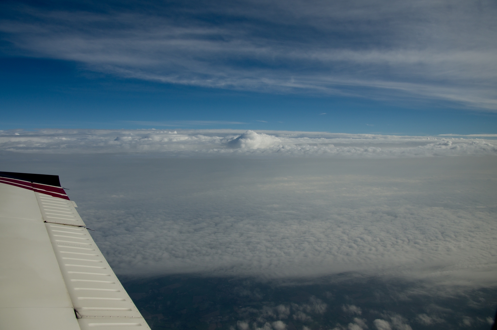
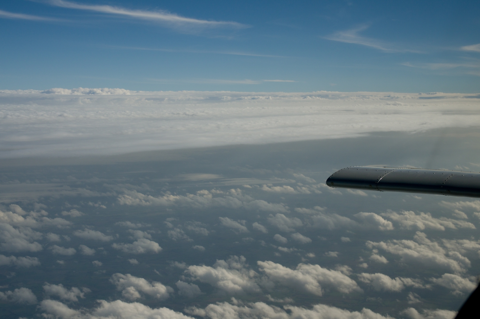
Later it opened up a bit

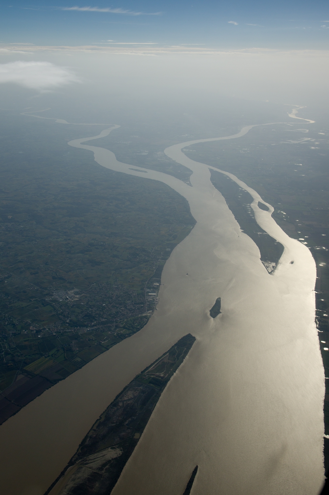
We are flying over the infamous Les Blayes nuclear facility whose prohibited area extends about 1000m (3200ft) above the ground. At FL150, not a problem. The ground speed of 140kt indicated virtually no wind
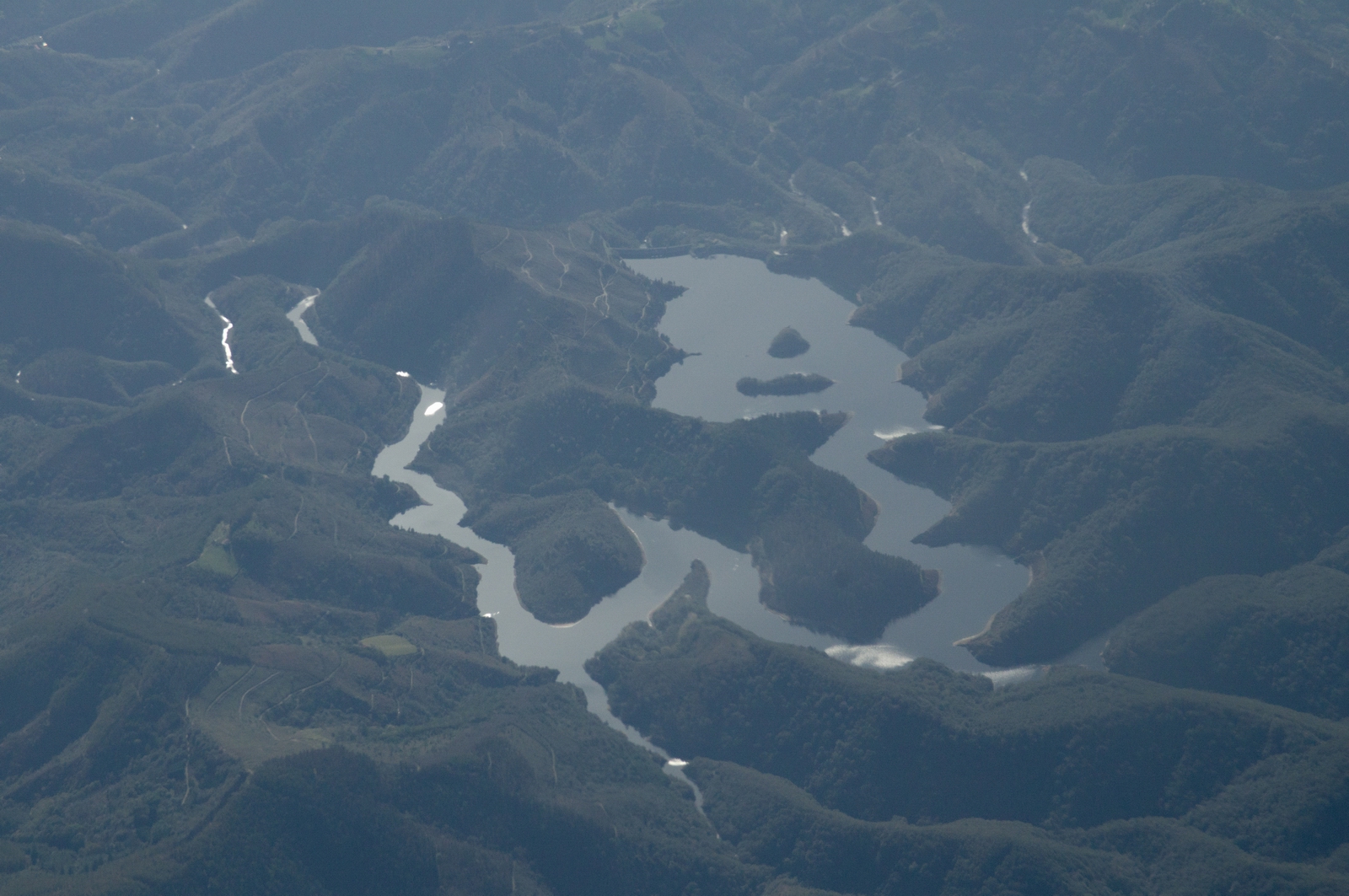
The upper 2/3 of France is not particularly scenic from the air, but there are exceptions
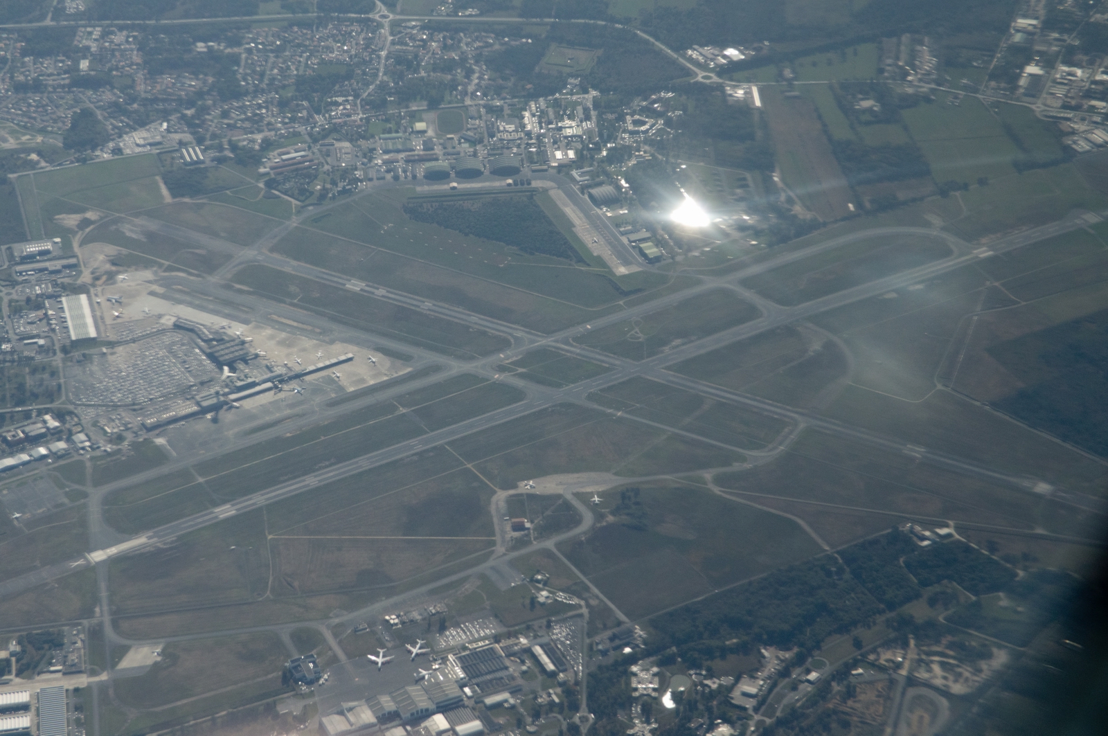
Bordeax airport
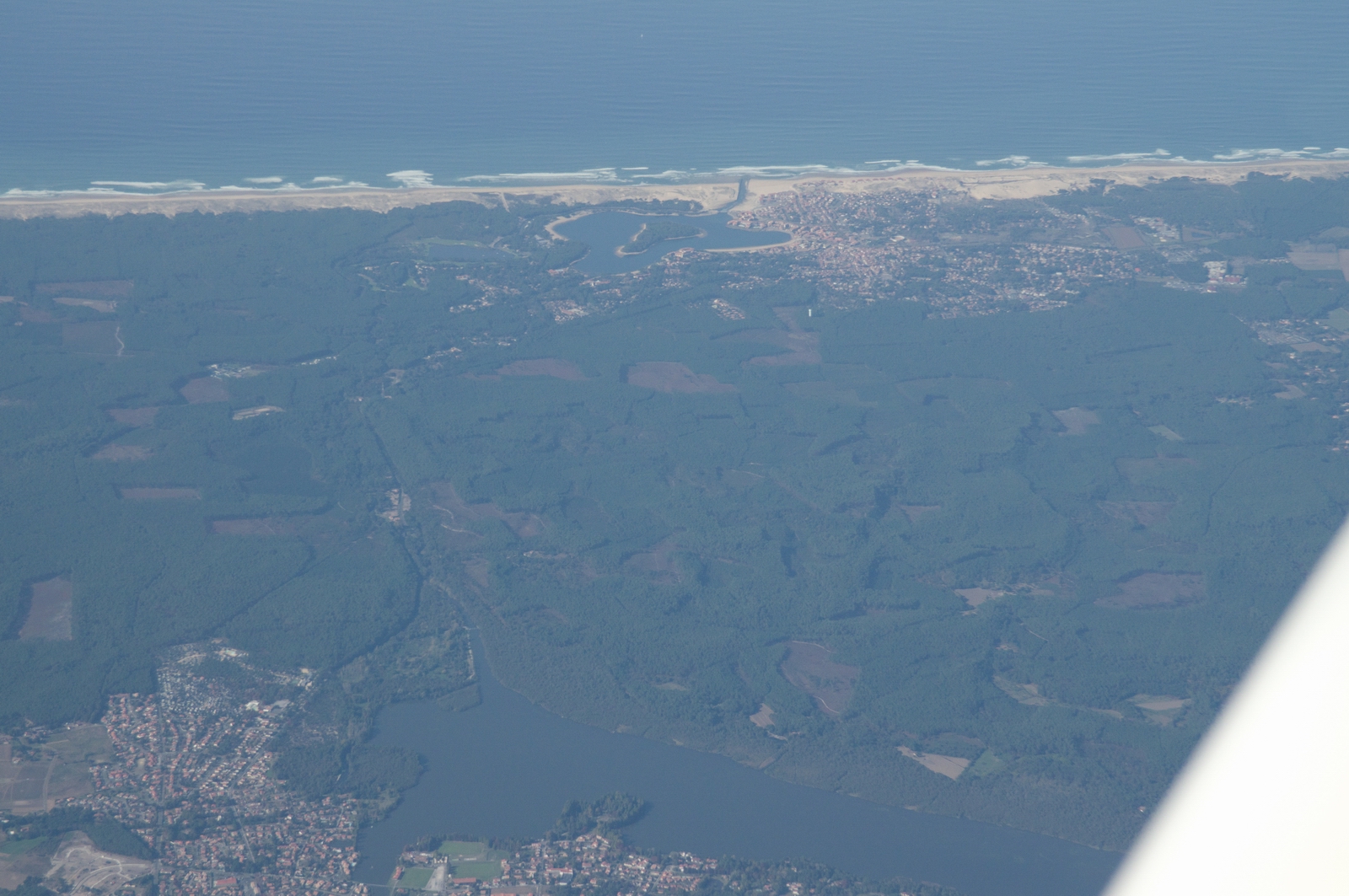
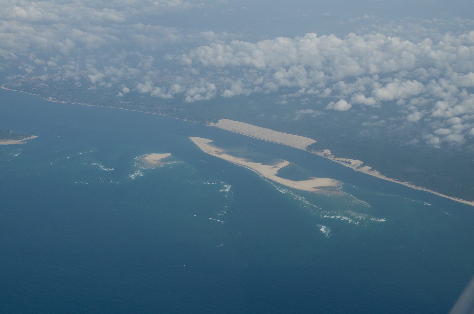
The long straight beach on the west coast of France. My first ever holiday
(1983) was there, with a bunch of "mates", on a camping ground full
of Brits, in the woods. I don't remember much about it, despite considerable
efforts at the time to make it memorable... ![]()
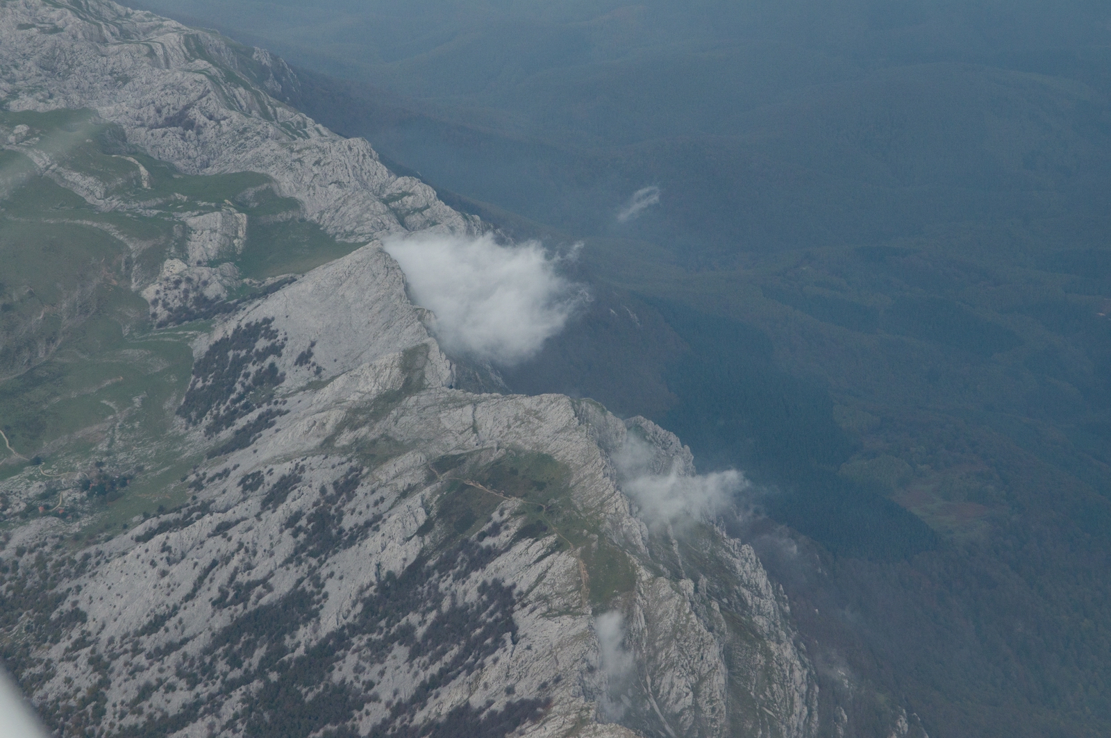
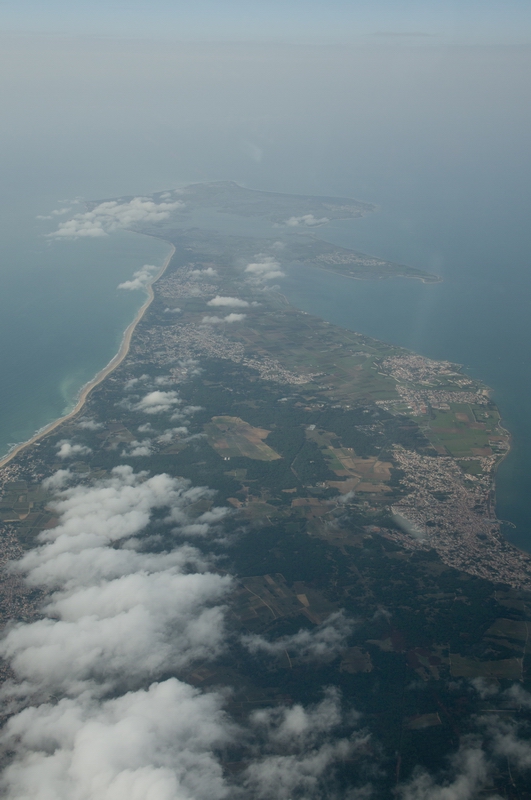
We are just crossing over a small bit of the Pyrenees into Spain
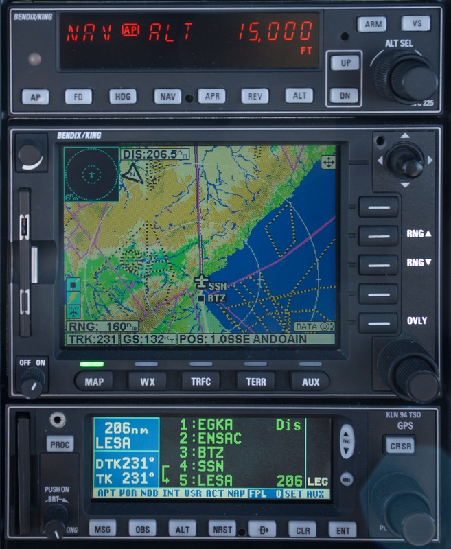
BTZ is Biarritz and SSN is San Sebastian
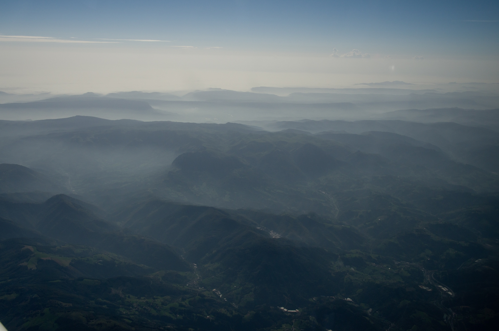
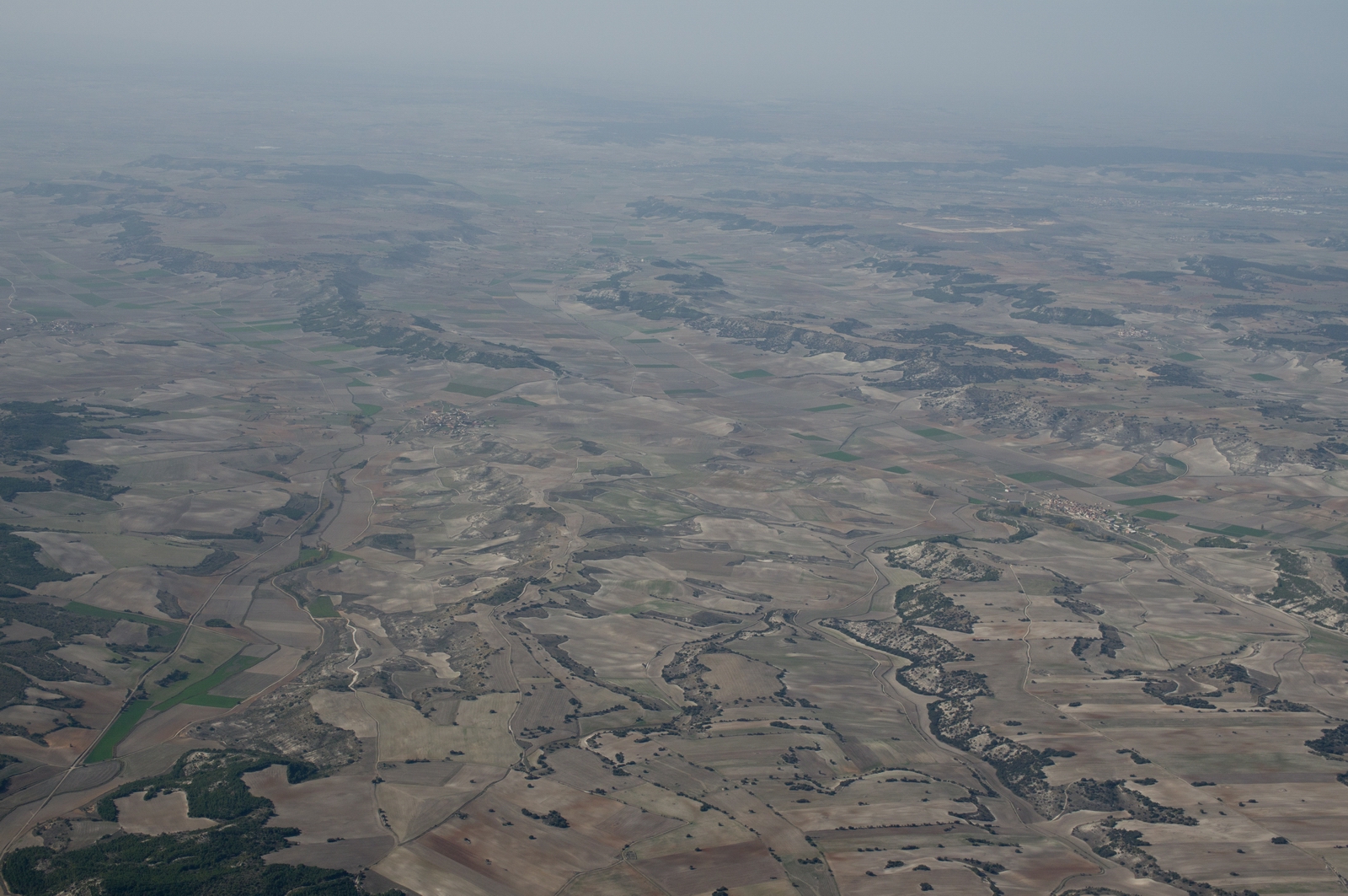
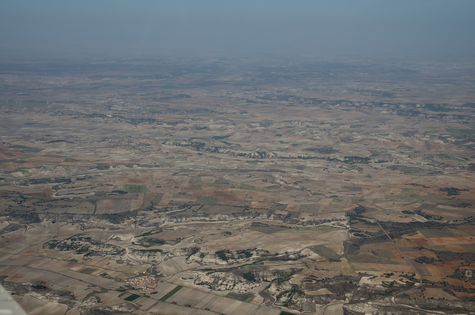
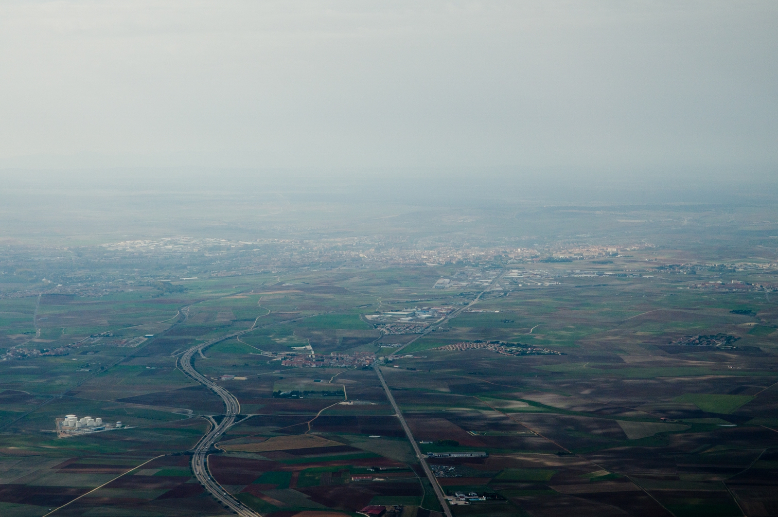
The first part of Spain is green
but it quickly becomes barren - perfect for shooting the 1960s spaghetti westerns
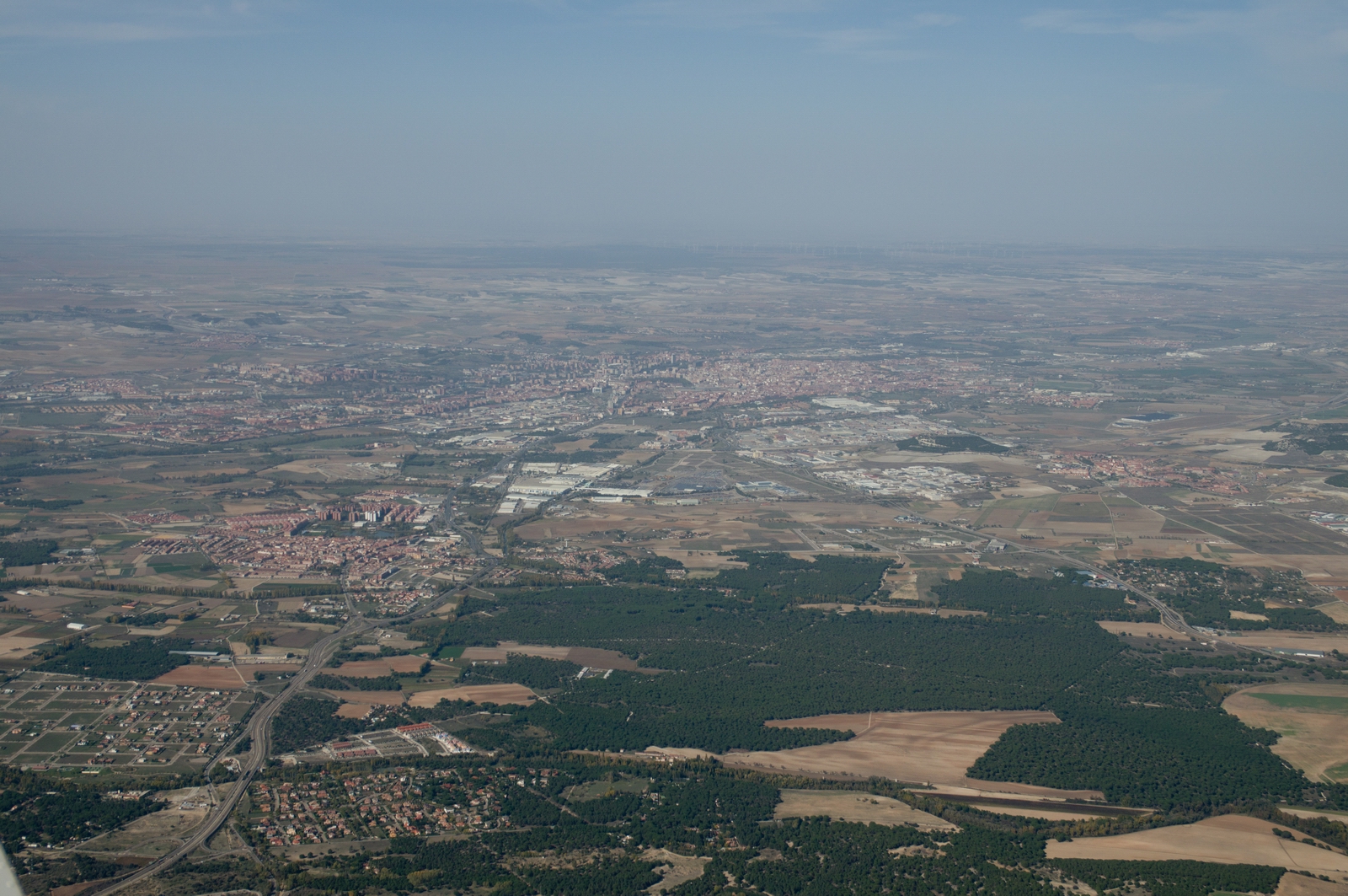
Valladolid
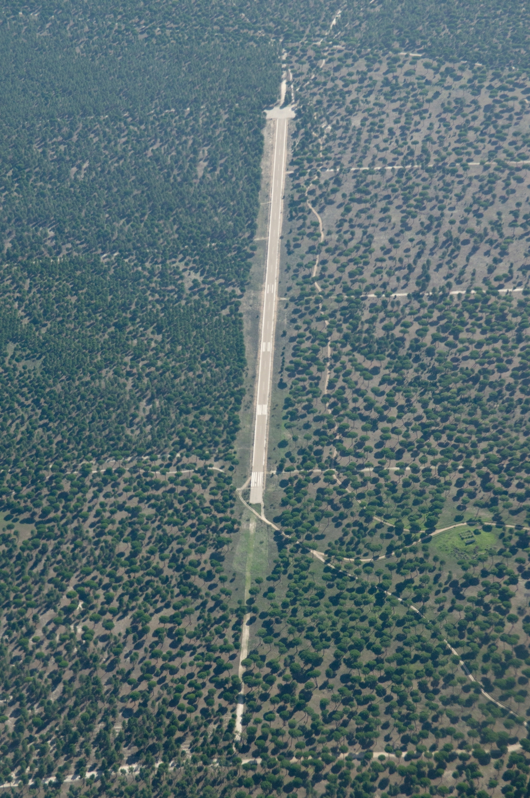
A mystery runway in the woods, not shown on the chart. Apparently these are used to support firefighting operations, and are distinguished by a total lack of infrastructure on the ground
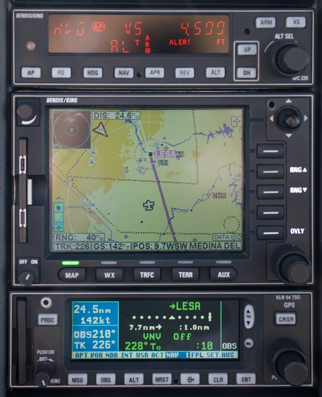
After ATC checking that I was visual with the ground, I was cleared for a self-positioned intercept of the ILS which was nearly straight-in. The magenta line is from the GPS (in OBS mode) which is set up to represent the localiser, for extra situational awareness and a gross error check. This pic is just before a sharp right turn towards the localiser
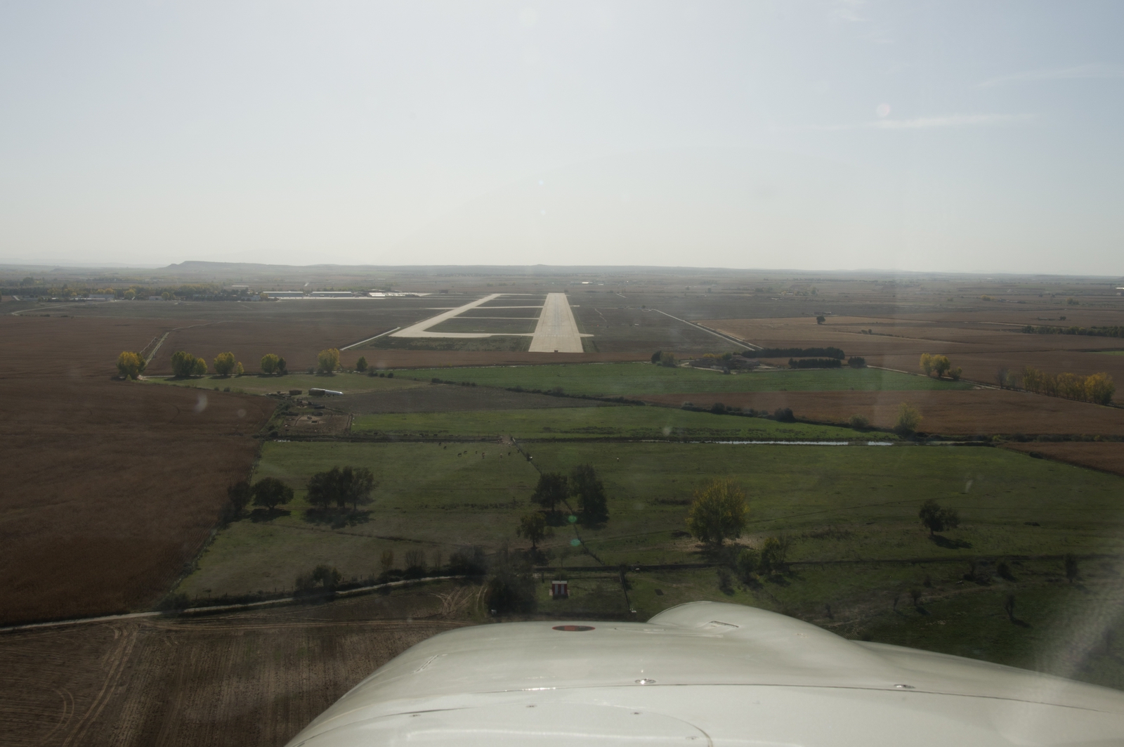
Final approach into Salamanca LESA
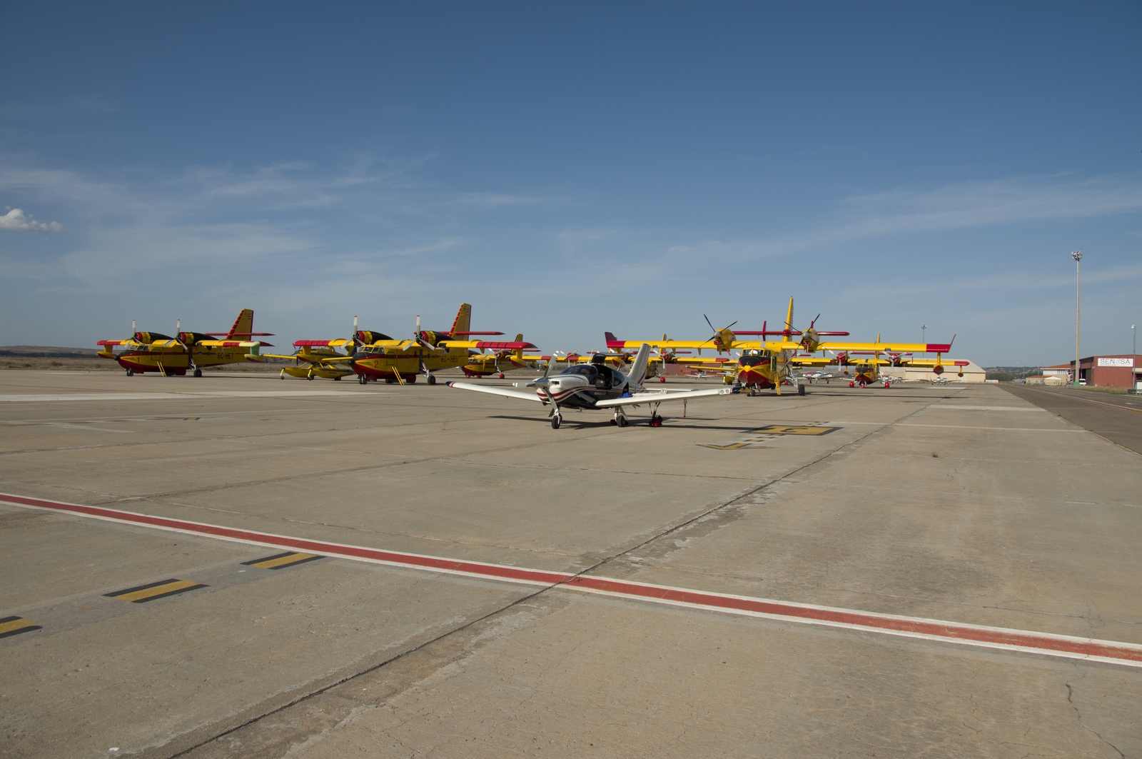
The yellow firefighting aircraft can be seen behind my TB20
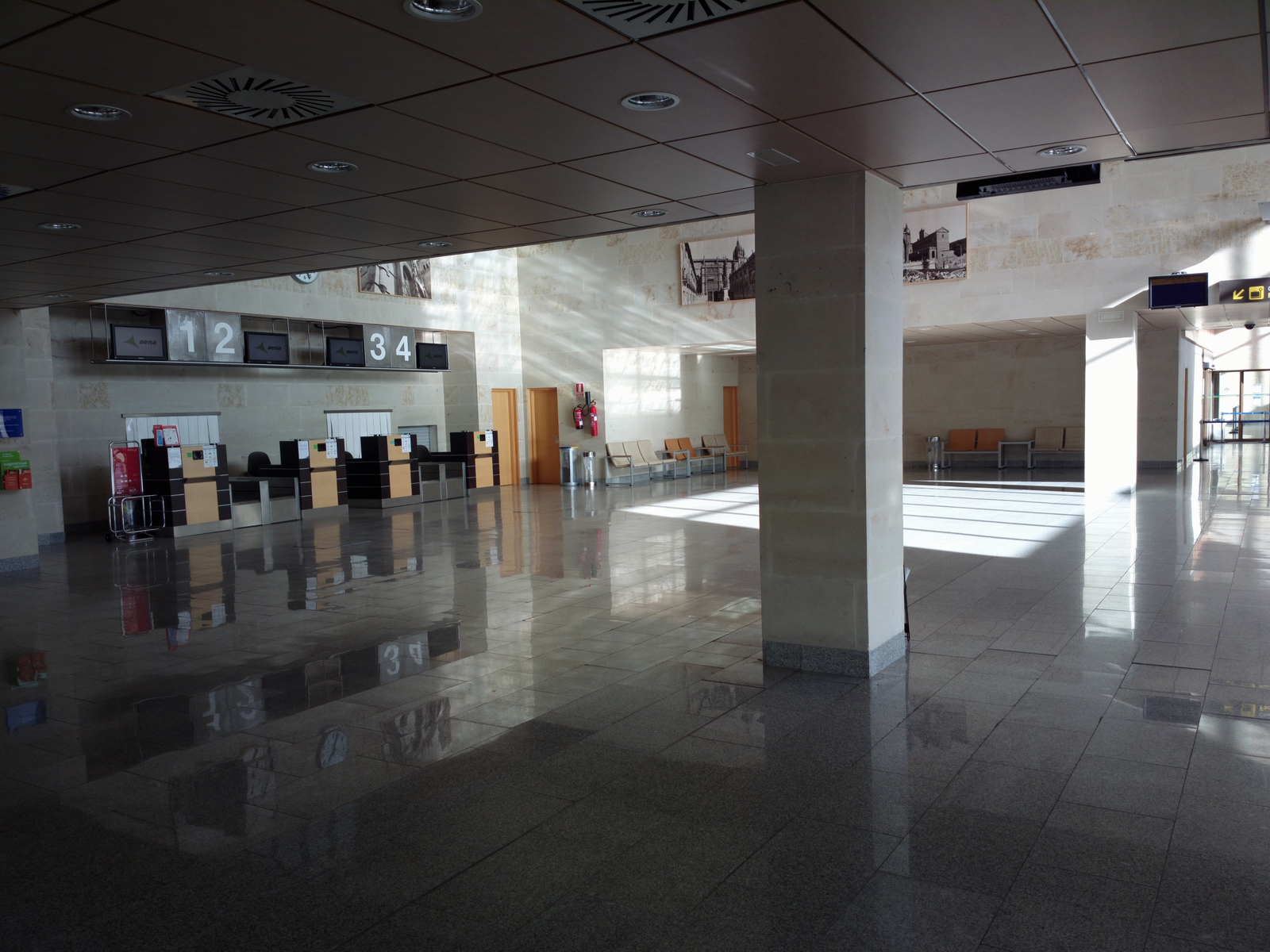
There is a flying school there which showed zero obvious aviation activity, especially for a weekday (Thursday)
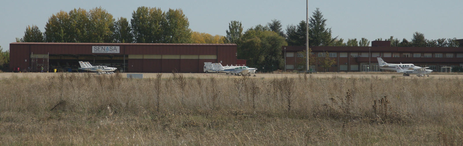
but there was even less activity elsewhere at the airport
ATC told me where to park but anything else led to a statement that they are not responsible for civilian operations, so I was left to discover how to get avgas, and how to get out of there. I found two students of the school hanging around (both from N Europe and they spoke English) who gave me a phone number of Operations, but they spoke almost no English.
Eventually, together with more hand gestures with two more employees of a helicopter firm, I was able to make the request for avgas and a bowser turned up. The fuel (Visa or Mastercard) was €2.90/litre which is high but not abnormal for southern Europe...
Then I had to get out of the airport. I did earlier notice two men in uniforms
at a distance and wondered if they were waiting for me. They were certainly
watching me with interest, and I was hoping it wasn't my legs ![]() Another difficult phone call to Ops showed they were indeed the police and had
been waiting there for over an hour... They checked my passport and drove back
to wherever they were based.
Another difficult phone call to Ops showed they were indeed the police and had
been waiting there for over an hour... They checked my passport and drove back
to wherever they were based.
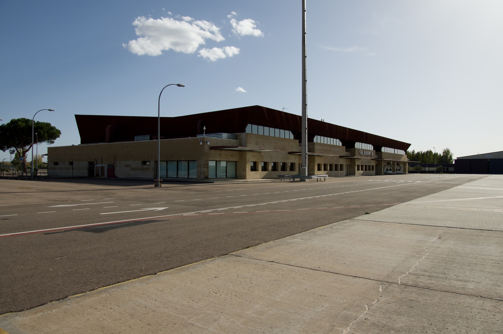
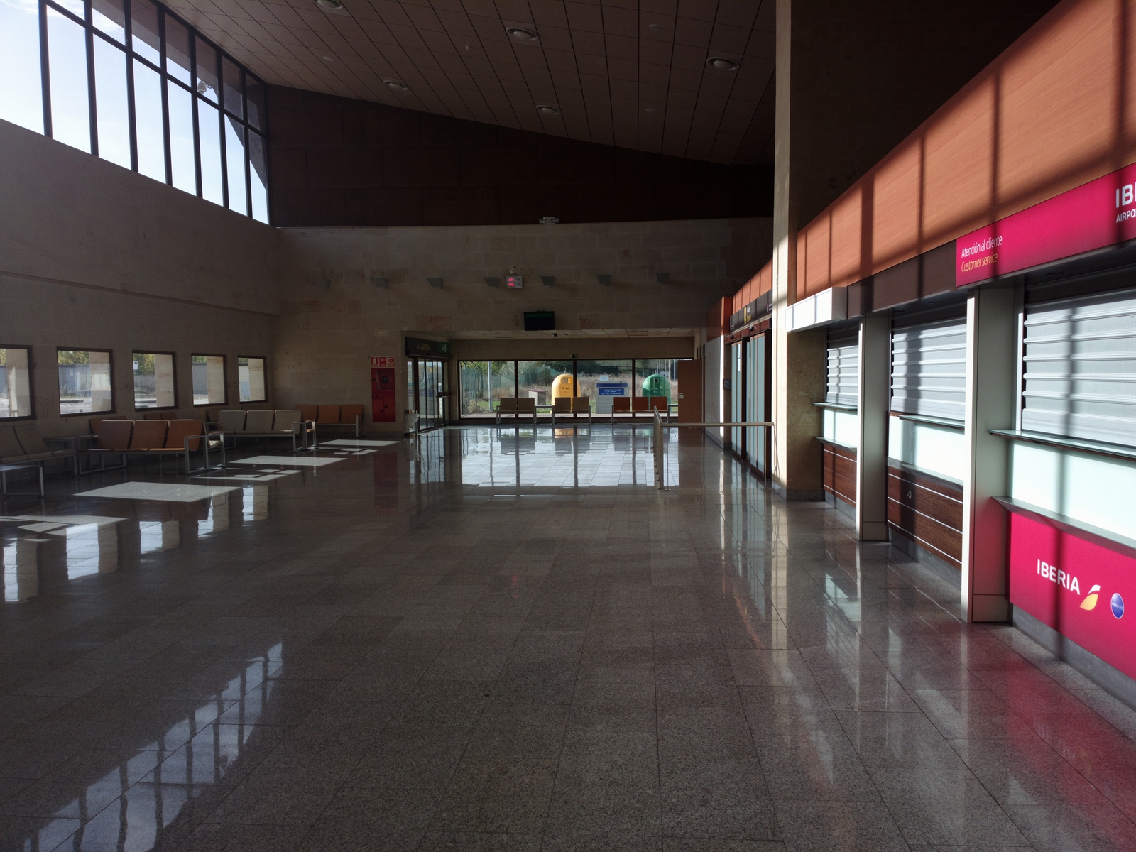
I then tried to get a taxi but there was not a single live person in the main building (shown above). Eventually the Ops guy came downstairs and we had a "discussion" about how to get out of there 2 days later. The airport opens 1000Z but Ops start at 0700Z, which should give me enough time to pay up and get out to the aircraft. He also phoned up a taxi for me, which came to €25.
English is not widely spoken in Spain outside the tourist areas, but I knew that in advance from previous trips (where e.g. even the tourist office didn't have a single English speaking person)... and at least everyone was friendly.
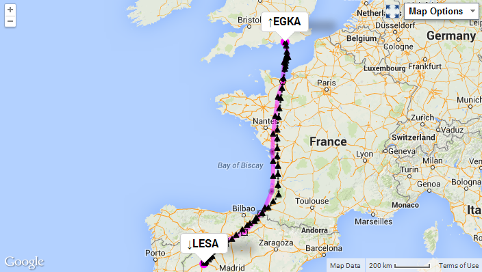
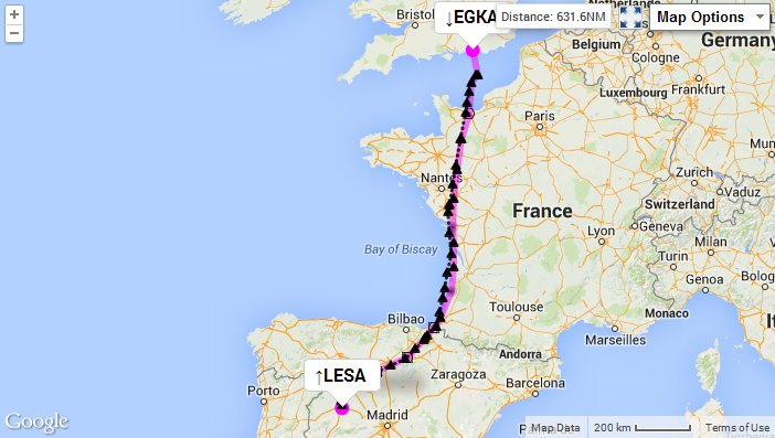
The route actually flown is shown in black:
Salamanca
I stayed in the Eurostars hotel which was very good. It wasn't dirt cheap but there is no point in sleeping rough if one has to fly afterwards...
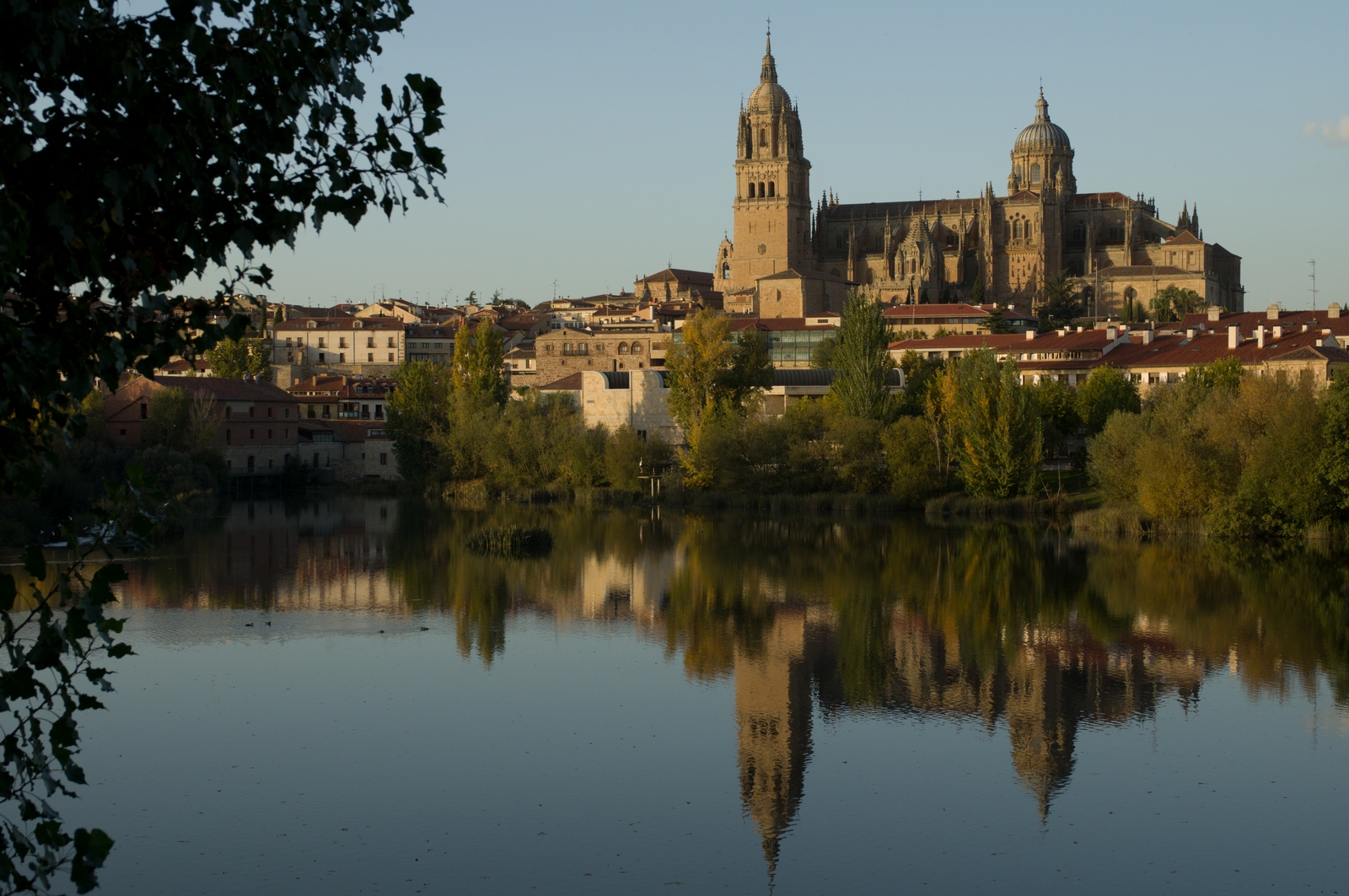
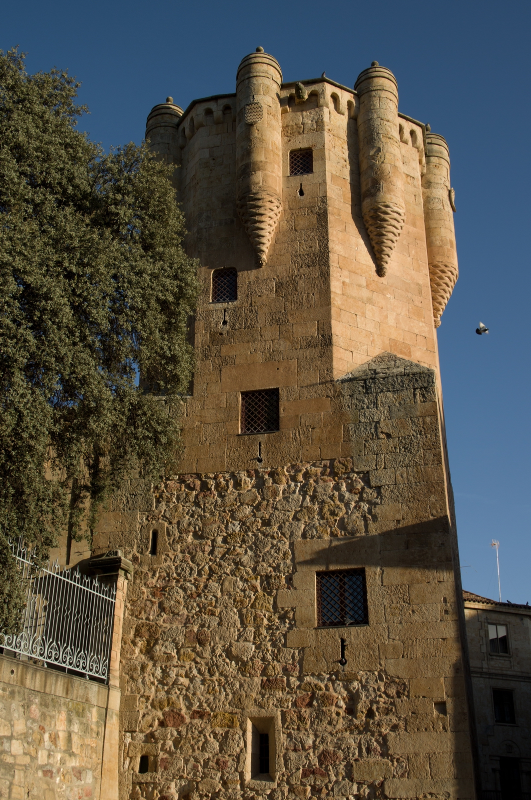
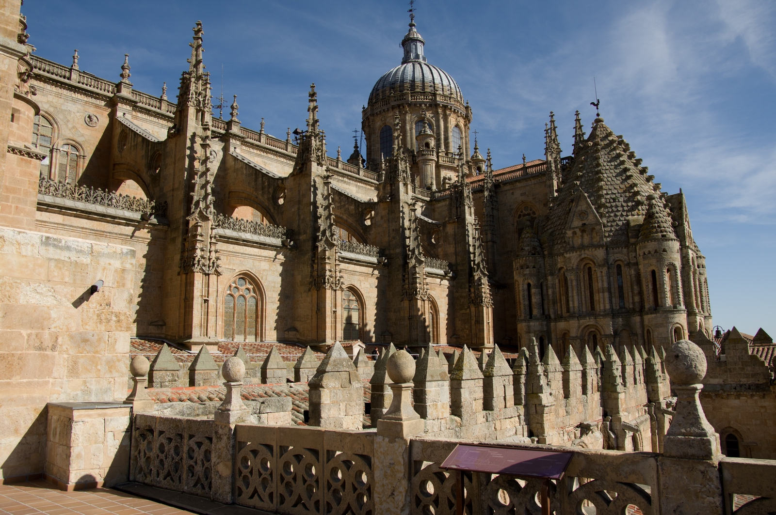
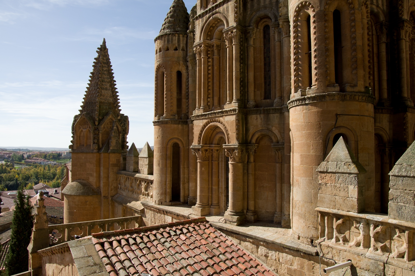
The evening sunlight was perfect for the medieval architecture
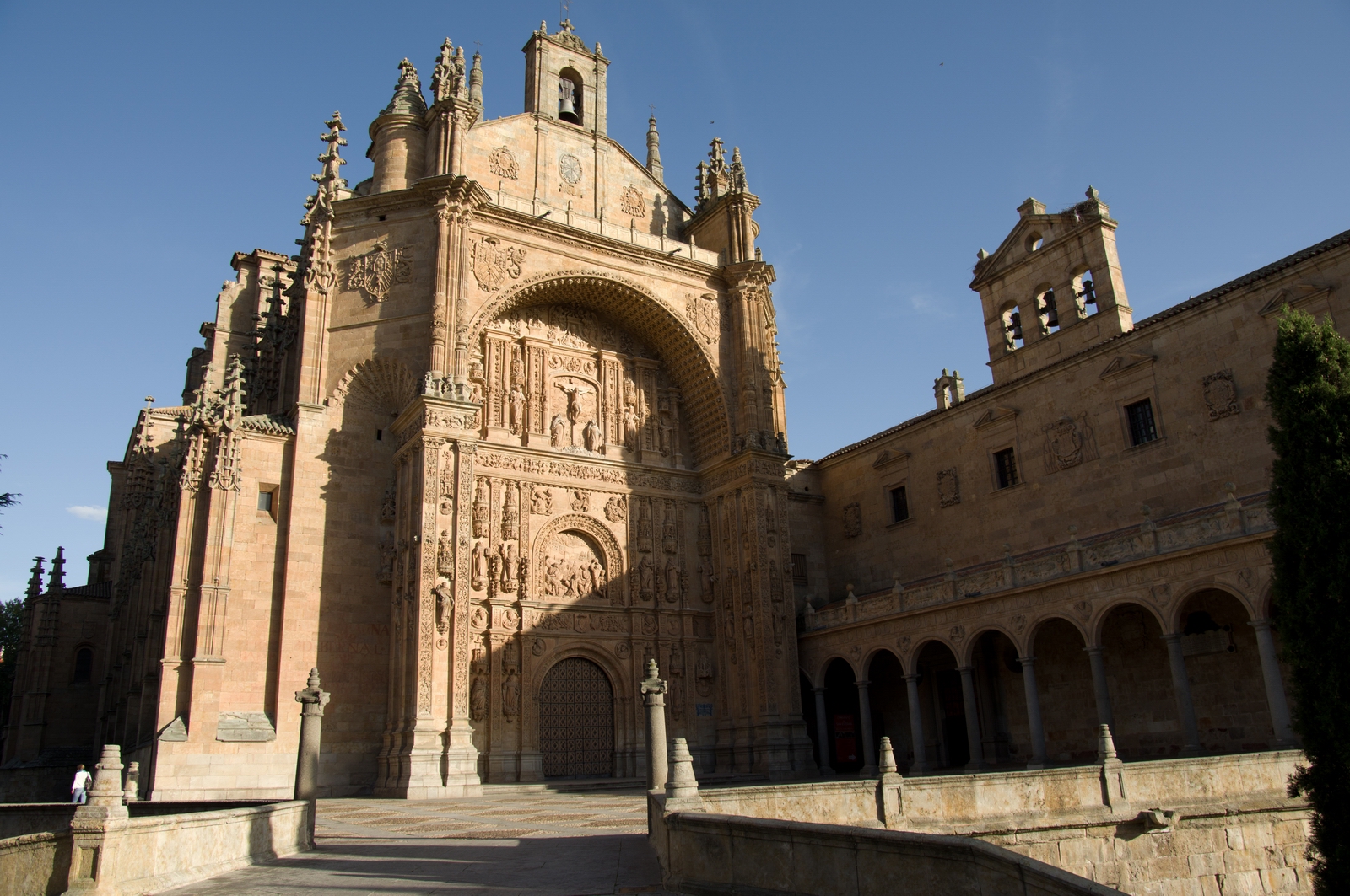
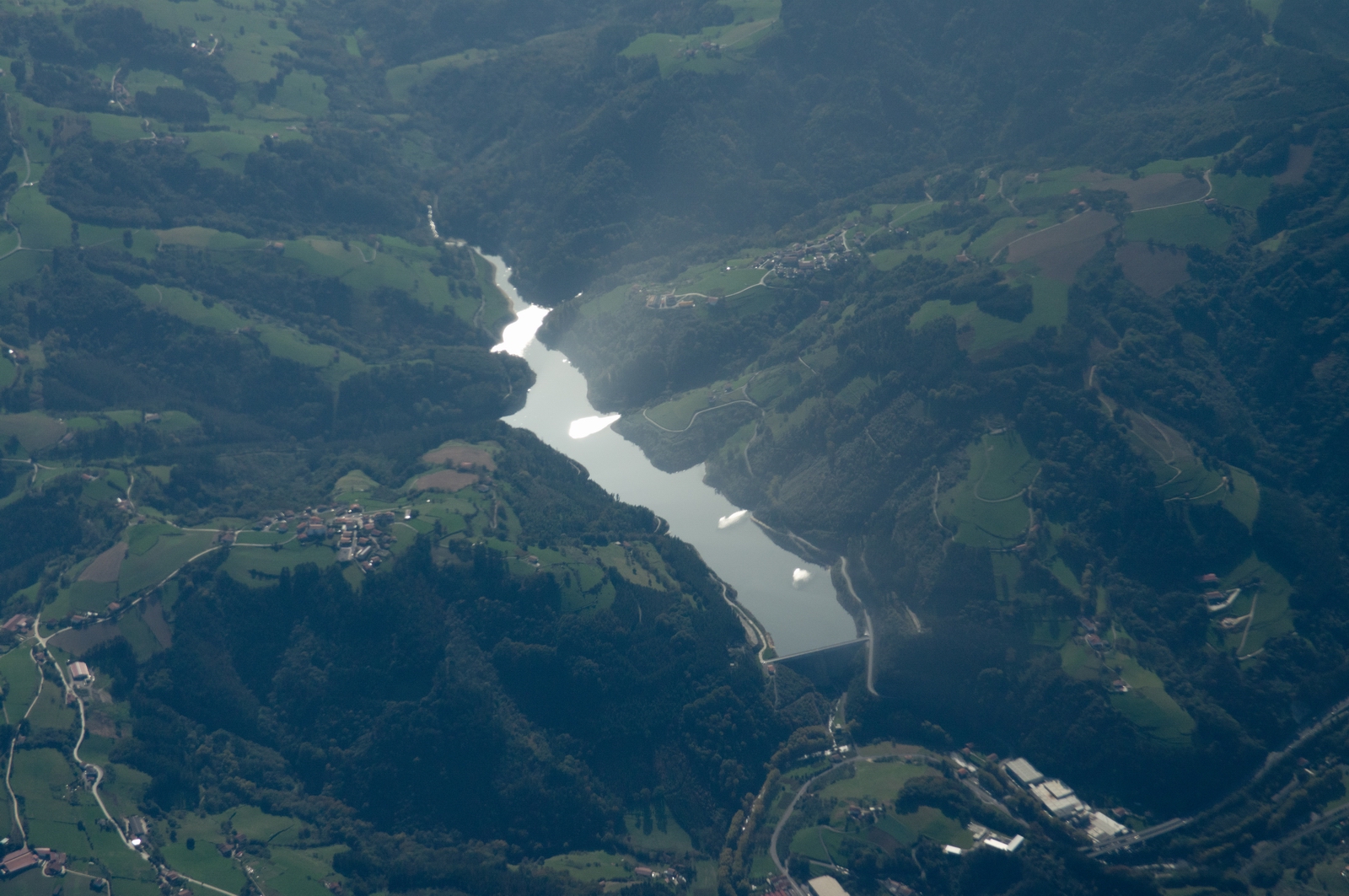
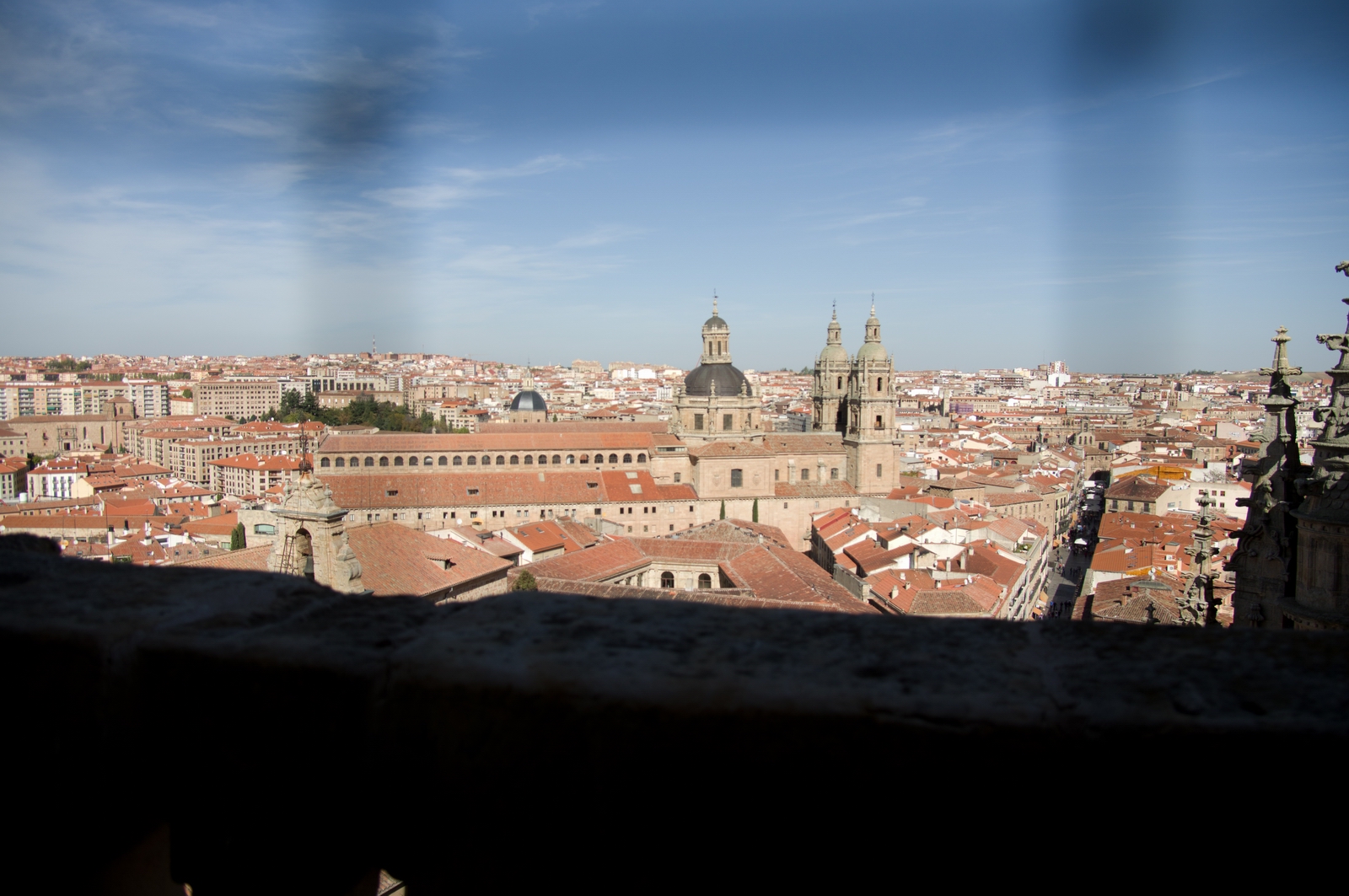
Like Zaragoza, Salamanca is on a river
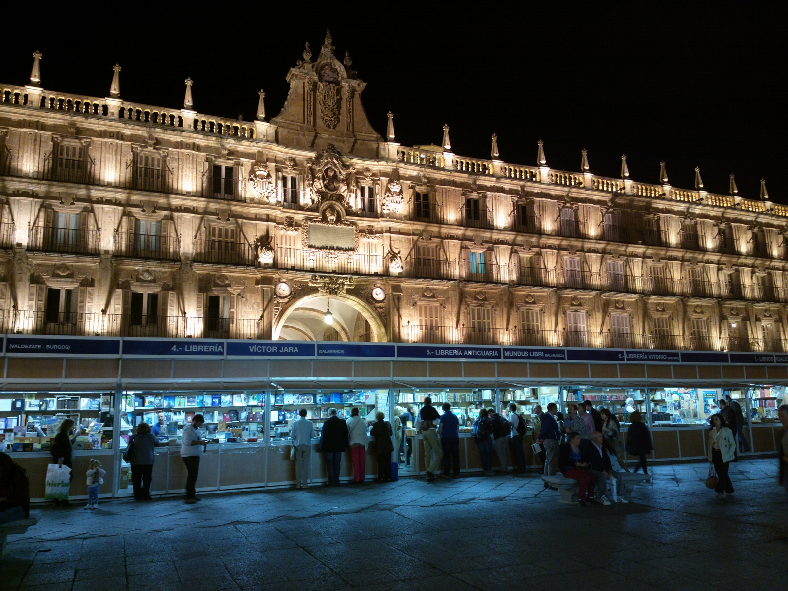
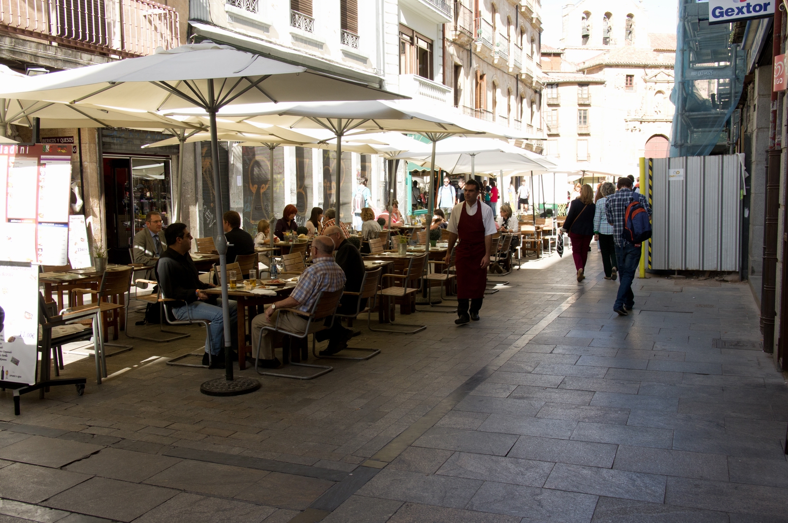
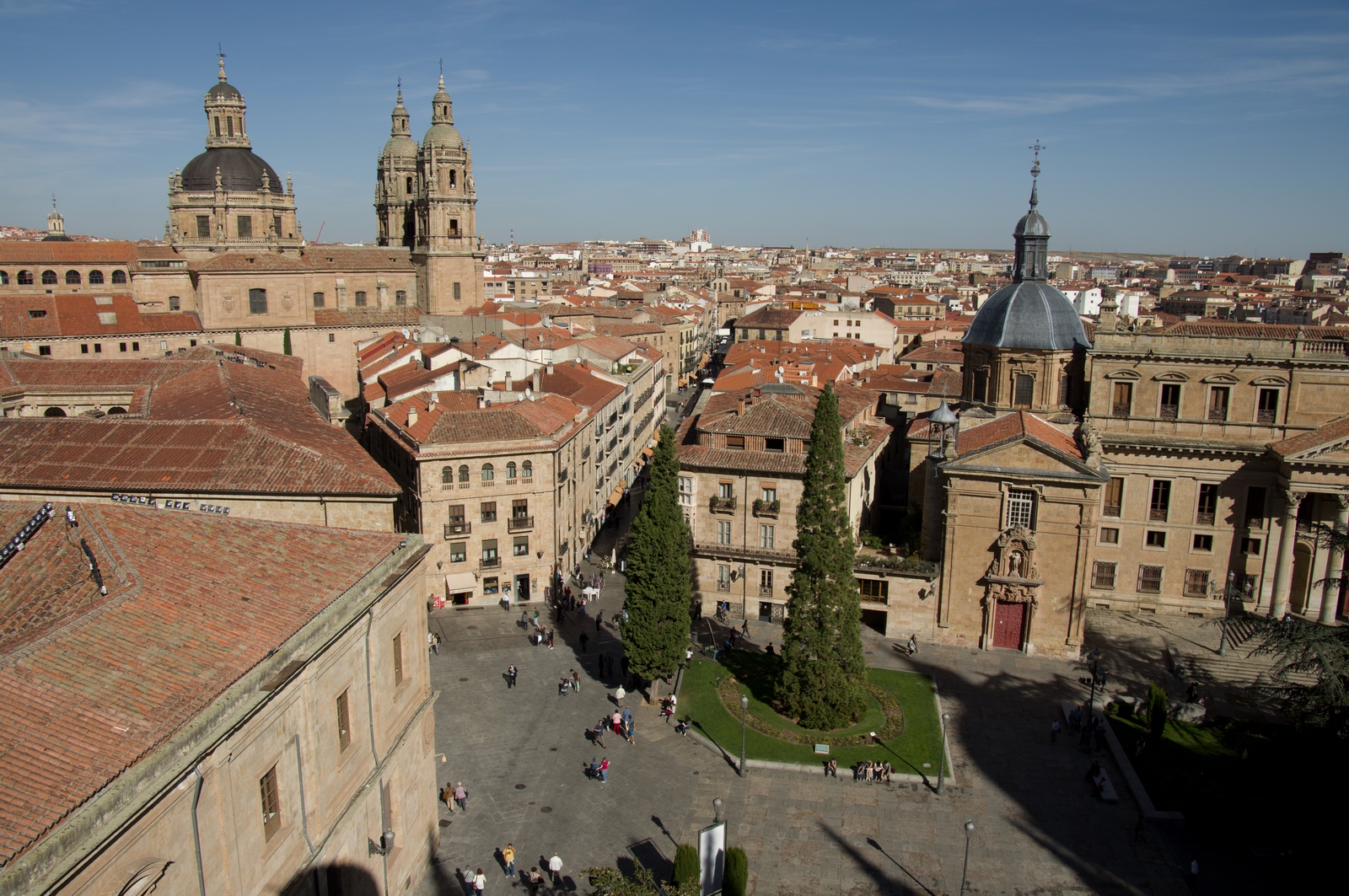
There is a very nice market square where you can get just about anything
although deciphering the Spanish menus is a task... and not all of the food was good. I had a mixed seafood paella which was absolutely awful (the seafood didn't taste like food at all) and ended up having a nice salad elsewhere. There are cafes everywhere but the menus are pretty similar
The following day was decision-time for whether to stay the full 2 nights as planned or fly back that day, to beat the worsening weather. I had a good look at it all and decided to stay - largely because there was no sferics activity (lightning) in the approaching front, nor any serious convective activity (CBs) and the 0C level was well above the MSA so the whole flight back could be done safely in IMC if necessary.
This decision had to be done right because there was a lot of bad weather coming after this brief period, I had to be back at the office on the 3rd November, and the airline options for getting back to the UK are messy and extremely expensive.
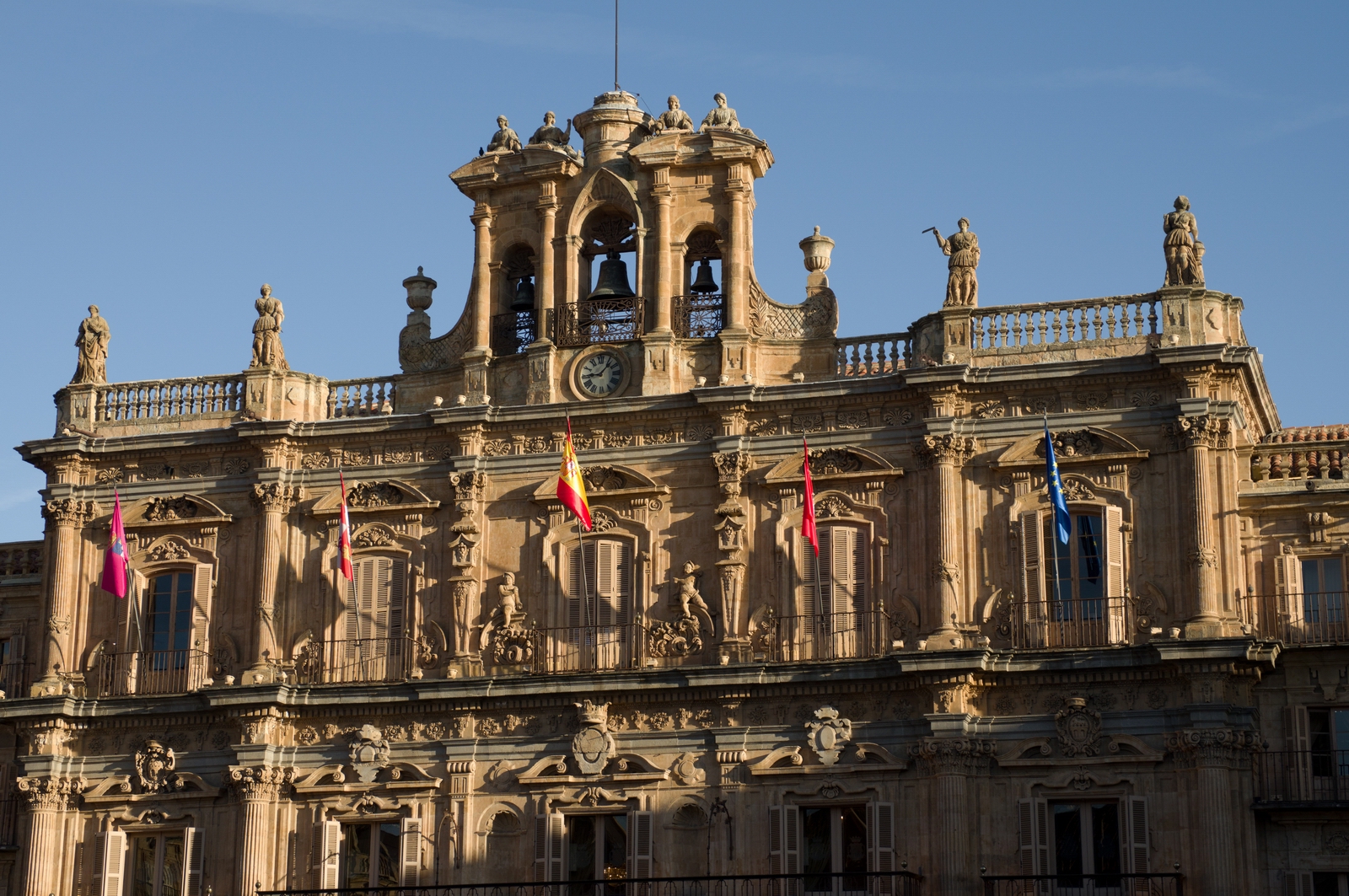
So, more photos in the morning light
The market square again
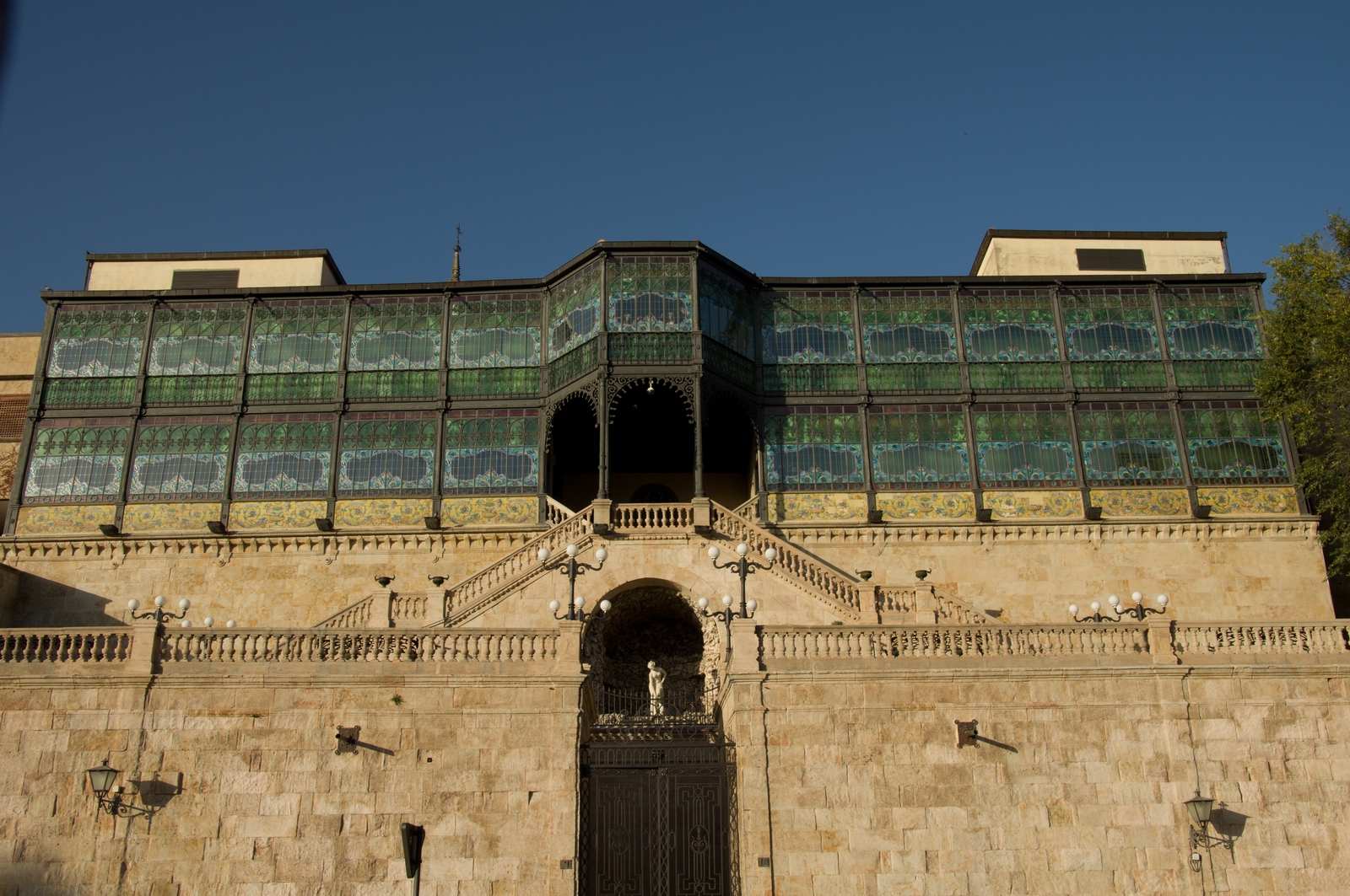
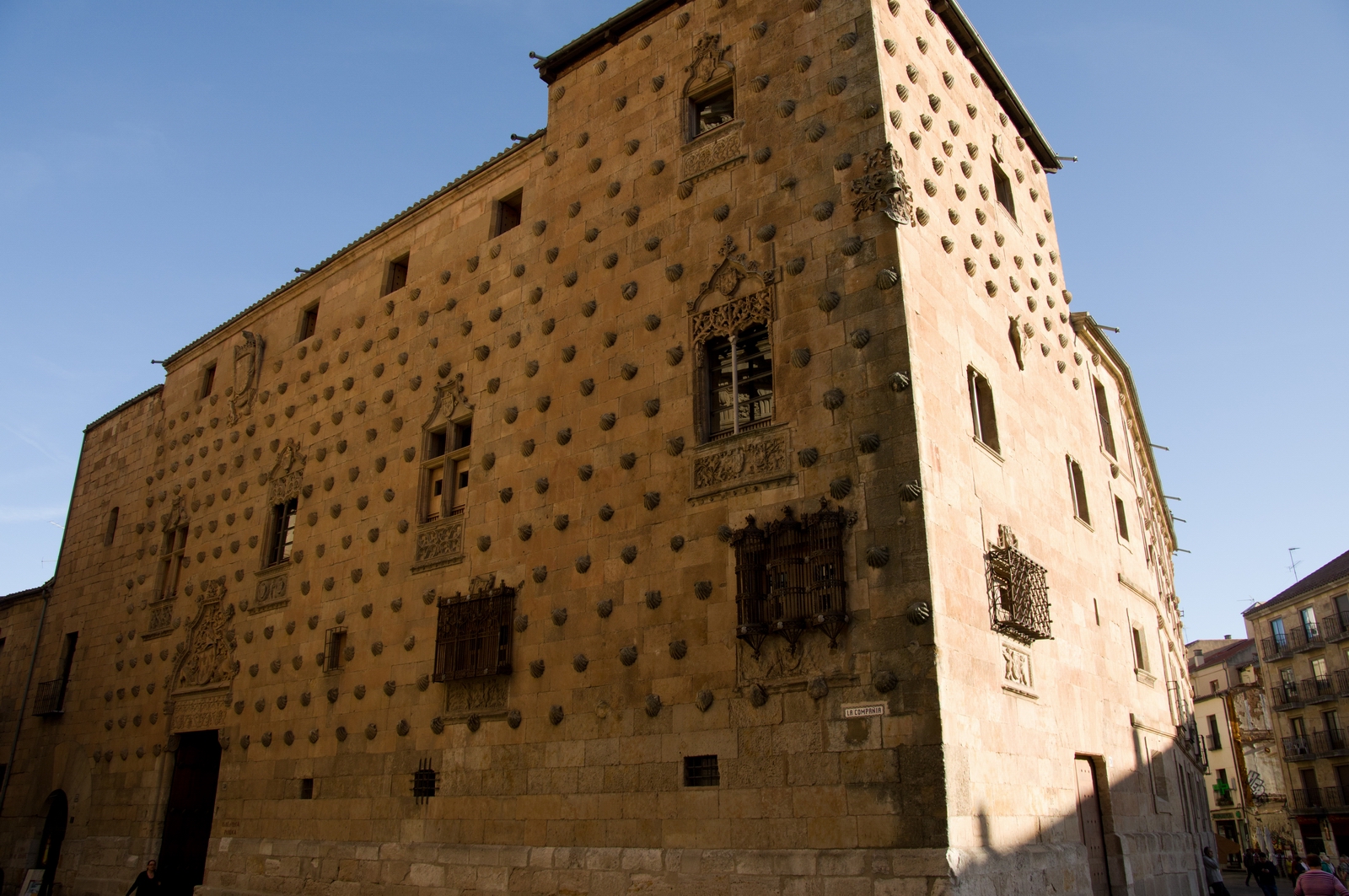
The "shell house" - inside is a public library
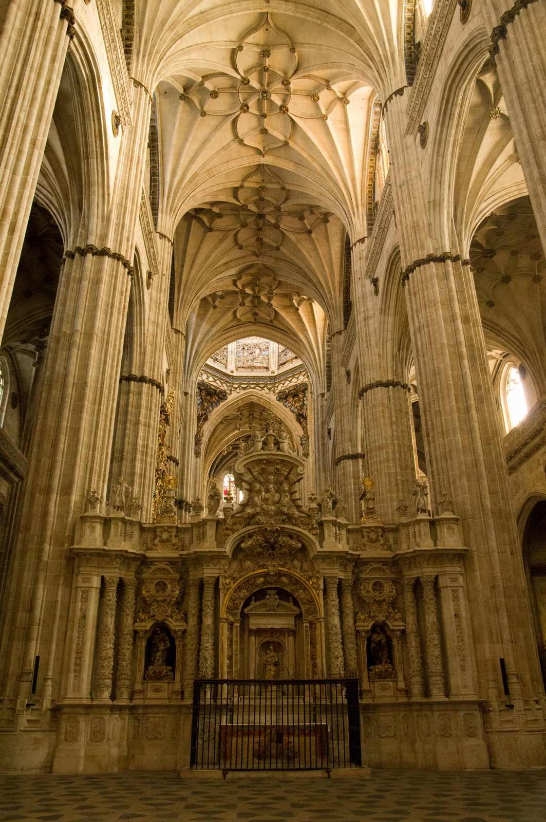
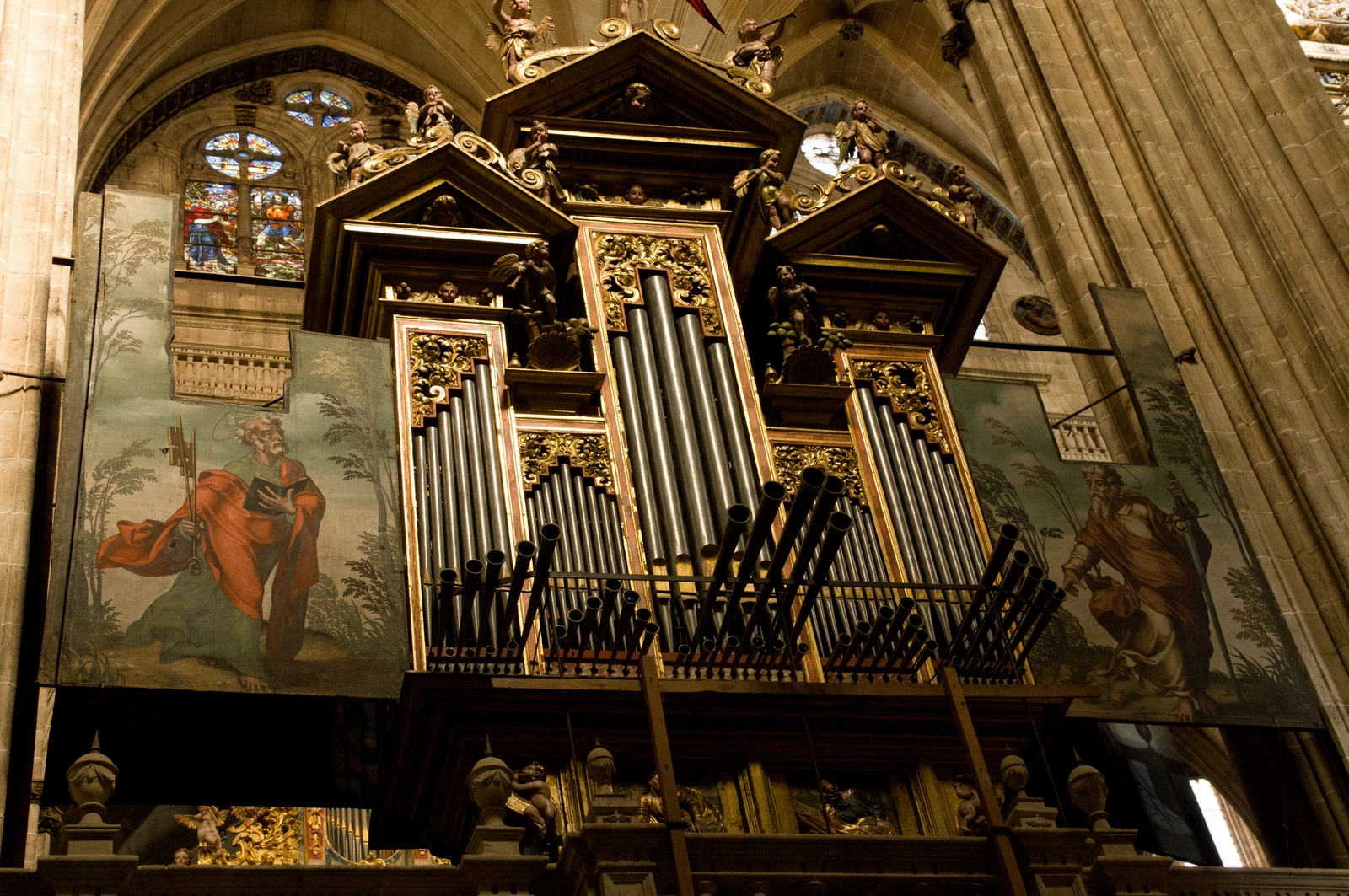
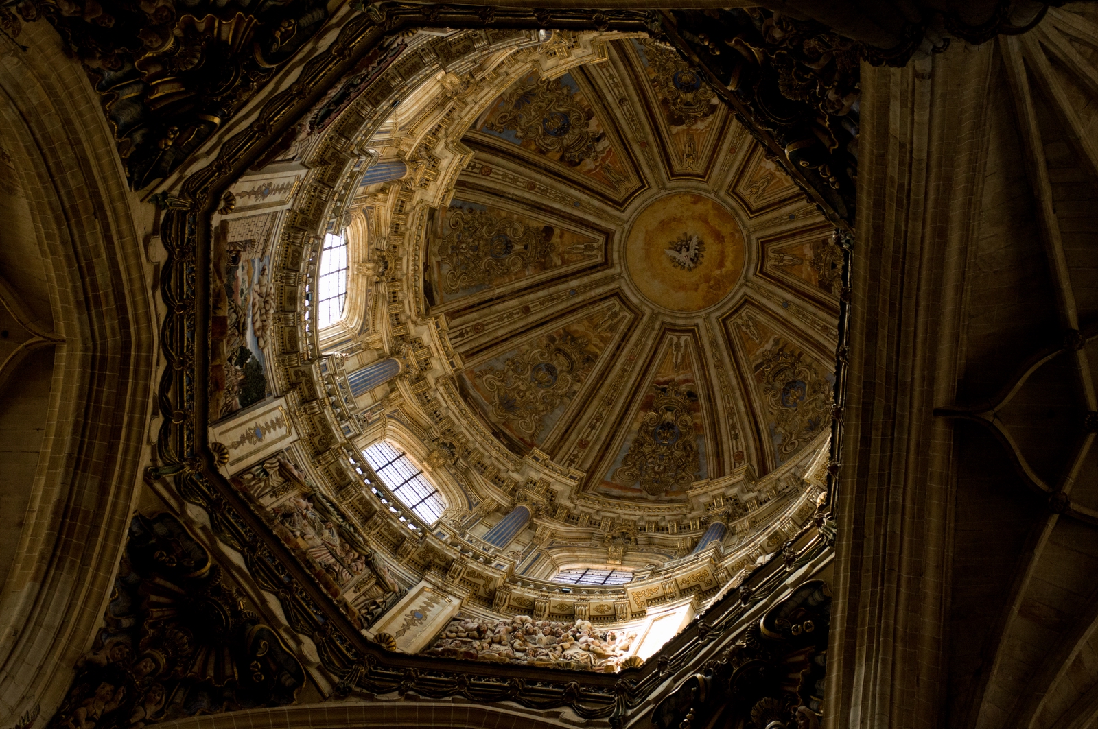
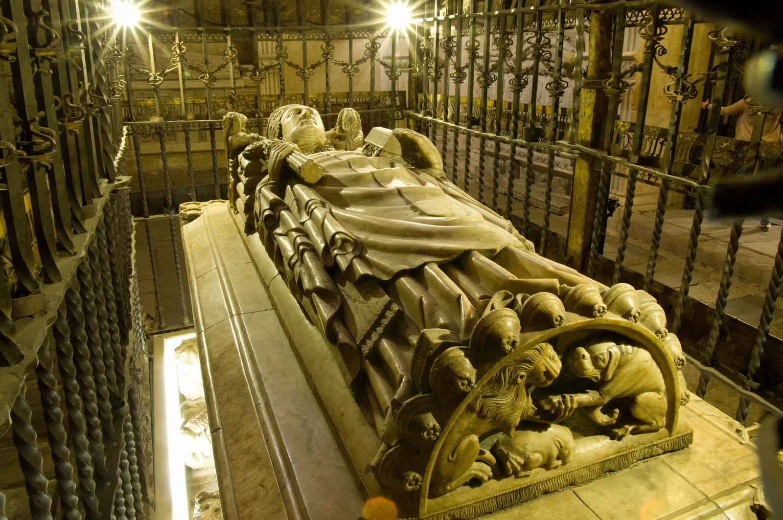
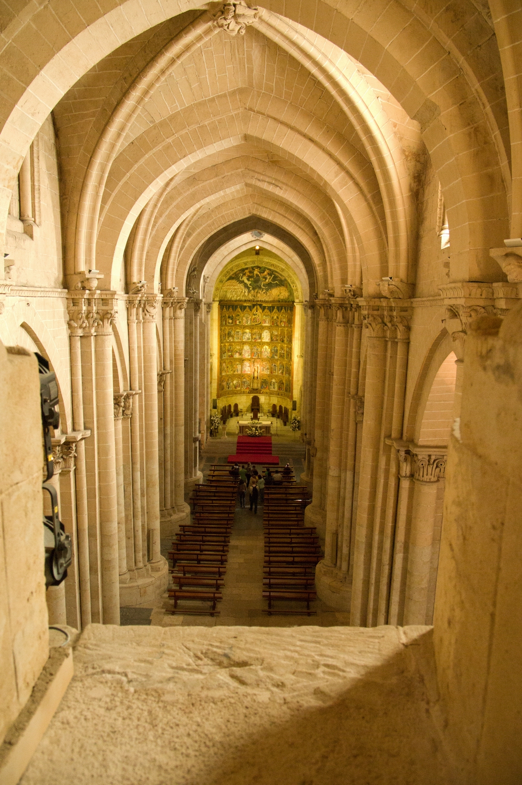
Inside one of the cathedrals. They ban flash photography but this is hardly relevant with modern DSLR cameras with their ISO 50000 capable sensors
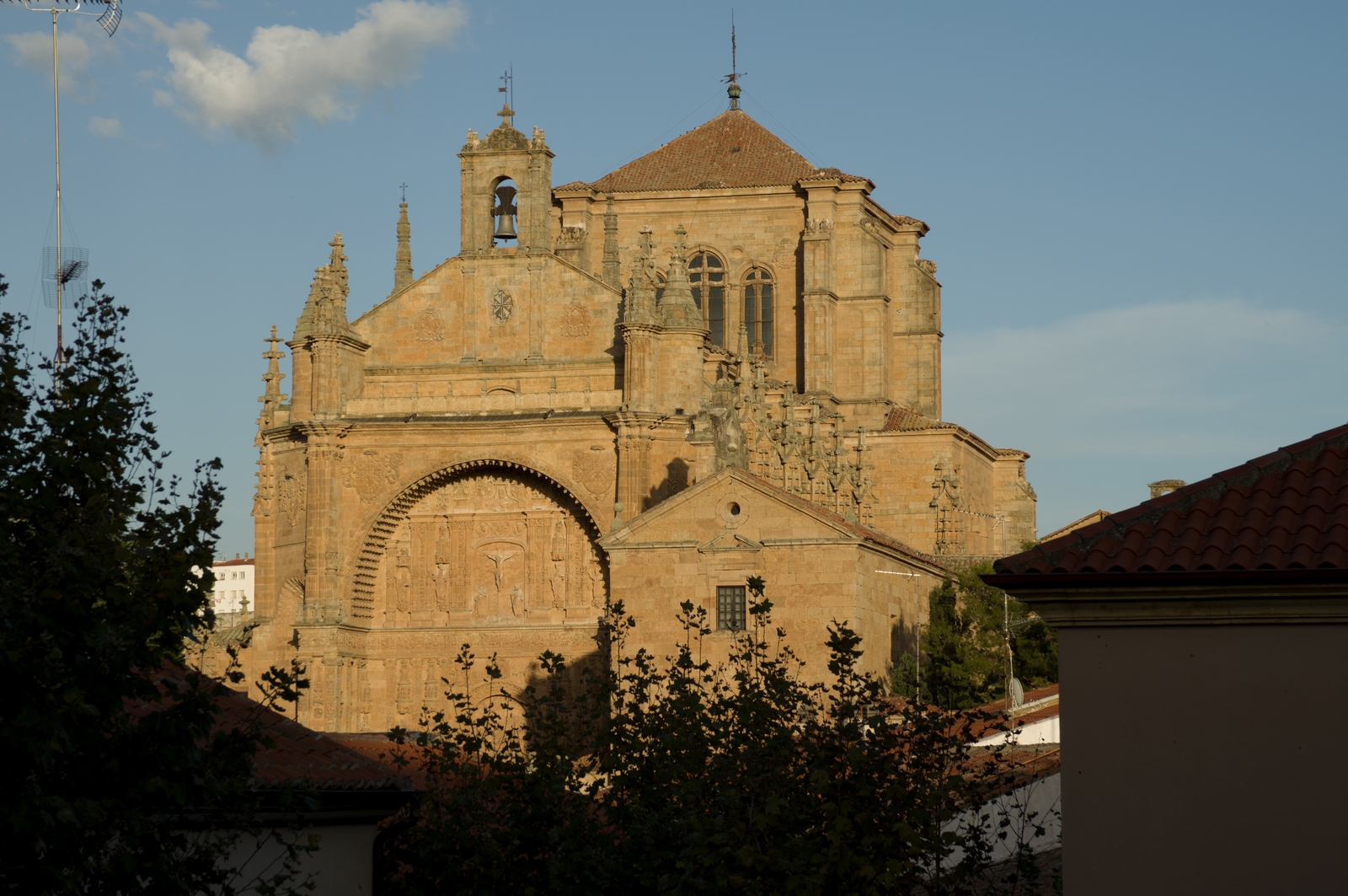
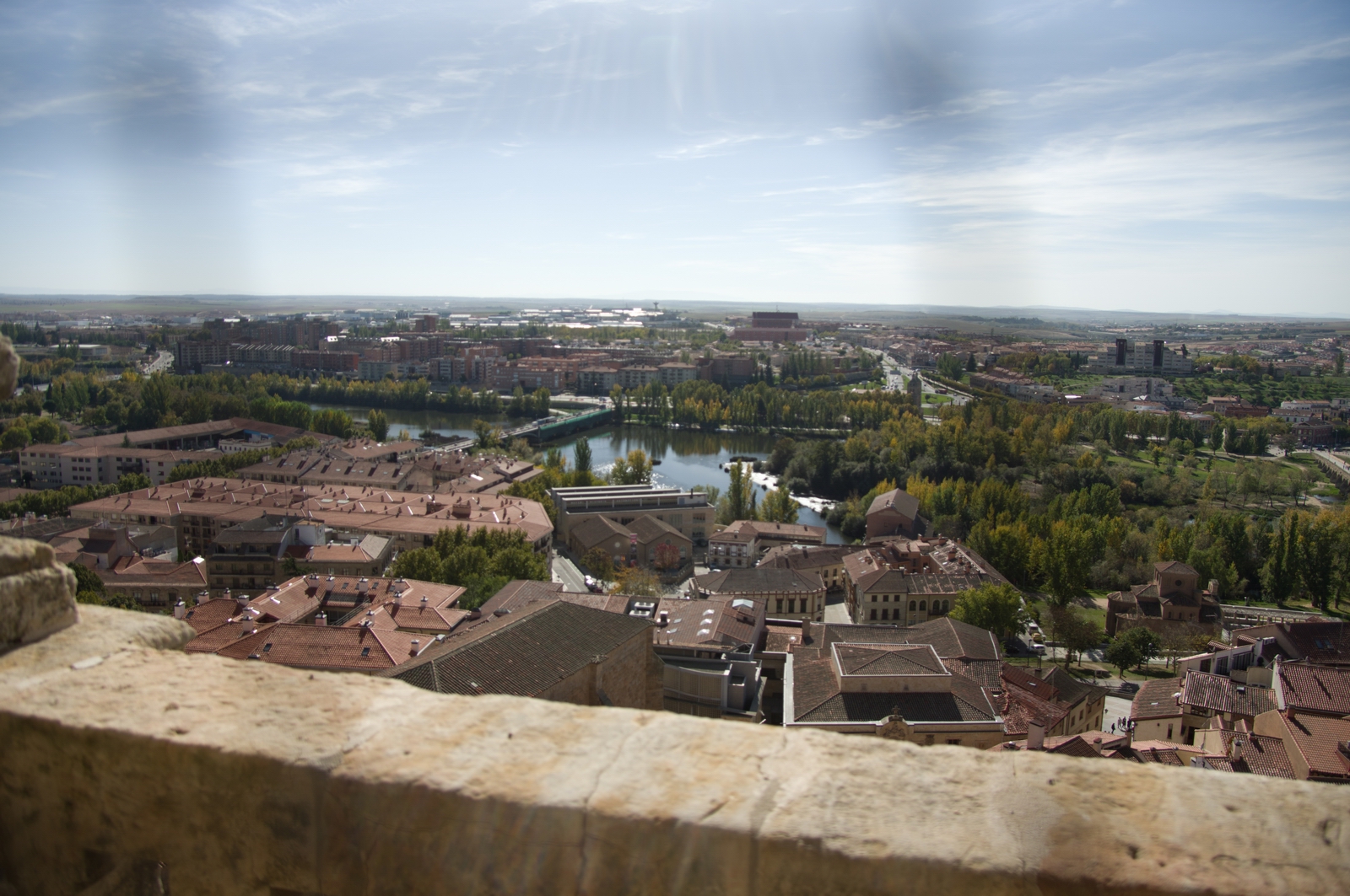
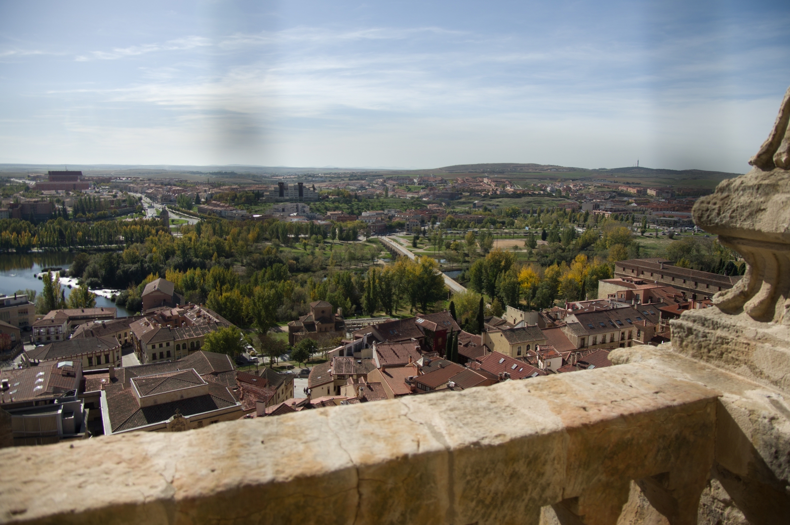
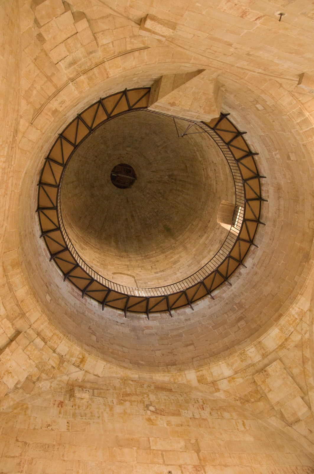
Steps to the top of the Jeronimo cathedral
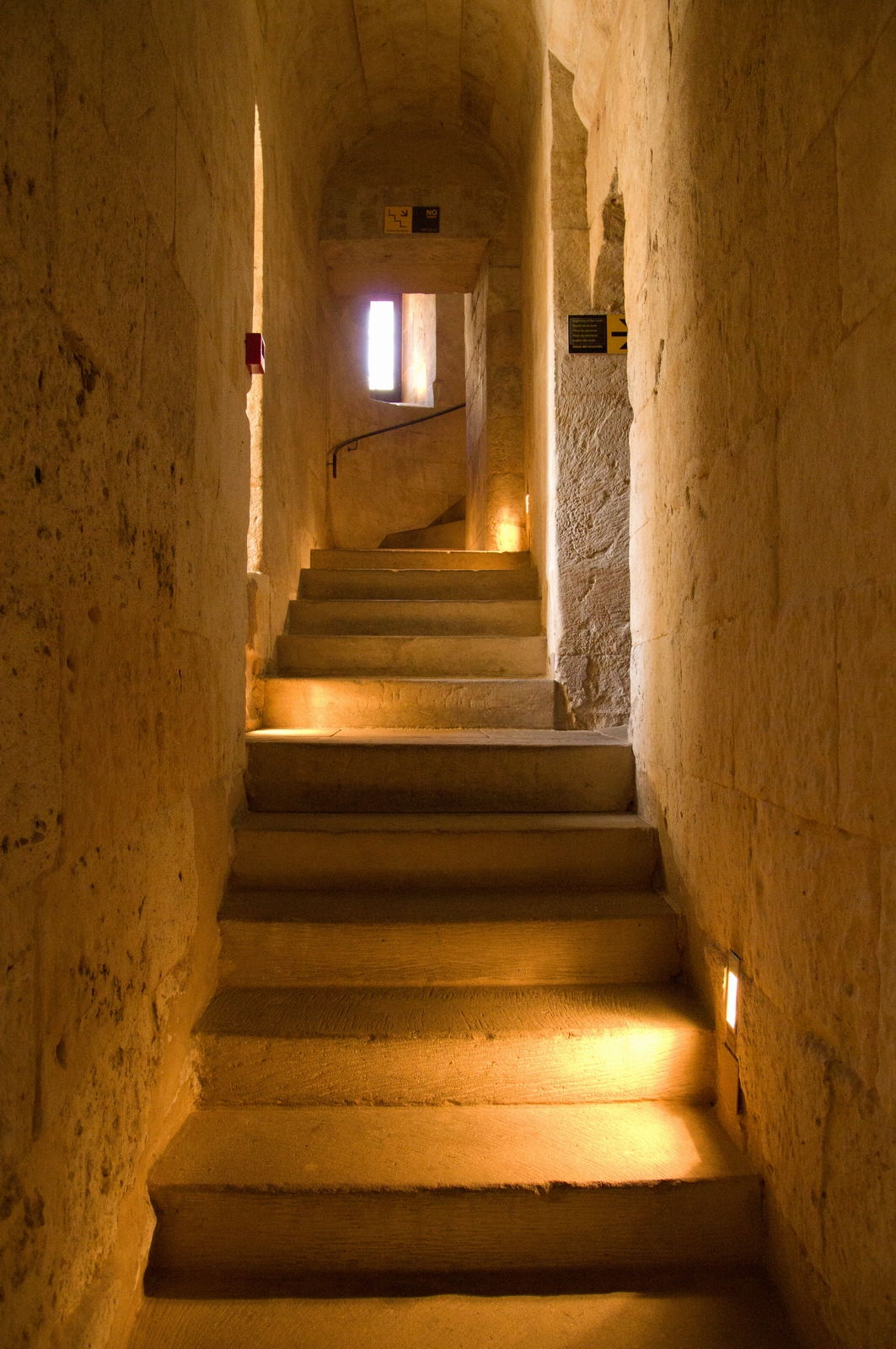
At the very top, there is mesh in the windows which can be seen here. Salamanca is truly in the middle of nowhere and you can see the barren landscape in the distance
The very top, but you can't go there - the staircase was blocked
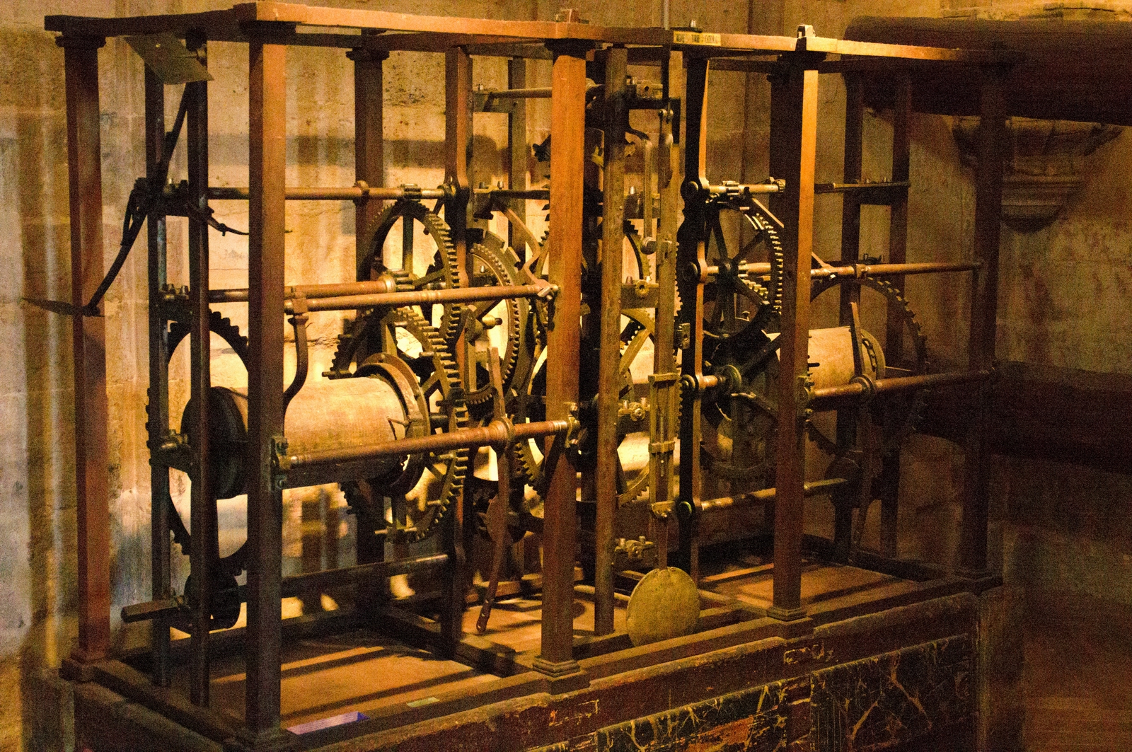
This must be the old bell-ringing machine
The Spanish do like their chemically processed meat, despite the well documented cancer risk...
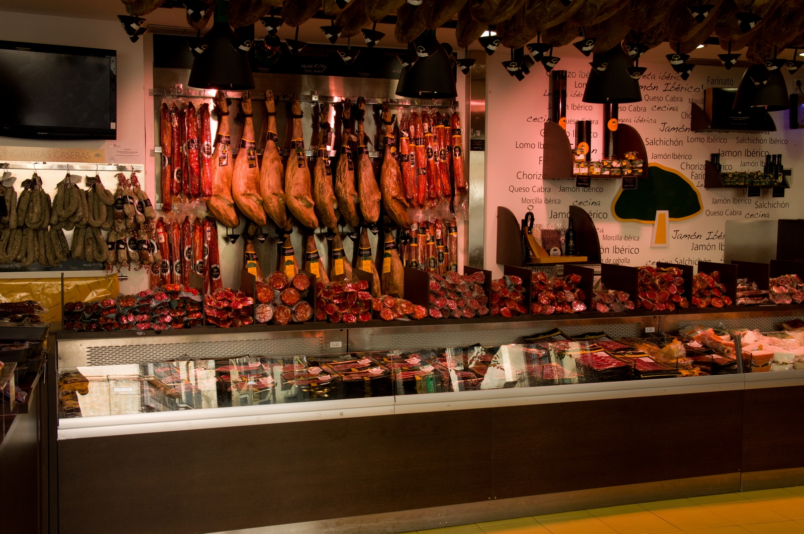
I must confess to buying not just some fruit but also two little parma ham
sandwiches to eat on the return flight ![]()
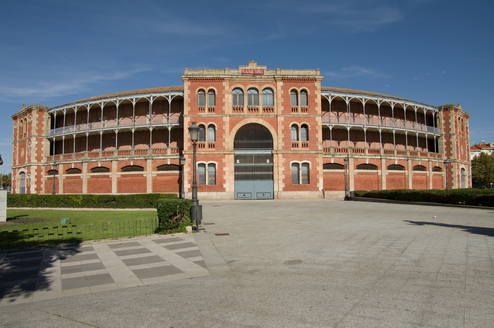
In the northern part of the city is the bullfighting ring
Return Flight
This was filed for 1030Z - the earliest possible given that the airport opens
for aviation operations at 1000Z. Under IFR one can depart up to 15 mins early
and in many cases they aren't too bothered if you start the engine even sooner...
anyway, you soon find out when you call up for the start clearance ![]()
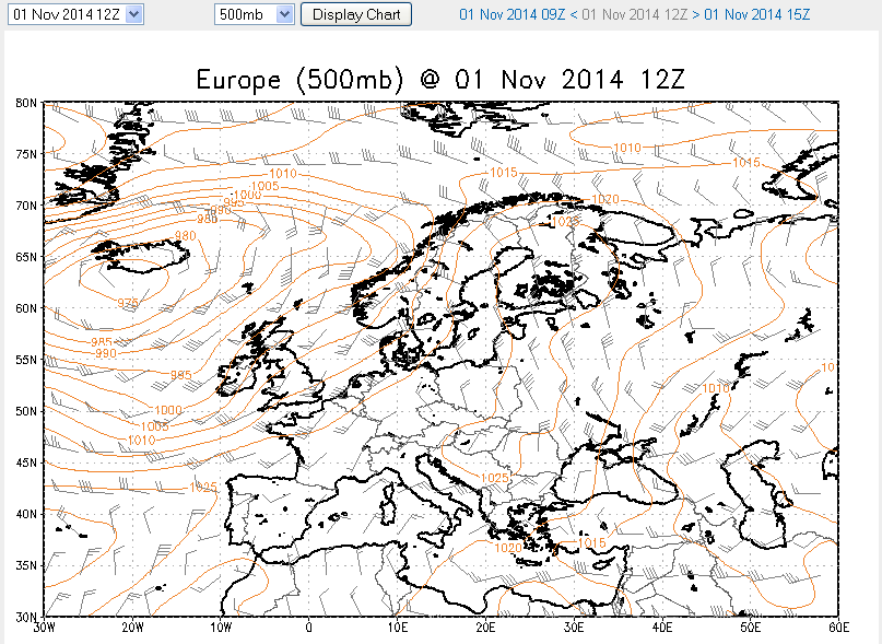
The 0600 1200 1800 MSLP charts showed the front which would obviously be crossed on the way back to Shoreham, so it was a case of estimating the conditions on it.
The 0600 and 1200 SigWx charts showed that the front was likely to be dissipating during the morning.
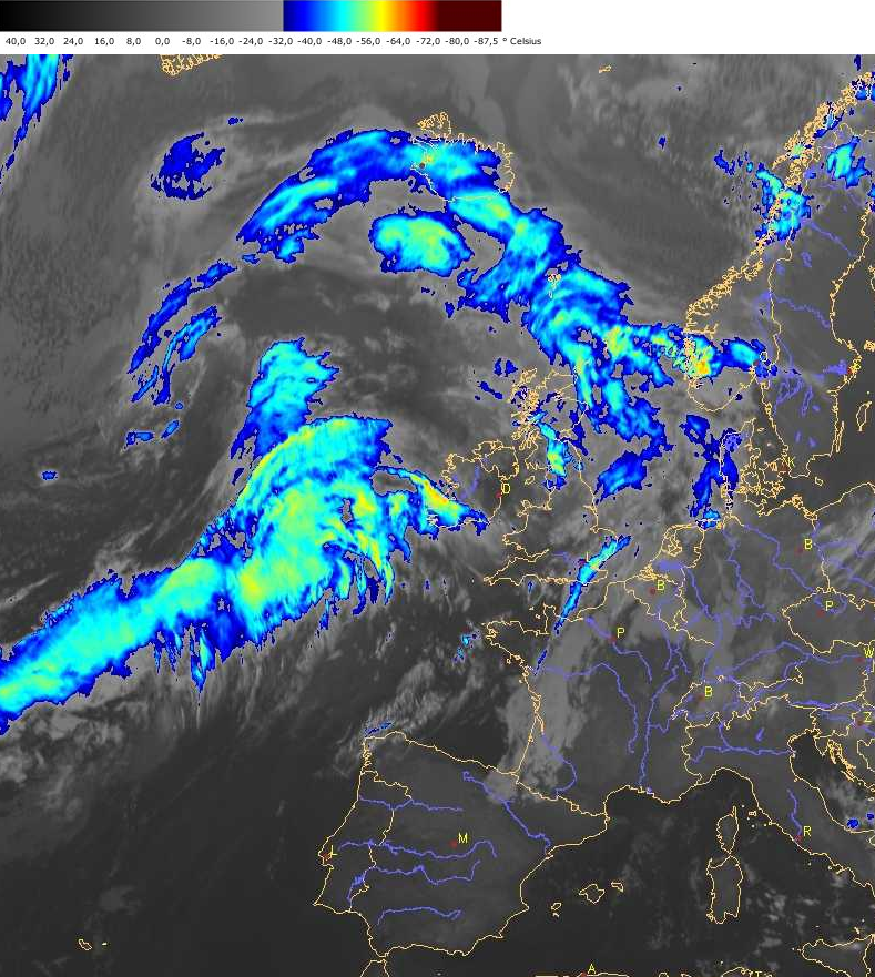
The 0300 and 0700
IR images showed that the weather was barely moving over most of the distance
but was certainly moving fast near the UK. The shade of grey indicated cloud
tops around FL150-180 so OK for the TB20 and also did not contain any "lumps"
which might indicate CBs. Here is another slightly
later IR image. All these IR images come from the same agency - EUMETSAT - which
sells them to various weather packaging firms, and "suitably delayed"
versions find their way out free of charge - usually on advertising-funded websites
![]() The IR images never
lie as a “cloud tops metar” – but they can sometimes mislead
if there is irrelevant thin cloud at a very high altitude.
The IR images never
lie as a “cloud tops metar” – but they can sometimes mislead
if there is irrelevant thin cloud at a very high altitude.
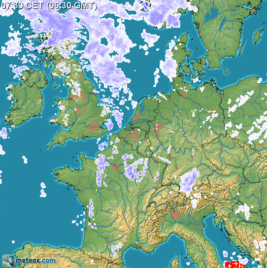
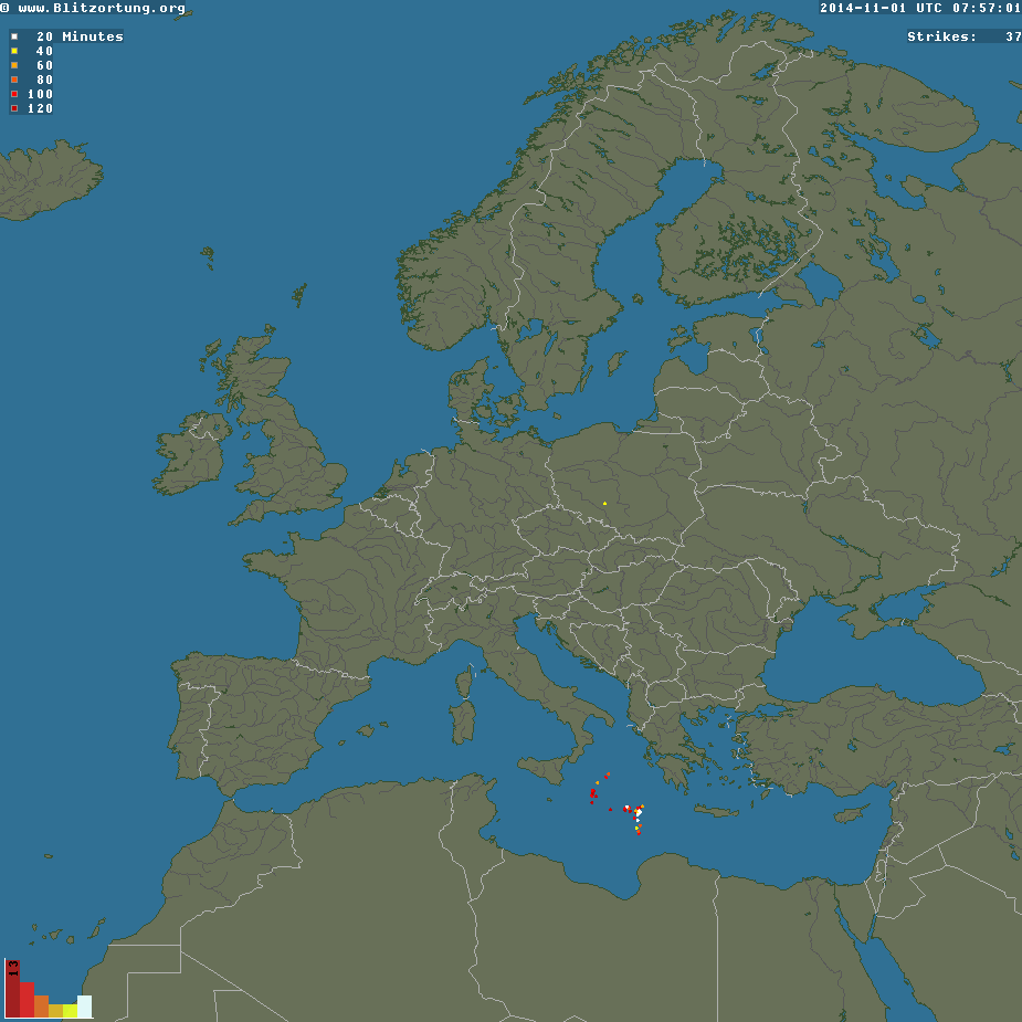
The sferics image was totally clean which was great.
The latest winds forecast showed a nice tailwind, with a direct tailwind component of around 25-30kt.
The taxi to the airport was another €25. This makes it €50, which is perhaps ironic when so many people moan about landing fees and - particularly among UK pilots - boycott any airport charging more than ten quid...
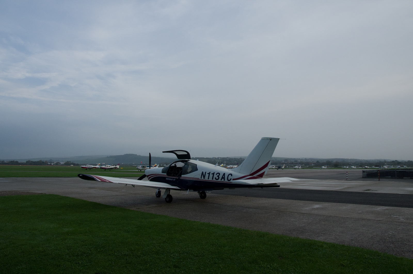
The airport was as "busy" as when I arrived
There was just one person in evidence: a security officer. He directed me upstairs to Operations. The man there spent half an hour discovering that the police (necessary for any flight to/from a non-Schengen country) had not been notified, despite me having had detailed emails with them before the trip. So they were telephoned and they said they would be there in 15 minutes. They actually turned up 45 minutes later, but it was OK since I had two hours to play with.
The man then spent about 30 minutes typing in the data for the invoice (€49 total which included €30 for 2 nights' parking) and then starting looking around for a rubber stamp, so I said I don't need a rubber stamp!
Eventually the police arrived and that was it, so I went out airside.
Everybody was totally friendly but the lack of organisation is just amazing. I don't think Salamanca has more than one flight per day. The flying school probably does its own thing, not involving the passenger terminal staff.
For Salamanca airport, based on this, I would recommend 1 hour for Schengen
traffic and 2 hours for non-Schengen traffic, for "processing" ![]()
The departure clearance was "Cleared to EGKA, ZMR, FL110, squawk 1036, next Madrid 136.525". Straightforward, but it does show one of many fallacies in IFR: EGKA (Shoreham) is in Class G airspace so there is no possible clearance all the way to EGKA. As soon as you drop out of controlled airspace and into Class G (which on this route happens soon after entering UK airspace), your IFR clearance is de facto terminated, you are de facto VFR (though you can be in IMC...hey, ho), and you cannot re-enter controlled airspace. Nowadays, London Control will actually tell you that - undoubtedly they have had a few thousand foreign pilots bust CAS as a result of this sort of thing...
Departure:
Initially the route goes to ZMR but otherwise it is exactly identical to the outbound route. This is very rare in the Eurocontrol world where there are lots of unidirectional routes. ATC then mostly ignore these, so they merely serve to complicate the route generation...
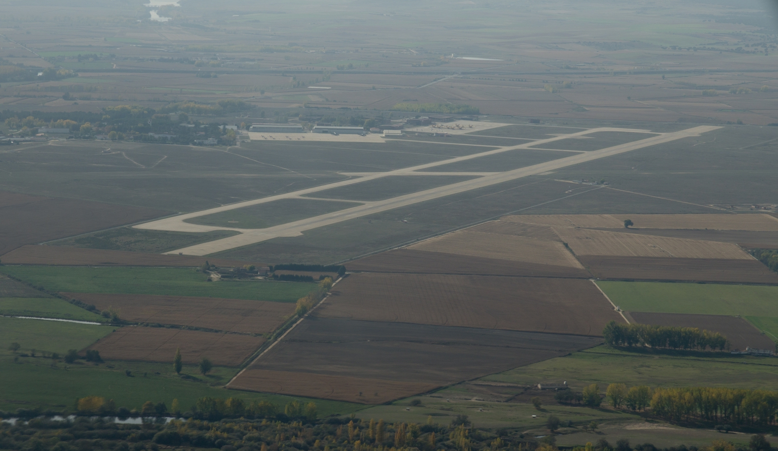
This is Salamanca, obscured by haze
The bottom end of the front had already passed over Salamanca during the night, so, initially, FL110, the flight was between layers and there was no point in climbing higher because the layer above was trivial
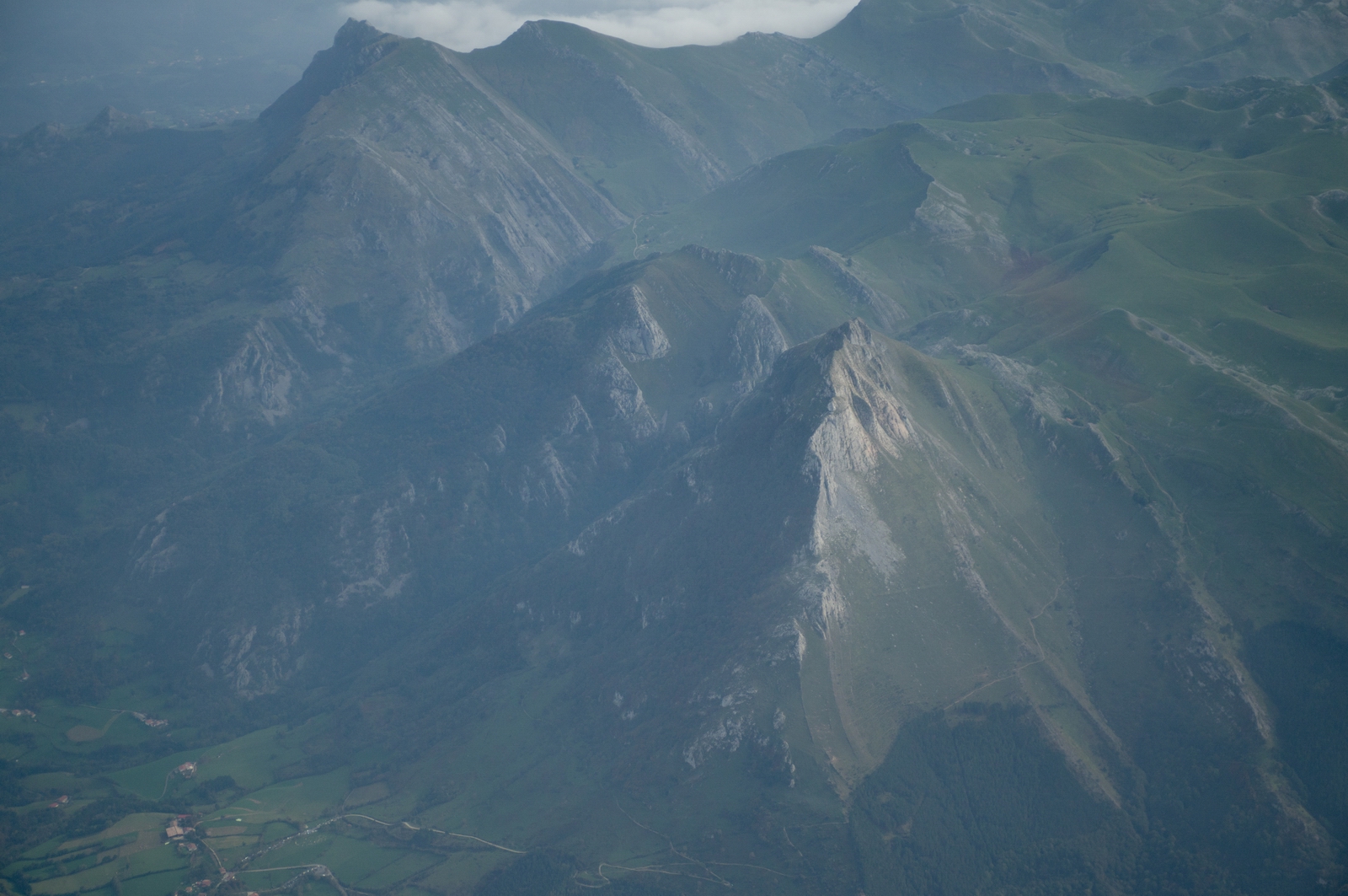
The weather above soon disappeared. This is near the north-eastern end of Spain - an interesting rock formation
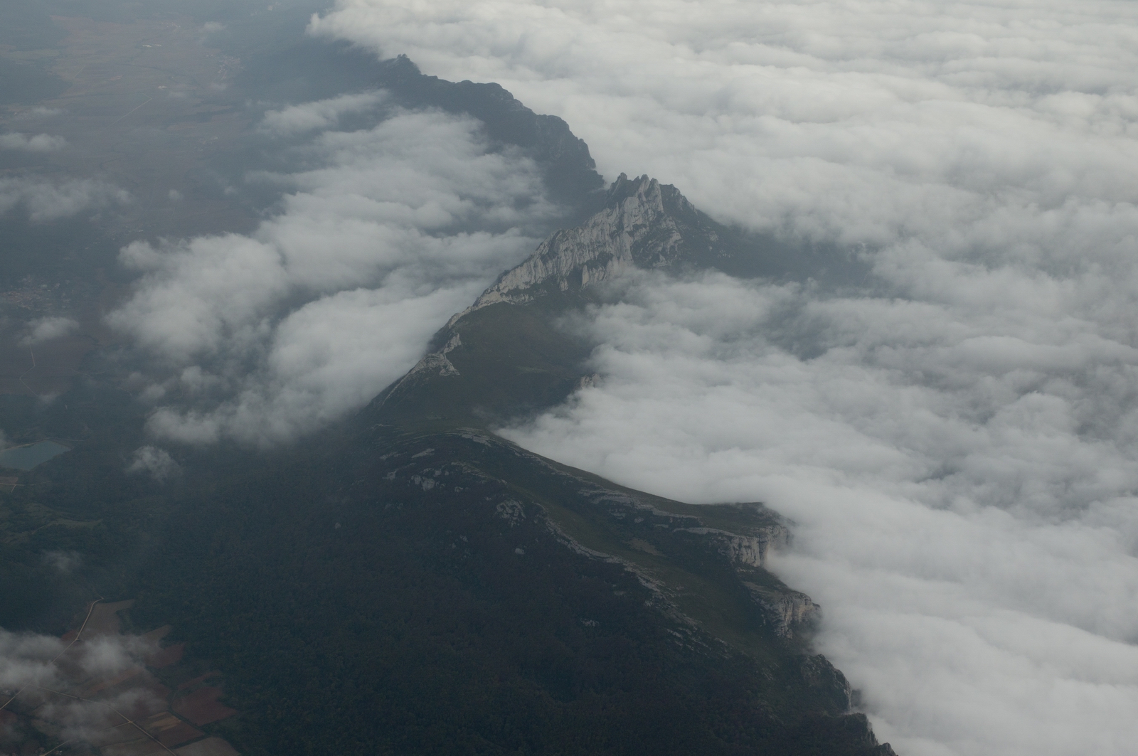
You can guess the wind here is flowing left to right ![]()
and we are back to the long beach of France. It being a weekend, I was cleared straight up, through the infamous R31A1 military area which is normally inactive at weekends. The distance to land was always in glide range though, from FL110
The tailwind was a very welcome 30kt or so all the way! 2014 was definitely the "year of the headwind" with some very difficult flights, so this was a nice change.
Ille de Re - an island near La Rochelle
The front had indeed pretty well dissipated in northern France. Here it is to the left, in the distance
and here it is to the right after flying above it and below a thin layer
Parts of the front would have needed about FL160 to cross above, which validated the earlier assessment of the IR images
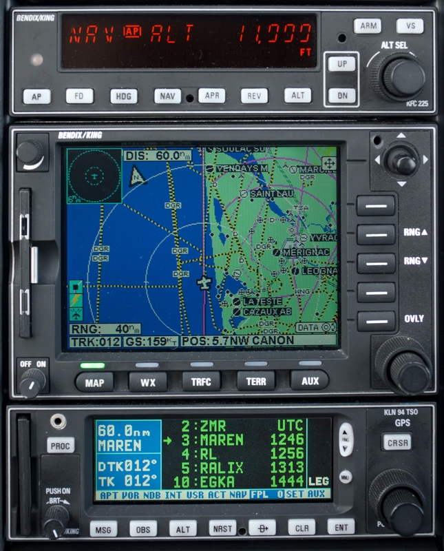
A nice ground speed on the GPS - 170kt. The TAS was 145kt (0C, 2400rpm, 10.0 USG/hr). I got a very long shortcut of about 160nm to CAN and then very soon to NEVIL.
Nearer the UK the weather cleared up
and a very impressive ground speed (202kt) was seen due to a combination of the tailwind and a -300fpm descent
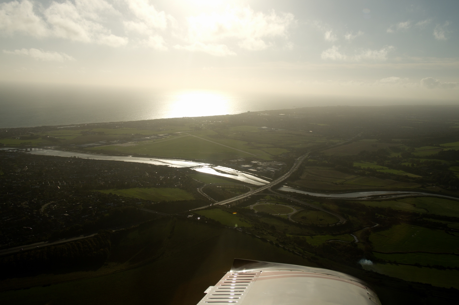
London Control were very flexible. They make a real effort to help light GA nowadays, offering various descent options. I went down to FL090 and then a continuous descent to Shoreham for the last 70nm or so.
Finally, we are home, left base for Shoreham EGKA
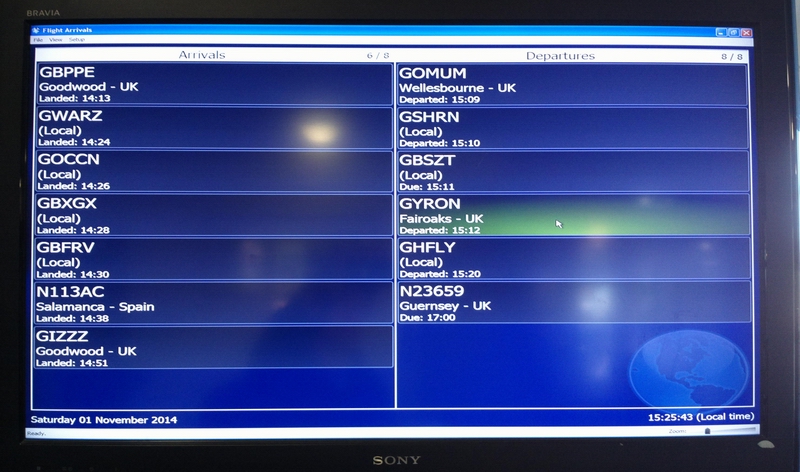
This is the Shoreham Airport arrivals/departures board. It is rather sad that most of the GA community doesn't fly very far...
Due to the super tailwind, the return flight was just over 4 hours airborne. The route actually flown is shown in black:
General
Most of the pics were taken with a Pentax K3, in DNG raw format, and were corrected in Lightroom, with some cropping and with most of the airborne ones done with the "blacks" function to reduce the haze. They were converted to "90% quality" JPG in Lightroom. Other operations that are typical for a trip writeup include fixing-up the last-modified date/time from EXIF data and batch renaming to a pattern like file-#### and these I do afterwards in ACDSEE PRO v7. An ancient ACDSEE v5, which came on a free magazine cover CD about 10 years ago, can do all this and is far faster but it won't open raw files. This is a reasonably quick workflow but needs a camera capable of a "raw" format because the Blacks function is available only with raw files.
Very little oxygen was used on this trip - probably 10% of the 48 cu. ft. cylinder. But without oxygen I would have never attempted it because one cuts off half of the aircraft operating ceiling and would spend most of the flight in icing conditions and heavy turbulence.
No general aviation aircraft were seen airborne on the entire trip.
This page last edited 12th November 2014

%20@%2030%20Oct%202014%2009Z%20(QFF%20-%20Wind).png)
%20@%2001%20Nov%202014%2009Z%20(QFF%20-%20Wind).png)