Trip to Zaragoza - November 2007
Objective
This article describes an IFR (airways) flight from Shoreham (EGKA) to Zaragoza in Spain (LEZG).
The format of the flight is very similar to other "simple" airways flights I have done e.g. Prague. Other VFR and IFR trip reports can be found here.
Aircraft
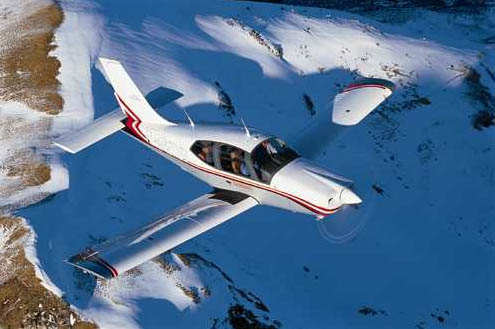
The aircraft is a 2002 Socata TB20GT which has a zero-fuel range of approximately 1100nm and a cruise speed of 155kt TAS at 10,000ft. It has a ceiling of about 20,000ft and is equipped with oxygen.
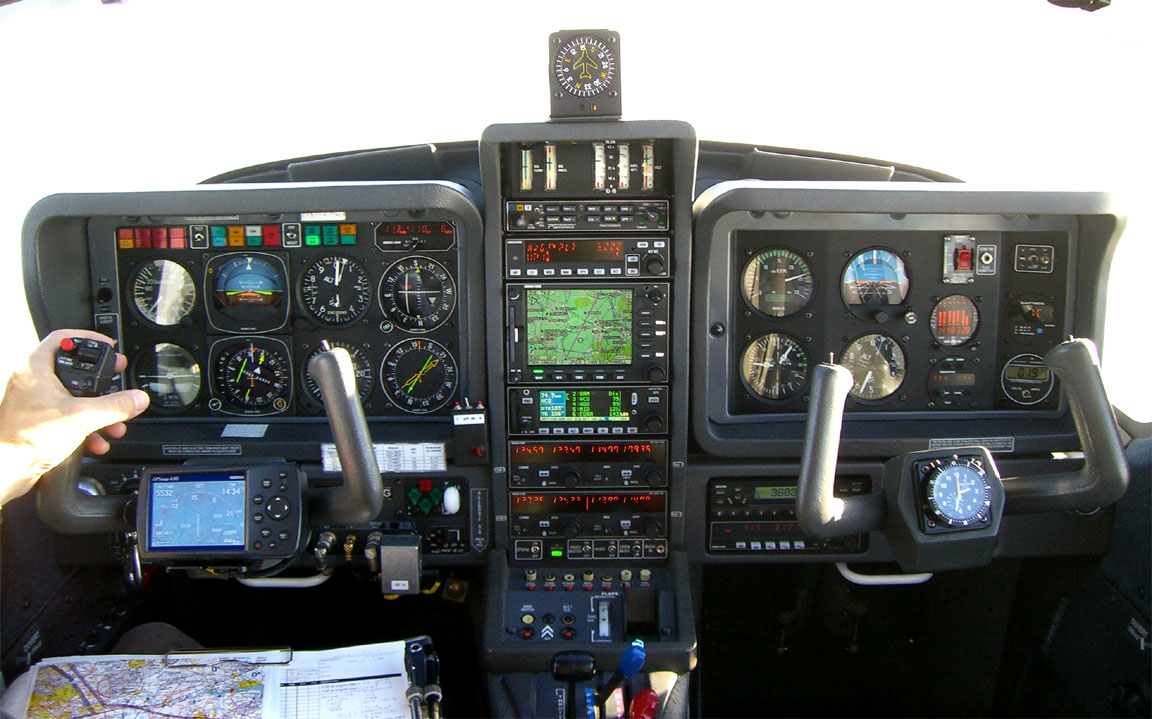
Navigation equipment includes a KLN94 IFR/BRNAV GPS and a KMD550 MFD and these are used for primary navigation. The aircraft has a KFC225 autopilot which can track VOR/GPS/LOC/ILS and fly a preset altitude or VS. There is an additional battery powered Garmin 496 GPS which also provides an audio terrain warning (TAWS) function with a European obstacle database.
Weather
My usual sources for weather for IFR/airways trips are the MSLP charts in the first instance (example) which are available up to 5 days ahead and show obvious features, the SigWx form (available about 18 hours ahead) and TAFs/METARs for departure, destination, alternate, and perhaps some airports along the route.
Airways flight in Europe has to be done at certain minimum altitudes and if there is any cloud these would normally place the aircraft into cloud. Therefore, the general strategy for IFR flight is to reach VMC on top and stay there in the sunshine for the entire flight. Anything else results in an unpleasant and potentially turbulent flight with - especially over hours - a high chance of icing. Therefore, the above weather sources are supplemented by more modern sources such as Meteoblue which offer data on vertical cloud profiles. However, the quality of cloud tops forecasting (whether from Meteoblue or the SigWx form) remains poor and one is doing well if the forecast is within a few thousand feet of reality! The Meteoblue site has recently been re-worked with a Java interface and thus works only some of the time and only with some client PC operating systems...
Equipment
On any significant trip I carry a laptop (Thinkpad X60s 1704) and a lightweight portable printer
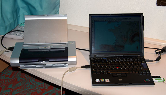
The laptop carries flight planning software (Navbox for VFR and Jeppesen Flitestar for IFR/airways), and also approach plates and enroute charts in electronic format (Jeppview). It also has internet access via WIFI, GPRS and 3G. This enables one to get weather, notams, file flight plans, send faxes to airports, and for longer trips it enables routings to be re-worked anytime on the ground.
Most importantly, it achieves independence from airport weather briefing and flight plan filing services which at best are an unpredictable waste of time and are often missing altogether. The printer (a Canon IP90) prints on normal A4 paper and thus isn't as small as the specialist portable printers, but weighs very little. Obviously all possible planning is done before departure, at one's home where internet and printing cost virtually nothing.
The Flight
The outbound routing, Eurocontrol minimum acceptable level FL130, was:
EGKA DCT BOGNA N615 BENBO A56 DRAKE N859 SITET A34 LGL H20 BOBSA A34 BENAR
H20 KOVAK A34 AMB B19 ENSAC R10 BTZ R299 PPN R10 ALEPO DCT LEZG
Alternate: Pamplona LEPP
Distance: 551nm (GC); 610nm (airways)
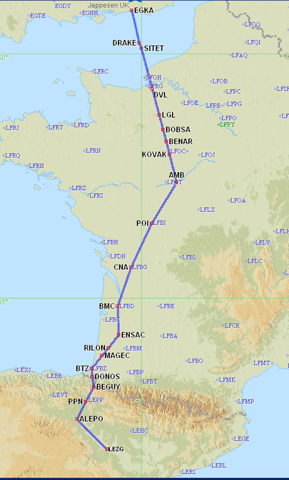
Note: the Eurocontrol routings given here and elsewhere will most likely not work by the time you might try them because the precise form needed to get the route into the computer changes from one week to the next. Consequently, the above diagram does not show the initial few waypoints and in fact shows the filed return route which was identical to the outbound route through France and Spain.
As usual, the routings on this trip were worked out in mere minutes using the ASA website, and required only straightforward hacking at the UK end to make Shoreham connect to the airways system. Additional notes on IFR route planning and weather services in Europe are here. Edit 3/2009: two new airway route generation tools have been recently developed - Autoplan FlightPlanPro
On the day of departure the weather was fine for an IFR flight. TAFs/METARs SigWx were OK. For a short-duration trip like this the NOAA data is also useful: Shoreham Zaragoza. Finally, the vertical profiles taken from the most recent available - 0000Z - soundings (select Europe / Skew-T) confirmed that the high pressure sitting over the huge area in question did not have unexpectedly high tops: Shoreham Zaragoza. There was no frontal activity over the entire region.
Local cloudbase was around 1000ft. However the cloud tops were at only around 2000ft so glorious sunshine was reached within a minute or so after departure
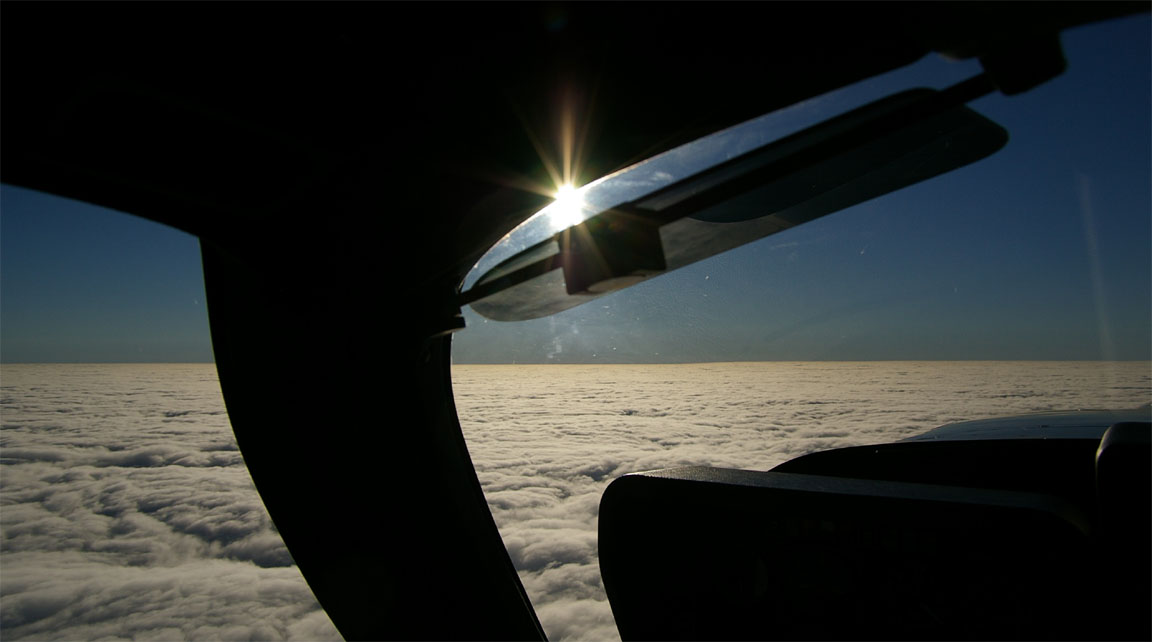
The flight plan had been filed for FL130 - the minimum level at which the Eurocontrol routing worked - but I asked London Control for a "stop climb" at FL090 which was immediately granted as always, and the flight continued at that level for nearly the entire route, above a very smooth overcast
This flight could not have been done under VFR, except as a low level scud run most of the way into France - always tricky due to the extensive military airspace there at low levels - and then what happens when one gets to the mountains? Much of the terrain in southern France and northern Spain was shrouded in cloud. Despite the superficially good weather, a VFR-only pilot would have probably been stuck.
Interestingly, it could have been done by a UK pilot with the IMC Rating. One would climb to VMC on top while still in UK airspace and then continue under VFR all the way to the destination. This trip was one of the cases - not uncommon if flying away from the UK in a southerly direction - when the UK weather requires flight under IFR but the destination weather is good VFR. The IFR privileges of the IMC Rating are limited to UK airspace but its removal of the "in sight of the surface" requirement of a UK issued PPL is valid worldwide. The routing over France would have been done FL065-FL105, within their published Class E "airway" routes. However - and this happened to me a number of times before I had the IR - one can easily get stuck abroad if the weather there changes. The full IFR option, available only with the IR, avoids this problem and generally speaking the only weather which is a "stopper" is one which would be hazardous to fly in.
There was 10-15kt of tailwind. Had it been much more I would have asked for a higher level which is usually worth doing to get a stronger tailwind. Flying at FL090 also saves oxygen which, while strictly speaking is not required below 12,500ft in a U.S. registered aircraft, I would always use on any reasonably long flight because it greatly reduces tiredness. I keep a large oxygen bottle at home (more info on oxygen here) so refilling the aircraft bottle costs me almost nothing.
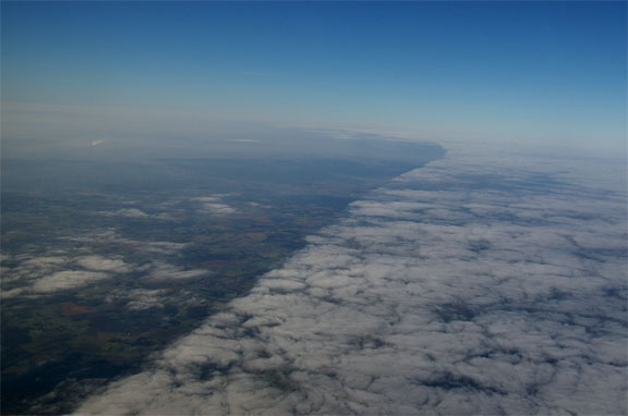
Around Bordeaux the cloud suddenly thinned out and disappeared
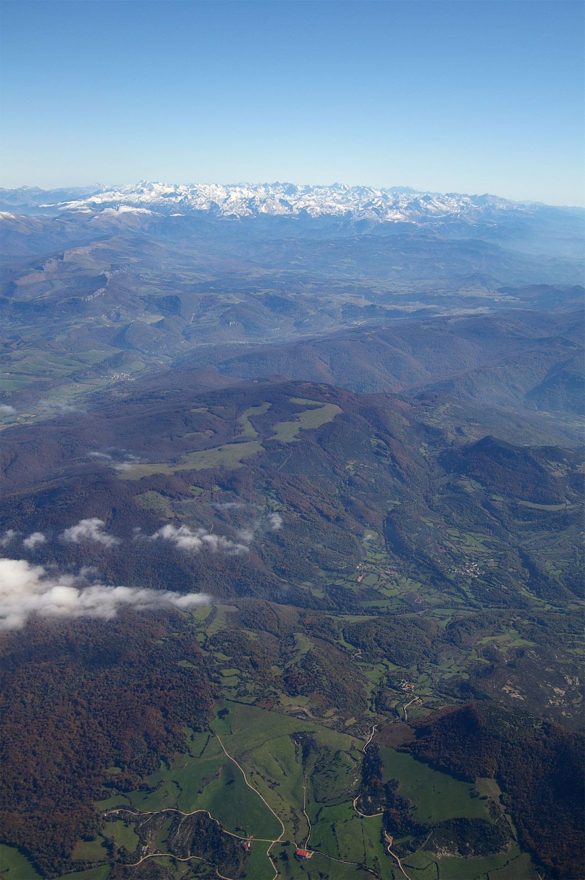
and soon after the Pyrenees appeared on the hazy horizon, with only very slight covering of snow
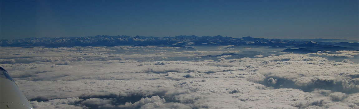
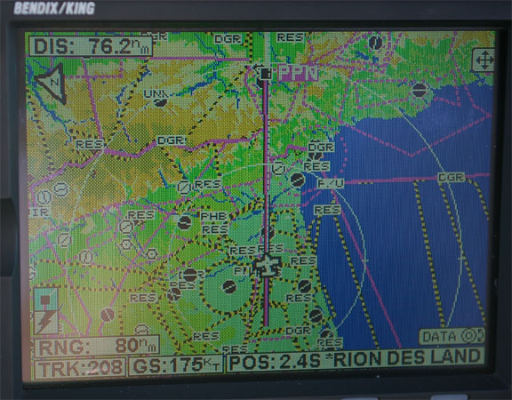
The above picture appeared to the left of the track; the mountains were crossed on a direct track to Pamplona where the terrain is quite a bit lower. The tailwind also picked up to around 20kt as can be seen from the 175kt ground speed below
Approaching the mountains, turbulence picked up a bit so I asked for a climb to FL110 which took care of that.
The Pyrenees disappeared into the distance
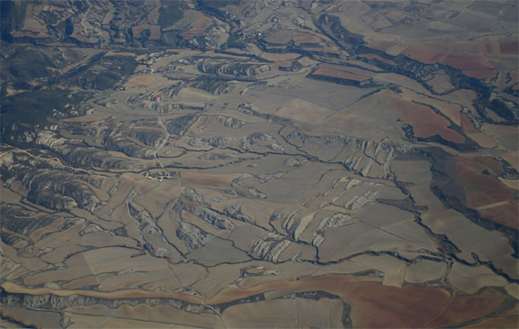
to be replaced with the barren and often moon-like terrain of northern Spain
The flight was characterised by a series of long DCTs issued by ATC, skipping large sections of the filed route. The first was by London Control clearing me all the way to Deauville, and some were 100-150nm long. One, which I had requested because it was a particularly good shortcut, took the track outside controlled airspace (which in France at FL090 generally means outside Class E which is CAS only for IFR anyway) and as is usual on these occassions ATC requested a confirmation that this was OK. Anyway, many UK pilots think that IFR outside CAS is illegal in France but clearly it isn't.
With about 50nm left to run, Madrid Control gave me a DCT to the Zaragoza NDB (ZZA) which forms the entry point of their procedural ILS (runway 30R) approach and soon transferred me to Zaragoza Approach who issued a descent to FL090, FL070, 5000ft and then a clearance for the approach in the standard "report beacon outbound" and "report localiser established" manner. Given that my filed route ended at ALEPO, I was expecting the ALEPO1A STAR (being the only candidate which connected to my filed route) but as is often the case it turned out to be much simpler.
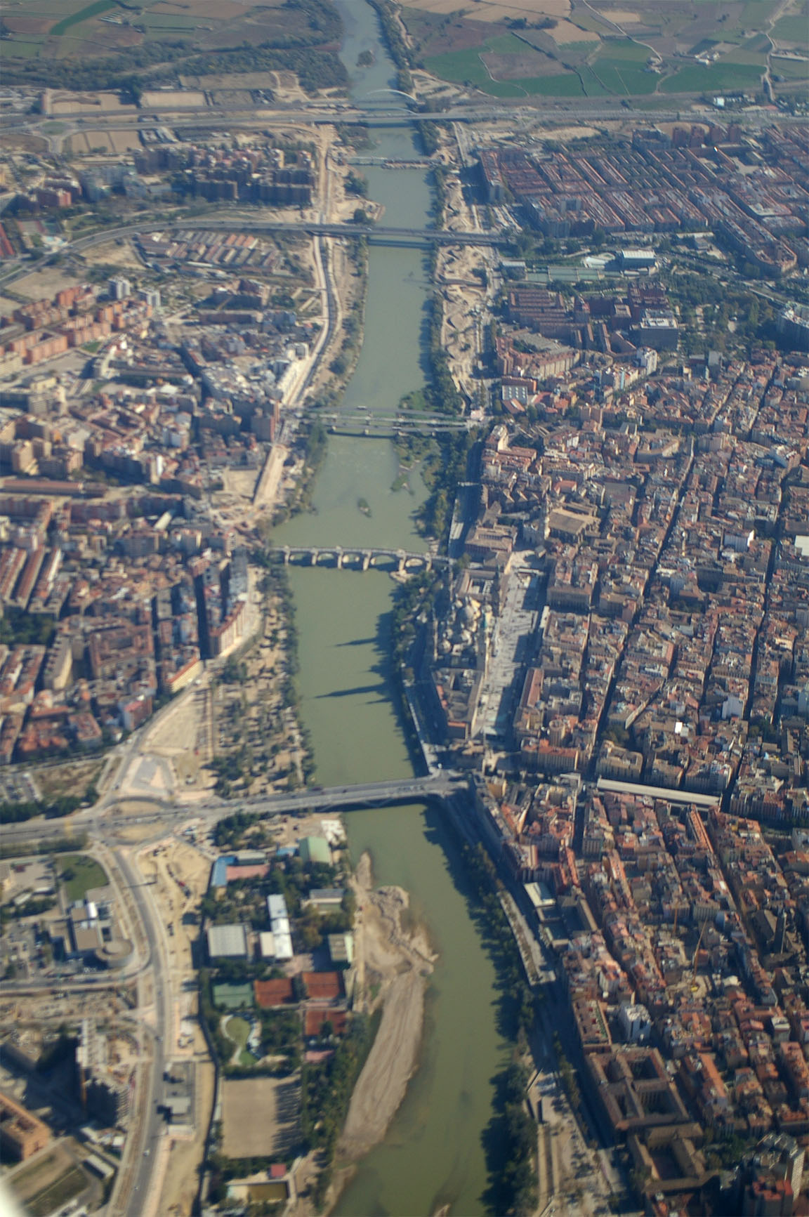
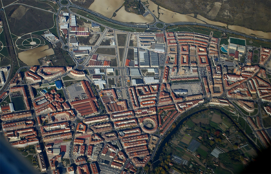
The procedure passes over the city
The approach was completely straightforward and I maintained 140kt all the way round, only slowing to the gear limiting speed of 130kt at the glideslope intercept, because there was a jet behind.
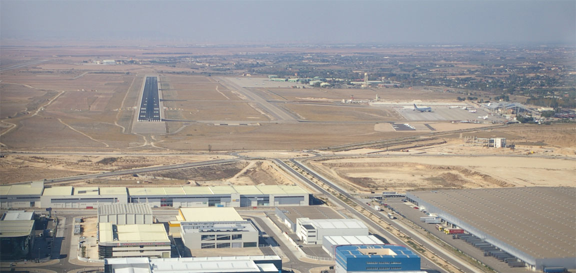
Zaragoza airport is a huge place with military aircraft based there too. There is another runway for the military, longer than the one shown above, a few miles in the distance so it looks like two separate airports.
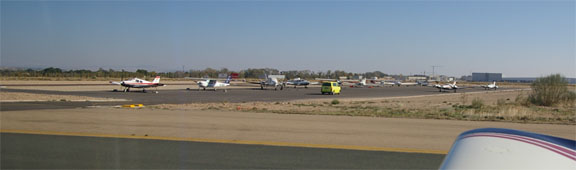
The taxi is behind a FOLLOW ME vehicle to a GA apron which is well away from the main terminal
I requested avgas while still talking to Tower, and they (despite their English being only marginally understandable) evidently organised it because the bowser turned up almost immediately. The AIR BP card was accepted but only the final invoice will tell me whether my request for "commercial" pricing will be granted. In Spain, one can generally get duty free Avgas on production of evidence of a business owned aircraft; elsewhere in Europe one needs to produce an AOC to get the same result. Update: the AIR BP invoice included a large amount of tax called "MOT" and came to £1.20/litre.
Most unusually in my experience, a policeman (armed as usual but most charming and polite) arrived immediately by car to inspect my passport, presumably because I had arrived from outside the Schengen area. After confirming to me that I would be simply walking back to the terminal he then drove off.
A Cessna piston twin landed and taxied in; judging from the dress code on an airline pilot training flight.
The walk between the apron and the terminal is quite a distance and one would not want to be doing it carrying 50kg of cheap booze! It was also suprisingly cold in the strong wind despite the intense sunshine from the clear blue sky.
Inside, the airport is somewhat disorganised, made slightly worse by most people in Zaragoza (including the tourist information desk) not speaking a word of English. At any foreign airport, the two most useful words are "private aircraft" accompanied by a gesture of flying a little aeroplane, and these usually lead you to somebody who knows the correct door. There is evidence of international flights, and the usual Ryanair stickers on some luggage handling trolleys, but it's clear that when there are no flights very little happens. To avoid unpredictable delays before departure, I always try to pay all fees after landing, and the GA office is upstairs and not easy to find. However the total cost of landing and 1 night's parking was just Euro 11 which is excellent and the man there was very helpful. I would take a Euro 11 invoice and a deserted airport anytime, over the Euro 200 sort of price range which is becoming rather too common around Europe. He was most suprised that I had already filed the departure flight plan over the internet and did not need the met briefing. It appears that most GA pilots are still relying on airport briefing and flight plan filing facilities; some people must have a lot of time on their hands.
The taxi to the city centre is about 20 minutes and costs about Euro 30.
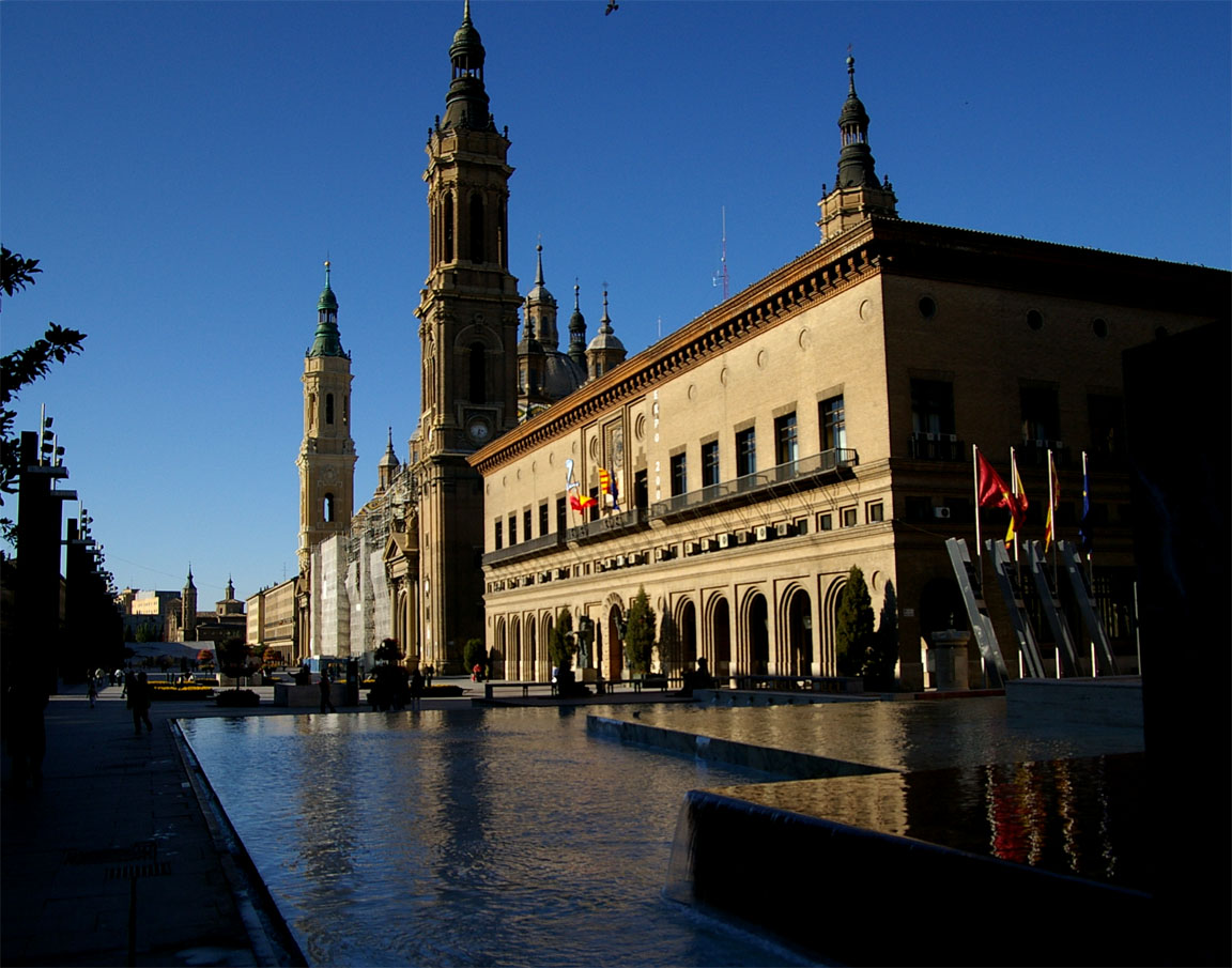
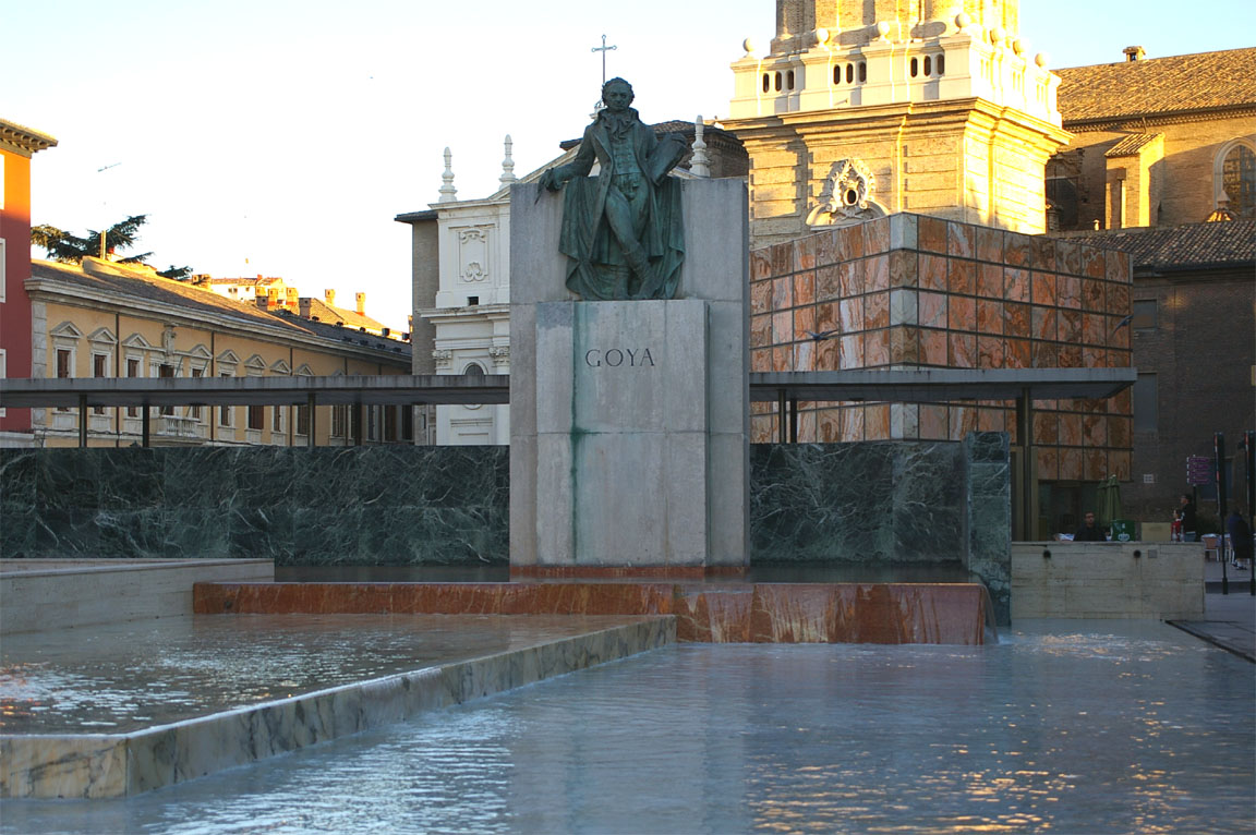
Zaragoza is a very old city, with a mix of ancient and some curious modern architecture. It's definitely worth a visit for a few days.

The return weather was OK (TAFs/METARs SigWx). I printed off the weather on the portable printer in case they wanted to see it before letting me back out to the aircraft, but in fact it was the printed flight plan acceptance they wanted to see. Returning to the airport there was no obvious way to get to airside so I walked upstairs to the GA office to ask, and they warned me about the flight plan printout and very kindly produced one for me.
The Return Flight
The routing, minimum acceptable level FL130, was
LEZG DCT ALEPO R10 PPN R299 BTZ R10 ENSAC B19 AMB A34 DVL DCT NEVIL DCT EGKA
Alternate: Bournemouth EGHH
Distance: 551nm (GC); 614nm (airways)
Very unusually for Eurocontrol routings, this route is the exact reverse of the outbound route. The only differences are trivia at the UK end which are needed to get the route into the computer and which are never flown as filed anyway. It seems that most airways in France and Spain are not only bidirectional but there are not many standard routes.
The departure clearance was as expected given the filed route starts at ALEPO - ALEPO1B and was one of the simplest I have seen. The climb clearance was FL130 on the SID.
Around ALEPO we were handed to Madrid Control who took the call but showed no interest, later handing us over to the wrong frequency (Bordeaux instead of Biarritz).
This flight was slightly longer due to headwind of 10-15kt. Again the Eurocontrol routing had to be filed at FL130 minimum, but after departure I asked for a stop climb at FL100. I then asked for a descent to FL080 to reduce the headwind; this worked to some degree and was still at/above the airway MEAs. A number of excellent shortcuts were requested and granted; the longest being 200nm from CNA to LGL.
Pamplona appeared directly below
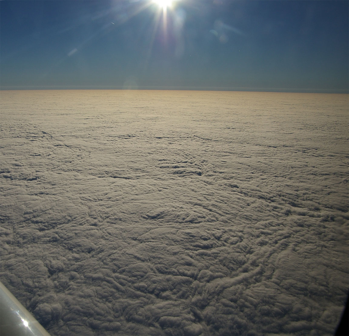
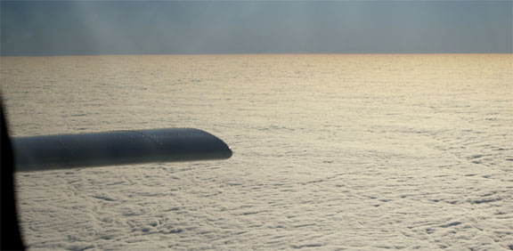
The northern French / UK weather was very similar to what it was on the outbound flight - a more or less solid overcast; with a very pretty texture but very boring to watch for 3 hours:
The last shortcut granted was a straight 170nm leg all the way to Shoreham, evidently coordinated with London Control in some way.
The notoriously unreliable KFC225 autopilot failed about 100nm before leaving France. In contrast to the previous half a dozen servo failures (which were characterised by the roll servo burning out, usually in a manner which the stupid autopilot computer never noticed) this time I picked up a burning smell. The circuit breaker for the servos had already popped but I immediately switched off the autopilot master switch and, just to make sure, pulled the other two breakers associated with the autopilot system. The smell cleared immediately. Then I checked that any other circuits that would be needed later on in the flight (fuel pump, etc) were still operating OK. All was fine, so I decided to continue the flight to the French coast at least. No problems occurred by then so, with two battery powered GPSs and a battery powered radio as backups for a total loss of electrical power, and no need for pitot heat (OAT was +9C) I decided to continue to destination.
Most suprisingly, the last French unit (Nantes) handed me to London Information rather than London Control. This may have been caused by the flight being at only FL080 but it's a naughty thing to do because it dumps an airways IFR flight (which is proceeding under an implicit whole-route clearance, under positive ATC control and without having to worry about controlled airspace etc, onto a Flight Information Service (FIS) which in the case of London Info cannot authorise flight into controlled airspace and does not even have a radar screen. It thus amounts to a summary eviction from controlled airspace. These things do unfortunately happen in the UK. If it had not been for the destination being a simple one on the coast and with plenty of high enough uncontrolled airspace on the way there, I would have refused and asked to be handed over to London Control.
Once with London Info, I explained that about half an hour earlier I had an autopilot failure accompanied by smell in the cockpit, which cleared once the autopilot was isolated. I added that should something else happen I would switch off all electrical power and continue to Shoreham non-radio. I also advised them that I had a battery powered radio and would try to use that if necessary. With two battery powered GPSs (the other one being an LS800 tablet computer working from its own rooftop GPS antenna) it would have been very difficult to get lost. They acknowledged and confirmed they advised Shoreham of my ETA etc.
It was close to sunset at the time of the descent

Unfortunately, the word "smell" changed to "smoke" somewhere along the line of communications, and probably later changed into "fire" and together with everybody having had a good hour's notice of the landing, I landed to a welcome comprising of at least four fire engines, two ambulances, police cars and a lot else. All this without making even a Pan or Mayday call, but I would not complain.
Other than jet contrails at high levels, no other aircraft were seen anywhere enroute. So much for the "crowded" European airspace. This is common on IFR flights around Europe as there is little or nothing flying enroute below FL200. Apart from the temporary excitement with the autopilot, the flight was as uneventful as one could hope for.
Airborne times were 3:45 (out) and 4:15 (return). The TB20 would have just made it (zero fuel) there and back from the UK without landing!
Pilot: FAA CPL/IR, approx 850 hours.
Any feedback, reports of dead links, corrections or suggestions much
appreciated:
Contact details
This page last edited 23 March 2009
