
Trip from Shoreham, UK, to Krk, Croatia, July 2020
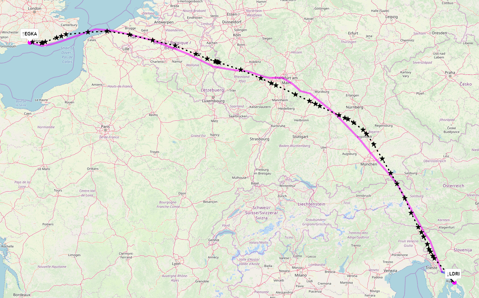
This article describes a trip from Shoreham EGKA, UK, to the island of Krk, whose airport is called Rijeka. To take advantage of tailwinds, and to minimise headwinds, the outbound route was flown through Germany and the return route via France
Here is a glossary for non-aviation readers.
Some background to this trip is in this EuroGA thread.
Airport PNR/PPR
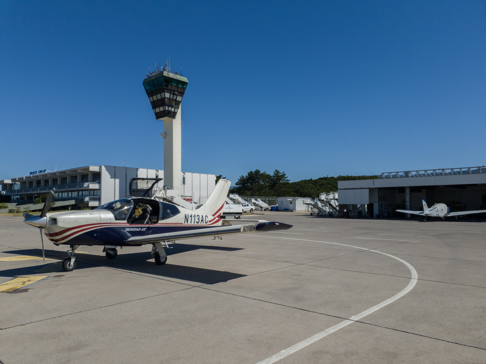
Despite being an "airline" airport, Rijeka LDRI was easy and really friendly, with fast replies by email. Croatian airports are generally very well organised and GA-friendly.
It was also helpful that this trip was done at the start of the relaxation of travel restrictions due to coronavirus - before the tourists from N Europe started to arrive in big numbers ![]()
Accommodation
With GA travel, there is no short-notice cost penalty so you can stay at home until the destination weather is good. AirB&B and Booking.com provide good solutions for accommodation and are widely used by pilots.
Booking.com is mostly normal hotels although many apartments appear on it also, hence it tends to be "hotel prices". I use Booking.com as the standard way to look for hotels. It is generally better than AirB&B for short-notice trips because you get a guaranteed booking right away whereas with AirB&B you "request" the apartment, and many AirB&B hosts play silly games and take up to 24hrs (the max allowed time) to respond, presumably in the hope of getting a longer-duration booking. AirB&B offers an "instant booking" facility on some properties however and this is supposedly non-cancellable. The other thing to watch with AirB&B is that you get every "broom cupboard" on it, so one should not go too downmarket... in one €40/night apartment we had sewage coming up through the floor! So, when looking for an apartment for several people, I normally look at apartments priced around the cost of a single hotel room - say €100/night. However, if you have a few days to play with, AirB&B is usually much better value for money; in most cases one can get a whole 2- or 3-bedroom apartment for the cost of the €100 hotel room. One issue with Booking.com is that most of the establishments offer only 1 room on it (to make it look like they are nearly fully booked, to scare people into booking something fast) which can make it impossible to book for a group; this is obviously solved by googling for the hotel and contacting it directly. Normally the hotels prefer that anyway because Booking.com takes a cut of at least 15%. But occassionally one finds a lower price on Booking.com, and bizzarely I have never managed to get a lower price by booking directly!
Pilot
FAA CPL/IR, EASA PPL/IR, ~2700hrs.
Aircraft
The aircraft is this 2002 TB20GT; one of the last made before production ended. This photo was taken in 2018 on a flight between Crete and Karpathos, in Greece:
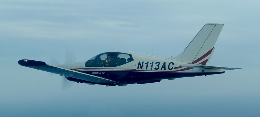
In January 2018 a full TKS ice protection system was installed. This was a big job, with numerous nontrivial aspects, but the end result was well worthwhile in expanding the operating envelope, by enabling safe penetration of non-convective icing conditions - basically icing layers which can be climbed or descended through fairly quickly. It was good to discover afterwards that the TKS system did not affect the cruise speed - something of a problem on other TB20 / TB21 installations where a speed loss of 5-7kt had been reported. The above pic shows the not yet painted TKS fluid refill door, just left of the "3". There is a payload loss of 50kg (with a full tank of fluid) which makes the TB20 a 2-seater if doing a trip with a lot of stuff. The system is totally effective against any icing conditions I have encountered but in those conditions it will empty the tank in around 1 hour! And the sticky fluid makes a mess; it is best to wash the aircraft down after such a flight with some hot water.
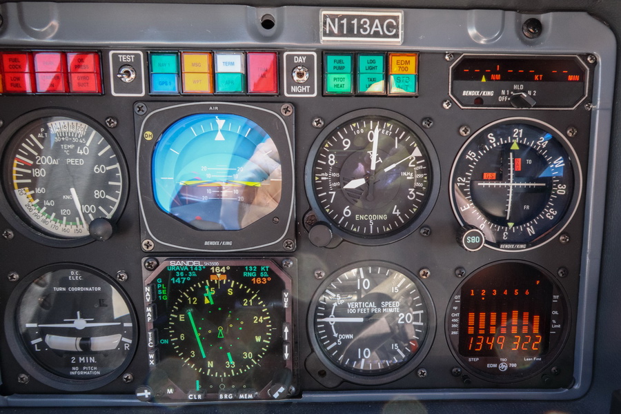
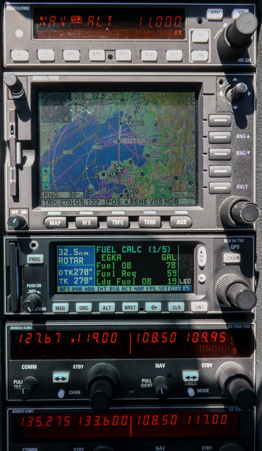
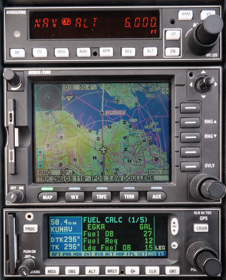
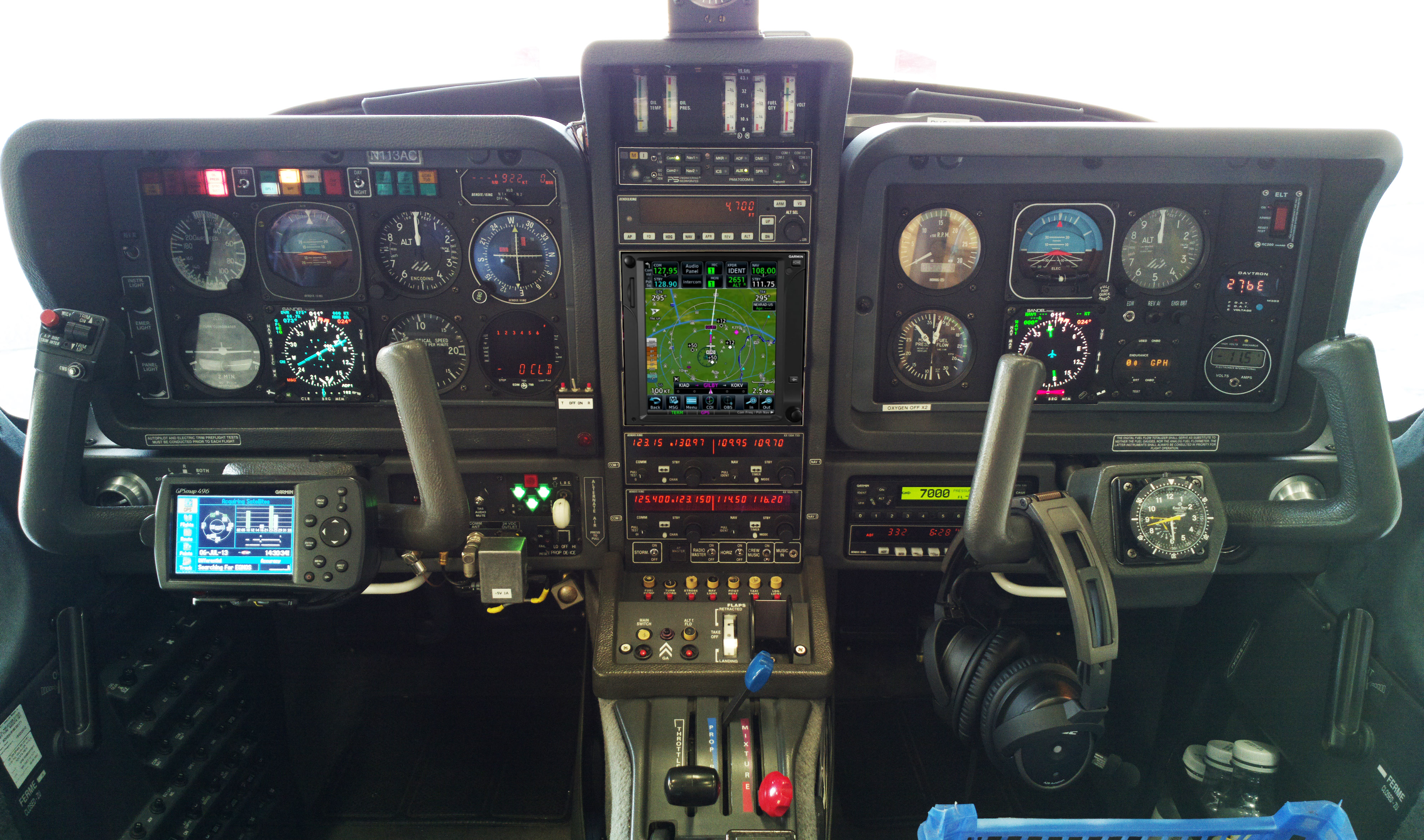
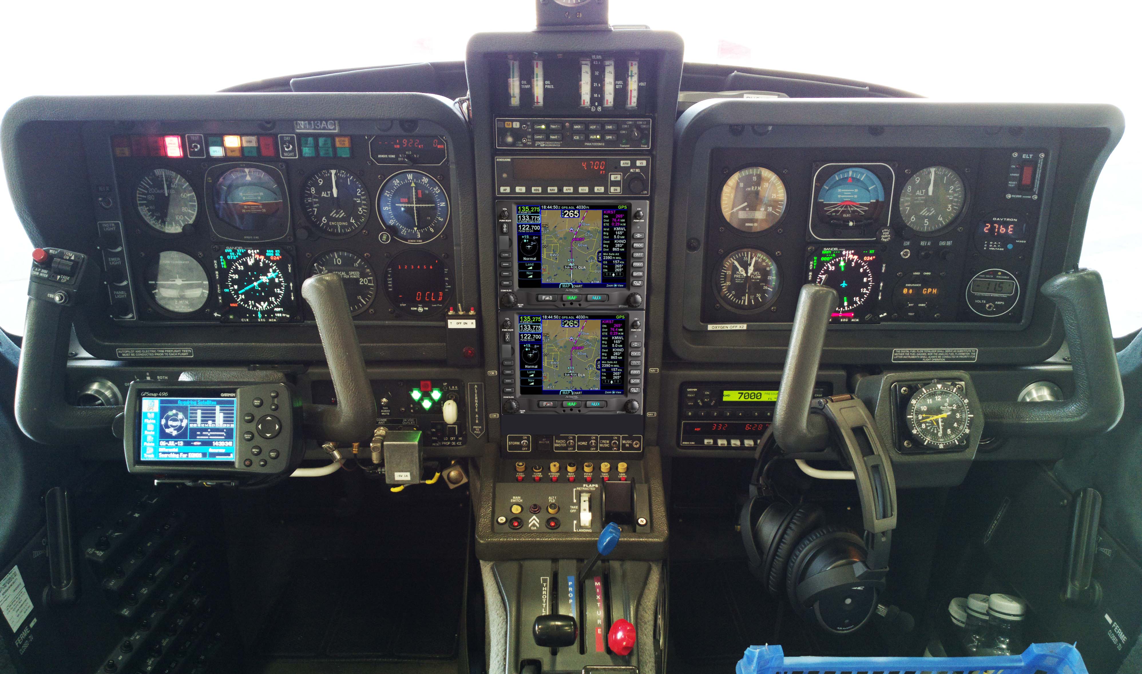
The aircraft is equipped for BRNAV (RNAV 5) and can fly ILS and GPS/LNAV approaches using the autopilot. This is sufficient for current European IFR flying. The cockpit is largely as delivered in 2002, with a Sandel EHSI installed in 2011 on the LH side and with the RH side later reworked with another Sandel EHSI and arranged to form a usable "pilot panel" so the aircraft can be flown from the RH side.
There is no LPV approach capability but LPV is not yet (to me) operationally relevant in Europe especially if flying to/from the UK which normally needs an airport with Customs/Immigration. France is ahead of most countries in removing ILS approaches (from airports not served by airlines) and replacing them with LPV. Adding LPV capability (which also gives you the very useful "+V" advisory glideslope on most GPS approaches) could be done with a cheap-and-dirty solution of a used GNS430W, but that would leave various dysfunctional loose ends, and a decent installation would be a Garmin GTN650+GTN750 (or just the 750) or Avidyne 2xIFD540 (the foregoing links are photoshopped mockups) and these jobs would cost about 30k but much more importantly I don't know of any installer who I would let loose on my aircraft on which I value the virtually 100% uptime!
The aircraft has an operating ceiling of 20,000ft in ISA conditions. I have taken it to 21,000ft but in the fairly common summer conditions of e.g. ISA+15 it will reach at most 18,000ft at MTOW.
This is the current panel, with the Aera 660 GPS on the LH yoke; this is wired to the intercom to provide a GPWS function with audible warnings in the headsets, as well as providing an emergency "DCT box" for navigation following a total loss of electric power. The Aera 660 is shown running the Garmin Safetaxi product which makes it a lot harder to get lost at a big airport ![]()
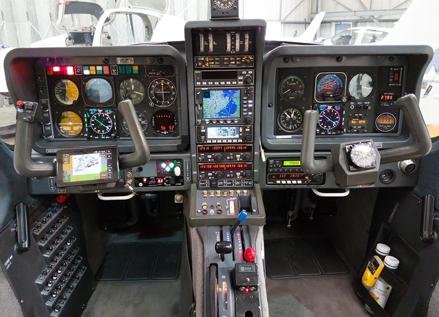
The Golze ADL150 satellite weather receiver was also installed in January 2018. This gives simple but usable graphical weather data for most of Europe, plus tafs and metars. With an upfront cost of around €500 and monthly costs of around €25 this is one of the best add-ons one can install in an IFR aircraft.
Routes
The IFR routes were developed with the Autorouter which was also used to file the flight plans. This facility is currently free. The only other options for autorouting are RocketRoute (over €200 a year) and Foreflight (around €100/year). Foreflight dominates the US market and is working on a European version, but it isn't there yet in terms of required functionality. For VFR flight plan filing I use EuroFPL. I also use EuroFPL for filing IFR flight plans as a backup, or for unusual situations e.g. where a specific ETA must be filed (to fit inside a purchased airport slot) and the Autorouter aircraft performance model does not allow that. With the recent demise of FlightPlanPro (one of the original autorouting tools, from 2008) the lack of a realistic backup for the Autorouter is a concern to many pilots... I have already found problems with delaying flight plans, for example, which works via the telegram interface but not via the website.
In case the Autorouter disappeared while on a trip like this, I generate the routings before leaving home and save them in a file which I email to myself. Then I could use one of the other flight plan filing tools (e.g. EuroFPL, or at worst AFPEX) to file the flight plans. This is not 100% reliable because a flight planned route may no longer be valid a week later, but it usually works, or may just need a little tweak.
Some notes on IFR in Europe are here.
The outbound route was filed for FL100 initially, rising to FL140 for the Alps. On this trip we are not crossing the Alps at their higher points; those need FL160-FL180.
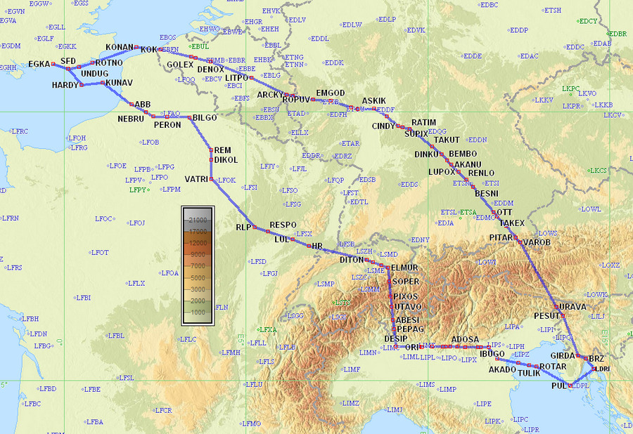
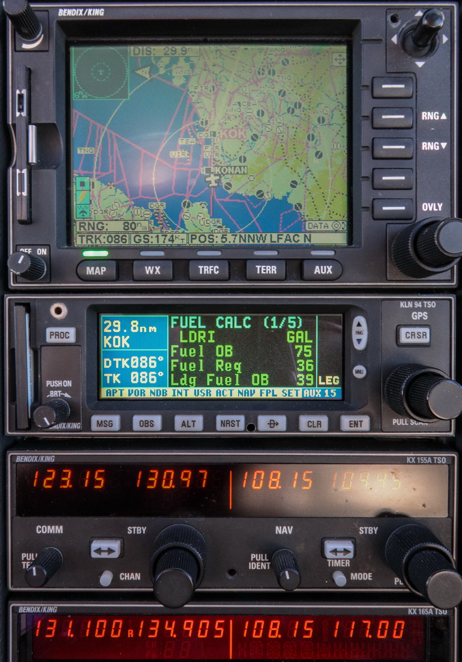
EGKA F100 SFD DCT UNDUG DCT ROTNO DCT KONAN L607 DENOX DCT LITPO DCT ARCKY L607 SUXIM/N0147F140 L607 RUDUS L984 ASKIK Z74 KOSEK L603 RATIM/N0152F100 L603 BESNI DCT OTT/N0148F130 M867 VAROB DCT URAVA/N0152F100 DCT PESUT DCT GIRDA LDRI
802nm as filed
683nm GC
Alternate: Pula LDPL (and many others along the Croatian coast)
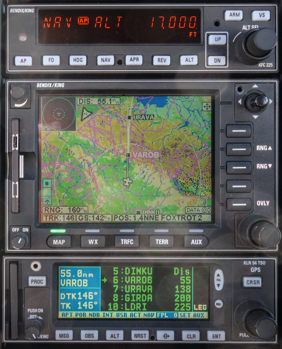
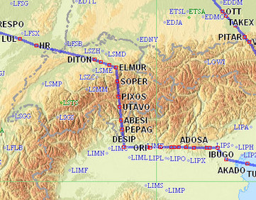
The return route was filed for FL110 initially, rising to FL140 for the Alps. That is the lowest crossing point available anywhere near the middle (UTAVO etc). It's a highly scenic route on which you go really close to the mountains.
LDRI F110 PUL4L PUL P11 ROTAR L615 AKADO Y265 INBUT N503 VIC L615 PEXUG/N0148F130 L615 DESIP N851 UTAVO/N0147F140 N851 ELMUR L613 MANEG/N0152F110 L613 HOC G4 RLP B3 BILGO H20 XORBI H40 NEBRU/N0150F120 H40 ABB N20 KUNAV DCT HARDY DCT SFD EGKA
886nm as filed
826nm GC
Alternates: Biggin Hill EGKB, Lydd EGMD
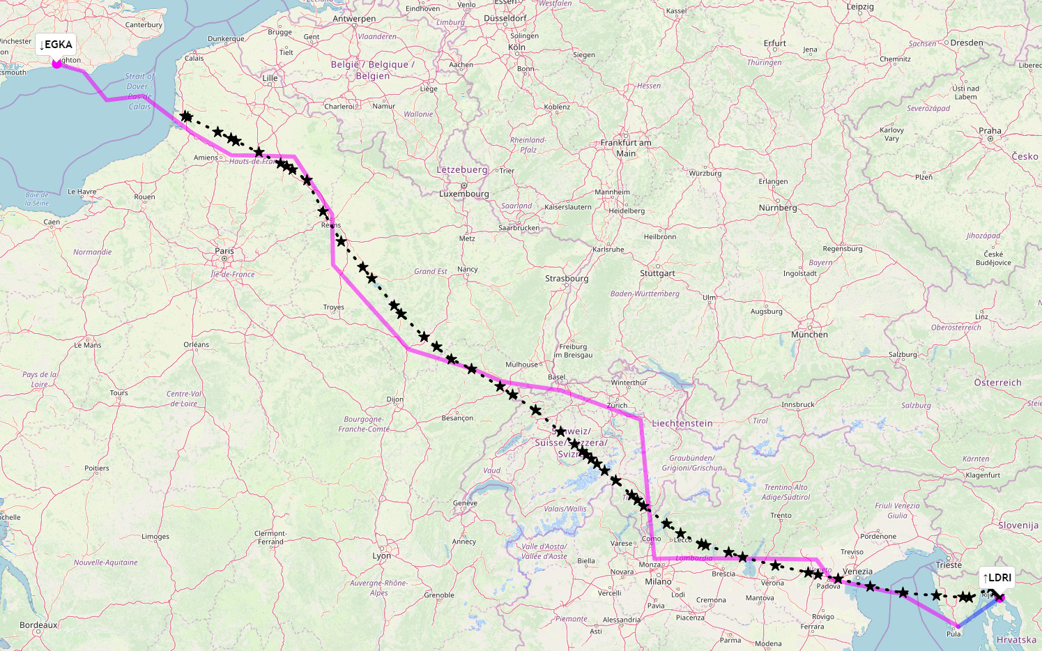
The upper one is outbound; the lower one is the return route:
The return route was chosen to be more southern partly to reduce exposure to the strong forecast westerly airflow, but I normally do this anyway because it is tactically better for crossing the Alps. I don't nowadays cross the Alps in solid IMC - even though I have full TKS ice protection, in case of power failure - and this route gives me a longer distance on which to climb while watching the weather over the Alps to my right. The idea is to be above any IMC by the time one reaches DESIP. Also the flight to DESIP burns off a handy amount of fuel which improves climb performance. In comparison, a departure from LDRI straight over the Alps (e.g. direct to URAVA) would give me a much shorter distance for the climb.
Many pilots fly "fully electronically" nowadays but for any significant trips I always prepare a printed paper package comprising of the route pic, a plog (a waypoint list; this is rarely used since the route picture shows most of the waypoints, and the flight is done with GPS navigation), and the terminal charts for the departure, destination and alternate(s). For terminal charts for unplanned airports I have a collection of PDFs on various devices including my phone. The advantage of paper is that the battery can't go flat ![]()
Weather sources
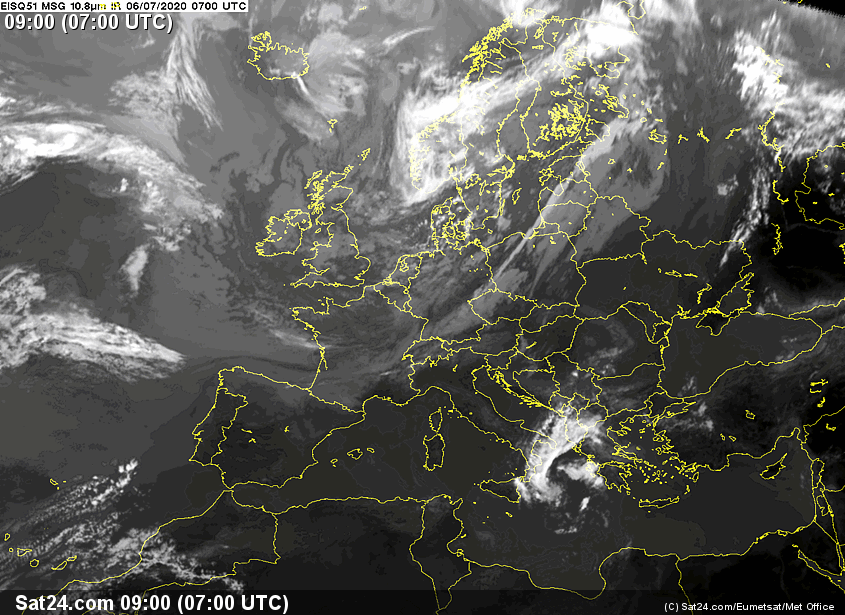
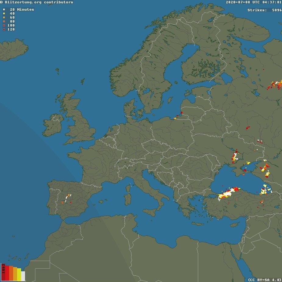
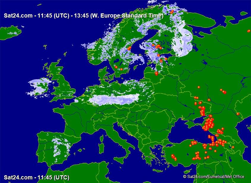
For many years I have been using tafs, metars, radar, IR (infra red) images for cloud tops, sferics (lightning) for convective activity, and the UK MO MSLP charts for the general picture.
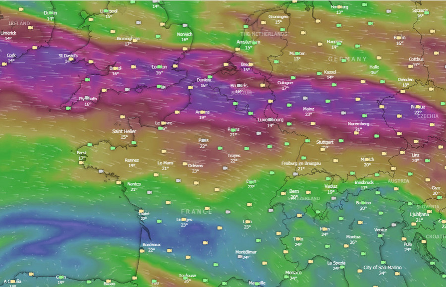
The Windy.com website is a new addition to the set of weather tools and is proving to be nothing short of a revolution. It offers three new European weather models - ICON NEMS and ECMWF - all of which are generally better for Europe than the GFS model which was universally used by pilots beforehand. European weather data has always been tightly guarded as a "commercial secret" so everyone used GFS, which was freely provided by the US. Somehow, Windy.com is able to offer these new weather models. The wind visualisation at different levels is very good; of course it is no more accurate than the weather models but it offers an easy way to assess which route is likely to get the worst or best winds. In reality I have found it to be within 10kt, usually. For IFR pilots, the "rain" layer is perhaps the most useful one, and I find the ECMWF model the most accurate, with ICON being the least accurate.
Shoreham EGKA to Rijeka LDRI
This 800nm leg shows the great range of the TB20, which can fly for around 1300nm to empty tanks.
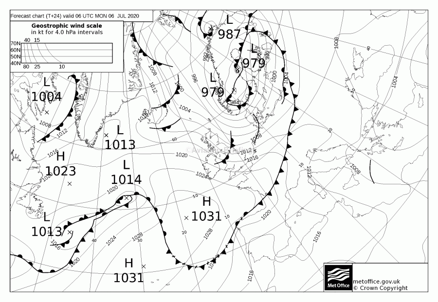
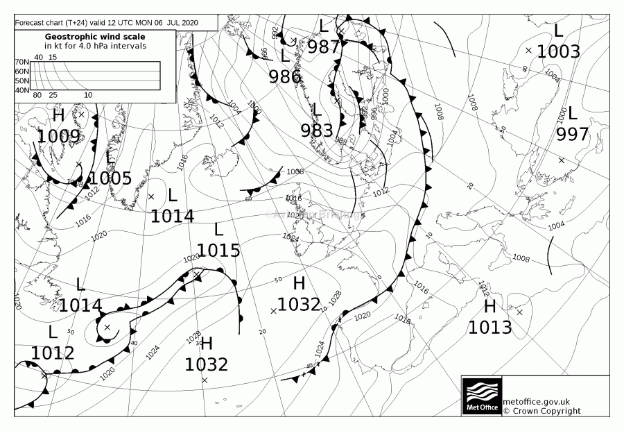
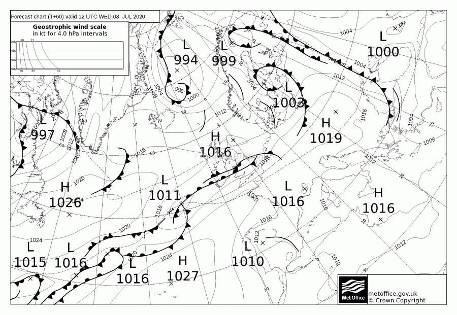
MSLP: 0600 1200
TAFs/METARs Notams IR Radar
Autorouter briefing pack
The IR image showed tops to maybe FL150. Unusually, I did not save the sferics image for this writeup but as can be seen from the above MSLPs there wasn't much there. The long cold front has very little pressure gradient across it and this doesn't produce much activity.
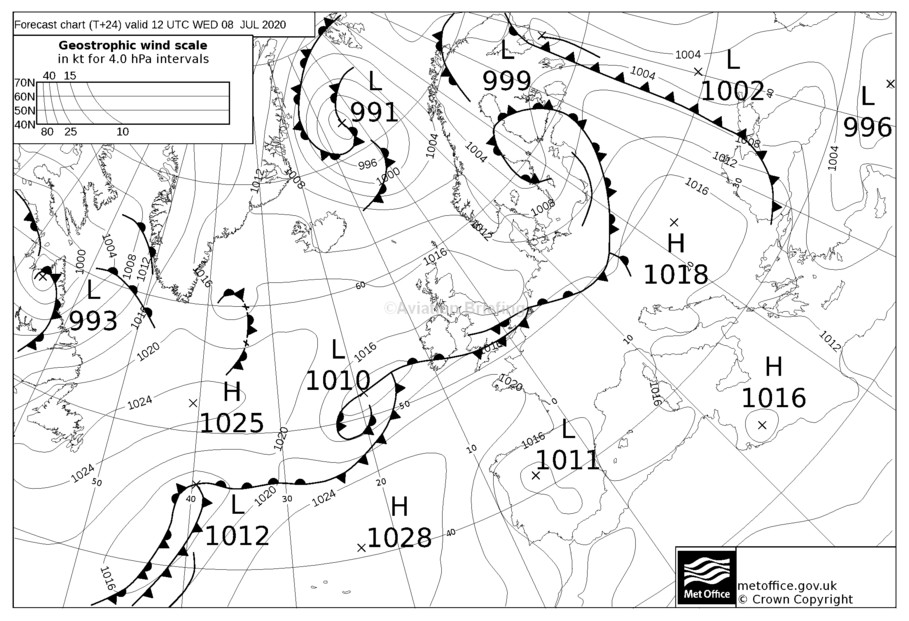
The return MSLP showed some weather north of Shoreham. I decided to go anyway. That weather later moved south and complicated the return...
Departure weather was nice
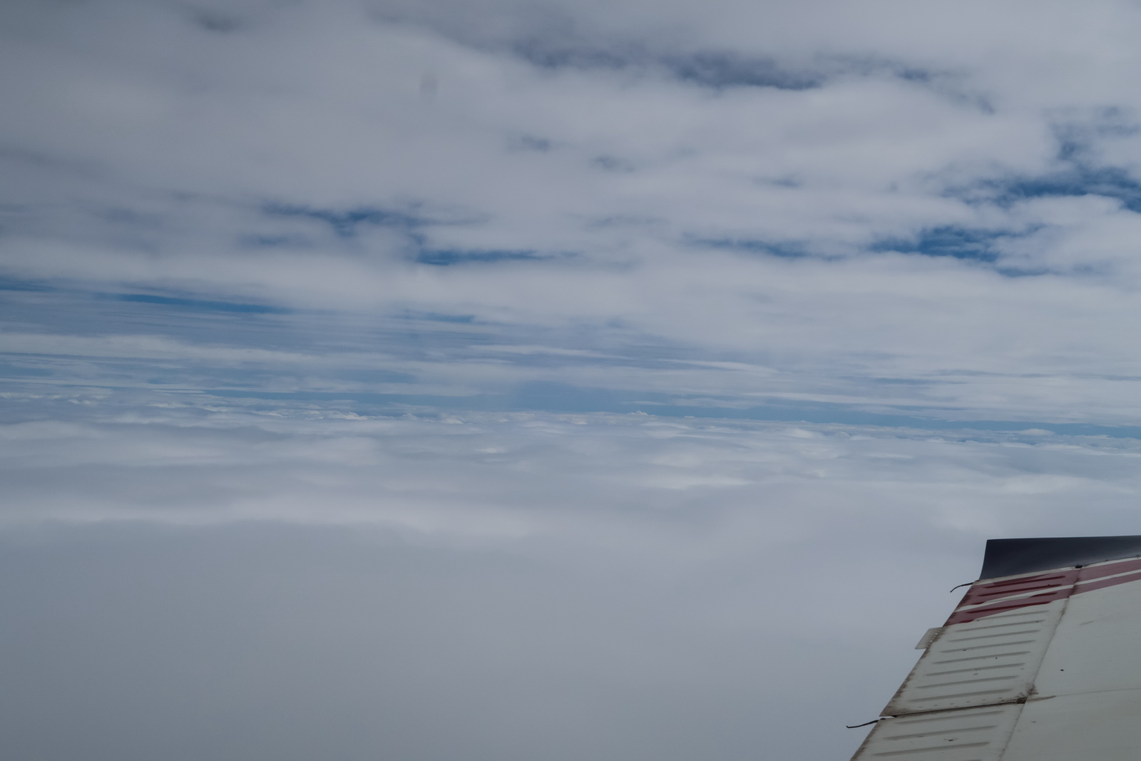
This is what IFR is mostly about: flying VMC on top of any weather, and not having to worry about busting controlled airspace ![]()
London Control cleared me into controlled airspace on track SFD as usual, FL100, and then FL130 and FL140 as I requested higher levels to get more tailwind.
The UK has recently adopted an aggressive "100% bust them all" policy, with every infringement, no matter how brief, of controlled airspace, danger area, ATZ, being followed up and the pilot being busted for it. Details here. Their clear aim is to reduce these pilot errors to zero. They don't "get" that the vast majority of infringements are minor pilot errors which are an inevitable part of flying outside controlled airspace, especially given the UK's disjointed ATC services. Some pilots get warning letters, many get sent to a 1-day "infringements course" (which costs £300-£500 and is mostly full of experienced pilots who got caught because they were using Mode S, some business jet pilots and even some instructors and examiners) and if you infringe again within 2 years of that course you are likely to get your license suspended, for many months and with no appeal. A very long discussion can be found here. As a result, many pilots are flying with transponders off (which is not legal) or with transponders removed or non-functioning (which is legal). However, this flight quickly passes into controlled airspace and under radar control by ATC, so this issue disappears. Also there isn't an issue with having to avoid traffic
I had a pretty good tailwind - up to 45kt was encountered! To get even more of this I climbed higher than the normal FL100. At FL140 the TAS was 138kt at 9.5GPH which shows the amazing range of the TB20, even though it is not the fastest SEP tourer out there. The LFOB (landing fuel on board) is accordingly being computed at 39USG
FL140 was reached around Lydd - 30 mins after departure - and that was not climbing anywhere near Vy.
Brussels issued KOK LNO ARCKY as usual and that crosses Belgium. Then Langen in Germany
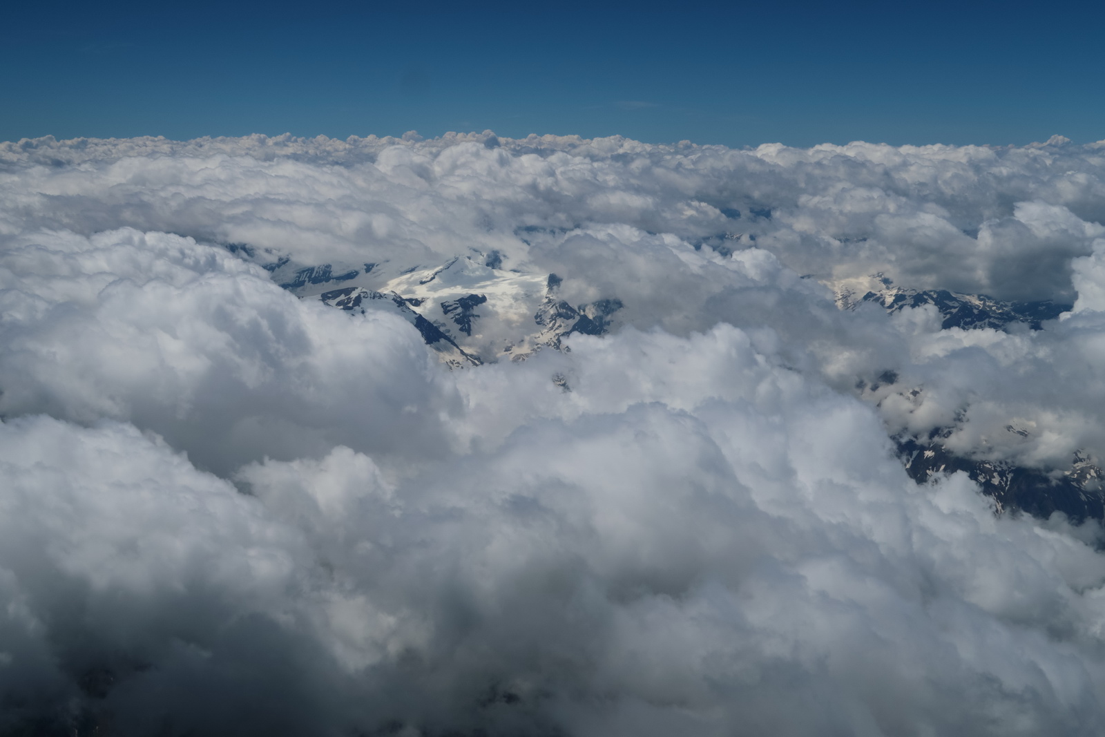
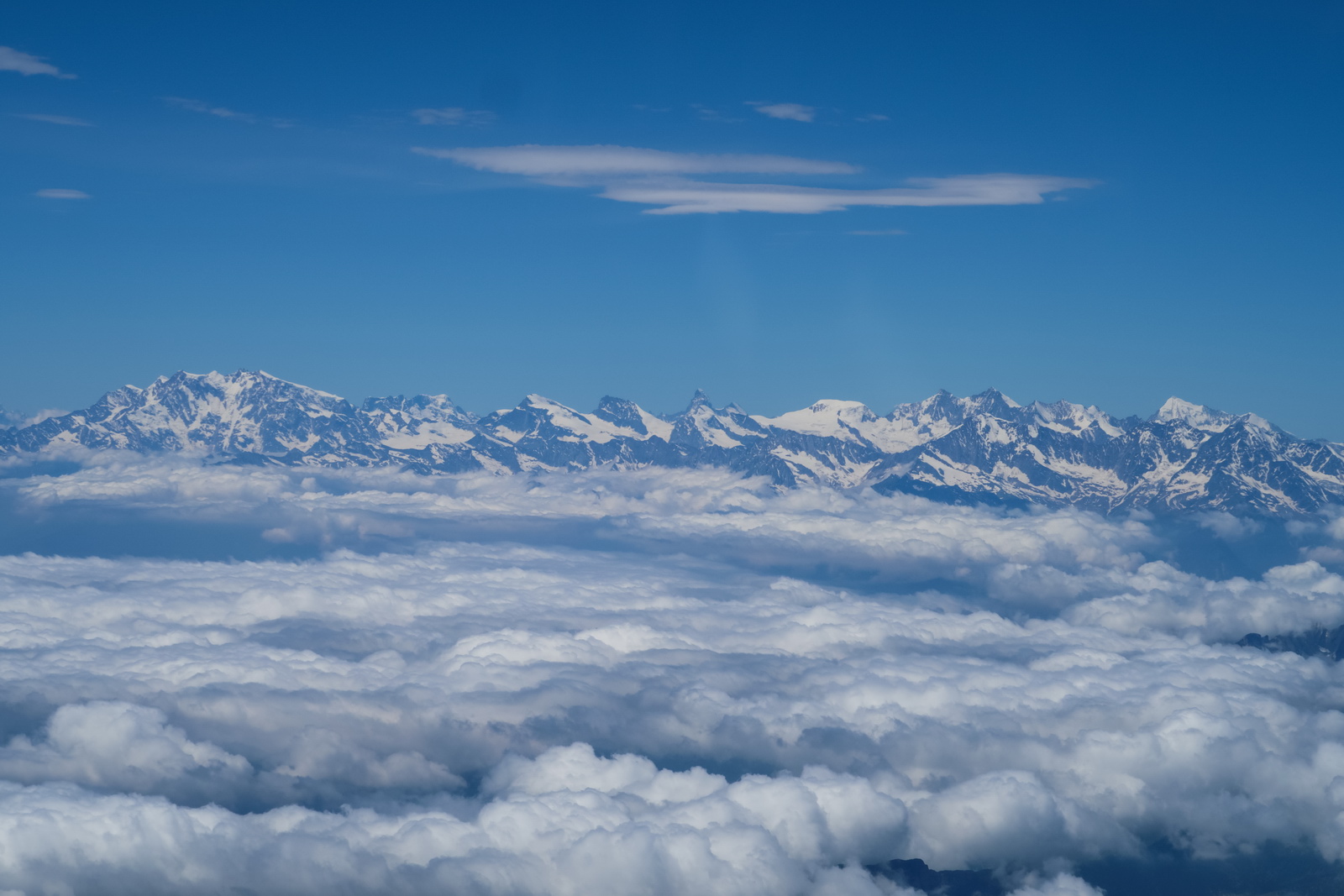
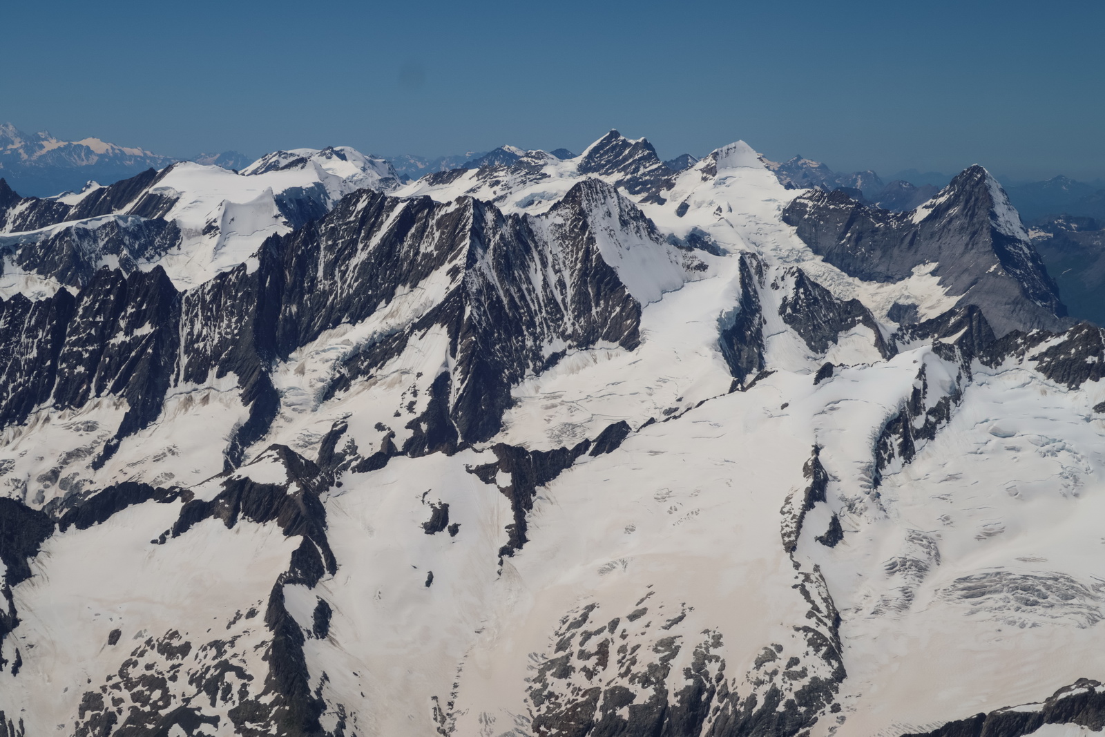
Approaching the Alps. Now at FL170, to make sure we stay above any buildups. The tailwind has more or less dropped off
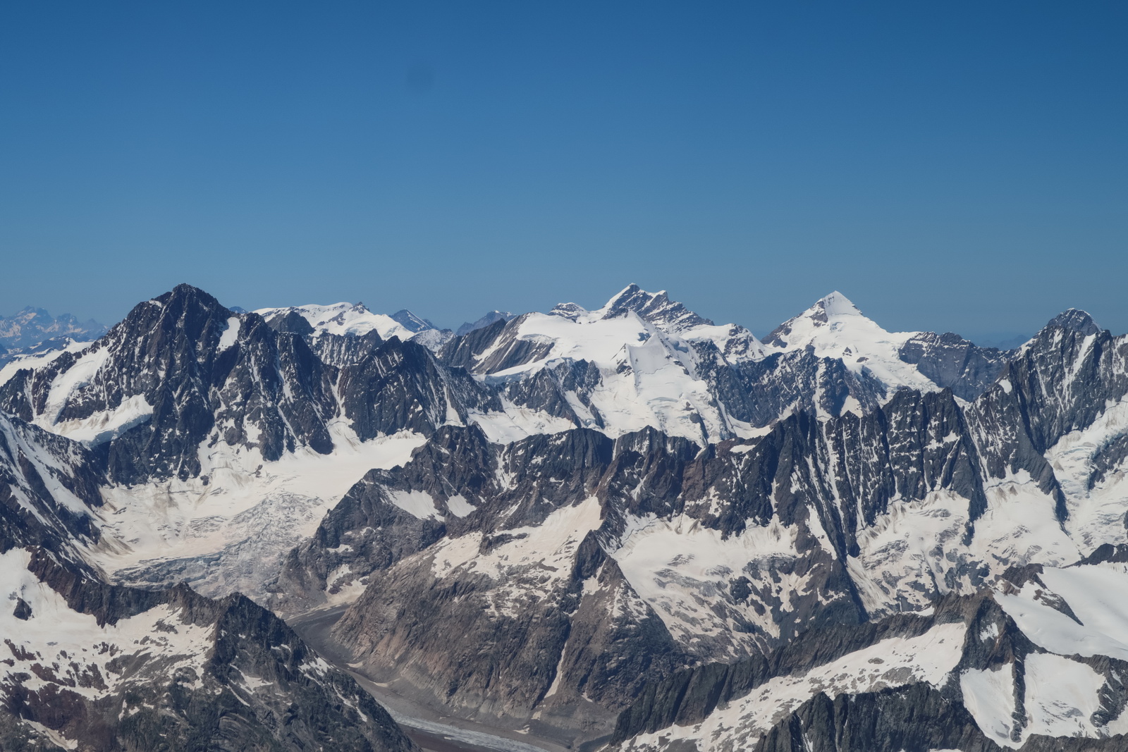
I never get tired of flying over the Alps, although they look their best with lots of snow and under a blue sky ![]()
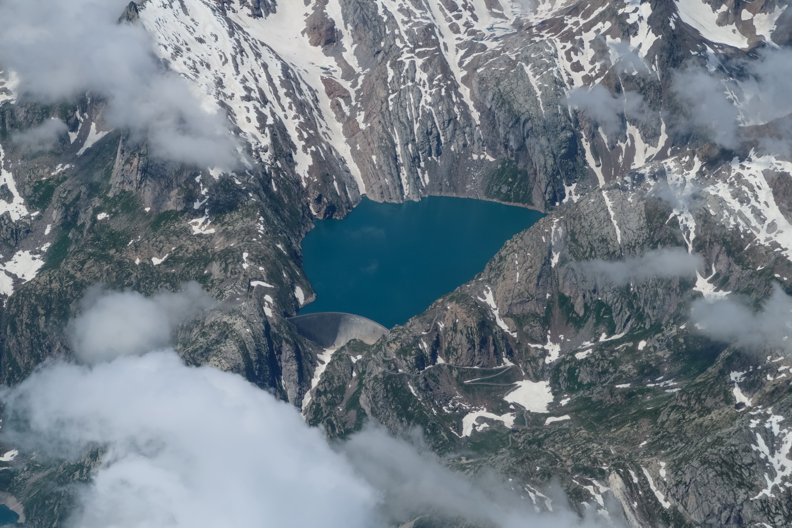
For this sort of flying where the engine failure scenario is not great, I run a special topo map of the Alps and always have a plan on which of the many canyons to glide into. The terrain here looks close but actually is at least 5000ft below
The TB20 performs well, with a TAS of about 140kt. This is at "best power" - due to the good reserves there was no point in flying slower - hence the EGTs are in the 1300s, which is about 150F ROP
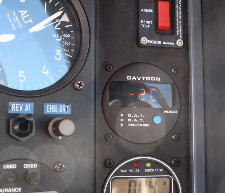
Astonishingly the temperature was -2C at FL170. This really shows how far above ISA the atmosphere can be, especially in the summer. And that really impacts the altitude performance
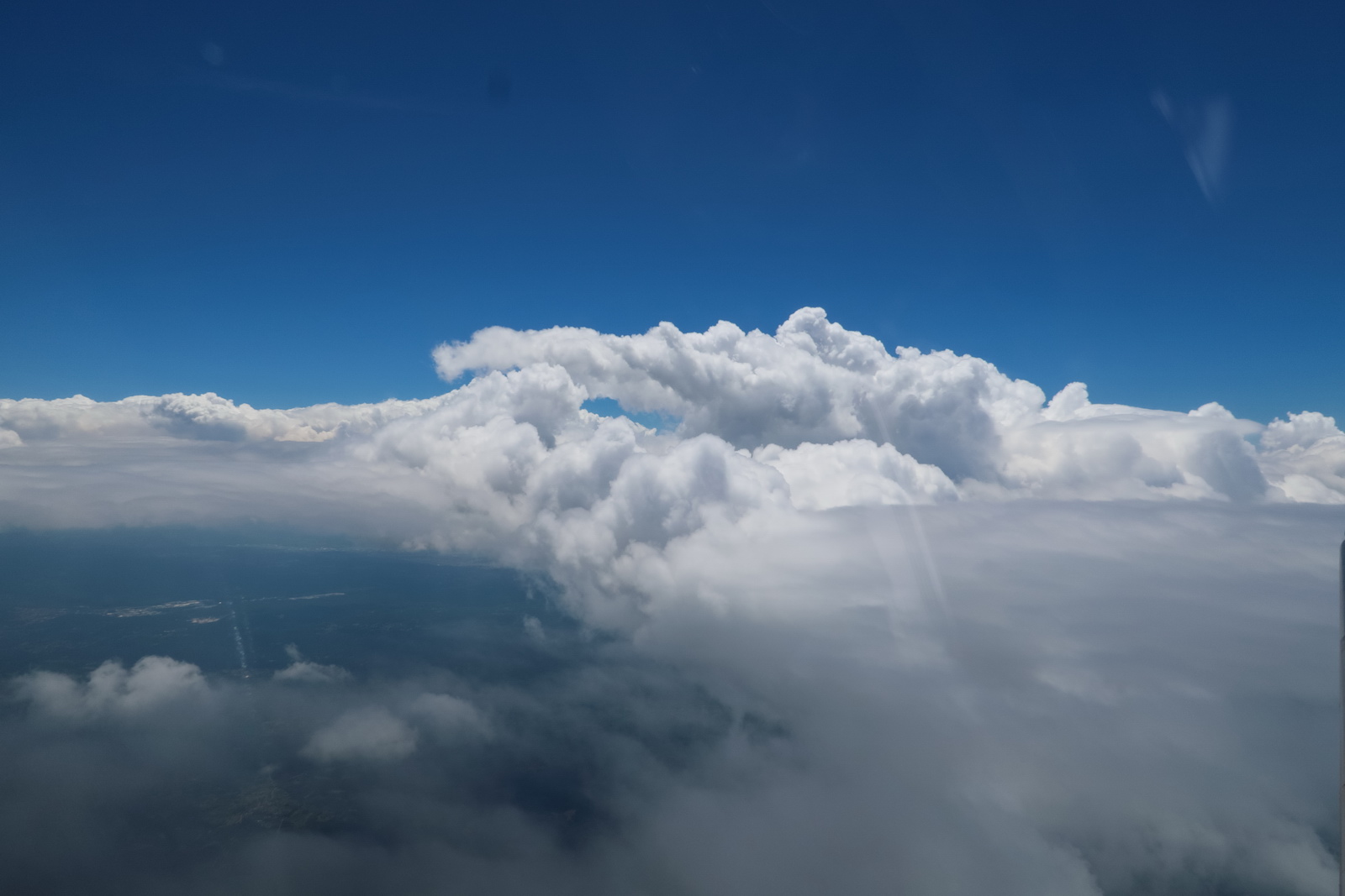
There were some buildups around...
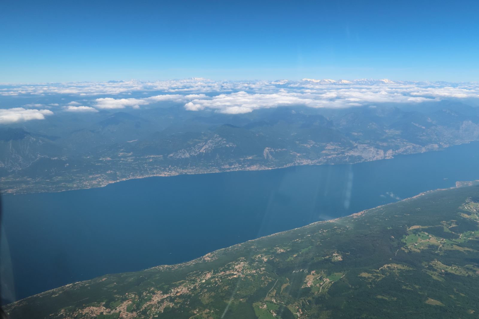
Handovers to Vienna and Ljubljana, and then Croatia.
LJDI - Divača, in Slovenia
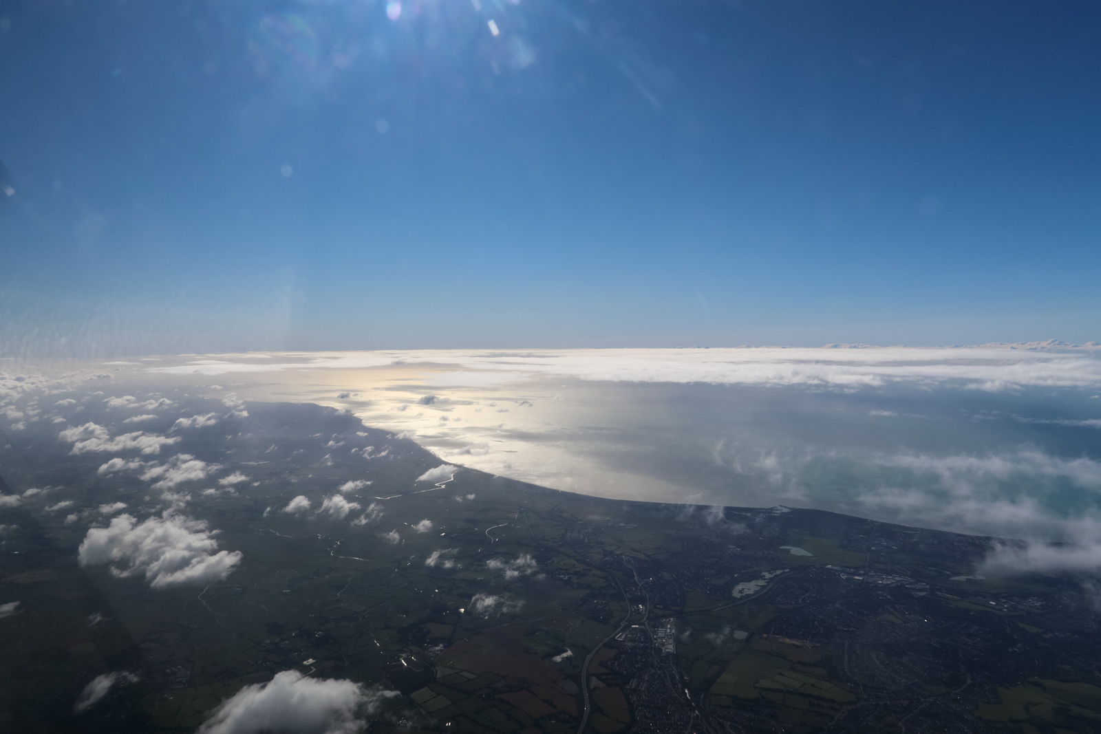
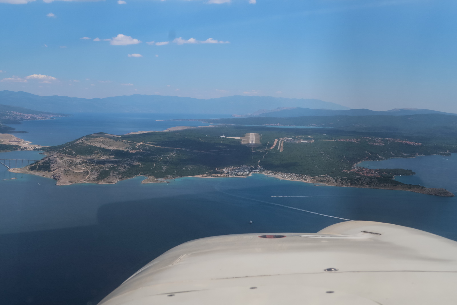
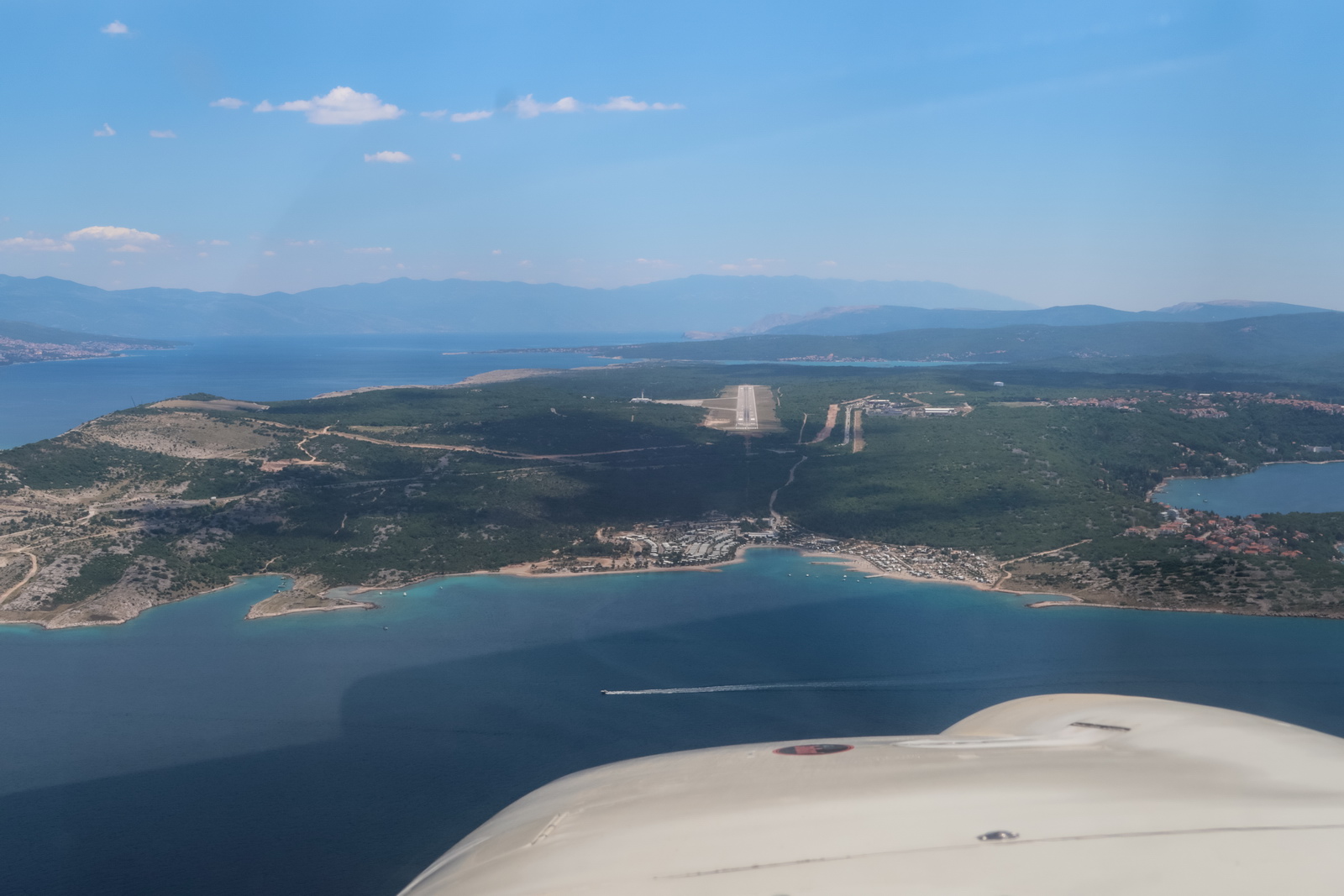
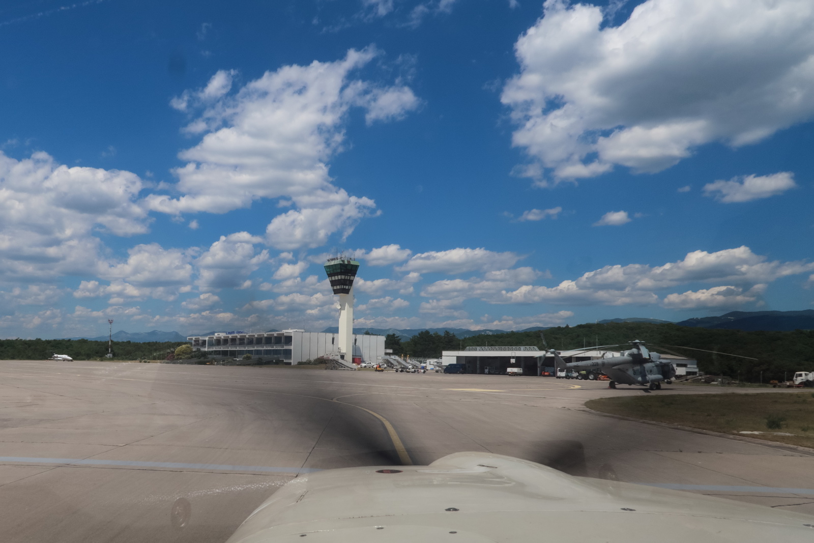
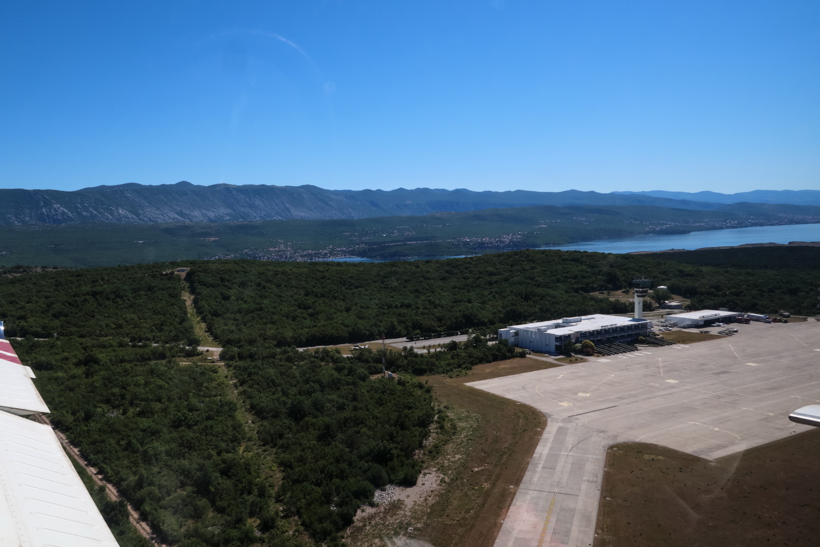
Now over the Alps and descending. Rijeka airport is now visible if you know where to look. They don't offer vectors to the ILS due to the terrain
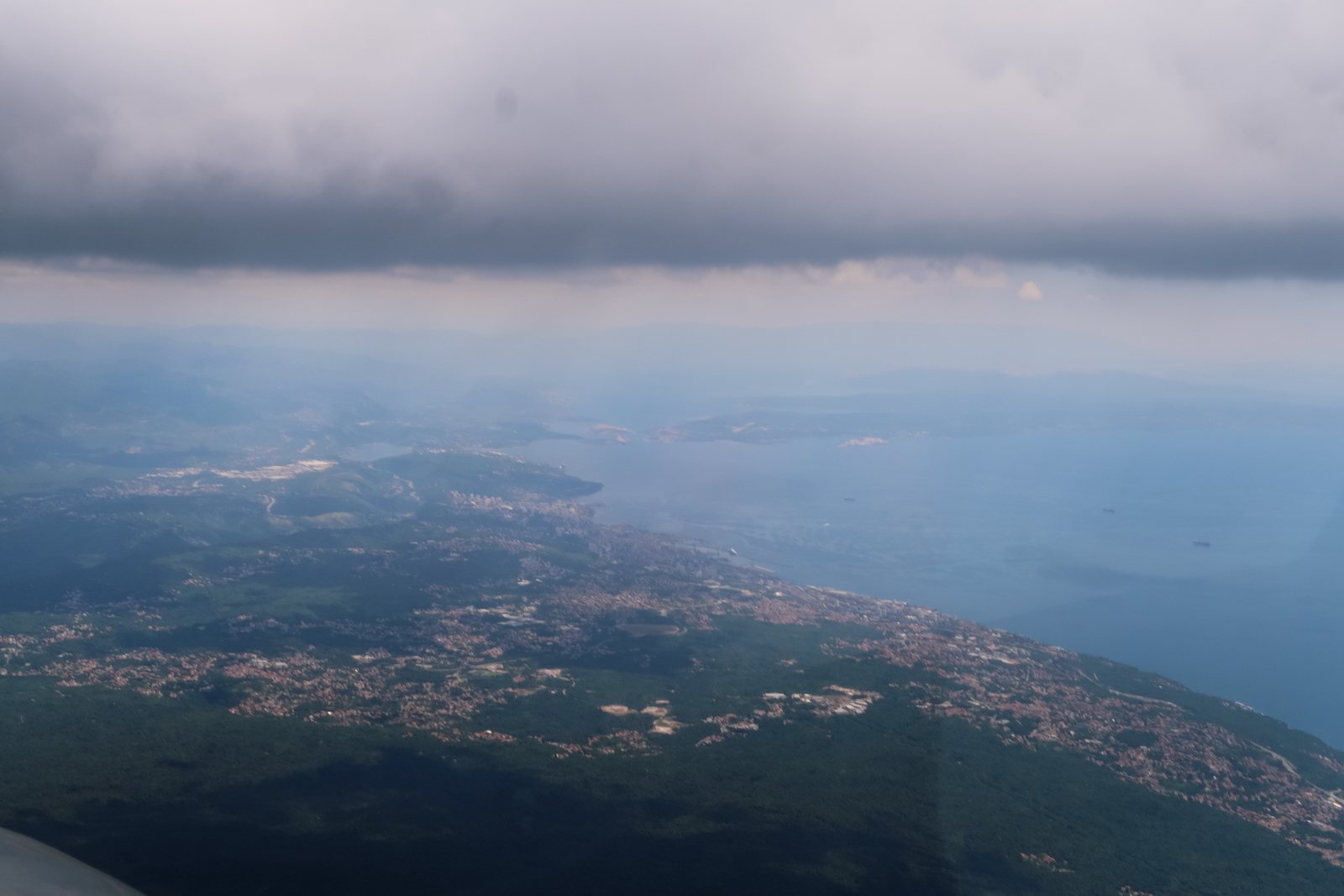
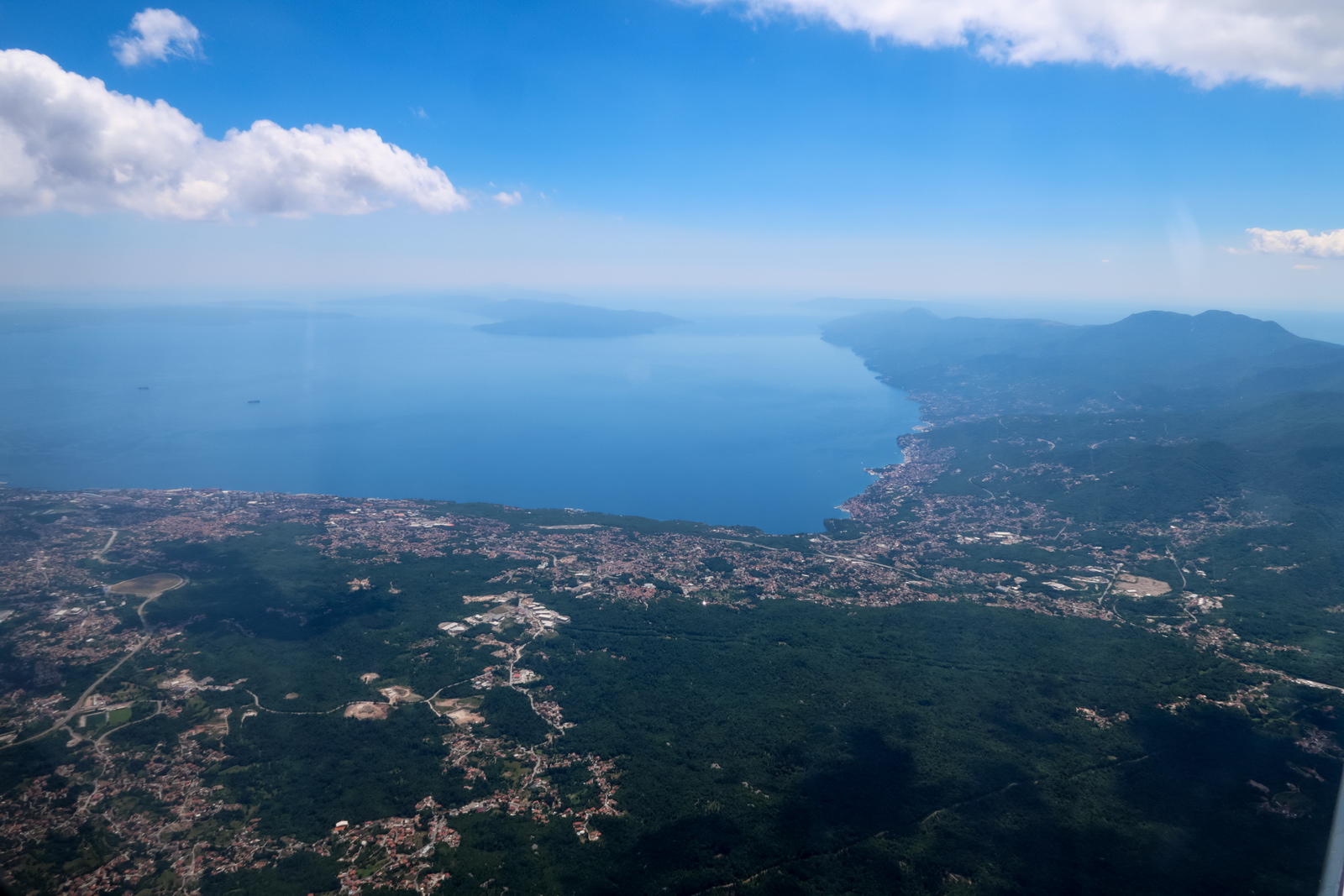
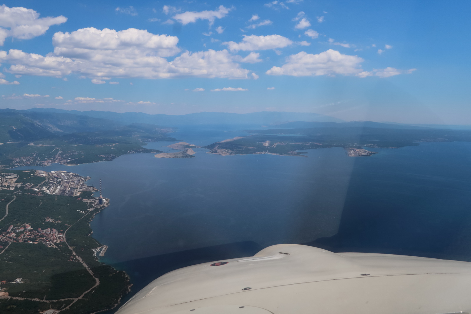
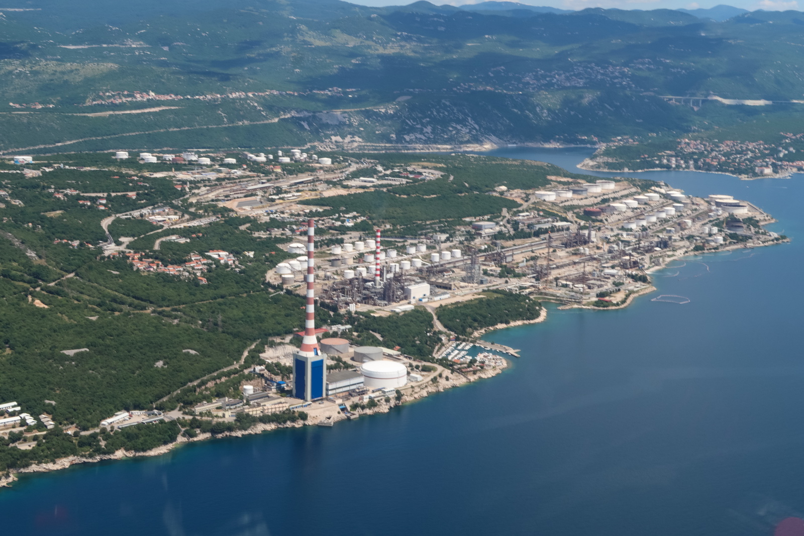
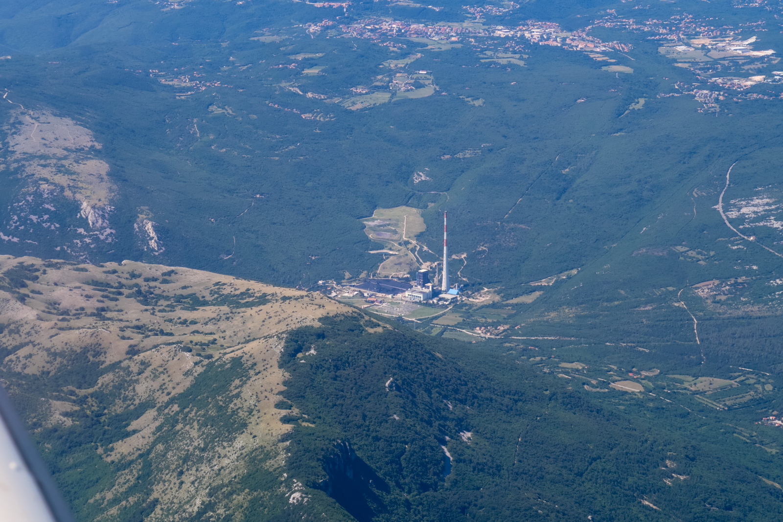
Rijeka itself is quite an industrial town
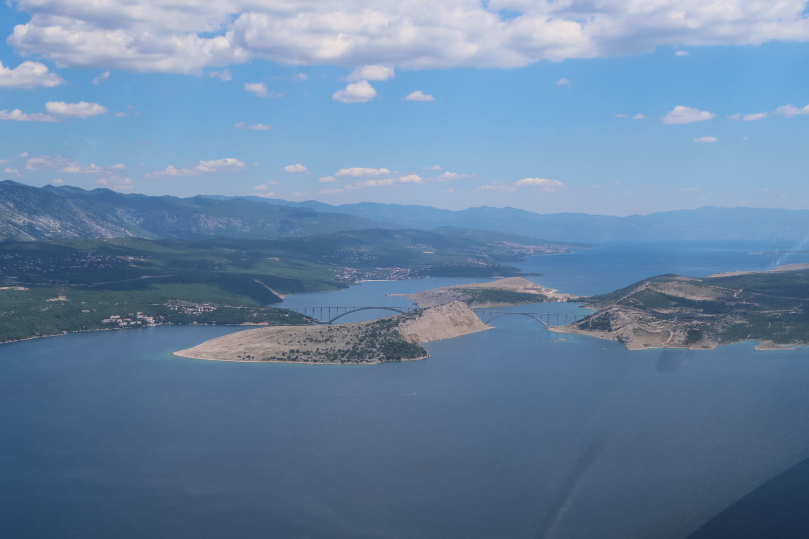
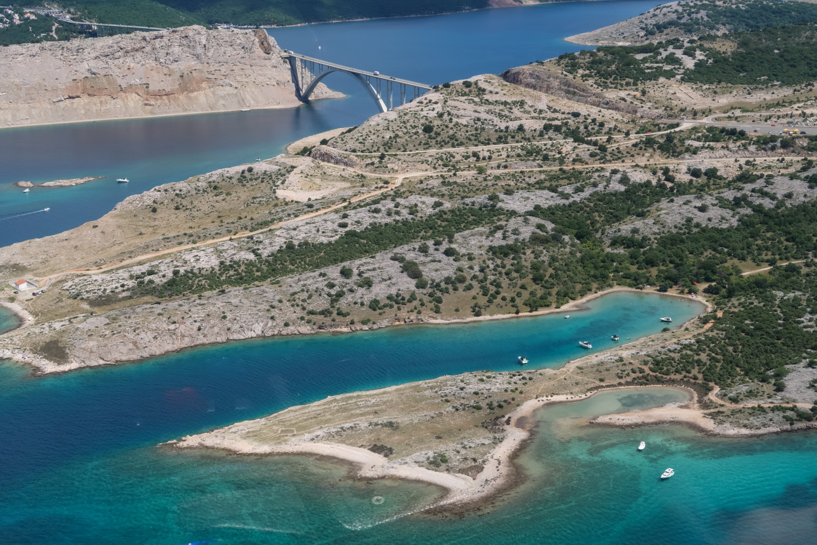
The bridge to the island of Krk; used to be called "Tito's Bridge" in the days of Yugoslavia
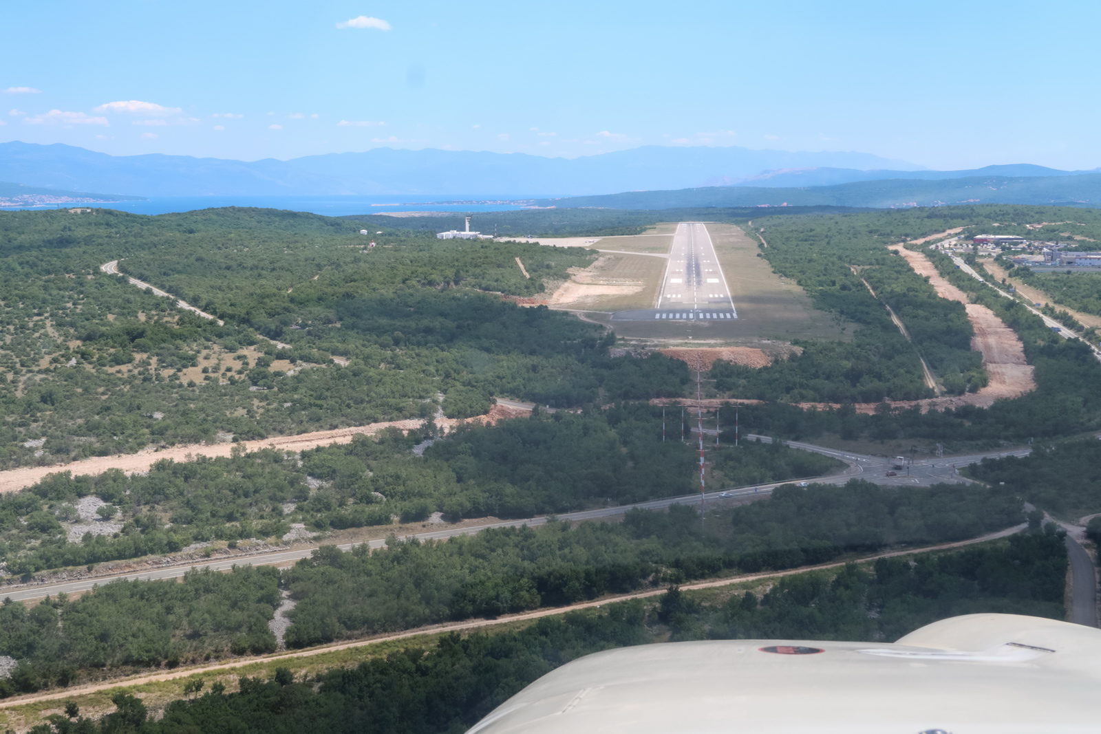
Right on the ILS
This was the route actually flown (filed is purple)
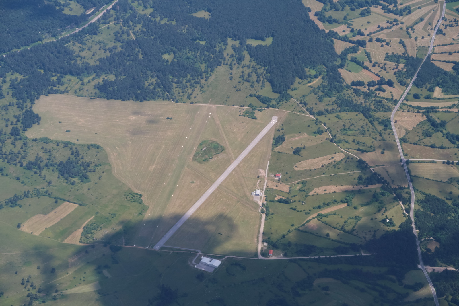
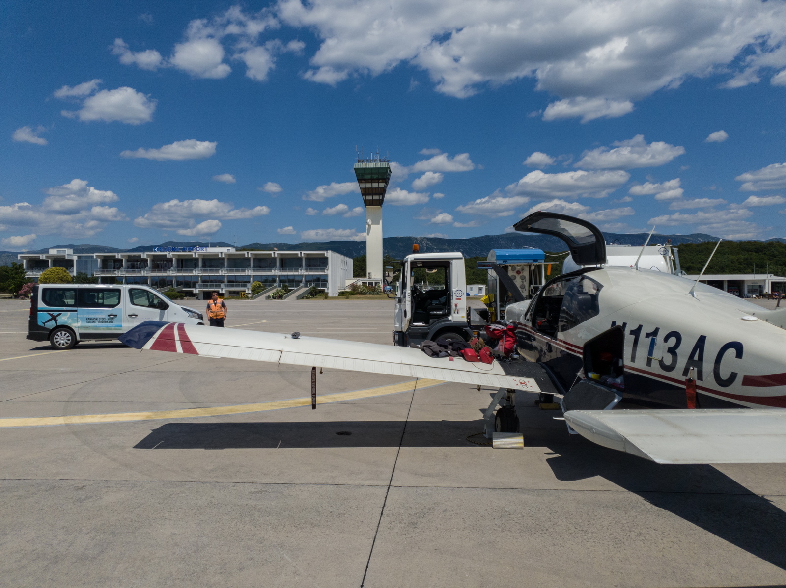
Nice new looking airport. In normal times they get a few airliners per day but were still really friendly, and at €63.75 the price is OK too
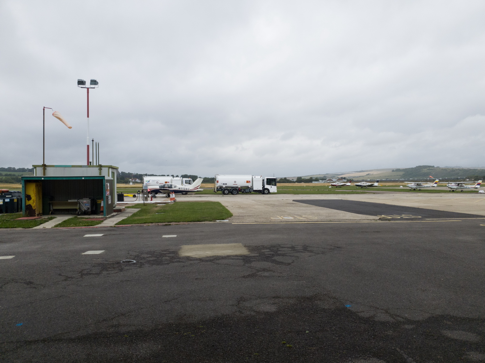
The computed fillup was 199 litres and the bowser (which arrived immediately) said 200 ![]() One could have flown all the way to Dubrovnik... There were 3 other GA planes parked
One could have flown all the way to Dubrovnik... There were 3 other GA planes parked
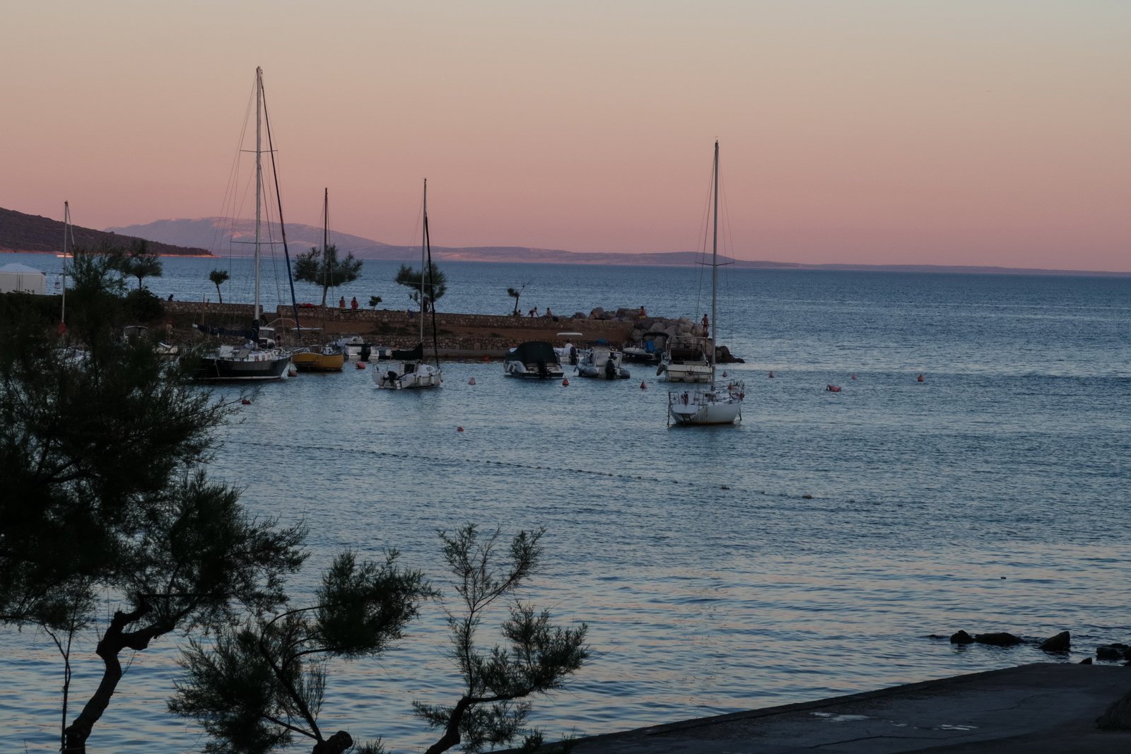
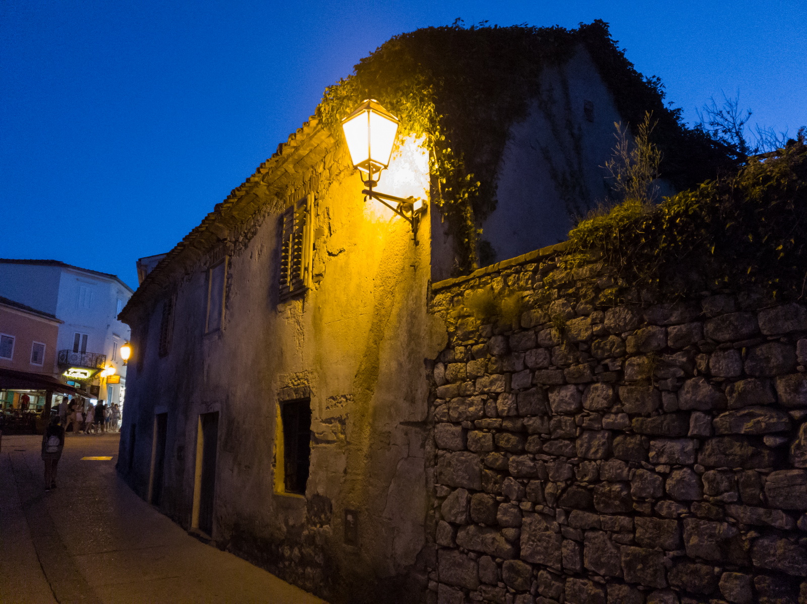
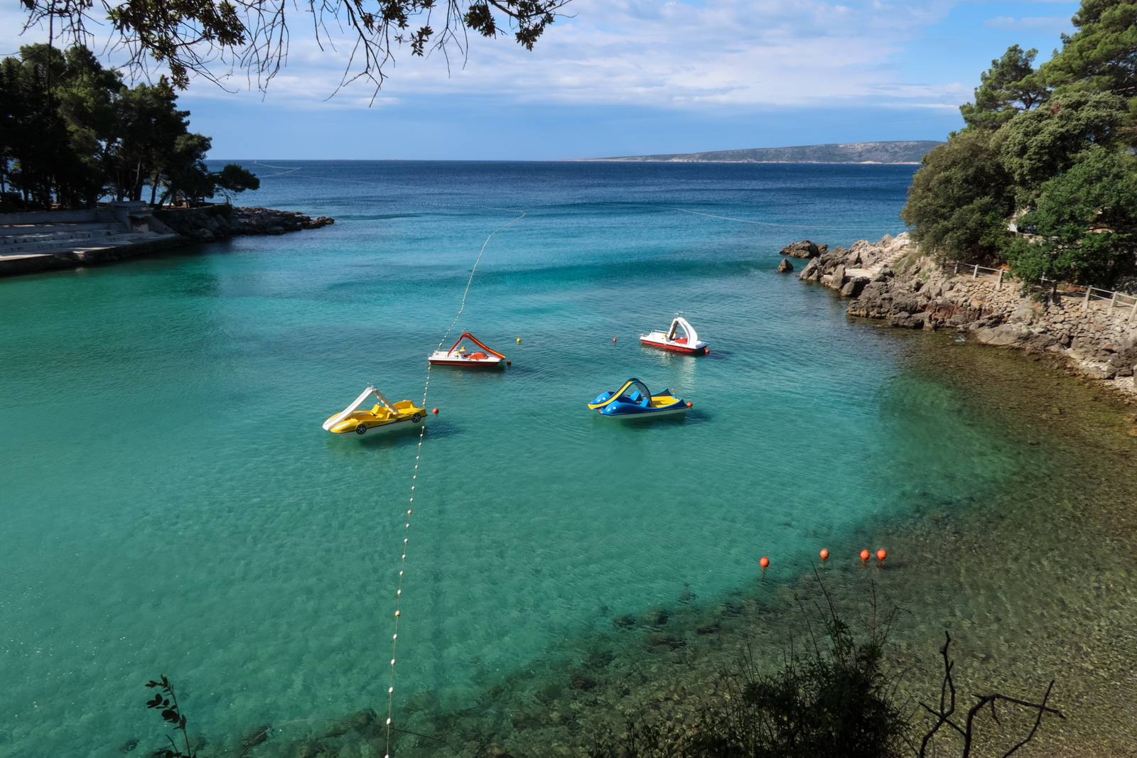
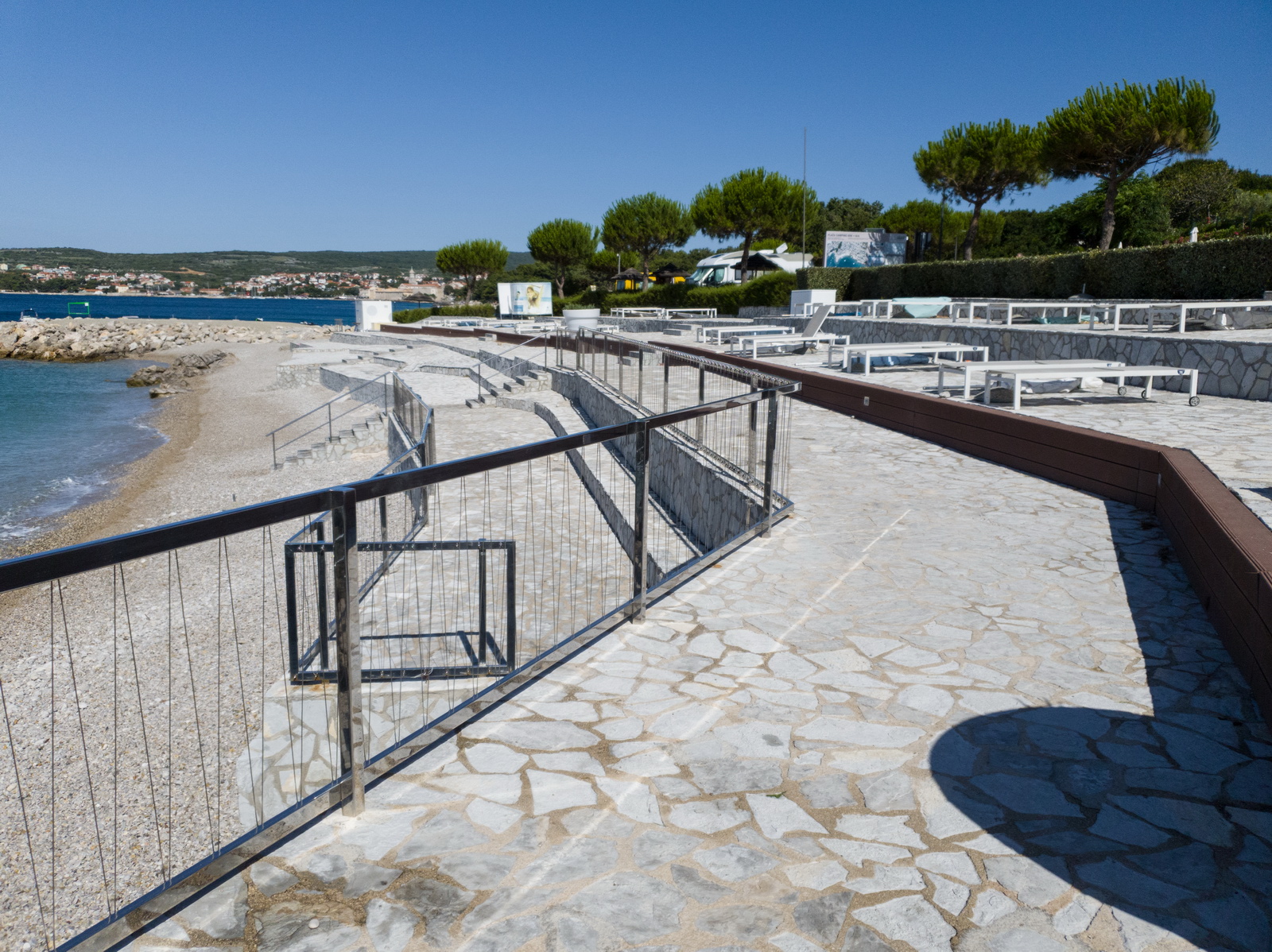
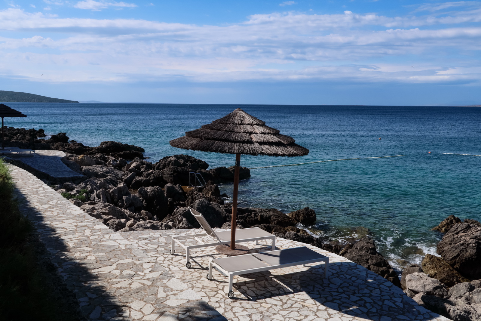
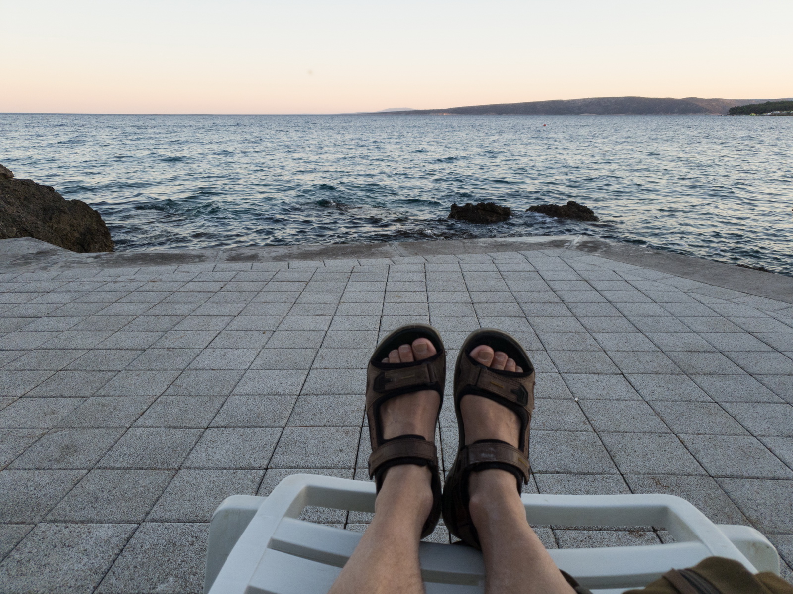
Krk
This trip was done just after the initial peak of the coronavirus infection had passed and before the various quarantine and other travel restrictions came back. Accordingly, there were almost no foreign tourists - because there were no airline flights! Actually the first flight - a Ryanair from Stansted - was arriving 1hr after I landed. So it was a really wonderful time to see the island, just like on a trip I did to Mali Losinj in May 2020. There were tourists but they were mostly from the local area. The level of the virus was practically zero and it was wonderful to be able to walk around freely. In the UK, myself and my girlfriend live in a small village and had been diligently isolating since March 2020, not even visiting a supermarket since then, so the chance of bringing the virus with me was negligible. Had I lived in say Birmingham I would not have done this trip... The hotels were however really careful with virus precautions, keeping everyone well apart, and with different procedures at breakfast. Due to nice weather all eating was easily done outdoors and that has been our standard procedure since; we stopped going to indoor restaurants etc back in March 2020
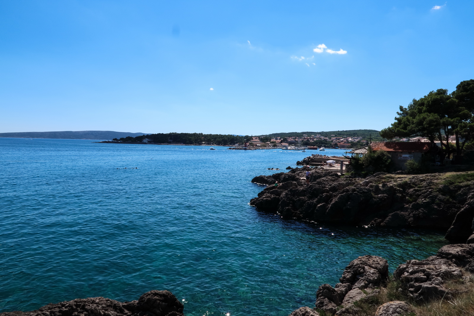
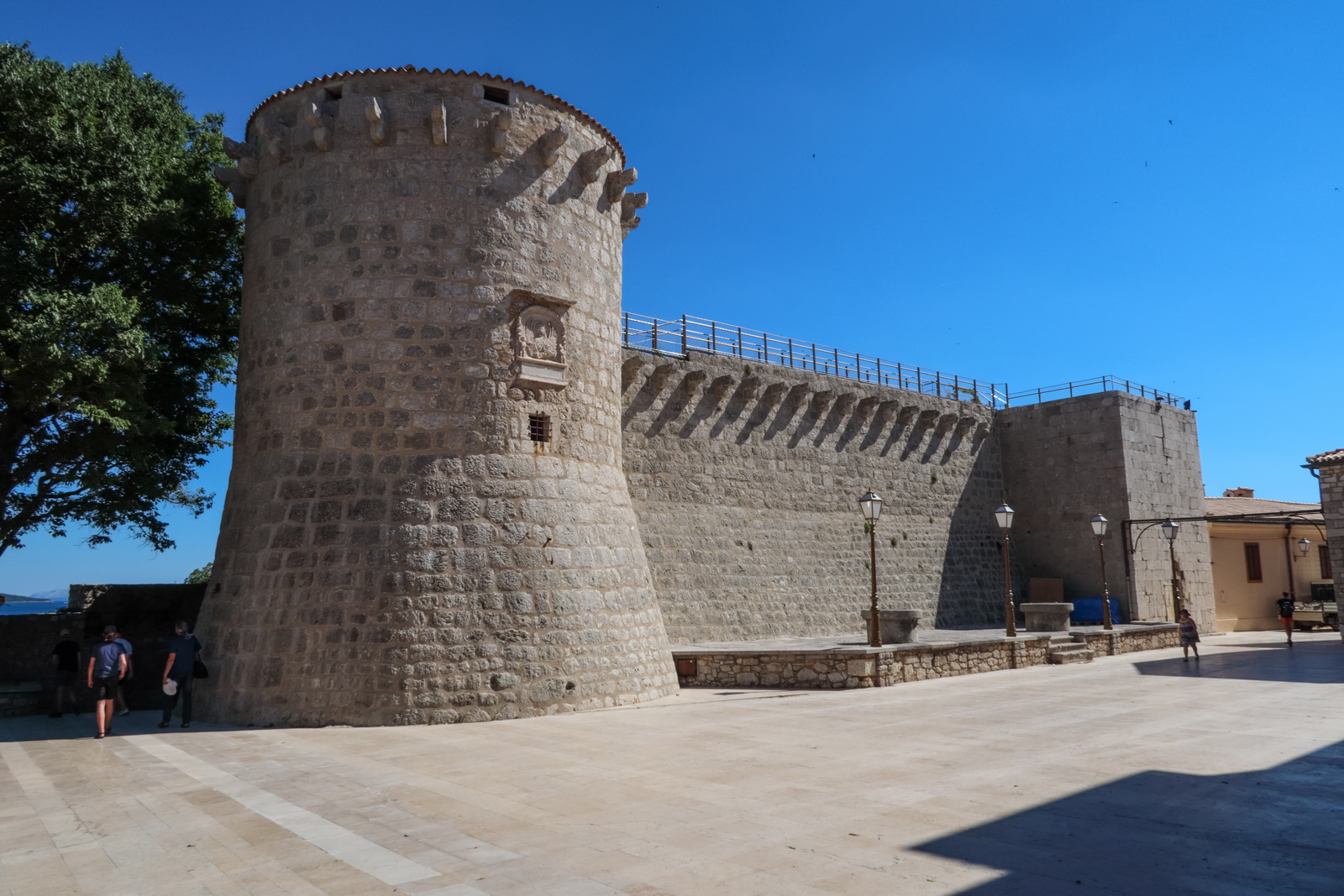
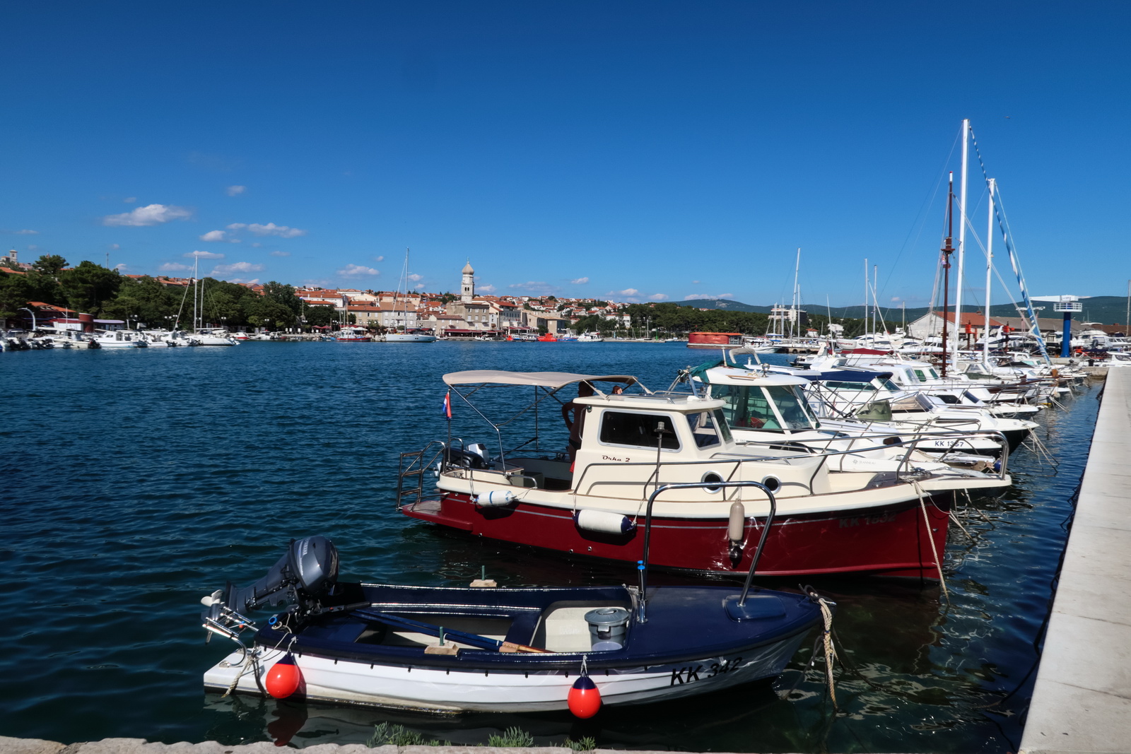
The old town of Krk is not big but there is a lovely coastal walk which I walked quite some way round. It appears rideable on a mountain bike and that would be a much better idea because one could go all around the island. One could spend way more time there than I had, especially if camping
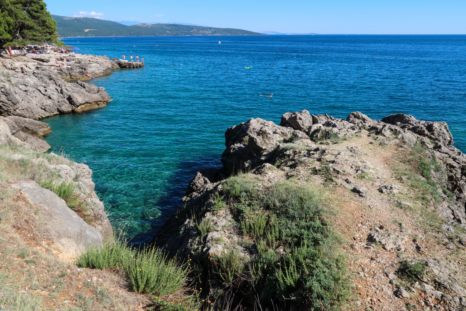
The economic disaster is obvious from the empty resorts. Many of them were being renovated during this handy gap in business, however. One probably has to be careful about sea urchins, when going into the water
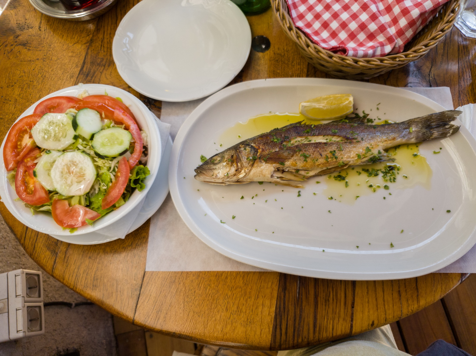
For health reasons we eat a mostly plant based diet - examples - but this is not really possible when travelling because one can't get the more "substantial" veg, and then fish is just wonderful ![]()
The island of Losinj can be seen in the distance, on a clear day
Return flight
The weather was basically good for most of the route but the UK end looked dodgy, with cloudbases approaching minima at Shoreham. The MSLP shows that the bad weather had moved south, right over Shoreham. I have often diverted to Biggin Hill (which has an ILS) and it is a "£200+ adventure" largely due to the taxi fares but if it has to be done it has to be done...
MSLP Tafs & Metars Radar IR Sferics Windy.com winds
The radar image would improve due to a westerly airflow. Importantly sferics (lightning) was clear. The winds would also mean that the fuel situation would need to be watched carefully...
Excellent departure weather. There was a very strong wind overnight (gusting to 57kt) and the airport staff, knowing this, moved the several GA planes near the hangar. They moved them back into position the next morning. Such an amazingly friendly airport!
I moved the FP earlier by 30 mins because I had time to spare, and luckily didn’t get a CTOT; they are much more likely if you file at a short notice.
This time we have headwind and the computed LFOB is just 19USG, but that's fine also. ROTAR is the Croatian/Italian airspace boundary
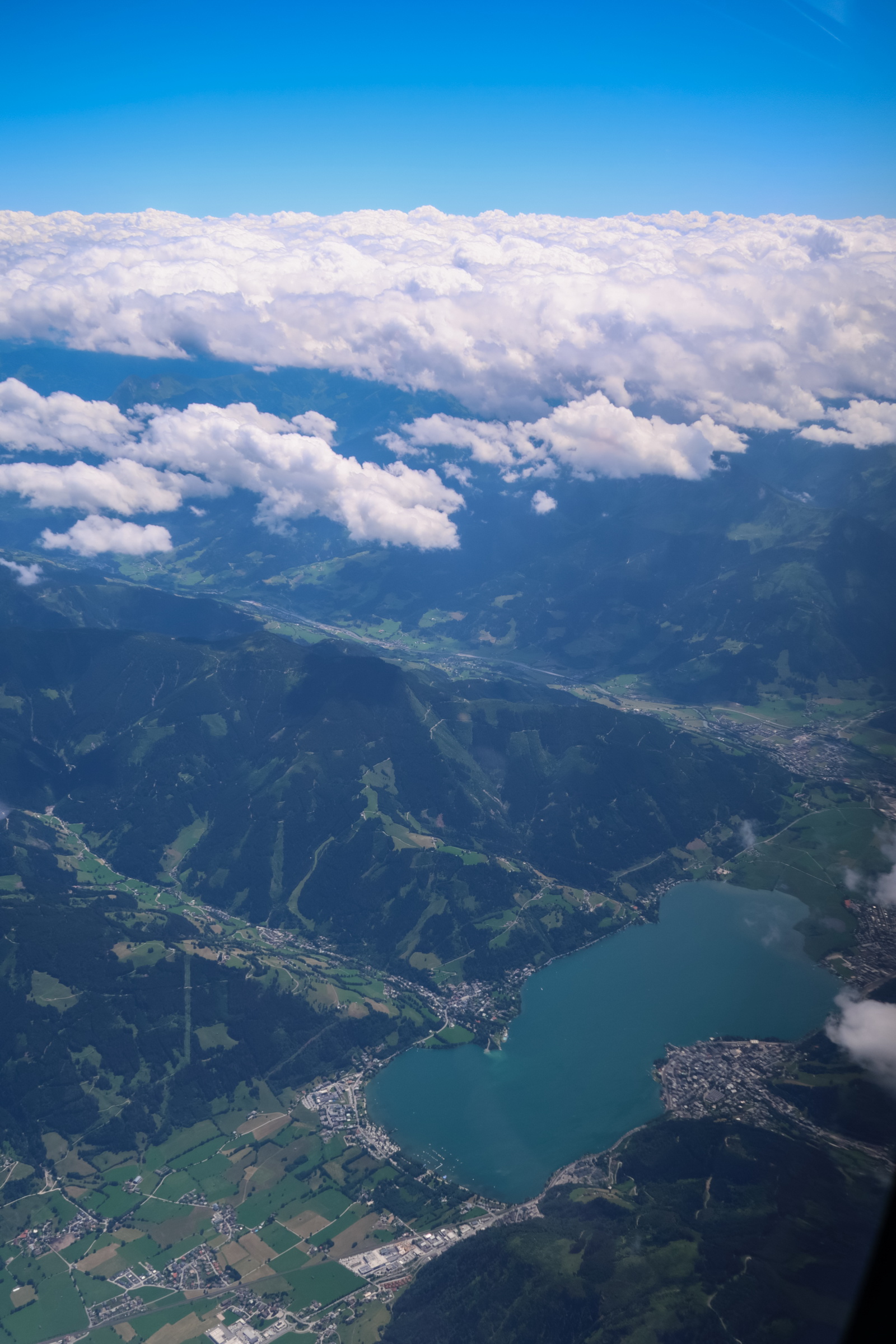
The Alps to the right, during the climb. From FL110 or so, they look pretty clear
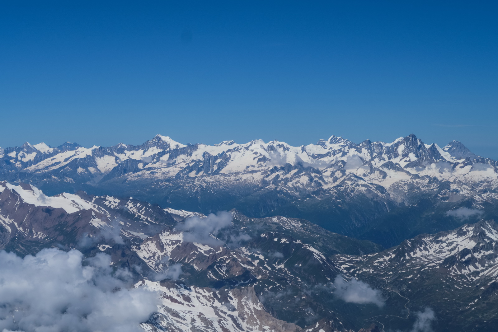
On this route I normally press Italian ATC to give me shortcuts, to take out the two obvious doglegs. I start working on them around ADOSA, asking for a DCT UTAVO, and then when talking to the Swiss I start asking for a DCT HR. It's always fun ![]()
Italian ATC tends to be reluctant; I suspect the coordination is a hassle even though there is obviously no jet traffic this close to terrain. It helps to be at FL160 because that opens up the radar vectoring area. However I achieved a spectacular success with Swiss ATC: they asked if I am happy to cancel IFR, and crucially assured me of a re-clearance to IFR afterwards (something you never get an assurance of in the UK, for example, where an exit from controlled airspace permanently terminates any clearance, and could leave you hanging in Class G, facing hazardous weather). As I was well above the terrain on the proposed route, I accepted
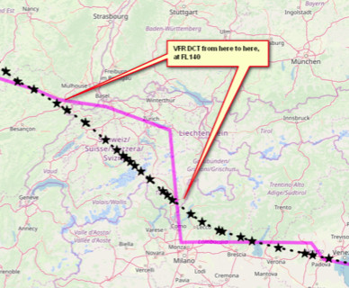
The result was a great shortcut and some stunning scenery from "just" FL140:
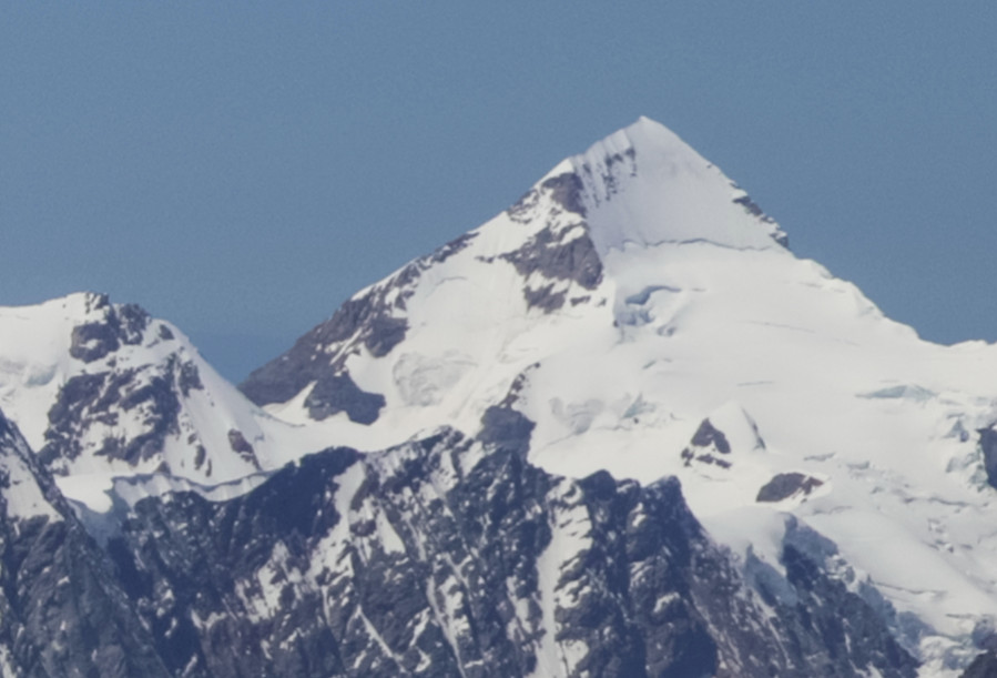
Lago dei Cavagnöö in Switzerland
This mountain is probably Mönch - 13474ft so, surprisingly, just below our altitude which at FL140 was somewhat above 14000ft. Our GPS altitude (true altitude) was around 14700ft
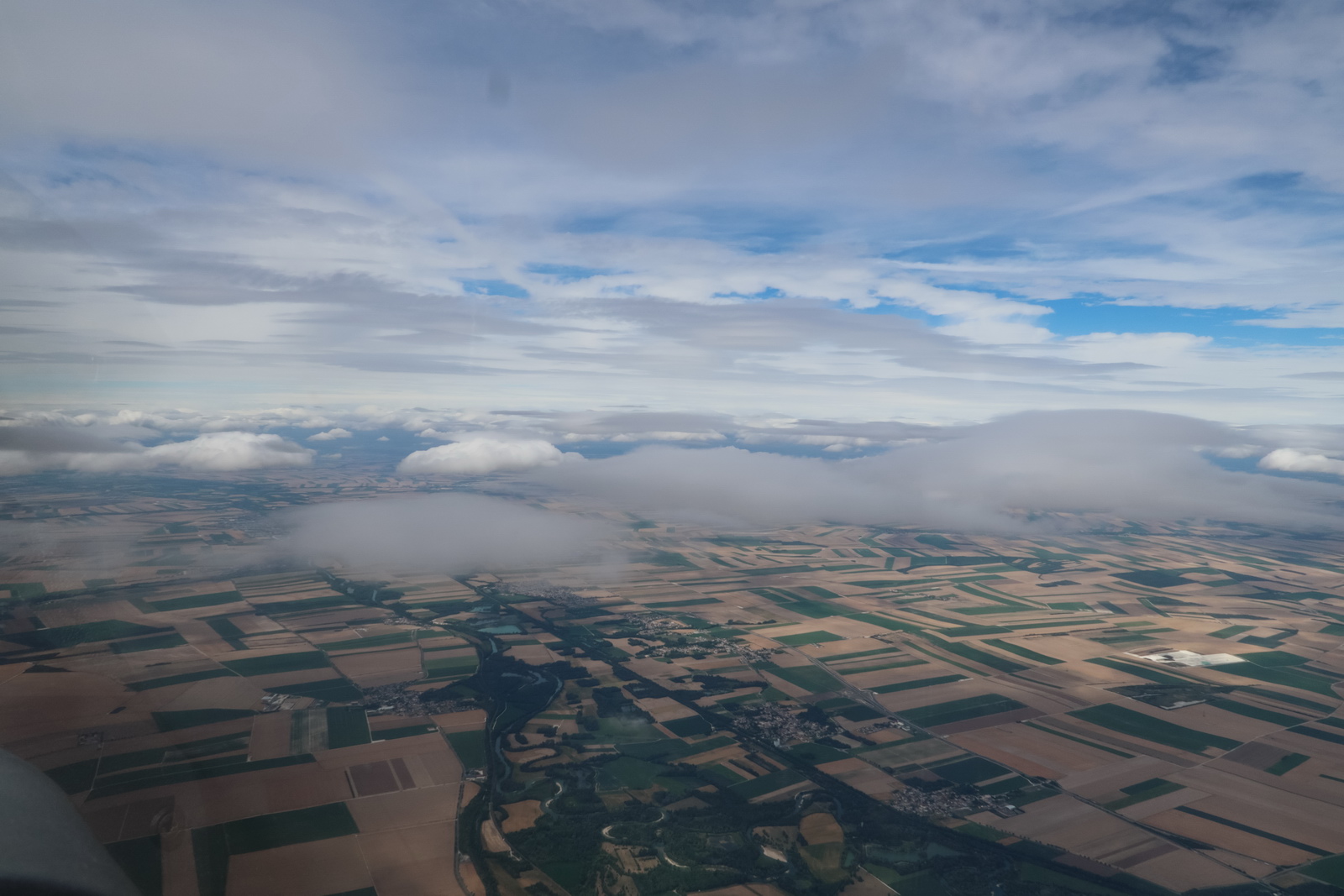
Over the Alps now and into France. We can see the worsening weather ahead...
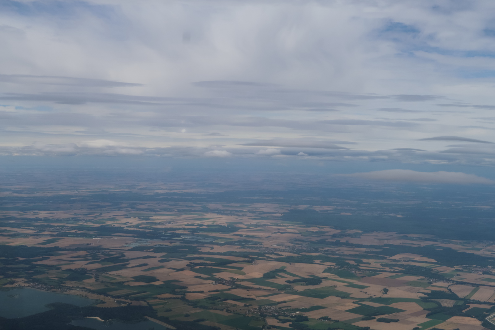
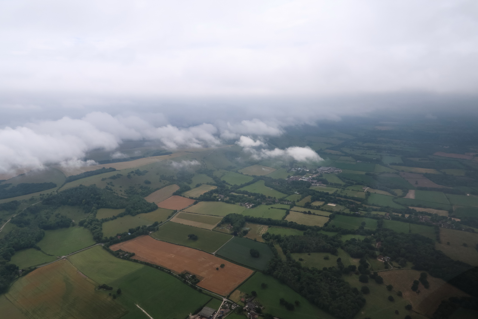
Most of N France looks like this - fields and more fields, as far as one can see
This was an updated radar image showing most of the stuff had indeed moved east, and the tafs/metars had also improved. The Shoreham situation is actually landable from 02 also; I have landed at EGKA with a 10kt tailwind. The DH is much lower on 02. Also the weather over the UK was clearly worse further inland, and Gatwick EGKK did have a lower cloudbase than say Bournemouth, Shoreham or Lydd.
Descending a bit now. In a headwind situation where fuel may become critical it makes sense to fly as low as possible, and French ATC doesn't really care if you are in Class E (base normally FL065) or Class G below that...
The headwind is strong now - about 30kt - but 15USG forecast is fine, to fly one approach at Shoreham and them immediately fly to Biggin Hill and get there with an hour's fuel, which is plenty.
Being at 6000ft, and later at 5000ft, I knew London Control would not take the flight (because I would be below UK controlled airspace; base FL075) and sure enough Lille handed me over to "London 124.6" which the local hacks will recognise as London Info and that silently terminates your IFR clearance. This is a real trap for foreign pilots. With no desire to get busted by the CAA I stayed below the 5500ft base of CAS further down
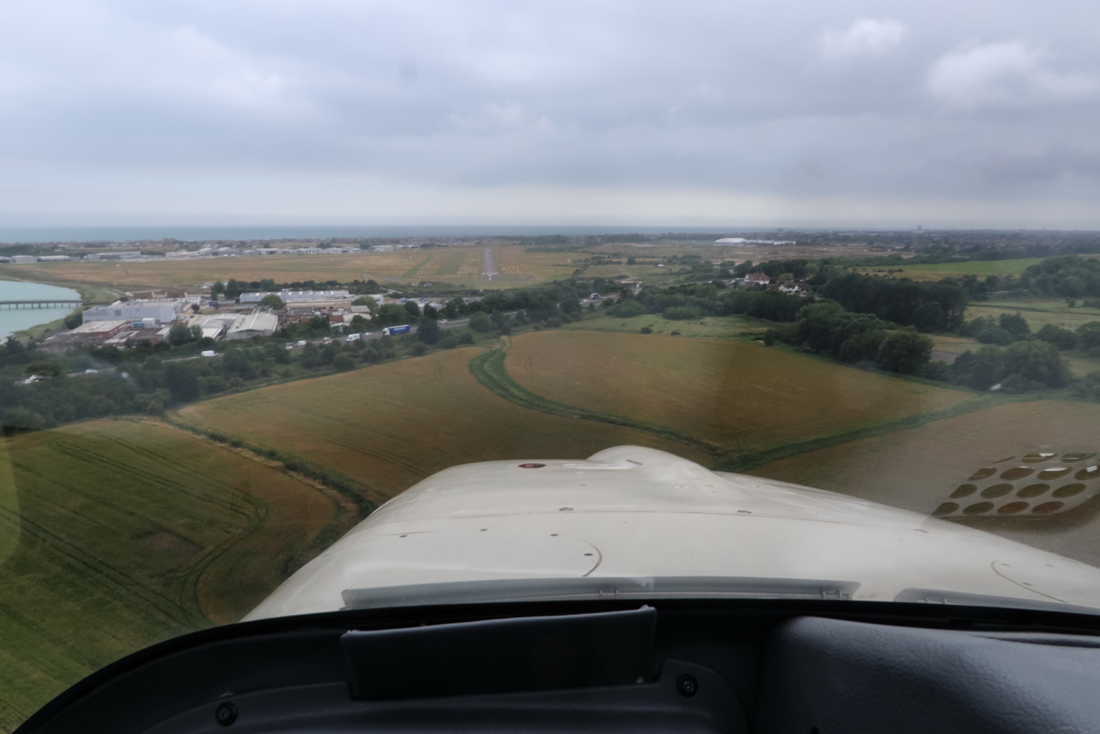
Now over the South Downs, heading for NITEN which is the IAF for the 20 approach, 2200ft. The weather looks OK here
and indeed it was - on final approach on 20 I popped out of the cloudbase around 1000ft
This was the route actually flown (filed route in purple). You can see how one vanishes from the Eurocontrol system as soon as one is handed over to London Info. Interestingly the VFR portion, generously granted by Swiss ATC, didn't stop the tracking, so it looks like they call it "VFR" just locally ![]() Later I also got some very slight shortcuts past some of the French military areas, but not through Paris airspace which they told me is "totally prohibited" even though it undoubtedly had very little traffic
Later I also got some very slight shortcuts past some of the French military areas, but not through Paris airspace which they told me is "totally prohibited" even though it undoubtedly had very little traffic
Parked at the pumps and watching the cloudbase, which is 900-1000ft now.
The fillup was just 1.6% off the computed LFOB. That is fine, especially after parking in a warm place for a couple of nights, which evaporates a few litres.
The Golze ADL150 proved its worth yet again, delivering wx data with 100% reliability, even just for tafs and metars on this occassion, although there was intermittent 4G over France which is a new thing (normally you get nothing at all, like over Belgium).
It was a brilliant high-value trip, which became impossible (well, impractical) shortly afterwards due to a quarantine imposed on Croatian arrivals in the UK. These trips were very special during 2020 because they were hard to do out of the UK. Within the Schengen area the virus situation was largely disregarded for travel purposes - symbolically - but both the UK and Croatia are non-Schengen and, at time of writing (Sep 2020) the UK is imposing a quarantine on arrivals from most places, and Croatian pilots can't go anywhere useful either.
Flight times (airborne times)
Shoreham EGKA – Rijeka LDRI 4:40
Rijeka LDRI – Shoreham EGKA 6:00
Fuel on landing (US gallons)
Rijeka LDRI 33.1
Shoreham EGKA 15.7
For an idea of the reserves, the fuel burn enroute ranges from 11.5 USG/hr at low level to 8.5 USG/hr at FL160.
Airport costs (including VAT) for TB20, 1400kg MTOW, AOPA discount if applicable
Rijeka LDRI €63 avgas €1.88
Shoreham EGKA £30 avgas ~£2.00
Contacts
On this trip there was absolutely no issue communicating with the destination airport. Very quick and friendly! EuroGA airport database report.
Oxygen
An oxygen system is practically necessary for IFR in the Eurocontrol system. Occassionally, the weather is nice and one can fly at FL090 or so but most people would still get tired after several hours. Also many routings are not available below oxygen levels, due to controlled airspace structures, and in some cases terrain.
On this entire trip the usage was around 25% of the 48 cu. ft. cylinder, for 1 person. Without oxygen I would have not done the trip because one cuts off the top half of the aircraft operating ceiling (the Alps cannot be crossed, for example, and one cannot climb above most cloud) and in the wrong conditions could spend most of the flight in icing conditions and turbulence.
The Value of an IR
On this trip, the flights could have been done under VFR, but lower down, on different routes, and with a lot more hassle with ATC and airspace. The last bit of the return flight would have been a low level scud run, however...
Photo Galleries
For the photo galleries I have for many years used the feature in Photoshop,
which works well enough. The gallery in this report were generated with Juicebox
which has a free version with various limits (e.g. up to 50 photos) and a $45
version which does everything. It runs on Adobe Air and seems to have issues
with large galleries on a win7 64bit machine so I run it in a winXP compatibility
mode ![]() It delivers good
results but has some annoying features e.g. stripping off EXIF data, which should
arguably be preserved, or at least be configurable. It also can't process images
over 4096 pixels wide which a lot of modern cameras do exceed so I have to downsize them a bit first.
It delivers good
results but has some annoying features e.g. stripping off EXIF data, which should
arguably be preserved, or at least be configurable. It also can't process images
over 4096 pixels wide which a lot of modern cameras do exceed so I have to downsize them a bit first.
Gadgets
No trip report can be complete without this bit ![]() However, I didn't bring very much this time. The photos were shot mostly with a Samsung
S10e phone, and a Canon G7X pocket camera which produces photos which far exceed anything from any phone.
However, I didn't bring very much this time. The photos were shot mostly with a Samsung
S10e phone, and a Canon G7X pocket camera which produces photos which far exceed anything from any phone.
All photos were taken in DNG (or CR2, for the G7X) raw format and processed in Lightroom to crop and remove some haze. This avoids the fashionable but ridiculous enhancements (over-saturation and over-sharpening) which the phone makers do. The other program I use instead of Lightroom is ACDSEE PRO which is easier to use in the way it can be used on any randomly chosen picture folder. Lightroom workflow is a lot more formal, but it is much quicker for uniformly processing lots of photos. For example, I apply +20% vibrance and +20% clarity in Lightroom, to all RAW images. On phone pics I bring down highlights a bit. All these programs try to impose weird workflows which are counter-intuitive unless you work in just the way they want you to...
In theory one could do everything needed on a trip with just the Samsung phone. It can be used to get weather, file flight plans, run the ADL150 app, and of course do all the normal comms with other people. It can even take "ok" photos. It is however too painful to use for much typing, or viewing approach plates. So, I have a Samsung Galaxy T705 8.4" tablet. It is functionally practically identical to an Ipad (which I have too, kicking around the house, for web browsing) but is much better for a "power user" because it isn't as restricted as an Ipad. For example it can be expanded with a micro-SD card; say another 128GB. The T705 version of this tablet takes a SIM card and with a contract SIM (I have a Vodafone contract on both the S10e and a cheaper version of it on the T705). This tablet also acts as a "backup phone" because it is a fully functional phone. I have VOIP installed on both the S10e and the T705, via the Localphone VOIP service which works most of the time and this delivers extremely cheap outgoing calls. On the phone I use the CSIPsimple VOIP app and on the T705 there is a built-in VOIP function which seems to work.
One cannot beat a laptop for productivity, and I use a Dell XPS13 (I have the older XPS13-9360 version with a 1920x1080 screen) which is does basically everything anyone could ever need and with the quad core I7 processor is very fast - good enough for movie editing/rendering and faster than most of today's ~3GHz desktop computers. However, I didn't bring the laptop on this short trip.
In the aircraft I run the above T705 Android tablet. That also runs the app for the ADL150 satellite weather receiver.
This page last edited 25th September 2020