Trip to Tempelhof - August 2008
Objective
This article describes an IFR (airways) flight from Shoreham (EGKA) in the UK to Tempelhof (EDDI) in Germany.
The format of the flight is very similar to other "simple" airways flights I have done e.g. Prague. Other VFR and IFR trip reports can be found here.
Tempelhof is a famous airport which was the scene of the 1948-1949 Berlin airlift. After many battles over its survival in recent years, in which it was strongly supported by its neighbourhood - the opposite of what normally happens elsewhere, it is scheduled to close in October 2008.
Here is a glossary for non-aviation readers.
Aircraft
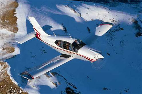
The aircraft is a 2002 Socata TB20GT which has a zero-fuel range of approximately 1100nm and a cruise speed of 155kt TAS at 10,000ft. It has a ceiling of about 20,000ft and is equipped with oxygen. It is not certified for flight into icing conditions but has a TKS de-iced propeller.
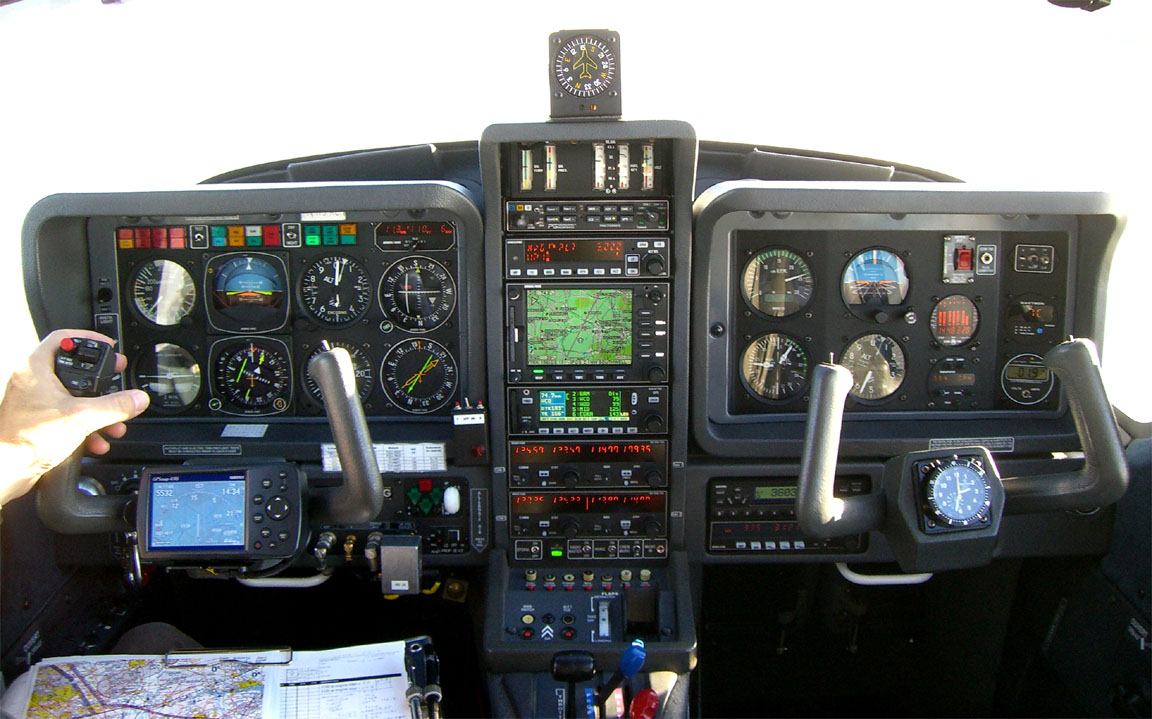
Navigation equipment includes a KLN94 IFR/BRNAV GPS and a KMD550 MFD and these are used for primary navigation. The aircraft has a KFC225 autopilot which can track VOR/GPS/LOC/ILS and fly a preset altitude or VS. There is an additional battery powered Garmin 496 GPS which also provides an audio terrain warning (TAWS) function with a European obstacle database.
Weather
My usual sources for weather for IFR/airways trips are the MSLP charts in the first instance (example) which are available up to 5 days ahead and show obvious features, the SigWx form which shows weather above FL100 (example - available about 18 hours ahead) and TAFs/METARs for departure, destination, alternate, and perhaps some airports along the route. For more short-term detail, this data is supplemented with weather radar and sferics data 1 2.
Airways flight in Europe has to be done at certain minimum altitudes and if there is any cloud these would normally place the aircraft into cloud. Therefore, the general strategy for IFR flight is to reach VMC on top and stay there in the sunshine for the entire flight. Anything else results in an unpleasant and potentially turbulent flight with - especially over hours - a high chance of icing. Therefore, the above weather sources are supplemented by more modern sources such as Meteoblue and NOAA which offer data on vertical cloud profiles, as well as offering longer range forecasts. However, the quality of cloud tops forecasting (whether from Meteoblue or anywhere else) remains poor and one is doing well if the forecast is within a few thousand feet of reality!
Equipment
On any significant trip I carry a laptop (Thinkpad X60s 1704) and sometimes the Canon IP90 lightweight portable printer
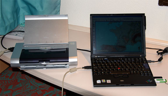
The laptop carries flight planning software (Navbox for VFR and Jeppesen Flitestar for IFR/airways), and also approach plates and enroute charts in electronic format (Jeppview). It also has internet access via WIFI, GPRS and 3G. This enables one to get weather, notams, file flight plans, send faxes to airports, and for longer trips it enables routings to be re-worked anytime on the ground. It also connects via bluetooth to a satellite phone (see further below) for internet and fax functions anywhere.
Most importantly, it achieves independence from airport weather briefing and flight plan filing services which at best are an unpredictable waste of time and - as at Tempelhof for example - may be missing altogether. Obviously all possible planning is done before departure, at one's home where internet and printing cost virtually nothing.
European IFR Airways Route Generation
This has always been a difficult process because the European airways system contains a huge number of rules and restrictions, with thousands of changes every day. Eurocontrol/CFMU have never made their in-house route generation tools available externally, though they do offer a route validation website. Some notes on the subject are here.
However, this time I used a new software tool: AutoPlan route generator
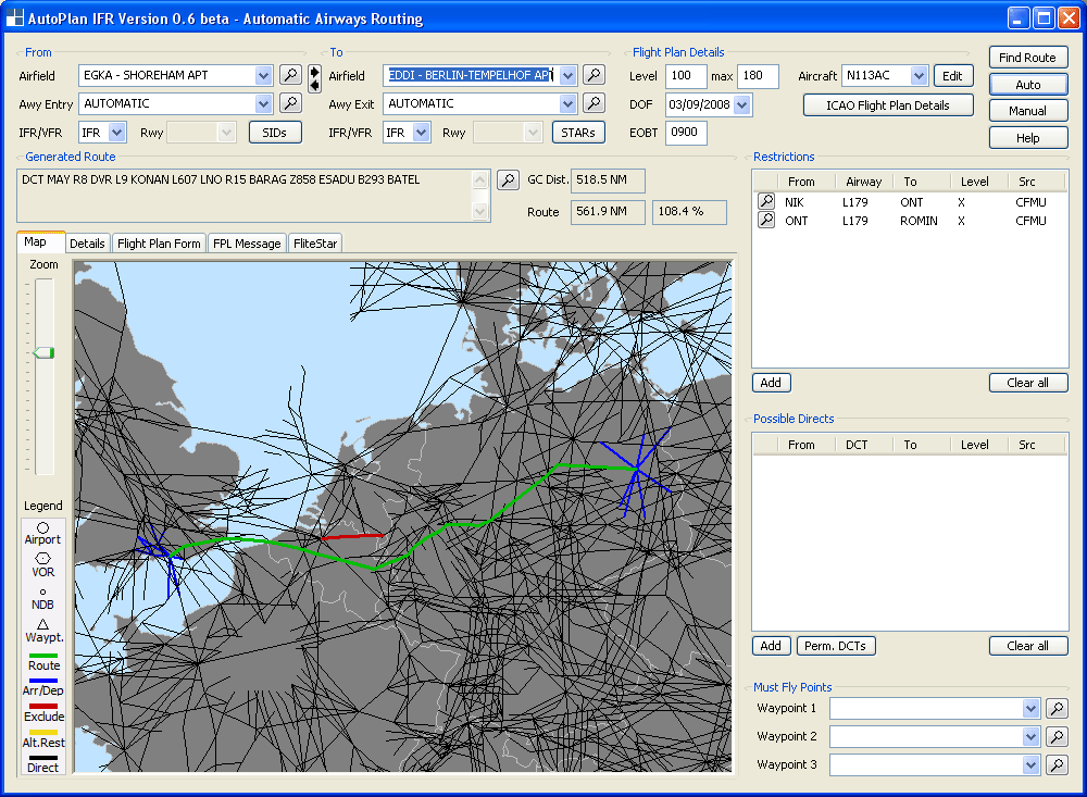
This program generates valid and usable lower airways routings for anywhere in Europe. The route is initially determined using a maze algorithm and is then submitted to CFMU for validation. The resulting error messages are interpreted, appropriate exclusions are added, and the process is repeated as necessary. Most European routes are validated after just a few automatic iterations. Very occassionally, one needs to add an exclusion manually. The end result is validated for the actual date/time of the planned fight. This program reduces a sometimes horrendous process to a minute or two, and eliminates the need to purchase and study the various standard route documents. I have so far tested it with every airways route I have ever done and it did them all very easily, with a trivial manual intervention in some cases.
Enroute Weather Data
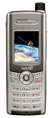
Another new development on this trip was satellite weather data. I use a simple system comprising of the Thuraya SG-2520 satellite phone
which is bluetooth-connected to the LS800 tablet computer which normally runs some kind of VFR GPS moving map program, or Jeppview for approach plates, and in this case it runs a normal web browser
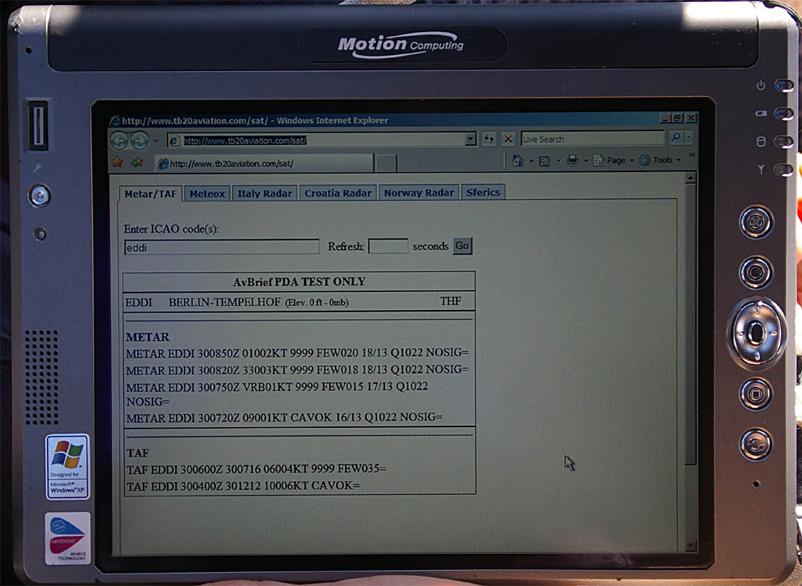
Satellite phones have come a long way since the £20/minute rates of years ago. Thuraya offer PAYG dial-up data at 9.6k baud for $0.99/minute, or GPRS data for $5.00/MB.
Additional information on the system is here.
The in-flight weather data was hardly necessary on the outbound flight but came in very handy on the return flight. It is far better to find out about a diversion two hours ahead than when dialling up the ATIS and then having to fly to the alternate on one's reserve fuel.
Other Preflight Procedures
Tempelhof does not need prior notification (other than the flight plan) but IFR inbound flights need an airport slot. This is obtained by telephoning 0049 69 78 07 26 15 (24HR). When I did this the evening before the flight I was advised there was no slot shortage at all; otherwise the solution is to cancel IFR just before arriving.
I normally fax any airport before flying there, with standard questions e.g. do they need PPR; do they have avgas; costs, etc. This is a simple process which often turns up information which is totally wrong in the standard printed flight guides or flight planning software.
Flight plans are filed electronically, using either Homebriefing or the new UK NATS AFPEx facility. While AFPEx is free, it is available only to UK resident pilots and with a lengthy security procedure, and is not generally suitable for usage while travelling because it forces a fresh download of its 5MB Java application which is infeasible if one is using GPRS/3G data. Either facility will accept flight plans without geographical restrictions.
The Flight
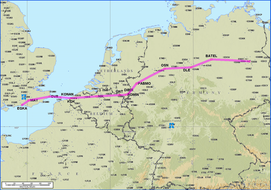
The outbound routing was:
EGKA MAY R8 DVR L9 KONAN L607 KOK DCT NIK L179 OSN L980 DLE T207 BATEL EDDI
Alternate: Schonenfeld EDDB
Distance: 518nm (GC); 537nm (airways)
Note: the Eurocontrol routings given here and elsewhere will most likely not work by the time you might try them because the precise form needed to get the route into the computer changes from one week to the next.
One of the objectives on this trip was to do a movie of the final approach into Tempelhof. This required good weather there.
The first thing I look at are the MSLP charts, and on the day of departure (planned for 0800Z) these 0600 1200 showed a high pressure over the whole area, which is a good start. The TAFs were also good. Finally the SigWx showed nothing of relevance at high level.
The weather picture for the return flight on the following day (arrival in the UK planned for 1700Z) was much less good. The MSLP chart for 1200 showed a cold front moving in, with a trough ahead of it. This suggests scattered thunderstorms, which is OK unless embedded in other cloud. The 1200 MSLP for the following day merely showed the front further along, over Berlin which is even less convenient because it may mean a climb through a lot of nasty stuff. However, one could not get much better data that far ahead.
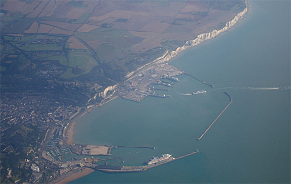
The initial weather conditions were very good if rather hazy. The UK coast was left behind at FL100 near Dover
Initially, London Control gave us a climb to FL100 on the current heading (about 090) and this went all the way to Belgian airspace. After that, the flight was characterised by a series of long DCTs issued by ATC - sometimes because I asked for one - skipping large sections of the filed route. One useful shortcut would have been ONT-PABMO which was granted but rather late.
I was experimenting with the most economical possible cruise setting. At FL100, the air is thin enough so the engine is run with the throttle wide open, which leaves only RPM and the fuel flow to play with. I found that 2200rpm and 9.0GPH (US gallons/hr) delivered around 21 UK MPG in zero wind - not bad for a TAS of 138kt (159mph)
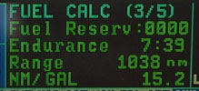
The above pic, showing the 1038nm remaining range, was taken around halfway on the outbound flight. From that point, 1038nm would have got us to Corfu in Greece!
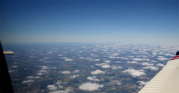
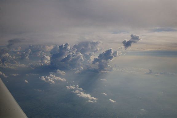
Over Germany, some scattered cloud was found
The outbound flight could have easily been done under VFR - albeit with the usual stress of having to ask every ATC unit along the route for a transit of controlled airspace and having to act fast, and dogleg under/around CAS, if one of them refuses.
The FL100 cruise level made it unnecessary for us to use oxygen. However, one does get pretty tired after 4 hours at FL100 with no oxygen.
With about 50nm left to run, Berlin gave me a DCT to LANUM which forms the entry point of their procedural ILS (runway 09R) approach which bypassed the BATEL6V STAR and, following another DCT to BERAV took us direct to the FAF of the ILS 09R approach. We were cleared for the ILS 09R approach and asked to report localiser established. Very simple.
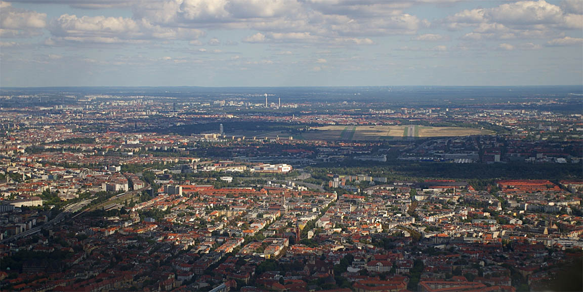
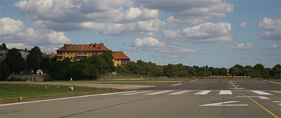
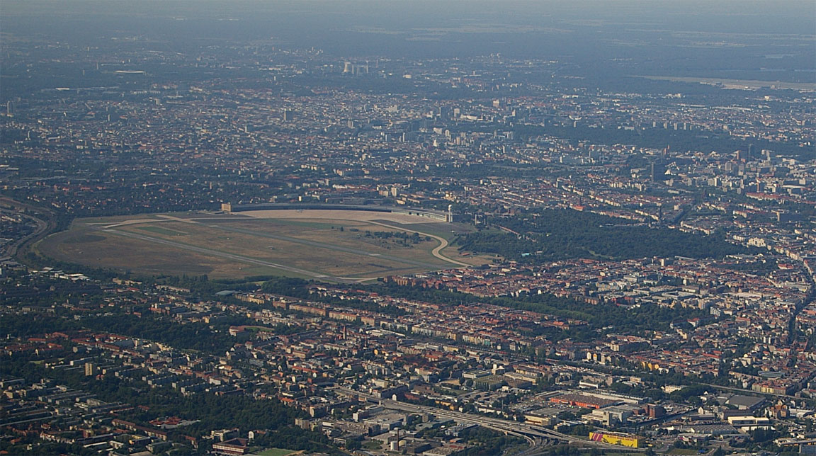
The airport is a very large open area surrounded by sprawling Berlin
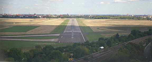
with houses very close to the far end of the runway
It has often been said that the final approach passes below the level of many peoples' windows and this is evident looking at this building close to runway 27
Due to Tempelhof's historical significance, I filmed the arrival with a sunvisor-mounted Sony 580 HQ1 miniature camera
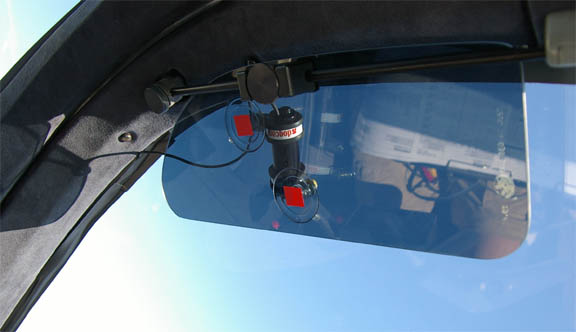
The camera's composite video signal was converted to USB with a miniature high quality video digitiser (Ebay, £40) and was recorded on the LS800 tablet computer mentioned earlier, using WinXP's free MovieMaker program. The originally recorded video was 10MB per minute, in full PAL TV resolution. Unfortunately, camera is not camcorder-quality but is better than any webcam I tried. Also, due to the camera's very fast shutter, there is a problematic propeller effect. Cockpit reflections are a problem no matter what one does to eliminate them - the only solution is to mount the camera externally (it is waterproof) which is a tricky proposition... It was an interesting exercise, anyway.
IFR arriving traffic gets a FOLLOW ME vehicle to a huge apron in front of the original huge airport building
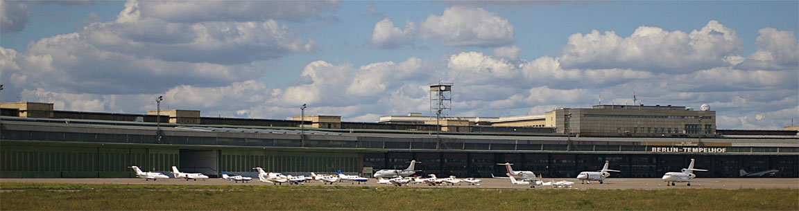
and there is a DC3 parked underneath a large overhanging roof
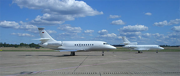
There is some upmarket scenery present too
As per the standard procedure anywhere, we asked for avgas before leaving the aircraft. The refuelling operation was well organised and a bowser turned up within minutes. They accept credit cards, or AIR BP.
There was some confusion as to the airport exit procedure. A large slow moving queue at a desk staffed by a single very slow working man suggested this would take hours, but in fact we just needed to collect a form to fill in and hand in a copy of it, and out we went.
Tempelhof has got one thing totally right: a dedicated "GA" passage
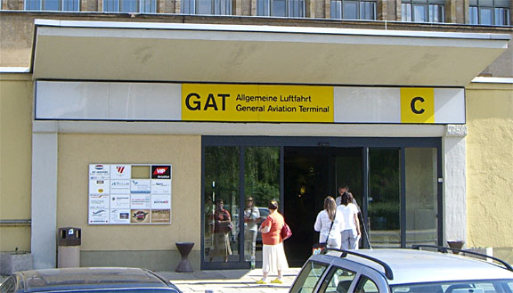
which leads straight outside. This "highly sophisticated" solution seems to escape the imaginations of airport managers all over Europe, who struggle with handling GA pilots and their varied possessions - often carrying items which would get you arrested if you carried them onto an airliner (e.g. headsets) - and who instead prefer to jack up the landing fees to silly levels which solves the "problem" by killing off GA business, or by imposing "mandatory handling" which has the same effect because the handling company can make money more easily by dealing only with high net worth individuals arriving in business jets.
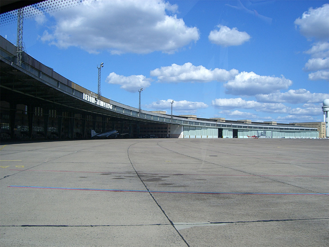
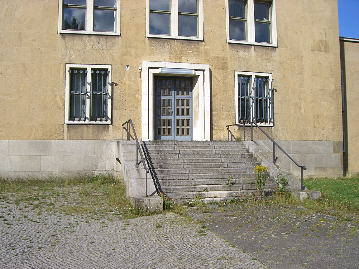
The main Tempelhof building, designed by Albert Speer, is one of the biggest in the world in horizontal extent. It appears largely empty despite some businesses being based in parts of it and weeds are growing around much of it
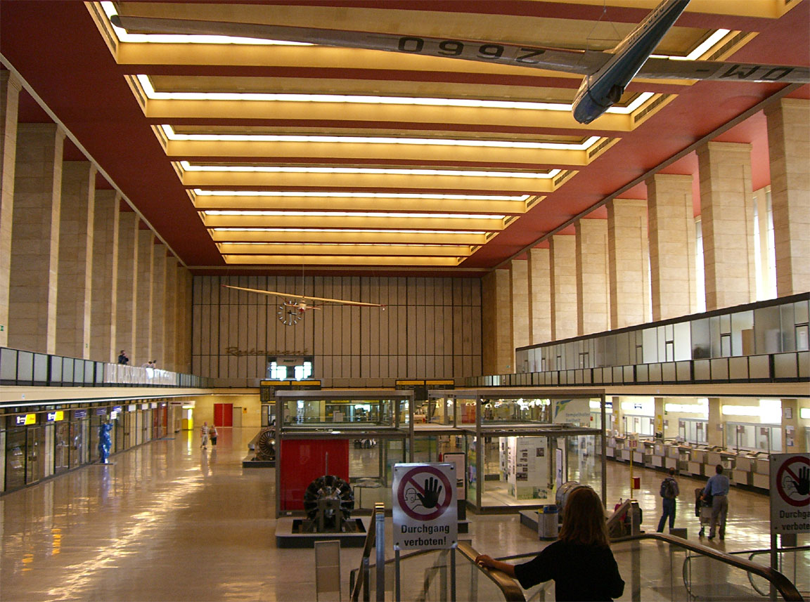
There is a huge "airline passenger" hall which, through just two gates, serves a few airlines flying to some European cities
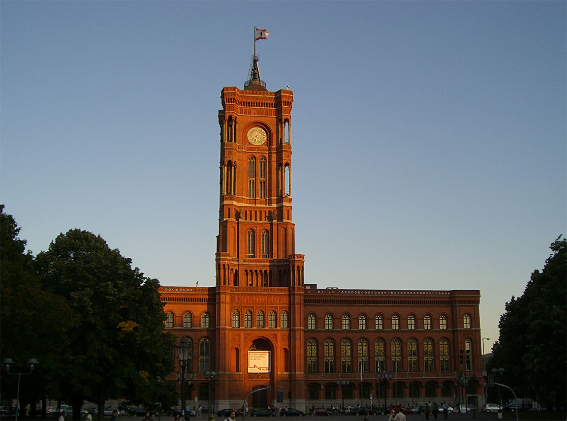
The airport is right inside Berlin city and a tube station is a few minutes' walk.
I won't try to write a travel brochure on Berlin but it's definitely worth a visit for a few days
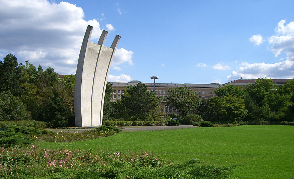
Near the airport is a monument to the pilots who lost their lives in the Berlin airlift
The return flight weather picture was complicated. The planned arrival time was 1700Z. The 1200 and 1800 MSLP charts showed much the same picture as was seen the day before. The following day - a possible return option - 1200 MSLP showed a nasty looking warm front over the destination, which usually means low cloud and drizzle which is a regular problem at Shoreham and results in the cancellation of many flights there. The SigWx 1200 1800 suggested higher level cloud for nearly all of the route and since Belgium onwards has no terrain issues, this made it possible to return to Shoreham at a low level (basically, as a VFR flight not receiving any kind of ATC service). Curiously, the 1800 SigWx has an area marked "40" which is quite relevant here but which is not referenced at the bottom of the chart! On the morning of the departure, the visible and IR satellite images showed a largely broken/scattered cloud in the south east UK and this was moving to the east. The morning sferics picture showed an impressive thunderstorm and the radar picture confirmed this. The TAFs and METARs confirmed this weather but suggested the worst of it would clear up by 1600Z i.e. before the arrival in the UK.
So.... a complicated picture with the different bits of data being inconsistent. I didn't even bother with the forecast tephigrams since these are of poor reliability in this kind of very dynamic weather. I also very often find that forecasts like PROB30 TEMPO 1421 3000 +SHRA TSRA are much more often than not the Met Office covering all bases just in case and nothing much happens on the day.
The decision was to GO and deal with whatever is encountered enroute, and with sufficient reserve fuel at the destination to go all the way to Spain there were plenty of diversion options.
Getting out through the airport was more difficult than arriving. The same one man was now facing a queue of about 15 increasingly irate people and with 10-15 minutes for each, this was going to take much longer than the 1 hour I allowed for this task, and would probably take us past our home airport closing time of 1900Z. I telephoned the OPS number for Tempelhof and told them this is completely unacceptable and asked if we can leave and have the bill sent to us. A man appeared and most reluctantly and only after examining my pilot's license etc agreed to send us the bill, and let us go. The total invoice came to Euro 71.40.
The Return Flight
The routing, FL100, was
EDDI GENTI Y203 HLZ L980 OSN L179 NIK DCT MAK L607 KONAN DCT LYD R803 SFD EGKA
Alternate: Bournemouth EGHH
Distance: 518nm (GC); 540nm (airways)
ATC were very busy. The SID expected was GENTI 3R - the only one which connected to the filed route - but curiously this was not given in the departure clearance which was just a transponder code followed by a takeoff clearance. I queried this a couple of times but didn't get a reply. It sounded like they were simply despatching everybody "VFR" to get them out of the way. Anyway, we got airborne and after some interesting airborne exchanges with ATC we were transferred to Berlin Departures who gave a FL080 climb and after a while a right turn and a DCT to HLZ which was around 100nm away...
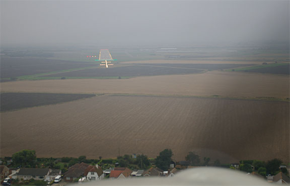
Tempelhof airport was finally seen from around 8000ft
On the return flight, we got two DCT legs of over 100nm each. Both waypoints were actually VORs but both were way outside reception range - this illustrates how today's airways flight is an entirely GPS-based RNAV point to point navigation exercise in which ground based navaids are irrelevant. An IFR GPS is - in the GA context - the only possible means of compliance with the FL095+ BRNAV requirement, anyway.
The general strategy in IFR is to remain VMC on top, and around OSN we climbed to FL120 to remain above the cloud, later FL140, FL160, FL180 around PAMBO and eventually FL200 around ONT.
FL200 is the TB20's official operating ceiling and, for best power, the settings were 2575 rpm, 10.1GPH (100F ROP), giving a TAS of 140kt at -15C. This is hugely impressive performance for a non-turbocharged aircraft.
Oxygen is obviously mandatory for any serious airways flying. Without it, one is chucking away 50% of one's operating ceiling, as well as the one really smart weather avoidance route (VMC on top). The oxygen flow rate at FL200 is quite significant but the system delivered a blood oxygen figure of 95% which is very good. Following some major hassles trying to get oxygen bottles refilled on European trips, I now have a big 48 cu. ft. carbon/kevlar bottle from Mountain High which would last for many hours, and weighs just 3kg.
This weather did not relate much to the SigWx but it was fine
The cloud was broken or better and ground was always visible, suggesting the cloudbase was high - probably around 5000ft most of the time back to the Channel.
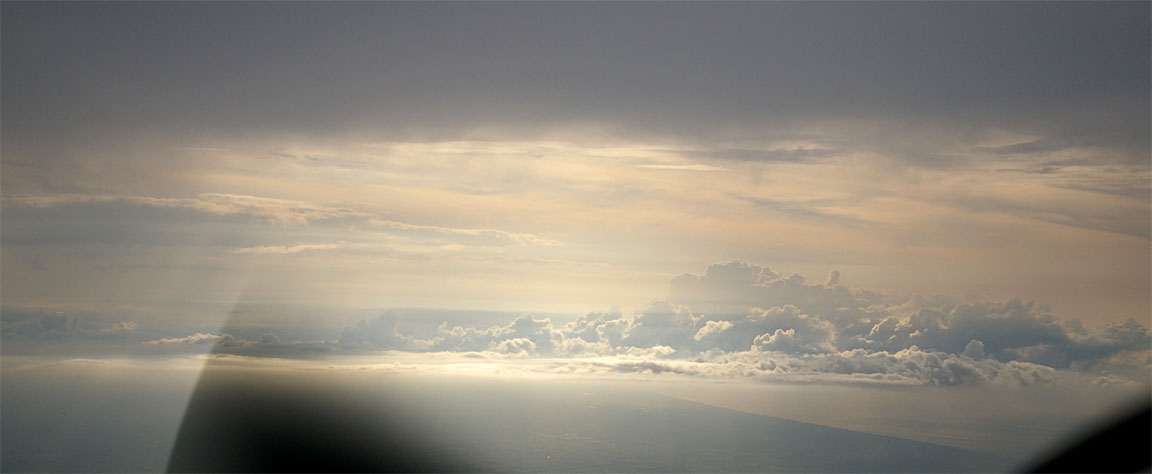
By the coast of Belgium things became rather more solid but FL200 was still fine. The stormscope was showing some returns but well scattered and well to the south of our track. The following pic shows a very high cloudbase (c. 10,000ft) with tops to c. FL250 at the coast of Belgium
Brussels reported that London Control would not accept FL200 traffic on the filed route and offered NIK COA SASKI which is only slightly different and which I accepted, but I soon decided that it was time to descend below this stuff and proceed to the destination at a lower level, on the original route.
I was monitoring the weather enroute using the satellite link. The destination weather started off "possibly feasible but a diversion to somewhere with an ILS is likely" but this soon changed
METAR EGKA 311620Z 17010KT 1000 FG BKN002 BKN005 18/17 Q1009=
METAR EGKA 311550Z 18009KT 3200 HZ SCT003 BKN005 18/17 Q1009=
EGKA 311520Z 19009KT 3500 HZ SCT004 BKN006 19/17 Q1009=
METAR EGKA 311450Z 18008KT 4500 HZ SCT004 BKN008 19/17 Q1010=
Broken cloud at 200 feet and 1000m visibility in fog! Given the proximity of high terrain, an approach to runway 20 would have been both illegal and virtually infeasible; the minimum for the circling approach to runway 20 is an 800ft cloudbase. At least this was evident a couple of hours before the planned arival time, allowing plenty of time to plan ahead.
The alternate was Bournemouth EGHH which has an ILS that can be flown down to 200ft cloudbase, or Lydd EGMD with 400ft. Lydd was much closer and its weather was OK for a visual approach at the time of the last METAR
METAR EGMD 311620Z 22014KT 7000 FEW020 19/17 Q1010=
but there turned out to be plenty of low cloud in the vicinity and following a weather update from their ATIS (6000m visibility, 1000ft overcast) I asked for the ILS. The weather closed in rapidly after that but the ILS was easy, becoming visual at 800ft. There was a fair bit of other inbound VFR-only GA traffic which could not get into Shoreham either - as well as a Lancaster bomber which was seen flying very close to the runway and the final approach path at a few hundred feet, before heading off somewhere north along the coast. VFR-only pilots have major problems in this kind of weather
The flight from Lydd to Shoreham was done the following morning, in good weather. The nasty stuff had by then moved on, as this impressive sferics display shows.
Other than jet contrails at high levels, no other aircraft were seen anywhere enroute, and no obvious GA traffic was heard on the airways sector frequencies. So much for the "crowded" European airspace. This is common on IFR flights around Europe as there is little or nothing flying enroute below FL200. The entire trip was uneventful, with no significant turbulence on either flight.
Airborne times were 3:55 in both directions. There was some headwind and some tailwind, on each leg. The TB20 would have just made it there and back from the UK without landing!
The fuel at Tempelhof was my most expensive ever, at about £2/litre.
The aircraft performed perfectly. Some notes on Socata TB20 ownership and operation are here.
Pilot: FAA CPL/IR, approx 1000 hours.
Tempelhof Airport was closed permanently shortly after this flight.
Any feedback, reports of dead links, corrections or suggestions much
appreciated:
Contact details
This page last edited 24th September 2008
