
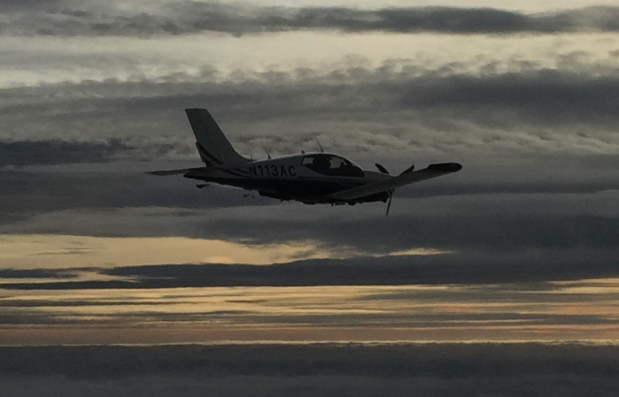
Trip from Shoreham, UK, to Menorca, Spain, October 2017
Menorca is an island south east of Spain. This was a late-2017 EuroGA fly-in.
Here is a glossary for non-aviation readers.
Airport PNR/PPR
Menorca LEMH is not a "cheap" airport and has mandatory handling. This has the potential to drive the cost well into 3 figures, but Spain has a law which provides for an option to request the minimum possible level of handling. This was revealed by a local pilot and after some effort (the handler was reluctant, as expected, to receive less money) we managed to get this agreed. Ultimately the value of this was lower than expected because they loaded a list of add-ons ![]()
There is another airport near LEMH, San Luis LESL, which is operated by an aeroclub. This is much cheaper than LEMH but has no customs/immigration and no fuel except for aeroclub members.
Some discussion took place and the only one of the three handlers who responded to the request was MTA. The laboriously extracted quote was ambiguous and only showed a part of it and the eventual price paid was €204.16 for the 1400kg TB20 and 3 nights' parking. The use of the handling company also covered any PNR/PPR issues, as is normally the case.
The majority of the fly-in participants did not need customs/immigration and flew to LESL, refuelling enroute as necessary.
Accommodation
With GA travel, there is no short-notice cost penalty so you can stay at home until the destination weather is good. The short-notice hotel issue can be tricky but AirB&B and Booking.com can be very useful and are widely used by pilots. We stayed in a really nice AirB&B apartment in Mahon; the main city.
Pilot
FAA CPL/IR, EASA PPL/IR, ~2300hrs.
Aircraft
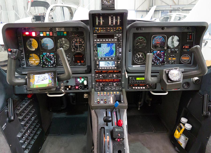
The aircraft is this 2002 TB20GT; one of the last made before production ended.
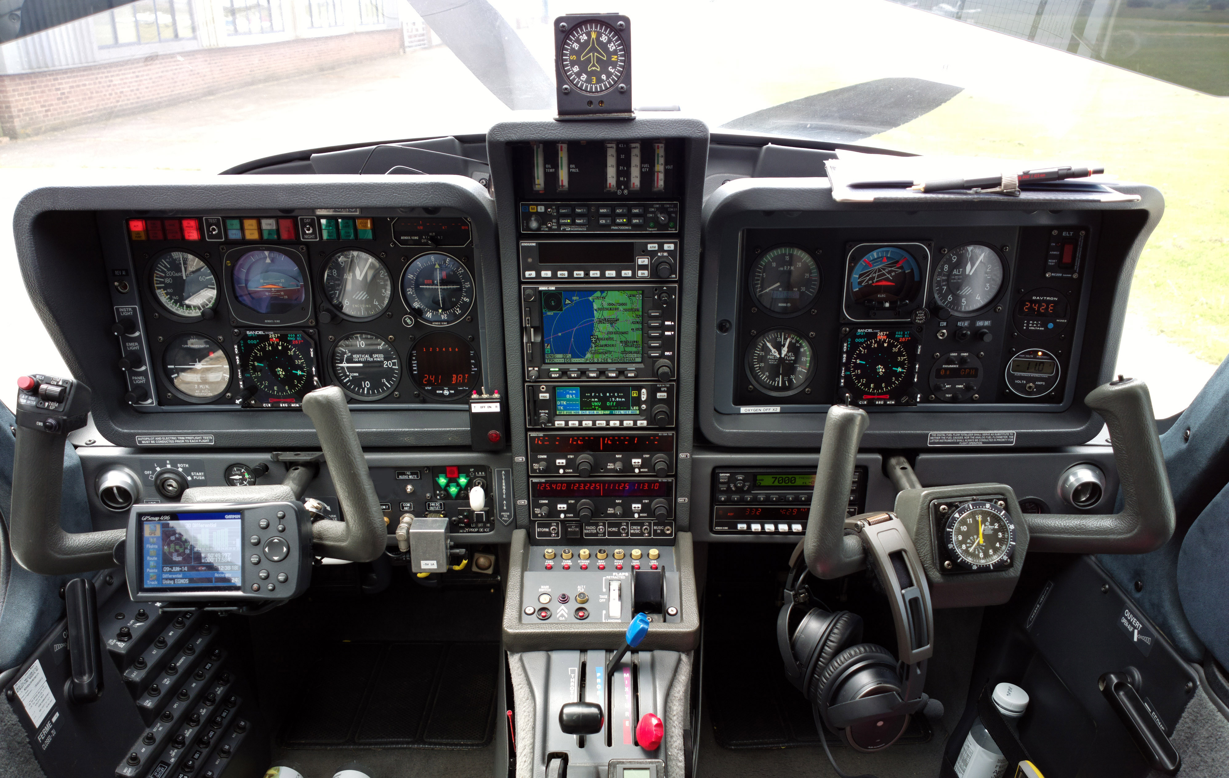
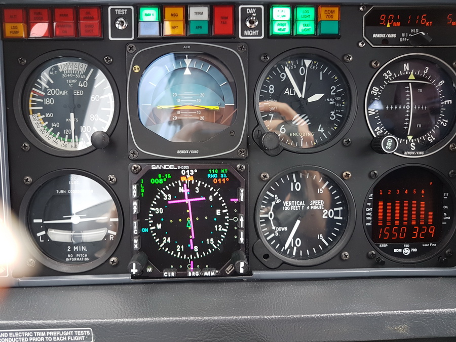
It is equipped for BRNAV (RNAV 5) and can fly ILS and GPS/LNAV approaches using the autopilot. This is sufficient for all practical European IFR flight. The cockpit is largely as delivered in 2002, with a Sandel EHSI installed on the LH side and with the RH side reworked with another Sandel EHSI and arranged to form a usable "pilot panel" so the aircraft can be flown from the RH side.
There is no LPV approach capability but LPV is not yet (to me) operationally relevant in Europe especially if flying to/from the UK which normally needs an airport with Customs/Immigration. In the case of this trip, Menorca LEMH has an ILS.
The aircraft has an operating ceiling of 20,000ft in ISA conditions. I have taken it to 21,000ft but in the fairly common summer conditions of e.g. ISA+15 it will reach 18,000ft at MTOW.
Planned upgrades for 2018 are: full TKS anti-ice system (previously I had only TKS propeller protection) and the ADL150 satellite weather receiver. At time of writing (3/2018) both of these have been installed but the ADL150 is not fully functional due to a compatibility issue with the KLN94 GPS. New panel.
The Garmin 496 in the left hand yoke has been replaced with an Aera 660 which does the same job - mainly GPWS warnings wired to the intercom - plus it adds the excellent Garmin Safetaxi airport mapping which should make it a lot harder to get lost at an airport. Both GPS models have an almost completely useless controlled airspace depiction and a separate tablet based VFR mapping app (I have EasyVFR, and some other generic moving map apps) is needed for VFR flight.
Routes
These were developed with the Autorouter which was also used to file the flight plans. This facility is currently free. It does IFR flight plans only (I Y and Z but not V). There are very few other options for autorouting and all cost significant money. There is RocketRoute; a free PC tool FlightPlanPro which was developed by one of the RocketRoute people before RR came along and which at time of writing is non-functional in much of Europe due to a lack of database updates; Foreflight which is a US product which is working hard to become a player in Europe and has an autorouting add-on.
It's worth a mention that for flight plan filing there are various options. An overview is here. For VFR I use EuroFPL. I also use EuroFPL for filing IFR flight plans for unusual situations e.g. where a specific ETA must be filed (to fit inside a purchased airport slot - the classic case is the Aero Friedrichshafen exhibition at EDNY where the militant tower personnel would cancel a flight plan whose ETA does not hit the 15 minute time slot which was booked weeks in advance!) and the only way to achieve this may be to tweak the EET on the flight plan. The flight plan filing feature of the Autorouter does not allow these flight plan parameters to be edited.
Some notes on IFR in Europe are here.
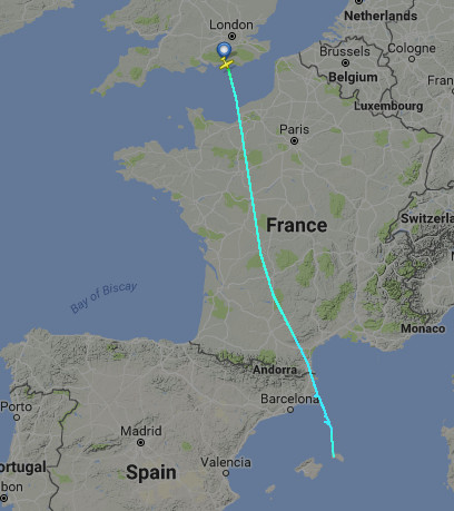
Shoreham EGKA - Menorca LEMH
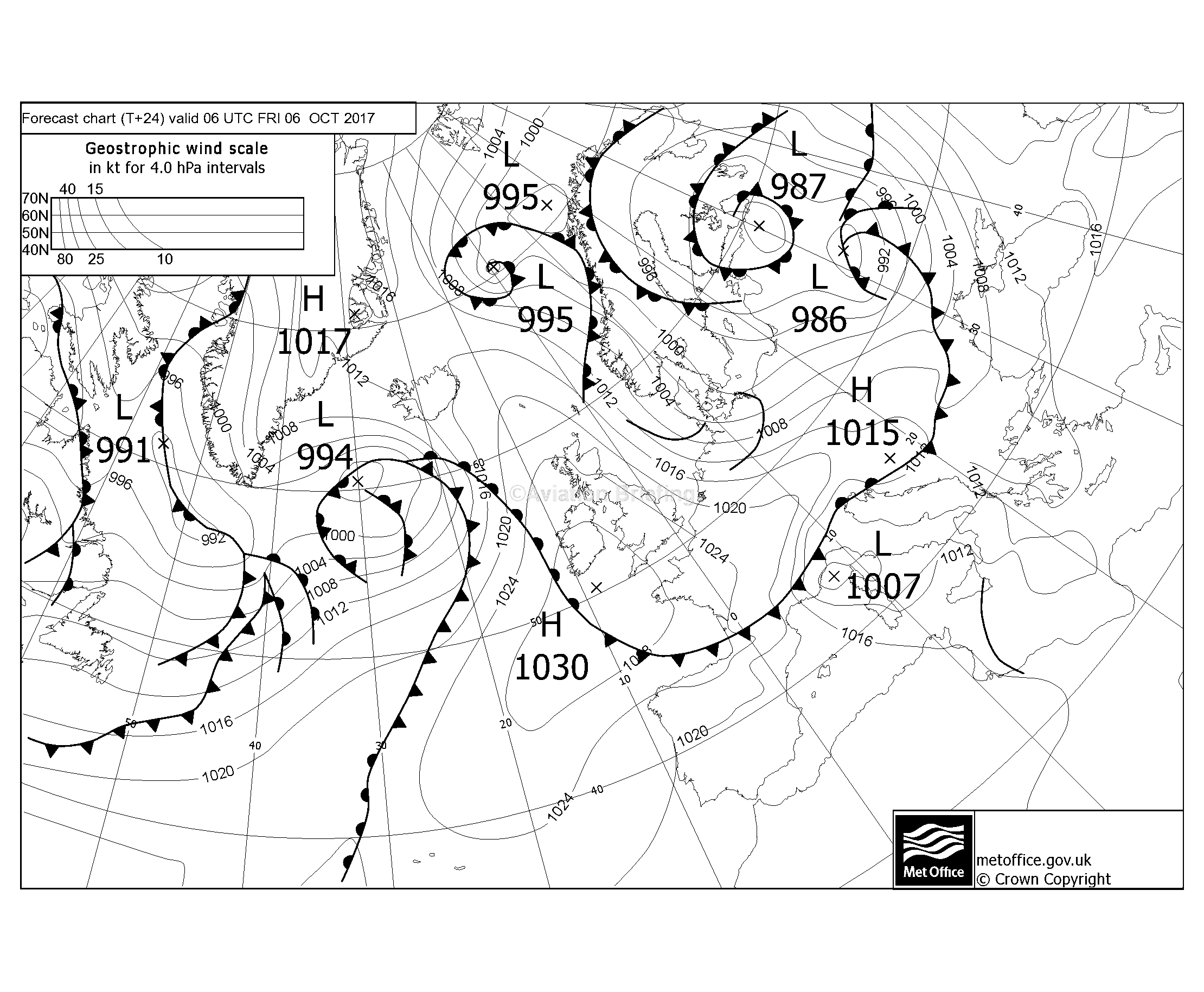
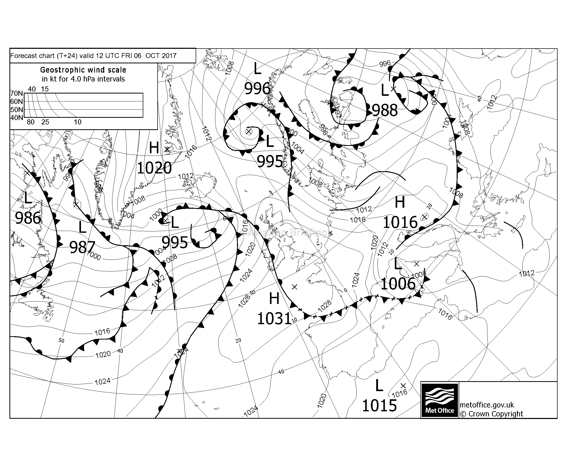
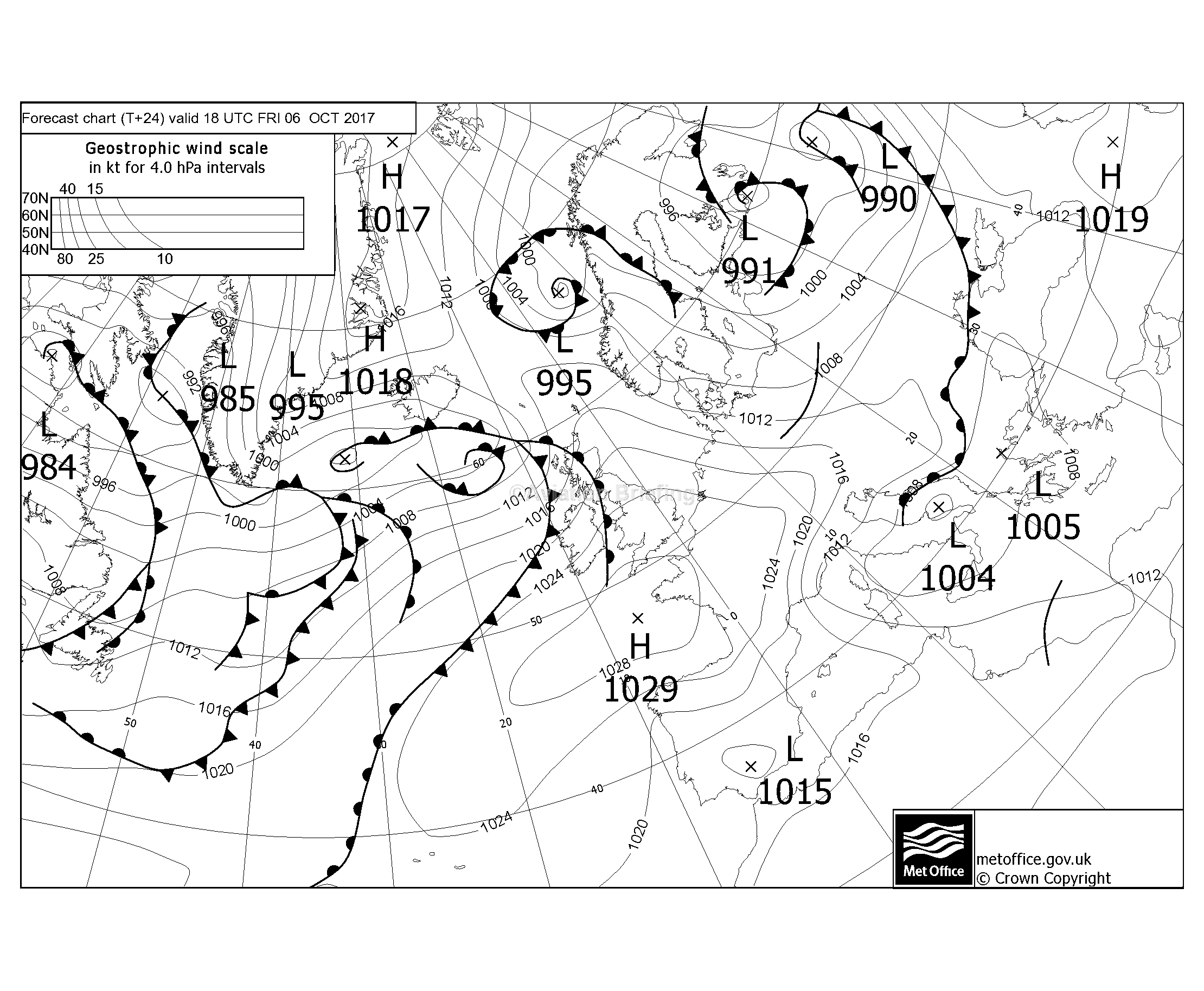
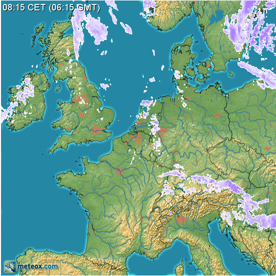
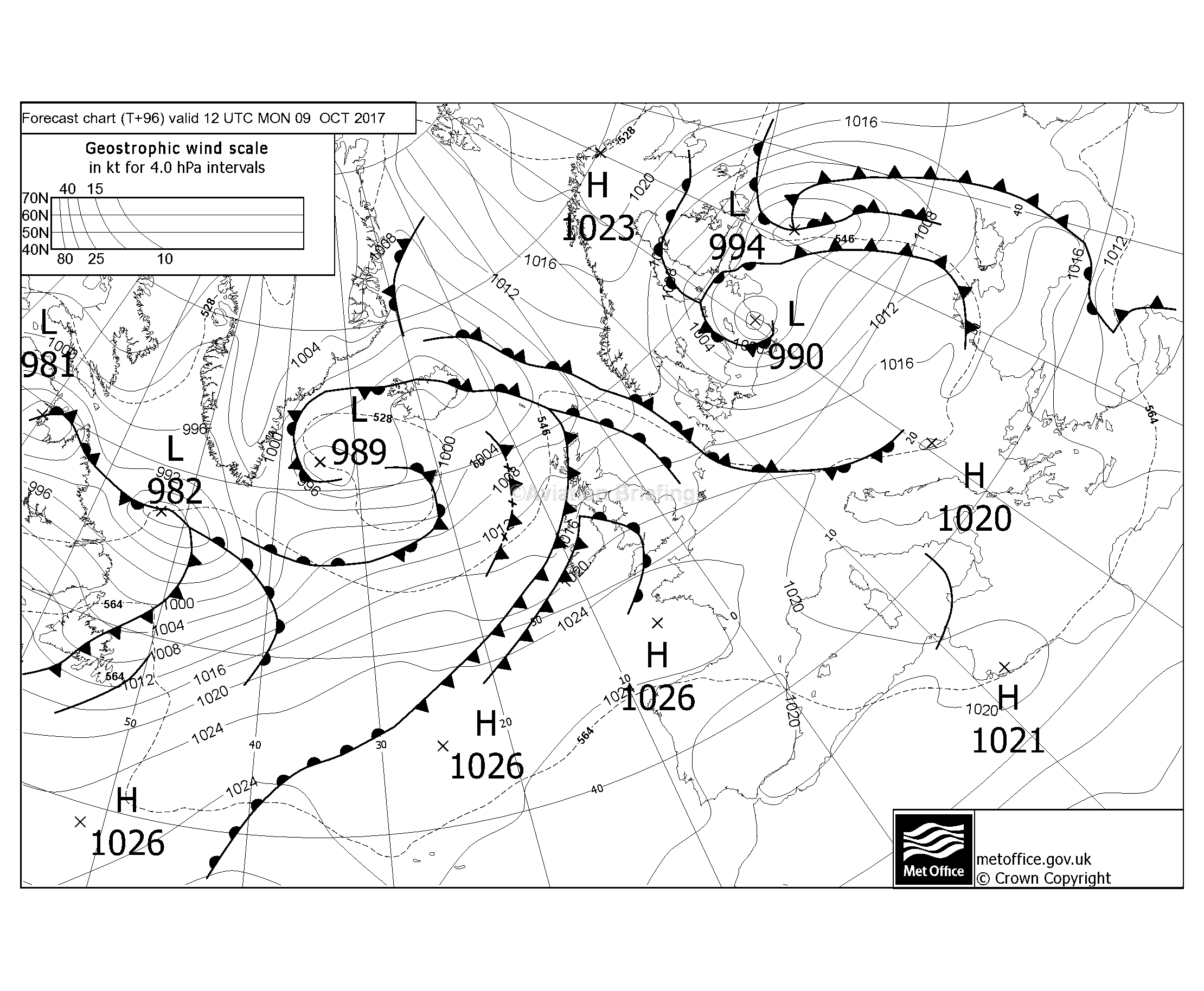
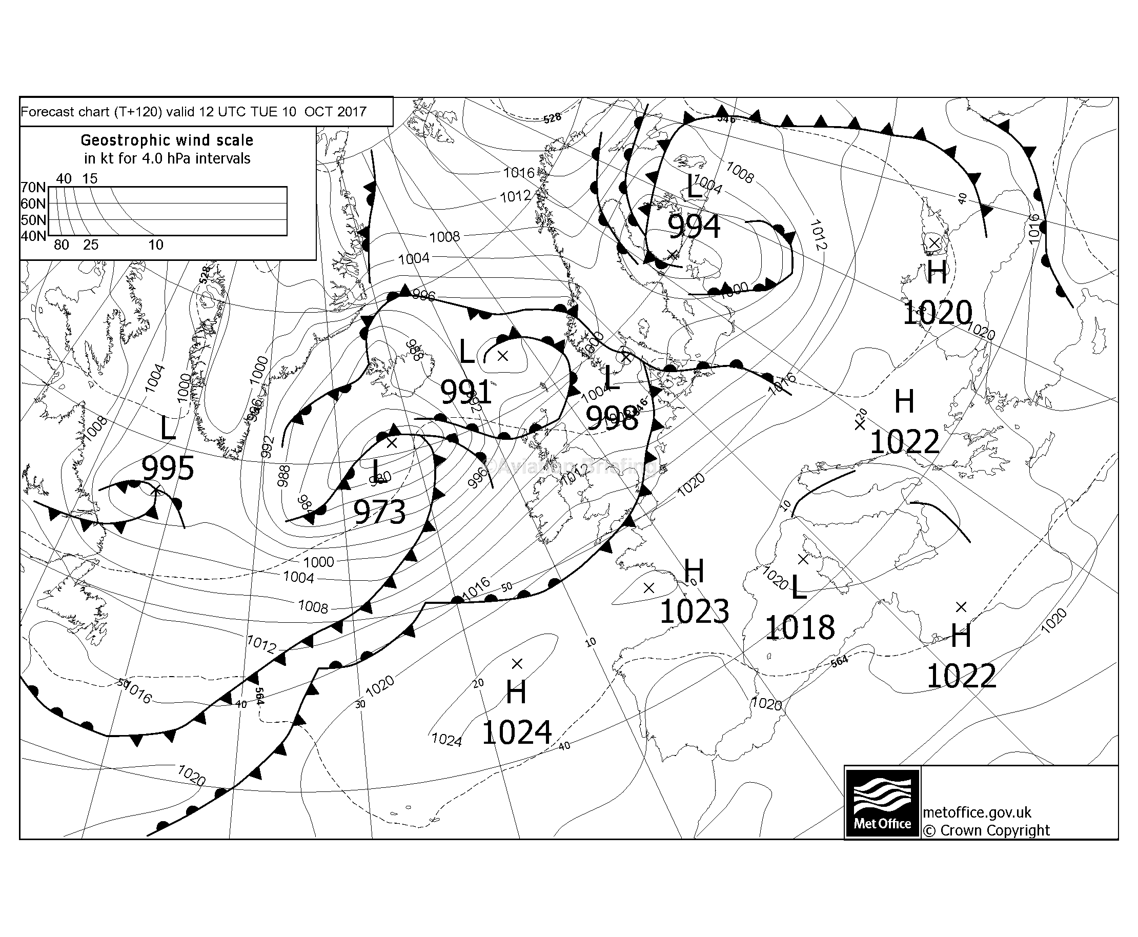
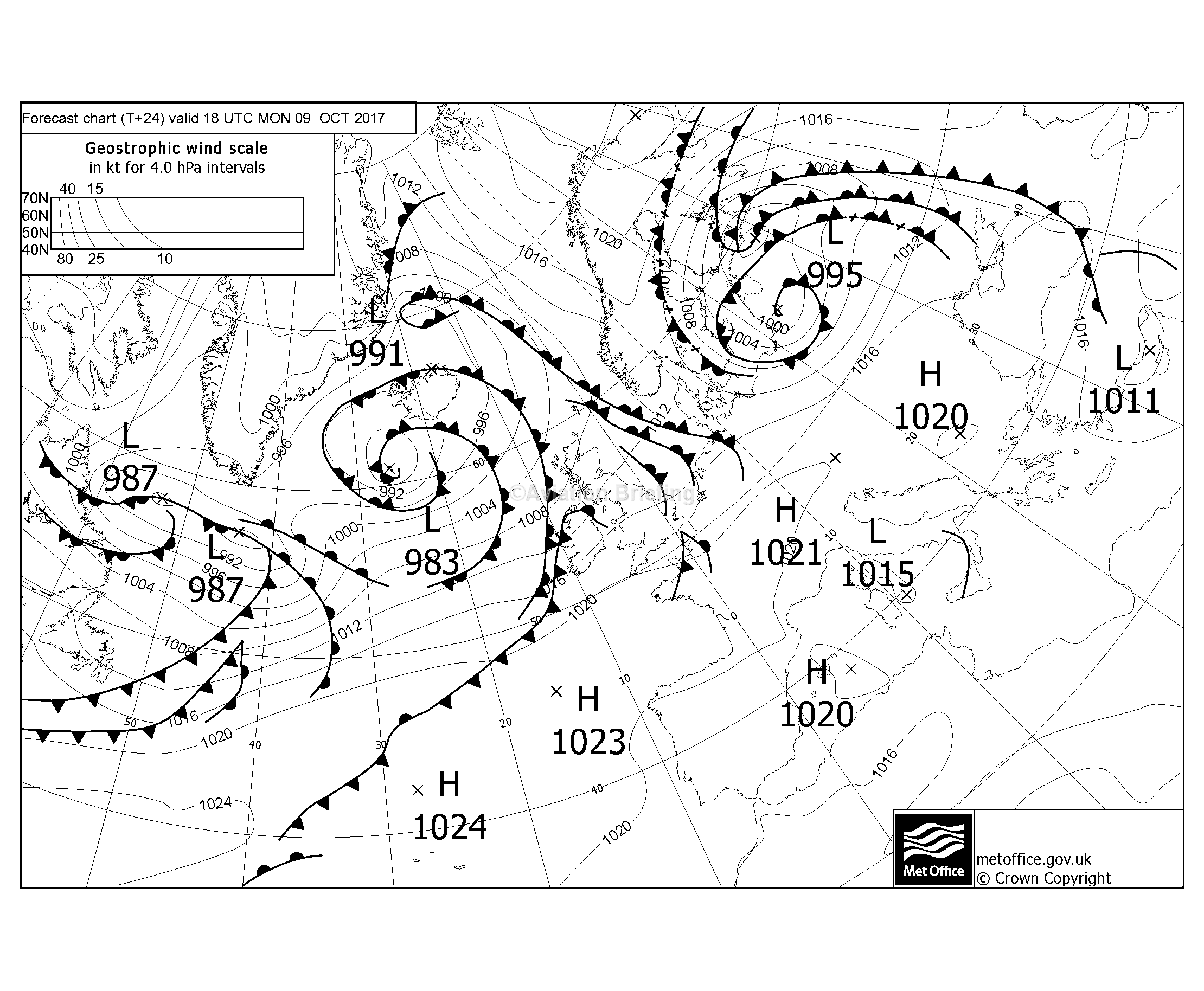
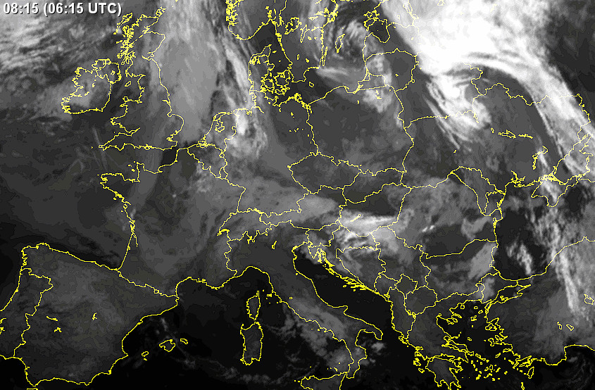
The MSLPs show a cold front across the route, dissipating later in the day, but these fronts (with almost no wind gradient across them) tend to be relatively benign and usually the TB20 can fly over the top of them. The IR image showed cloud tops perhaps around FL100. The radar image was clean.
MSLP: 0600 1200 1800
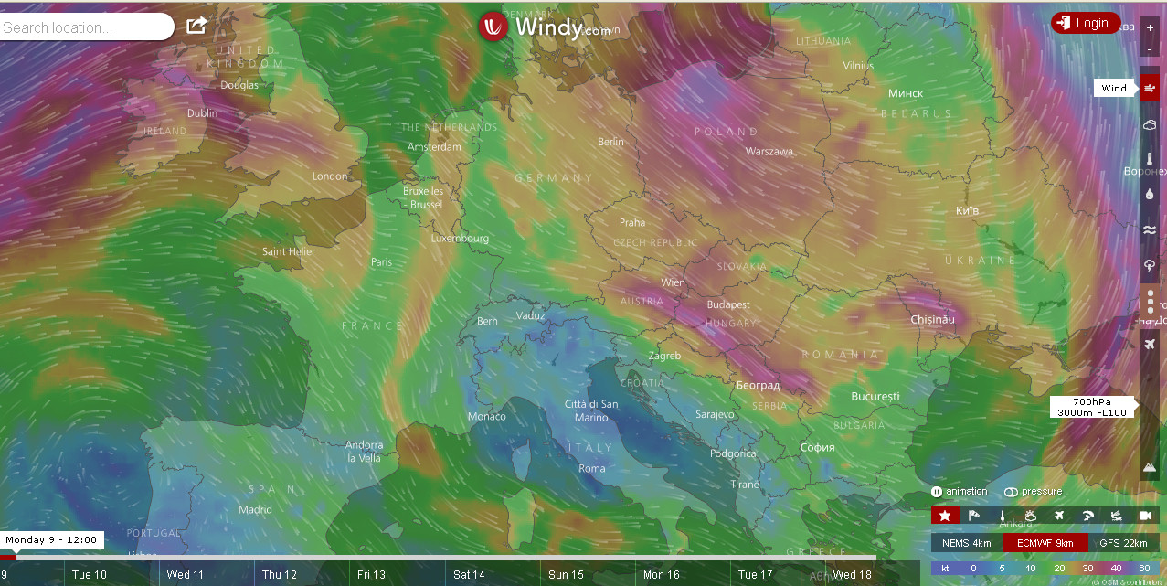
IR Radar TAFs/METARs sferics winds
Autorouter briefing pack
The weather for the return flight looked OK for the 1st planned day but not so good for the one after.
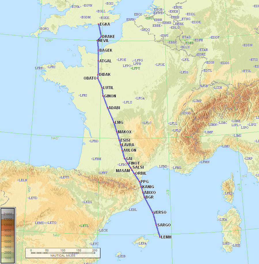
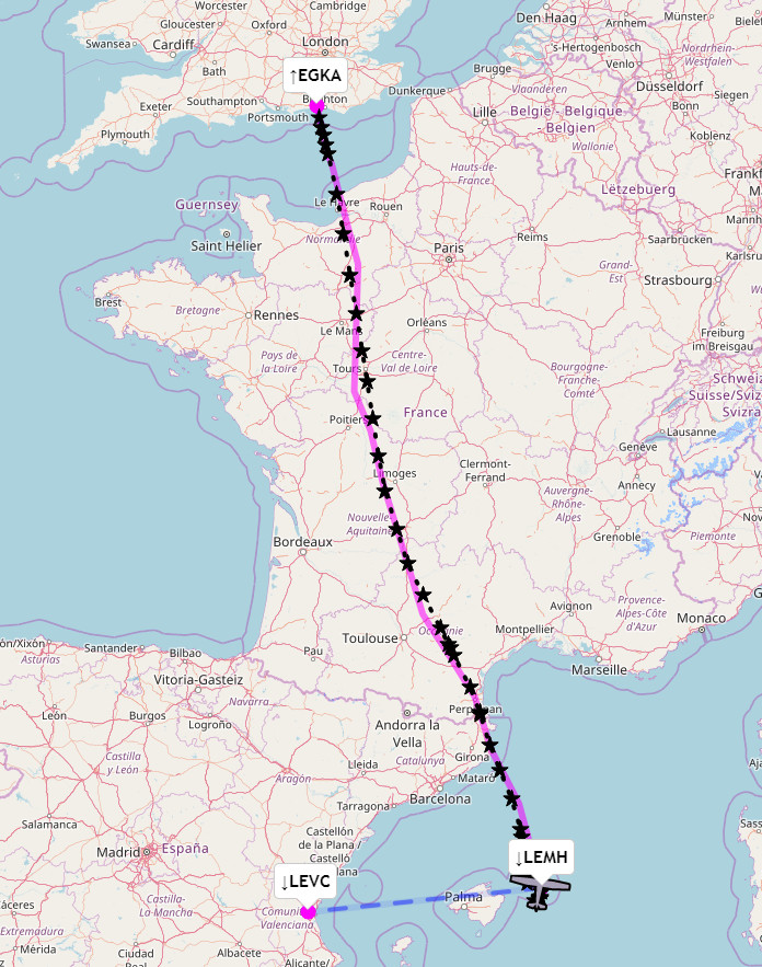
The route was filed for FL100. In France most routings are relatively efficient and this one was no exception.
EGKA DRAKE DCT SITET A34 LGL DCT PEPAX DCT TUDRA DCT LMG G36 ORBIL G36 PPG A27 BGR A67 SARGO LEMH
Alternate: Valencia LEVC
696nm as filed
685nm GC

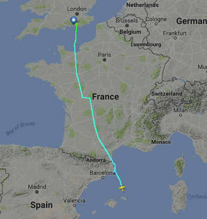
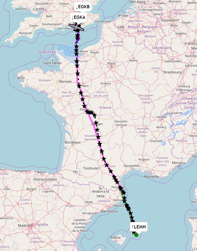
Actual route flown (FR24)
The Eurocontrol track is here.
Departure conditions were great - straight out over the sea
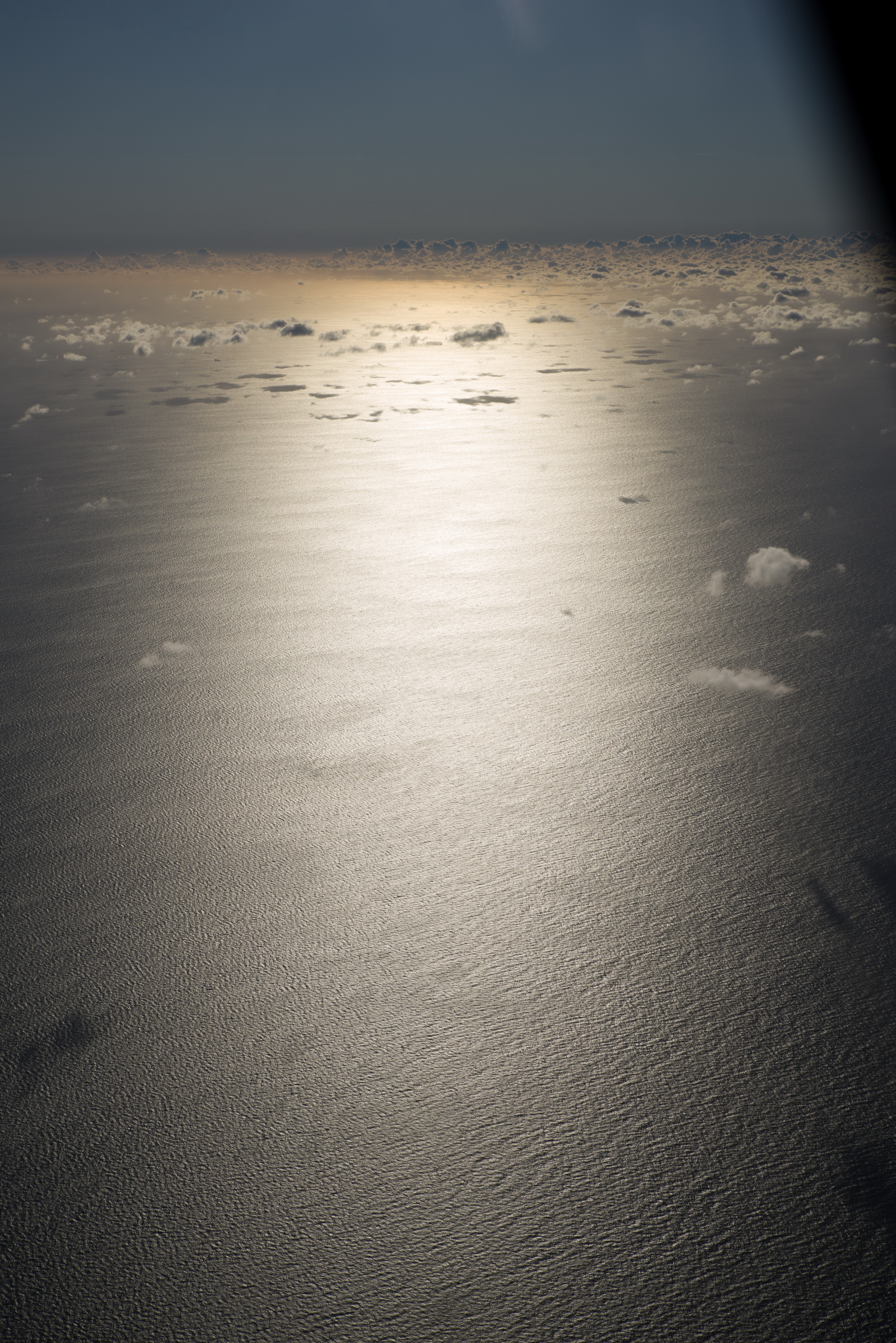
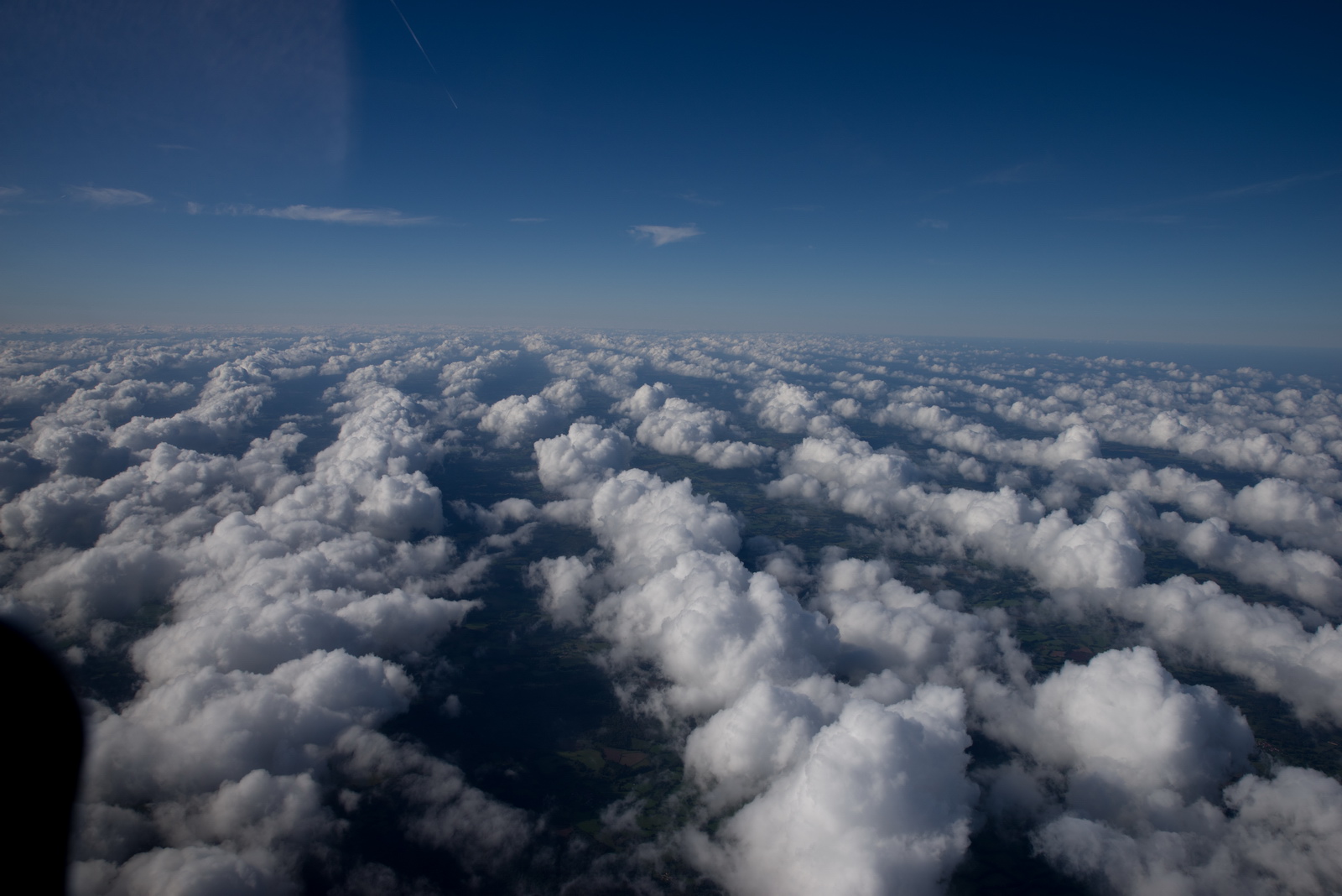
Later we got these strange regular cloud patterns, with tops around 8000ft
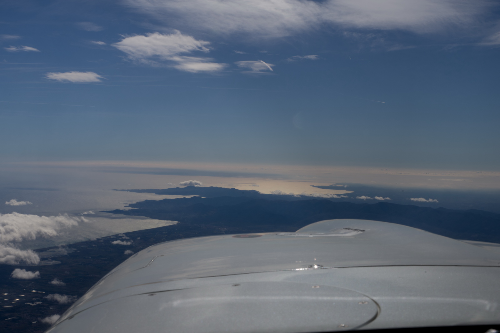
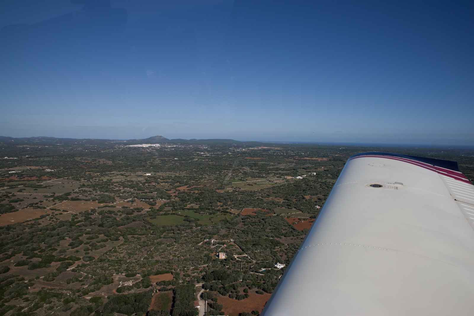
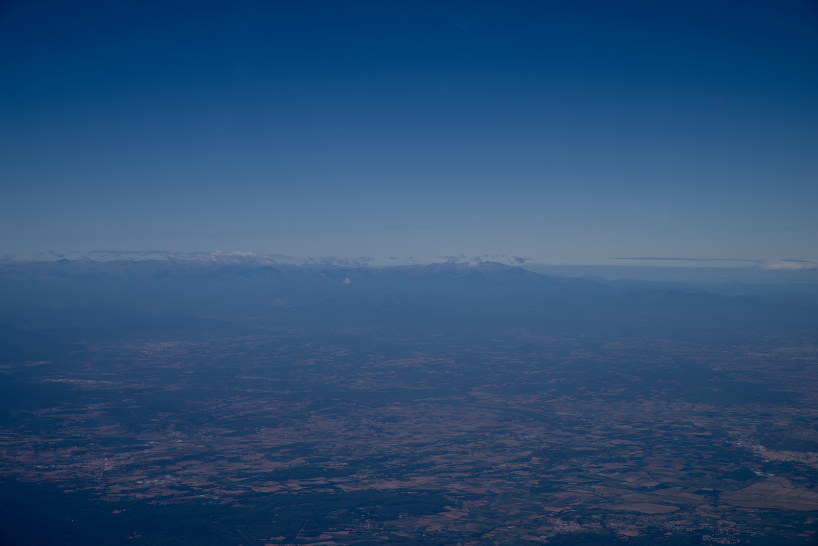
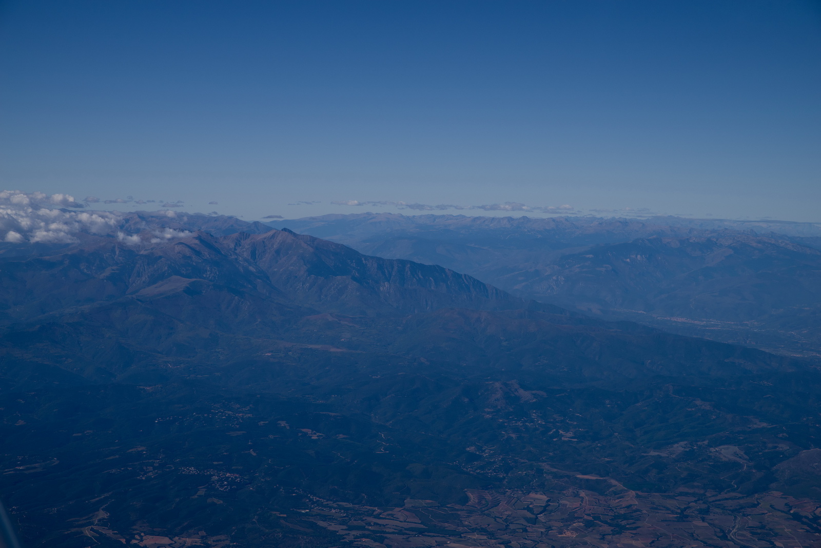
After an unremarkable flight across France, mostly at FL120 to remain above the cloud, the Pyrenees appear on the right
With the strong tailwinds, we started to see heavy up and down draughts exceeding our ability to hold altitude at max power at FL120; I lost 200ft at one point to avoid stall, but Spanish ATC never said anything and probably didn't notice
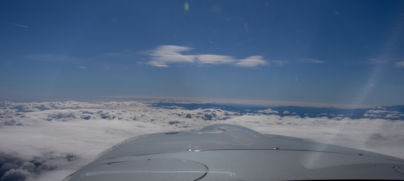
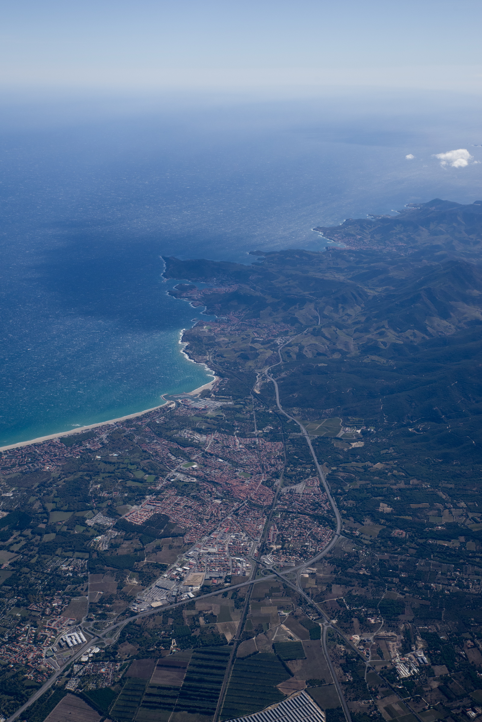
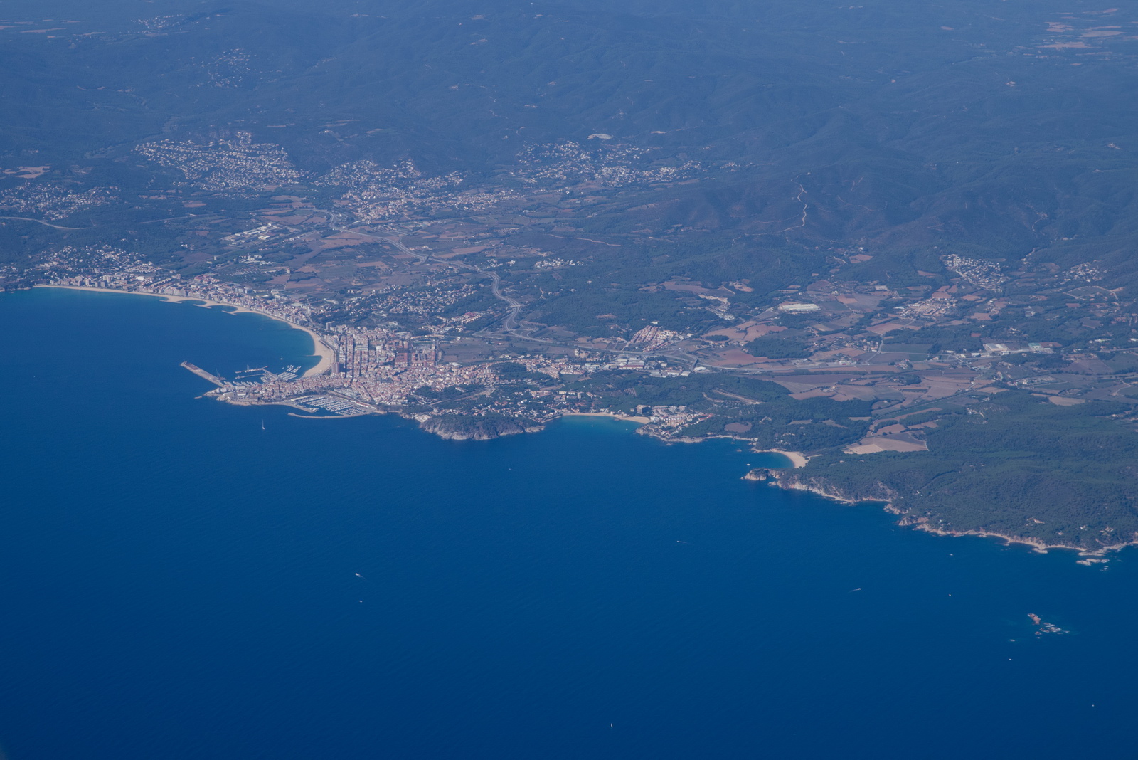
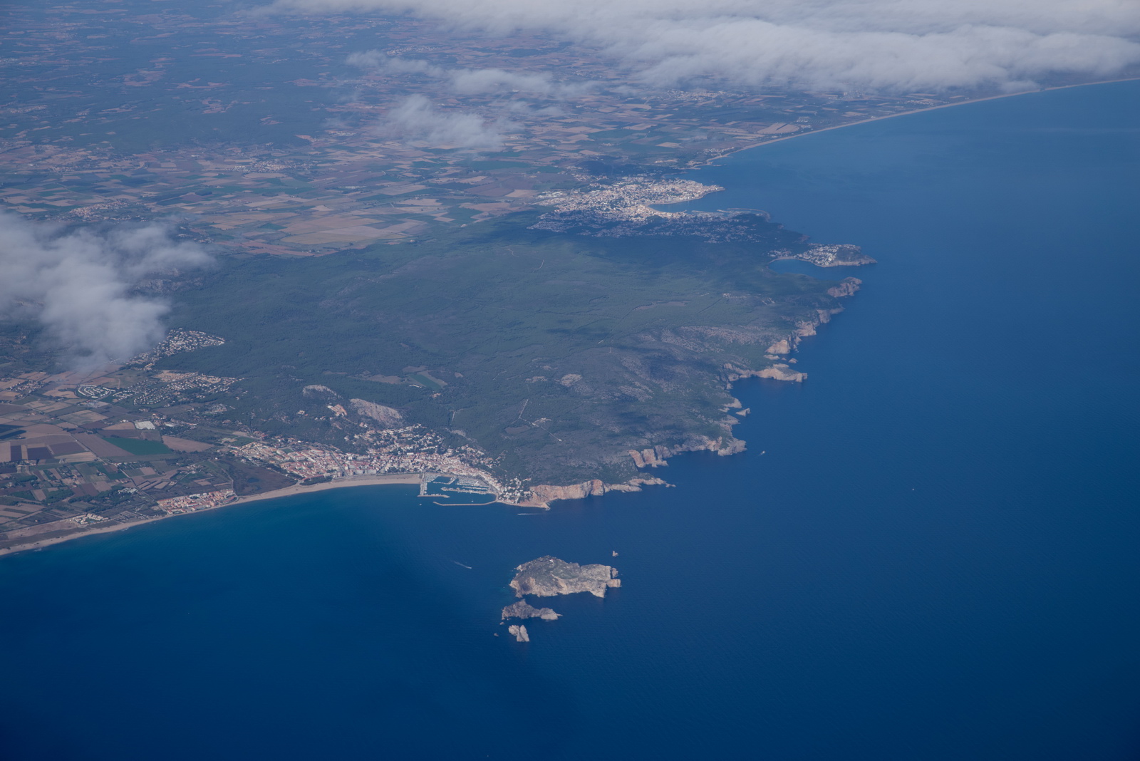
Approaching the southern coast of France, near Perpignan
 i
i
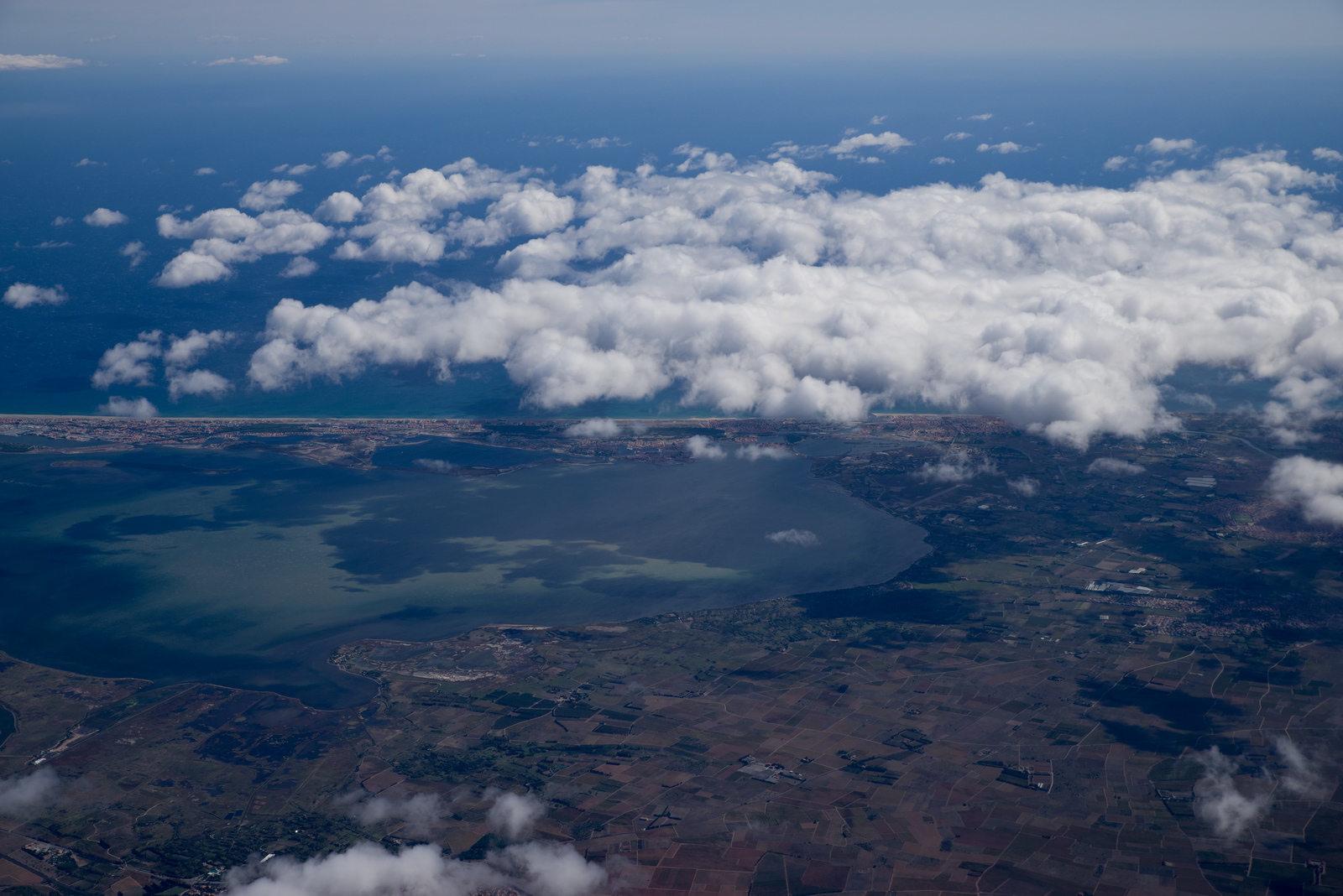
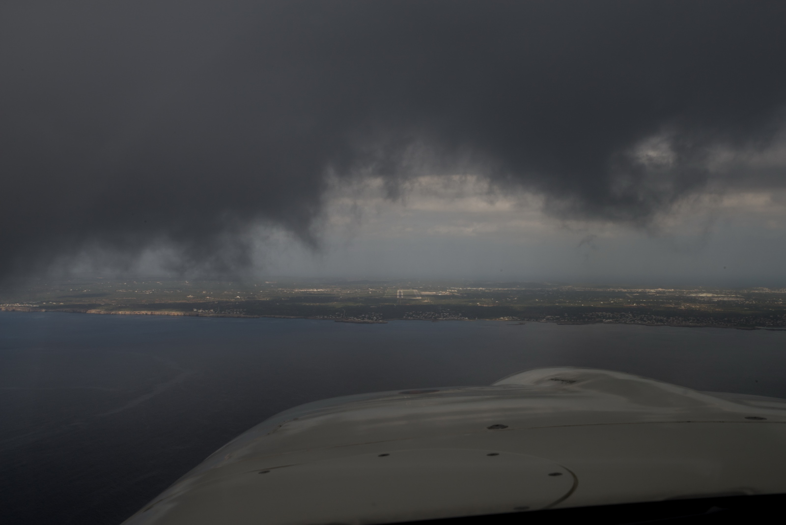
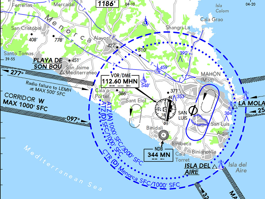
Menorca appeared soon and here we can see that the approach into the airport, from the south, will be under the big cloud
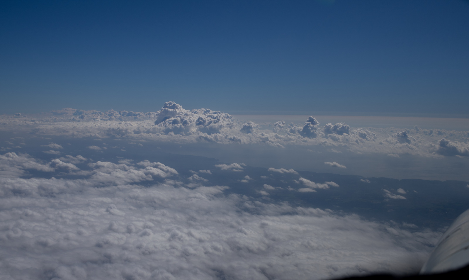
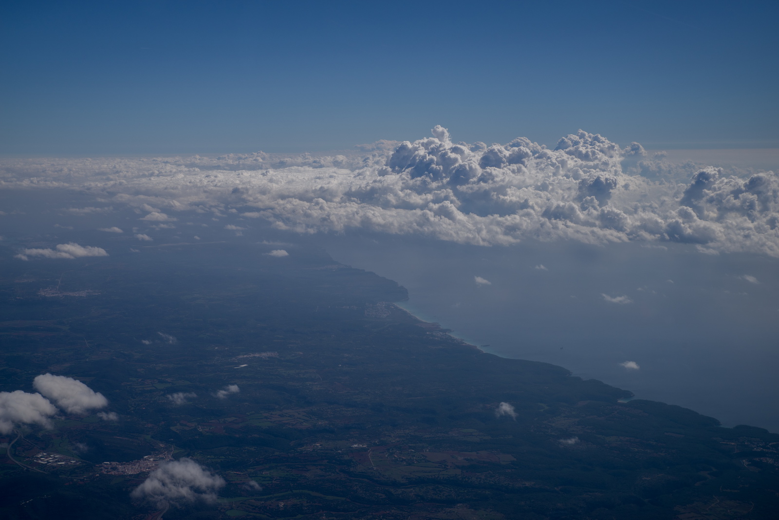
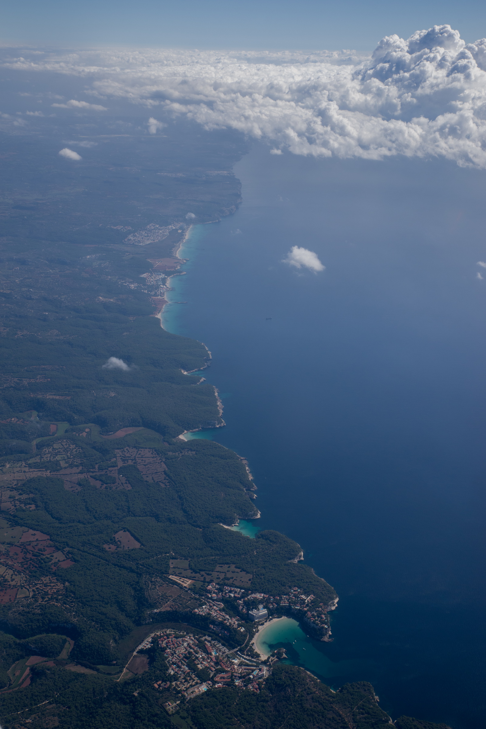
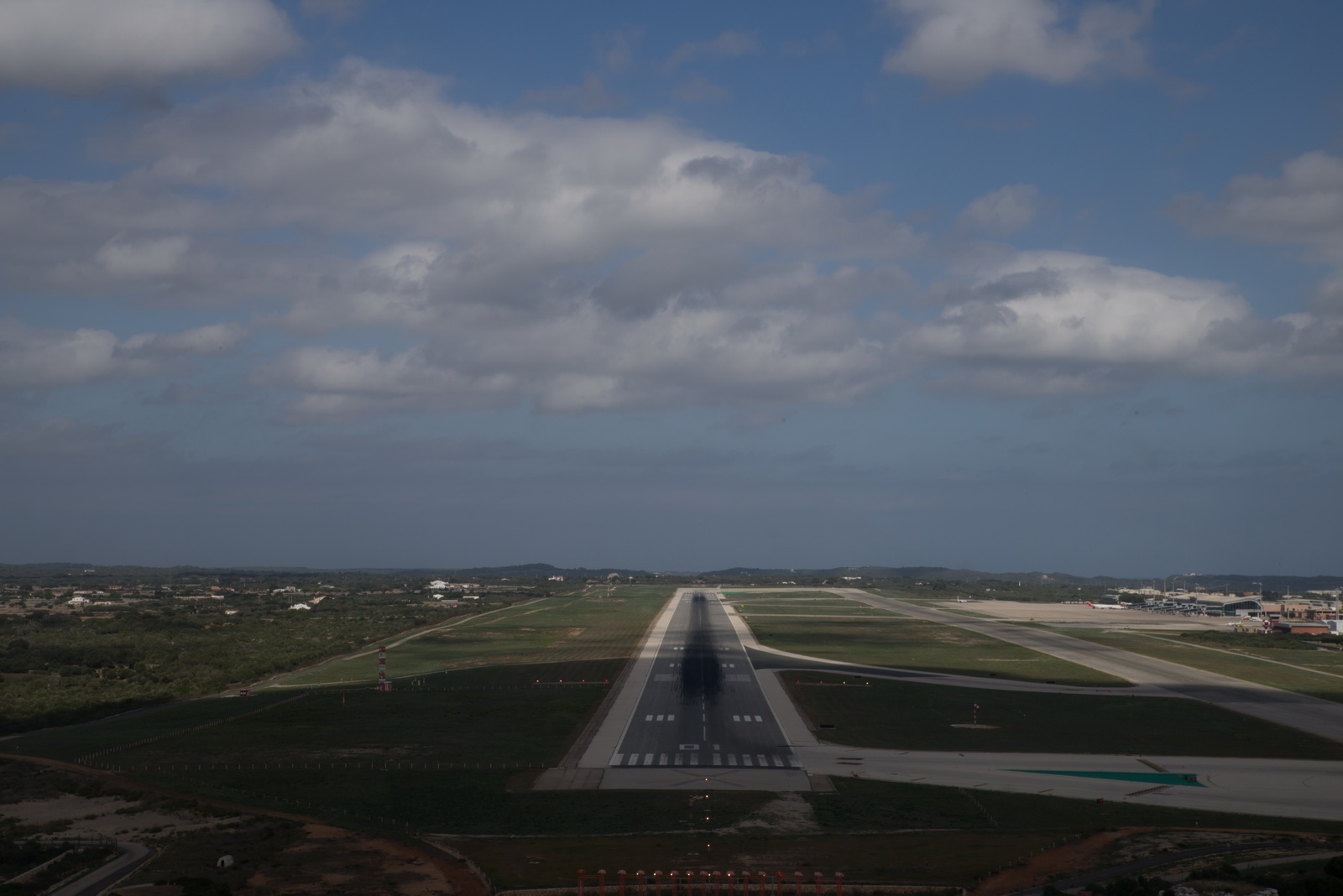
You can see the airport here
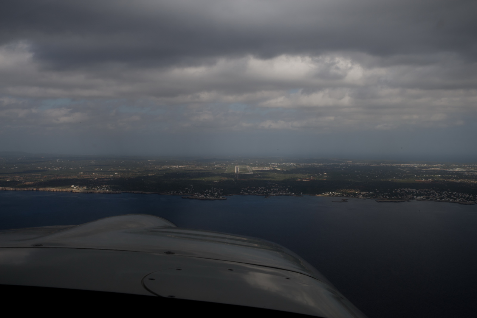
On the localiser now. We slowed right down on the expectation of some rough stuff and just missed the bottom of the cloud

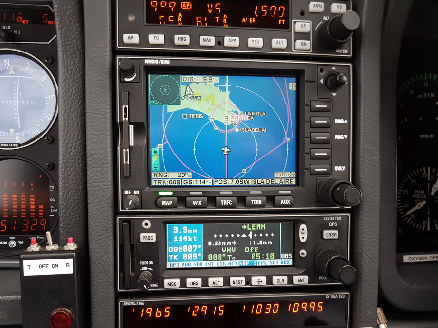
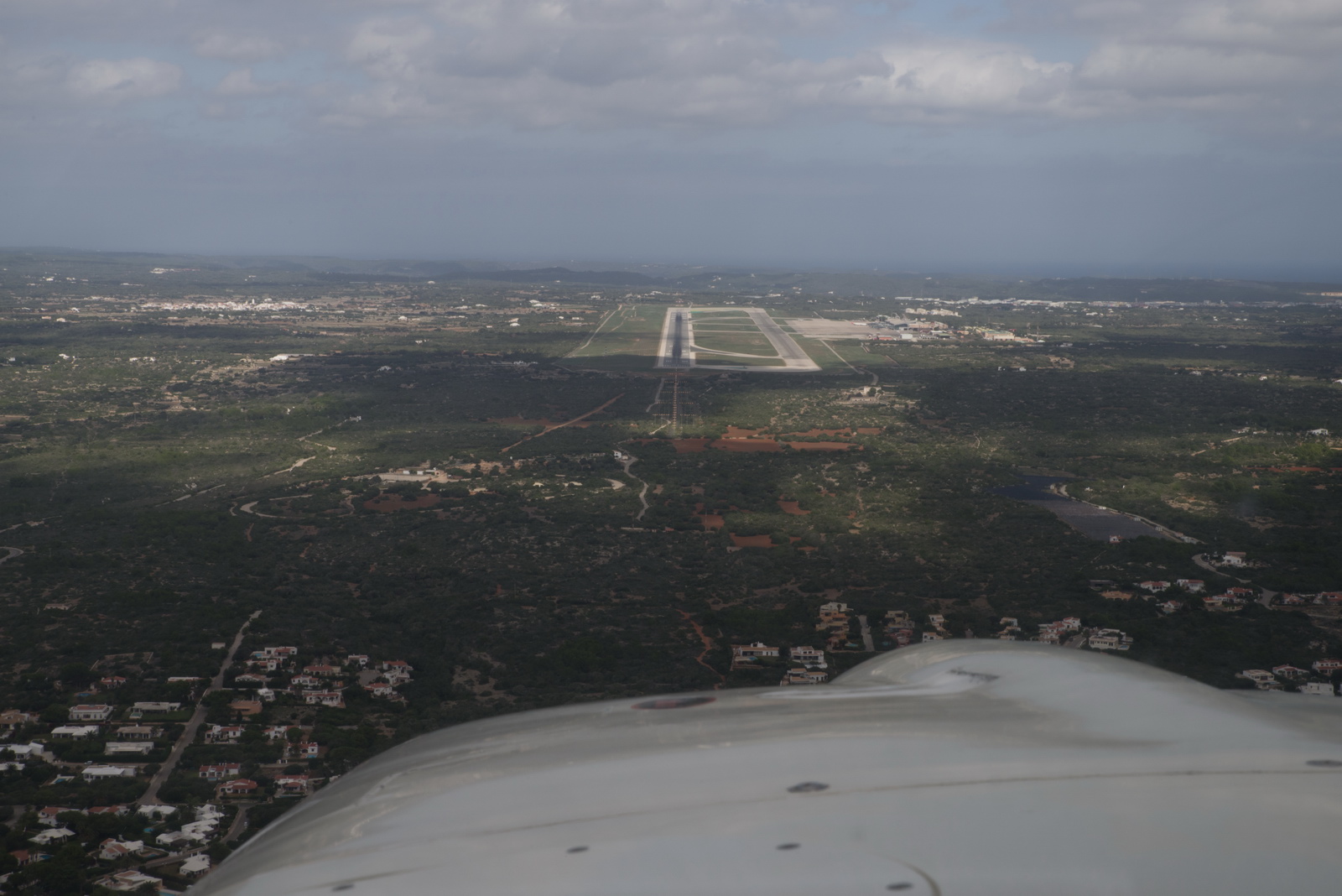
Glideslope not yet intercepted here. GPS is set up in OBS mode, for reference
Still descending on ATC directions to the ILS platform. After a DME arc, there’s a couple of stepdowns before the glideslope starts, for no obvious reason
On the ILS now
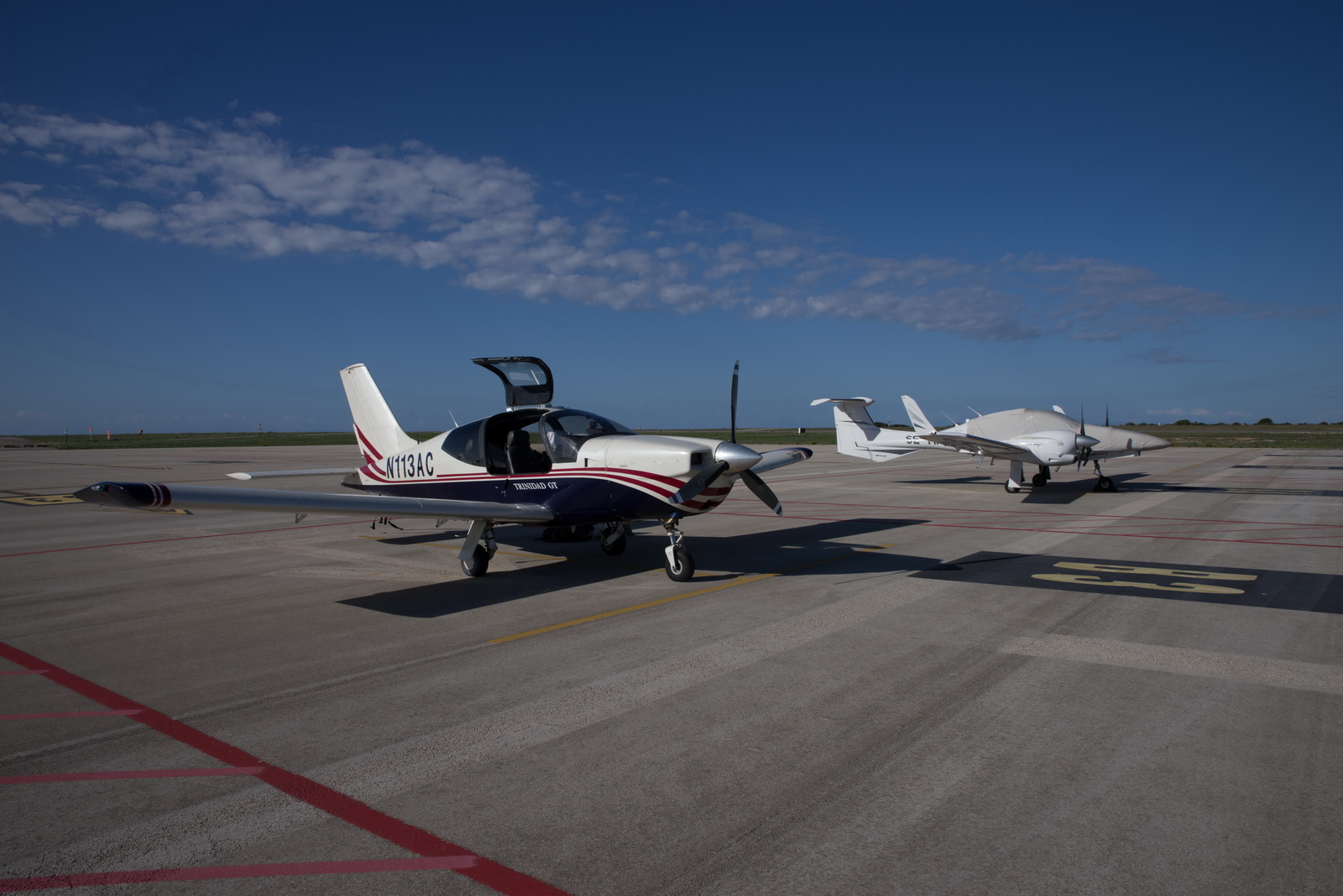
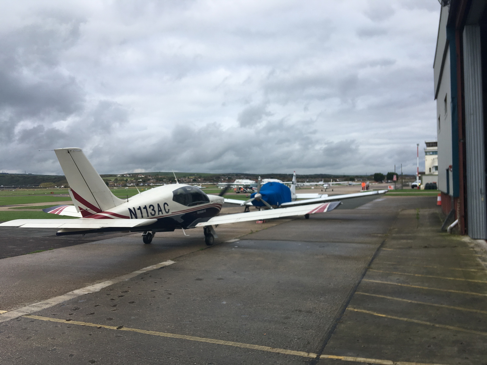
Parked next to a DA42 belonging to one of my friends; he flew direct from Croatia and like me wanted to avoid an intermediate stop for immigration and fuel
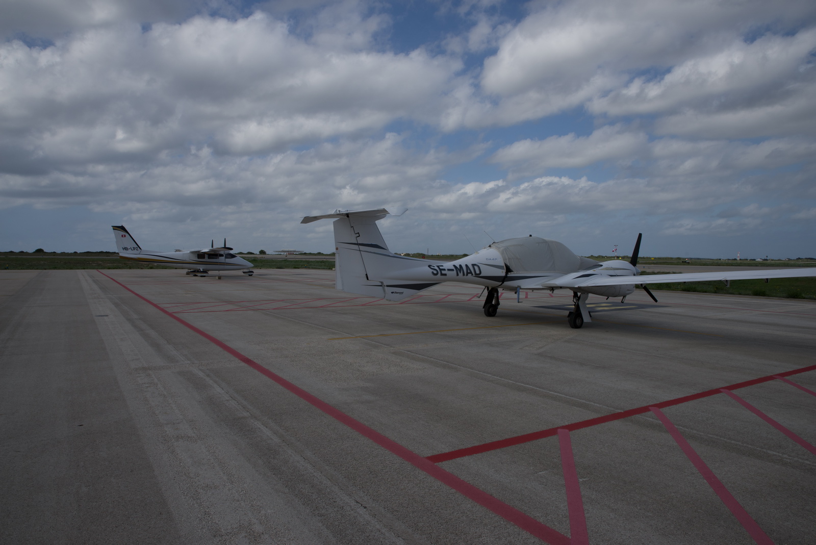
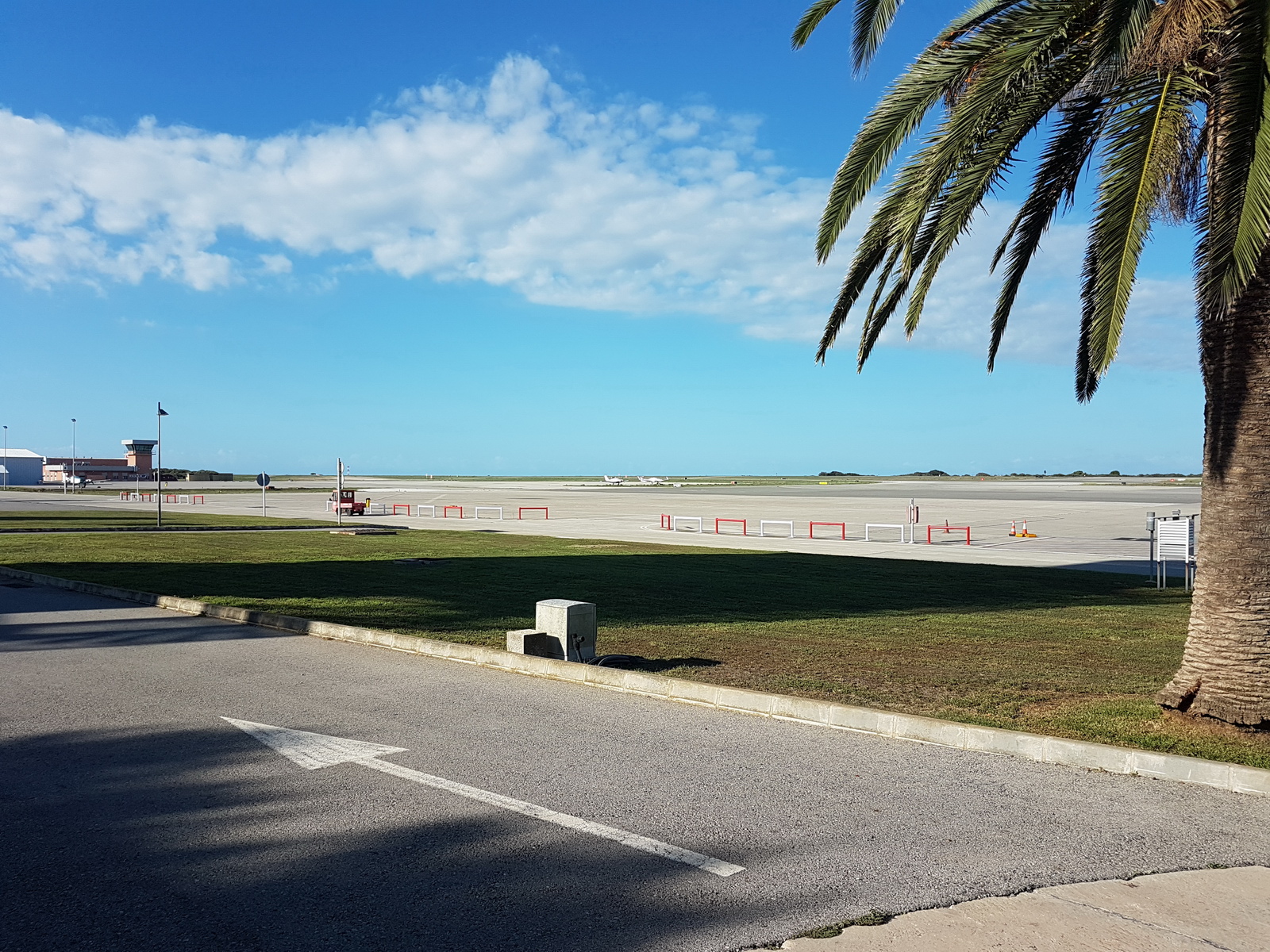
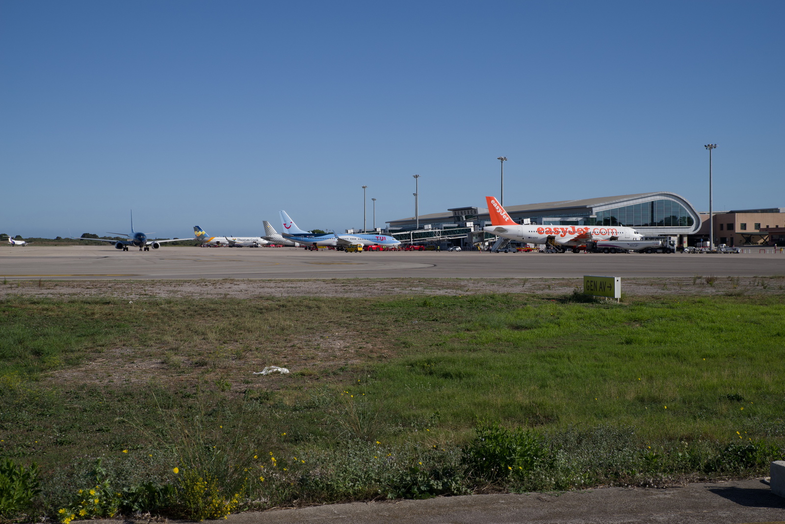
There is no shortage of parking at Menorca; it's a pity the airport is so overpriced for GA access
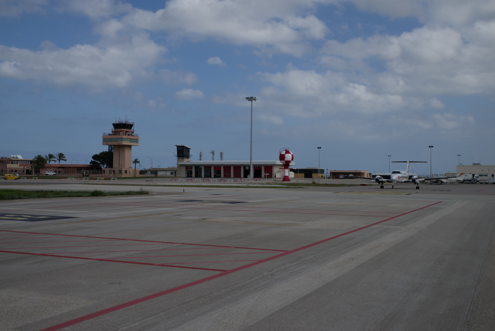
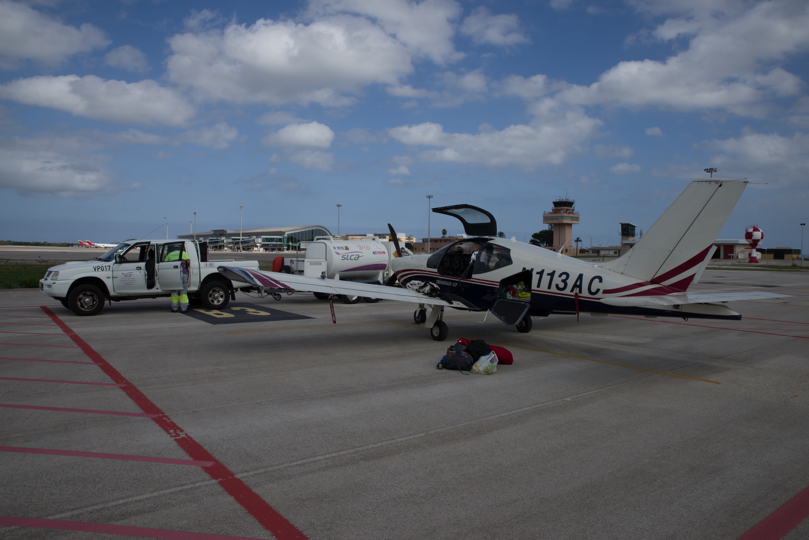
The service, however, was great and we got fuel almost immediately and the handler turned up at the same time to take us to the terminal
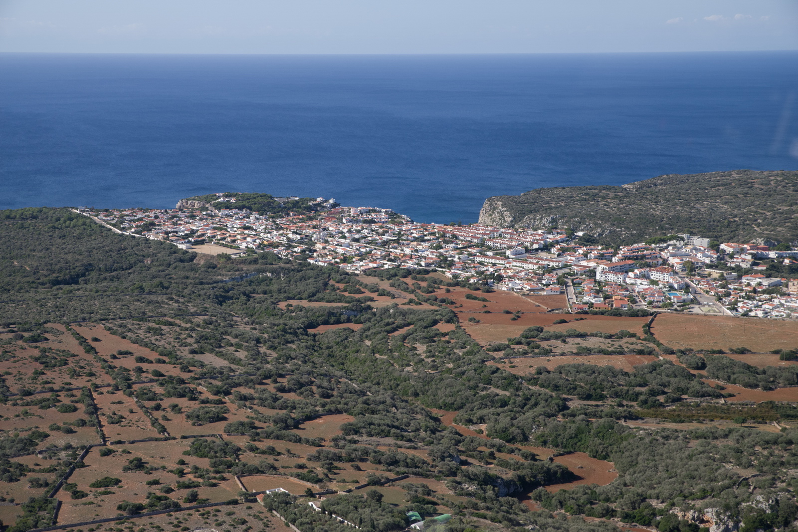
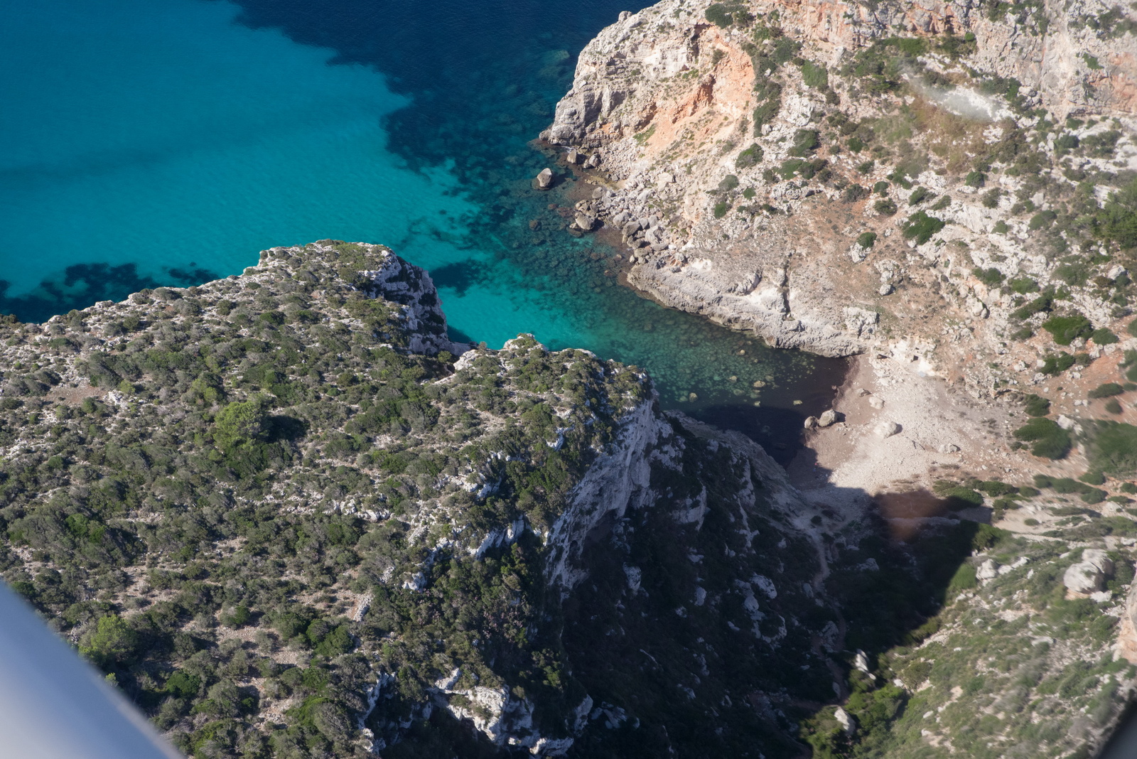
Menorca is a really scenic island. With huge thanks to my friend Emir, we drove around the island and had a good look around. It is much less spoilt by mass tourism than the other Balearic islands. Here is a selection of photos:
Menorca LEMH - Shoreham EGKA
MSLP: 0600 1200
1800
IR TAFs/METARs Winds
Autorouter briefing pack
The route was filed for FL100. The flight plan was Z - a VFR departure and a change to IFR later; this was done to enable an efficient departure route. For some reason which I can't find now, the validated IFR departure routes went way out in the wrong direction, towards Italy.
LEMH SARGO DCT VERSO DCT BGR A27 ABIXO A27 KANIG IFR A27 PPG G36 LMG DCT ADABI DCT GINON J55 LUTIL DCT OBATO DCT DIDAK DCT ATGAL DCT BAGEK DCT NEVIL DCT DRAKE EGKA
Alternates: Biggin Hill EGKB, Lydd EGMD
704nm as filed
685nm GC
Actual route flown (FR24)
The Eurocontrol track is here
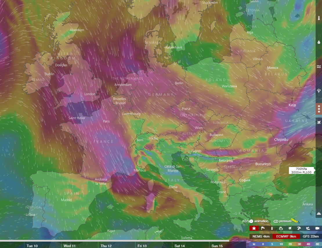
There was no weather affecting the return flight. The MSLP was almost clear, radar and IR were clear, and the wind forecast showed headwinds winds of about 15kt. Apart from the headwind, this is pretty good! The TAFs showed some worsening weather at the UK end but with cloudbases well above instrument approach minima.
The handler would not take payment until the day of departure, which is normally a risky strategy (paying after landing is much safer) but they were very quick. The airport's GA area was deserted that morning but the airline part was packed. The handler took us right past a huge (about 300-person) long queue to the passport desk ![]()
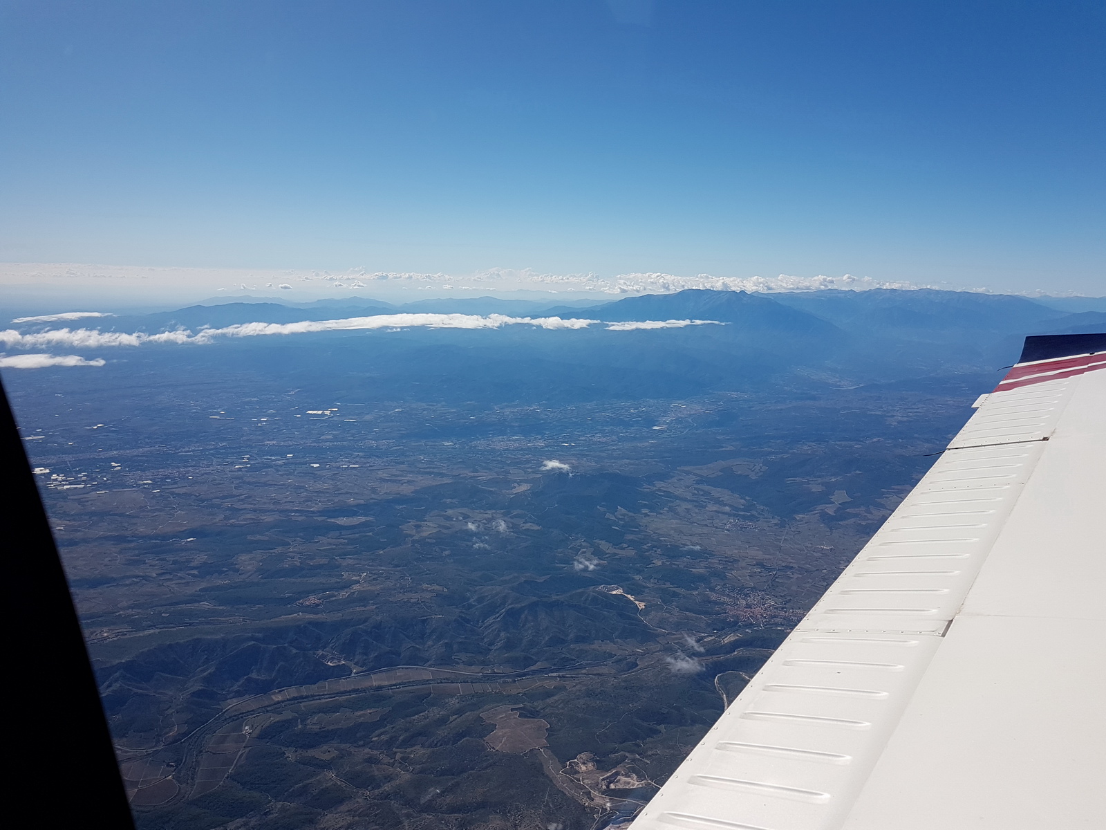
The VFR departure followed the VFR route via corridor W to the west so we were kept to 1000ft
ATC were really helpful and nice, however, and speaking excellent English. This is flying west, along the southern coast, at 1000ft
Now we are turning to the north and climbing to 2000ft
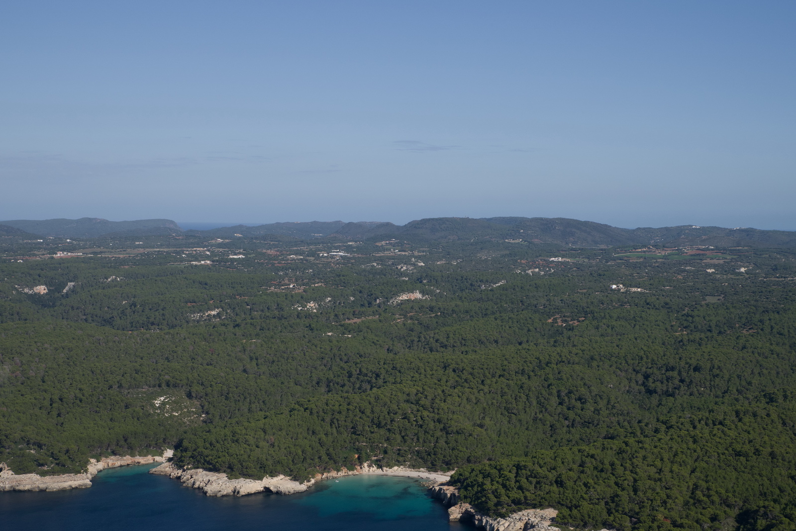
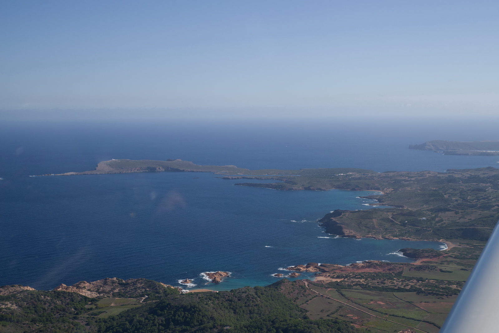
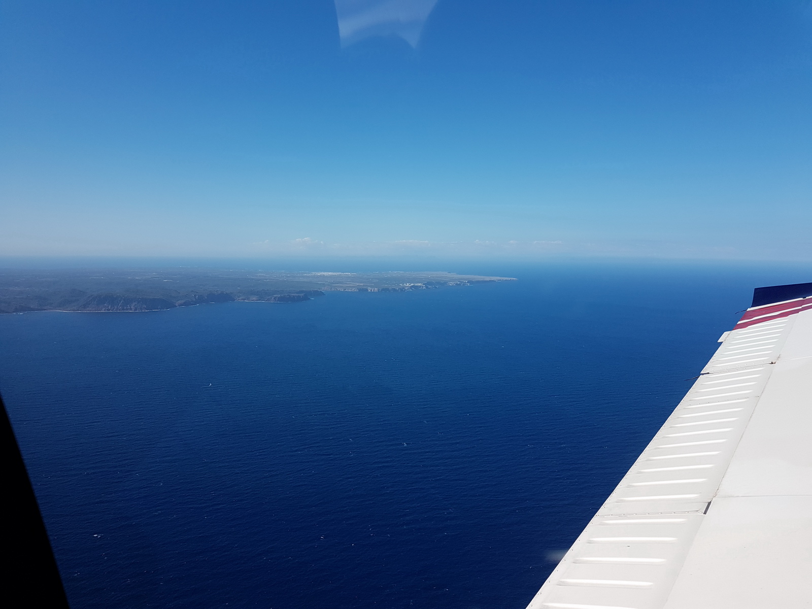
The north coast
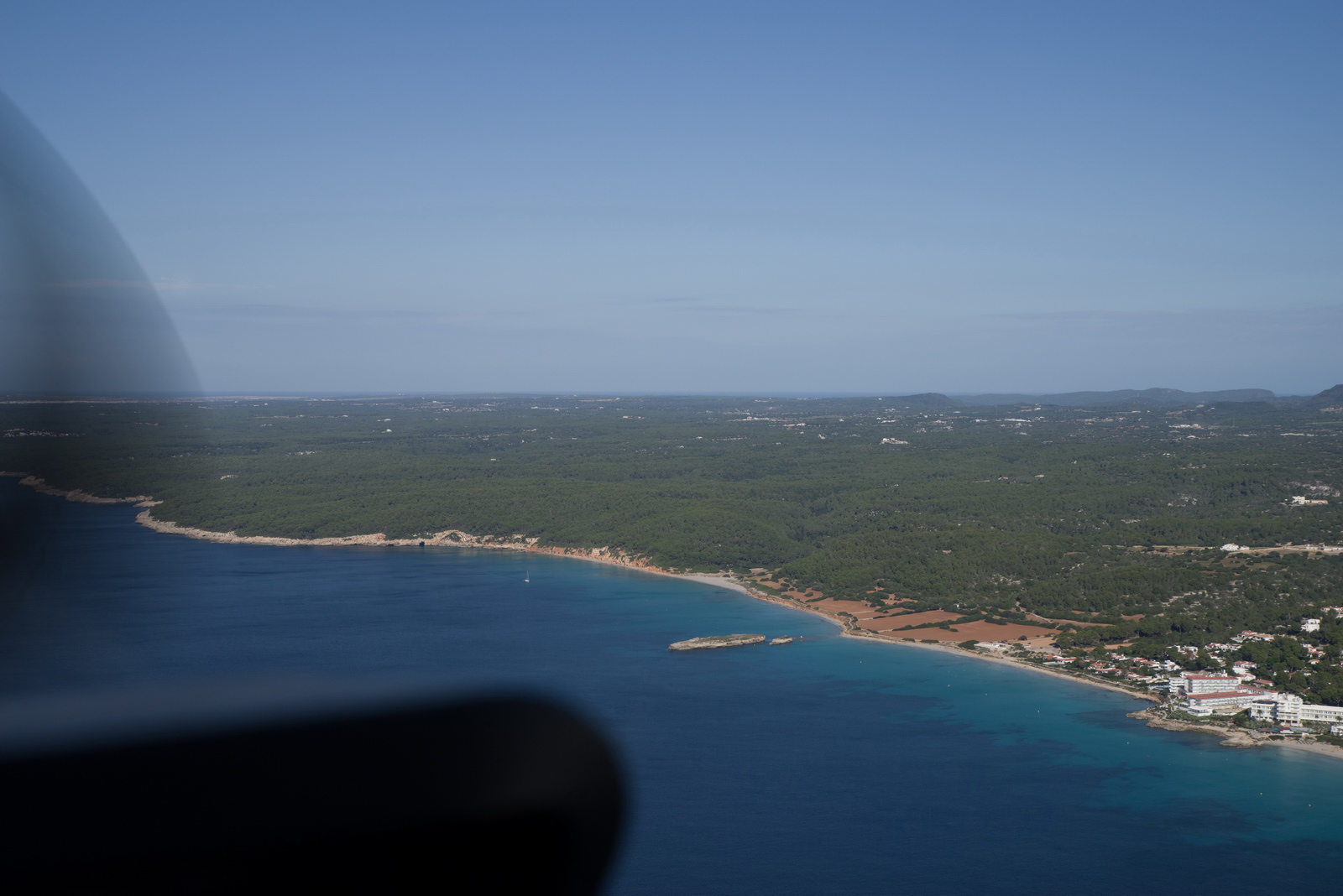
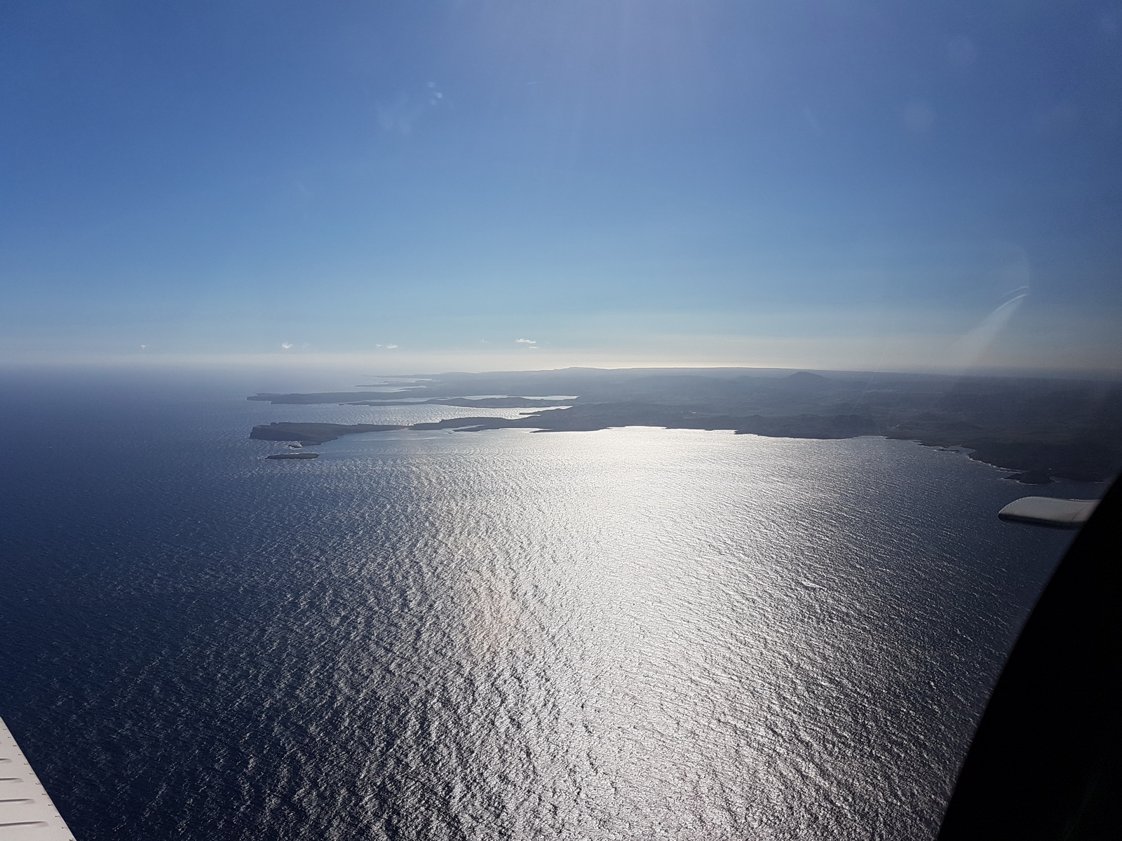
The last views of Menorca
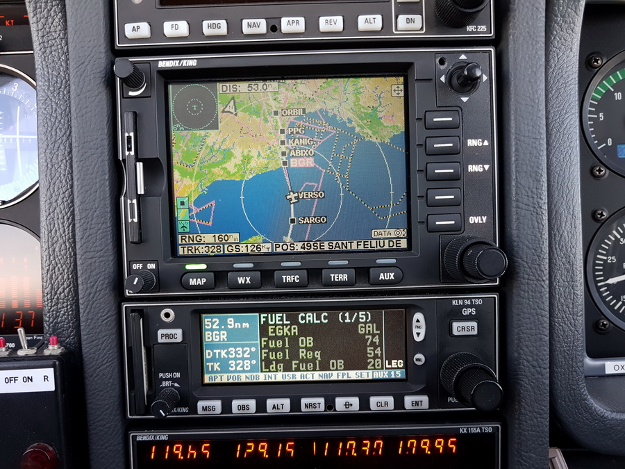
We picked up the IFR clearance around SARGO and way before the filed change at KANIG; ATC were relaxed provided we didn’t go above FL100. The fuel totaliser was showing 20 USG fuel at the destination, which is OK but does show the effect of the 15-20kt headwind and the resulting GS of just 126kt
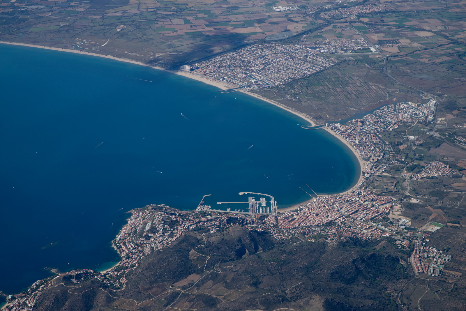
France...
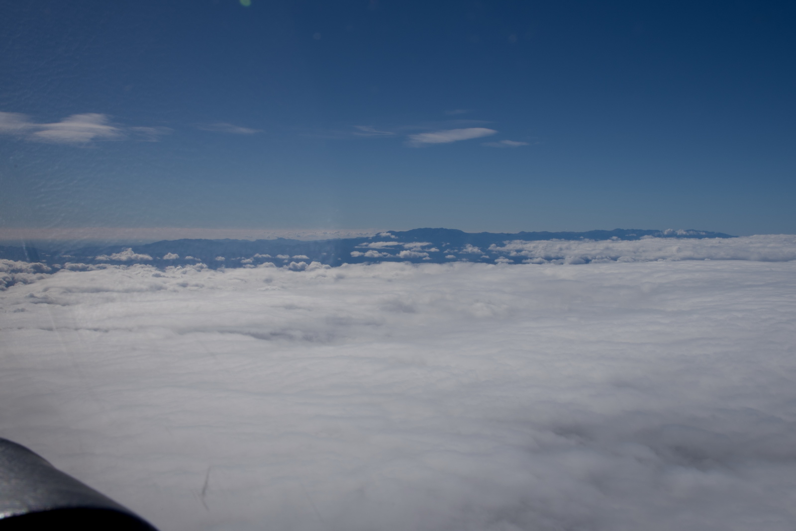
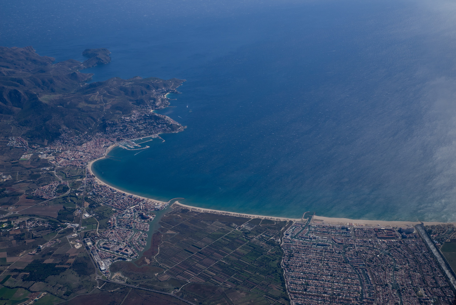
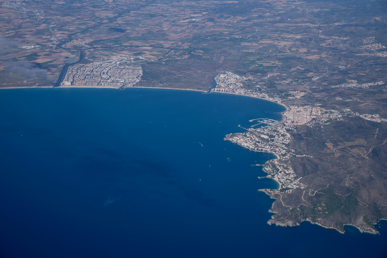
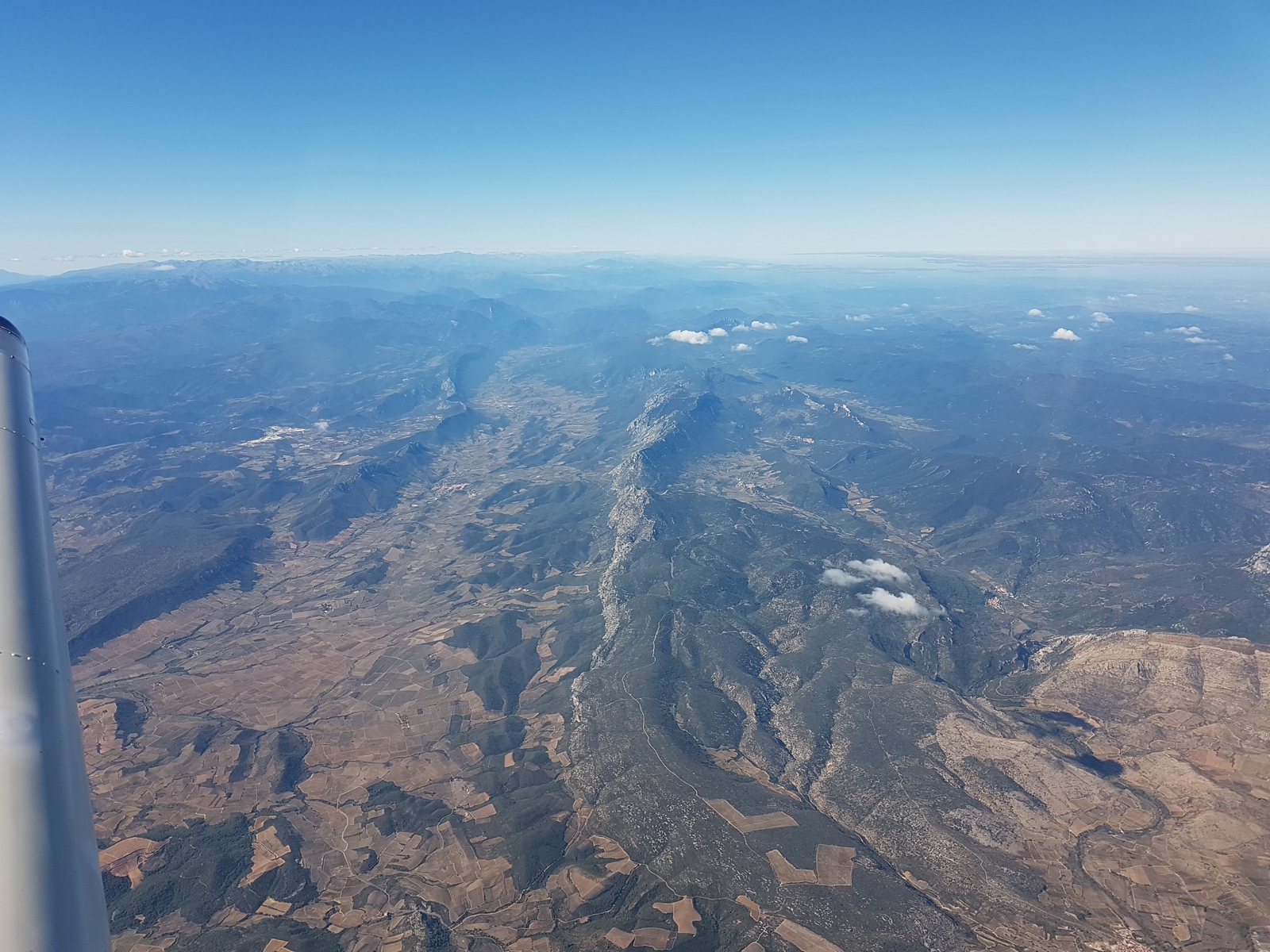
and the east end of the Pyrenees in the haze
Back at the Pyrenees; this time we climbed to FL120 before this point but there was less turbulence than on the other flight since the wind was a lot lighter at about 20kt
The flight across France was along much the same route as the outbound flight and there was nothing new to photograph. We had a headwind of around 20kt all the way home.
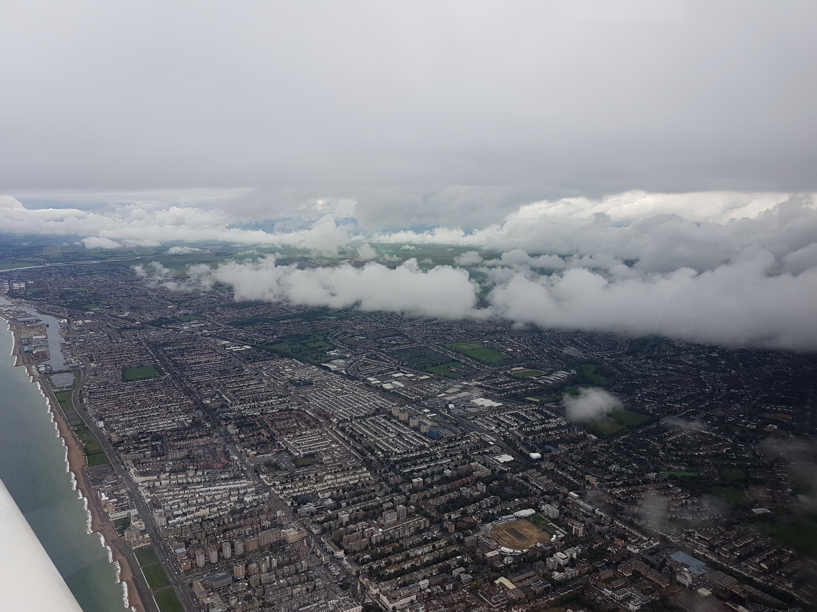
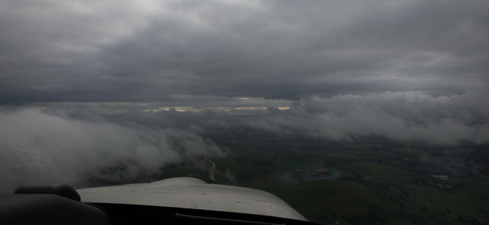
Now we are back in the UK and the conditions look somewhat ominous and slightly worse than the forecasts
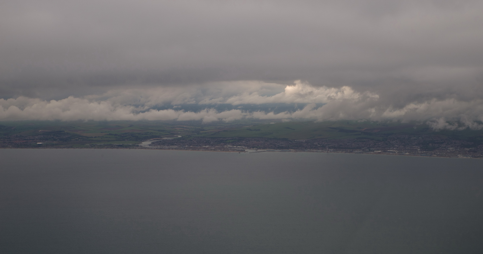
This is a view to the west, with the airport visible in the left corner, so not bad but with a lot of low lying cloud in the way. I managed to get some updated weather data on my phone over 4G and got an unexpected change of wx at Shoreham:
091320Z 22009KT 9999 BKN006 16/15 Q1018
This meant either RNAV 02 and take the tailwind, or try RNAV 20 and see if we get visual at the MDA of 800ft. This wx picture suggested 20 would work (ATC also then reported FEW at 600ft and more at 1000ft)
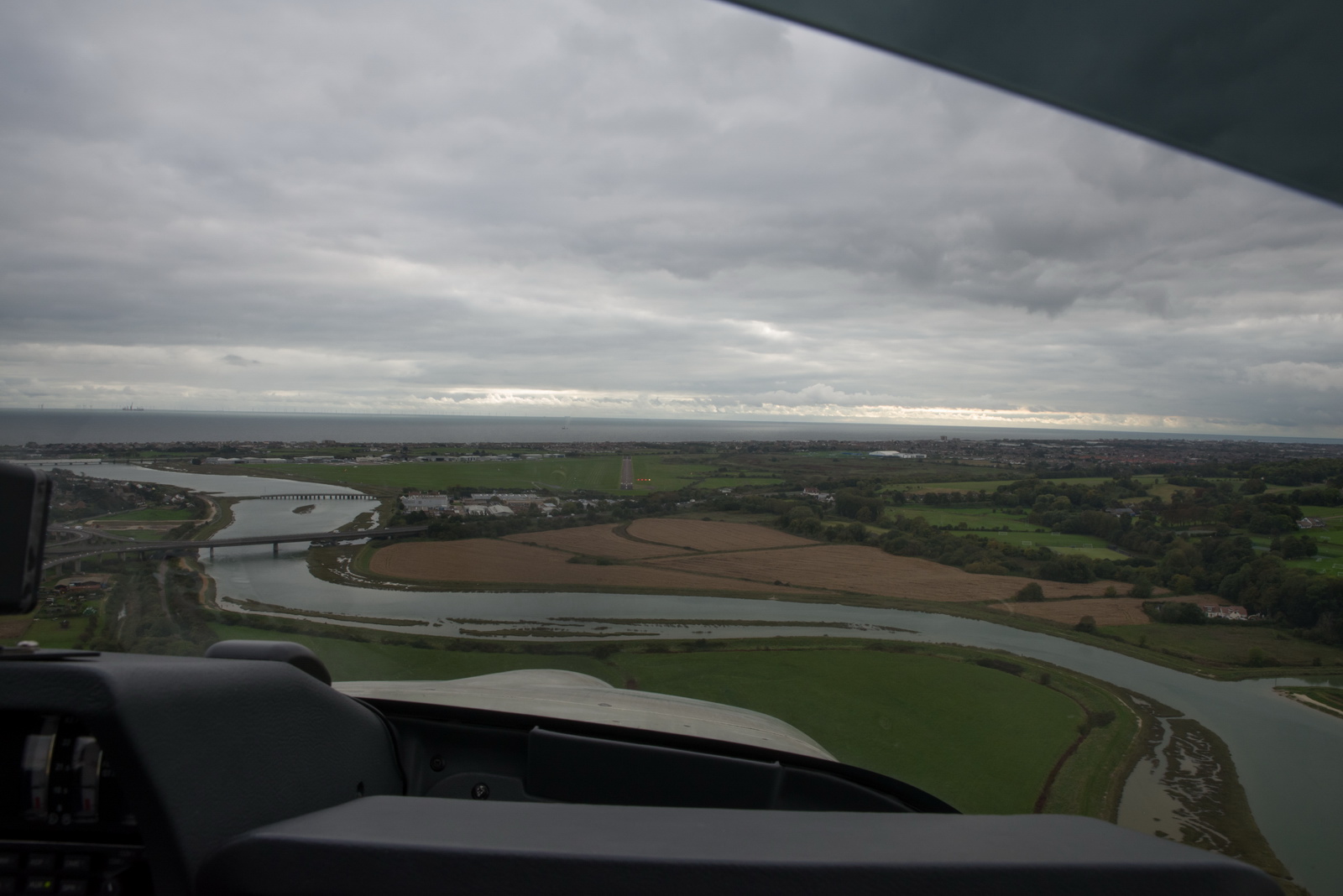
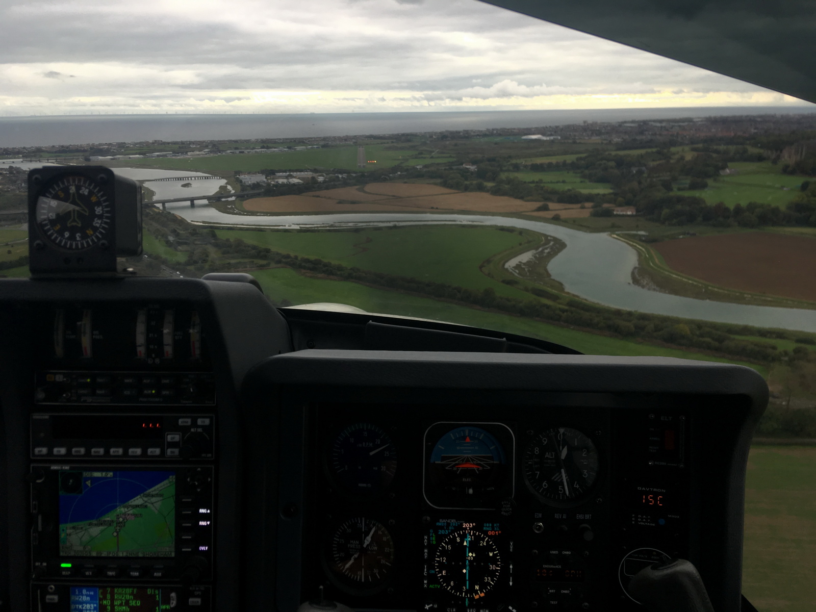
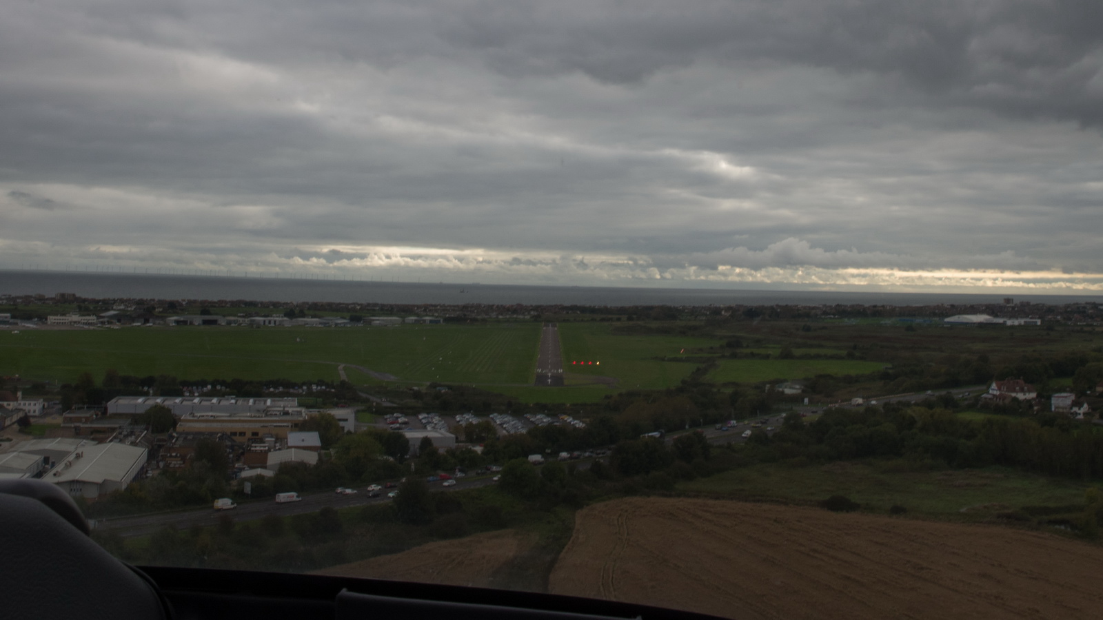
On the final approach track
It worked out fine. On final:
You always get more than two reds when aiming for the start of the runway ![]()
Parked up and done
Airport costs (including VAT) for TB20, 1400kg MTOW
LEMH
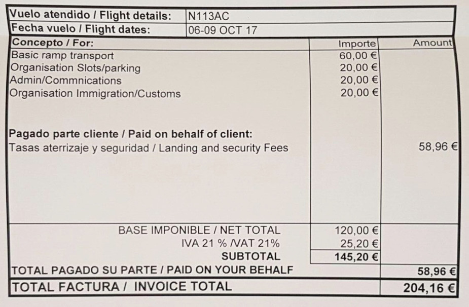
This sort of cost is just about OK for a one-off trip but it almost completely kills regular GA traffic. This is a trend in much of Europe, however... airport mismanagement, especially appointing handling agents who have exclusive rights, is widespread. In the above case the handler quoted €60 and you can see the other charges come from elsewhere. "Admin/Communications"??
Oxygen
An oxygen system is practically necessary for IFR in the Eurocontrol system. Occassionally, the weather is nice and one can fly at FL090 or so but most people would still get tired after several hours. Also many routings are not available below oxygen levels, due to controlled airspace structures, and in some cases terrain. Also on this trip it was necessary to go to FL120 which will get most people very tired very quickly, and it not legal under EASA rules.
Very little oxygen was actually used - probably 25% of the 48 cu. ft. cylinder, for 2 persons on both flights. But without oxygen I would have not done the trip because one cuts off half of the aircraft operating ceiling and in the wrong conditions could spend most of the flight in icing conditions and turbulence, just to stay at non-oxygen levels. In this case the weather looked good but one can never be entirely sure, especially for the return flight.
The Value of an IR
From almost all of Europe, this trip could have been done under VFR all the way. You can fly right across France VFR below FL120 e.g. FL115. That would have been 100% VMC all the way back from Menorca. The tops were about FL080 on the way back. It was only over the UK that there was the low level cloud, but e.g. Shoreham was accessible under VFR even while I was flying the 20 IAP. However, IFR is much simpler for both planning and pilot workload.
Photos Galleries
The galleries in this report were generated with Juicebox
which has a free version with various limits (e.g. up to 50 photos) and a $45
version which does everything. It runs on Adobe Air and seems to have issues
with large galleries on a win7 64bit machine so I run it in a winXP compatibility
mode ![]() It delivers good
results but has some annoying features e.g. stripping off EXIF data, which should
arguably be preserved, or at least be configurable. It also can't process images
over 4096 pixels which the Pentax K1 camera does exceed so I have to downsize them a bit first.
It delivers good
results but has some annoying features e.g. stripping off EXIF data, which should
arguably be preserved, or at least be configurable. It also can't process images
over 4096 pixels which the Pentax K1 camera does exceed so I have to downsize them a bit first.
Gadgets
No trip report can be complete without this bit ![]()
The photos were shot with a Samsung S7 phone and a full-frame Pentax K1 DSLR which is really outstanding especially with the 24-70 f2.8 lens.
The Pentax photos were taken from the camera in DNG raw (the camera takes jpegs to one SD card and raw to a second SD card) and processed in Lightroom to crop and remove some haze. The other program I use instead of Lightroom is ACDSEE PRO which is easier to use in the way it can be used on any randomly chosen picture folder (whereas the Lightroom workflow is more formal) but most professionals use Lightroom and once you are working on a project comprising of say 100 photos it just works better. All these programs try to impose various weird workflows which are counter-intuitive unless you work in just the way they want you to... I went on a 2-day Lightroom course and didn't get very much from it.
Nowadays I shoot raw on the S7 phone as well (using the Footej Camera app which is the only one which works properly for raw and for saving to the SD card; bizzarely, the native camera app won't save raw to the SD card) and use the same Lightroom workflow as for the K1. This produces better photos because it avoids the excessive saturation and unsharp-mask sharpening which the phone does for Jpegs. I think this process takes a smartphone camera about as far as one can get, and is not time-consuming. Even without doing any corrections, or possibly just upping the contrast say 20% on every pic, the result is better than with the native app. There is a little-known subtlety involved with smartphone camera apps: they are all only a little more than a "control panel" for the phone's camera API, so a "100% quality" jpeg from one app is just the same as from another app. The app does little or nothing with the actual photo. In Samsung's case the API is also crippled for 3rd party camera apps so e.g. the focus takes a lot longer.
In theory one could do almost everything needed on a trip with just the Samsung S7 phone or any other good smartphone. It can be used to get weather, file flight plans, and do all the normal comms with people and airports. It can even take "fairly ok" photos. However, a lot of stuff is just too painful on a phone, and some is practically impossible. So what else does one need to carry? I normally chuck in the Samsung Galaxy T700 8.4" tablet. It is functionally practically identical to an Ipad (which I have too, kicking around the house) but is much better for a "power user" because it isn't as restricted as an Ipad. For example it can be expanded with a micro-SD card; say another 64GB. Historically, Apple have never allowed any such storage expansion although I believe that is now changing. The tablet also tethers to the S7 phone's wifi hotspot for internet connectivity. There is a version of this tablet (the T705, which is the one I have) which takes a SIM card and with a contract SIM (I have a Vodafone contract on both the S7 and a cheaper version of it on the T705) you get mobile data almost everywhere on it. This tablet also acts as a "backup phone" because it is a fully functional phone. I have VOIP installed on both the S7 and the T705, via the Localphone VOIP service which works most of the time and this delivers extremely cheap outgoing calls. On the phone I use the CSIPsimple VOIP app and on the T705 there is a built-in VOIP function which seems to work.
However, I have found that anything involving significant typing is still too cumbersome and one cannot beat a proper laptop for sheer productivity. One could use a bluetooth keyboard for the tablet (or the phone) but by the time you carry a decent size one you may as well carry a laptop! I use a Lenovo X230-I7 which is does basically everything anyone could ever need and with the I7 processor is very fast - fast enough for movie editing/rendering and faster than most of today's ~3GHz desktop computers. The X230, bought secondhand in 2013 for £600, new about £1800, is now obsolete but various versions of these very fast and well built laptops come up on Ebay in as-new condition, for peanuts. These I7 quad-core ~2.5GHz laptops are as fast as anything today and particularly excel in video editing and rendering which pushes any PC to its limits. The best laptop today for both power and travelling is probably the beautifully built Dell XPS13 which I use too elsewhere, but it comes at a price of over £1500.
In the aircraft I run a Lenovo T2 10" tablet with Windows 8 and this runs everything needed. It could be replaced with an Android tablet but it is very fast in rendering PDFs (terminal charts, etc) and runs Oziexplorer which I use for VFR charts and the topo maps shown earlier in this article. It is also really solidly made. The current version of it is here. With the planned upgrade to the ADL150 satellite weather download product (which uses WIFI) I may well drop the Windows tablet altogether and use the T705.
Flight times (airborne times)
EGKA-LEMH 4:05 hrs
LEMH-EGKA 5:45 hrs
This page last edited 17th March 2018