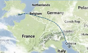
Flight from Shoreham EGKA to Mali Losinj LDLO, May 2013
This writeup is a simplified version of my normal ones in which I go into a lot more detail of each trip.
Pilot
FAA CPL/IR, JAA/EASA PPL/IR, ~1600hrs.
Aircraft
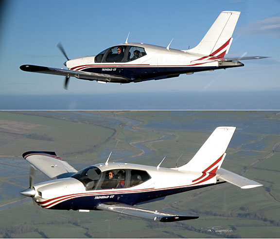
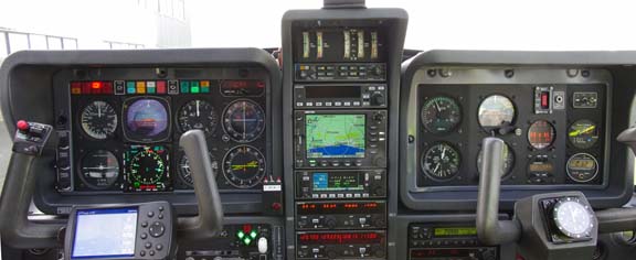
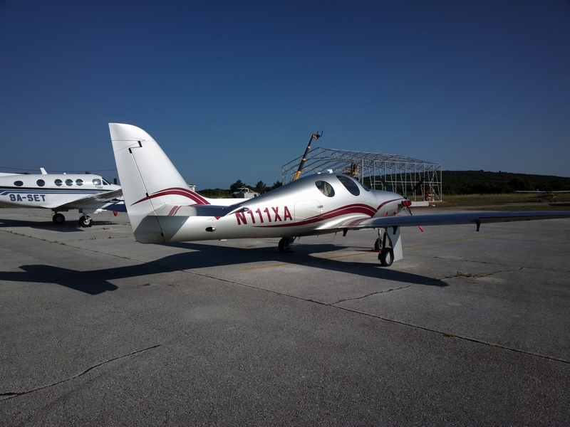
The aircraft is a 2002 TB20GT
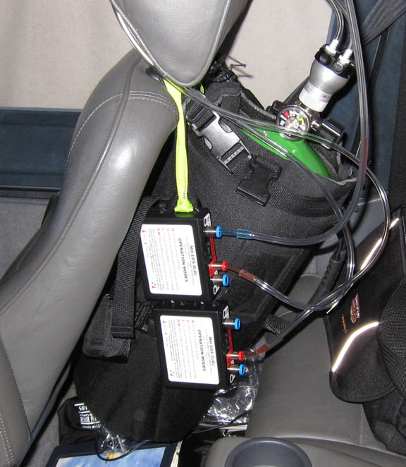
Oxygen is used on all IFR flights, with the Mountain High O2D2 electronic regulators and cannulas
European IFR flight is only marginally feasible without oxygen (due to the Eurocontrol routings) and the direct Alps crossings such as the ones described here are not feasible at all under IFR due to the MEAs. They are feasible under VFR but one would be flying so close to the terrain (on the routes used here) due to controlled airspace bases that one would need to pick very stable weather with light winds. Flying say 5000ft above the terrain provides a lot of protection from mountain waves.
Weather
Weather was generally very good, though it became very convective at the Adriatic end for the return trip, which had to be brought back 1 day earlier than planned.
Routes
These were developed using FlightPlanPro and filed using EuroFPL
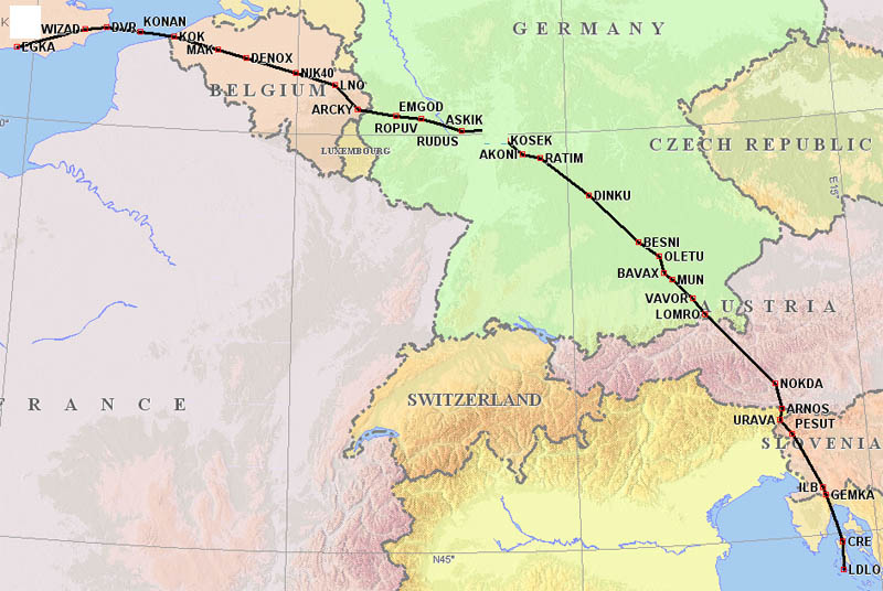
EGKA F140
WIZAD M140 DVR L9 KONAN L607 RUDUS L984 ASKIK Z74 KOSEK L603 OLETU Z106 BAVAX
M867 LOMRO/N0150F150 M867 NOKDA Q100 ARNOS P125 URAVA L607 CRE
LDLO
LDLO F110
PUL P11 ROTAR L615 DESIP N851 ELMUR L613 HOC G4 RLP B3 BILGO H20 XORBI H40 ABB
N20 KUNAV Y8 WAFFU
EGKA
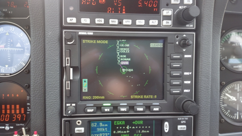
When filing via EuroFPL, one gets a waypoint list from Eurocontrol, which is delivered by email and, if using their premium service, by SMS also. This one is for the outbound route:
 Time    Point     Lvl    T. Dist

07:37Z   WIZAD     F140      50
07:40Z   *1WIZ     F140      55
07:44Z   DVR       F140      66
07:48Z   *5108     F140      76
07:55Z   KONAN     F140      90
08:06Z   KOK       F140     114
08:20Z   MAK       F140     147
08:22Z   GOLEX     F140     152
08:29Z   DENOX     F140     168
08:42Z   GILOM     F140     198
08:58Z   LNO       F140     234
09:08Z   ARCKY     F140     258
09:11Z   SUXIM     F140     264
09:20Z   ROPUV     F140     286
09:29Z   EMGOD     F140     305
09:39Z   UBIDU     F140     328
09:42Z   RUDUS     F140     335
09:50Z   ASKIK     F140     352
09:56Z   KOSEK     F140     368
10:03Z   AKONI     F140     383
10:05Z   SUPIX     F140     388
10:09Z   RATIM     F140     397
10:22Z   TAKUT     F140     427
10:28Z   DINKU     F140     440
10:35Z   AKANU     F140     456
10:40Z   LUPOX     F140     467
10:45Z   RENLO     F140     478
10:50Z   BESNI     F140     490
10:57Z   OLETU     F140     507
11:03Z   BAVAX     F140     519
11:06Z   MUN       F140     527
11:15Z   VAVOR     F140     547
11:21Z   LOMRO     F145     562
11:50Z   NOKDA     F150     632
11:58Z   ARNOS     F150     651
12:01Z   URAVA     F150     659
12:06Z   PESUT     F150     672
12:13Z   OGODI     F150     690
12:24Z   *ILB      F150     717
12:26Z   GEMKA     F150     723
12:41Z   CRE       F68      758
12:51Z   LOS       F15      780
Outbound Flight
TCU (and bigger) stuff near Shoreham (showing up as lightning on the stormscope) but luckily not in the direction I was going
Climbed up to FL130 initially, through some holes
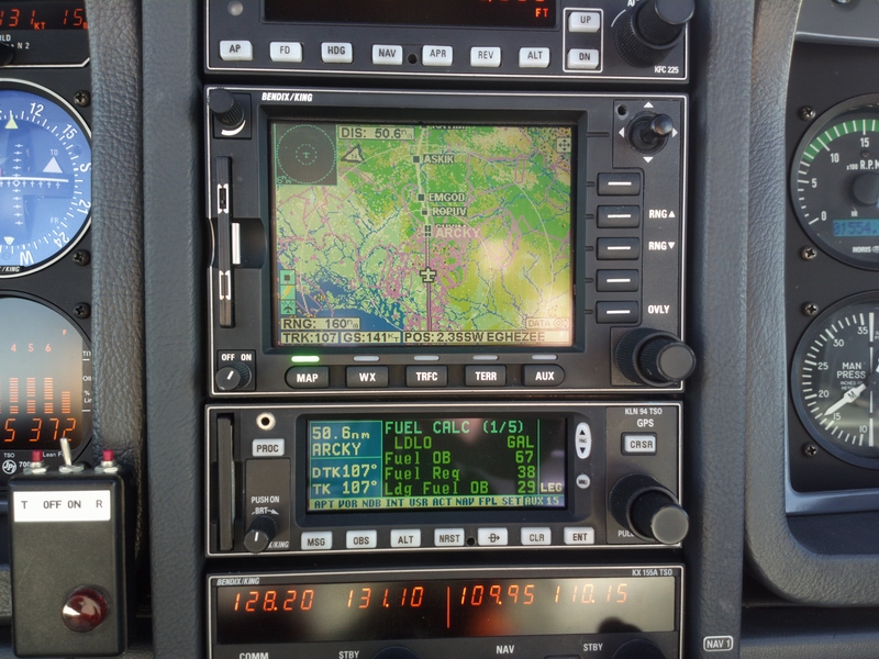
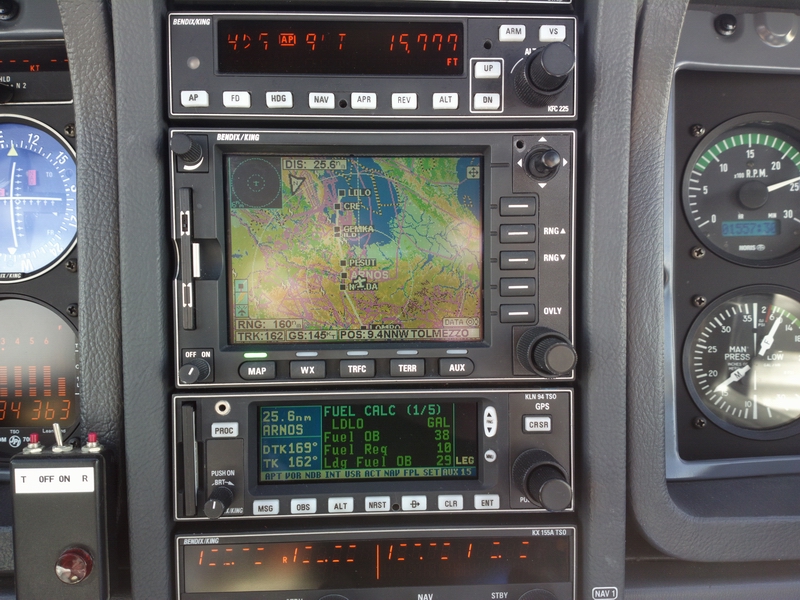
Fuel on Board stabilised at 29 USG early on, and actually I landed with 29.0 in the tanks
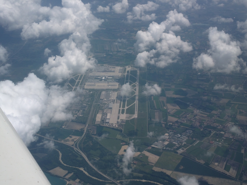
Munich airport from about FL150
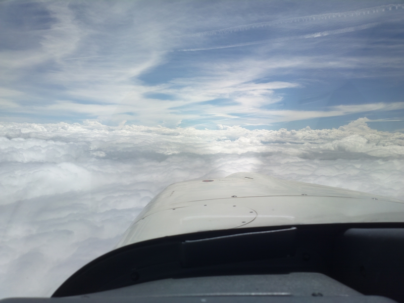
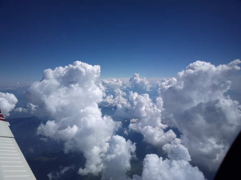
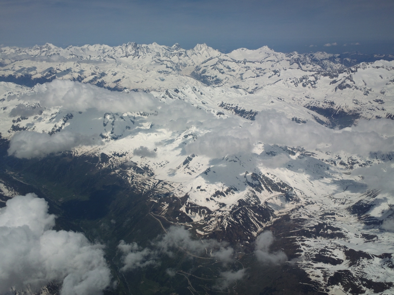
This is just staying above the muck. I was lazy and stayed at FL150 over the Alps, because skimming over the top is fun, and there was no turbulence (the wind aloft was c. 10kt and I was c. 5000ft above the terrain)
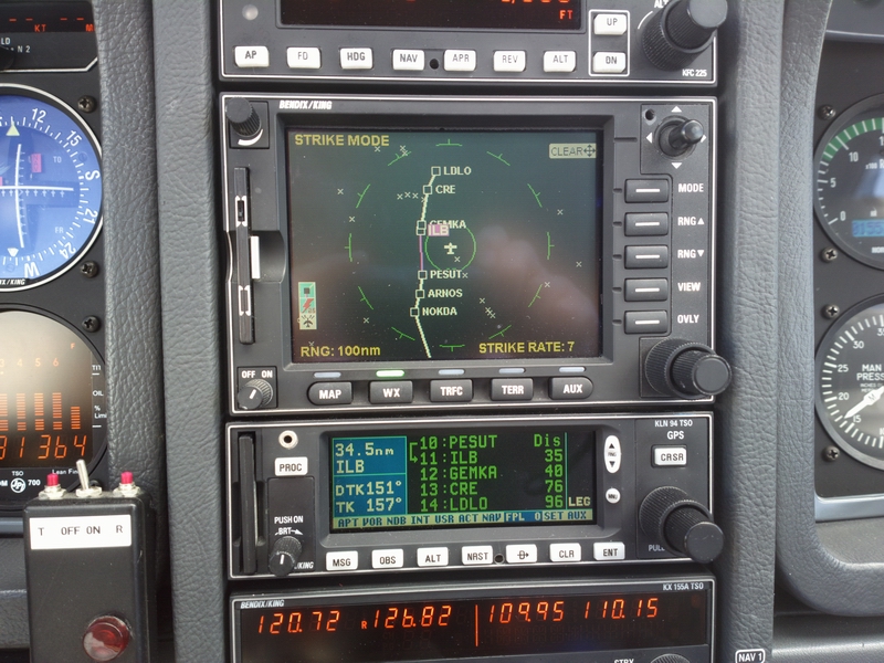
Engine failure options appear unattractive but actually there are loads of big flat-bottomed canyons and I was running a special topo map of the Alps (ripped off from Google Terrain using an automatic tool called Mobile Atlas Creator) as a GPS moving map, running under Oziexplorer
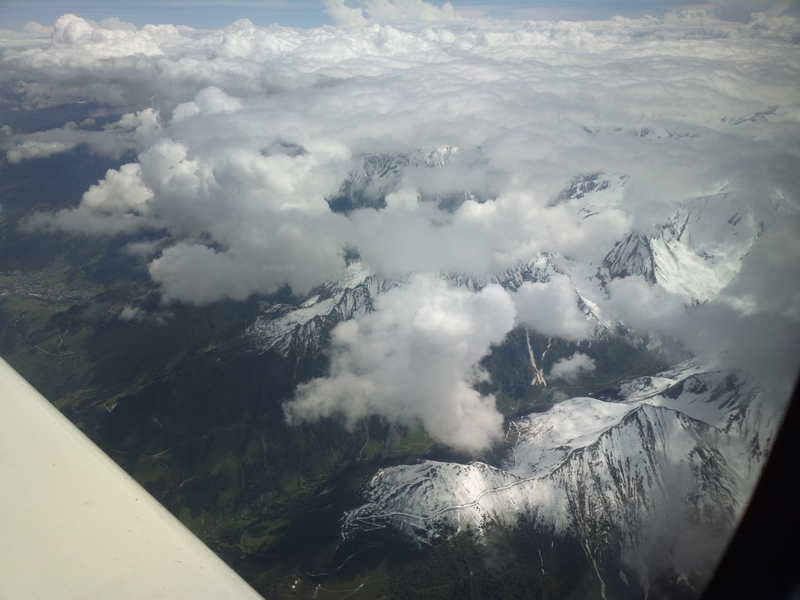
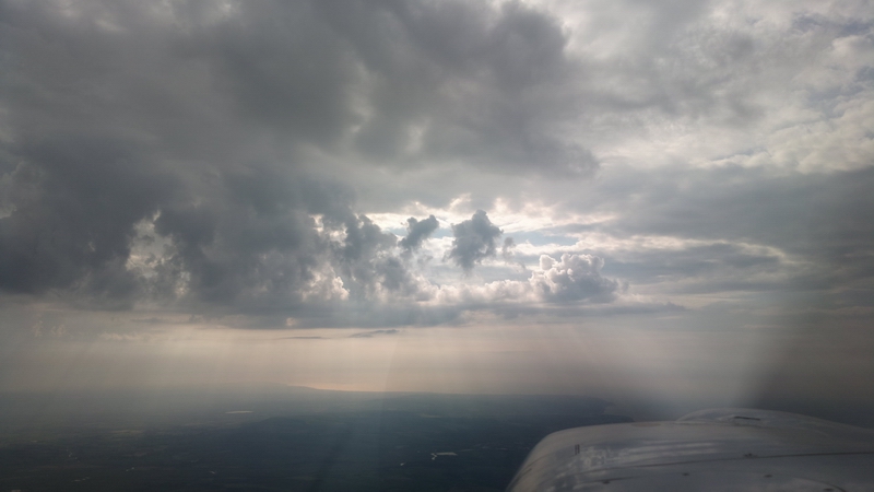
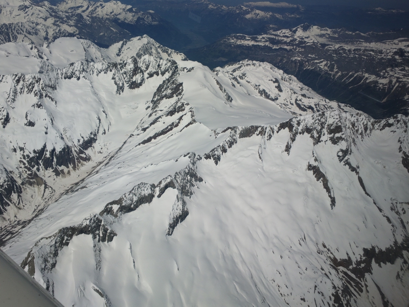
A bit of zigzagging around bigger stuff was needed but usually one could pick a line which missed a load of buildups in one go
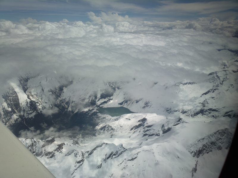
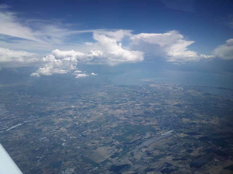
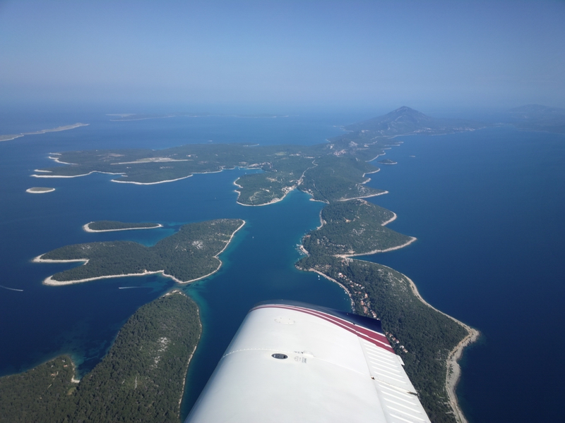
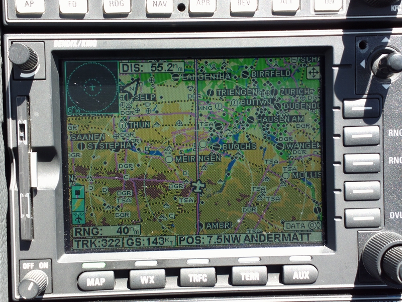
At last, the Adriatic appeared on the MFD
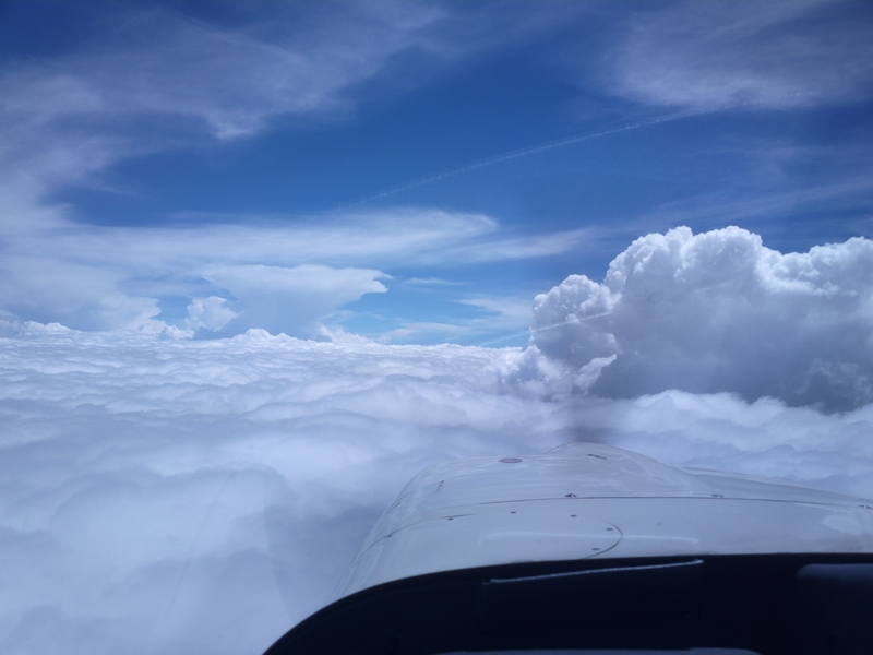
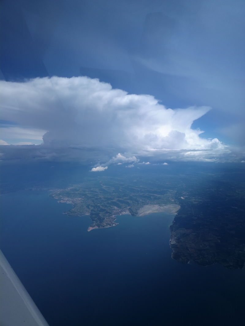
A few more impressively large buildups to avoid
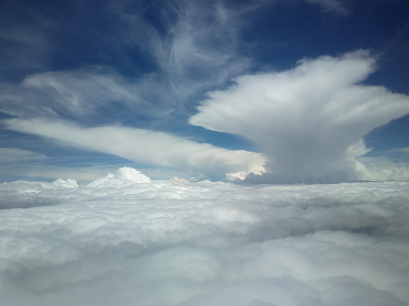
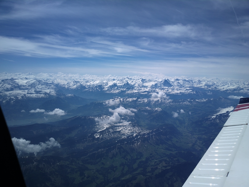
After the Alps, in the general area of Venice, it cleared up a bit
but the stormscope was mapping the CBs pretty well
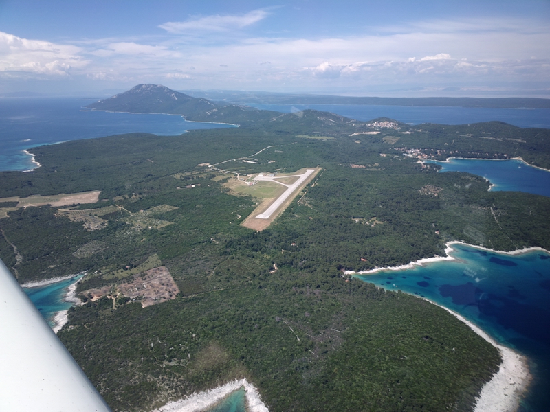
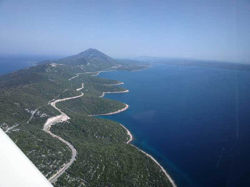
Finally, Losinj LDLO
Earlier, the wind was 260/11 or so, so I expected runway 20, but they gave me 02 and the wind was OK for that at the time, but it turned around just as I was on final so I went around and landed on 20. This is the second time the wind turned around really quickly within a week
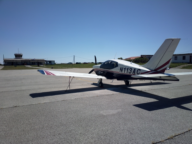
On the ground. It looks like it always used to, but they have a new bowser, which is accurate
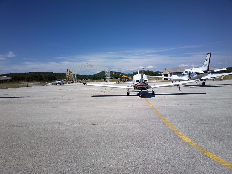
They are building what looks like a hangar; apparently it is intended for the King Air 350 shown in the photo, for VIP travel
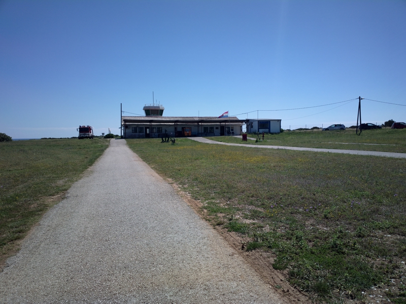
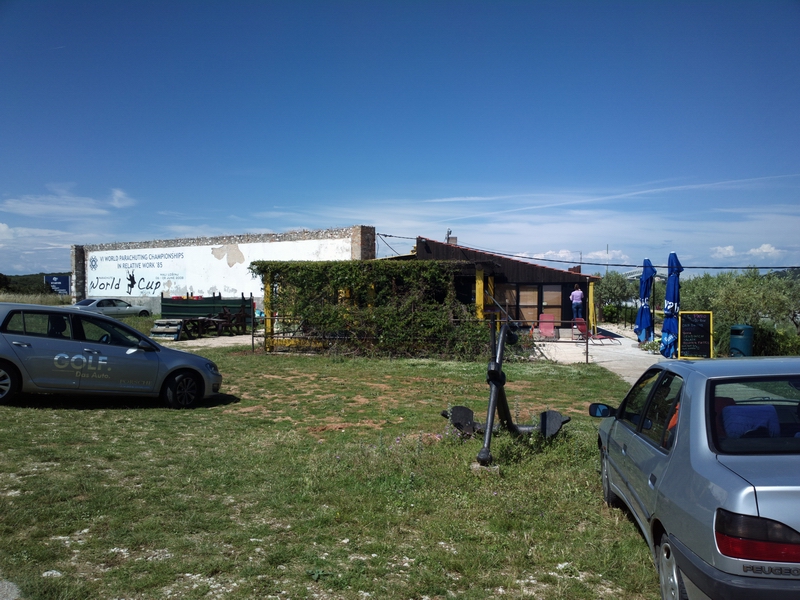
No yellow jackets required for the walk to the "passenger terminal"...
A super little cafe; a perfect place to have a beer after such a gruelling hard IFR adventure
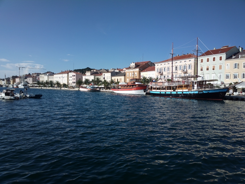
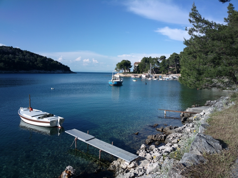
Losinj
The town of Mali Losinj is very scenic
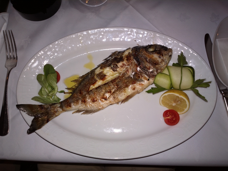
The food is excellent. The Med has been over-fished and a fish like this would have been 50% more (€30+) in Greece. But then Croatia is not in the € (they accept Euros freely, however) so they avoid the huge price hikes suffered throughout the Eurozone
I spotted this amazing aircraft on the way out - a pressurised turboprop Lancair Evolution
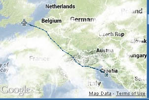
Return Flight
I decided to return a day early due to the worsening convective outlook, with the MSLP chart filling up with troughs
[MSLP]
The departure wx was better than on the way there, but still with some buildups. We got a departure clearance straight up to the filed FL140 and "cleared to EGKA" as per classical IFR ... little do they know EGKA is in Class G so the clearance is meaningless. I climbed to FL160 to stay above some of the stuff
and then we have the Alps, on a different route this time
The end of the Alps...
The value of an IR
In terms of ATC interaction this trip was completely trivial. Unlike with VFR, they work with you, with a clearance implied for the entire route. However, had everybody operated airspace according to ICAO rules (instead of running unpredictable private policies on VFR access) the whole trip could have been done VFR, at the same levels, except the UK Class A portion.
The two filed routes were:
Outbound
Actual flown
Return
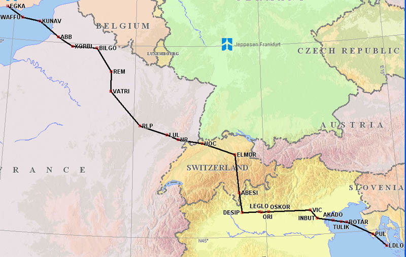
The Alps crossing above is probably the shortest possible crossing of the high terrain that can be filed via Eurocontrol. If you actually fly that DESIP-ELMUR leg as shown, i.e. without asking for the obvious shortcut, you get across the mountains very quickly.
Actual flown
I was asking for every shorcut possible, as usual, and I got some 150nm+ ones.
London Control offered a very late descent, from FL140 about 30nm out, which normally is what is desired, to maximise height when out over the sea, and have the best options to avoid weather in the arrival area. In fact I really got the impression that London Control have revamped the way they see light GA and are trying to be extra helpful nowadays, providing traffic reports, etc as you descend. Very professional!
The Mountain High O2D2 oxygen regulator worked great as usual; at FL160, with heart rate of 75 and blood o2 of 95%. It's the way to go!
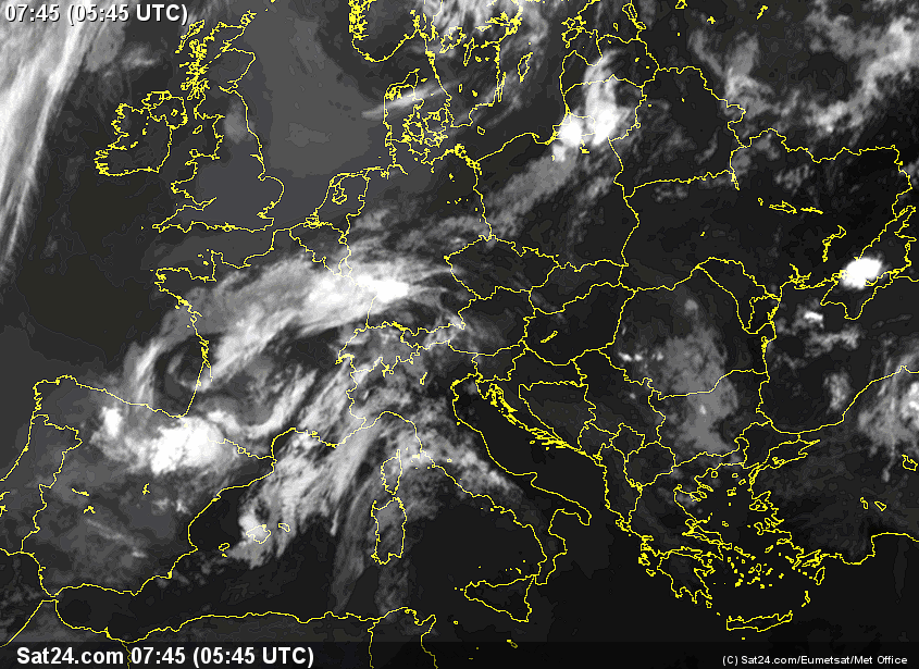
The decision to depart a day early was fairly well validated by looking at the following day's IR image which shows a lot of convective activity N of the Alps, though it may have been OK with a detour into central France
All pics were taken with the Nokia 800 phone. This takes a ~ 40 megapixel image and reduces it to a (configurable) 12 megapixel image of a quality which approaches that of a DSLR. The pictures are not up to the DSLR standard but the 808 makes it possible to do a trip like this without carrying all the normal gear. The 808 has various issues, one of which is a difficulty in getting a good focus, and it is not really suitable for "action" photography, but it is good enough.
Very little oxygen was used on this trip - probably 10% of the 48 cu. ft. cylinder.
This page last edited 19th July 2013