Flight from Shoreham EGKA to Peenemunde EDCP, August 2013
Peenemunde is the site of the German V1 and V2 rocket development in WW2. There is an airport there, with a large runway.
This writeup is a simplified version of my normal ones in which I go into a lot more detail of each trip.
Pilot
FAA CPL/IR, JAA/EASA PPL/IR, ~1600hrs.
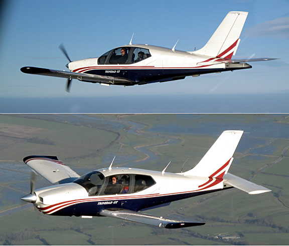
Aircraft
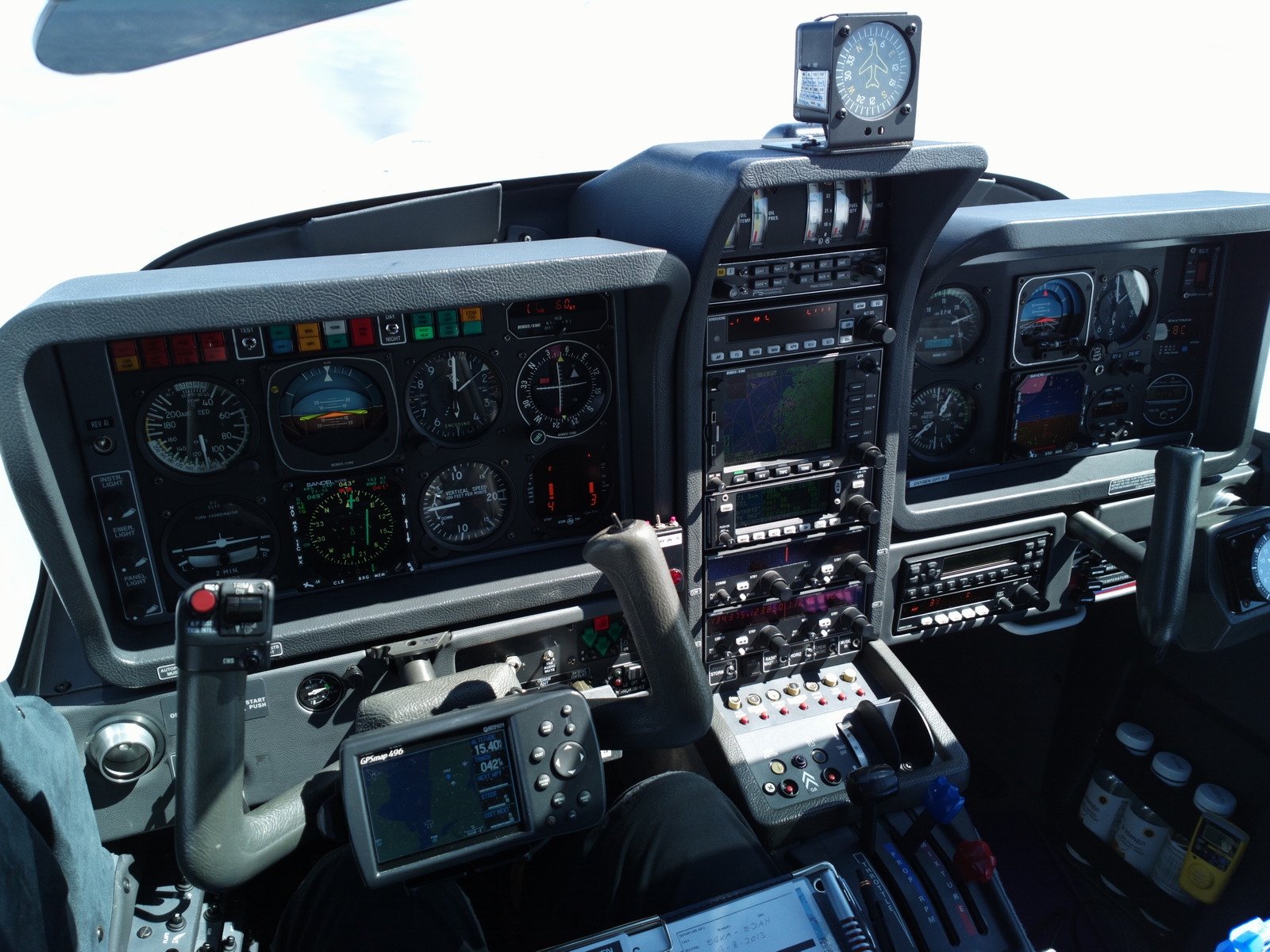
The aircraft is a 2002 TB20GT
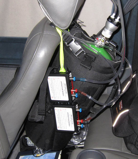
Oxygen is used on all IFR flights, with the Mountain High O2D2 electronic regulators and cannulas
European IFR flight is only marginally feasible without oxygen, due to the minimum practical Eurocontrol routings. This trip was filed at FL100, which is OK for legal non-oxygen flight (although after a few hours most people will be very tired), but I had to climb to FL160 to stay above convective weather.
Routes
Peenemunde has no Customs so a stop was planned at Heringsdorf EDAH which is about 20nm to the south of Peenemunde. This also provided a bad-weather option whereby one could get to Peenemunde from Heringsdorf using conventional transport.
Because the flight from Shoreham to Heringsdorf is about 4 hours, it would not make sense to fly out and see Peenemunde the same day, so I planned to stay at Heringsdorf for 1 night first.
On the way back, a Customs stop is also needed. This time I picked the old easy option: Le Touquet LFAT. This then offers a number of "convenient for getting home" diversion airports.
The routes were developed using FlightPlanPro and filed using EuroFPL. Unusually, both routes did not benefit from filing higher than FL100 so that is what I did. France is similar but other European routes, for example a crossing of Frankfurt, need to be at say FL140 to avoid a huge dogleg.
FL100
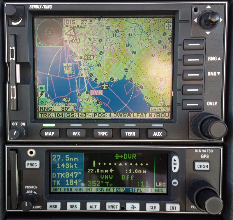
EGKA WIZAD M140 DVR L9 KONAN L607 KOK DCT COA L179 HELEN N873
GRONY M105 EEL N125 WSR Z102 UDAXI EDAH
The return route was filed as a "Z" (VFR to IFR) flight plan because Germany bans IFR in Class G and they got Eurocontrol to reject "I" flight plans to/from Class G airports. It is hoped that under EASA they will have to stop this practice.
FL100
EDCP LABES IFR M725 MASOR Z130 RITEV T299 GEVNI Z102
WSR N125 EEL N872 NIK DCT MAK L607 KONAN DCT LYD LFAT
The flight from LFAT to EGKA was planned as just a DCT, VFR. The IFR version is simply LFAT DCT LYDD DCT EGKA FL070.
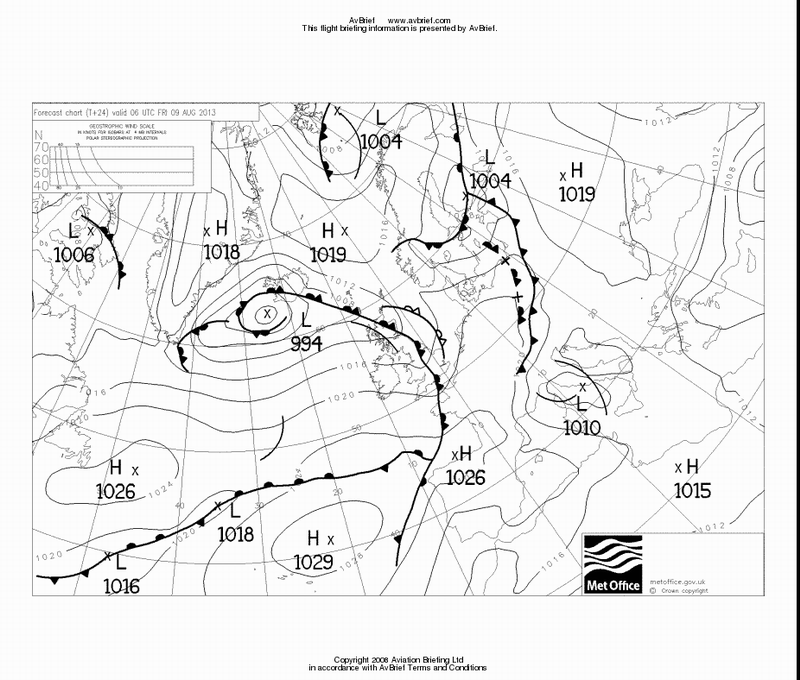
Weather
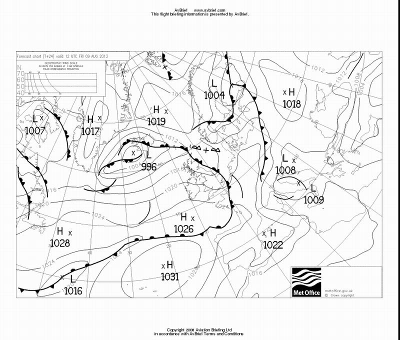
The weather was far from perfect, with a lot of instability around. The 0600 and 1200 MSLP charts for the day of departure suggested a lot of cloud and possibly some TCU/CBs activity.
By leaving Shoreham at the earliest possible moment (0800 UTC) I was hoping to depart from underneath the really bad weather and leave it quickly behind but I was delayed by obstructions in the hangar and departed 2 hours later. This turned out to be quite a fortunate move because now I had plenty of bits of blue sky at the airport and would have to outclimb any buildups enroute which is generally the safer option, not least because it avoids flight in IMC with unknown stuff inside it, and one can turn back if the weather cannot be outclimbed.
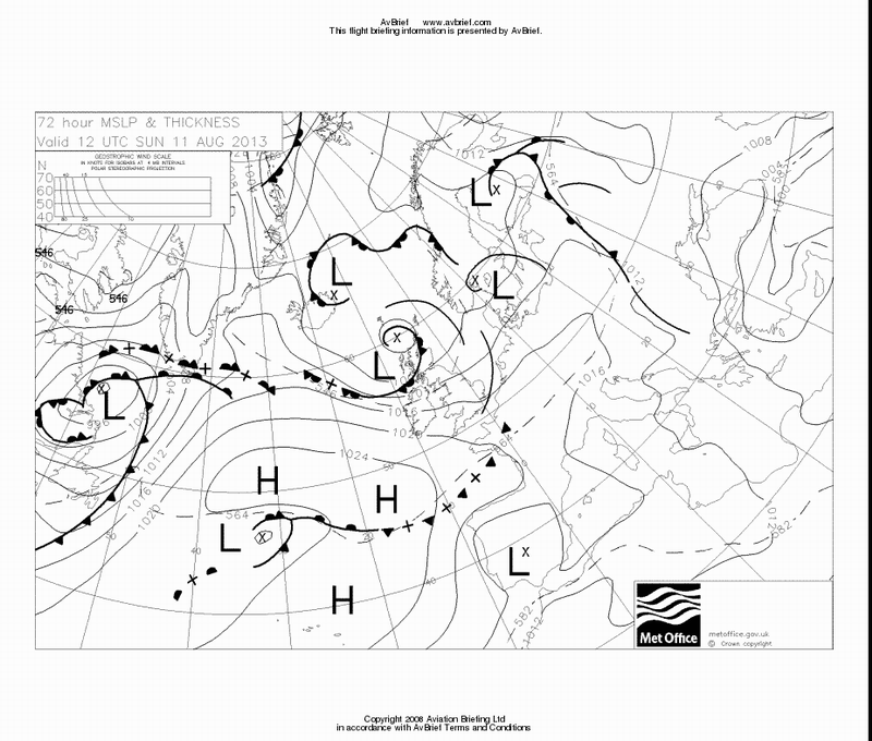
The forecast for the return flight was about the same. The forecast for the following day was better, which is always a good thing to have, just in case.
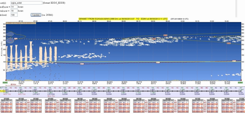
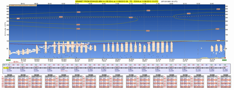
The GRAMET plot for the departure (for the original earlier time) is
The departure surface weather data was
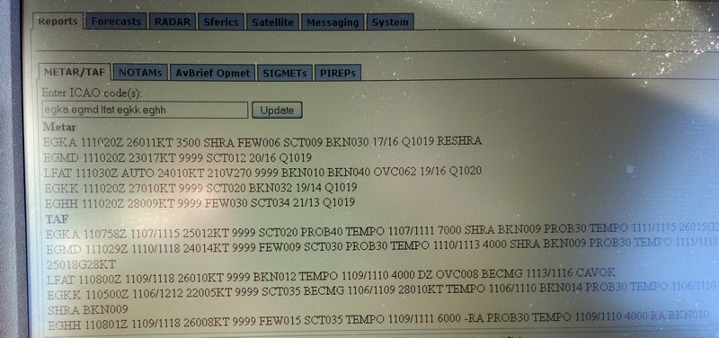
METAR EGKK 110520Z 22004KT 9999 FEW040 15/13 Q1019
TAF EGKK 110500Z 1106/1212 22005KT 9999 SCT035 BECMG 1106/1109 28010KT TEMPO
1106/1110 BKN014 PROB30 TEMPO 1106/1110 7000 RA SHRA BKN009
which made sense looking at the MSLP, with the front passing through early in the morning.
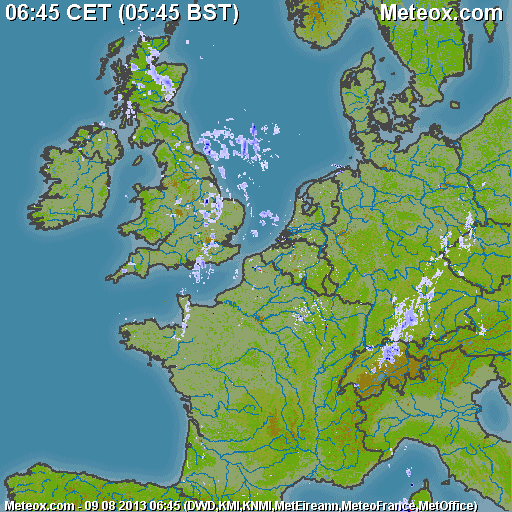
The IR image
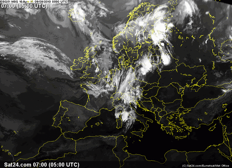
suggested cloud tops in the "medium" range i.e. about FL150, plus or minus a few thousand feet. I have always found this IR image to be reliable as an indicator of whether the flight is feasible VMC on top in the TB20 which can go to FL200 if necessary so it is just as well that a greater accuracy is not available because it is not needed.
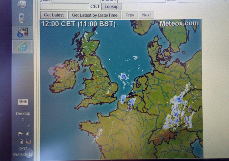
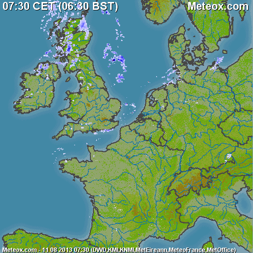
This is the radar picture taken earlier in the morning, which plausibly depicted the locally visible weather
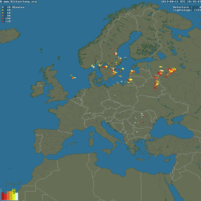
The sferics (lightning) image was clean
Outbound Flight
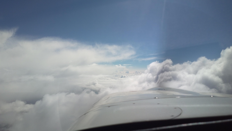
After the 2-hour delay the local weather had cleared up a bit but there was a lot of big stuff around
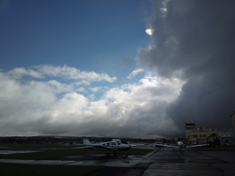
which was easily outclimbed by heading for one of the holes before calling up London Control, and upon first contact telling them that the current heading was required "to avoid". Soon I was on top at FL080 and shortly after I got cleared to the filed FL100
Here we are, well to the right of the filed route, avoiding weather
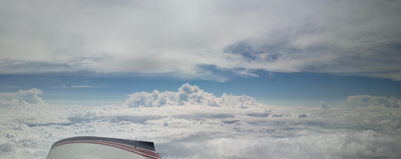
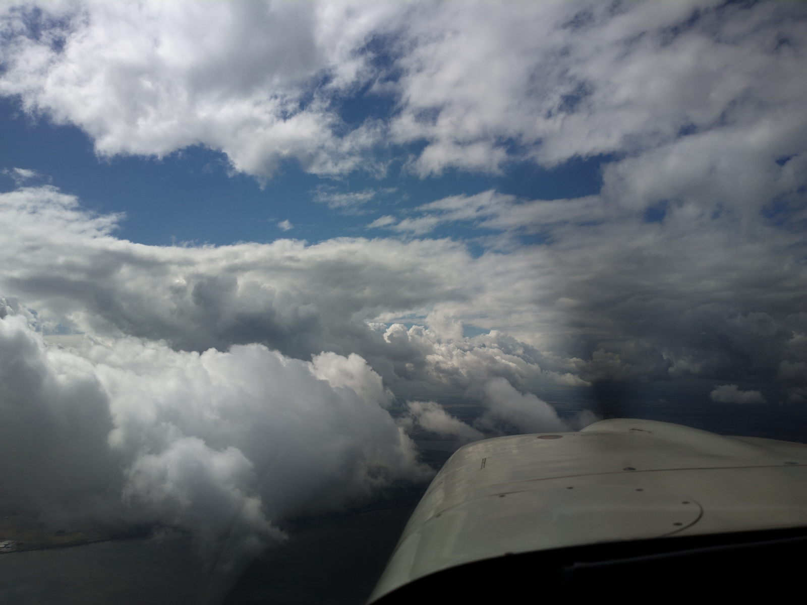
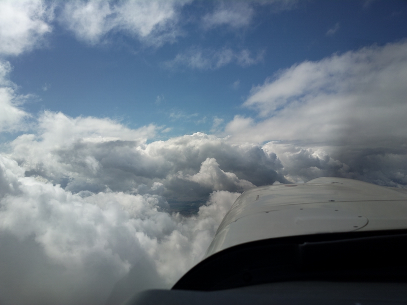
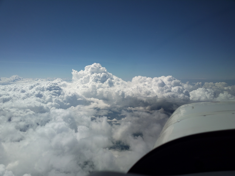
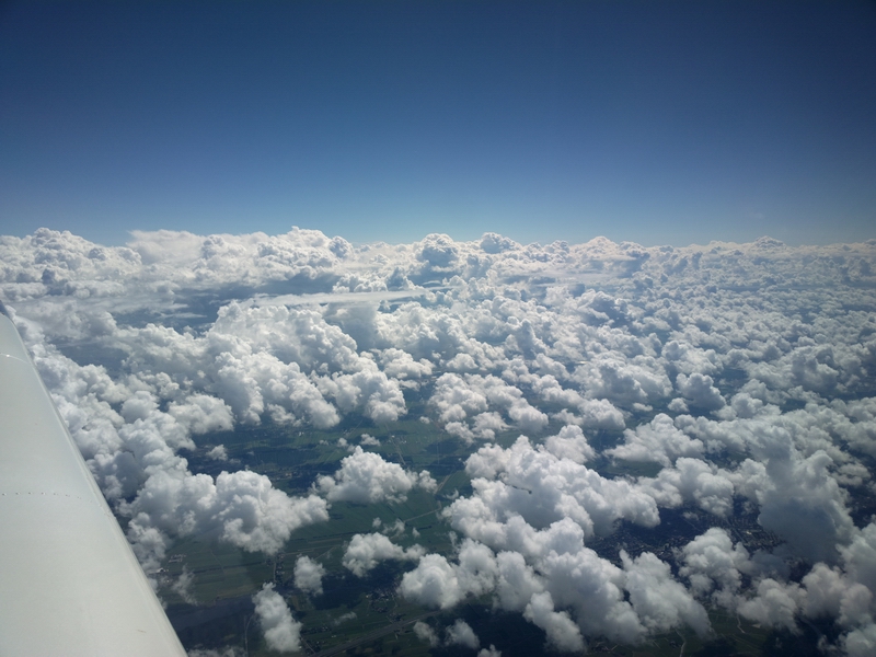
Later on, the tops grew higher and higher and soon I had to climb to FL150 and later to FL160
The layer above was thin and not worth the effort of climbing above it - maybe FL200
IFR at FL150...
Obviously the GRAMET plot was no more accurate than what was blindingly obvious by looking at the MSLP chart...
The TAS at around FL150 was 148kt at 9.1 USG/hr, at -8C. There was about 15kt of tailwind most of the way.
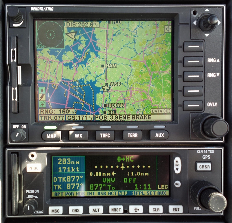
This is the mother of all shortcuts - 203nm across most of the width of Germany. One can see the earth's curvature in the way the GPS track curves away from the current-track line
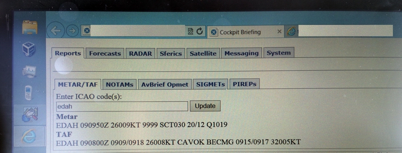
Destination weather, obtained over the Thuraya satellite phone link to the Lenovo win8 tablet, looked good
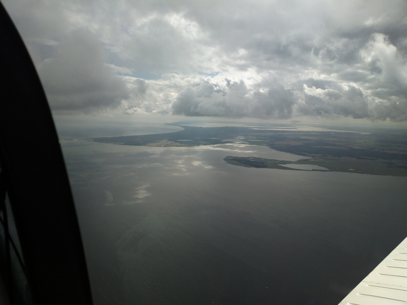
With about 100nm to run the weather mostly cleared up and I started a continuous descent all the way to Heringsdorf. GA cannot get airliner-style continuous descents; the best one can do is a slow descent say 2000ft at a time and hope they will allow the next one before you reach the last one. It is a useful fuel saving technique.
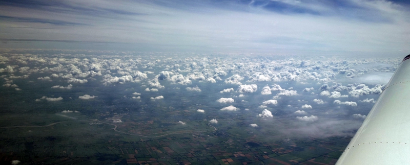
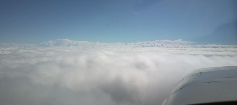
A bit of cloud to descend through
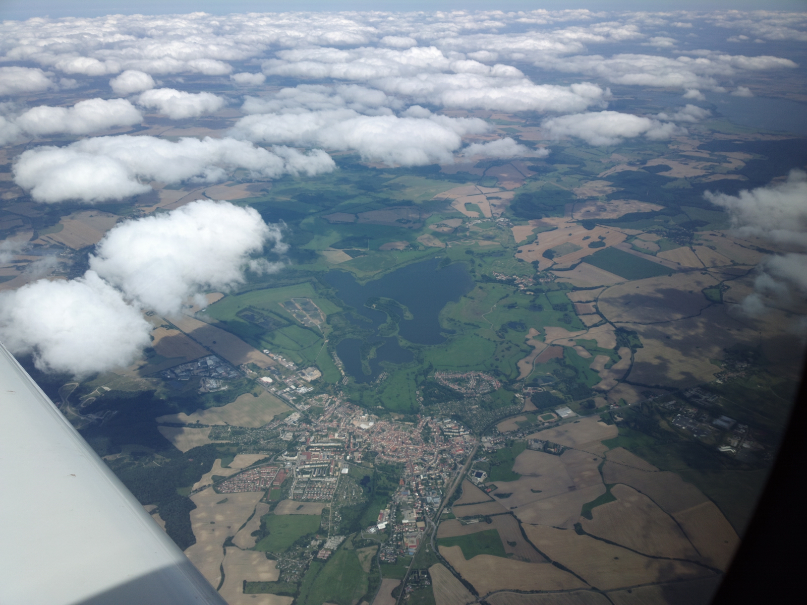
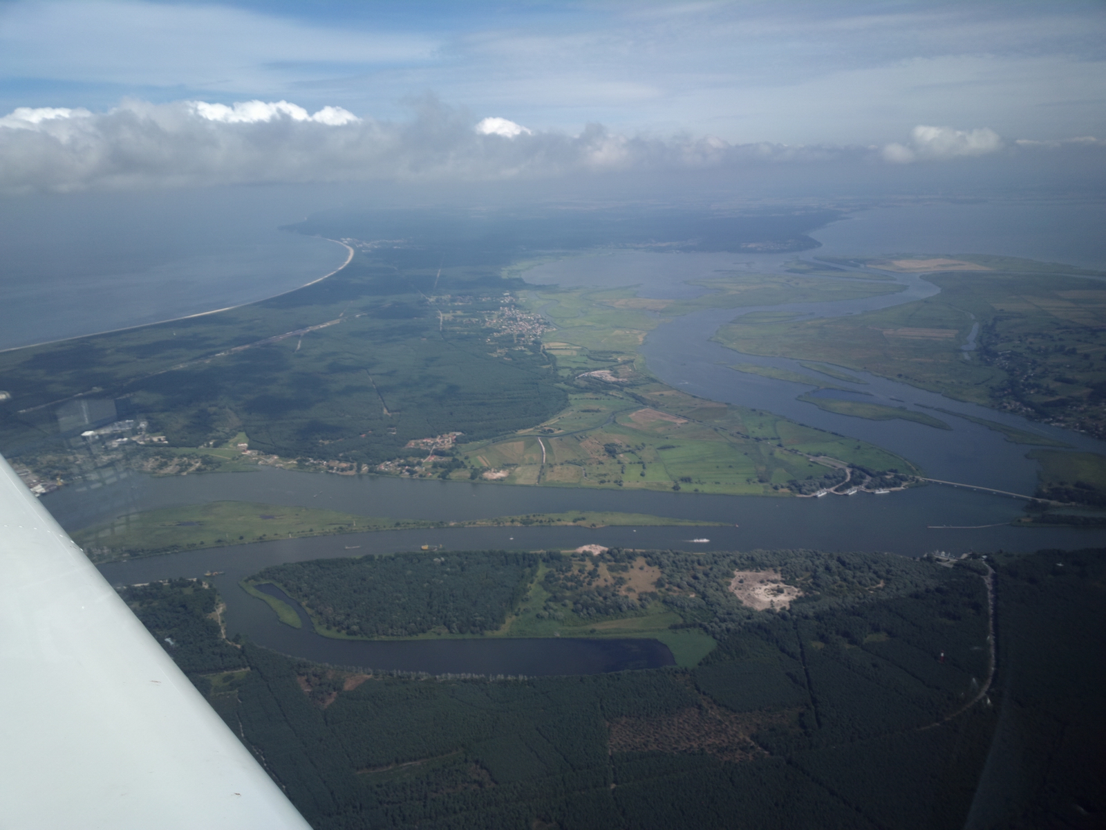
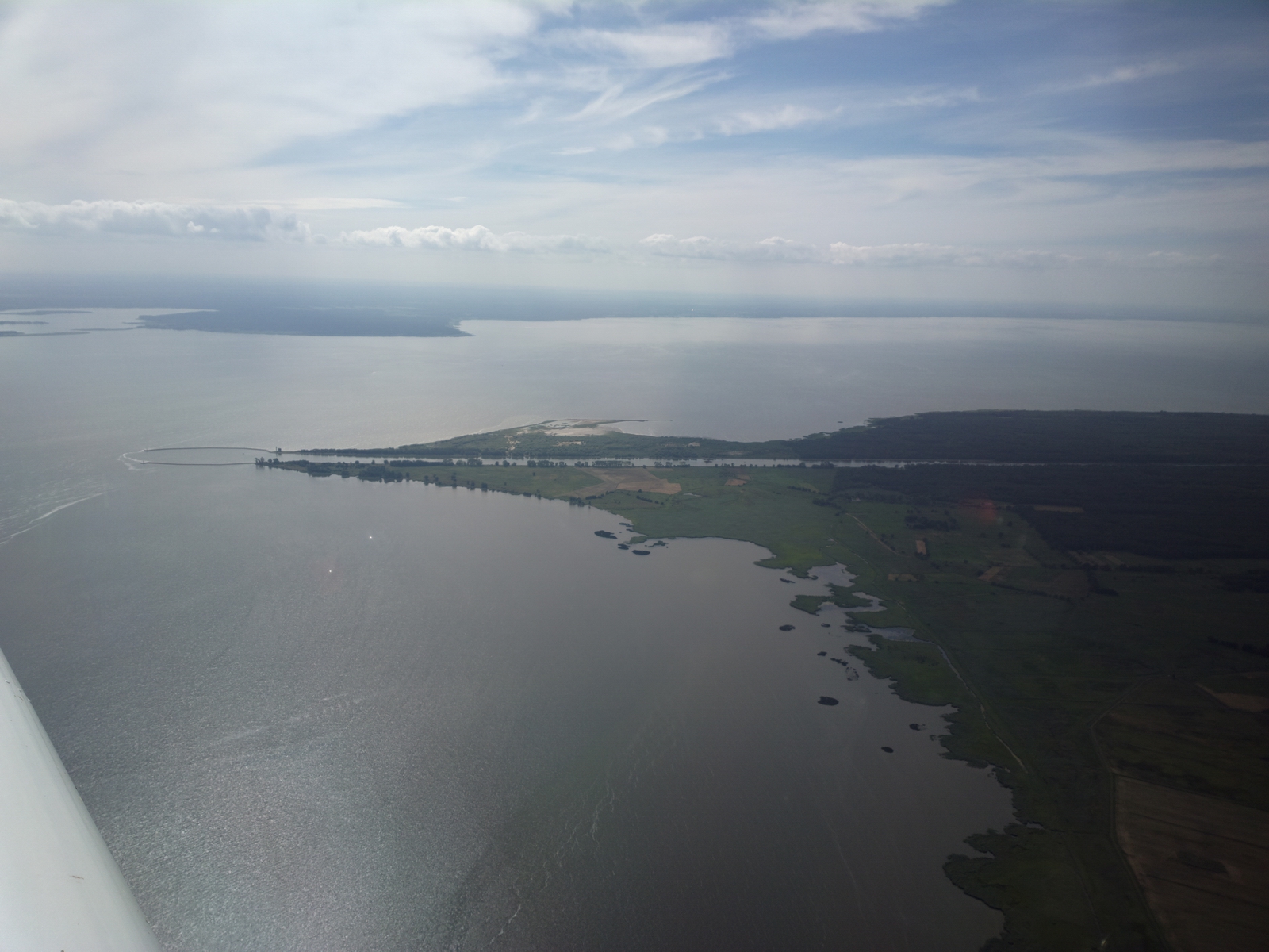
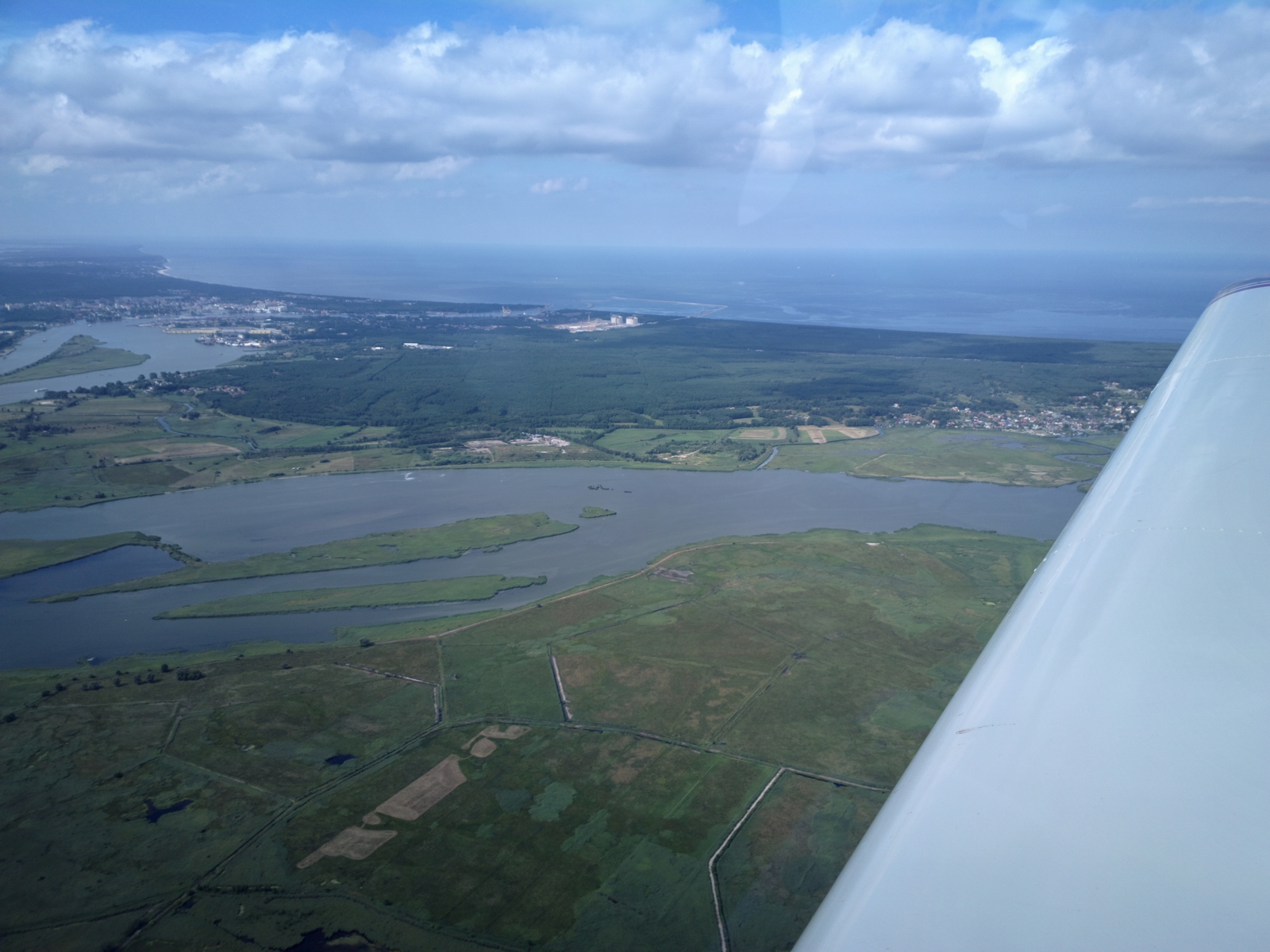
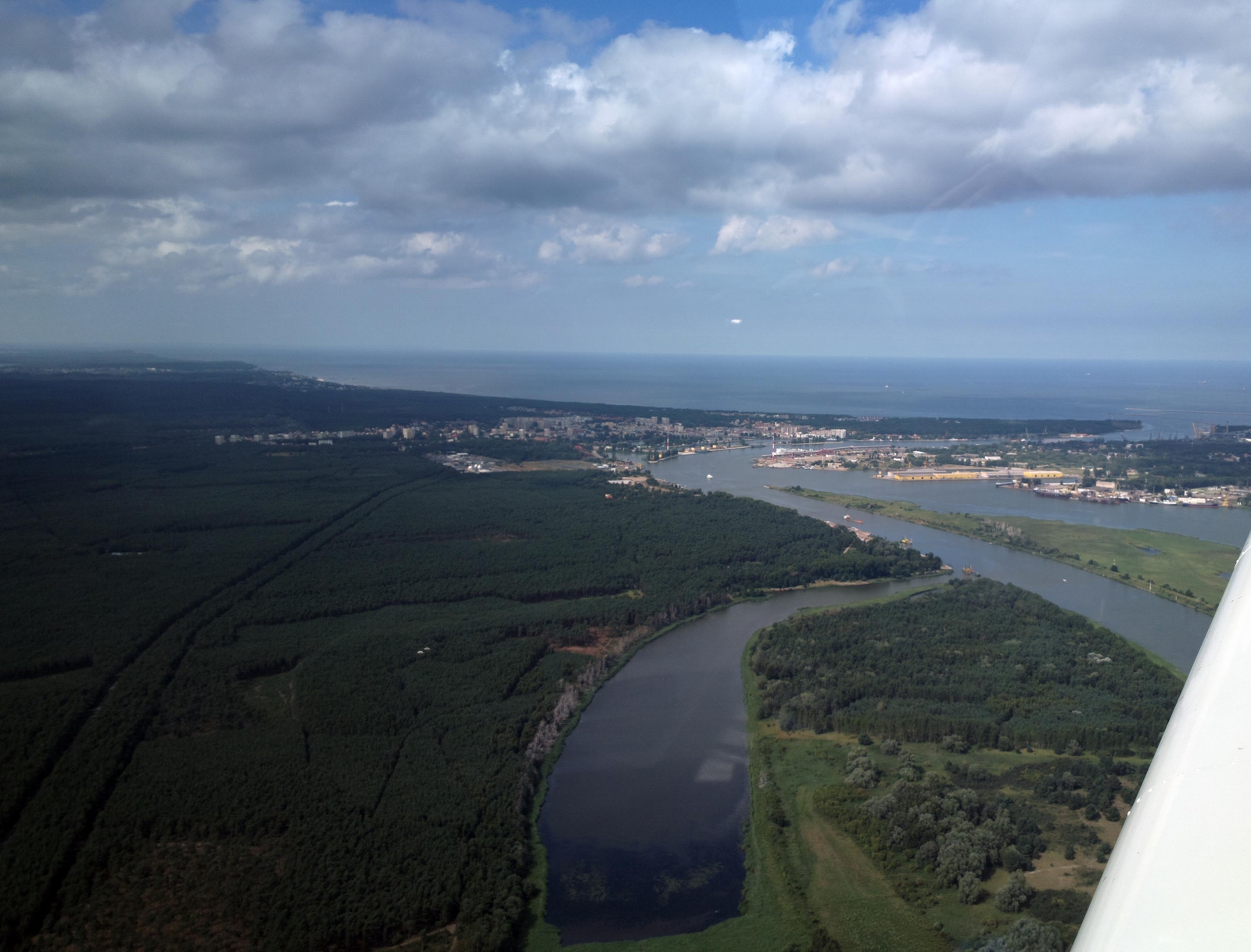
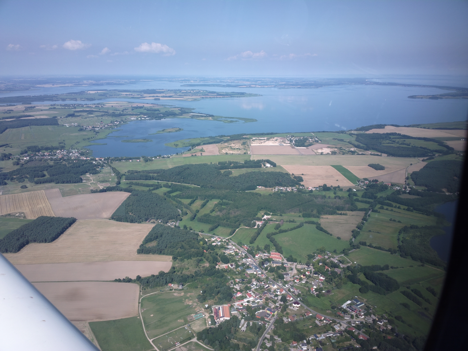
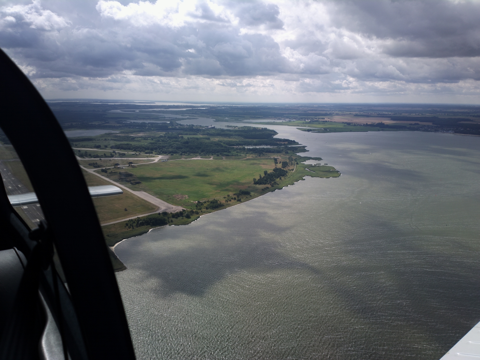
The Baltic coast is very scenic
Most of the EDAH ILS flight path is in Polish airspace. Apparently German ATC is not allowed to vector traffic in Polish airspace unless Poland publishes an MRVA (minimum radar vectoring altitude) which they don't for this area, so the Heringsdorf ILS is procedural-only. They call it "standard ILS" which I had not heard before. This is the autopilot flying the ILS from NAV1 (the EHSI) with NAV2 (the CDI) displaying the ILS also, independently.
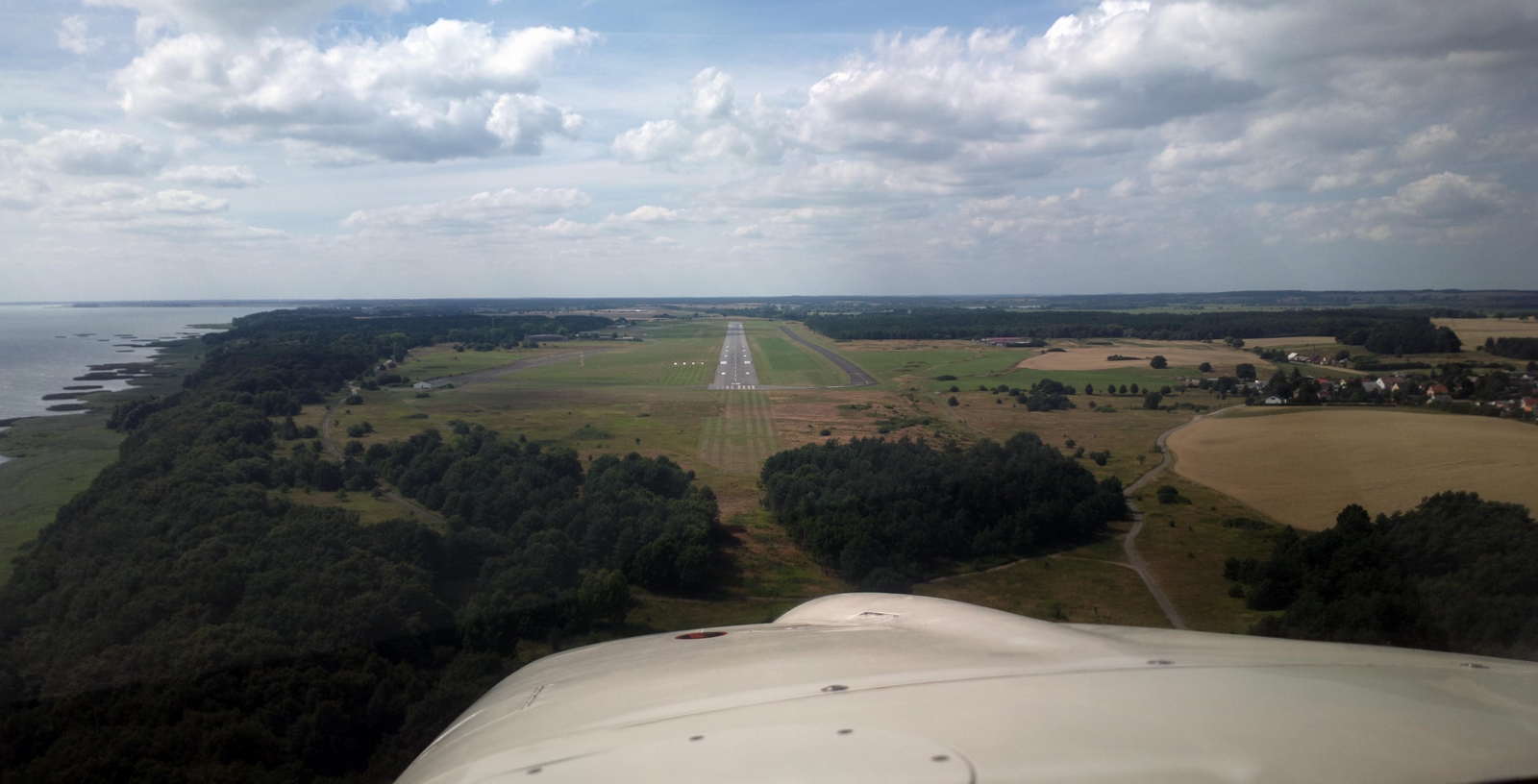
Final approach
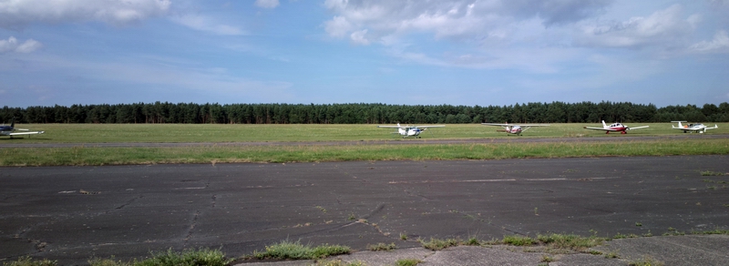
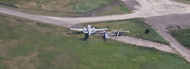
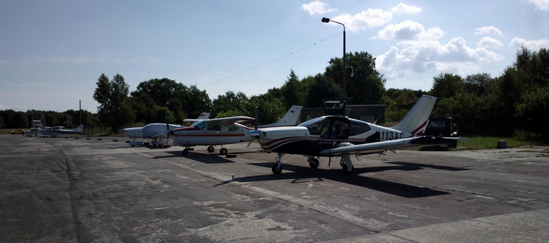
Some interesting aircraft are based there
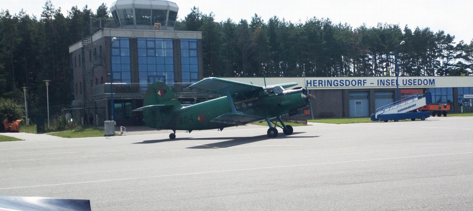
along the usual GA types
Heringsdorf airport looks like the typical ex Soviet Bloc setup which I recall from my time in communist Czechoslovakia, with loads of bits of old concrete. As usual, I asked for and got hard surface parking but one had to survey the surface rather carefully! The ex Soviet Bloc concept of a "hard surface" is perhaps more suitable for a tank
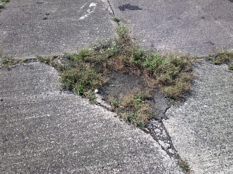
They should have insisten the Russians resurface these taxiways before leaving
the country ![]()
The airport is 24hrs Customs PNR but as is usual in N Europe (except airports frequented by big airlines) nobody was interested; you walk through a hut (just visible behind the Rockwell Commander) where a man takes a bit of money from you
Fuel was about €2.60/litre. Landing and parking for 1 night was about €20. The taxi to the town was €20.
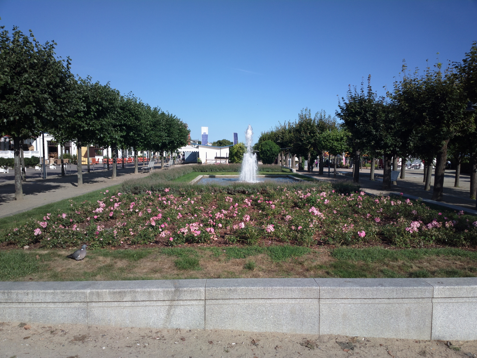
Heringsdorf is in a fashionable part of Germany where a lot of Germans go for a holiday. There are also many Poles - unsuprising since it is only about 2km from the Polish border. The hotels are pricey (I paid €170 at the Ahlbecker Hof) but the standard of the hotels seems high.
One big problem I find with Germany and apparently particularly this part of the former DDR is that it can be very difficult to find healthy food. It is even worse than the UK, though the obesity levels in the two countries are probably comparable. For very short stays this doesn't matter much, but I found there was very little that looked even edible. Almost all the food I could find outside the hotel was stodgy greasy sausages. The hotel had no less than 3 restaurants serving variously fancy and fatty food but with the help of the receptionist to translate I managed to get a bit of fish and some basic salad - lettuce, tomatoes, cucumber.
They have interesting "devices" on the beach which you can rent
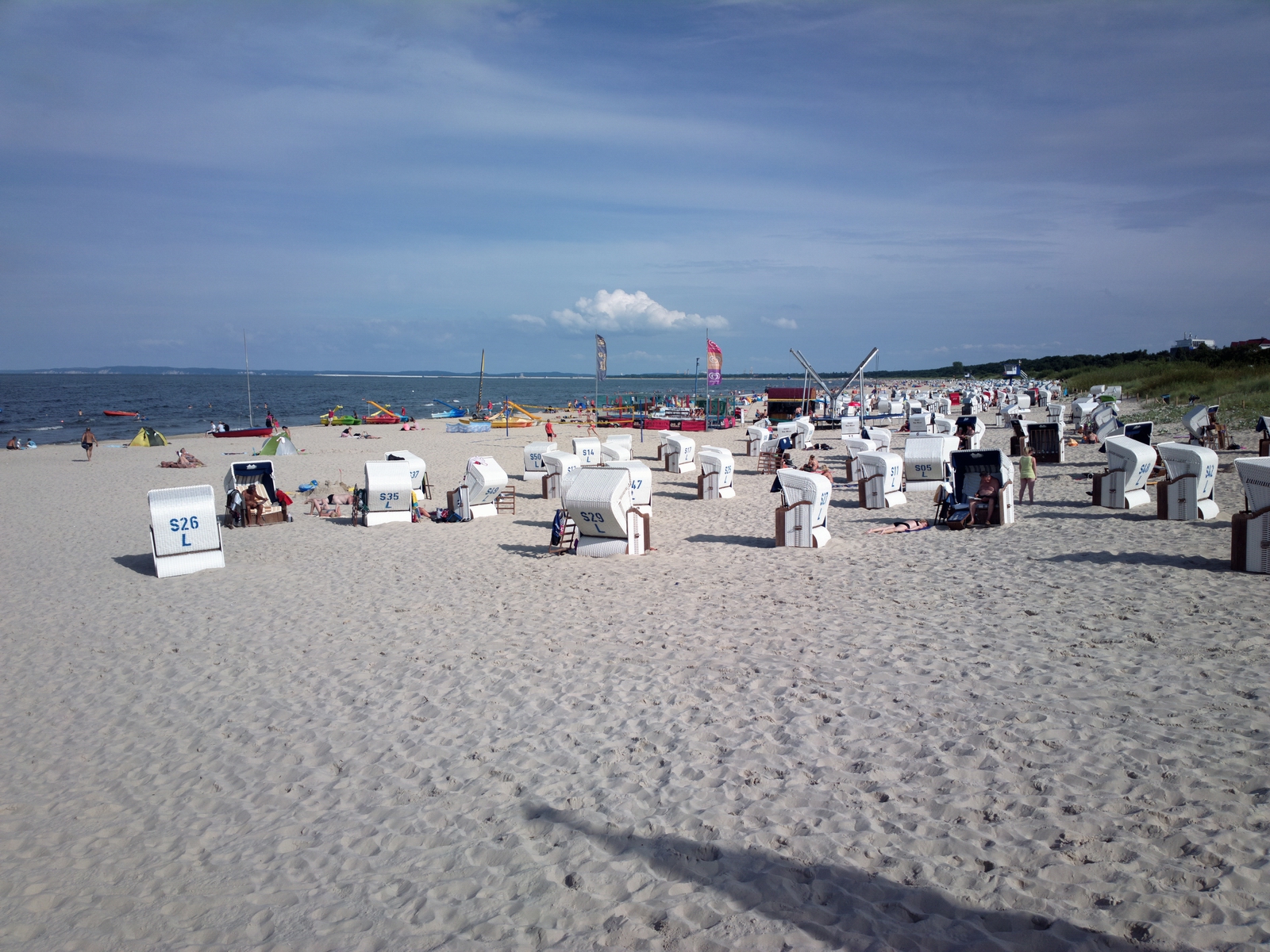
It's very pretty; a bit like an upmarket Bognor Regis except the food is probably similar
Heringsdorf to Peenemunde
The VFR flight next morning to Peenemunde was trivial - no flight plan and about 15 minutes airborne time and that included a long orbit to get some photos.
I had the "real" VFR chart running as a GPS moving map on the tablet computer and the chart depicted what looked like vast restricted areas, which may have been bird sanctuaries
Using the GPS I carefully flew through gaps between them; they turned out to be mostly the water areas. One basically just follows the railway line. In fact the railway works so well (we took it the next day) that the flight is pointless unless one wants to get Peenemunde in one's logbook.
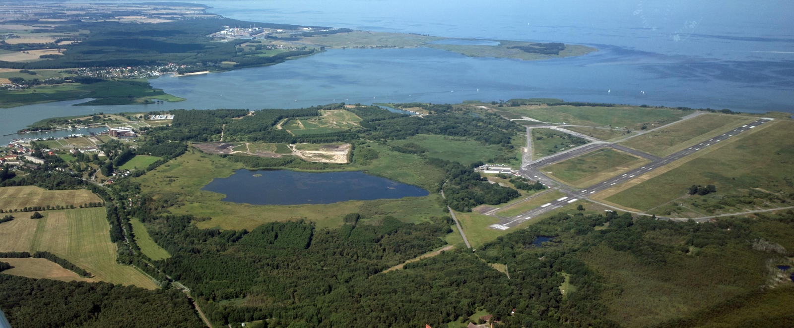
The airport, which looked dead, is FIS (not ATC) and the FISO sounded like I woke him up

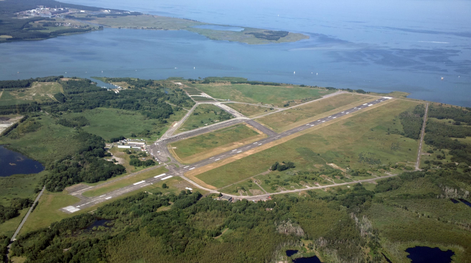
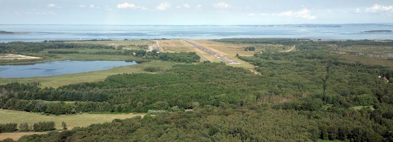
This is Peenemunde airport, with the rocket museum just visible on the left side of the pic
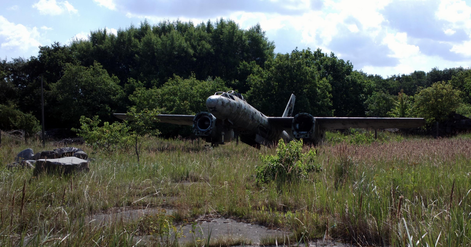
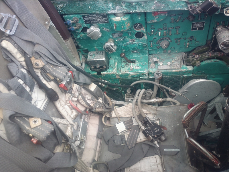
Some of the many pieces of ex Soviet Bloc aircraft left lying around
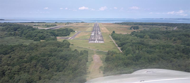
Left base, 800ft AGL
Final - out of focus
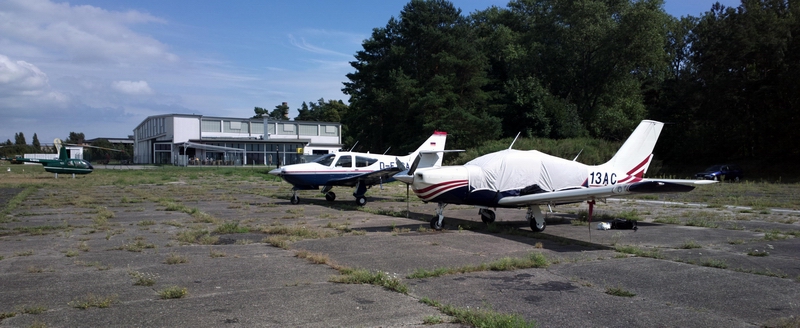
Hard surface parking was no problem. The tarmac was soft in the heat and pushing the plane around was difficult for one person. Avgas was pricey - €2.90 or so - but I had fuelled up at Heringsdorf anyway
The "C" is actually crossed out, with a metal bar screwed across it; the real "C" is a little hut just visible at the far left of the picture above
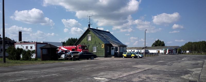
The airport has a tiny cafe serving greasy sausages and ice cream, with a glass of water for €1.50. I walked all around it and there was nothing else. There was a lot of motorcycle racing taking place and they were eating more greasy sausages from another cafe.
Peenemunde
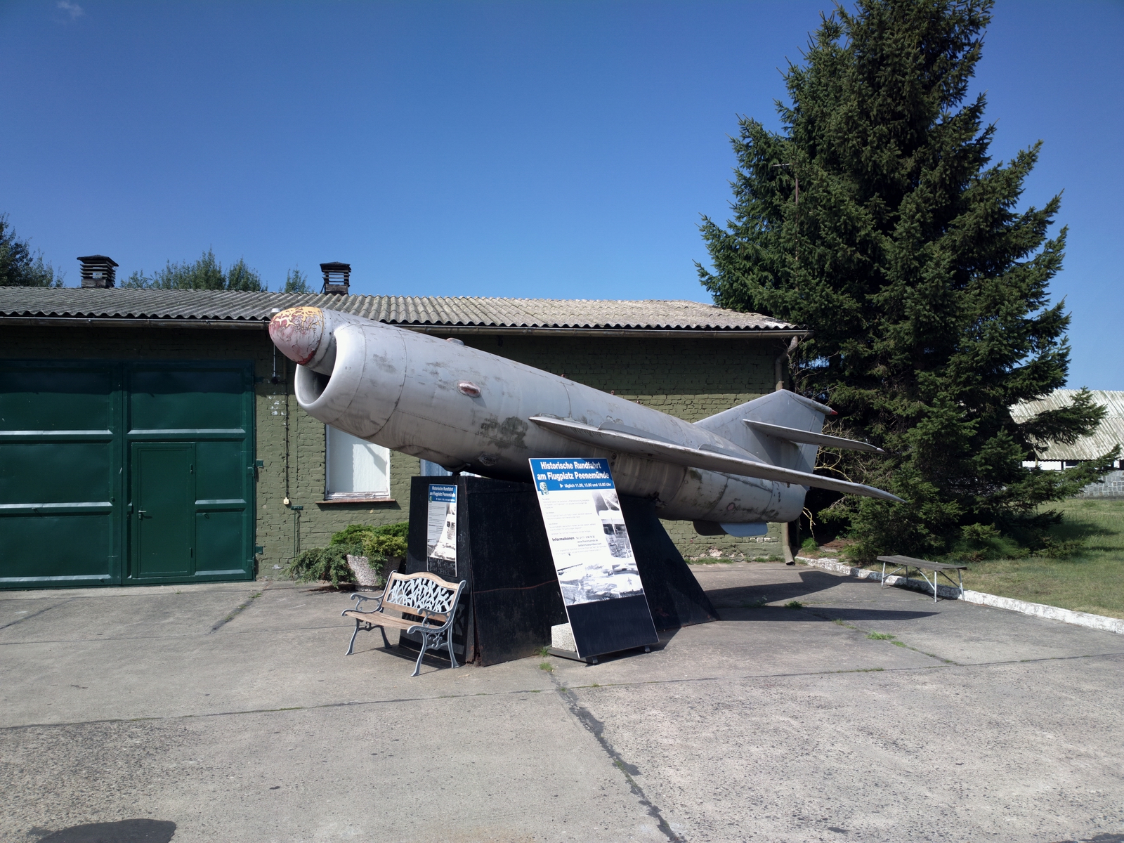
This interesting exhibit has the cockpit of a jet but the wings and engine
pods of a turboprop, and looked like it's Soviet Bloc CofA had expired but nobody
bothered to deregister it ![]()
This must be the company car. The red flags on the front are those of the long-defunct USSR

An apparently unmanned aircraft of an unknown type, with the jet engine amazingly still inside
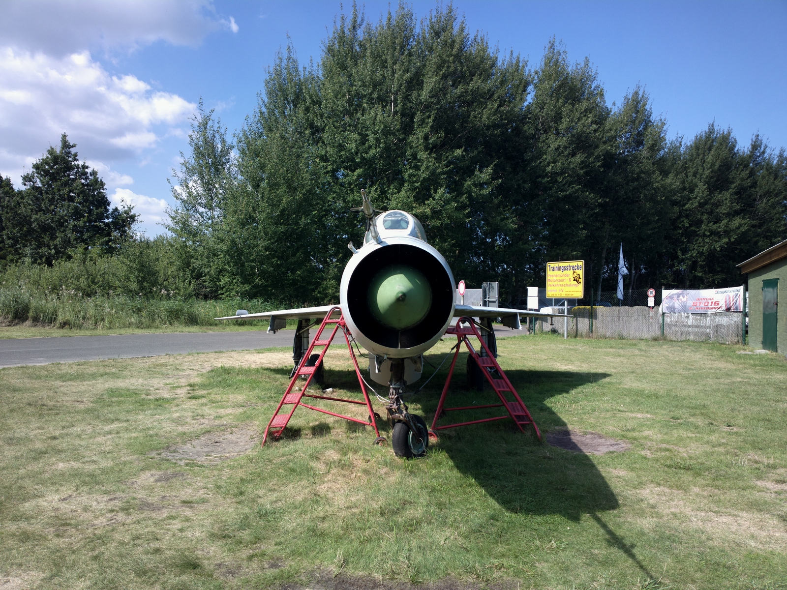
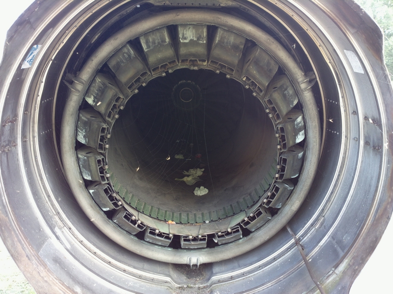
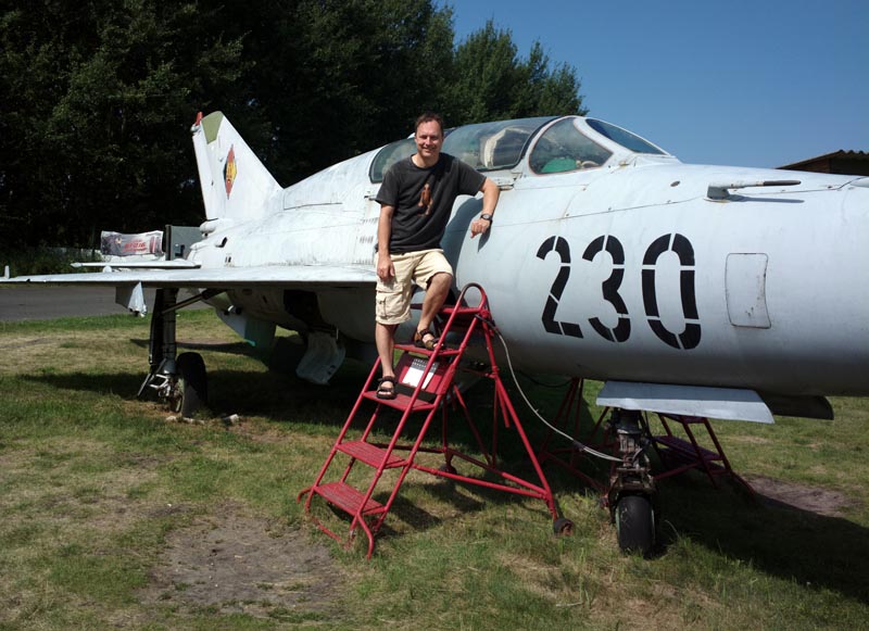
A complete Mig 21 2-seat trainer jet, with the engine and probably the ejector seat cartridges still inside. The wing loading must be "interesting"...
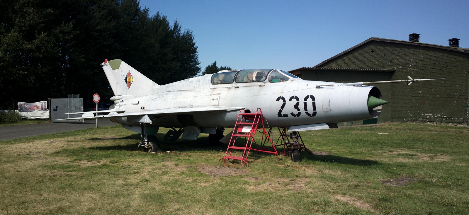
What was really nice was the way you could just climb all over this plane. In the "west" you cannot get near most interesting stuff...
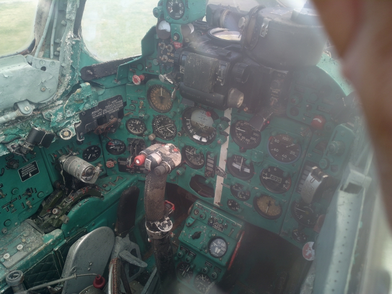
The ADF still worked so I got my JAA IR revalidation done while I was there,
with a USSR-CRE/IRR examiner ![]()
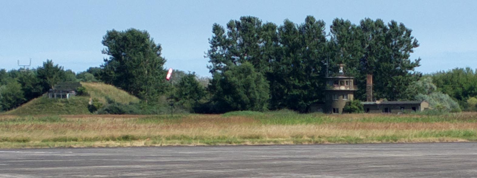
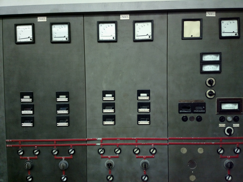
This is presumably the original WW2 control tower, with a bunker next to it for the rare occasions when the Allied bombers managed to successfully navigate to this part of Germany
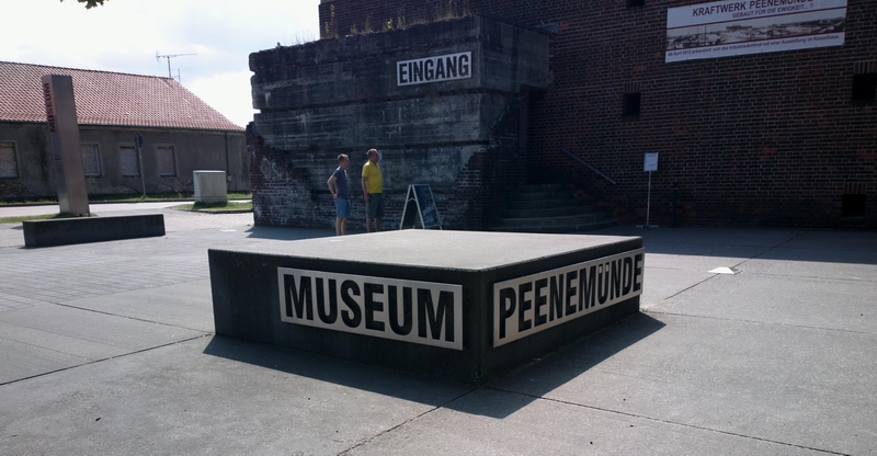
My colleague Achim arrived shortly afterwards in his C182RG and we went off to the Peenemunde museum. I rented a bike (about €7 for 24hrs) from a hut at the airport that sells tickets to the motorcycle racing. Achim had a super high tech €1000 collapsible bike which is obviously a super thing to have for GA travelling.
The Peenemunde museum is about a 20 minute bike ride away from the airport
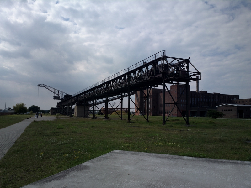
This is from the power station
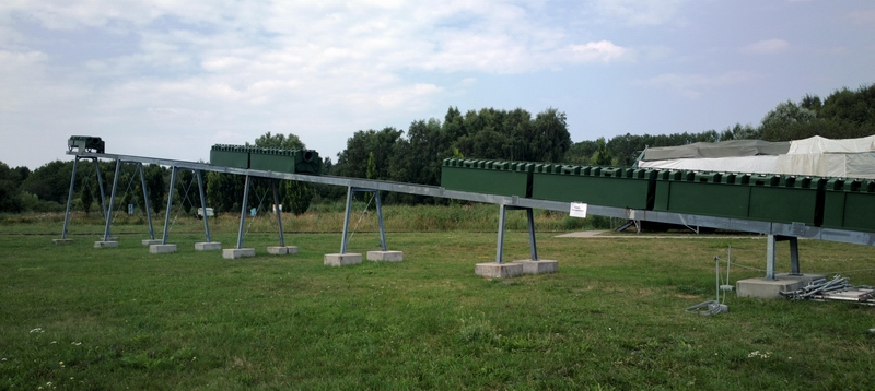
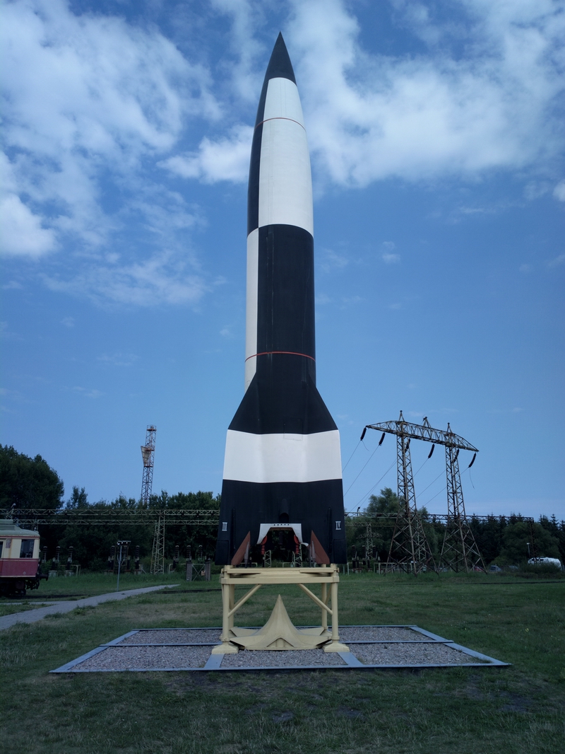
There is not a huge amount to see as far as the V1 and V2 rockets go. Almost everything of value was carted off to USA, the USSR, or to Britain, together with as many German scientists as they could find who knew how the stuff worked. There are mockups of the V1 and the V2
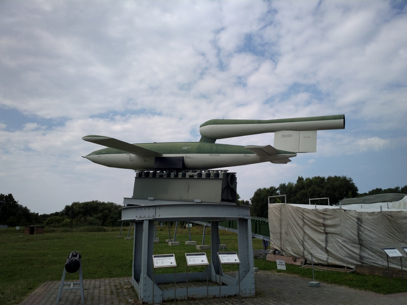
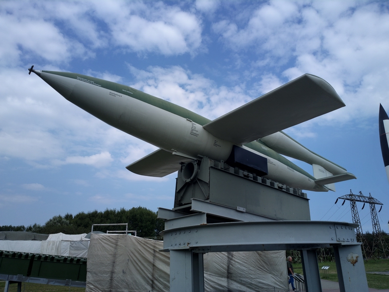
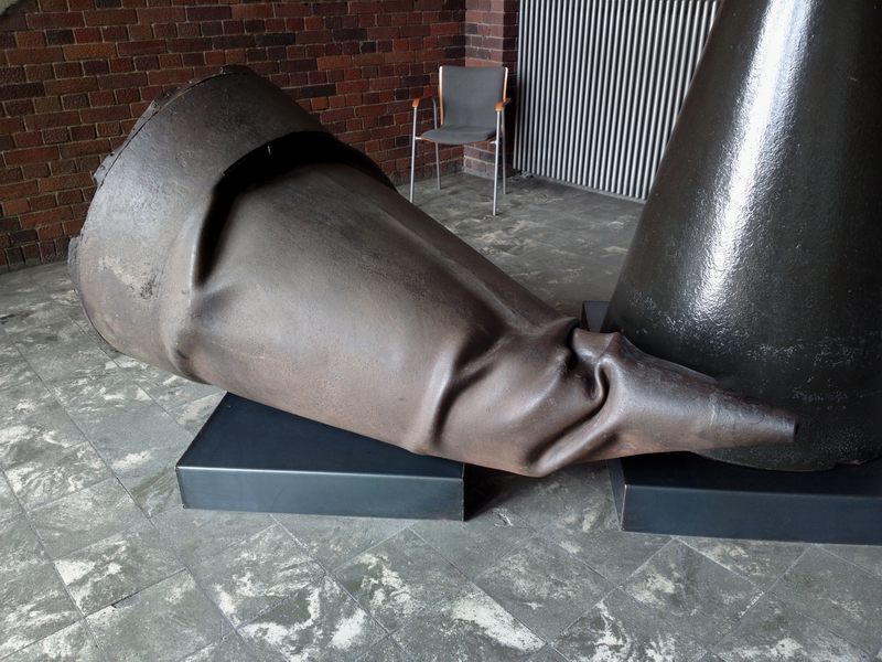
The nose cone of one of the many V2s which didn't fly very far
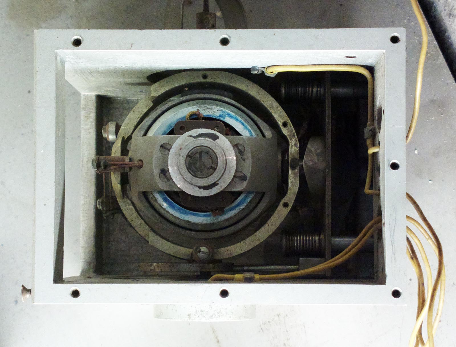
This is a two-gimbal gyro, probably from a V2. I was tempted to buy it and send it to Honeywell for an overhaul; I am sure they would not notice anything because it looks exactly like current GA models
The V2 rocket engine, with the complex nozzles which mix the fuel (alcohol) with liquid oxygen - a nontrivial technology which needs a huge amount of R&D to get a stable combustion over the wide range of ambient pressures, from sea level to outer space
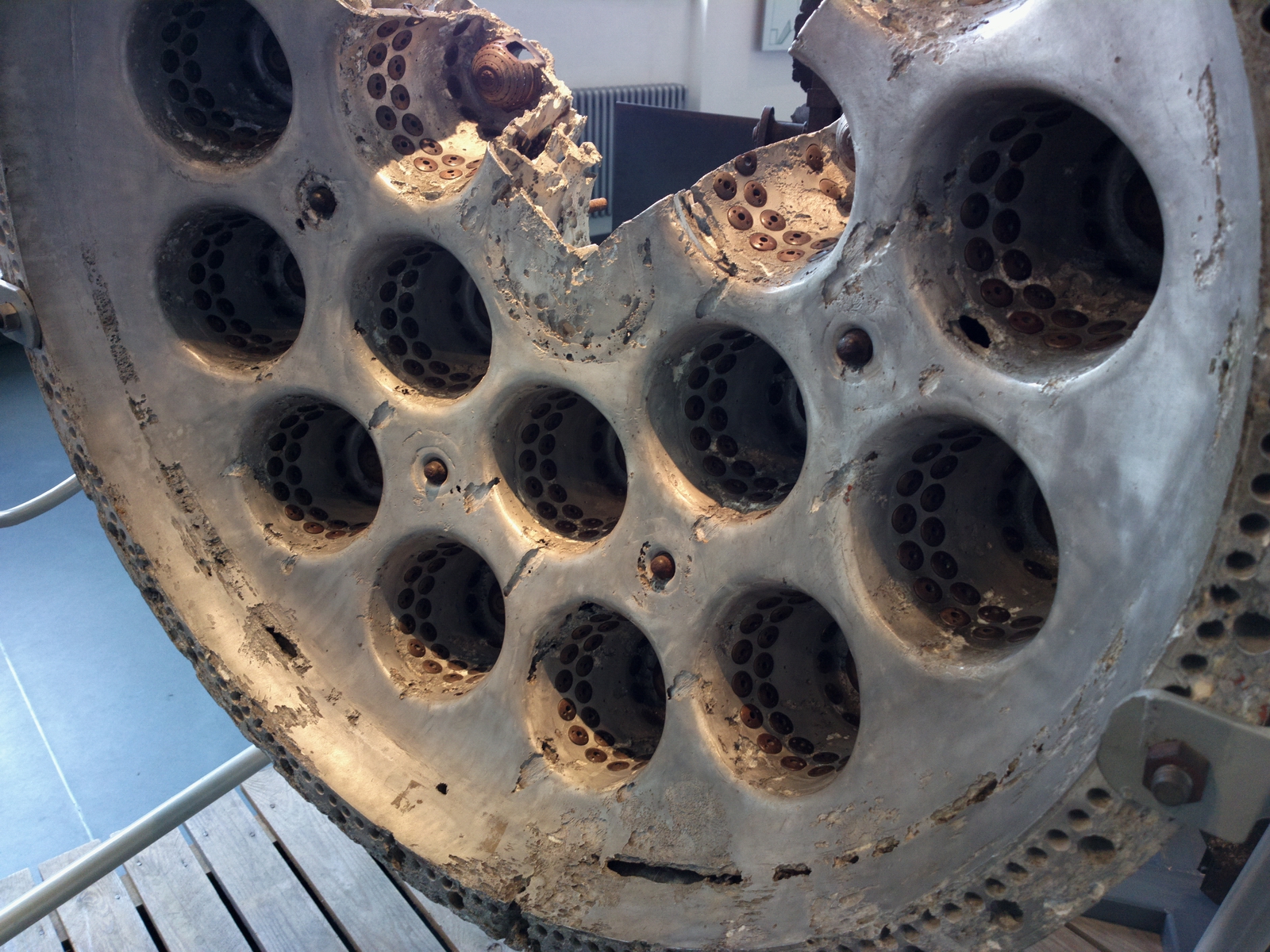
A close-up; the liquid oxygen is injected in the middle and the fuel around the periphery
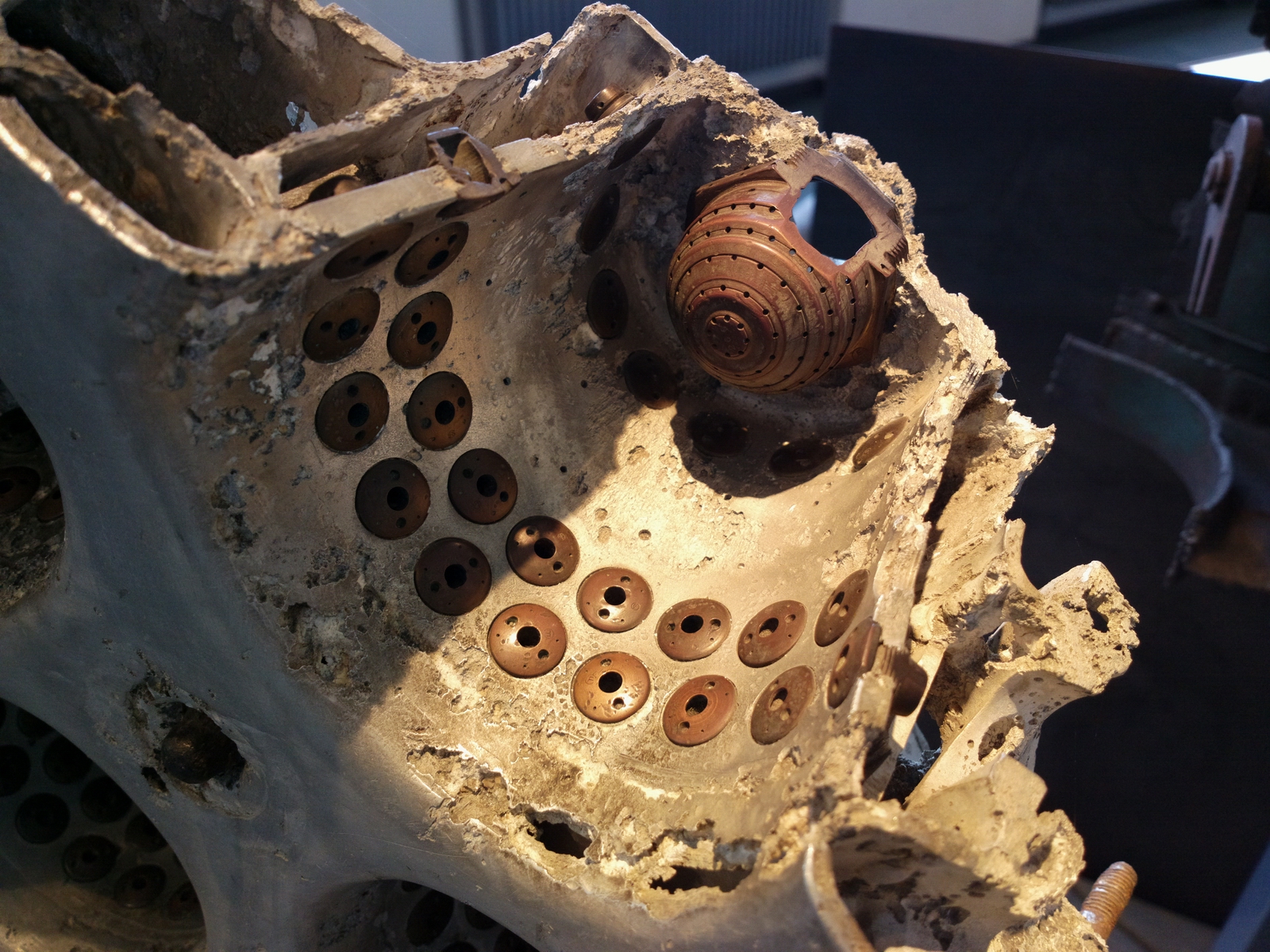
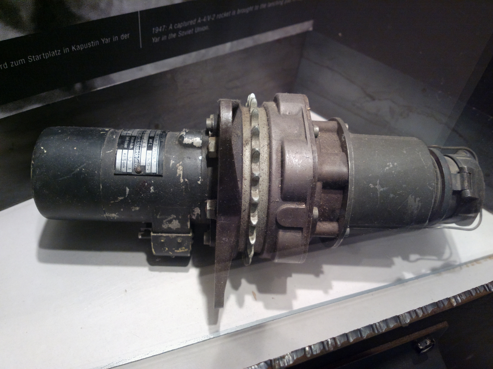
A really nicely engineered turbo fuel pump. The rocket exhaust gas drives the centre turbine (red) and the two outside sections (blue) each pump the fuel components into the engine. The Saturn engine used in the Apollo programme did it the same way; unsuprising since Von Braun designed both

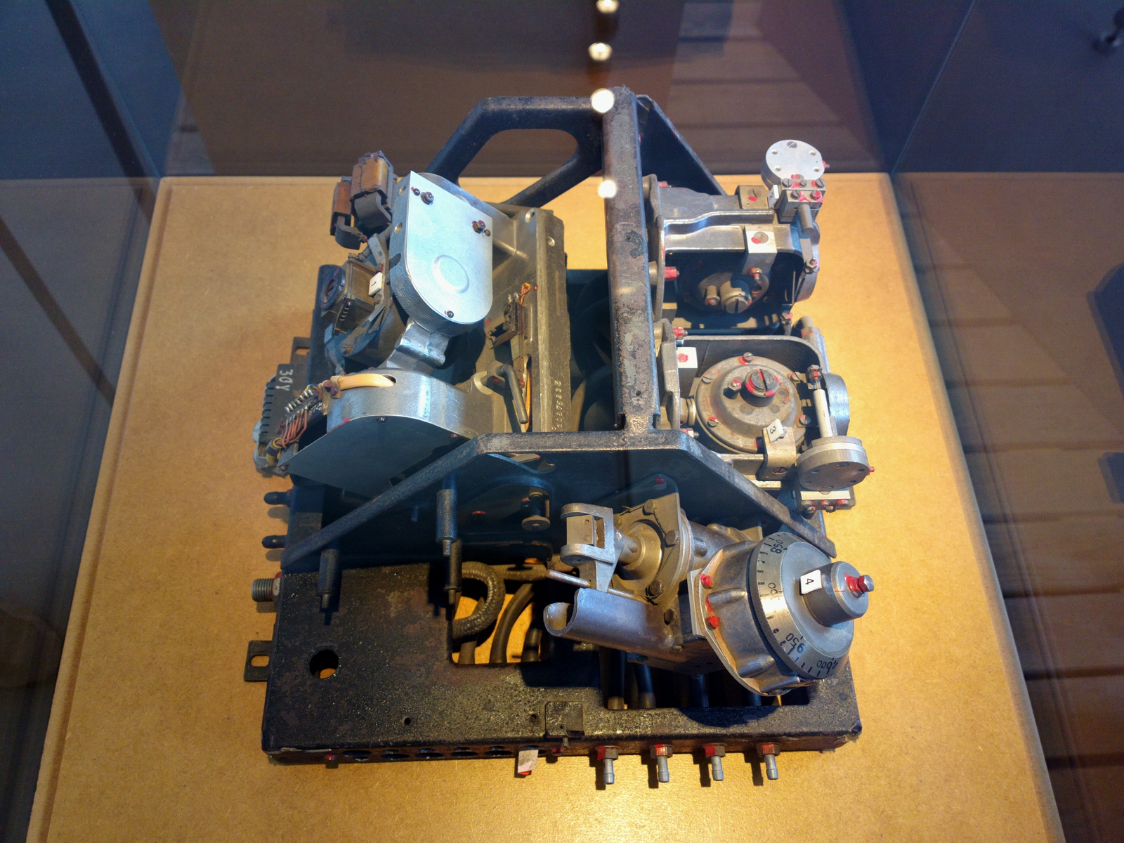
This is the guidance package from the V1, which flew straight and level at low altitude and at a low speed - unlike the V2 which went ballistically up into space and then back down. The technology is instantly recognisable, with a 2-gimbal gyro for an AI, an altimeter with an altitude preselector, and a couple of other gyros, presumably for stuff like heading and yaw stabilisation
The point at which the V1 would fall to its target was apparently done by counting the revolutions of a little propeller mounted on the front of it. When the counter reached zero, the V1 would pitch down towards the ground. This must mean that they needed a good wind forecast.
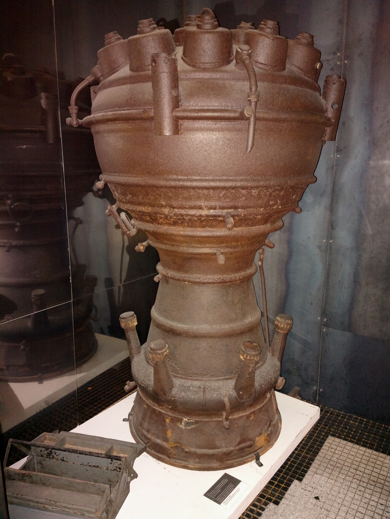
The complete V2 engine - about 1.5m high
This is a hydraulically assisted autopilot servo; probably much more reliable than the electric ones which Honeywell turn out today
There was some other unrelated stuff; this is the drive train from a ship. A twin turbo diesel engine at one end and a prop at the other end
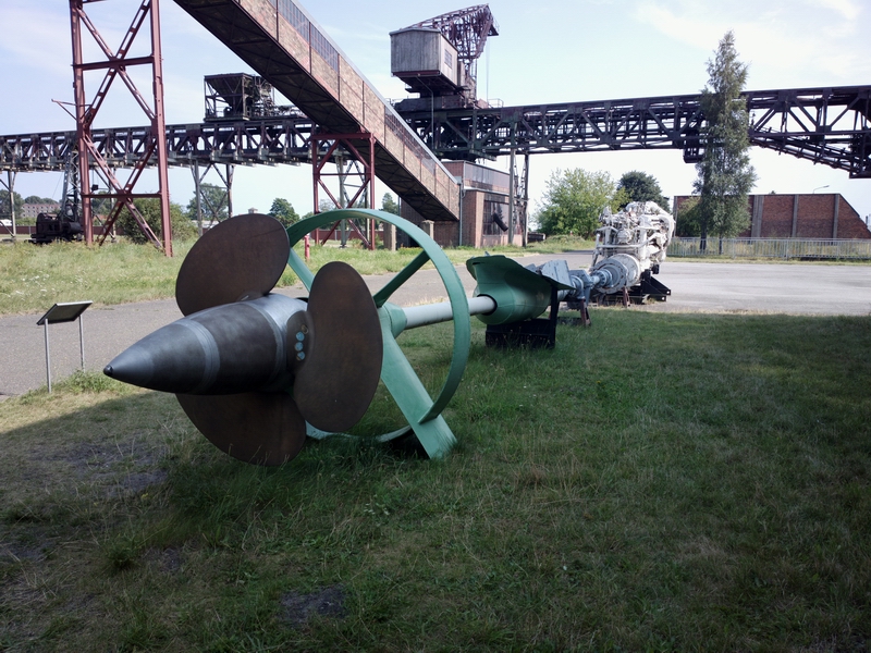
There was also an ex-USSR missile boat and a submarine. We saw the boat but ran out of time to do the submarine when a huge CBs approached.
The whole place was thoroughly bombed during WW2 and the power station and a bunker for observing the rocket launches are about the only buildings still standing.
The whole area is full of Russian military installations, left behind when Germany re-unified and the Russians were given a year to move out. There are signs everywhere around the edges of the forests that the area contains dangerous munitions. There will certainly be huge quantities of unexploded WW2 bombs because the area was heavily bombed and a good percentage of the bombs didn't go off.
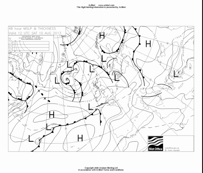
We cycled to the hotel and during the 1hr ride, mostly along really nice tarmac bike tracks in the woods (a very good German speciality) got caught in a lot of heavy rain. This is the MSLP for the day which shows a trough in just the right place...
The GRAMET plot for the return flight is here
The radar image was relatively clean
The sferics image was clean
Return Flight
I started up but forgot to pay, of which the chap on the radio reminded me... He takes cash only - another €20 or so. A noise certificate reduces the fee by about €2 but he didn't ask to see it so I forgot. At some German and Swiss airports a noise certificate makes a huge difference.
There was a lot of heavy weather still around from the previous day
The departure from Peenemunde is VFR, remaining outside controlled airspace (which means you really need the VFR charts even though the rest of it is a Eurocontrol IFR flight - same as when flying to/from a UK Class G airport) and you call up Bremen Radar for the IFR clearance, which took about 2 minutes to come through and was straight to the filed FL100. I had to head for some blue holes for the first 50nm or so...
The blue holes would usually close by the time I reached them so some zig-zagging was involved
I soon climbed to FL120 to stay on top. In this respect the GRAMET was not far off.
The weather for the possible destinations was again obtained over the satellite phone and while it was not great it was above minima at all airports of interest
With a 25kt headwind, the return flight was a tedious 4:45, FL120-FL140 most of the way...
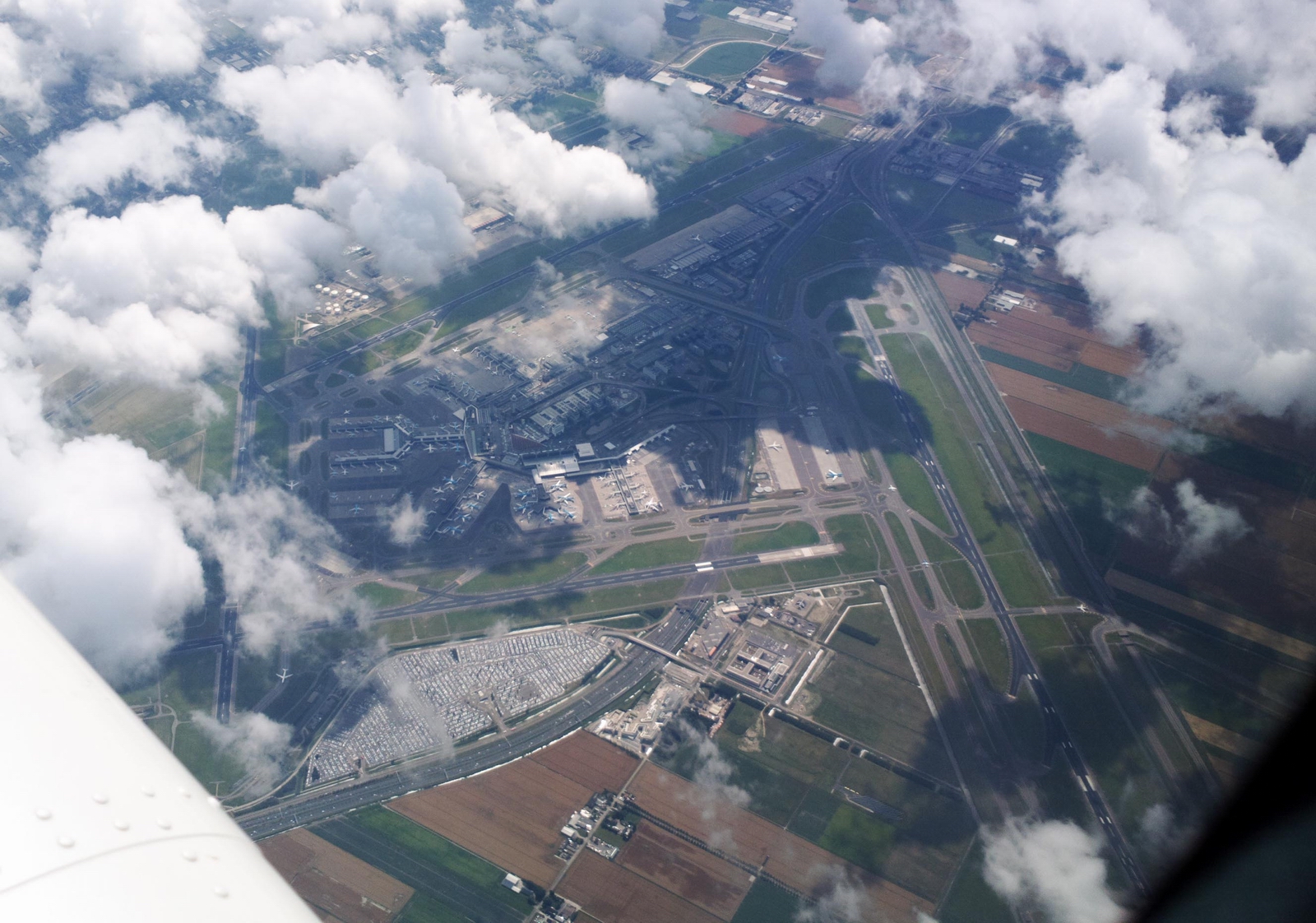
This is Schiphol airport from about FL140
There was plenty of convective stuff back home, with a lot of it over Le Touquet and a huge one at Dover
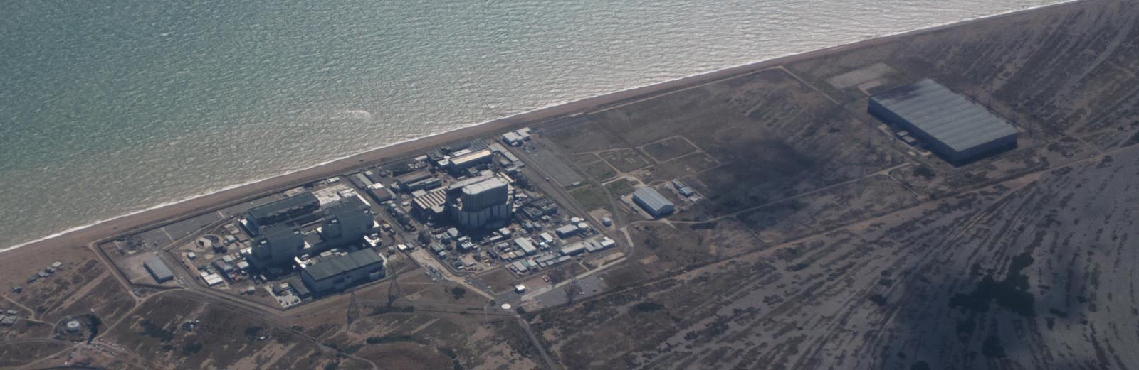
Back home... this is the nuclear power station near Lydd EGMD, which has a danger area around it, to 4000ft
No traffic was ever seen (visually or on TCAS) at anywhere near my level, until back over the UK when I saw a number of contacts on the TCAS, either below me or Mode A (altitude unknown) which had to be kept at a distance.
The GRAMET for the return flight was not far off, though its forecast tops were about 4000ft lower than actual.
The Value of an IR
This trip demonstrates how "light IFR GA" can be used for flights in less than great weather, avoiding hazardous weather, provided one has the unquestioned access to airspace which is possible only by having the full IR. The 0C level was often in the cloud so icing would have been virtually guaranteed in IMC.
In better weather (there was some low cloud around too - 1000ft or lower) the trip could of course have been done under VFR, and would have been quite scenic. But the route planning through Belgium is non-trivial, with a huge number of military areas
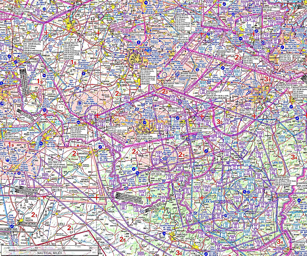
The Belgian military have gone completely mad and grabbed every piece of air they could. In practice it is not as bad as it looks, by the time you spread the chart on the floor and actually look at it properly. I have in the past (pre-IR) flown through Belgium at higher levels, say FL080, under control by IFR ATC, which suggests that the ATC there is comfortable with pilots who turn up at KONAN at such a level and simply ask for a "proper" IFR-like route. But obviously a VFR flight cannot go through Class A, and there is some of that on the route.
All pics were taken with the Nokia 800 phone. This takes a ~ 40 megapixel image and reduces it to a (configurable) 12 megapixel image of a quality which under ideal conditions can approach that of a DSLR. Due to various factors (unpredictable autofocus performance, slow shutter speed, etc) the pictures are not up to the DSLR standard in practice but the 808 makes it possible to do a trip like this without carrying all the usual gear. I would still take my Pentax K5 DSLR if going somewhere exceptionally scenic, and its superior controls make it easy to get in-focus pictures virtually all the time. Elimination of cockpit reflections is easier too.
Very little oxygen was used on this trip - probably 10% of the 48 cu. ft. cylinder. But without oxygen I would have never attempted it because one cuts off half of the aircraft operating ceiling and would spend most of the flight in icing conditions and heavy turbulence.
This page last edited 14th August 2013
