Flight from Shoreham EGKA to Cologne/Bonn EDDK June 2013
This was one of the EuroGA fly-ins.
This writeup is a simplified version of my normal ones in which I go into a lot more detail of each trip.
Pilot
FAA CPL/IR, JAA/EASA PPL/IR, ~1600hrs.
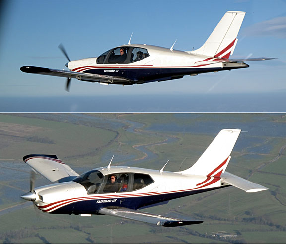
Aircraft
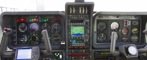
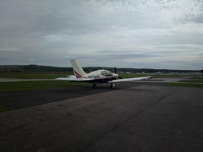
The aircraft was a 2002 TB20GT
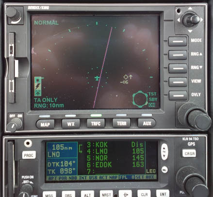
Oxygen is used on all IFR flights, with the Mountain High O2D2 electronic regulators and cannulas
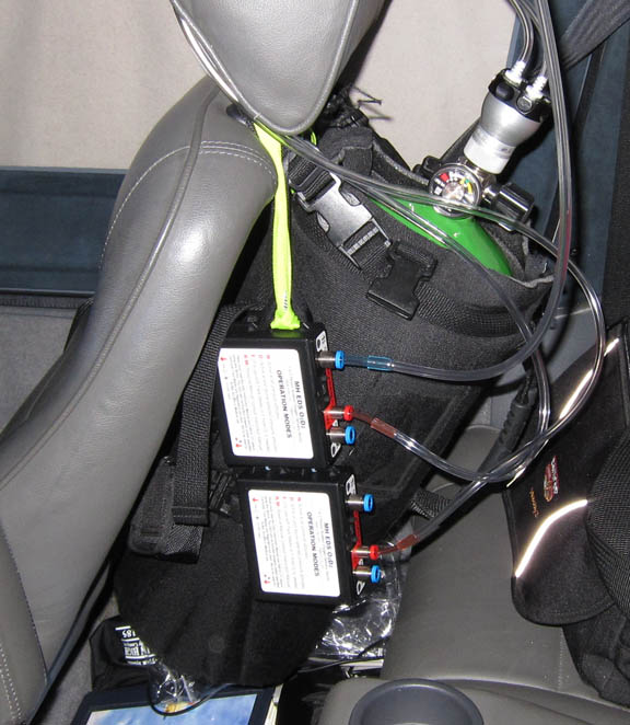
Due to the Eurocontrol routings, European IFR is only marginally feasible without oxygen.
Weather
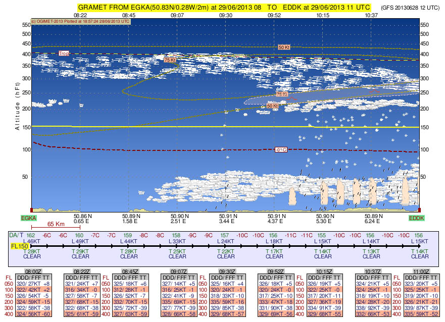
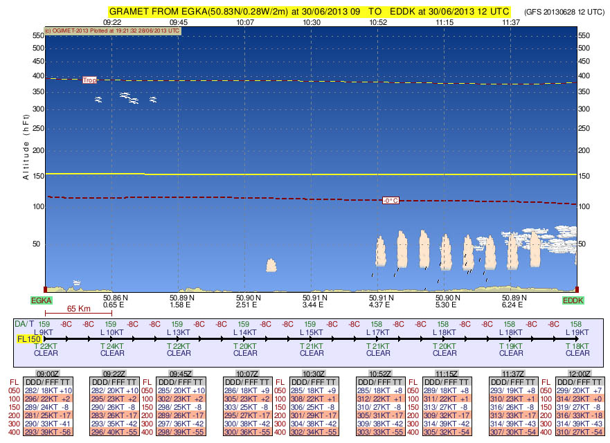
Nowadays I use a simplified method which uses satellite IR images to get cloud tops. This is now being supplemented by the GRAMET vertical profiles described below. TAFs and METARs are finally used to establish surface conditions.
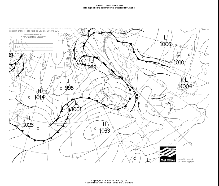
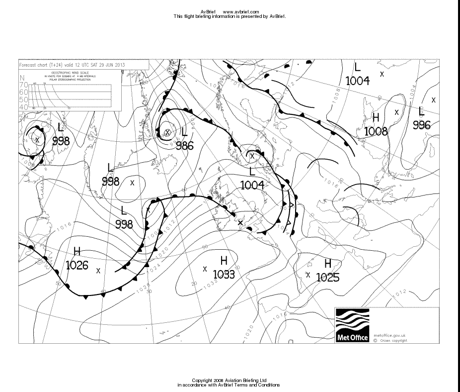
The MSLPs for 0600 and 1200 showed the wx would gradually improve through the morning. Same for the 0600 and 1200 SigWx - it's not often that I look at those due to the fairly useless way they show information but some people like them.
The GRAMET plot for the outbound flight suggested in would be doable between layers OK, with an escape route into warm air below the 0C level if necessary
The return flight looked a lot better
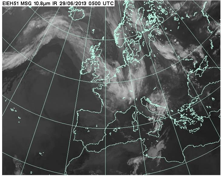
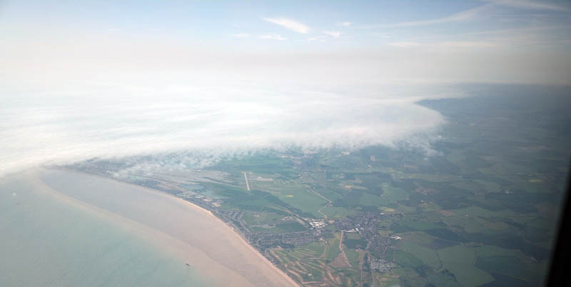
Returning to the outbound trip - the IR image looked scary
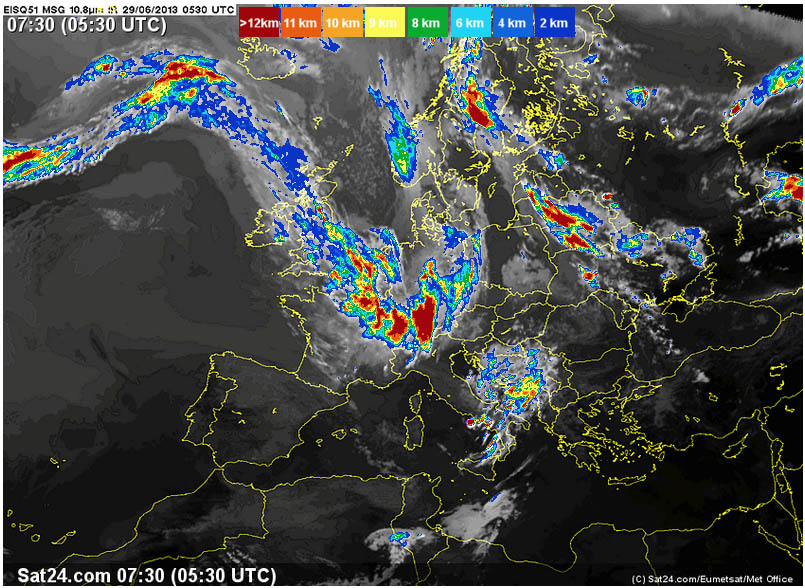
but sometimes this is due to wispy high altitude cloud, as indeed suggested by the first plot above. The higher-resolution UKMO IR image shows this cloud a bit better. One can see it is just thin stuff
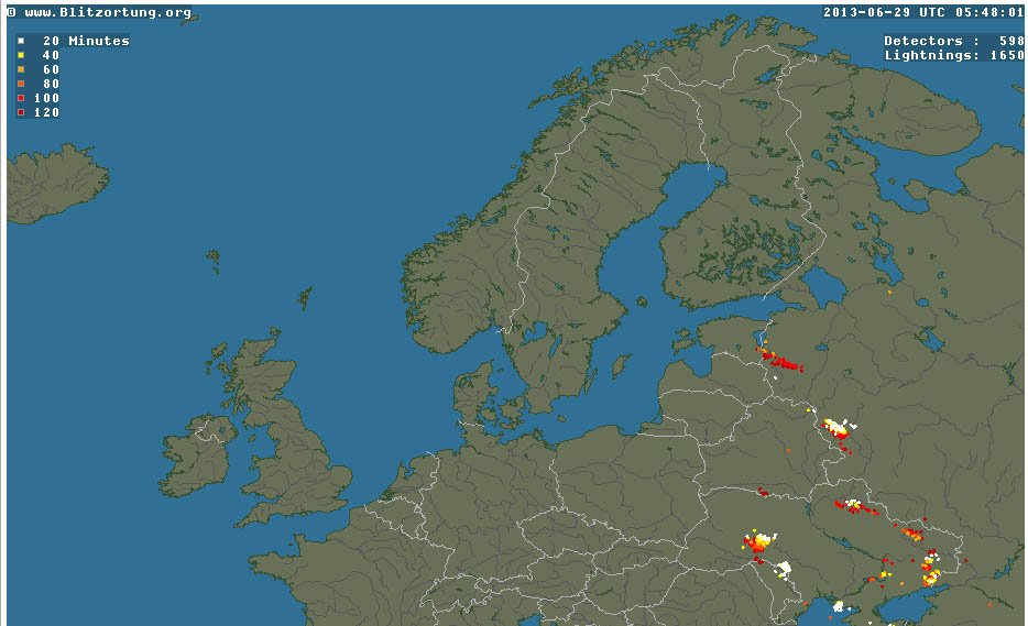
Finally, on the morning of the flight, the radar image was clean
as was the sferics (lightning) image
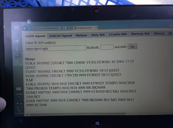
The surface conditions were OK and well above ILS minima
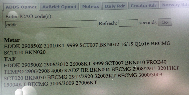
EDDK 281100Z 2812/2918 16005KT 9999 BKN020 TEMPO 2812/2815 RADZ BKN014 BECMG 2812/2814 22008KT TEMPO 2822/2912 4000 RADZ BR BKN012 BECMG 2907/2910 31010KT
Routes
These were developed using FlightPlanPro and filed using EuroFPL
EGKA F140
DCT LYD M189 DVR L9 KONAN L607 LNO M170 NOR DCT
EDDK
EDDK F110
NOR M170 LNO L607 KONAN DCT LYD
EGKA
The return route was filed at just FL110 because anything higher takes one over pointless a tour of the North Sea... at artefact of the airways structure in south east UK (which Eurocontrol enforce but ATC ignore on actual flights anyway).
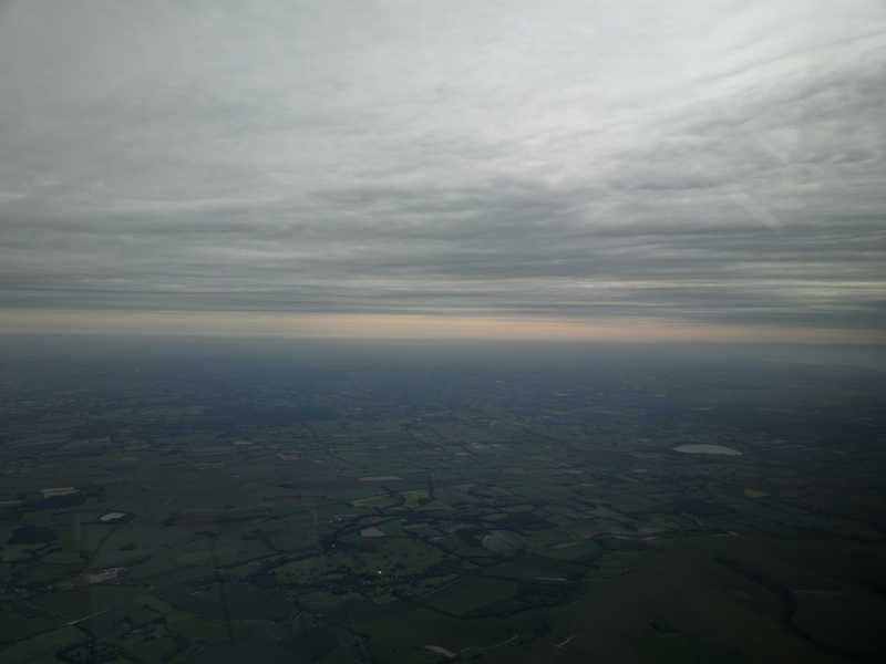
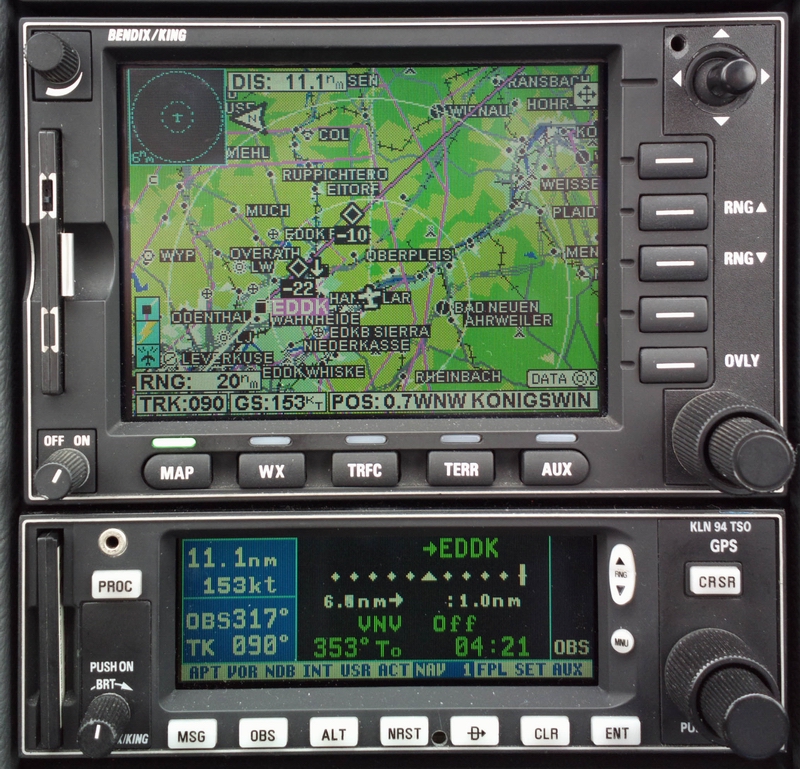
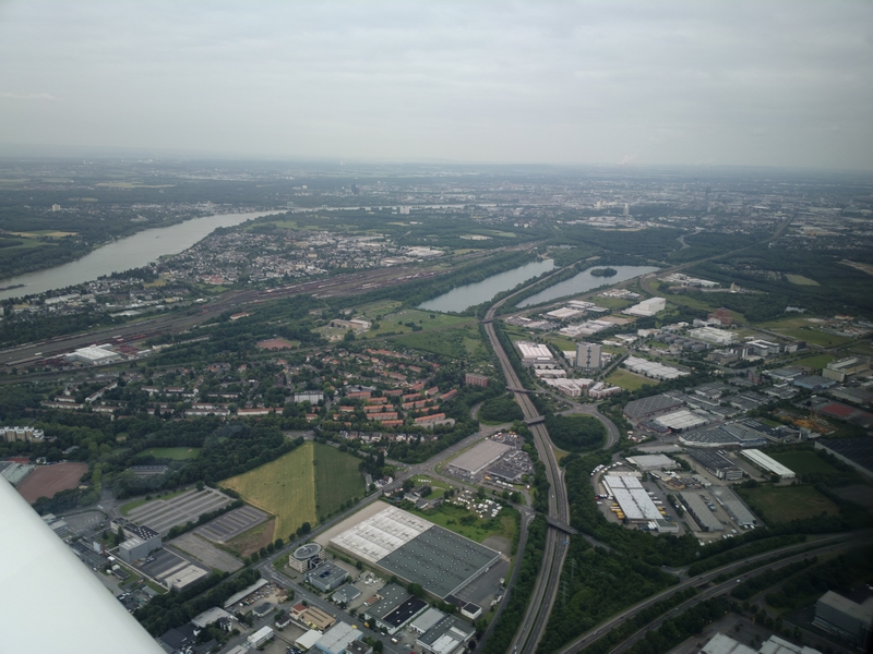
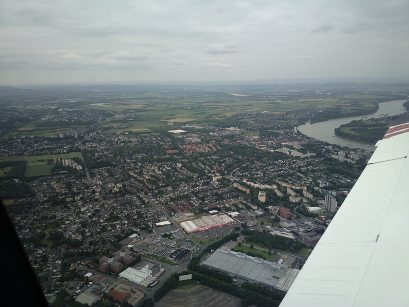
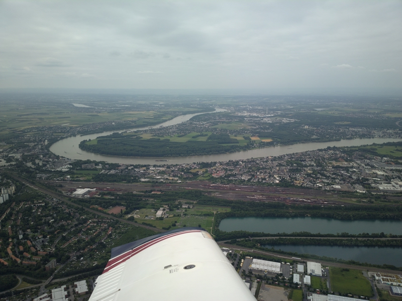
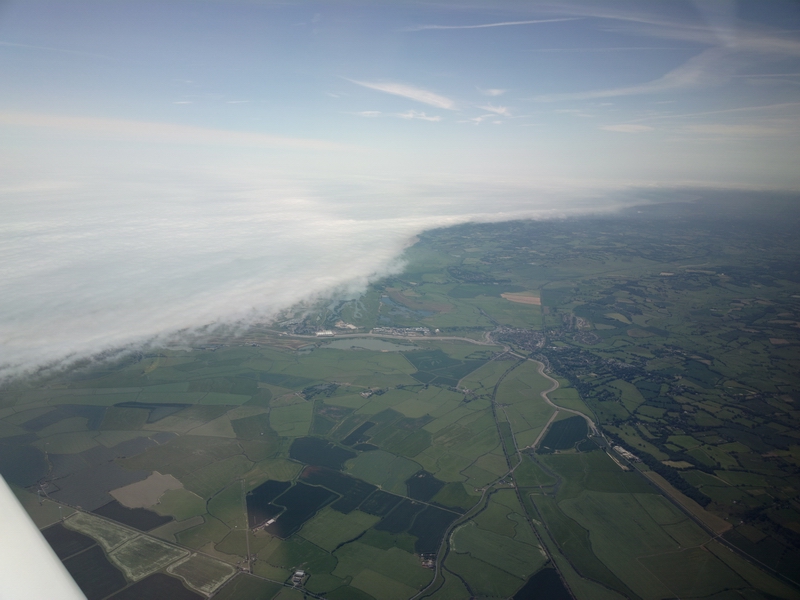
The general departure conditions are seen here
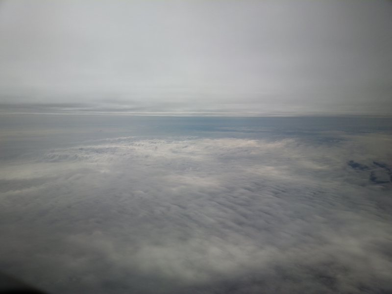
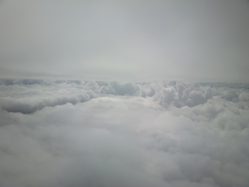
We soon climbed up into the cloud layer
and here we are between the layers as expected. It wasn't quite as per the GRAMET plot; the first layer was FL080-FL110 and the base of the next one was about FL150. But in the context of reasonable IFR aircraft performance this was a good enough forecast
I levelled off at FL130 because any higher would have been a bit too near the layer above.
With generous engine temperature management, the TB20 climbs to FL130 in about 20 mins, which is pretty good. One could do it faster but there is no point.
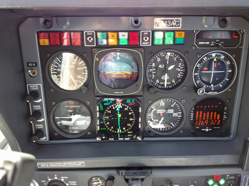
At FL130, -3C, TAS was 152kt at 9.6 USG/hr. There was about 10kt of tailwind.
As an aside, the only other aircraft seen were airliners high up, as usual, but I did see one on TCAS which after a lot of looking I did eventually spot as a tiny dot... amazing how small an airliner is 5nm away even when you know where it is and that it is only 600ft below you
Nearer the destination I got the weather over the Thuraya 7100 satphone weather link, displaying on my Lenovo T2 tablet which has a very badly stuck-on screen protector...
Due to the Apple restrictive practices, the above functionality is not possible with an Ipad, unless one finds a satellite phone which has a WIFI interface. They do exist, from e.g. Thuraya, in the form of an add-on module, but in real use (in flight) are fraught with reliability problems. Here I am using a simple dial-up networking (DUN) connection which is trivial to set up under Windows. It should be possible to do this with an Android device if one chucked 4 or 5 figures at a developer to create DUN support. I also use the tablet to run VFR charts under Oziexplorer, for emergency and other uses. It runs Windows 8 which is awful but it runs the required apps satisfactorily.
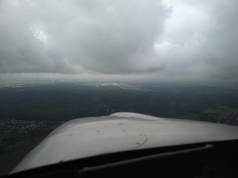
Still between layers, during descent
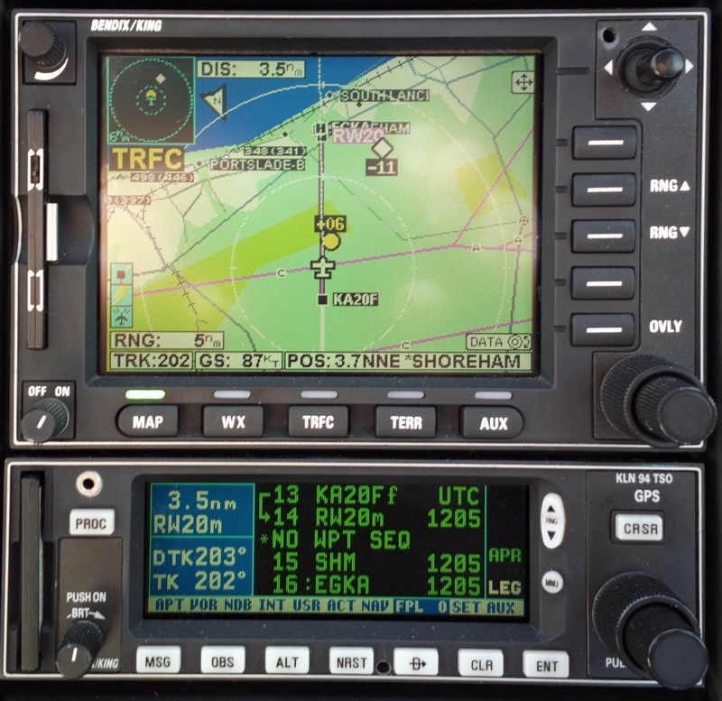
Despite the dozens of published STARs, everything is radar vectored so it's easy.
A couple of airliners on the ILS before me, and some more after me (not yet showing up)
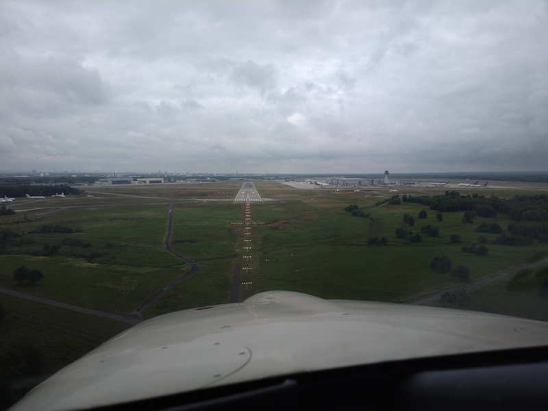
The ILS was to runway 32R. As about 1000ft, visual, I got an invitation to do a visual approach to 32L (to enable an airliner to depart on 32R, and to get out of the way of faster traffic on the 32R ILS behind me) and here we are established on a 5nm final for 32L
Short final 32L
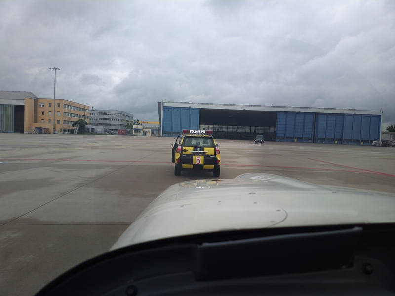
You get a FOLLOW ME car for both arrival and departure (though the latter cleared off after about 20 metres)
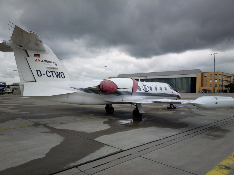
A Lear with wingtip tanks holding enough fuel to take a TB20 around the world...
The handler van turned up immediately... here we are waiting for the the avgas bowser
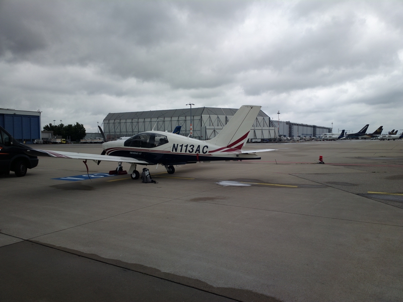
The BP avgas man claimed he takes only AIR BP cards, not Visa etc. I gave him an AIR BP card (doesn't get used much these days) but I did enquire about Visa and eventually it transpired you can pay by Visa, via the handling company...
We landed with 62.1 USG in the tanks. Full tanks are 86.2 usable fuel, so one could fly from Shoreham to Cologne and back without refuelling and have enough fuel to reach - probably - northern Spain. The bowser fillup was just 0.2% off my fuel totaliser figure... I would certainly expect a German bowser to be spot-on.
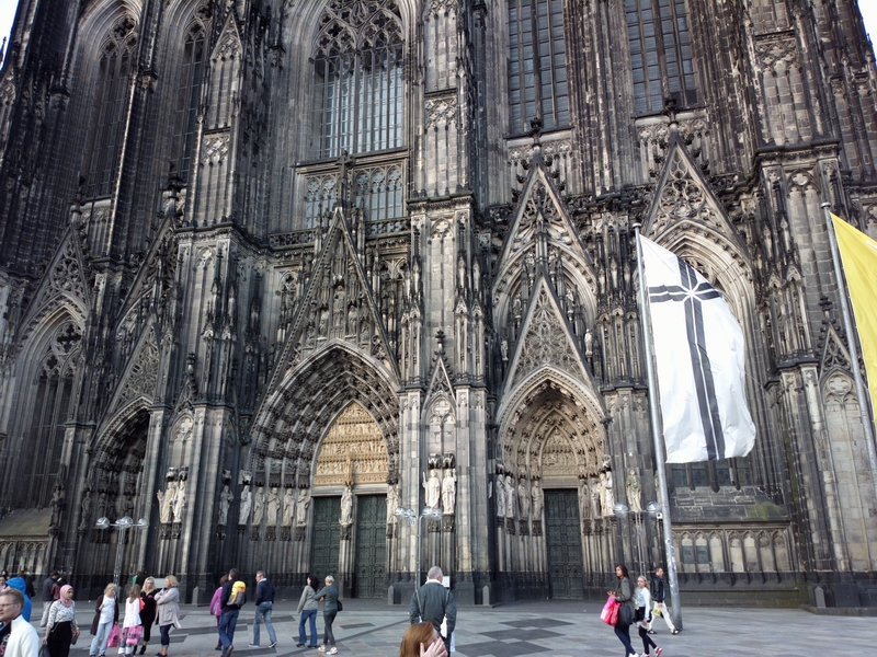
Cologne
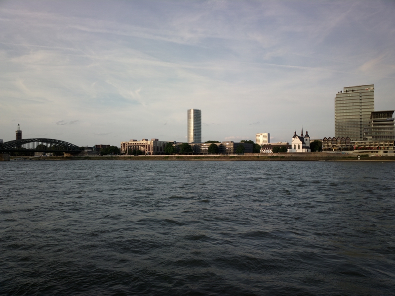
The tall building in the above pic is the EASA HQ - the organisation which has caused so much grief to European pilots generally and to the IFR community specifically, with their purely politically motivated attack on FAA licensed pilots. They certainly picked a choice location, with loads of superb restaurants and "night life".
Return Flight
The return weather was much better
and off we went
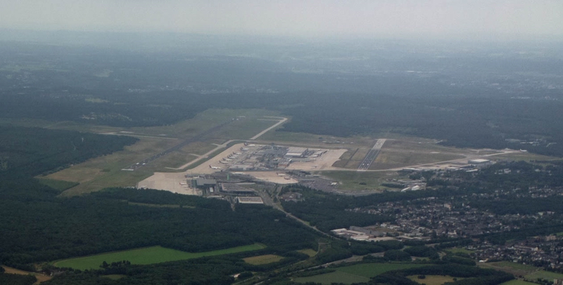
The airport behind us - the departure was from 32L
There was a thin layer of cloud about FL070
The return flight was all at FL100.
We got a DCT to KOK - a shortcut of 155nm right across the whole of Belgium.
Now the BAD NEWS - from the satellite phone weather link
Superficially at least, the Shoreham (EGKA) weather was well below minima, which is 800ft for the 20 approach.
I had actually had that data before departure, but there wasn't much point in hanging around Cologne... even diverting into a dodgy motel at Southend (or even Lydd) is better because one can get transport back home.
Also the fog tends to clear. Also, a Metar reports weather within a 5nm radius of the airport so it could exist in one direction only and the rest could be blue skies. Often, at Shoreham, the fog is over the sea only and in this case the approach would be on 20, looking at the 220/14 wind...
Crossing the UK coast near Dover one could see the Lydd runway still nicely visible outside the blanket of fog
and I did consider going in there while it was available, but it was more sensible to at least call up Shoreham (its ATIS could not be heard from that distance, even at FL100) to see what the conditions there are.
London Control were too busy to obtain weather etc so I got a descent out of controlled airspace and changed over to Shoreham fairly soon so I could find out the conditions. They turned out to be OK, with the fog hanging over the coast
There was a fair bit of light cloud around at low level so I did the RNAV approach to 20; here we are established on the final approach track and descending
Some other traffic around... not sure if the traffic 600ft above me was known to the airport
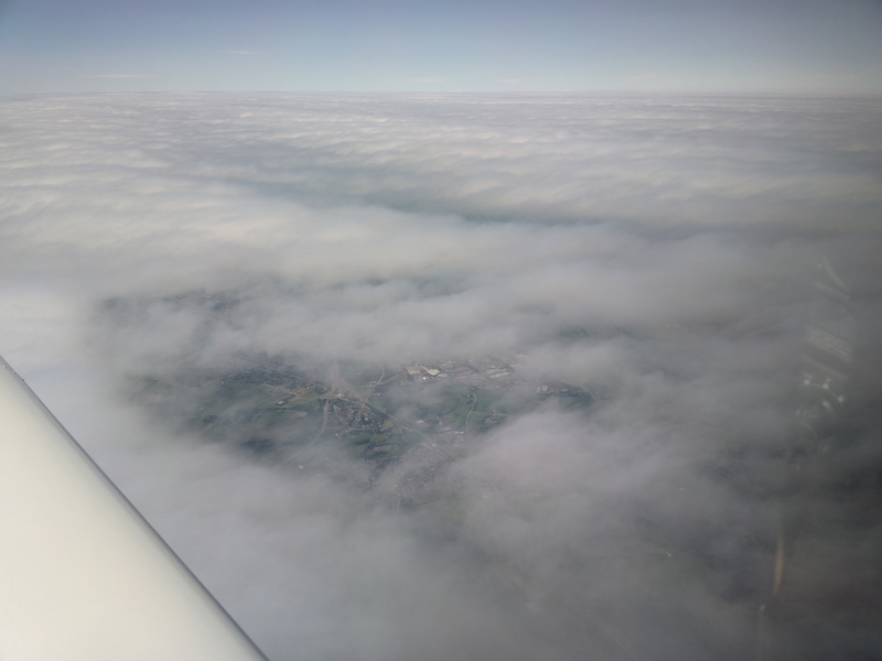
Just getting in before the fog
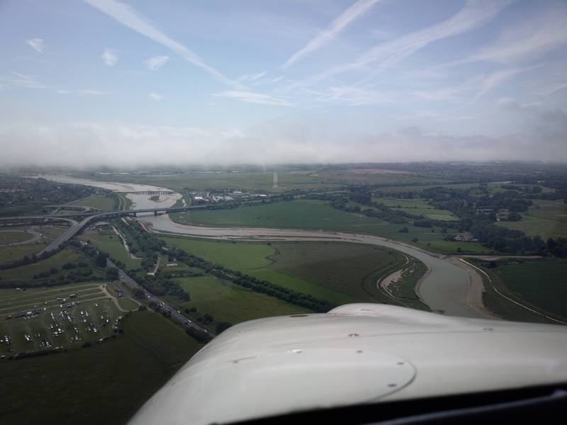
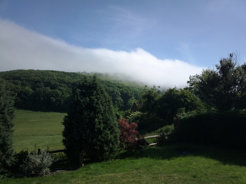
Later, driving home, one could see the stuff pushing over the hills just inland of the airport
The actual return route flown is here, from the Eurocontrol tracking data
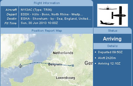
I did not get a chance to capture the outbound route from the EuroFPL site although I do have the GPS track logged by Oziexplorer running on the tablet.
Both flights were just over 2hrs airborne time.
The handling company at Cologne is very efficient and very posh. The total cost was €110, which is not totally outrageous for a single visit, though I got ripped off by another €20 because I did not have the right sort of noise certificate. I had three of them, but none showed the current tail number. All three shored the airframe S/N but they did not accept that. For an N-reg there is a way to self-generate one and I must get around to doing that... Germany and Switzerland alone seem to operate this noise certificate charade.
After all that business with avgas needing an AIR BP card, it turned out that the man did not apparently process it, so I paid for the fuel with everything else, upon departure. Avgas was about €2.2/litre.
I think there will be a further invoice for a "navigation charge", though I don't know who the German CAA is going to send it to.... probably the US trustee, whose details they can find on google.
It was a great meeting, but it was a pity that a number of others could not make it due to sub-VFR weather. This shows the value of an IR, though one does need to be based at an airport which has instrument approaches if this is needed.
All pics were taken with the Nokia 800 phone. This takes a ~ 40 megapixel image and reduces it to a (configurable) 12 megapixel image of a quality which approaches that of a DSLR.
Due to the short flights at relatively low altitudes, so little oxygen got used that the gauge on the cylinder barely moved.
This page last edited 11th July 2013
