Of a number of long trips that I have done in the TB20, this one was the first one to be written-up. The purpose of the write-up was to show that long and interesting trips outside the UK are easy, provided the planning is done correctly. As a result, this article is rather detailed and devotes a lot of time to flight planning.
For non-aviation readers, here's a glossary
Outside the UK, this trip was flown under VFR.
9/2016: This article is now out of date in various respects. The biggest change is the internet and with it the availability of weather data. Also Greece has become easier when it comes to communications; the handlers (I normally use Swissport) communicate well by email.
Objective
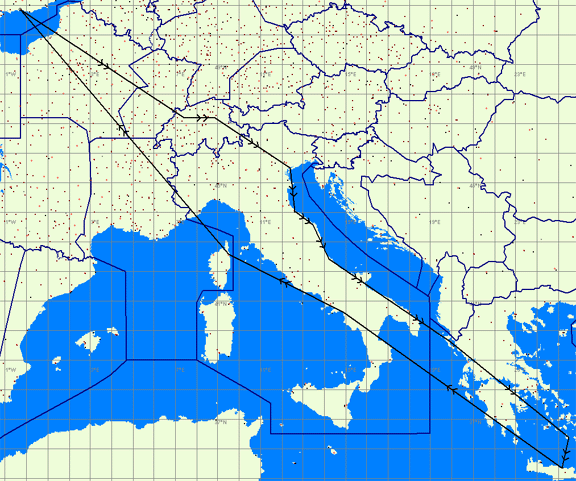
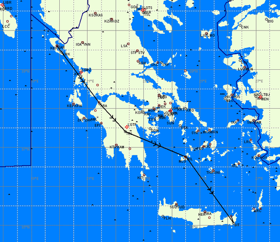
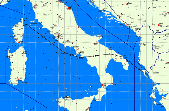
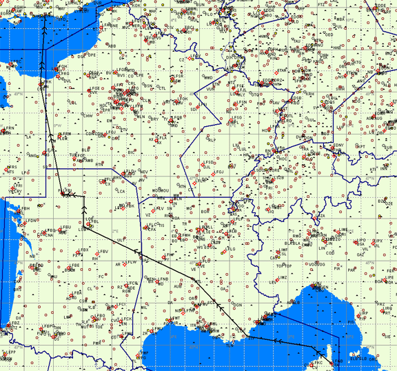
We wanted this to be a trip via a number of interesting locations. The original plan was for a flight from the base at Shoreham (EGKA) to Switzerland, then over the Alps direct to Venice (San Nicolo), then to somewhere in Southern Italy or Corfu, then to Santorini, then Crete (Iraklion). On the way back, via Corsica and Cannes:
The above diagram is only an illustration, with the actual route being a lot more complex. VFR flight is subject to many constraints, one of which is that one cannot assume that transit through controlled airspace (CAS) will be granted, so the route must be planned to be entirely outside CAS. Any CAS transits one can get are a bonus.
The flight over the Alps was expected to provide great views and was to be done at a high enough level (well above the MSA) to not have to worry about flying in the canyons and taking risks with mountain waves and the other aspects of traditional mountain flying. Of course this required good weather - light winds and few clouds. It also required an aircraft capable of the required altitude.
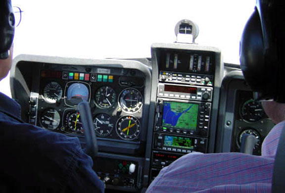
At the time I had 450 hours, and a PPL with a Night and an IMC Rating, and I do about 150 hours/year. I had 300 hours on the type (TB20) of which about 50 hours were instrument time in actual IMC. The aircraft is a Socata TB20GT, with 140kt IAS cruise at 65% power (10.5GPH) and endurance of nearly 8 hours (zero reserve) at that power setting. It has an autopilot with altitude and vertical speed hold, tracking a heading, GPS or VOR track or an ILS. The GPS is a KLN94 with a KMD550 multifunction display (MFD). The aircraft also has a WX500 stormscope, an ADF/VOR RMI, and a TKS de-iced propeller. The de-iced propeller is very effective but the aircraft is not authorised for flight in any form of icing.
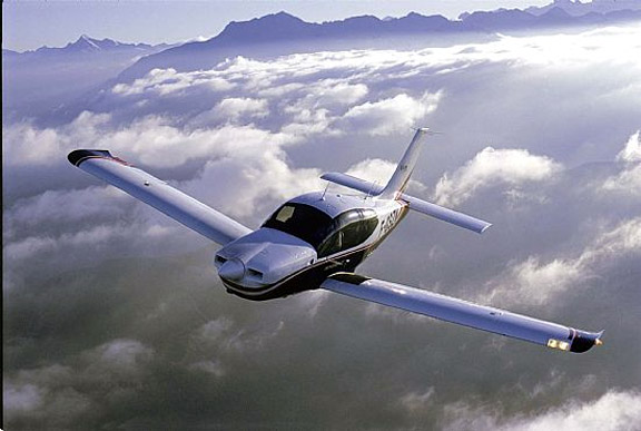
(above pic from Socata)
There were two of us altogether, leaving two free seats. This turned out to be just OK for the amount of stuff we ended up taking with us, including emergency equipment needed for the long over-water flights.
We managed to do the really interesting parts but we got stuck in Switzerland for a few days with weather unsuitable for any kind of "VFR" departure, let alone for the crossing of the Alps, and because we had just two weeks in total, the route had to be altered.
The aircraft performed perfectly. A TB20 has an absolutely ideal speed, range and load capacity for this type of trip. Other than a number of relatively small hassles concerning flight planning on the move, the trip turned out to be a lot easier than expected.
Planning
Outside the UK, the flight had to be "VFR" because I did not then have the full IR. The route was planned to be navigated fully IFR (GPS/VOR/DME/ADF), with no visual navigation necessary en-route. This is how I always navigate.
Articles have appeared in the UK aviation press suggesting a trip like this must be planned months in advance. This is nonsense. Once the process is known, everything that can be done in advance can be done in a few days. However, many of the things one needs to do aren't covered by PPL training which is of little use beyond simple flights around the UK.
At the end of this article is a section called Lessons Learnt. However, some things become apparent early on when planning a trip like this.
The first snag is the lack of aviation charts for the further reaches of Europe.
In the UK, the CAA charts are the obvious choice, and I think they are the best and the clearest. The only real alternative are the Jeppesen charts but the CAA ones are far clearer.
For France, people use several (mainly SIA, IGN and Jeppesen) but some very experienced French airspace pilots I know say only the 1:1M SIA charts are the truly official ones.
Nobody loves the word "official" more than the French who vigorously go after pilots who ended up where they shouldn't have been, particularly with the restrictions (TRAs) around their nuclear power stations which in their early days didn't reliably appear in UK-supplied notams. I discovered this "notam problem" to my cost in 2003. One hears nothing for 6 months, then one gets a letter from the CAA asking for the details of the pilot at the time. So one has to be especially careful with flight planning in France; this problem is much reduced if keeping to their published "airway" routes which usually have minimum altitudes of FL065 or so.
As far as I know, the French TRAs do now reliably appear in the AIS Narrow Route Briefing obtainable from http://www.ais.org.uk and further information on them, complete with a very good graphical representation, can be found in PDF form at http://www.sia.aviation-civile.gouv.fr/default_uk.htm (look for the AIP Supplement).
However, the SIA charts are awkward to use because the lower and upper limits of each piece of restricted airspace must be looked up in a separate book which comes with the charts. This makes planning a flight a relatively slow process, but when it's done properly, one can do the whole flight at one or two levels which is far better than flying at a low level (say 2000ft) while glued to one's GPS, dog-legging around bits of low level military airspace. A lot of this airspace isn't active at weekends but one must still plan on it being active because as far as I know most of it cannot be checked out until airborne. In a case where the route is particularly inefficient, one could plan an alternative one which assumes certain danger (Dxxxx) areas are inactive - this can be established on the first call to a French regional information frequency e.g. Brest Info - but whereas the airspace is likely to be unused only on a weekend, one can find the regional info service is unmanned at weekends! I have found occassions when there was a recorded message giving another frequency, with no response on that frequency either! Good information on flying in France is at http://flyinfrance.free.fr
Alternative charts for France are the IGN 1:500k charts. These are very nice and clear but they go only up to FL055 which keeps you low down, among all the military and restricted airspace, and the best routes through France are the "airways" whose bases usually start at FL065. I used the IGN charts in 2003 but now think they are useless except for short low level flights within France.
For Italy, there are the Jeppesen "VFR/GPS" charts. There are Italian ICAO charts too but I didn't know about them at the time.
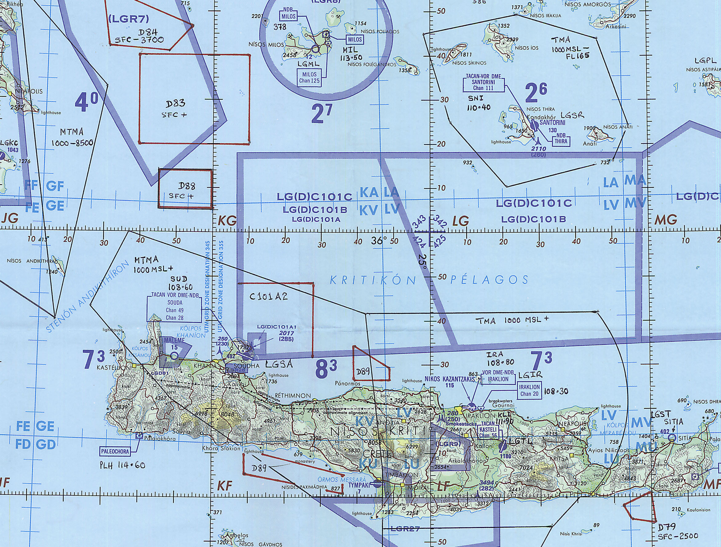
Past Italy, into Greece, there are no more VFR charts as we know them. The Jeppesen VFR charts stop at the end of Italy. I spoke to several pilots based there, and they use American ONC or TPC charts. Here and here are some outlets. These charts are old; the most recent ONC chart for the area (chart reference G3) is dated 1998. It shows only danger and restricted areas and as expected a lot of these were out of date.
No CAS (controlled airspace) is shown on the ONC chart. To get CAS details and updated restricted areas, one needs to buy an IFR (airways) chart or get someone in Greece to obtain the printed AIP and mail/fax the relevant parts. The airways charts are produced by Jeppesen and Aerad and are available for just about everywhere because IFR traffic operates worldwide. I used the Jeppesen #14 low level IFR chart and, for cockpit use and easier reference, I marked-up the CAS boundaries from that onto the ONC chart. This process took a few hours but I cheated by using Navbox for the co-ordinates of the various airspace shapes. It is amazing that a pilot should have to do this today but there are only several hundred GA aircraft in the whole of Greece, of which some fly IFR anyway, so there is no pressure to do anything about it. The resulting ONC chart looked like this (1MB file showing a small section of it).
Electronic charts: Currently, there are few electronic alternatives to printed charts. In Europe, practically all maps are copyright and the copyright holders are very tight with releasing the data in electronic form. So buying a pile of printed charts is the simplest thing. For this trip, this came to about £150. In the USA, all charts are available free of charge! Update: It is possible to get electronic VFR charts in the Jeppesen FliteStar/FliteMap product with the VFR Raster Charts add-on. This provides all the Jeppesen "VFR/GPS" charts which go as far as Italy; outside that Jeppesen have padded out the coverage with the old U.S. ONC charts. This European chart CD costs about GBP 200 which compares well with the cost of the equivalent printed charts. The cheapest program that will run this data is FliteStar VFR which is about GBP 100. The Raster Charts CD can be purchased directly from Jeppesen. From within FliteStar or FliteMap, one can print out en-route sections of these charts. Unfortunately, the quality of the printed charts is not as good as the printed Jeppesen chart, forcing one to print them out with a very small scale which then results in a large number of pages for a given flight. Jeppesen have also dropped the FliteMap product so there is no longer any official way to plan a VFR flight and get a GPS moving map function over the planned route. 9/2016: Jepessen discontinued there VFR charts in 2013.
Navbox Pro (www.navbox.nl) is an excellent program, excellent value for money and is more up to date than most printed charts. It comes with downloadable monthly updates. Every pilot should have it. One still uses the printed chart as the reference for CAS and terrain elevations (MSA) but Navbox makes the generation of the plog instant. Navbox can also generate a ready to use ICAO Flight Plan which, if you have a printer connected to the PC, or have a PC-based fax like Winfax, can be faxed straight to the departure airfield. All this for about £80! 9/2016: Navbox was discontinued in March 2016.
The next one is airfield data. It is possible to get a lot of this from various websites. Most countries have their own AIS website. In 2004, Greece didn't but luckily I had a few excellent contacts in Greece who emailed me scans of some pages from the Greek AIP.
The standard thing is to buy the Jeppesen Bottlang airfield manuals (called Trip Kits). I did that; the cost was about £150 in total to get a set covering the relevant countries. These VFR kits contain airfield details but a lot of the info (e.g. fuel or Customs availability, phone/fax numbers) turned out to be inaccurate. But unless one is very sure of which airfields one is going to visit (in which case one can try to obtain the particular airfield info as described earlier) one has to buy this stuff. These manuals are also very heavy to carry! Jeppesen also sell electronic data in their JeppView products, at a hefty price, but this is IFR only. May 2007: these VFR guides have just become available in electronic form, under the Jeppview 3.5 application.
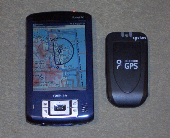
The next item which caused me some concern were VFR routes which were shown on some charts, notably the Italian ones. In the end this turned out to be a lot of hot air, but I may as well describe what I did: Flying these routes, weaving as they do all over the place, obviously needs good local knowledge, and having them on the GPS is a good idea. Standard aviation GPS Jeppesen map data doesn't show these routes so I looked for a way to show the real printed chart on the GPS - this is possible using at least two software products: OziExplorer and the now-discontinued Jeppesen Flitemap. I used the former and scanned in a number of aviation charts using a print services bureau which had an A0 scanner and didn't ask questions about copyright. The charts for the whole trip, including a huge ONC chart of Greece and surrounding countries, were a few hundred megabytes. Oziexplorer running on a PDA makes an adequate GPS which shows the same chart (always North Up) as one already has on one's lap. In the end, ATC did not care where we went provided we were outside controlled airspace.
Another practice which several people mentioned to me was that Italian and Greek controllers like to route pilots via airways intersections e.g. TIGRA. The French and Greek ATC both referred to them, particularly for FIR boundaries. For example TIGRA is on the Italy/Greece boundary and on one's flight plan one is expected to enter the EET to TIGRA rather than the EET to some FIR boundary whose name may not even appear on the chart. In a UK-France flight for example, one might use an EET to LFRR or EGTT but equally one could use the EET to NEVIL, SITET etc which lie on the FIR boundary. My view is that flight planning using navaids and intersections is a very good habit to get into anyway.
A good moving-map GPS with an up to date database is essential for this kind of trip. When flying with the potentially inaccurate ONC charts, often too far from a navaid, having to immediately conform to some controller's instruction to remain clear of some airspace, not using a GPS is just hard work. Also most airfields in the further reaches of Europe are military and getting lost in some of these places is likely to make some people nervous.
The last aspect of planning is the need to always get notams. Historically, this has been poorly taught in the UK because the only practical way to get them for a long trip - a Narrow Route Briefing via the internet - has been available only since about 2003. Prior to this, the best one could do was to wade through a printed list of notams for a large area - useless for a long distance trip.
While some countries like the UK and France make their notams available via well publicised national websites, Greece doesn't have a website. However it does feed notam info into the worldwide notam distribution system, and Greek pilots use foreign (non-Greek) websites for not only checking their notams but also filing their flight plans. It therefore appears perfectly OK to use the UK AIS website for checking Greek notams and this worked well for us. Officially, ICAO says that one should use each country's national notam system for notams within that country. In reality this is nonsense because it all goes into a common database. The exception is the French "series D (domestic)" notams which apply to airfield notam info only, and only to airfields incapable of handling international flights; this would be an issue if one was flying between small airfields within France. I used only the UK AIS website for all notams.
Filing flight plans, mandatory for international flights and advisable for long over-water flights, was done by handing them in at the various airfields, except for the departure from Wangen-Lachen (LSPV) where it was faxed to Zurich. Faxing them to the departure airfield using some sort of mobile fax device (I had a laptop with a GSM fax modem) is a very good way to do it which can save a lot of time but one must have a 100%-sure-correct fax number for doing this, and one must then phone the tower to check they got it and have no problems with it. I think faxing is most useful with both large airports (where even finding the appropriate office can be difficult) and with small ones (where the flight plan needs to be sent to a nearby large airport instead). Update: I now use the Austrocontrol website for filing flight plans, so everything is now done via the internet. For UK resident pilots, there is also the free new AFPEx facility. 9/2016: I use EuroFPL for VFR flight plans.
Never file a VFR flight plan too far (days) ahead of time. I used to do this up to 2003, filing flight plans days ahead using the DOF (date of flight) option but most of them got lost. Apparently, there is no automated system for handling a forward-dated VFR flight plan other than hanging it on a clip somewhere. When one has passengers and limited time and the OAT is +35C, it is no use discovering the tower doesn't have the flight plan when one is ready to go - especially at a big airport where one cannot just walk across the tarmac to re-file it but has to wait for an escort which might take hours to turn up. If you are really desperate for an early getaway, fax the flight plan from the hotel when leaving for the airport. Update: the Austrocontrol site mentioned elsewhere appears to work fine, releasing the flight plan into the system only on the specified date.
Emergency Equipment: due to the long over-water routes we carried a life raft with a canopy, life jackets, and (in a self contained emergency bag) a 406MHz EPIRB, an ICOM A22 handheld transceiver with a headset adaptor, and an old battery powered Skymap-2 GPS.
Mountain flying: Whenever I had asked about flying over the Alps, people told dark tales about mountain waves and such. As expected, almost nobody in the UK actually knew anything. I have not had mountain flight training, but felt sure that one could do the flight without having to worry too much if one was high enough above the terrain and there was not much wind. The question is - how much wind is too much? It turned out the all the people that talk about "mountain flying" are talking about flying relatively deep in the canyons, where obviously they could be affected by downward airflow if they fly on the wrong side of the canyon. The downdraught isn't limited to flight below the peaks but I could not find anybody who knew anything about how high above one should be; what is the estimated vertical air velocity for different values of wind. I can understand why people fly in the canyons - a typical Cessna/Piper aircraft cannot do the altitude and doesn't have much of a climb rate. The typical issues are in this flyer from New Zealand (local copy); written without the patronising and often misleading manner typical of UK CAA leaflets. Many people have been killed doing this; e.g. flying into a canyon which has a dead end and is too narrow to turn around in. In the end, the crossing was done when there was virtually no wind, but the local mountain pilots suggested that what I proposed to do, say 2000ft above, would be perfectly fine if the forecast wind for the altitude was less than say 30kt.
The Flight
Sunday 12/9/04
We departed from Shoreham (EGKA) to Switzerland, with a destination called Wangen-Lachen (LSPV), and a Customs stop before that at Grenchen (LSZG).
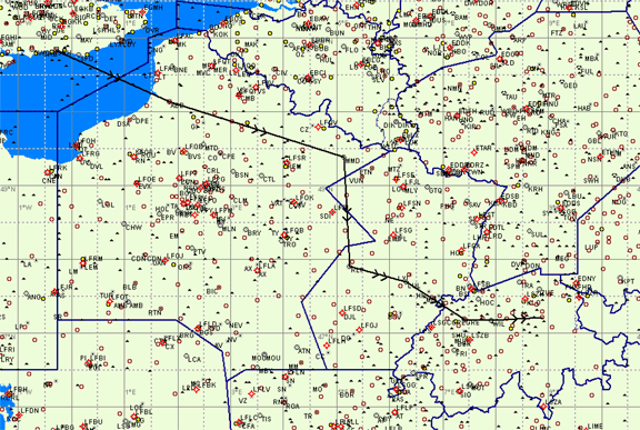
The route from the UK, mostly over France, was a real planning task as is usual over France if going VFR, due to the military airspace which covers most of the country, danger areas, various temporary and permanent restricted zones, you name it. As it turned out much of it was inactive at the weekend but that cannot be assumed. At the time of this flight I was not using the higher level "airway" routes which would have been much easier.
The route was EGKA ABB MMD RLP LUL LSZG WIL LSPV with a refuel stop at Grenchen LSZG. The French sectors were flown at FL055/075.
The flight was uneventful except for a moment of some concern when entering Switzerland at about 5000ft QNH, at which time I changed from the French SIA chart to the Swiss ICAO chart. We had descended through scattered clouds over France, from FL075 to about 4500ft some time before the changeover but, when entering Switzerland some time later, the hills looked a lot higher than the chart suggested!! Obviously we didn't fly into them but it was only on the ground at Grenchen that I looked at the Swiss chart carefully and discovered that it showed some elevations in feet and some in metres!! Apparently this is because the Swiss air force uses metres but I bet this has killed a few pilots. In fact the chart didn't look right anyway, just looking at the way the elevations were grouped. Note 5/2011: I am informed by a Swiss pilot that the Swiss ICAO chart is now wholly in feet.
We stopped at Grenchen in Switzerland (LSZG)
to clear Customs and to get fuel. As it turned out, we need not have waited for the fuel because contrary to some published info Wangen-Lachen does have fuel but the need to clear Swiss Customs remained.
There was some sort of very serious (turbine powered, in some cases) model aircraft competition going on, which was stopped for a few minutes at the top of each hour to allow "normal sized" planes to get in and out.
Grenchen has an impressive pilot briefing room, containing not only the dedicated terminals which appear to be standard in Swiss airfields (these appear to be maintained by a nationwide outfit called Skyguide, who even come round to refill the printers) but also an array of terminals showing satellite images. No internet though…
The landing fee was small but we paid about £30 "noise tax". I didn't know that I had a noise certificate so I don't know if showing it would have made a difference; the official looked up a TB20 in a thick book and read off the noise tax next to the type.
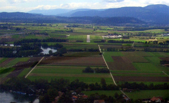
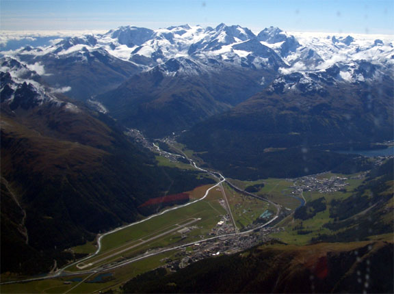
The flight to Wangen-Lachen was very short but the weather wasn't great, with cloud at about 5000ft and rain. The airfield is very distinctive, close to a lake and with the start of the runway being within a few m of the shore:
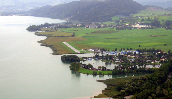
The runway is just 500m which leaves no margin for any messing about, either on takeoff or on landing. According to the TB20 takeoff performance chart 500m is OK for the altitude and for a reasonable temperature, but I wouldn't go any shorter especially at any elevation.
The people at the Wangen-Lachen flying club were very friendly. It is a small club which operates a number of Mooneys among the more usual types. There is the usual pilot briefing terminal (which I could not work out how to use) and a constantly updated satellite image terminal. It must be wonderful to live locally to an airfield like that... There is no instrument approach but it's pretty obvious that one could descend safely through cloud over the huge lake, with a combination of GPS and nearby VORs.
A good site for flying in Switzerland is http://www.nelly.ch.
Friday 17/9/04
The stop at Wangen-Lachen was planned to be just two nights but the weather didn't co-operate. There was too much cloud about, with a very slowly moving warm front. It isn't a good idea to fly over mountains shrouded in cloud as the likely outcome of an engine failure would be a 90kt glide into a rock. The icing level below the 13500ft MSA was an additional consideration which required any clouds to be scattered or better. So we did some shopping and walking; staying in a nice (expensive) hotel in a very nice (expensive) town called Rapperswil, by a lake
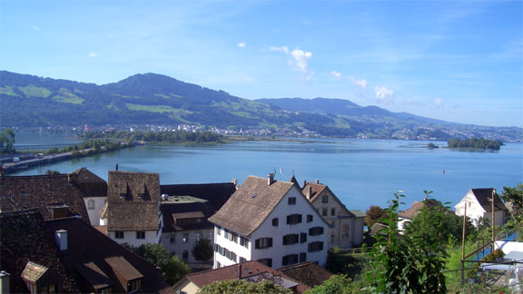
Zurich is a short train trip... Switzerland is a very picturesque country with plenty of lakes and mountains and everything is well organised. On a sunny day the scenery is breathtaking. But of course on a sunny day one would be flying! The airfields appear to be very friendly to general aviation, with good facilities and no hassle. It is also very accessible from the UK. The Swiss can be very serious in their endeavours as this pic from a Zurich art gallery shows:
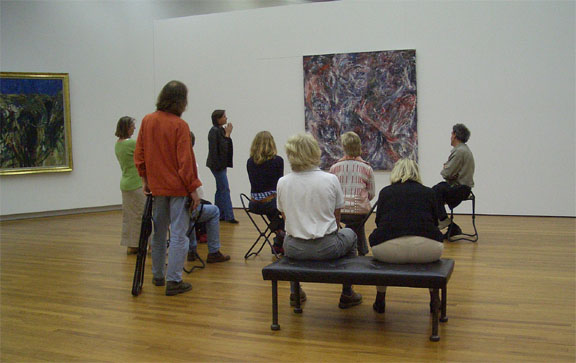
But not always...

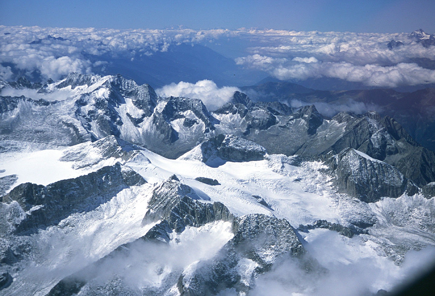
On Thursday I got invited to fly with one of the flying club residents, Louis, to drop him off at Sion (LSGS) and then follow him back to LSPV in formation, after he collected an Archer from Sion. This involved flying under a cloudbase well below the MSA, in canyons. I was very concerned about this but eventually agreed to go, after carefully working out the track and seeing the icing level was well above the clouds so a climb to a safe level, followed by an ILS somewhere, would be possible in case of loss of navigation or visibility. Also there was very little wind over the entire area. On the way to Sion we flew among some spectacular mountain scenery at up to 13000ft:
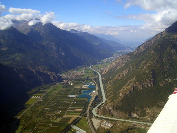

The following is St Bernard's Pass:
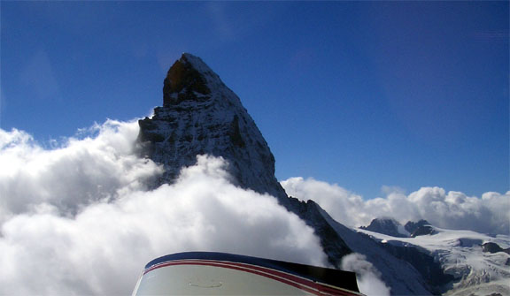
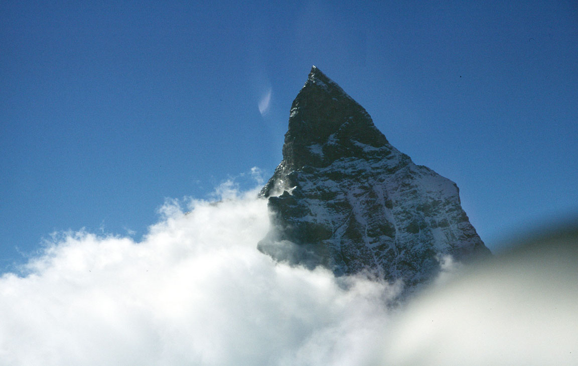
and here's the Matterhorn:

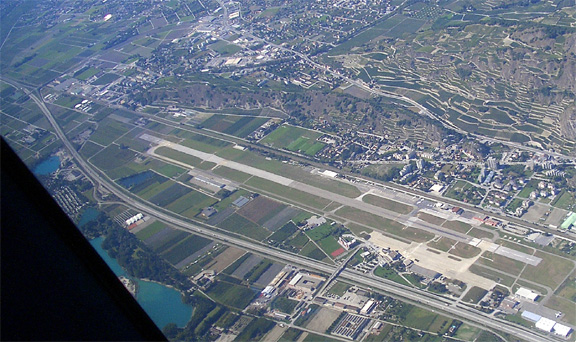
Sion is a very new looking airport, with everything well organised and clean. Some military jets are based there and were flying circuits.
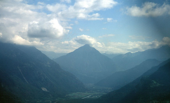
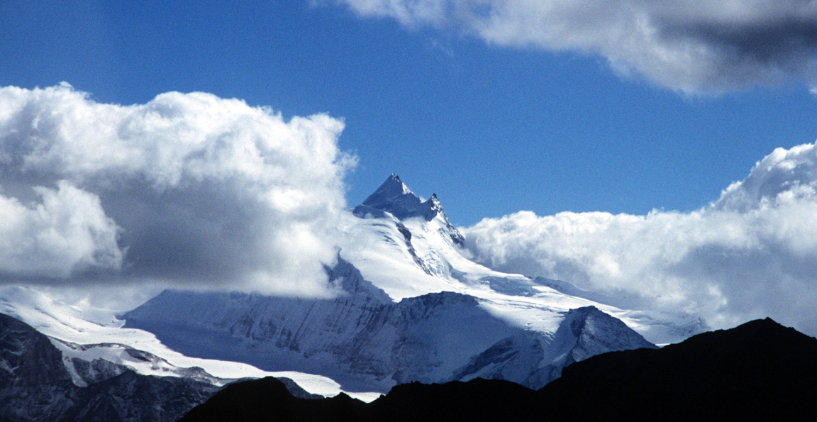
We also saw Mont Blanc in the distance:
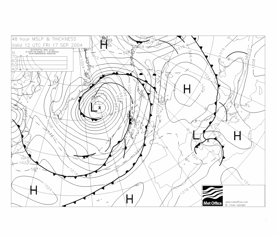
Eventually, on Friday, the situation comprised of a high pressure over most of the mountains, with a thin scattered cloud over the airfield (which was itself in a wide valley, elevation 1400ft) at about 4000ft, with icing level at about 10000ft. No METARs or TAFs were published for any of the airfields en-route but eventually I managed to phone Samedan; a mountain airfield which was about halfway along the route; they reported a thin haze layer at about 8000ft. The synoptic charts showed little or no air movement was expected over the entire area. The forecasts for N Italy were as expected given the warm front hanging over the area: lots of cloud and some heavy rain but that didn't matter because the forecast cloudbases were some 2000ft, the terrain was nearly sea level, and we always had the option of simply staying over the sea, outside any CAS, at any low level as required. The worst likely outcome was getting a thorough wash.
So it was a GO. The alternative, already decided on due to the need to get back to the UK within the two week time limit, would have been to return to the UK shortly. It would appear that a better way to do the flight over the Alps would be to wait in the UK (where one has easy access to all the internet-based weather information services, using one's own PC) until the weather is good and then go all the way over the Alps to N Italy in one go, but had we done that we would have got trapped by availability of Avgas and Customs (see next).
I made a phone call to check out the intended destination, Venice San Nicolo (LIPV) and got no answer. Telephoning Venice Tessera (the big international airfield) revealed that the Bottlang data for San Nicolo was thoroughly inaccurate and there were no Customs. Also I learnt that Tessera has no Avgas.
So it was decided to skip Venice and fly direct to the furthest stop which was within safe range: Corfu Kerkira (LGKR) - a longish 5+ hour flight but one which would avoid having to waste time on the ground in Italy. Until then I had not realised how much of the information in the Bottlang guides was rubbish.
On that morning there was nobody about at the club house who spoke English and after some hassle filing a flight plan via our GSM/laptop fax to Zurich we finally got away, climbing in a 5 degree left orbit to about FL100, then calling up Zurich FIS and departing on a direct track to the VIC (Vicenza) VOR, climbing to FL130 which was the Class C CAS base (Zurich would not allow transit at the requested level of FL150), with an intermediate waypoint of RESIA to establish an FIR boundary crossing point which was needed for the flight plan.
The MSA was some 14500ft based on 2000ft above the highest terrain within 5nm of track. However as the flight was in perfect visibility this was not a problem. The flight plan route was LSPV RESIA VIC BRD TIGRA LGKR. RESIA is the Swiss/Italian FIR boundary and TIGRA is the Italian/Greek FIR boundary.
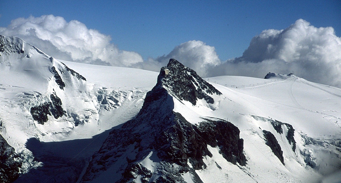
Immediately on climbing above the scattered cloud we were treated to an amazing view of the mountains, and this got a lot better still as we climbed and proceeded over the Alps.

Zurich were with us until about 3/4 of the leg to VIC, after which they told us to contact Padova. Initially Padova didn't respond (out of range) so I stayed on a listening watch with Zurich.
The entire flight over the Alps was uneventful, with negligible turbulence despite flying only 1500ft above some of the terrain. Oxygen was used for the whole distance of about 150 miles. We used up about 2/3 of the bottle. Admittedly the flow rate was set to 15000ft which was higher than necessary but it shows the practical limit of a single bottle. The portable oxygen kit can be freely imported from the USA, filled up for £10 at a local scuba shop, and because it is portable it does not need CAA approval. Oxygen use makes a huge difference to how tired one gets - even at just 10,000 feet.
We overflew Samedan (LSZS), speaking to them briefly before returning to Zurich FIS frequency
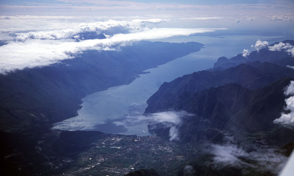
We could see Lake Garda in the distance
The Alps disappear into very flat terrain at practically sea level at about 12D before VIC so at 10D we descended to FL085 at which we were cleared by Padova to VIC. After that we continued at the proper semicircular level of FL075 (the quadrantal levels are a UK-only thing) but soon we reached a stage where one Italian controller cleared us to point X and the next one refused to go along with it, insisting simply that we remain outside CAS, so we continued the flights at various levels between 1000ft (over the sea) and 4000ft, generally along the east coast of Italy. A lot of time we stayed 5nm offshore to avoid the circular CTRs around the coastal airports. The PDA-based GPS showing the scanned paper charts was very useful in fine dodging of CTRs and such because the Jeppesen database in the KMD550 doesn't show everything.
Halfway down Italy we did get the thorough wash as forecast but there was no real turbulence. No other aircraft were seen.
Italian controllers mostly don't have radar and like to frequently ask for reports of radial/distance to their VOR. As per convention they want the FROM radial even if one is flying TO the VOR, and don't appear to understand the English word "to" if it is used in the "230 radial TO the ABC VOR, distance 15 miles" manner. Otherwise, they are quite particular in making sure their incoming/departing traffic (mostly regional and RyanAir type stuff) is aware of nearby VFR traffic; presumably because they often have no CAS outside their Class D CTR and have to hope their traffic will climb high enough before it is 5 miles away. But usually the traffic just says "we have him on TCAS". No doubt a Mode C transponder is a good idea.
About halfway down Italy I got my first ever GPS failure in some 350 hours of IFR navigation using a GPS. This was obviously jamming (intentional or not) because the GPS track started to rotate like a clock and both of our GPSs (of different designs and each with its own active rooftop antenna) lost contact together. The failure of the KLN94B/KMD550 initially resembled a fluxgate magnetometer failure (which I had seen before, caused by the SLAVE/FREE switch set to FREE by accident) but a quick check showed the HSI, RMI and compass all agreeing, and within seconds the "unable to navigate" message popped across the KMD550 screen. So I just flew the existing heading, VMC anyway. A minute or two later all was back in operation. If somebody got a temporary VOR or ADF failure they would never bother to mention it, so I am relating this only because GA is so full of anti-GPS traditionalists! This sort of flight, in places where air traffic controllers (who mostly speak poor English) are likely to get very upset if a pilot looks like he doesn't know what he is doing, would have been vastly more difficult and very stressful without the accurate navigation which a GPS provides.
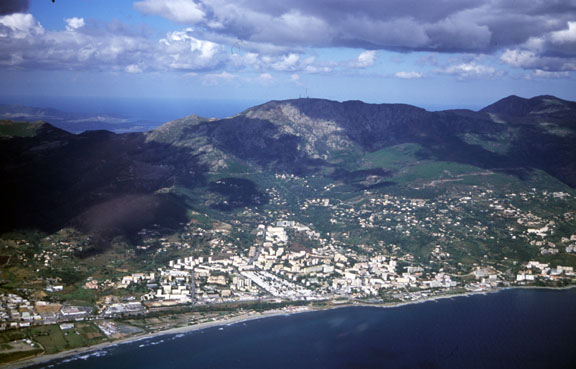
The rest of the route to Corfu (Kerkira, LGKR) was uneventful. Kerkira approach (they have radar) was very professional all the way from the FIR boundary (TIGRA), clearing us to an overhead transit and a right base for runway 35, landing from the right in the pic below:
As one should always do, I asked for fuel while still talking to Tower but that is where the problems started. We were greeted by a very efficient lady in an Olympic Airlines handling car who said she would organise everything, including putting the fuel and handling on one invoice which could be settled with a VISA card; she said the requirement for a large wad of Euro cash for fuel causes problems for visitors from abroad. The next morning we turned up to depart and found her gone, no fuel available supposedly because the bowsers were refuelling a load of airliners, and a different and much less helpful lady insisting we get escorted to the plane and sit by it however long it takes. Also the were no pilot briefing facilities (not that I needed any) and filing the flight plan involved a lift up to the tower. The door at the top of the lift would not open so I went back down and walked up the steps… It was very interesting to see the set-up there but the very friendly ATCO said the destination, Sitia, is military and a special permit code is needed to go there, and it takes a few days to get it. I told him this is not what I have been told by people who fly from there; he got on the phone to Sitia and appeared to sort it out. But he could not help with fuel.
Eventually after putting some pressure on the unhelpful Olympic ground personnel we got the Avgas-only bowser along - a different one to the turbine fuel bowser and there was no issue with VISA payment after all…
The route followed an A14 airway and was LGKR KRK ARA TRL MIL SIT LGST and was flown entirely at FL075:
All ATCOs on the route, with Athens FIS for most of the latter part, were very professional if often difficult to understand. Athens FIS was most keen to ask for reports of distance (plus reports when specified distances were reached) to various VOR/DMEs and TACANs, plus ETAs to each waypoint. The KLN94B GPS, with the route programmed into it and all this stuff available anytime for every waypoint, was an incredible timesaver. Apparently a helicopter crashed somewhere in the mountains a few days before, so ATC were more careful watching everyone. No other aircraft were seen.
The Greek controllers also like to ask for ETAs to waypoints which are airways intersections. This was no problem with the KLN94B where one would simply insert the intersection into the flight plan and obtain the ETA to it. Otherwise, one needs the IFR airways chart (which shows the VOR radials/distances) and a lot of OBS knob twiddling…
The flight to Sitia over Greece and its various beautiful islands was uneventful but visually spectacular despite a lot of haze.
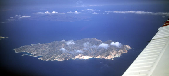
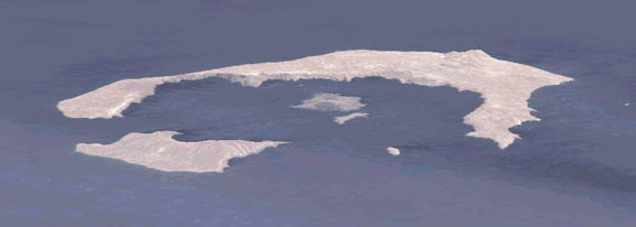
We saw the C-shaped island of Santorini from about 30 miles away, barely visible through the haze. It was a pity we didn't visit... The following 3D image was created using the amazing NASA World Wind satellite/shuttle imagery application and is from the perspective of our flight past:
and here is a real picture which I obviously didn't take; I found it on the web somewhere. It shows the airport in the foreground. A flight to Santorini is planned for 2005 - trip report here.
Before Sitia we were transferred to Iraklion (LGIR) Approach, then talking and landing in Sitia shortly afterwards. Iraklion wanted estimates to, and a reports at, the ATLAN intersection.
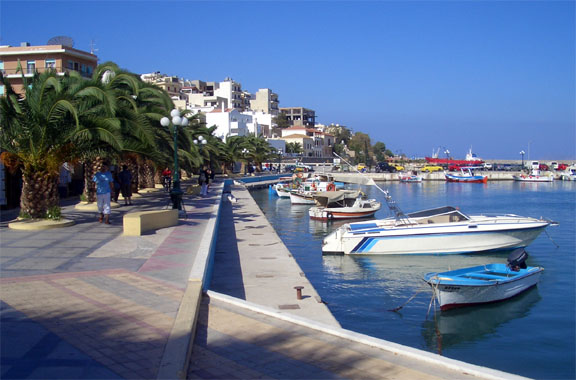
(above pic from Kyprianos Biris; the town of Sitia and the harbour where our hotel was are on the right)

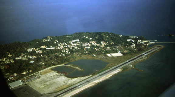
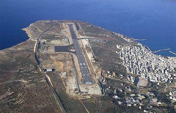
Sitia was chosen because apart from Iraklion (LGIR) all airfields on Crete are military and require long PPR; around 10 days. The Sitia runway is huge and the airport doesn't have the serious crosswind problems which lots of people have warned me about regarding Iraklion. Reportedly the airport has plans to accept B737-size traffic in 2005 although during our stay there was very little traffic; just a few movements per day. The landing/parking fee was the right side of negligible.
We stayed in Sitia for four days, discovering that it is a lovely town full of great restaurants and places to see. It doesn't have the "tourist problem" - yet! Greek food is the best and by far the healthiest there is... They have simple cooking but the high quality of the ingredients ensures that everything tastes really good.
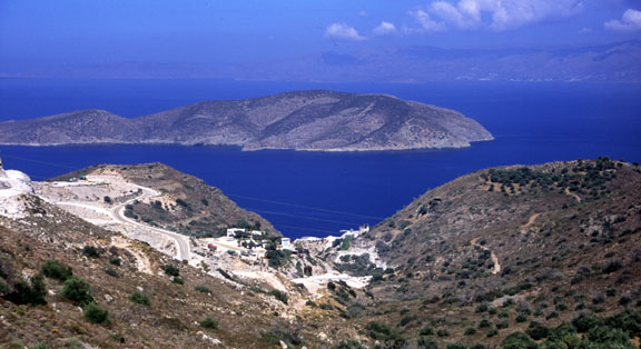
We rented a car (a little Daewoo with air conditioning, Euro 90 for 3 days after some haggling, cash of course, including what in the UK is called fully-comp insurance, unlimited mileage) and during a long drive along the northern coast discovered that Iraklion is a very difficult place to get in or out of due to heavy traffic, and landing there would have made going anywhere a lot more difficult. There are amazing views along the coast:
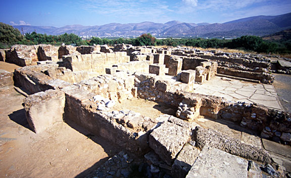
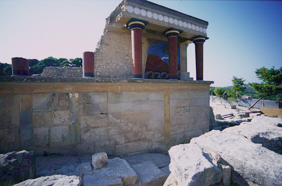
We saw some of remains of the ancient civilisations. The following is the Palace of Malia which was about halfway between Iraklion and Sitia:
The famous and tourist-packed Knossos site was visited too (below). It was heavily restored in the 1920s although the accuracy of the restoration is now being questioned. In the end, one realises that almost nothing is known about these ancient people. They left no significant written records. Knossos was as far west as we went; it took a whole day to drive there from Sitia, given the winding mountain roads much of the way. However, there was suprisingly little traffic outside the towns in Crete, compared with anything seen in the UK today.
Thursday 23/9/04
We flew back from Sitia (LGST) to Corfu (LGKR). The destination was determined by the fact that Sitia didn't open until 1300 local which didn't leave enough time to go further; e.g. to Salerno. Waiting until the following day was out because of a worsening weather forecast, and a direct return to the UK from Salerno would have been outside the range of the aircraft. A direct flight from Sitia to Corsica would have been about 6+hrs which is just too long for 7hrs endurance, especially given Italian controllers' habit of clearing one to a waypoint in CAS and then telling one to remain outside CAS, forcing a large detour.
The flight to Corfu, at FL085 all the way, was uneventful, and most of the time visibility was very poor due to haze. The route was the exact reverse of the previous one i.e. LGST SIT MIL TRL ARA KRK LGKR. No other aircraft were seen.
This time things were much smoother on the ground. The airport was very quiet. We had asked for fuel while still in the air, and the same super-efficient-sounding Greek lady with the world's supply of eye make-up took care of everything. The bowser turned up within minutes, a huge bus took us the 200 yards to the terminal, and after going up into the tower and filing the flight plan for the following day's flight (to Corsica) we were off and in a hotel within a 5-minute walk from the airport.
There were just two planes at LGKR: a new Rockwell Commander 115 and an old piston twin. We heard perhaps one other aircraft on the main FIS frequency in the 3hr flight - there really is very little GA traffic in Greece and a lot of it had been grounded by the ludicrous 45-mile radius prohibited areas during the Olympics.
However, the Greek lady wasn't quite right - much as anything in Greece can ever be deterministic. She told us we could save a lot of money if we both called ourselves "crew", with myself the "pilot" and my lady passenger "crew in transit". This would have reduced the handling charge from approx Euro 15 to Euro 3, but the official doing the paperwork saw through this and disallowed it. However we paid around Euro 80 during our first stop at Corfu (which, being used to paying £50 in places like Cardiff, I didn't question) so clearly few if any people at these big airfields really know what they should be charging, and it is hard to dispute it because almost nobody speaks much English...
Friday 24/9/04
The flight from Corfu (LGKR) to Corsica Bastia (LFKB). This went across Italy LGKR TIGRA BRD GIO SOR PNZ MOULE LFKG (with TIGRA and MOULE being the respective FIR boundaries):
It was flown at FL085 until just before Salerno. While it was uneventful it was not the sort of flight one would have chosen for fun. A couple of hours was spent 1000ft-2500ft above the sea, tens of miles from any coast, enforced by a ridiculously large 1000ft+/2500ft+ Class A area stretching tens of miles over the sea west of the coast near Rome. For much of the time we were out of VHF communication with anybody - except perhaps overhead airliners listening on 121.50. No other aircraft were seen.
From Corfu at FL085, we initially talked to Brindisi for transit through their Class E airspace. Strictly speaking they didn't need to be asked because VFR traffic can go into Class E anyway. However the Class E is vertically between some Class D and Class A so obviously passenger traffic has to pass through it. They were very helpful, first telling us that we cannot continue via GIO because it is within a huge restricted military zone. However after I said that they may wish to know that the only available chart for the area doesn't mention this, they cleared us through there at not below FL095.
Later, the comms with Napoli were sporadic even at FL085, no doubt due to the hills around there, on the way to overhead Salerno. Even UK airliners were having obvious problems with them, calling many times (after departure, I presume!) before giving up.
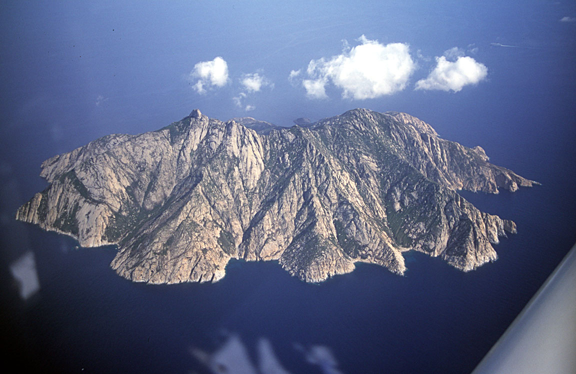
While on the over-water run, we flew past a number of spectacular islands, some inhabited, some not. One of them was the Island of Monte Christo; an uninhabited piece of rock which, due to the calm sea, looks like it's floating in space:
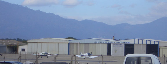
Bastia approach were very competent and clear. They get a fair bit of bizjet and passenger jet traffic. There is a large hangar with "aeroclub" on it
Corsica (from what we saw of it in a single evening) is well worth a visit, but don't expect anybody to speak a single word of anything except French!
Saturday 25/9/04
The final leg was from Bastia (LFKB) to Shoreham (EGKA): LFKB NORKA STP MTL LMG BALAN POI CAN NEVIL EGKA (NORKA and NEVIL being the respective FIR boundaries):
Getting out through the Bastia airfield was a hassle, with nobody knowing what to do with a private pilot. The #1 job was to file the flight plan, after which we could waste a bit more time. After about half an hour we found somebody who escorted us through the various police and passport checks. They also wanted to see my PPL, which I didn't have with me but I was able to find my CAA PPL number which was enough. Most likely it would have been far better to go via the Bastia aeroclub!
Departure from Corsica, initially to the north:
The planning for this had been particularly time consuming, due to the French military airspace dictating various levels and requiring doglegs around many areas. At the weekend, on past experience, one cannot rely on any particular frequency being manned so it was planned to be flown without radio. However, radio calls established that no military airspace was active en-route and not only we were able to fly the lot at FL085 but also we were able to delete the BALAN waypoint. Amazingly for a weekend, the French ATC were on the ball, watching us on radar with transponder codes on the entire route, except a bit towards CAN where we lost them. Clearly weekends are the best time to fly VFR in France!
This flight could not have been done without a GPS (at least without one that works for most of the time) and constant reference to the chart, marked up with things to look out for including a couple of para drop zones which came up on the notams.
In retrospect, a better way to do this route would have been via the French "airways" as described here.
The route took us over Cannes and St Tropez, with a number of bizjets landing below us. We had a great if hazy views of the French Alps in the distance:
We flew near one of the power station TRAs, at FL085 so well above the prohibited area:
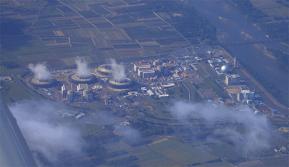
The planned route actually took us over it but I diverted around it just to make sure.
The weather was good, with scattered clouds at about 5000/7000ft all the way to the middle of the English Channel, at which point - welcome to Britain - we hit a solid wall of mist. I did the NDB/DME procedure to get into Shoreham (EGKA), popping out of the cloud at about 1000ft and a few hundred yards to the right of the runway centreline despite being accurately on the inbound track; such is common with the EGKA 20 NDB/DME procedure, presumably due to the presence of the hills affecting the ADF.
This was, at the time, my longest ever flight. Upon landing, we filled up and as usual checked the Shadin flowmeter FOB (fuel on board) reading against how much went in from the pump. The two were very close, about 20 USG which is nearly 2 hours' fuel. This was after a 5:45 hour flight.
It was a great trip and I would do it again anytime!
Flight (airborne) times:
EGKA-LSZG Shoreham-Grenchen 2:50
LSZG-LSPV Grenchen-Wangen-Lachen 0:25
LSPV-LGKR Wangen-Lachen-Kerkira 5:25
LGKR-LGST Kerkira-Sitia 2:50
LGST-LGKR Sitia-Kerkira 3:05
LGKR-LFKB Kerkira-Bastia 5:25
LFKB-EGKA Bastia-Shoreham 5:45
Fuel costs
Fuel costs were all within a 20% band around the UK price of about £1 per litre.
Lessons Learnt
Be familiar with the charts
Without doubt the most potentially dangerous thing was not realising that some elevations on the Swiss ICAO chart were in metres. For a UK-trained pilot who has used only SIA and Jepp charts on previous flights obroad, this was completely unexpected. The way it is done is particularly misleading because airfield elevations and sector altitudes are in feet with no "ft" suffix, terrain elevations that are in feet do have the "ft" suffix, and terrain elevations that are in metres do not have a suffix. This could wreak havoc with MSA planning if not spotted. Non-flying purists would argue that VFR flight must be in VMC but there are situations where the chart needs to be relied on; for example for towers, cables and other obstructions invisible until too late.
From now on, I am avoiding the locally published "ICAO charts", sticking to Jeppesen charts instead where available. They are 100% in feet. They are not the clearest but they are uniform. Note 5/2011: I am informed by a Swiss pilot that the Swiss ICAO chart is now wholly in feet.
Assume that published airfield data is wrong
With the Jeppesen Bottlang guides this is a very safe policy! Nearly all airfields involved (actually or potentially) in this trip had a major error in one or more of: opening times, Customs presence, phone/fax numbers, PPR requirements, fuel availability. A lot of the phone numbers listed are public contact numbers intended for checking international flights and there is no way to contact anybody who knows about GA or even speaks English! Also any fax numbers given, even if they receive a fax, are in most cases useless for GA related functions such as faxing in flight plans.
Navbox, despite its low price, was found to be the most accurate information source for airfields. Apart from still having a fair number of useless phone/fax numbers, the only errors I have ever found in Navbox were a) a nonexistent VOR shown near Athens and b) wrong airfield data for Sitia but the latter is a new airfield with not yet fully published data.
It is tempting to get airfield data from the internet. There are lots of websites. A start is the Eurocontrol website which here carries links to various national AIPs - even if a lot of these are essentially empty. This section contains a lot of 3rd party links. There is another section (limited with regard to what can be used to browse it) which carries a collection of national AIPs as PDF files; it can be accessed here - broadband is desirable for some massive Java downloads. There was little useful information on Italy or Greece though.
Ultimately, however, no matter how many websites there are with airfield info one cannot practically print out the information for every airfield one might land in or divert to. It might however be practical, with broadband, to download hundreds of PDFs into a laptop - if the data can be found! Jeppesen sell this data in their JeppView IFR products, but there is no current substitute for their bulky, heavy and expensive Bottlang printed guides.
A partial solution is to contact every planned-stop airfield directly in advance. I did this to some extent and found that most didn't reply to faxes. Later I learnt that a phone call is much better; the trick is discovering the number for an ATCO or somebody else who can speak English. A local aeroclub should also be useful but I did get some duff info from some of their members...
Make sure you can get fuel before walking away from the plane
At many airfields, getting fuel is a time wasting process especially if they use a bowser. The standard tip is to ask for it immediately after landing while still talking on the tower frequency. The one thing which the staff at every large airfield is very good at is getting everybody escorted off the aircraft and into the terminal. So the trick is to refuse to leave the aircraft until it has been filled up. This could be difficult if somebody is desperate to use the toilet …. Something which also helps is to ask for fuel while still in the air; I realised this is what the airliners were doing at Corfu.
Make sure you can get weather and notams and file the flight plan for the next flight
Facilities available to General Aviation pilots are simply not geared up for people doing long trips like this. The information traditionally available to private pilots is typically TAFs, long TAFs, METARs, Form 214, Form 215 (and their local equivalents) plus synoptic charts. There are "ways" to get hold of these at most airfields UK and abroad, even if it means demanding to go up into the control tower or putting up with a load of hassle or locating a fax and using fax-back numbers. There may also be ways to get notams; the Swiss flight briefing machines for example will do what looks like a narrow route briefing for a one-leg route.
This is fine if you like hanging around airfields or flying clubs, stay in each place for just one night, and the weather always turns out to be fine, or you and your passengers are retired perpetual travellers and have plenty of time. One can get long TAFs (24hrs ahead) for large airports and for overnight stops this is usually adequate for establishing whether it will be worth getting out of bed the next morning.
But what if one stays somewhere for a few days? The only info released for free by the UK Met Office that goes that far ahead are the synoptic charts. These show fronts and isobars, but there is no way to get a good idea of cloud cover and cloudbase - other than by assuming that e.g. a warm front will have the traditional characteristics of a warm front (low cloud and rain). This isn't really good enough.
Fortunately, there are many weather websites nowadays, mostly disseminating data from the freely accessible GFS (Global Forecasting System) global model. One is http://www.arl.noaa.gov/ready/cmet.html which is a very usable gateway to GFS data but
GFS data should be as good as anything else for a large scale but may not take into account local effects such as sea breezes. But it is better than nothing if looking a few days ahead.
There are also plenty of "amateur" weather sites and one needs to be careful as these as they can contain old data. With TAFs/METARs the date the forecast was prepared is stated but this is not clearly the case with synoptic charts and I have found websites containing out of date data. There is no point in using these sites for weather info which can be obtained free of charge from properly run sites like Avbrief.
Practically, you don't want to have to go from your hotel to the airfield and mess about for hours at an airfield briefing room, only discover some weather/notam/fuel/whatever problem, and then have to extend the hotel stay and perhaps get chucked out because they are now fully booked and have to find another hotel. This gets expensive, especially in Switzerland! I had mobile internet and fax, details here.
Mobile phones: Use a mobile phone which (if PAYG) can be topped up from abroad. I had two SIM cards, one topped up with the now-common swipe card, and a backup one with a linked VISA card which could be topped up from anywhere with a free phone call. Sure enough, the first one ran out after a week and could not be topped up… The only sure way is to use a contract, or (if PAYG) to register a credit card to the SIM card and then the account can be topped up through any means of accessing a website. A small point but hugely irritating when one has faxed in a flight plan and needs to check if they got it OK. A hotel should normally have a fax machine but it won't always be available.
Toilets... The plastic device which resembles a watering can (available from pilot shops) is invaluable for long flights and works very well. It works well for women too but it is desirable to be able for them to climb into the back seat - so fly a 4-seater aircraft with just two occupants! The device would also be entirely usable when on the ground, waiting for fuel…
Contact the local aeroclub first. A number of airports, even big ones, have a flying club there, and asking to "taxi to the aeroclub" after landing saves a lot of hassle. I don't know of a systematic way to find such clubs though, apart from doing a Google search (unproductive when looking for non-English websites) or contacting the AOPA in the relevant country. I did actually contact the Greek AOPA and got a some contacts but most were unable to speak enough English to help. This sort of thing could take a lot of time however. Suprisingly the Jeppesen Bottlang manuals don't generally carry aeroclub details and, in a lot of small clubs, nobody answers the phone anyway.
Divide up the luggage. It became apparent that the contents of the aircraft needs to be organised into three groups:
1. What always stays in the aircraft (e.g. oil, tie-down kit)
2. What one always takes to the hotel (e.g. toothbrush)
3. What one takes to the hotel which is specific to the current stay (e.g. charts
for the next leg)
It may seem obvious but organising this in advance would have saved us hauling a lot of unnecessary stuff.
Choose suitable stops and suitable passengers! This kind of trip, enormously rewarding and interesting for both of us, would not have been possible with most passengers. One can get flight planning done on the move as described, but the variability of weather and, given the lack of reliable airfield information, the uncertainties in whether one can land and get fuel at a particular airfield, create a situation where a certain amount of flexibility is required. It is best to choose stops which are interesting enough to get stuck in for a few days if necessary, and people interesting enough to be stuck somewhere with :)
Get a full IR!! The best way around the weather has to be a full IR and then one can fly VFR when the weather is nice and IFR/airways when it isn't. In reality it isn't anywhere near as simple as this - the weather doesn't care what license privileges the pilot has and airframe icing and turbulence remain major issues with a non-pressurised piston aircraft like the TB20. What a full IR gives you is the ability to land on an instrument approach, and the ability to depart from under a low cloudbase - neither of these can be done under VFR, even if the en route segment can usually be flown under VFR and generally would be flown in VMC anyway, to avoid icing issues. Now I have the IR so have worldwide IFR privileges.
Documents
We didn't have any aircraft inspections on this or any other trip, but (at the time of writing) the aircraft was G-registered. It is now N-registered and these are known to attract attention especially from the French who have been particularly aggressive in their inspections, occassionally demanding that VAT is paid on landing, only to be repaid upon departure! This is a complicated subject and it appears that one needs a document proving that VAT was paid on the aircraft when ir originally entered the EU, or the UK if made in the EU as ours was. The key thing is that a suitable document can come only from a Customs office; a VAT invoice may be accepted on the day but is definitely not sufficient. UK Customs used to supply a Certificate of Free Circulation (CFC) but these are no longer issued. Another suitable document is called C88 or IM4. For an aircraft bought new from a dealer, the dealer should have supplied such a document (mine didn't). I now have a CFC but it was obtained through a complicated route.
Acknowledgements
I owe many thanks to Alena Klaoudatos and Kyprianos Biris (Greece) for the large amount of info they supplied me with. Also to Louis Mettler (Switzerland) for the great flight in the Alps. A number of others supplied me with information on Italy and Greece.
I apologise for the somewhat wrong colours in some of the pictures - some were slides scanned on an old slide scanner. Those pics that have an option to click on them to see a larger image were taken with a 35mm camera (OM4ti with a 35mm-80mm zoom); the others were taken with a Casio Z4 or Z40 (4 megapixel) pocket camera. Some of the wide angle pics of the historical sites were taken with a 27mm lens.
Last updated 24th September 2016.
Any feedback, reports of dead links, corrections or suggestions much appreciated:
Contact details
